Several pleasant surprises popped up at this year’s Institute of Navigation’s Joint Navigation Conference (ION JNC) in Orlando, Florida, and the best by far centered on the presenters and the attendees. In a change from recent years due to budget restrictions, better known as sequescastration, this year two senior Air Force generals attended and actively participated in several events.
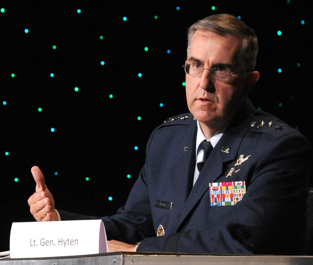
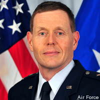
General (S) John E. Hyten (USAF), currently the Vice and soon to be the Commander of USAF Space Command (AFSPC), participated in two days of ION JNC and was featured as the keynote speaker on the second day of the plenary session. As a senior steward of the Global Positioning System, indeed for all USAF Space Systems, General Hyten has a special place in his heart for GPS, having served as the Commander, 50th Space Wing, Schriever AFB in Colorado, the home of GPS.
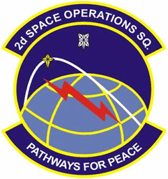
50th Operations Group, 50th Space Wing, Schriever AFB, CO.
The squadron was activated Jan. 30, 1992.
Conference attendees were pleasantly surprised with the access they had to General Hyten as he toured exhibits and joined fellow attendees for lunch, presentations, and discussions in the hallways. General Hyten made it clear that he was there to interact with ION JNC attendees and welcomed everyone to engage him in conversation. A rare invitation from a very busy general officer with huge responsibilities — and an invitation that many attendees clearly took to heart, as General Hyten was continually engaged in discussions during his two-day stay.
In his plenary presentation, General Hyten addressed GPS and the general lack of knowledge in the public today concerning the origins of the system. Hint — the answer is the United States Air Force. More on that later.
Major General Robert Wheeler (call sign Wheels) also attended ION JNC this year to speak during the classified day on June 19 and to participate as an ad hoc member of the always-popular War Fighter Crosstalk Panel. General Wheeler currently serves on the staff of the Secretary of Defense (SECDEF) as Deputy Chief Information Officer for Command, Control, Communications and Computers (C4) and Information Infrastructure Capabilities (DCIO for C4IIC). General Wheeler is a command pilot with more than 5,000 hours in multiple aircraft, including the B-2 bomber in which he saw combat time over theater.
It was obvious from his initial comments in the classified sessions that General Wheeler is a warrior and staunch supporter of GPS and all things PNT-related. As much as I would like to relate some of his more pithy remarks, they were made in a classified environment, so sharing them is impossible in this venue. However, suffice it to say the General’s comments were well received by the war fighters who attended as well as the classified session attendees, which included many of our closest international allies.
The comment was made several times in my hearing that “We sure hope General Hyten and General Wheeler are invited back again next year.”
If all goes according to plan, General Hyten will be a four star and a MAJCOM Commander in just a few weeks. If he thought he was busy before . . .
Now let’s utilize that sage observation as a segue to General Hyten’s Plenary remarks at this years ION JNC. Having known John Hyten for over 20 years it has always been my experience that he does things just a bit differently – he hears a slightly different drumbeat and this year’s plenary speech was certainly no exception. Right from the start this speech was a bit different. General Hyten warned his audience he was going to praise them for their hard work and then gently admonish them but in a good way. With that opening statement he certainly had everyone’s attention. General Hyten asked for a show of hands from those attendees who knew that GPS originated with the USAF, the 50th Space Wing at Schriever AFB and particularly the 2SOPS (2nd Space Operations Squadron).
In the GPS/PNT-savvy audience Gen Hyten was addressing, literally every hand went up, and that was evidently what he hoped to see. The response was not a surprise to anyone, however the general went on to make the point that if he went out into the general population in the Renaissance Hotel at SeaWorld he would be lucky to find one in ten who even knew what GPS stood for, and that it came from space, and almost none would know that it was, is, and will for the foreseeable future always be provided free of charge to global users courtesy of the USAF.
GPS has been provided by the USAF free of charge for global users ever since President Ronald Reagan declared it so via a Presidential Decision Directive issued in 1988 shortly after the Soviet military shot down a Korean Air airliner (Flight 007) that had strayed off course and into Soviet Airspace due to a navigation error.
Ironically, General Hyten made the point that if the U.S. Government charged for use of the GPS signals, even at a nickel (5 cents) per user per device per year, it would pay for itself, and everyone would know that the USAF provided the service on behalf of the U.S. Government.
However, since it is free, ubiquitous, and considered almost a utility today, everyone around the world just assumes it will always be there and they don’t think about how or why the signals are provided. GPS is just always there.

General Hyten went on to make several cogent points concerning current and future use of GPS and other PNT assets. At the same time he warned us that there are those in the Pentagon [Obviously shortsighted, my comment, not the general’s.— DJ] who erroneously question why we still need GPS today. They myopically see it as an antiquated, compromised system. When in fact GPS and multi-GNSS PNT systems are on the cutting edge of technology.
The general made the comparison with WWII bombers that were being shot down at an alarming rate until the War Department (circa 1943) started the practice ofusing fighter escorts to help them fight through and return home safely. The analogy applies to GPS, which even today is being purposefully and at times maliciously attacked by spoofers and jammers.
Augmentations
Fortunately there are numerous actions that can and are being taken to secure GPS as a critical global service — fighter escorts if you will — that will not only help GPS maintain its preeminent Gold Standard position in the world of global PNT, but allow the system to grow and mature, even flourish, with additional high tech capabilities such as CNAV and MNAV (new civilian and military navigation messages).
Indeed the general stated that we have just begun to explore all the transformational capabilities being added to our GPS/PNT and multi-GNSS arsenal with the addition of L1-L2 M-Code (military code) and L2-L5 CNAV signals.
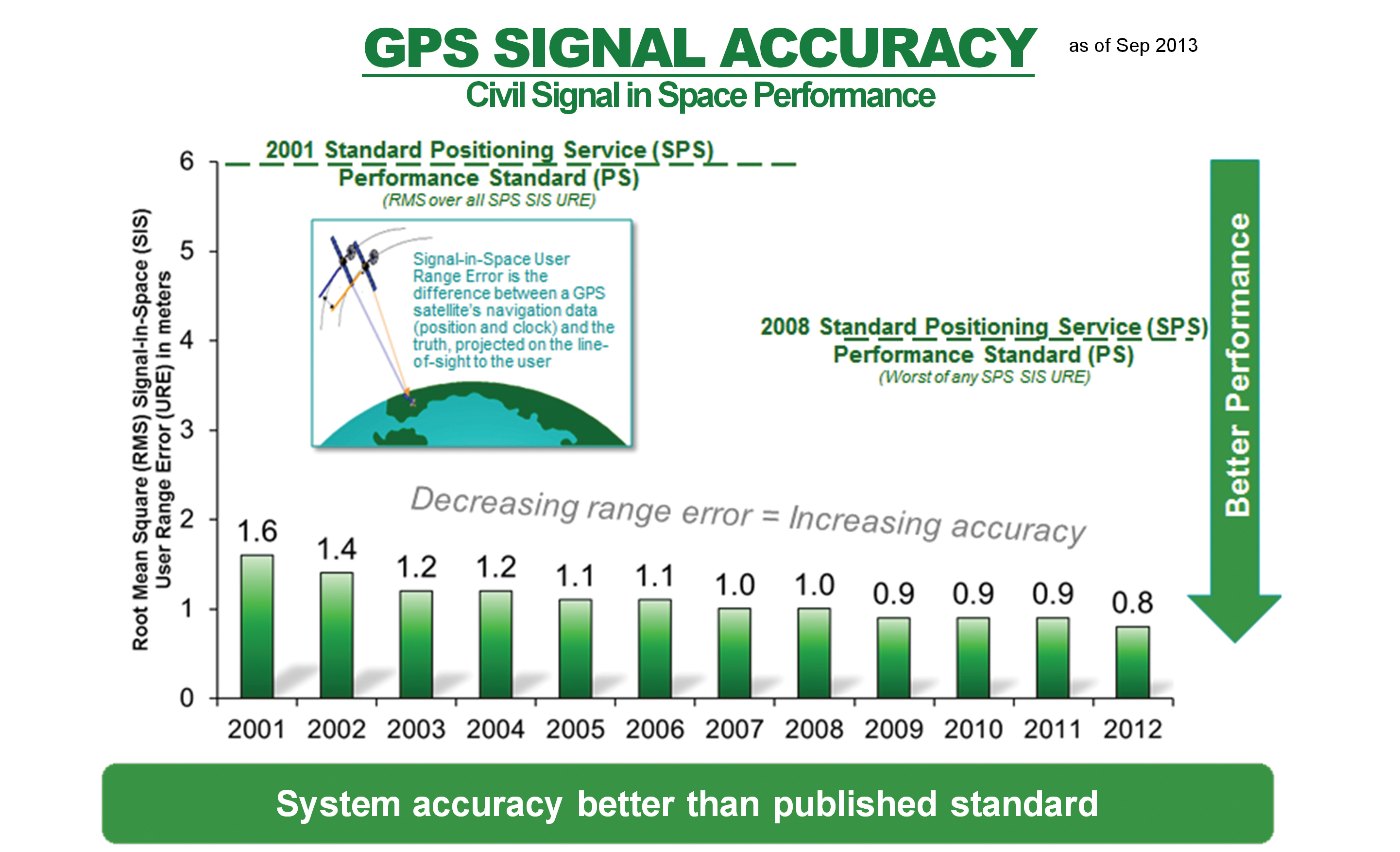
Of additional interest are space-based augmentations (SBAS) such as WAAS (Wide Area Augmentation System) and EGNOS (European Geostationary Navigation Overlay Service) as well as independent regional terrestrial augmentations and backups such as E- and D-LORAN (long range navigation), which today have demonstrated a time stability of 1×10(-12) and a position accuracy of 5-10 meters, an order of magnitude better than LORAN C’s 50-1,000 meters.
General Hyten went on to warn the commercial PNT vendors and government program managers in the 400+ audience that they must cease placing commercial GPS receivers in critical government systems that support the war fighters, government users, and our critical national infrastructure. Indeed he said this is why we have SAASM (Selective Availability Anti-Spoofing Module) and M-Code: to help secure these critical systems against interference, jamming and spoofing, intentional or otherwise. He also pleaded with industry manufacturers and vendors of PNT devices to please build their devices in strict adherence to the U.S. government;s ICD process. While the general declined to mention specific cases or companies, most in the room were aware of the ramifications of ICD non-compliance, from usefulness, mission and financial perspectives.
The general cited several known cases where, due to noncompliance, several systems just never did work well or consistently in a war zone. He said he knew of cases where “…the PNT systems worked fine in Yuma, Arizona but failed to work in Afghanistan. Please do not put commercial systems in critical military equipment.”
Pseudolites
Pseudolites are another area where the general has concerns. This is of course a hotly debated spectrum issue. Whereas we in the United States have been fighting highly-publicized spectrum battles, attempting to preserve the sanctity of the GPS spectrum globally, the Europeans are on the verge of approving pseudolite implementations all over the European continent that could seriously degrade GPS/PNT/Galileo signal reception and make PNT systems unusable or at least undependable in some critical areas, especially around the approaches to airports. Although on the surface pseudolites may seem like a good solution, I always remember what Dr. Bradford Parkinson is fond of saying: “An improperly implemented pseudolite is just another name for a potential GPS or PNT jammer.”
The Unofficial Test
After General Hyten’s comments, I decided to put his theory to the test. Just how many people know GPS is provided free to the world courtesy of the United States Air Force?
As someone who has been working GPS issues since 1975, I find it hard to believe that the American public is so uninformed about a system that is so critical to their everyday existence, because as most of you know, GPS is pervasive in almost all of our critical and not-so-critical national infrastructure. Indeed stealth GPS chips and receivers are embedded in so many devices today that it would be easier to name the devices that don’t use GPS. So I took the General at his word and set out to conduct my own mini-survey.
However, before I even had a chance to think much about what I would ask, I stepped into an elevator at the Sea World Renaissance Hotel where the ION JNC was taking place and found myself face to face with an elevator full of attendees from a major medical convention in the same hotel. They saw the ION JNC patch on my black golf shirt and asked me about it.
I told them and then asked what they knew about GPS. As in, did they know where the GPS signals came from and who provided them? Lots of answers were given and none of them remotely correct.
Frankly I was appalled, and before they exited the elevator I made sure they knew that GPS signals came from space and were provided totally free by the USAF. Mission accomplished. But not so fast; unfortunately the rest of my day and ad hoc surveys went about the same way. Some actually knew that GPS signals were free, some knew or thought they were provided by the government but had not a clue what agency or service.
Most thought they were radio signals from ground transmitters and were provided by the GPS equipment manufacturers. After asking more than 100 people where GPS signals originated and who provided them, I received exactly two correct answers, from wives whose husbands had recently served in the military in theater.
In my informal survey, 2% (two percent) of the respondents knew the right answers — and they had a military background. None of the true civilians had a clue. It was appalling and discouraging! Apparently General Hyten has done his homework and his point is well taken.
We need to get the word out that GPS is totally free, provided to the world by the United States Air Force. A simple but important message. Simple yes, and certainly discouraging at this specific venue, as this is a major part of the mission of ION and JNC — educating the world about the capabilities of GPS. Now I guess we need to emphasize the basics, just as GPS acquisition has reverted to a “back to a basics” approach. I agree with General Hyten that we (all those of us who care about GPS and all that it enables) need to do the same: get out the basic message every chance we get. Join me, won’t you, in getting that simple message across?
The next ION symposium, ION GNSS+ 2014 will take place September 8-12, 2014 at the Tampa Convention Center in Tampa, Florida. I hope to see you there.
Thanks
In closing I tip my hat to Lisa Beaty, the Executive Director of ION, and her entire team especially the new Military Division headed by my good friend and Institute for Defense Analyses (IDA) colleague Jim Doherty. Jim arranged the classified Cross Talk Military Panel this year, which was the hit of the show, as it has been under Jim’s leadership for the past several years. Jim stepped down this year as the Military Division Chair during the ION JNC symposium, and he will be sorely missed, although I suspect he will still be involved in some fashion.
The bottom line is that the ION symposia just keep getting better every year. The venues and the host hotels are first class, the food is excellent, and most of all the speakers and papers presented are scrubbed to the point that you really only get the cream of the crop. Unfortunately, you can’t say that about every GPS/PNT symposium today.
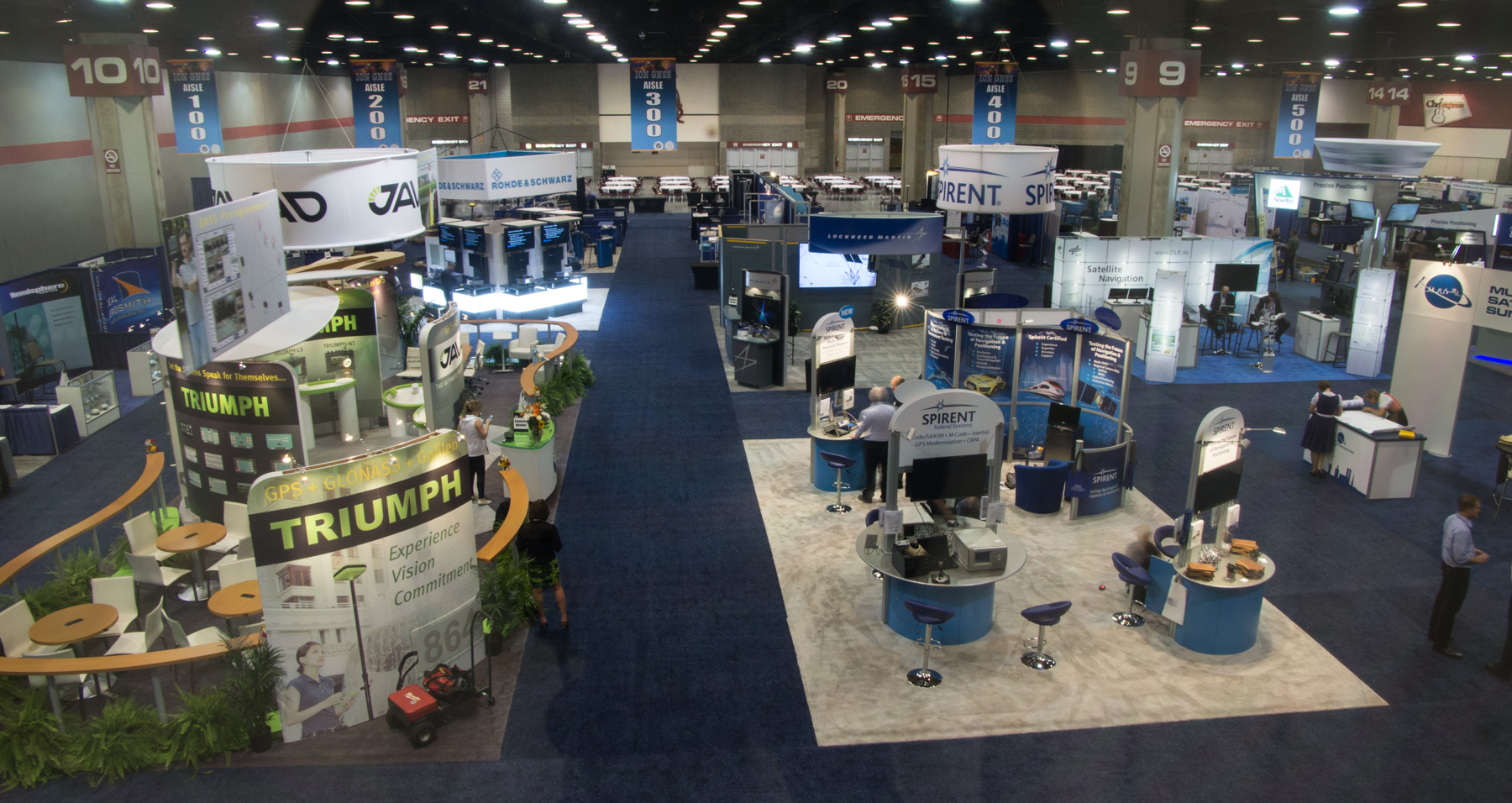
This year the exhibitors were in a large area that allowed everyone more room, and it made for a much more relaxed atmosphere in the exhibit area. I found that I spent a great deal more time with the exhibitors this year than in years past, and what I discovered there will be the subject of several future columns.
Until next time, happy navigating and remember, GPS comes to you courtesy of the United States Air Force.
Aim High!
What’s Don Reading?
Beyond Horizons – A Half Century of Air Force Space Leadership
David N. Spires, PhD – Professor Emeritus University of Colorado, Boulder, CO.
Reading good history volumes is one of my favorite pass times and when it comes to an early history of Air Force Space there is none better than Beyond Horizons.
Dr. Spires does an excellent job of setting the stage and explaining exactly how Air Force Space Command came into existence and why it was so sorely needed. The current volume covers the US Air Force and Air Force Space from its very beginnings at the end of WWII; think Dr. Theodore von Karman (Toward New Horizons) and General of the Army (Five-star) H.H. Arnold.
General Arnold actually flew a Wright Flyer back in 1911 and would have retired as a 5-star Army General but on May 7, 1949, Public Law 58-81 changed the designation of Arnold’s final rank and grade to that of General of the Air Force, and he remains the only person to have held the rank. He is also the only person to hold five-star rank in two U.S. military services. General Arnold was instrumental in funding and authorizing research conducted by von Karman, and von Karman was instrumental in research that eventually led to an Air Force and an Air Force Space Command. It is all here in this fascinating book which is edited by longtime friends and colleagues George W. Bradley III (PhD) and Rick W. Sturdevant (PhD), who serve today as the Chief and Deputy Historians respectively at Air Force Space Command.
I highly recommend this wonderful historical masterpiece, which is now in its third printing, and I predict will see many more versions and updates. In fact you can read it online at: http://www.afhso.af.mil/shared/media/document/AFD-110125-038.pdf
The only pastime better than reading, this book is talking about it with the author personally, who was also a career Air Force Officer, which I have had the pleasure of doing briefly, on several occasions, and the conversations were fascinating. David is just full of interesting facts and stories concerning Air Force Space. I am convinced that if he were to commit them all to paper, there would be several volumes. I hope you enjoy this fascinating Air Force Space history.