Broadcom Corporation has announced a new GNSS chip for Internet of Things (IoT) and wearable devices that simplifies integration of GNSS into low-cost products. The advanced chip enables devices such as fitness bands to deliver pinpoint location while consuming minimal power and in some cases can eliminate the need for a separate microcontroller (MCU).
The Broadcom BCM47748 removes a bulk of the signal processing from the device MCU by calculating position, velocity and time (PVT) on-chip, delivering significant system power savings. The chip uses intelligent firmware to extend battery life while also maintaining accuracy in speed, distance and position for an enhanced user experience.
Broadcom At ION GNSS+: Broadcom’s Stephen Mole is presenting on the topic of achieving low power consumption in wearables at ION GNSS+ 2015, taking place Sept. 14-18 at the Tampa Convention Center in Florida. Stephen will present during the A5 session, Applications using Consumer GNSS, on Friday, Sept. 18, at 9:40 a.m. inRoom 23.
“Broadcom is extending its navigation leadership into the IoT ecosystem by helping customers deliver a premium location experience without compromising battery life or requiring a costly, power-hungry host processor,” said Prasan Pai, Broadcom senior director, Wireless Connectivity. “With more consumers demanding GNSS in a wider variety of applications, we see a tremendous opportunity to expand our reach into new devices with market-leading GNSS technology.”
By absorbing location computations on-chip, Broadcom not only reduces power consumption but can also dramatically lower costs for original equipment manufacturers (OEMs) by replacing the device MCU and reducing board space. Additionally, firmware inside the BCM47748 automatically adapts to user activity and context, whether biking, walking or running, to provide precise location results to the user, enabling performance that is not sacrificed for power savings.
Key features:
PVT computed on-chip
Integrated GNSS receiver with concurrent support for GPS and GLONASS, combined with accelerometer inputs to produce stable, accurate and low power speed and distance
Context engine and adaptive firmware to enable low power consumption for every activity and context without compromising accuracy
Ability to produce GNSS fixes with only 5mA current consumption in certain scenarios
MCU host interfaces include SPI, UART or I2C
Sensor interfaces include I2C master, SPI master, I2S, ADC and GPIO
Large on-chip memory for enhanced PVT accuracy and customer applications
Embedded processor with self-boot capability
Geofencing and lifelogging capabilities
70 ball WLBGA package with 0.4mm ball pitch
The Broadcom BCM47748 is currently sampling with customers. Evaluation kits and reference designs are also available.
UNAVCO’s GAGE Facility includes more than 2,000 continuously operating GPS/GNSS reference stations around the world.
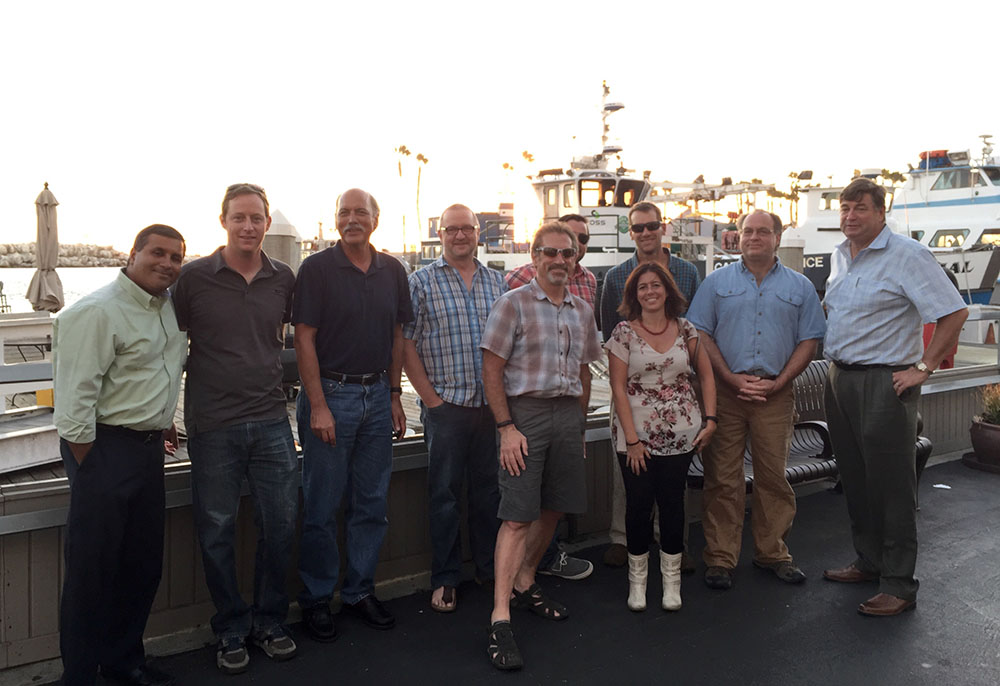
UNAVCO has selected Septentrio to be the preferred vendor of next-generation GNSS reference stations for the Geodesy Advancing Geosciences and EarthScope (GAGE) Facility. The Preferred Vendor status is valid through the duration of the GAGE Facility Cooperative Agreement with the National Science Foundation (NSF).
The selection of Septentrio was made following a rigorous competitive selection process. Under the agreement, Septentrio will supply GNSS reference stations to upgrade and expand the continuous GNSS reference station networks operated by UNAVCO.
UNAVCO is a non-profit university-governed consortium that facilitates geosciences research and education using geodesy. UNAVCO’s GAGE Facility includes more than 2,000 continuously operating GPS/GNSS reference stations around the world. UNAVCO-supported networks include EarthScope’s Plate Boundary Observatory (PBO), the Continuously Operating Caribbean GPS Observational Network (COCONet), the Trans-Boundary Land and Atmosphere Long-Term Observational and Collaboration Network (TLALOCNet) and the Polar Earth Observational Network (POLENet).
UNAVCO staff from Boulder, Colo., with three Septentrio staff near Septentrio’s headquarters in Torrance, Calif. Back row from left to right: Mo Kapila, Director of OEM Sales, Septentrio; Henry Berglund, Engineer, Development and Testing; Chuck Meertens, Director of Geodetic Data Services; Dave Mencin, Real Time GPS Manager; James Downing, Contracts and Permitting Manager; Jim Normandeau, Manager of Principal Investigator Project Support, Equipment, and Repairs; Warren Gallaher, Engineer, Development and Testing; and Neil Vancans, Vice President, Septentrio Americas. Front row from left to right: Freddy Blume, Manager, Development and Testing and Francesca Clemente, Manager, Technical Support, Septentrio. (Credit: Septentrio)
“This decision, following a highly competitive technical evaluation, is an important validation of Septentrio’s family of high-performance GNSS receivers,” said Neil Vancans, vice president, of Septentrio Americas. “Septentrio is firmly established as the preferred choice of receivers within the scientific and academic community for ionospheric observations, timing and other demanding applications, due to their superior multipath mitigation, resistance to ionospheric disturbance and in-band jamming. We look forward to working closely with UNAVCO to support its important mission of advancing geodetic science.”
“The critical technology in the new generation of reference station receivers is available in the Asterx 4 OEM boards, which also provide low and scalable power options. This technology is being extended across the full line of Septentrio products,” added Vancans.
“This Preferred Vendor relationship gives UNAVCO a unique opportunity to provide technical input during the ongoing development process of Septentrio’s next-generation PolaRx-series GNSS receivers,” said Frederick Blume, senior project manager for Development and Testing at UNAVCO.
Septentrio made the announcement during ION GNSS+, being held this week in Tampa, Fla.
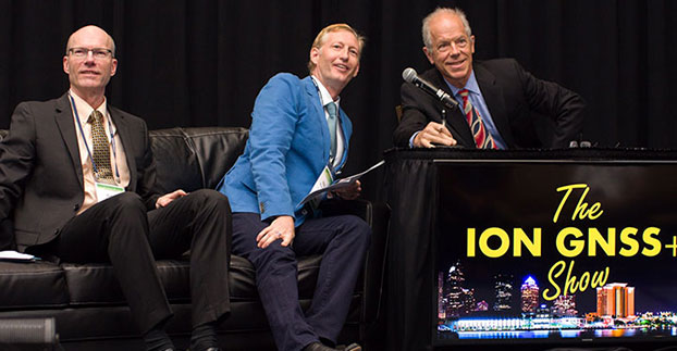
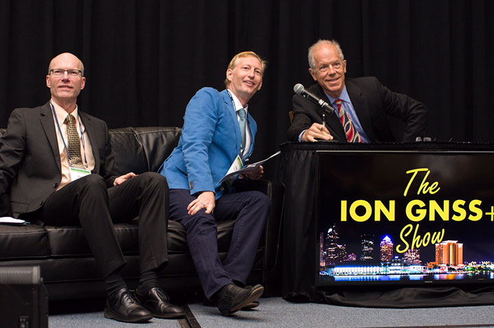
Alan Cameron, GPS World editor and publisher, interviews Technical Chair Paul McBurney; at left is Program Chair Gary McGraw. Each presenter was interviewed for “The ION GNSS+ Show” following a five-minute lightning presentation. (Courtesy of ION)
Tuesday night’s Plenary Session at ION GNSS+ took attendees to space with a high-flying presentation on NASA’s planetary exploration endeavors by keynote speaker James L. Green, director of Planetary Science for NASA. He touched on most of the planets, with the July fly-by of Pluto by the New Horizons probe the climax of his talk.
Following the keynote, the ION GNSS+ program chairs shared insights on the topics to be covered at the conference in a lighthearted — and very fast-moving — format. Each presenter had only five minutes to describe their program track. Afterward, they were invited to the set of “The ION GNSS+ Show,” where moderator (and GPS World editor and publisher) Alan Cameron asked them a few questions.
This year’s conference feature panels of industry experts, policy updates, the world’s largest GNSS commercial exhibit and more than 300 technical presentations presented through both Systems and Application Tracks and Peer-Reviewed Tracks.
Program chairs who gave lightning talks before joining Alan on the couch, and their topics, were: Paul McBurney, GopherHush Corp., Mass-Market Applications; Sandra Kennedy, NovAtel, High Performance & Safety-Critical Applications; Andre Hauschild, German Aerospace Center, System Updates, Plans and Policies; Zainab Syed InvenSense, Multisensor Navigation and Applications; Olivier Julien, ENAC, Algorithms and Methods; and Grace Gao, University of Illinois at Urbana-Champaign, Advanced GNSS Technologies.
Planetary Navigation. During his keynote address, Green took the audience on a journey navigating through the solar system. He explained that NASA’s goals are to advance our knowledge of the origin and history of the solar system, discover the potential for life elsewhere, and assess what hazards humans may face in exploring space. First stop was our nearest neighbor, the Moon, which was explored in 2012 by NASA’s Gravity Recovery and Interior Laboratory (GRAIL) spacecraft. GRAIL uncovered the origin of massive invisible regions that make the moon’s gravity uneven, a phenomenon that affects the operations of lunar-orbiting spacecraft. Because of GRAIL’s findings, spacecraft on missions to other celestial bodies can navigate with greater precision in the future.
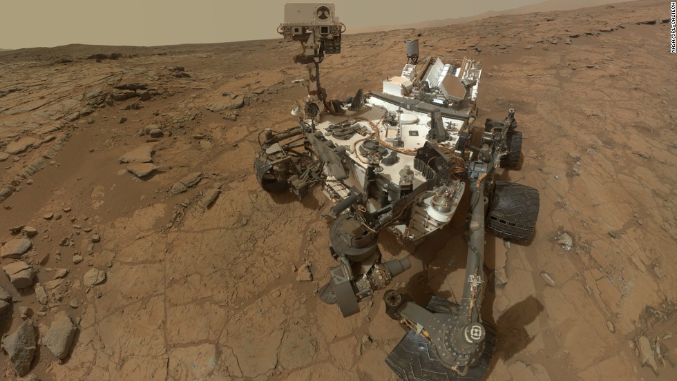
Moving on to Mars, Green shared the background and successes of the Curiosity rover, which is still on Mars researching the Red Planet. Curiosity also took a selfie.
Curiosity landed on Mars in August 2012 and took this selfie, which is an aggregate of more than a dozen separate images.
Green said Andy Weir’s novel The Martian, which has been made into a movie that will be out in October, is a realistic depiction of what exploring the hostile red planet would be like for humans.
The New Horizons flyby of Pluto drew several audience questions following Green’s presentation. With an orbit of 248 years, it was a challenge to determine the precise navigation route to the Solar System’s outermost planet, especially when travel at 16 kilometers a second could spell disaster if the probe encountered any space debris — even a particle the size of a grain of sand could end the mission. Mission control constantly reassessed the spacecraft’s trajectory using imagery from the Hubble space telescope and then New Horizons itself.
NASA was surprised to find that Pluto’s surface has relatively few craters.
The GPS World staff reports live from ION GNSS+ in Tampa, Fla., September 14–18, providing news, photos, videos and more. GPS World will be there with a full team, including Editor and Publisher Alan Cameron, Managing Editor Tracy Cozzens, and our market-sector editors. We’ll be providing near-real-time coverage of the show on GPSworld.com and on Twitter.
GPS World will also video record the indoor navigation demonstrations, and portions will be posted online at the GPS World YouTubechannel.
If you’re attending, be sure to come by the GPS World booth during the exhibit hall reception Wednesday evening to film a video-selfie with Mary Ann, our August cover great white shark. The video-selfies give you 30 seconds to tell us about yourself and will be posted to our YouTube channel.
Check back throughout the week for updated information from the event.
PCTEL’s GPS/GLONASS high-performance asset tracking and synchronization helix antennas are now available commercially. The antennas capture the frequencies needed for GPS, Galileo and GLONASS satellite reception. This cross-compatibility allows global OEMs to use one standard platform to serve both European and U.S. markets.
PCTEL will display its new IP67-rated GEO-GNSS antennas and other mobile and GPS antennas Sept. 16-17 at ION GNSS+, Booth #416.
PCTEL uses its proprietary filtering design to allow wideband coverage while achieving superior out-of-band rejection, the company said. The small form-factor helix antennas will withstand harsh environments.
“Customers expect PCTEL to solve challenging problems,” said Rishi Bharadwaj, PCTEL’s vice president and general manager, Connected Solutions. “We designed PCTEL’s GEO-GNSS series for complex asset tracking and network timing applications.”
For more information about PCTEL’s GEO-GNSS helix antennas, visit the PCTEL website.
Technology Advancement Group (TAG) will be showcasing precision, navigation and timing technology integration solutions at the ION GNSS+ conference, which will be held Sept. 14-15 in Tampa, Fla.
In particular, TAG will display a custom-designed military GNSS survey system that is the U.S. Army program of record for geodetic, construction and airfield surveying.
TAG’s Precise Positioning Service Global Positioning System Survey (PPS GPS-S) system was designed specifically for use by survey teams to have access to centimeter-level GPS survey accuracy with the added benefits of a fully-certified military GPS receiver that is supplemented with a GNSS receiver for real-time kinematic surveying with multi-constellation operations.
The PPS GPS-S system has been specifically designed to address the stringent requirements of military survey missions including geodetic, construction, airfield, and field artillery survey. It gives the military surveyor the tools they need to complete their missions with minimum time-on-station even in the face of GPS signal interference, attempted spoofing, or electronic warfare, the company said.
TAG was recently awarded a $24 million contract by the U.S. Army Geospatial Center for its AN/GSN-16 military survey system.
Core components of the PPS GPS-S system include a base station and two rovers, each integrated with a GNSS antenna with protection against jamming or spoofing, a custom-designed rugged tablet with an internal RF radio that has a 20-km range, and GPS-S accessories for additional functionality. Designed for continuous operation, the PPS GPS-S system includes multiple power options such as dual hot-swappable Li-Ion batteries, 12V battery, DC/DC converter, NATO adapter, and 4-slot Li-Ion charging station.
Powered by Carlson Surv-PC, TAG’s PPS GPS-S system is tailored for military environments that require tactical computer-aided design (CAD) operations. With an intuitive graphical user interface, surveying operations can be conducted in the field allowing for work to be completed in real-time. Accurate geospatial information system (GIS) data capture and a full suite of CAD functions allows survey teams to remain in the field to complete the drawings without the need to return to base.
For ION GNSS+, TAG will be in booth #102 of the exhibit hall in the Tampa Convention Center.
The Institute of Navigation (ION) GNSS+ conference is scheduled for Sept. 14-18 this year, just down the road in Tampa, Fla. It’s just over an hour’s drive for me, so I’ll be there again this year.
The reminders from ION have started to show up in my inbox, touting issues like PNT privacy, a new UAV session, a return of the popular indoor navigation demonstrations with a significantly larger group of companies demonstrating, an update on what’s happening in indoor navigation regulation-land, and with a number ways to find out what’s happening on social media. So most GNSS industry people will now have their reminder to register, get a hotel room and choose the sessions they want to attend for their week in Tampa.
GPS World will be there as usual with our full team, including our market-sector editors, along with near-real-time coverage of the show on GPSworld.com and on Twitter. The exhibition floor looks to be almost full, so if you were sitting on the fence thinking about exhibiting, its probably time to make a decision — there only appear to be a few booths still open.
GPS World will also video record the indoor navigation demonstrations, and portions will be posted online at the GPS World YouTubechannel.
Also, come by the GPS World booth during the exhibit hall reception Wednesday evening to film a video-selfie with Mary Ann, our August cover great white shark. The video-selfies give you 30 seconds to tell us about yourself, and will be posted to our YouTube channel.
The CGSIC (Civil GPS Service Interface Committee) meets and tutorials will be held on Monday and Tuesday, but the week basically gets going with the plenary session on Tuesday evening.
James L. Green, director of Planetary Science for NASA.
This year, ION has called on Dr. James L. Green, director, Planetary Science at NASA, to give an insight into NASA’s interplanetary exploration over the last several years. He plans to take us “on a journey navigating our way through the Solar System showing you new worlds and new discoveries through the eyes of our planetary spacecraft.” In the last several years alone, the understanding of the origin and evolution of the solar system has changed dramatically. He’ll demonstrate how our foundations of knowledge have literally been reestablished.
Technical papers and applications sessions get rolling bright and early on Tuesday morning.
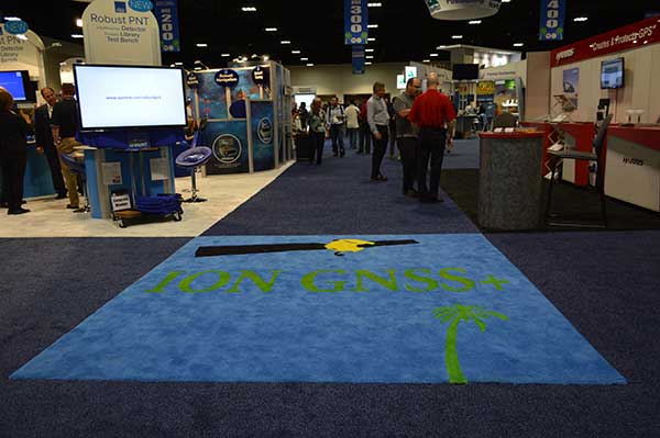
Then the exhibit hall opens up at 10 a.m. on Wednesday, with more than 50 GNSS and related exhibitors from around the world showing their new products and innovations. Exhibitors range from GNSS systems manufacturers to simulation, timing, engineering and system integrators, chip and receiver manufacturers, antenna and RF component suppliers, test-solution suppliers, indoor location experts, inertial navigation companies, government and R&D agencies, military and commercial GNSS suppliers, satellite system and component providers, survey-systems suppliers, and a smattering of Internet of Things (IoT) proponents. The exhibit floor runs Tuesday through Thursday in parallel with the applications presentations and panels and technical papers.
The show floor at ION-GNSS 2014.
Key application presentations for me to catch include the indoor location demonstrations on Wednesday afternoon, and the new UAV navigation session on Thursday morning. But there are around four parallel presentations on systems and applications and four sessions of technical papers each morning and afternoon Tuesday through Friday, so there are enough topics on a huge range of GNSS and related navigation technologies that would satisfy almost anyone in the industry or anyone wanting to learn about the industry.
Indoor Location Demonstration
The list of vendors who plan to demonstrate at the indoor location demonstration session is lengthy:
Nokia
InvenSense
RX Networks
Indoor.rs
Samsung
CSR
Combain
Pole Star
ByteLight
Microsoft
That’s about twice as many participants as last year, when the audience was treated to a number of demos that worked, and some which basically didn’t. So, this is an opportunity to redeem themselves for those who had problems, time to update and show improvements over last year for the ones who demonstrated successful indoor navigation, and for the newcomers, we shall see what they have to offer. Hopefully, companies will have recognized that it’s essential to a have a large-screen display replicating handhelds for a large audience to follow what’s going on.
UAV Session
The UAV session appears to concentrate on alternate navigation and other sensors for unmanned airborne vehicles. Papers include modeling and calibration to remove magnetic biases coming from other devices on the platform; a kind of indoor navigation for micro-UAVs entering buildings for assistance in disaster conditions; navigation using optical imaging with and without GNSS; Stanford’s JAGER jammer detection project using DME and ADS-B signal navigation; and integrity requirements for UAV sense-and-avoid systems. Another panel session on Friday discusses integration of UAVs into the U.S. National Airspace System.
If these couple of topics don’t fire you with enthusiasm, don’t worry – there are masses of other great topics to pick from in the extensive technical program at ION GNSS+. Right now, pre-registration for ION GNSS+ is running 26 percent ahead of where it was last year, so we could have 1,300-1,400 technical attendees this year.
So, come on down to Florida – yes, it’s warm (the Convention Center is air conditioned), but its not too warm — even for a guy like me from the frozen North!
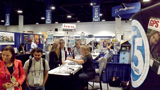
Crowds gather at the GPS World booth at ION GNSS+ 2014.
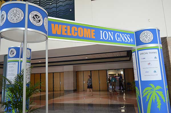
ION GNSS+ 2015 is the 28th International Technical Meeting of the Institute of Navigation’s Satellite Division and the world’s largest technical meeting and showcase of GNSS technology, products and services and other sensors in today’s marketplace. The conference will be held Sept. 14-18 (tutorials Sept. 14-15) at the Tampa Convention Center in Tampa, Fla.
James L. Green, director of Planetary Science for NASA, will take the audience on a journey navigating through the solar system during his keynote address. He will show new worlds and new discoveries through the eyes of NASA’s planetary spacecraft.
This year’s conference will feature panels of industry experts, policy updates, the world’s largest GNSS commercial exhibit and more than 300 technical presentations presented through both Peer-Reviewed Tracks (Multisensor Navigation and Applications; Algorithms and Methods; and Advanced GNSS Technologies) and Systems and Application Tracks (Mass-Market Applications; High Performance & Safety-Critical Applications; and System Updates, Plans and Policies).
GPS World staff will be moderating the Lightning Talks section of the plenary session, as well as hosting a booth in the Exhibit Hall.
Tap into our up-to-the-minute show coverage here at gpsworld.com and via Twitter (@GPSWorld).
Alan Cameron, GPS World Editor and Publisher, provides the following video introduction to the conference.
This year, unlike in previous years, the technical program (registration brochure) will only be distributed online. Users can search and sort the program online or download and print a PDF version. A printed on-site guide book will still be available to attendees.
ION GNSS+ 2015 is the 28th International Technical Meeting of the ION Satellite Division and the world’s largest technical meeting and showcase of GNSS technology, products and services and other sensors in today’s marketplace.
Attendees who book a hotel room first will save $200 by entering the hotel confirmation number from the Tampa Marriott Waterside Hotel and Marina at the start of the registration process. Attendees will need a valid hotel confirmation number to claim this discount during registration.
ION GNSS+ brings together international leaders in GNSS and related positioning, navigation and timing fields to present new research, introduce new technologies, update current policy, demonstrate products and exchange ideas. The focus of this meeting is the growing emphasis on GNSS and the rapidly evolving field of alternative navigation methods.
This year’s conference will feature panels of industry experts, policy updates, the world’s largest GNSS commercial exhibit and more than 300 technical presentations presented through:
Peer-Reviewed Tracks
Multisensor Navigation and Applications
Algorithms and Methods
Advanced GNSS Technologies
Systems and Application Tracks
Mass-Market Applications
High Performance & Safety-Critical Applications
System Updates, Plans and Policies
GPS World Editor and Publisher Alan Cameron discusses the importance of the annual ION GNSS Conference at the 2014 event, also held in Tampa.
Despite being an avowed Anglophile since my first visit to the United Kingdom, somewhere around 50+ years ago, I just could not help myself. Professor David Last, Professor Emeritus at the University of Wales (Bangor) and former president of the Royal Institute of Navigation (RIN) was holding forth, with that wonderful, attention-arresting public school accent, on weighty PNT (position, navigation and timing) matters before an awestruck audience.
Professor Emeritus David Last.
And what did I do? I just could not stop myself reminding him and everyone within earshot that the American Institute of Navigation (ION) predated the British Royal Institute of Navigation by more than two years. The point being, of course, that while two years actually makes little difference in the scheme of things, actuarially speaking we yanks rarely have the opportunity to make such a claim where our stiff upper-lipped Red Coat cousins are concerned. So, when the opportunity presents itself, as it typically does at ION GNSS+, then in my opinion, we former colonists just have to jump in with both feet — or one if by land and two if by sea, and all that.
An even more compelling argument for being first revolves around GPS versus Galileo operational satellites. The first GPS operational launch occurred in 1978, while Galileo has yet to launch a non-R&D operational PNT satellite, into a useable orbit that is. Now, before you accuse me of being smug, I am actually making a case for increased cooperation between the United States Air Force (USAF) and our European counterparts (ESA) where precision positioning, navigation and timing (PNT) schemes are concerned. For when it comes to satellite navigation and PNT, we yanks can definitely declare “been there, done that” mistakes and successes. What better place to “crow,” or rather, impart our considerable knowledge and network with fellow PNT aficionados, than at ION GNSS+.
ION GNSS+
All vocal eloquence jealousies and juvenile kidding aside, in many respects the ION GNSS+ event is actually the epitome of international cooperation in the PNT and GNSS (Global Navigation Satellite System) arena. This annual premiere event is described as “the world’s largest technical meeting and showcase of GNSS technology, products and services,” and I wholeheartedly agree. Indeed, the 2014 event, which took place from September 8-12 at the Tampa Convention Center in Tampa, Florida, had the stated goal of bringing together international leaders in GNSS and related positioning, navigation and timing fields to present new research, introduce new technologies, discuss current policy, demonstrate products and exchange ideas. It was a networking paradise in a wonderful, albeit somewhat steamy, venue, which you can review in two excellent videos concerning the event at the ION website.
This ION conference improves every year in content and attendance, and this year was no exception. Congratulations to Lisa Beaty and her whole team for a great conference, year after year. My favorite events are the annual GPS World Leadership Dinner and the prestigious annual ION Kepler award luncheon. Notice a trend?
GPS World Leadership Dinner
This much ballyhooed event becomes more and more of a draw each year. Tickets are coveted (as scare as hen’s teeth as Granny used to say) and competition is fierce. Every year we have about twice as many people wanting to attend as we have room to accommodate them. So the competition is never boring. This year was special in that one of our own GPS editors was nominated for an award and was overwhelmingly elected to receive it.
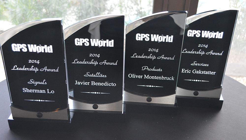
The Leadership Award winners this year were Javier Benedicto Ruiz, the Galileo Project Manager from the European Space Agency (ESA), who won in the Satellites category, while an old friend Sherman Lo, who is a senior research engineer and associate investigator (APNT) at Stanford University, won in the Signals category. Our own Eric Gakstatter, contributing editor for Survey and GIS from GPS World, won in the Services category; and finally Oliver Montenbruck, who is head of the GNSS Technology and Navigation Group, from DLR, the German Space Operations Center, won in the Products category.
GPS World 2014 Leadership Trophies.
The invited guests, and there was not an empty seat in the house, heard various perspectives from sponsors Lockheed Martin, Exelis, Raytheon, and Braxton Technologies, as well as visions of GNSS progress from our four award winners.
This event will be covered in much more depth in our December issue, but suffice it to say it was as usual a great event. I wonder from year to year how we will ever top the previous year’s entertainment, which always involves audience participation, but Alan Cameron just keeps coming up with outrageous ideas that seem to always pan out. Hope to see you there in Tampa next year.
The Kepler Award
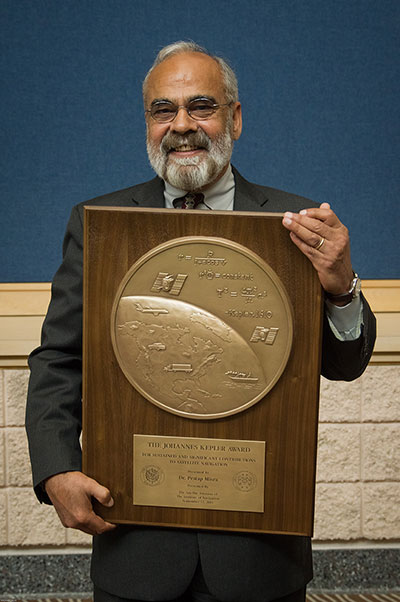
This year, the highly prestigious ION Kepler Award was won by Dr. Pratap Misra. Even though I am happy to say that through the years many of my friends and colleagues have won this coveted award, I can honestly say, in my opinion, there has never been a more deserving award winner than Professor Pratap Misra.
[Correction: The newsletter summary of this article misspells Pratap Misra’s name. We apologize for the error.—Editors]
Pratap Misra, 2014 Kepler Award recipient.
I have had the good fortune to know Professor Misra for many years, and frankly erroneously assumed, along with many others, that since he is so obviously deserving he had previously won the Kepler Award.
The Kepler Award is presented annually by ION in recognition of an individual’s unparalleled, sustained and significant contributions to the development of satellite navigation. It is the highest honor bestowed by ION’s Satellite Division. Professor Pratap from Tufts University meets and exceeds all of these qualifiers and more. He is simply self-effacing and polite as he quietly goes about being the best in all he endeavors.
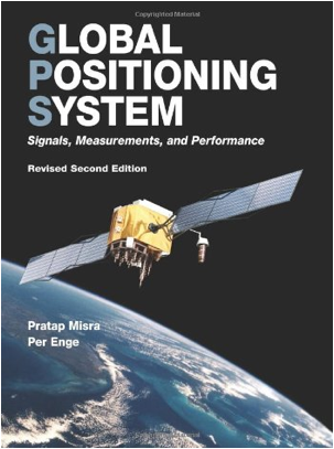
Throughout the years, I have found Pratap to be extremely dedicated to his work, and more recently to his students. These are key attributes. Academically, I can honestly say that the authoritative tome Global Positioning System: Signals, Measurements and Performance that he coauthored with, another friend and colleague, Professor Per Enge of Stanford University, is among the most dog-eared in my PNT library. This widely praised volume is often described as a “comprehensive introduction to GPS: the system, signals, receivers, measurements, and algorithms for estimation of position, velocity, and time.” And while it was originally intended as a textbook for senior or graduate-level engineering courses, it also serves remarkably well as a self-study guide for practicing engineers and as a reference tool for writers and researchers. I consider it to be one of the three PNT bibles that are a must-have in every PNT subject-matter expert’s (SME) library. (The other two are Global Positioning System: Theory and Applications, Volumes 1 and 2, by Bradford W. Parkinson and James J. Spilker, and Understanding GPS: Principles and Applications, Second Edition, by Elliott Kaplan and Christopher Hegarty.)
Revised Second Edition by Pratap Misra and Per Enge.
In recent years, Pratap Misra has been honored as both an ION and IEEE Fellow and has served as a past chairman of the ION Satellite Division. He has held numerous volunteer positions within ION, but most recently he has focused on something near and dear to his heart, the support of student programs. This is where Professor Pratap Misra is without peer. Frankly it is obvious that his students adore him, and it is due in no small part to his single-minded dedication to and concern for them.
Every time we meet, the majority of his words and thoughts concerns his students. Their welfare is always uppermost in his priority list. Inevitably, while we are attempting to conduct a quiet and private conversation or interview, we are constantly being interrupted by well-meaning students, past and present, who just want to thank Pratap for his help and support. I could fill up several pages with the technical accomplishments of Professor Pratap Misra, but none of those accomplishments, recognitions or awards mean as much to him as the love, support and success of his students. It is so obvious to anyone who pays attention that he wholeheartedly thinks of his students as and treats them just like family.
I am sure, or at least hope, we all have past professors or teachers in our lives that we remember fondly, and then there are the few or perhaps only the one that changed the course of our lives for the better. Professor Pratap Misra is one of those rare latter individuals, so deserving of the appellation — a professor that made a difference in the lives of his students. I am so proud that he deservedly won the Kepler Award and am deeply honored that I can call him my friend.
GPS-IRT Update
The Global Positioning System Independent Review Team (GPS-IRT) is now officially part of the Independent Strategic Assessment Group (ISAG) under the auspices of the Institute for Defense Analyses (IDA). For 19+ years, the GPS-IRT was a separate team within IDA that researched GPS matters with the “goal of insuring both the military and civilian communities would benefit from new GPS/PNT capabilities and services.”
As a result of this organizational change, Air Force Space Command (AFSPC) chose to formally recognize the GPS-IRT’s 19+ years of effort in support of GPS modernization.
Last Thursday, General John Hyten (USAF), the commander of Air Force Space Command, presented a commemorative plaque to Mr. Kirk Lewis, the executive director at IDA, for both the GPS-IRT and the ISAG. The plaque will be displayed with the GPS satellite on permanent display at AFSPC headquarters, in the James V. Hartinger building on Peterson Air Force Base, Colorado. The plaque contains the names of the four prestigious chairmen who led the GPS-IRT over the last 19 years, as well as the names of the members of the IRT over that same time period. Sadly, two of the chairmen and five of the members are no longer with us, but we can only hope they are looking down upon us fondly and giving us guidance of a different sort.
Until next time, happy navigating, and remember: GPS is brought to you courtesy of the United States Air Force.
Broadcom Corporation today announced the industry’s first low-power GNSS and sensor hub combo chip to deliver new always-on location applications for a full range of mobile devices.
The Broadcom BCM4773 minimizes battery drain and adds a new layer of intelligence to location technology on mobile devices by integrating the GNSS chip and sensor hub into a single combo chip. Broadcom’s architecture enables information from Wi-Fi, Bluetooth Low Energy (BLE), GPS and micro electro-mechanical systems (MEMS) to be calculated on a single system-on-chip (SoC) instead of the application processor (AP). This design drives more than 80 percent power savings by offloading from the AP and lowers cost by reducing board area by 34 percent.
“Broadcom today extends its leadership by announcing the industry’s first combo chip that brings GNSS and sensor hub technology together to revolutionize mobile apps in areas such as health, fitness and lifelogging,” said Mohamed Awad, Broadcom director, Wireless Connectivity. “We are proud to make all mobile platforms even smarter by enabling them to dynamically predict and react to consumers’ needs.”
Additionally, Broadcom brings more intelligence to context awareness by integrating GNSS and providing a direct connection to the Wi-Fi combo chip. This allows a mobile device to know where a user is and what the user is doing to further personalize the experience. For example, a BCM4773-based smartphone can use information from Wi-Fi, BLE, GPS and MEMS to recognize when a runner is outdoors versus inside on a treadmill and dynamically manage these technologies to save battery life and optimize the user experience, all without involving the main AP.
Key Features:
Optimized for hardware offload of sensor fusion, on-chip positioning, geofencing and location batching
More than 80 percent power savings compared to standard GNSS receivers
34 percent board area reduction by integrating GNSS receiver and sensor hub
Standalone microcontroller offloads fusing of sensor data from the AP to maximize power savings
Concurrent support for five different satellite systems, including GPS, GLONASS, SBAS, QZSS and BeiDou
Ultra-low power on-chip positioning for background and foreground location using GNSS
On-chip Wi-Fi positioning using a direct connect communication protocol to the Wi-Fi SoC
Batching support for all devices connected to the Location Hub, including Wi-Fi, MEMS and GNSS
Two U.S. Air Force officers provided a GPS program update at Tuesday morning’s Civil GPS Service Interface Committee meeting plenary session at the ION GNSS+ 2014 conference in Tampa, Florida. Here are some key points from the presentations by Colonel Matthew Smitham, deputy director, GPS Directorate, and Lieutenant Colonel Todd Benson, Commander, Second Space Operations Squadron:
31 primary satellites on orbit, 7 satellites in residual status, 1 satellite in test status
best weekly URE of 58.7 cm during week of 18 August 2014
newer satellites typically perform better than older ones
anticipate URE dropping to about 30 cm in a few years as more modern satellites come on line
60-70 navigation data uploads to the satellites are performed each day; average of about two per satellite per day
IIFs:
SV 3 and SVs 5-12 have improved rubidium clocks; one of the IIFs is running on a cesium clock
14 SVs are currently broadcasting L2C (set healthy); 7 SVs are broadcasting L5 (set unhealthy)
CNAV:
Data uploads are currently being done about twice per week to each satellite; daily updates expected by December 2014
average UREs currently about 1.4 m (data ages quickly with few uploads per week); expect CNAV URE to be marginally better than LNAV (Legacy NAV) when daily uploads begin
Continued progress in bringing M-code on line; expect early use by 2017
GPS III:
satellites will use three improved rubidium clocks
although the program is behind schedule, SV 1 will be available for launch starting in January 2016
the Block 0 version of the OCX (Next Generation Operational Control System), currently under test, will be needed to support the GPS III satellites
 Broadcom Corporation has announced a new GNSS chip for Internet of Things (IoT) and wearable devices that simplifies integration of GNSS into low-cost products. The advanced chip enables devices such as fitness bands to deliver pinpoint location while consuming minimal power and in some cases can eliminate the need for a separate microcontroller (MCU).