Tag: jamming

  • ESA fights interference in Arctic tests

    ESA fights interference in Arctic tests

    News from the European Space Agency

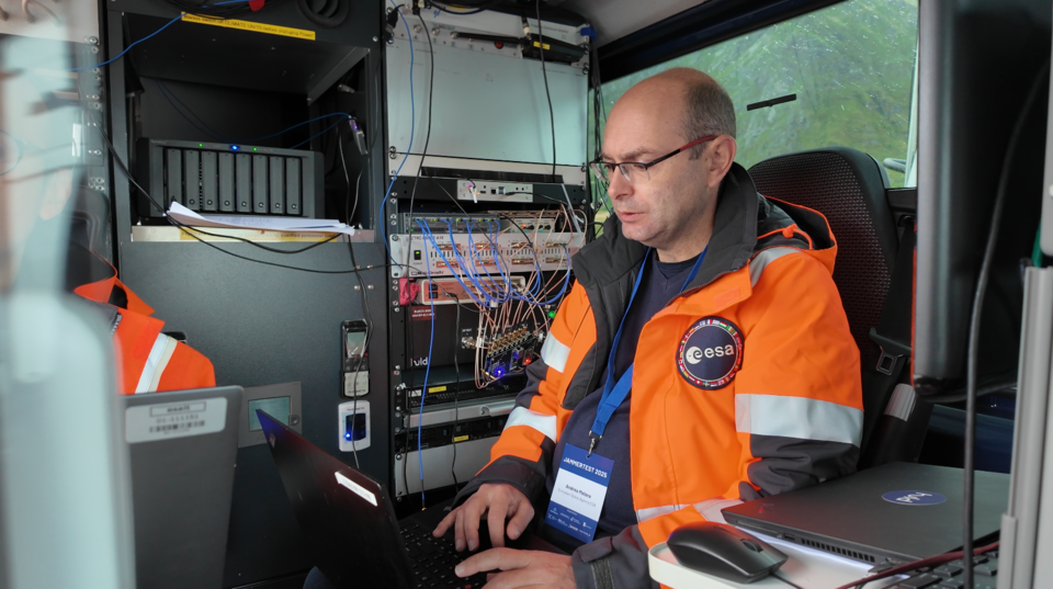
    In its pursuit of strengthening European resilience in navigation, the European Space Agency (ESA) took part in Jammertest. Jammertest 2025 brought together 360 participants from 120 organisations across more than 20 countries, spanning academia, industry and governmental institutions.

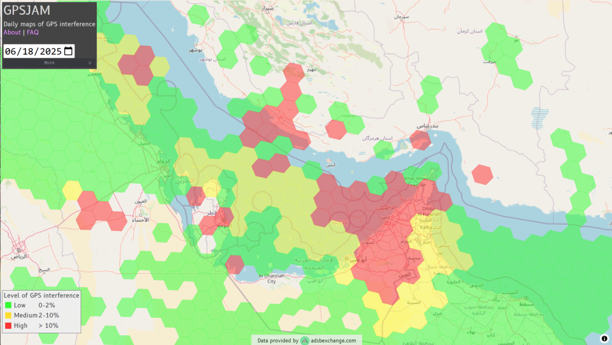
    Incidents of deliberate GNSS interference are on the rise, wih attacks happening daily worldwide. Disruptions threaten safe operations of energy grids, banking infrastructure, emergency transportation and civil aviation, with an outage potentially costing billions of euros daily for Europe.

    Bleik on the island of Andøya offered a suitable setting for Jammerfest. (Image: ESA)
    Bleik on the island of Andøya offered a suitable setting for Jammerfest. (Image: ESA)

    Jammertest. In a complex coordination exercise among seven Norwegian public authorities and facilitator Testnor, Jammertest organisers broadcast real satellite navigation interference for participants to observe how their equipment (on vehicles, drones, aircrafts, helicopters and vessels responds.

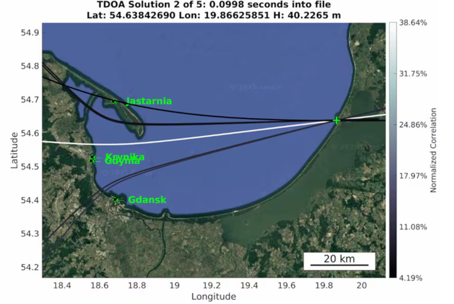
    At nearly 70 degrees North and 300 km inside the Arctic Circle, the small village of Bleik on the island of Andøya offers the ideal setting for Jammertest. To the east, towering mountains act as natural barriers that contain disruptive signals, minimising their impact on civil society. To the west, its open coastline allows signals to be transmitted over the sea, supporting maritime participants in addition to air and land users.

    The event’s test catalogue is extensive. Organisers simulate everything from simple handheld jamming to complex multi-source attacks launched from several locations simultaneously, including from mountaintops. “The goal is that every receiver is knocked out at some point during the campaign,” explains Tomas Levin, senior principal engineer at Norwegian Public Roads Administration and head of Jammertest.

    “At Jammertest, the full GNSS chain sits along a table, from chip manufacturers to those developing the algorithms that run on them, to the companies building products around those chips and the ones integrating these products into larger systems,” Levin said.

    Photo:
    ESA’s navigation and telecommunications testbed vehicles are custom-built mobile test platforms operated by ESA’s Navigation Laboratory to support test campaigns for navigation and telecommunications services, most notably Europe’s Galileo constellation. (Photo: ESA)

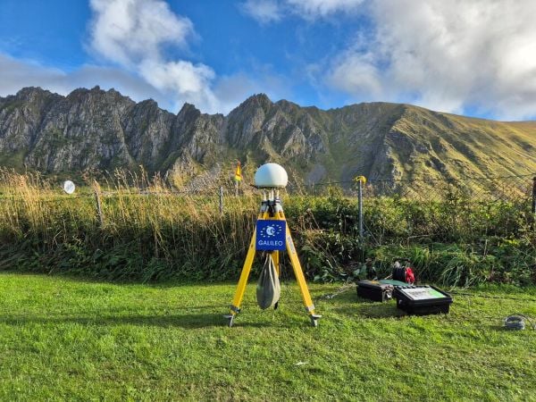
    ESA engineers arrived with several missions. As in previous years, the team tested the robustness of EGNOS and Galileo signals when picked by a range of antennas, from simple mass-market ones found in smartphones to military-grade antennas, both stationary and mounted on a moving van.

    A key objective was to test the performance of novel receiver technologies developed under various ESA programs, comparing them to current technologies. The team also tested equipment provided by industrial partners under ESA’s Third-Party services.

    More than 100 TB of data were recorded and will support internal research. Moreover, these data can now be replayed at the ESA Navigation Laboratory, allowing industry to analyse how new equipment responds to real-world interference scenarios. (If you are interested in using ESA’s NavLab testing and consultancy services, fill out the contact form on the Consultancy and Testing page).

    Finally, ESA also oversaw tests of new EGNOS ground receivers being developed by European industry under Horizon2020 and Horizon Europe programmes. These receivers aim to improve the system’s robustness in its next generation.

    Multi-beam satellite navigation antenna test. (Photo: ESA)
    A multi-beam satellite navigation antenna test. (Photo: ESA)

    Several projects tested at Jammertest by other participants were funded through NAVISP, highlighting the agency’s role in fostering innovation across the GNSS ecosystem. 

    “Jammertest is a unique opportunity,” concludes Derambure. “Here we have the edge of technology, the edge of testing scenarios. There is nowhere else where we can test this material in real conditions. I believe Jammertest will become a mandatory step for any new satellite navigation receiver technology.” 

  • CMC Electronics and ÉTS launch major research chair in resilient aviation navigation

    CMC Electronics and ÉTS launch major research chair in resilient aviation navigation

    A five-year research and development program has been launched to enhance GNSS navigation for aviation, encompassing security, integrity and spoofing resilience.

    CMC Electronics is partnerinng with École de Technologie Supérieure (ÉTS) in Quebec, Canada, to create the CMC Electronics Industrial Research Chair in Resilient GNSS Navigation. The five-year chair, valued at more than $6 million, unites CMC’s avionics expertise, led by John Studenny, internationally recognized GNSS navigation expert and standards contributor, with ÉTS’s renowned LASSENA laboratory under René Jr. Landry, an expert in aerospace navigation and cybersecurity.

    The chair will tackle critical threats to GNSS navigation for aviation, including jamming and spoofing. CMC and ETS aim to develop spoofing-resilient GNSS receivers capable of real-time detection, mitigation and total recovery from spoofing attacks, setting a benchmark in aviation safety and integrity.

    Research focus areas

    The chair’s work spans several integrated areas that target key GNSS security challenges:

    • integration of spoofing detection algorithms
    • spoofing resilience grading and stress testing frameworks
    • recovery mechanisms and certification benchmarking
    • advanced integrity algorithms (ARAIM)
    • sensor fusion and authentication technologies for spoofing mitigation
    • end-to-end spoofing-resilient GNSS prototype
    • next-generation inertial sensors with built-in integrity

    Together, these areas aim to produce operational, spoofing-resilient GNSS systems suitable for aviation environments.

    Broader impact and strategic alignment

    The chair will train more than 65 highly qualified personnel (HQPs) and promote equity, diversity and inclusion in engineering. It supports initiatives to increase women’s representation and aligns with ÉTS’s strategic research fields in aerospace, cybersecurity, sensors and intelligent autonomous systems.

    CMC Electronics is co-leading the research program and industrial deployment, ensuring that the outcomes are fast-tracked toward secure, export-ready GNSS solutions. Safran Trusted 4D contributes specialized expertise, and Jaunt Air Mobility provides operational insights for flight testing and system integration.

  • 123,000 flights disrupted by GNSS jamming

    123,000 flights disrupted by GNSS jamming

    A joint report by Sweden and five neighboring countries warns that nearly 123,000 flights were disrupted between January and April by Russian jamming and spoofing of satellite navigation systems, according to EU Today. The countries submitted their report to the International Civil Aviation Organization (ICAO).

    The disruptions were traced to Kaliningrad, St. Petersburg, Smolensk and Rostov. They affected flights operated by 365 airlines over Poland, the Baltics, Finland and Sweden. In April, more than 27% of flights in the region experienced interference, with some areas experiencing rates above 40%. Effects range from false position indications to cascading system faults that can persist for the remainder of a flight, even after leaving the most affected zones.

    Authorities have issued warnings to airlines, while Sweden’s defence minister said the government is prepared for continued threats.

  • HawkEye 360 launches advanced GNSS interference detection capabilities

    HawkEye 360 launches advanced GNSS interference detection capabilities

    HawkEye 360 has made powerful enhancements to its GNSS Interference (GNSS-I) Detection product suite. The upgrades — designed with defense, intelligence and national security operations in mind — offer unprecedented accuracy, coverage and insight into global GPS jamming and spoofing threats.

    The update includes a new wider frequency algorithm that better distinguishes individual emitters, incorporates GPS spoofing detection, and is terrain adjusted for better geolocation accuracy, delivering greater situational awareness and more precise geolocation of interference sources worldwide.

    HawkEye 360’s enhanced GNSS Interference Detection product suite supports strategic decision-making by providing timely, precise insight into potential signal disruptions, enabling stakeholders to better assess risk, respond confidently, and maintain operational continuity in dynamic environments.

    With this release, HawkEye 360’s GNSS-I Detection product suite now provides:

    • 15 times increase in geolocation density
    • Spoofing detection and differentiation
    • Terrain adjusted for increased accuracy
    • Consistent monitoring across wide areas of interest

    HawkEye 360’s new spoofing detection capability identifies potentially malicious transmitters that imitate legitimate GPS course/acquisition (PRN) codes — a tactic increasingly used to deceive aircraft and mislead navigation systems. The capability supports threat mitigation and trend analysis by detecting and geolocating these spoofers down to a kilometer-level precision.

    “In contested environments, timely RF intelligence is the key to mission success,” said Alex Fox, president, International Business Unit. “Traditional land, sea, and air systems struggle in Anti-Access/Area Denial environments, while our satellites provide global GNSS-I detection and geolocation coverage. These enhanced capabilities give defense and intelligence teams the ability to identify and neutralize threats before they disrupt operations, enabling faster decisions and sharper visibility into adversary behavior.”

  • Research exposes Russia as jamming culprit

    Research exposes Russia as jamming culprit

    Radio waves emanating from secretive facilities run by Russia’s military are the culprit behind GNSS jamming in the Baltic Sea, according to Defense News.

    The news outlet reports that Polish researchers collected jamming and spoofing information on incidents covering the Gdansk airport, shipping lanes, and the airspaces of Estonia and Finland. The interference has been recorded almost daily since Russia’s full-scale invasion of Ukraine in February 2022, resulting in flight cancellations, airport closures and commercial ships steering off track.

    In March, eight European countries, including the Baltic states, Finland, Poland, France, the Netherlands and Ukraine, lodged a complaint with the UN about the practice. Several UN agencies have also taken up the issue, including the International Maritime Organization, the civil aviation authority ICAO and the International Telecommunications Union.

    Russia, itself a Baltic Sea country, has not responded to the charges of interference. Likely origin spots include Kaliningrad, which is between Poland and Lithuania, and the St. Petersburg area. Both regions are known to have a heavy Russian military presence, including divisions specialized in electronic warfare.

  • Electronic warfare takes center stage with GNSS spoofing by Israel

    Electronic warfare takes center stage with GNSS spoofing by Israel

    News outlet MSN has published a slideshow detailing seven take-aways from recent GNSS spoofing defense moves against Iranian missiles headed toward Israel. The missiles instead ended up in the Mediterranean Sea, apparently because of successful electronic hacking.

    “The incident has caused tremors within the defense and cyber-defense communities, pointing to the mounting sophistication of electronic warfare and the weakness inherent in contemporary navigation systems,” the report states.

    The event is being studied as a sophisticated method that “deceived” the missile’s guidance, making it continue on a reasonable course while deviating it from its targeted direction, an advance in electronic warfare that requires knowledge of the missile’s flight algorithms.

    “Spoofing detection is much more difficult than jamming, since spoofed signals are made to mimic legitimate signals. Sophisticated detection techniques, like those employing pseudorange difference and sum sequence linearity, are being researched to separate genuine from spoofed GNSS signals. These detection techniques examine the consistency and conduct of signal measures, searching for minute discrepancies that indicate spoofing efforts.”

    Spoofing is also affecting civilian sectors, such as when cargo ships collided in the Strait of Hormuz. The International Air Transport Association and the European Union Aviation Safety Agency have published a comprehensive plan to mitigate risks stemming from GNSS interference. The plan was part of the conclusions from a jointly hosted workshop on the topic of GNSS interference.

    Agencies also are seeking reliable countermeasures as well as complementary PNT such as magnetic navigation.

    See the MSN slideshow here.

  • High-Q ceramic filters help overcome GNSS jamming

    High-Q ceramic filters help overcome GNSS jamming

    High-Q ceramic bandpass filters present a technical opportunity to build jamming-resistant GNSS receivers for mission-critical applications, according to a blog by Knowles Precision Devices.

    Bandpass filters play a critical role in mitigating GNSS jamming by isolating legitimate satellite signals from interference. These filters are designed to allow frequencies within the GNSS operational bands (GPS L1/L2, Galileo E1/E5) while attenuating out-of-band noise and intentional jamming signals.

    With their low cost and compact form factor, surface acoustic wave (SAW) filters are a natural fit for GNSS receivers, but they struggle in high-interference conditions due to limited out-of-band rejection and broader skirts, Knowles’ Peter Matthews explains. While SAW filters continue to meet performance requirements for consumer devices and systems, high-Q ceramic filters offer a robust upgrade for mission-critical applications needing mechanical and thermal stability, predictable tuning characteristics, and long-term reliability. 

    Image: Knowles
    Image: Knowles

    Q factor is used as shorthand figure of merit (FOM) for RF filters. In short, Q factor is expressed as the ratio of stored versus lost energy per oscillation cycle. It describes specifications like the steepness of skirts (that is, the selectivity) and insertion loss. Overall, losses through a resonator increase as Q factor decrease and will increase more rapidly with frequency for lower values of resonator Q. 

    Knowles’ high-Q ceramic filters offer: 

    • Sharp Skirts: Enable precise filtering near the band edges.
    • High Rejection: Attenuates out-of-band signals and jammers.
    • Low Insertion Loss: Preserves the integrity of weak GNSS signals. 

    These attributes are especially important in military and aerospace platforms where GNSS must function reliably in the face of hostile electronic countermeasures. High-Q ceramic filters enable precise frequency discrimination, ensuring that only legitimate GNSS signals reach the receiver.

    “Consider a drone conducting reconnaissance in a contested area or an autonomous harvester navigating with sub-inch precision on a farm,” Matthews explained. “Both scenarios require high signal clarity. Knowles’ high-Q ceramic filters, like the GPS L1, are engineered for use in L-band GNSS applications. These filters demonstrate low passband insertion loss (<2.0 dB), high out-of-band rejection (up to 40 dB), and compact dimensions, making them ideal for both portable and embedded systems.

    Knowles offers a range of high-Q ceramic filters. See the GPS L1 filter datasheet for detailed specifications. 

  • ESA teams up with Leonardo against satnav jamming

    ESA teams up with Leonardo against satnav jamming

    The European Space Agency (ESA) and Leonardo are embarking on a joint project to explore smart antennas powered by machine learning to block unwanted signals.

    Representatives of ESA and Leonardo signed a contract at the Paris Air Show to research and develop machine learning techniques to steer antenna arrays to block out unwanted signals. The project will be developed under the umbrella of ESA’s Navigation Innovation Support Programme (NAVISP).

    Smarter antenna designs for resilience

    Conventional antennas catch signals from all directions. A controlled reception pattern antenna (CRPA) can focus on signals coming from specific satellites and ignore signals or interference coming from other directions. These types of antennas are used in satellite navigation receivers to block jamming and counterfeit signals. They rely on electronics that control how they adjust their patterns (beamforming).

    Under contract with NAVISP, Leonardo — together with ELT Group as subcontractor — will explore the reduction of the distance between the antenna elements to reduce the size and weight of the antenna array, and the use of machine learning to determine the best antenna setup and adjust the settings faster. This approach will lead to smaller, smarter and more effective antennas, especially useful in space-limited environments such as aircraft.

    The project covers identification of the smarter algorithm for signal blocking, building and testing a real-time receiver demonstrator based on the selected algorithm, and comparing it to conventional larger antennas. The aim is to reach a Technology Readiness Level (TRL) of 4, delivering a lab-tested technology by the end of the project, in two years.

  • Ukraine receives Shark ultralights with EW capabilities

    Ukraine receives Shark ultralights with EW capabilities

    Ukraine has received its first Shark ultralight aircraft with electronic warfare (EW) capabilities from the Czech-Slovak company Shark.Aero, reports European Security and Technology (ES&T), a German publication. The Shark can detect and jam enemy drones and will strengthen the defense of Ukraine against Russian attacks.

    The Shark’s two-seat tandem configuration was originally designed as a high-performance ultralight aircraft for civilian use. Its main features are its high speed of nearly 300 km/h and its maneuverability.

    The military version of the ultralight is designed to detect and jam enemy drones. It offers the Ukrainian army a mobile, airborne defense option against loitering UAVs and reconnaissance drones.

    Electronic warfare system

    The first EW component suppresses GNSS navigation signals; the second suppresses video and remote control channels of enemy drones. The system is installed in a suspended container under the center of the fuselage so as not to affect the aerodynamics of the craft. From an altitude of 1800 m, the system can interfere with the operation of drones within a radius of up to 4.5 km.

    A Shark representative discusses the ultralight with EW capabilities below.

  • GNSS jamming widespread in Strait of Hormuz, ships collide

    GNSS jamming widespread in Strait of Hormuz, ships collide

    GNSS jamming is causing confusion for ships traveling through the Strait of Hormuz, reports gCaptain. The regional threat levels are labeled “significant” because of air strikes between Iran and Israel, according to the Joint Maritime Information Center (JMIC). Maritime threat levels are marked as “elevated”.

    The JMIC highlighted GNSS jamming problems around the Port of Bandar Abbas and throughout the Strait of Hormuz and Persian Gulf regions. Nevertheless, commercial shipping traffic has continued at normal rates.

    Naivgational error is considered the cause of a collision June 17 between two tankers in the Gulf of Oman. The Very Large Crude Carrier (VLCC) Front Eagle, with 2 million barrels of Iraqi crude bound for China, hit the Suezmax tanker Adalynn 15 nautical miles off Fujairah. There was fire on both ships, but no injuries. The Front Eagle appeared to be onshore in Iran days before the collision.

    Nearly 1,000 ships in the Gulf have been affected by mass interference since the start of the Iran-Israel conflict on June 12, according to shipping analysis firm Windward. Recent tracking data has shown unusual positioning errors, with vessels appearing to be in impossible locations.

  • Leidos uses quantum technology to thwart GPS jamming

    Leidos uses quantum technology to thwart GPS jamming

    Susceptibility to jamming is a significant military vulnerability of the GPS signal. Through a Defense Innovation Unit contract, Leidos is developing an alternative navigation technology that measures variations in the Earth’s magnetic field and harnesses the quantum properties of nitrogen in diamonds. 

    “With magnetic navigation (MagNav) there’s no signal to jam,” said Aaron Canciani, manager of the Leidos Transition of Quantum Sensing (TQS) team and a former U.S. Air Force scientist who is a pioneer of the technology. “The one thing MagNav does need is a very sensitive magnetometer, which is where quantum comes in.”

    Quantum sensing uses microscopic particles that can simultaneously exist in multiple states to more accurately detect aspects of geophysical properties like magnetic fields. Leidos has been doing quantum work for years, applying it to a variety of cyber security and sensing applications. 

    “Quantum magnetometers have the potential to greatly increase position and attitude accuracies in magnetic navigation systems,” Canciani said. “Nitrogen vacancy-diamond magnetometers use the crystal structure of a diamond to define a sensing axis in which quantum measurements of the complete vector field can be known to exquisite accuracies.”

    The sensor is being developed by Frequency Electronics Inc. under subcontract to Leidos and in collaboration with MIT Lincoln Lab.

    Compared to classic magnetometers, which tend to drift due to reliance on relative measurements, Canciani added, “These quantum measurements are linked to the magnetic field through fundamental physics-based constants.” 

    Ultimately, Leidos intends to fly a MagNav system with the new magnetometer. If successful, the technology has the potential to significantly advance navigation technology for military use.  

  • InfiniDome successfully resists jamming in test

    InfiniDome successfully resists jamming in test

    Security company InfiniDome has partnered with one of Israel’s largest vehicle tracking and fleet management companies to simulate a real-world car theft scenario.

    The test recreated a scenario in which criminals deploy in-car GNSS jammers to disable location reporting systems. Two identical tracking units were installed: one protected by OtoSphere-Lighthouse (80×78.5x28mm, 180g), infiniDome’s newest anti-jamming module for commercial use, and one left unprotected.

    Credit: InfiniDome
    Credit: InfiniDome

    As jamming began inside the vehicle, the unprotected tracker quickly lost GPS signal and failed to transmit location. In contrast, the protected unit maintained full functionality, continuously reporting real-time data throughout the test.

    The trial demonstrated the reliability of infiniDome’s technology in commercial environments, the company said. The OtoSphere-LightHouse module was developed to deliver advanced anti-jamming protection for critical applications. As GPS has become essential across industries — from logistics to emergency service — so have the risks.

    InfiniDome’s presence at the International Drone Show in Denmark June 18–19, comes at a time when European stakeholders are actively seeking solutions to protect UAVs, maritime, and fleet operations from GNSS disruption — a risk that’s no longer theoretical.