The launch of Xona’s test satellite begins a new era of innovation in assured PNT, with NovAtel receivers demonstrating early support of Xona’s signals
Hexagon | NovAtel has signed a memorandum of understanding with Xona Space Systems to collaborate in the positioning, navigation and timing (PNT) development of Xona’s new low-Earth orbit (LEO) constellation.
LEO constellations offer a new avenue of assuring PNT by providing stronger signals with satellites closer to Earth and improved positioning accuracy with rapidly changing geometry, NovAtel explained. Additional constellations and a larger number of available satellites improve visibility in cases where parts of the sky are obstructed by buildings and other obstacles.
Also, as the threat of unintentional or malicious jamming and spoofing increases, it becomes important to consider alternative sources of PNT and resiliency methods, the companies said.
“Precise and robust PNT forms the foundation for safe operation of modern applications such as automotive and autonomy,” said Brian Manning, CEO of Xona. “We are thrilled to be collaborating with NovAtel to demonstrate the benefits that our combined technologies can bring to these markets and many more.”
Xona’s new constellation will transmit encrypted signals on two frequencies, both offering authentication, further building new levels of resilience against malicious interference. NovAtel is an early adopter of Xona’s signals and an industry leader in resilient assured PNT.
“This agreement accelerates the future of alternative PNT,” said Sandy Kennedy, vice president of innovation at Hexagon’s Autonomy & Positioning division. “Our collaboration will demonstrate the complete assured PNT ecosystem that Xona has envisioned, and of which NovAtel is very excited to be part.”
Xona and NovAtel will be presenting innovations in assured PNT and the future of GNSS at the Autonomy & Positioning Reality Summit during HxGN LIVE Global in Las Vegas, June 20-23.
Hexagon | NovAtel’s GAJT-710ML installed on a U.S. Army vehicle. Photo: U.S. Army Futures Command
We asked Dean Kemp, Ph.D., director of Marketing, Aerospace and Defense for Hexagon’s Autonomy & Positioning division, a few questions.
How do jamming and spoofing threats change?
Jamming and spoofing methods change as new interference-causing technologies become available. As such, it’s vital for us to continuously evaluate potential sources of threats and provide the highest possible level of resiliency to interference in our solutions.
Have new threats emerged in the past six weeks in connection with Russia’s invasion of Ukraine?
Evidence is emerging that electronic-warfare systems capable of high-power jamming and spoofing across wide areas are being used within Ukraine. Fortunately, there have been no known impacts on allied forces. However, knowing that the technology is in place and in use highlights the importance of assured positioning, navigation and timing (APNT) and our contribution to building resiliency in allied forces’ equipment against the potentially destabilizing effects of jamming and spoofing.
How do you define APNT?
We use APNT to describe measurements that are always accurate, available and reliable. Our anti-jamming, anti-spoofing and other resilience-building capabilities provide trusted and available PNT information at the level of accuracy requested.
When did you introduce GPS Anti-Jam Technology (GAJT)? How do you define it?
GAJT was introduced in 2011 and is our leading APNT solution. GAJT units are utilized worldwide across land, sea and air, with rapid deployment supported by commercial off-the-shelf solutions and short lead times. GAJT provides jamming protection of satellite-based navigation and precise timing receivers from intentional jamming and unintentional interference whatever your application. Product variants provide features to best support anti-jamming capabilities for the warfighter, national infrastructure, low-SWaP platforms and other mission-critical applications.
What are the key differences between the GAJT-710ML, the GAJT-710MS and the GAJT-410MS?
The GAJT-710 is designed for land vehicles (ML variant) and marine vessel platforms (MS variant) with up to six simultaneous nulls to protect against jamming signals and interference. The next generation of GAJT-710 includes jammer direction-finding and a silent mode to reduce its thermal signature. The GAJT-410 maintains the high levels of interference-rejection performance in the 710 but in a lower size, weight and power (SWaP) design, with three simultaneous nulls, for both land and marine variants. It also utilizes a single RF cable to provide clean power, data and protected GPS signal. The GAJT-410 enables APNT while also reducing the need for platform modifications or armor penetration.
The GAJT-AE extends jamming and interference protection to unmanned and autonomous applications. Using an external CRPA antenna, the GAJT-AE offers flexibility of integration into space-constrained platforms.
Is the GAJT-AE-N Anti-Jam Antenna receiver-agnostic?
We designed our GAJT product line to be receiver-agnostic and compatible with legacy and modern GNSS receivers. This flexibility results in GAJT being ideal for civil and military applications, including SAASM and M-code systems.
How does your GNSS Resilience and Integrity Technology (GRIT, launched in 2020 November) relate to your GAJT antennas?
GRIT is a firmware suite for our OEM7 receivers that expands their situational awareness and interference mitigation tools. GRIT includes our Interference Toolkit (ITK) along with spoofing detection to identify when your GNSS signal may be under threat. It also empowers the user to develop interference location algorithms through time-tagged snapshots of data samples to characterize the RF environment around your operations. GRIT, alongside GAJT, forms the foundation of our APNT strategy in providing accurate and always-available PNT.
Do you have any recent contracts with the U.S. Department of Defense or the militaries of other NATO countries to supply GAJT antennas?
Our GAJT product portfolio has been sold in large quantities to military and civil organizations for many years, successfully proving itself in the field. In 2020, we achieved a milestone of more than several thousand units shipped worldwide, making it one of Hexagon | NovAtel’s more successful years.
As PNT becomes critical to more economic activities, any disruption in availability, reliability, resilience and integrity would weaken the critical infrastructure that sustains national security, business operations and public safety, according to experts speaking at the Geospatial World Forum.
This growing dependency on PNT services — and the potentially high economic cost of vulnerabilities — underscores how vital GPS and GNSS systems are to the global economy and national security of countries worldwide, the experts said. Resilient PNT systems are necessary to combat GPS/GNSS outages.
Robert Cardillo (Photo: GWF)
Building resilience into these systems will require multiple technologies ranging from network time-transfer services to terrestrial wireless infrastructure and low-Earth-orbit (LEO) satellites.
The Geospatial World Forum opened in Amsterdam on May 10. The second plenary of the day focused on the value of PNT in the global economy. Geospatial World is a global think tank working towards raising awareness around the use of geospatial data and technologies among governments and policymakers, businesses, and the public at large.
Robert Cardillo, president of The Cardillo Group and former director of the U.S. National Geospatial Intelligence Agency (NGA), headed the panel of experts.
“Our existence on this planet has been shaped by our individual and collective awareness of place and our confidence to be able to move securely and efficiently from one place to another, all within that common framework of position, navigation and timing, or PNT,” he said.
“The smartphone is a wonderful example of how far PNT has been integrated into our lives,” said Trimble founder Charlie Trimble. He laid down three basic phases involved in leading PNT to its place in the world economy.
“The path from the dawn of space age to the smartphone was anything but obvious or straightforward,” Trimble said. “First, Sputnik led to the global navigation systems. Second, the Shuttle disaster led us to the realization that the satellite system was an information utility. And now, the integration of PNT into the mobile and immobile internet is changing our world.”
From left: Charlie Trimble, Martin Sweeting, Rodrigo da Costa and Gillian Smith. (Photo: GWF)
“Our first contract was with ESA (European Space Agency) to look at the feasibility of using a navigation and timing satellite using small-satellite techniques, which in 1985 was considered a wacky idea,” recounted Martin Sweeting, executive chairman of Surrey Satellite Technology Ltd. “At ESA, we have embarked on a project called Hydro GNSS, which uses Surrey’s GNSS reflectometry to address several climate related issues, be it water detection or biomass, etc. This doesn’t stop here; we are looking at the lunar economy. PNT has indeed a very bright future, not just on Earth but also looking through this decade into the use of PNT on the lunar surface.”
Rodrigo da Costa
“New things are happening, particularly in the area of governmental satellite communications, space situational awareness and others, which are benefitting citizens every day,” said Rodrigo da Costa, executive director, EU Agency for the Space Programme (EUSPA). “Galileo, EGNOS (European Geostationary Navigation Overlay Service), Copernicus and GOVSATCOM programs are key areas of EU space activities. All these programs are massive investments and in the end, the result comes from their utilization in the different areas of our economy and daily life.”
“Just in the United States alone, GPS is approaching USD 1 trillion in terms of economic impact and is doubling every 2-3 years. But it is a single point of failure. This highlights the need for resilient PNT,” said Gillian Smith, vice president of marketing, NextNav. “We believe that our needs have evolved beyond technology that was really created in the ’60s. We need increased accuracy and availability in the urban environments in particular.
“I think many of you have experienced it if you’ve tried to use it in any major city,” Smith said. “That blue dot is going to bounce off of buildings and not be very accurate. We need indoor tracking and mapping. We need altitude data so that you know what floor you’re on when you’re thinking about accurate location. We also need to increase resilience and redundancy. That’s going to give us all increased security as well.”
The Value of GPS
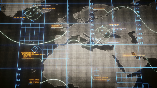
GPS jamming and interference is a grave issue that has come under the spotlight particularly since the Russian invasion of Ukraine, according to Geospatial World.
In 2019, a Washington, D.C., think tank documented more than 10,000 cases of GPS interference (jamming and spoofing) in the previous five years from Russia. By 2021, these had become increasingly sophisticated. In a peculiar case, the crew onboard NATO ships in Odessa saw their position being given as Crimea.
In the past six months, even before the war on Ukraine began, there were reports of GPS jamming in and around that region. In March, the EU Aviation Safety Agency had issued warnings of GNSS spoofing and jamming for flights over Europe, in particular around countries neighboring Ukraine and Russia.
Globally, the economic impact of GPS/GNSS disruption is difficult to state. The potential economic consequences of failing to sufficiently protect sources of PNT are enormous, with estimates ranging from millions to billions of dollars depending on the type, length, severity and geographic scope of the disruption.
Furthermore, the impact of a GPS/GNSS outage extends beyond basic economics and could result in risk to life. Emergency services, distress beacons and telecommunications networks all rely on PNT services — any disruption could cause serious consequences.
A 2019 report sponsored by the National Institute of Standards and Technology estimated that the loss of GPS would cost the U.S. economy USD 1 billion a day.
A 2017 study in the United Kingdom estimated a five-day GNSS disruption would lead to an economic impact of GBP 5.2 billion (USD 7.2 billion), with road, maritime and emergency service impacts accounting for 88 percent of the cost.
More than 100 experiments will be conducted with the Navigation Technology Satellite-3 (NTS-3), set to launch next year, according to a U.S. Air Force official and reported by FedScoop.
“We’re really excited to push the state of the art with more than 100 experiments on this little [NTS-3] spacecraft and we’re looking at ways that we can solve warfighters’ problems in the contested environment,” Maj. Gen. Heather Pringle, commander of AFRL, told reporters April 6 at the 37th Space Symposium in Colorado Springs.
Maj. Gen. Heather Pringle
Set to launch in 2023, NTS-3 is designed to push the boundary of today’s position, navigation and timing (PNT) technology to pave the way for a more flexible, robust, and resilient architecture for satellite navigation technology.
NTS-3 is a product of the Air Force Research Laboratory (AFRL) and industry, designed to test advanced techniques and technologies to detect and mitigate interference to PNT capabilities and increase system resiliency for military, civil, and commercial users.
Unlike the GPS medium-Earth-orbit satellites, NTS-3 will operate for one year in geosynchronous Earth orbit. Ultimately, NTS-3 will identify key aspects for new GPS receivers that incorporate multiple signals and readily adapt to warfighter needs.
The NTS-3 experiments will also involve ground equipment and terminals such as command and control stations and software-defined radios. Specific improvements to the ground segment will enable experimentation with automated “lights-out” operations, control station failover, and near-real time environment sensing and generation of error correction and tailored waveforms. Onboard systems will monitor clock accuracy and orbit parameters to mitigate errors and notify the user.
NTS-3 will test a new digital signal generator that can be reprogrammed on-orbit, enabling it to broadcast new signals, improve performance by avoiding and defeating interference, and adding signatures to counter spoofing.
AFRL also will explore antenna configurations to provide Earth coverage and steerable regional beams in multiple frequencies and signal codes. The NTS-3 satellite will be equipped with 110 antennas to help counter attempted GPS jamming.
Ultimately, NTS-3 is expected to provide users with enhanced signal stability, availability, integrity and accuracy.
L3Harris plans to deliver NTS-3 later this year. The company is assembling the satellite at its Palm Bay facility near Cape Canaveral, Florida. The plant was expanded in 2021 to accommodate the NTS-3 program.
GNSS jamming and possible spoofing has intensified in areas surrounding Ukraine, according to the European Union Aviation Safety Agency (EASA).
The agency issued a bulletin on March 17 warning of a GNSS outage leading to navigation and surveillance degradation. According to the bulletin, which was directed at national aviation authorities and airlines, reports analyzed by EASA indicate that, since Feb. 24, GNSS spoofing and jamming has intensified in four key geographical areas:
the Kaliningrad region, surrounding Baltic Sea and neighboring states
Eastern Finland
the Black Sea
the Eastern Mediterranean area near Cyprus, Turkey, Lebanon, Syria and Israel, as well as Northern Iraq.
“The effects of GNSS jamming and/ or possible spoofing were observed by aircraft in various phases of their flights,” the bulletin stated, “in certain cases leading to rerouting or even to change the destination due to the inability to perform a safe landing procedure.”
Potential issues include:
loss of ability to use GNSS for waypoint navigation
loss of area navigation (RNAV) approach capability
triggering of terrain warnings
inconsistent aircraft position on the navigation display
loss of ADS-B, wind shear, terrain and surface functionalities
failure or degradation of ATM/ANS/ CNS and aircraft systems that use GNSS as a time reference
airspace infringements and/or route deviations due to GNSS degradation.
In the current context of the Russian invasion of Ukraine, the issue of GNSS jamming and/or possible spoofing has intensified in geographical areas surrounding the conflict zone and other areas, according to the European Union Aviation Safety Agency (EASA). The agency issued a safety information bulletin on March 17 warning of a GNSS outage leading to navigation / surveillance degradation. According to the bulletin, which was directed at national aviation authorities and airlines, reports analyzed by EASA indicate that since February 24 GNSS spoofing and/or jamming has intensified in four key geographical areas:
the Kaliningrad region, surrounding Baltic Sea and neighboring states
Eastern Finland
the Black Sea and
the Eastern Mediterranean area near Cyprus, Turkey, Lebanon, Syria and Israel, as well as Northern Iraq.
“The effects of GNSS jamming and/or possible spoofing,” the bulletin stated, “were observed by aircraft in various phases of their flights, in certain cases leading to re-routing or even to change the destination due to the inability to perform a safe landing procedure.” It pointed out that in the present conditions it is not possible to predict these outages and their effects. Potential issues include:
loss of ability to use GNSS for waypoint navigation
loss of area navigation (RNAV) approach capability
inability to conduct or maintain various operations
triggering of terrain warnings, possibly with pull-up command and
inconsistent aircraft position on the navigation display
loss of automatic dependent surveillance-broadcast (ADS-B), wind shear, terrain and surface functionalities
failure or degradation of ATM/ANS/CNS and aircraft systems that use GNSS as a time reference and
airspace infringements and/or route deviations due to GNSS degradation.
The bulletin also offers several recommendations to airlines for mitigating these issues.
The Munich Satellite Navigation Summit program is now online and registration for the event is open. The summit will be held online March 7-8.
The Munich Satellite Navigation Summit focuses on satellite navigation in the present day and future, featuring global speakers and highlighting the latest developments in the field of GNSS. This year’s theme is “AI in GNSS – Intelligence brought to Navigation”.
The summit will feature 12 sessions from industry experts, including sessions on the following topics:
First and Second Generation of the European Satellite Navigation System Galileo
Modernization of the US Global Positioning System
Status and modernization of the Russian Global Satellite Navigation System GLONASS and the Chinese Beidou System (BDS)
Developments of regional systems like the Japanese QZSS and the Indian IRNSS and the Korean Positioning System (KPS)
Use of AI within the navigation world and its implications
A new platform will detect and characterize GNSS spoofing operations using artificial intelligence and commercially available data
Geospatial intelligence company Orbital Insight has been awarded a contract from the U.S. Department of Defense (DoD) to deliver a technology platform for identifying intentional GNSS interference and manipulation operations across the world.
The platform will leverage commercially available data to detect GNSS spoofing, where falsified or manipulated GNSS signals are used to confuse adversaries or obscure illicit activities, presenting risk to both government and commercial operations. Orbital Insight was selected through DoD’s Defense Innovation Unit (DIU) solicitation process seeking commercial solutions to counter the growing threat of GNSS disruptions to national security.
Research suggests that Russia conducted nearly 10,000 spoofing operations from 2016 to 2018 alone.
The new technology will significantly improve situational awareness for warfighters, intelligence analysts and safety-of-life applications. Orbital Insight’s platform will leverage its multisensor data stack, artificial intelligence and machine-learning capabilities to alert analysts and operators to potential jamming and spoofing events, techniques commonly used by adversarial actors to cover up activities or sabotage operations.
The platform leverages a suite of geolocation data — satellites, AIS, ADS-B and internet-of-things devices — along with new advanced algorithms designed to automatically recognize anomalies linked to spoofing, complemented by research intelligence from the nonprofit partner Center for Advanced Defense Studies. Research suggests that Russia conducted nearly 10,000 spoofing operations from 2016 to 2018 alone.
“Helping organizations understand what’s happening on and to the Earth is at the heart of what Orbital Insight does, and spoofing is a national security problem that has proven challenging to solve,” said Kevin O’Brien, CEO, Orbital Insight. “GNSS spoofing is essentially a data problem, and Orbital Insight’s AI and deep data stack can help identify spoofing, along with other major humanitarian and environmental challenges. This is a perfect example of private and public sectors uniting through technology.”
Other areas that may be addressed: identifying drug trafficking, illegal fishing, sea-borne piracy and unintentional commercial aviation disruptions
The technology has broad implications that extend beyond situational awareness of intentional GNSS interference. Other national security, humanitarian and environmental challenges may be addressed, such as identifying drug trafficking, illegal fishing, sea-borne piracy and unintentional commercial aviation disruptions.
Federal agencies are increasingly complementing their systems with commercial technology and data sources that are unclassified, universally accessible, and shareable with allies. The National Air and Space Intelligence Center will be the first customer to utilize the technology. Upon successful integration, the goal will be to expand this platform widely across the defense, intelligence and civil communities.
Orbital Insight received the DoD contract on the heels of announcing a Phase II Small Business Innovation Research contract from the National Geospatial-Intelligence Agency to deliver a computer-vision model that uses synthetic data to detect novel classes of objects.
The company also recently launched a new class of multiclass object-detection algorithms within its flagship GO platform to help the intelligence community monitor and differentiate activity at thousands of areas of interest. Like all of Orbital Insight’s products, these algorithms are being developed within an ethics framework that shapes the company’s work and values privacy.
Hoptroff’s Traceable Time as a Service to become an option for Orolia’s product portfolio; webinar scheduled for Dec. 15
Orolia and timing solutions provider Hoptroff are partnering to deliver a service combining Orolia’s resilient positioning, navigation and timing (PNT) solutions with Hoptroff’s timing synchronization software.
The collaboration will offer Hoptroff’s Traceable Time as a Service (TTaaS) as an add-on to Orolia’s suite of products, providing precise and verifiable time to customers in enterprise, financial, telecom, utilities, public safety, and other markets where traceable time is critical.
Webinar scheduled
Orolia and Hoptroff will host a joint webinar to discuss the partnership and new resiliency options for customers on Dec. 15 at 12 p.m. EST. Register here.
Hoptroff’s TTaaS offers an additional level of security and precision to meet stringent regulatory and resilient infrastructure requirements by delivering accurate time over the network using a VPN connection over broadband or fiber networks.
The bundled solution will simplify the challenge of getting accurate, traceable time in applications where GNSS access is not available or dependable. It can also serve as an accurate, reliable backup to GNSS to provide a high level of resiliency to timing systems being used in critical infrastructure.
“As industries evolve and computer applications become more complex and widely distributed, it is essential that devices in a distributed process share the same accurate timescale to reconstruct digital events after the fact,” said Tim Richards, COO at Hoptroff. “Network-based traceable timing, such as TTaaS, provides resilient backup to a GNSS installation in the case of signal disruption, monitors the quality of performance of time servers, and keeps a record of this timing quality at a location of the customer’s choice. Our partnership with Orolia means businesses will now be able to back up and monitor physical time servers and virtual servers in the cloud, so that they can be sure they share the same accurate timescale, and they have the records to prove it.”
“The partnership with Hoptroff aligns with Orolia’s resilient PNT strategy by providing a wireline solution to augment its space-based PNT solutions. This allows us to further simplify the challenge customers face when building a highly resilient timing solution,” said Jeremy Onyan, Orolia’s director of time sensitive networks. “By combining Orolia’s anti-jamming and anti-spoofing solutions, high-performance GNSS-based timing products, alternative signals like STL, a local high-quality oscillator, and now a wireline-based TTaaS we have one of the most robust portfolios of resilient PNT solutions in the market. Additionally, with the recent acquisition of Seven Solutions, we are well positioned to extend our capabilities into high-accuracy time distribution.”
Seven Solutions is a global innovator in White Rabbit sub-nanosecond time transfer and synchronization technology. “With the capability to distribute time with little to no accuracy loss, Orolia’s customers using Hoptroff’s TTaaS or other time references such as GNSS can extend that time to other parts of their networks and create a high level of resiliency against potential outages,” Onyan added.
The free resources are intended to advance the design of PNT systems and increase resilience of critical infrastructure to PNT disruptions.
The GPS Whitelist Development Guide presents a software assurance approach to addressing potential vulnerabilities and increasing reliability of GPS receivers. The guide addresses data-related requirements in the Resilient PNT Conformance Framework, which provides guidance for defining expected behaviors in resilient PNT equipment.
“We hope this guide and related resources will help industry advance towards a cybersecurity-based approach to PNT resilience,” said S&T Technical Manager Ernest Wong.
Originally released in March 2021 as open source on GitHub, the PNT Integrity Library provides users with a method to verify the integrity of the received GPS data. The update includes:
A compliance check on Interface Control Document (ICD) IS-GPS-200, which is a formal means of establishing, defining and controlling communication between the GPS space and other user systems; and
A Do-It-Yourself (DIY) Toolkit, which describes how a perspective end-user of the PNT Integrity Library can assemble a demonstrational toolkit with commercial-off-the-shelf (COTS) hardware.
“Since GPS signals can be jammed or spoofed, critical infrastructure systems should not be designed with the assumption that GPS data will always be available or will always be accurate,” said S&T Project Manager Brannan Villee. “Application of these tools will provide increased security against GPS disruptions. However, DHS also recommends a holistic defense strategy that considers the integrity of the PNT data from its reception through its use in the supported system.”
The Solo joins the BroadSim line of Skydel-powered GNSS simulators, which includes models suited for hardware-in-the-loop and multi-element antenna/controlled reception pattern antenna (CRPA) testing.
Live demonstrations of BroadSim Solo are taking place in the JNC Exhibit Hall at Orolia Defense & Security booth No. 117 through Aug. 26. Orolia provides M-code solutions for resilient positioning, navigation and timing.
BroadSim Solo shares the same Skydel simulation engine that runs on a standard BroadSim, BroadSim Anechoic and BroadSim Wavefront. It supports advanced scenario creation features and the benefits provided by a software-defined architecture such as high dynamics, a 1000-Hz iteration update rate and ultra-low latency of 5 ms.
Photo: Orolia
Nearly all civilian GNSS signals can be generated through the Solo’s single RF output (one frequency band at a time), along with jamming or spoofing signals, and GPS AES M-code. AES is an encryption method; rather than using the MNSA encryption, it is possible to use AES for testing purposes only.
BroadSim Solo’s compact form factor is designed to do away with bulk, fitting comfortably at a typical desk or workstation. Plus, the Solo addresses the permanent challenge engineers face with laboratory capacity and availability.
“Creating complex test scenarios can be a tedious process, especially when emulating challenged environments,” said Tim Erbes, director of engineering for Orolia Defense & Security. “Having the ability to create scripts at your desk significantly frees up lab time and space for running these important simulations. Also, scenario creation is no longer limited to one person fixed to one system. Imagine a team of engineers, each with a BroadSim Solo, simultaneously building tests. Having a whole fleet of BroadSim Solos? It’s game-changing.”
BroadSim Solo with the Skydel simulation engine offers an intuitive user interface, a comprehensive API supporting Python, C++ and C#, and automation tools and custom plugins that will speed up development cycles, increase performance and ultimately drive innovation.
“In an effort to enhance the customer experience and expand the reach of advanced GNSS simulators, we wanted to offer an affordable solution with all of the same core features as our most advanced BroadSim systems,” said Tyler Hohman, director of products for Orolia Defense & Security. “This gives our customers the opportunity to place more simulators in the hands of engineers and scientists without sacrificing capabilities. Our hope is that customers will find value in having a simulation ecosystem that is scalable based on their requirements.”
ADVA’s aPNT platform is key for the development of PGE’s critical network infrastructure (Photo: Business Wire)
Portland General Electric (PGE) is deploying Oscilloquartz PTP grandmaster clock technology as it upgrades to packet-based synchronization and protects its network against GNSS vulnerabilities and cyberattacks. The upgrades also conform to PNT Executive Order 13905.
PGE, one of the largest power utilities in the Western United States, is using the ADVA scalable timing solution to enable a smooth transition from legacy synchronization and ensure new levels of accuracy, reliability and resiliency. The new system will timestamp data and control grid substations at the edge.
With multi-band GNSS receivers and artificial-intelligence (AI) threat detection, ADVA’s assured PNT (A-PNT) platform helps maintain resilient timing, even in challenging circumstances such as deliberate jamming and spoofing attacks. It also provides multi-source backup, including PTP network timing and in-device holdover oscillators for when GNSS signals are unavailable or disrupted.
The solution is built on the OSA 5410 and OSA OSA 5420 series of edgeSync+ grandmaster clocks. It features multi-band, multi-constellation GNSS receivers and supports multiple PTP profiles, including substation power and core telecom backup sync, while also allowing conversion between them and supporting legacy interfaces.
The products are part of ADVA’s new aPNT platform, integrating threat detection, multi-source backup and ADVA’s intelligent Ensemble Sync Director.