Tag: Leica Geosystems

  • Esri and Hexagon promote joint collaboration at HxGN LIVE

    In 2015, Esri and Hexagon jointly announced a series of ready-to-use imagery services to Esri users through ArcGIS Marketplace. ArcGIS Marketplace delivers high-resolution aerial multispectral and basemap imagery services as a subscription through ArcGIS Online. In light of the collaboration, Esri will be participating in HxGN Live June 14-16 in Anaheim, California.

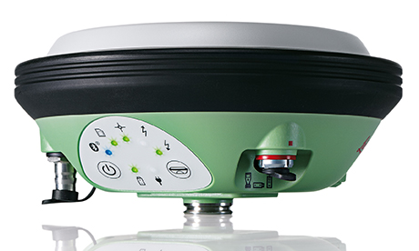
    Another collaboration with Leica Geosystems, a brand within Hexagon Geosystems, addressed the market for high-accuracy mobile field collection, which was released this year. It integrates Esri’s Collector for ArcGIS, a configurable mobile app for collecting and editing data in the field, with the high-accuracy Leica Zeno 20 from Leica Geosystems.

    “We’re excited to raise mobile data collection solutions to the next level of precision and interoperability through rigorous connectivity between our survey-grade Leica Zeno series and Esri’s GIS solutions,” says Hexagon Geosystems president Juergen Dold. “This industry collaboration between Leica Geosystems and Esri is another joint commitment to make it easier for professionals around the world to capture, manage, and share their data, regardless if they’re in the office or the field, without sacrificing precision or interoperability.”

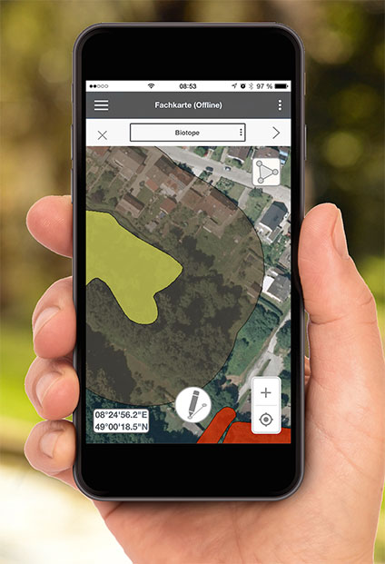
    The new solution, ZenoCollector, is an Android-based, professional-grade handheld. ZenoCollector connects to ArcGIS Online, automatically synching high-precision field changes to enterprise information and giving everyone access to the latest data gathered on the project sites, as well as access to high-resolution basemap services and Hexagon imagery services through ArcGIS Marketplace. This innovation of online content connected to mobile field tools and back-office systems now provides rapid synchronization to streamline field job planning, collection, and postprocessing of data.

    Esri For more information and demonstrations of these new offerings, visit Esri at booth No. 506 at HxGN LIVE.

  • Leica Geosystems launches smart antenna with superior performance

    Photo: Leica GeosystemsLeica Geosystems has launched a new antenna for static, long-term projects requiring a high number of sensors. The Leica GMX910 can also enable dynamic monitoring with up to 10-Hz data streaming and advanced multi-frequency, multi-constellation tracking.

    Starting with the basic GPS single frequency receiver and adding multiple upgradable options, this antenna fits the needs of diverse monitoring projects, the company said. The antenna supports multiple GNSS satellite systems and signals. Tracking up to 555 channels, this antenna anticipates the future and is ready for ongoing changes in GNSS technology.

    The smart antenna is also fully integrated in the Leica GeoMoS deformation monitoring solution and seamlessly connects to Leica GNSS Spider offering high-quality GNSS processing results.

    The highest reliability of data streaming is achieved by plugging a cable into the GMX910. An IP67 rating against dust and water, extended temperature ranges and low power consumption enables installation of the device in remote areas and severe conditions.

    The Leica GMX910 adapts to a wide range of GNSS monitoring applications, from complex man-made to natural structures. The smallest movements of bridges, dams or high-rise buildings are detected in real-time.

  • Leica Ultra locator finds underground utility lines

    Leica_UTLRA_application_2_

    Leica Geosystems has released the Leica Ultra underground service locating system for site engineers and underground utility specialists who need to trace buried utility lines accurately for safe underground excavations and utility surveys.

    The locating systems helps users attain the highest accuracy to avoid costly mistakes, such as cutting utility lines or delaying project schedules during excavation work. By providing a wide range of transmitter mode frequencies, operators in segments such as power, water, gas or telecom can easily and quickly optimize the locator performance in any operating condition.

    Users save time and effort by tracing utility depths and distances, Leica said. Multiple utilities in close proximity requiring a combination of adjustments can also be traced efficiently and with confidence.

    Clear visualizations of line direction and depth indication are displayed on a large LCD interface. Users can easily interpret signal displays in all light conditions. Bluetooth enables quick connectivity so users can easily transfer data to a GIS data collector.

  • Leica adds to geodetic monitoring software

    Leica Geosystems has introduced two new additions to its Leica GeoMo deformation monitoring solution: Leica GeoMoS AnyData and GeoMoS API.

    Users of the system can now create comprehensible visualizations and customizable reports, which enables powerful sensor data fusion for applications, such as air or water quality monitoring and construction or building management.

    Leica GeosystemsWith GeoMoS AnyData and GeoMoS API, multiple open interface standards are accessible to provide more information to projects than just classic geodetic monitoring applications, according to a news release from Leica.

    The open solution offers flexibility; it is capable of automatically acquiring, processing and distributing intelligent information locally or via the Internet in real time. Leica GeoMoS integrates, processes and distributes all project data within one software program.

    With these additions to Leica GeoMoS, necessary information is made easily accessible via web-based visualization. The program provides an efficient way to convert raw data streams into intelligent information.

  • Leica releases GNSS monitoring on board stand-alone receiver

    Leica releases GNSS monitoring on board stand-alone receiver

    A GNSS monitoring solution integrated into a stand-alone receiver detects fast movements of man-made and natural structures in real time.

    The new product from Leica Geosystems, dubbed VADASE, runs onboard Leica reference stations and monitoring receivers. The Leica Velocity and Displacement Autonomous Solution Engine (VADASE) provides an in-depth look into fast movements using unique processing algorithms. In real time, accurate high-rate velocity and displacement information of various activities and structures are provided to engineers and researchers for a complete, precise and reliable monitoring solution, Leica said.

    Leica GeosystemsLeica VADASE delivers actionable information independent of any GNSS real-time kinematic (RTK) correction service in real time. Displacement events are recorded on board a single stand-alone GNSS receiver, and the user can be notified by email. With this instant information, professionals receive a deeper understanding of how structural movements occur and can take necessary actions to mitigate damages and potentially save lives, the company said.

    Leica VADASE does not require additional hardware or infrastructure for differential processing (such as one or more reference stations or global correction services for precise point positioning); it provides autonomous processing capability with no extra equipment or services needed.

    Users can also apply the latest versions of Leica SpiderQC, Leica GeoMoS or any other customized software for advanced data visualization, analysis, threshold verification and notification.

  • Leica adds to GeoMo geodetic monitoring solution

    Leica adds to GeoMo geodetic monitoring solution


    Photo: Leica Geosystems

    Leica Geosystems has introduced two new additions to its Leica GeoMo deformation monitoring solution: Leica GeoMoS AnyData and GeoMoS API.

    Users of the system can now create comprehensible visualizations and customizable reports, which enables powerful sensor data fusion for applications, such as air or water quality monitoring and construction or building management.

    With GeoMoS AnyData and GeoMoS API, multiple open interface standards are accessible to provide even more information to projects than just classic geodetic monitoring applications, according to a news release from Leica. The open solution offers flexibility; it is capable of automatically acquiring, processing and distributing intelligent information locally or via the Internet in real time.

    Leica GeoMoS integrates, processes and distributes all project data within one software program.

    “Monitoring professionals are confronted daily with vast amounts of data collected and provided by a variety of sensors,” said Michael Rutschmann, senior product manager of Structural Monitoring at Leica Geosystems, in the news release. “With these additions to Leica GeoMoS, all information is now easily accessible via web-based visualisation. This is absolutely the most efficient way to convert raw data streams into intelligent information for any user.”

  • Leica Geosystems, NCTech Streamline Workflows, Improve Productivity

    Leica-Cyclone-panorama-O

    Leica Geosystems has teamed with NCTech, developer of reality imaging systems, to deliver automated, colorized 3D point clouds. In Leica Cyclone, 3D point cloud processing software, users can now automatically import and align high-dynamic range (HDR) data from NCTech’s iSTAR camera database, producing enhanced deliverables quicker and easier, Leica Geosystems said.

    “It is not only about attractive images but also the accuracy to which these images fit the 3D point cloud data that is paramount, and NCTech’s iSTAR camera produces high-quality HDR imaging at the accuracy everyone expects,” said Faheem Khan, vice president, business development for Leica Geosystems High-Definition Surveying (HDS). “Including this capability directly into Leica Cyclone provides fully optimized workflows for maximum productivity. This starts from data collection through to deliverable production that leverage new products, such as Leica TruView Global and JetStream to tackle the increasingly complex challenge of multi-platform, multi-device and multi-discipline project delivery.”

    Previously, Leica Cyclone users accessed iSTAR imagery database through NCTech’s ColourCloud software application, which produced colourised point clouds in E57 format. With the new partnership, export and re-import of this highly-accurate data is eliminated, speeding up and simplifying the overall 3D point cloud creation process.

    “We are excited to collaborate with Leica Geosystems on this development, which provides direct access for Leica Cyclone users across the world to colourise their point clouds using iSTAR’s panoramic HDR imaging,” said Cameron Ure, CEO of NCTech. “With our iSTAR products, we are focussed on capturing the most accurate colour data as rapidly as possible, and everyone benefits when that data is seamlessly integrated into our partners’ applications.”

    Photo: Leica Geosystems

  • SiTrack:One by Leica Geosystems Makes 3D Point Clouds without GNSS

    SiTrack:One by Leica Geosystems Makes 3D Point Clouds without GNSS

    Photo: Leica Geosystems

    Leica Geosystems has released SiTrack:One, a highly accurate rail track maintenance and refurbishment system incorporating the Leica ScanStation P40 to generate 3D point clouds. 

SiTrack:One by Leica Geosystems ensures complete coverage of an entire rail infrastructure surface without the need to receive GNSS signals for position information, the company said.

    With a new mounting design, the total solution for rail maintenance and refurbishment produces synchronized engineering, survey-grade 3D point clouds for accurate as-built drawings. 
The Leica ScanStation P40 can either be mounted vertically in the centre of the rails or inverted directly over the rail track. Rail bridge sleeper replacements can be measured quickly generating a numbered as-built replacement plan for each individual sleeper on a rail bridge.

    The sophisticated system is equipped with two powerful distance measurement instrument (DMI) or odometers that provide accurate positioning in GNSS-denied areas, such as underground railway tunnels or underground subway networks. The system’s on-site calibration process guarantees permanent alignment of the relative position between the sensors and its onboard inertial measurement unit, guaranteeing position accuracy.

    The German engineering firm Vermessungsbüro Riemenschneider GbR was the first to use the SiTrack:One by Leica Geosystems. When converting existing railway tracks in the course of track maintenance for the Deutsche Bahn AG, the firm required complete, accurate and consistent information on existing tracks, clear structure gauge, route topography and civil engineering works. With the SiTrack:One, Vermessungsbüro Riemenschneider GbR experienced significant workflow gains by leveraging the highly accurate point clouds directly into the engineering process.

    “The SiTrack:One by Leica Geosystems guaranteed  the complete survey of railway sidings with a minimum stay of surveying personnel in the danger zone of rail transport,” said Dipl.-Ing. Andreas Riemenschneider, principal of Vermessungsbüro Riemenschneider. “Thus, the costs of security measures were significantly reduced. The state-of-the-art system conforms efficiently to the demands for survey, visualisation, documentation, evaluation and approval of existing and new routes, all in accordance with rail transportation guidelines.”

    Developed from acquired knowledge 
SiTrack:One is the first solution to be released under Leica Geosystems from the acquisition of the former Technet-Rail 2010 GmbH. Leica Geosystems acquired the previous firm’s specialised knowledge of geospatial big data for rail transportation networks in May to increase its mobile mapping offerings for the rail industry.

    “One of our goals in obtaining this specific know-how was to provide users with a dedicated tool for passenger rail networks monitoring and maintenance, and with the development of SiTrack:One, we are taking the first step on this roadmap,” said Stuart Woods, Leica Geosystems Geospatial Solutions Division vice-president. “Professionals can now trust their measurements on rail are accurate even in the most difficult conditions.”

    SiTrack:One by Leica Geosystems includes software enabling data synchronization, post-processing and feature extraction. This solution is part of the SiRail Suite, which includes the SiRailScan and SiRailManager software solutions.

    SiRailScan allows for a complete extraction of the railway network with engineering accuracy level, while SiRailManager, the database management tool, creates a holistic view of an operator’s railway network from point cloud to geometry and signal layers. The combination of these solutions form the  SiControl platform, which conforms to the requirements of the  European Train Control System and produces complaint rail xml outputs for full train feedback control.

  • Hexagon Takes Top Honors in the Wichmann Innovations Award

    Hexagon Takes Top Honors in the Wichmann Innovations Award

    The new Leica Geosystems Pegasus backpack wearable mobile mapping solution.
    The new Leica Geosystems Pegasus backpack wearable mobile mapping solution. (Leica Geosystems AG, Switzerland, 2015)

    The top Wichmann Innovations Award has been given to the Leica Geosystems Pegasus:Backpack, a wearable reality-capture technology that combines five high-dynamic cameras and two lidar profilers within an ultra-light and ergonomic carbon-fiber chassis. Leica Geosystems is a brand of Hexagon.

    Companies from around the globe submitted products and applications to participate in the awards, which were presented by publisher Wichmann Verlag at the INTERGEO trade show, held in Germany in September. From hundreds of submissions, a jury of industry leaders selected 10 products and applications to receive votes from the general public. The main criteria for the awards were innovation, user-friendliness and practicality. Wichmann Verlag is known for its expertise in professional magazines and specialist books for geodesy and geomatics.

    The Pegasus:Backpack is a mobile mapping solution that creates a 3D view indoors or outdoors for engineering or professional documentation at the highest level of authority while using SLAM (simultaneous localization and mapping) to determine position in GNSS-denied areas. With a focus on fast and efficient capture, calibrated images and point clouds are quickly generated for applications as diverse as BIM 6D to industrial training and disaster analysis, Leica said.

    “The mobile mapping team has put a lot of hard work into understanding the needs of today’s professionals, and the Leica Pegasus:Backpack ensures they are not limited in how, where or when they collect their data,” said Stuart Woods, vice president of Leica Geosystems Geospatial Solutions Division. “With this achievement, the concept of mobile reality capture has been substantiated at the highest level and ushers in a new era in perception surveying and actionable mobile content.”

    Watch a video about the backpack taken at INTERGEO:

    Second place was awarded to Intergraph Security, Government & Infrastructure’s Green GIS, featuring the patented ECW (Enhanced Compression Wavelet) data compression format and ERDAS APOLLO software. Through the use of Hexagon Geospatial technologies, Intergraph’s solution drastically reduces data volume and minimizes storage demands and energy costs, leading to more efficient and environmentally friendly data centers.

    “Software has a significant influence in terms of the enterprise carbon footprint. Our software-driven Green IT approach is absolutely new and pioneering, and effectively supplements previous environmental and climate protection efforts made by the information and communications technology sector,” said Maximilian Weber, senior vice president, Intergraph Security, Government & Infrastructure EMEA. “Our Green GIS can help lower carbon emissions of our customers’ IT processes.”

  • INTERGEO Product Showcase

    GNSS Receiver for Mobile Devices

    The R2 GNSS receiver works with Trimble handheld devices and iOS, Android or Window mobile handhelds, smartphones and tablets using Bluetooth or USB connectivity. When paired with a mobile device, the receiver adds professional-grade GNSS capabilities for better accuracy. The rugged Trimble R2 provides GIS and survey professionals the flexibility to choose the mobile device, workflows and accuracy they need based on applications.

    The Trimble R2 GNSS receiver is compact and portable, weighing 2.4 pounds. With one button operation and field swappable battery, the receiver can be pole or vehicle mounted or carried on a backpack. The R2 is a multi-constellation receiver that supports GPS, GLONASS, Galileo, BeiDou and QZSS satellite signals as well as SBAS.The Trimble R2 can achieve sub-meter to centimeter positioning.

    Trimble, www.trimble.com

    Source: GPS world staff
    The Optech CZMIL Nova airborne bathymetric mapping system.

    Coastal and Marine Mapping

    The Optech CZMIL Nova airborne bathymetric mapping system is designed for coastal and marine mapping.With a powerful yet efficient laser, it maps deeper while flying higher, reaching depths of 80 meters in clear waters. The enhanced design and automated processing tools produce simultaneous high-resolution 3D data and imagery of the beach and shallow water seafloor, including coastal topography, bathymetry, benthic classification and water column characterization. Its bathymetric lidar is integrated with a hyperspectral imaging system and digital metric camera. Optech HydroFusion, an end-to-end software suite, handles data from all three sensors.

    Teledyne Optech, www.teledyneoptech.com

    Source: GPS world staff
    Leica Viva GS14.

    GNSS with Hybrid Communication

    The latest generation Leica Viva GS14 GNSS receiver now supports Verizon CDMA solutions along with all standard 2G/3G networks and UHF TX/RX radio in a single device, making it a professional GNSS receiver with all three communication systems built in. Users simply slide in their SIM card to experience instant connectivity for faster and easier field communications and SmartNet RTK corrections. No external equipment is required.

    Leica Geosystems, www.leica-geosystems.com

    Source: GPS world staff
    Tallysman’s VeraPhase 6000 high-precision GNSS antenna.

    High-Precision GNSS Antenna

    The VeraPhase 6000 family of antennas provides the lowest axial ratios (horizon to horizon, through all azimuths) across all GNSS frequencies (70 percent), a tight PCV (± 1mm through all frequencies, azimuths, and elevations), and a consistent PCO through all frequencies.

    The performance of the VeraPhase rivals that of choke ring antennas, but is much lighter, smaller and more economical. The antenna family is designed for use in survey, precision RTK and reference antenna applications.

    The VeraPhase 6000 also provides an available PCB within the base of the antenna for integration of a custom system board such as a dual-band or RTK GNSS receivers or other applications.

    Tallysman, www.tallysman.com

    Source: GPS world staff
    The GIS 2go Cadenza software suite.

    GIS Software Suite

    The GIS 2go Cadenza software suite for mobile GIS visualizes geodata and attribute data for efficient result presentation. This version offers new features for tablet or smartphone, allowing users to transfer maps from Cadenza or ArcGIS for Desktop to mobile devices for use offline and availability to others via the cloud, creating an extended field workstation. The mobile app also features faster exporting and optimized use of land registers for geometry and attribute editing in the field.

    Disy Informationssysteme GmbH, www.gis2go.com

  • Steep Questions: How Tall is K2?

    A Mountaineering Survey Team Determines K2’s Actual Height

    Surveying the world’s highest peaks is a daunting task. One international survey team set out to measure the Himalaya’s K2 peak, the second highest in the world after Mount Everest.

    In 2004, 50 years after an Italian team led by Ardito Desio first summited, a team tried to measure K2 with GNSS surveying equipment, but the attempt to bring the GNSS receiver to the top failed when a climber fell.

    For the most recent attempt, a Pakasti-Italian team took along a rugged industrial survey system 60 years after the first summiting, in June–August 2014.

    The team performed measurements at five different climbing campsites and on the K2 summit, using GNSS technology to collect the most accurate measurements ever made of K2.

    The measurements were accomplished by Pakistan’s Rehmat Ullah Baigh and Italy’s Michele Cucchi, who set up the receiver at each stop and allowed it to remain for approximately 20 minutes to collect the latitude, longitude and altitude of each point from the available satellites.

    Setting up camp also meant setting up a GNSS receiver to gather data.
    Setting up camp also meant setting up a GNSS receiver to gather
    data.

    One reference receiver was permanently positioned by team technical leader Maurizio Gallo close to the K2 Base Camp at the Gilkey Puchot Memorial, which is dedicated to climbers who died on K2. A second reference receiver was placed in Skardu, a final stop before heading up the mountains. At Skardu, computer expert Fida Hassain from Central Karakorum National Park helped install and process the transmitted data along with researcher Aamir Asghar and Giorgio Poretti, professor at the University of Trieste. The coordinated network of two permanent GNSS stations allowed data from the summit to be processed with excellent precision and is still in operation today.

    After the climb, the data was downloaded from the receivers and analyzed. The GNSS survey results lowered K2’s height from its previous altitude of 8,610.34 meters (28,248.03 feet) to 8,609.02 meters (28,244.75 feet) — 1.5 meters (3.3 feet) shorter than previously believed.

    The route to K2’s summit.
    The route to K2’s summit.

    Yet the biggest surprise was at K2’s Camp Four on the Abruzzi Spur, where expeditions on this route begin their final ascent to the summit. Previous measurements stated that the route began at 7,900 meters (25,920 feet). The new data collected proves that the route starts at 7,747.029 meters (25,416.667 feet), making the climb 150 meters (492 feet) longer than previously recorded. This is a challenging difference for K2 climbers, who at this point are struggling for weeks with the weakening effects of altitude sickness
    and the stress of staying focused.

    The team also plans to climb Mount Everest, where a reference station is located very close to the EVK2CNR’s Pyramid International Laboratory on the Nepali side of Mount Everest.

    Manufacturer

    The survey team used the Leica Viva GS14 GNSS receiver and two GX1230+ reference receivers and antennae provided by Leica Geosystems. Leica Geosystems used the opportunity to test its equipment’s portability, resistance to very low temperatures and rugged use on rough tracks.

    Adapted from an article by Katherine Lehmuller and Marco Mozzon in the Reporter (#72), the Leica Geosystems customer magazine, and other sources.
  • Esri and Leica Geosystems Combine for Mobile Data Collection

    The Leica Geosystems ZenoCollector2 comes with Esri Collector for ArcGIS.
    The Leica Geosystems ZenoCollector2 comes with Esri Collector for ArcGIS.

    Esri Collector for ArcGIS, a configurable mobile app for collecting and editing data in the field, has combined with the Zeno 20, Leica Geosystems’ ultra-rugged Android-based professional-grade handheld, in a new solution called ZenoCollector. ZenoCollector uses Collector for ArcGIS as its main user interface and comes bundled with an ArcGIS Online organizational subscription for one year.

    “Esri and Leica Geosystems recognize that enterprises may have particular field data collection challenges that smartphones can’t ideally meet,” said Esri president Jack Dangermond. “We’re excited to combine Collector for ArcGIS with Leica Geosystems’ industry-standard surveying units to create a more rugged and accurate solution for the more exacting needs of organizations.”

    ArcGIS Online connects ZenoCollector to the ArcGIS platform, automatically syncing field changes to enterprise information and giving everyone access to the latest data gathered in the field. Collector for ArcGIS also supports offline data collection. Any updates will be synchronized with the map once the user is reconnected.

    “We’re excited to raise mobile data collection solutions to the next level of precision and interoperability through rigorous connectivity between our survey-grade Leica Zeno series and Esri’s GIS solutions,” said Hexagon Geosystems President Juergen Dold. “This industry collaboration between Leica Geosystems and Esri is another joint commitment to make it easier for professionals around the world to capture, manage, and share their data, regardless if they’re in the office or the field, without sacrificing precision or interoperability.”

    Although Collector for ArcGIS is most often used on smartphones, field crews may need higher precision that only a dedicated survey device can deliver. ZenoCollector contains a professional-grade GNSS receiver that provides significantly higher position accuracies than GPS receivers on smartphones and other handheld GIS devices on the market.

    Leica’s Zeno series devices are also waterproof, even with the latch open, suiting the requirements of organizations operating in wet environments that would stress the tolerances of consumer-grade mobile devices.

    The announcement was made at the Esri User Conference, being held this week in San Diego.