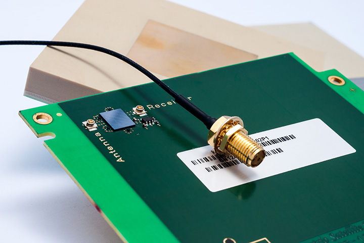
Imec and Septentrio have collaborated to design multi-frequency GNSS antenna that simultaneously receives all GPS, GLONASS, BeiDou, and Galileo bands. Developed under the European Community’s Seventh Framework Programme project Handheld, the compact antenna can be integrated in multi-frequency handheld GNSS devices for high-precision location applications up to 1 centimeter.
The announcement came at the Mobile World Congress being held this week in Barcelona, Spain.
The compact antenna integrates Imec’s GNSS antenna and Septentrio’s GNSS RF front-end. Imec’s antenna design satisfies the requirements for the high-accuracy GNSS market while remaining small enough to fit in a handheld surveyor device, the companies said. The antenna has desired uniform gain and phase coverage over the complete upper hemisphere, with strong suppression of unwanted reflected signals below or in the vicinity of the GNSS receiver.
The GNSS RF front-end, based on established front-end technology developed by Septentrio, is characterized by a superb out-of-band interference rejection to avoid notably device self-interference with other radiation sources such as Bluetooth and WLAN radios, as well as other ambient intentional and non-intentional interference. The compact multi-frequency antenna is a perfect companion of Septentrio’s compact and low-power AsteRx-m receiver, a credit card-sized dual frequency GNSS receiver that provides centimeter accuracy at less than 500-mW power consumption, by far the lowest power consumption in the professional GNSS market.
The research leading to these results has received funding from the European Union Framework Programme (FP7/2007-2013) under grant agreement n°287183.
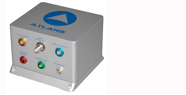
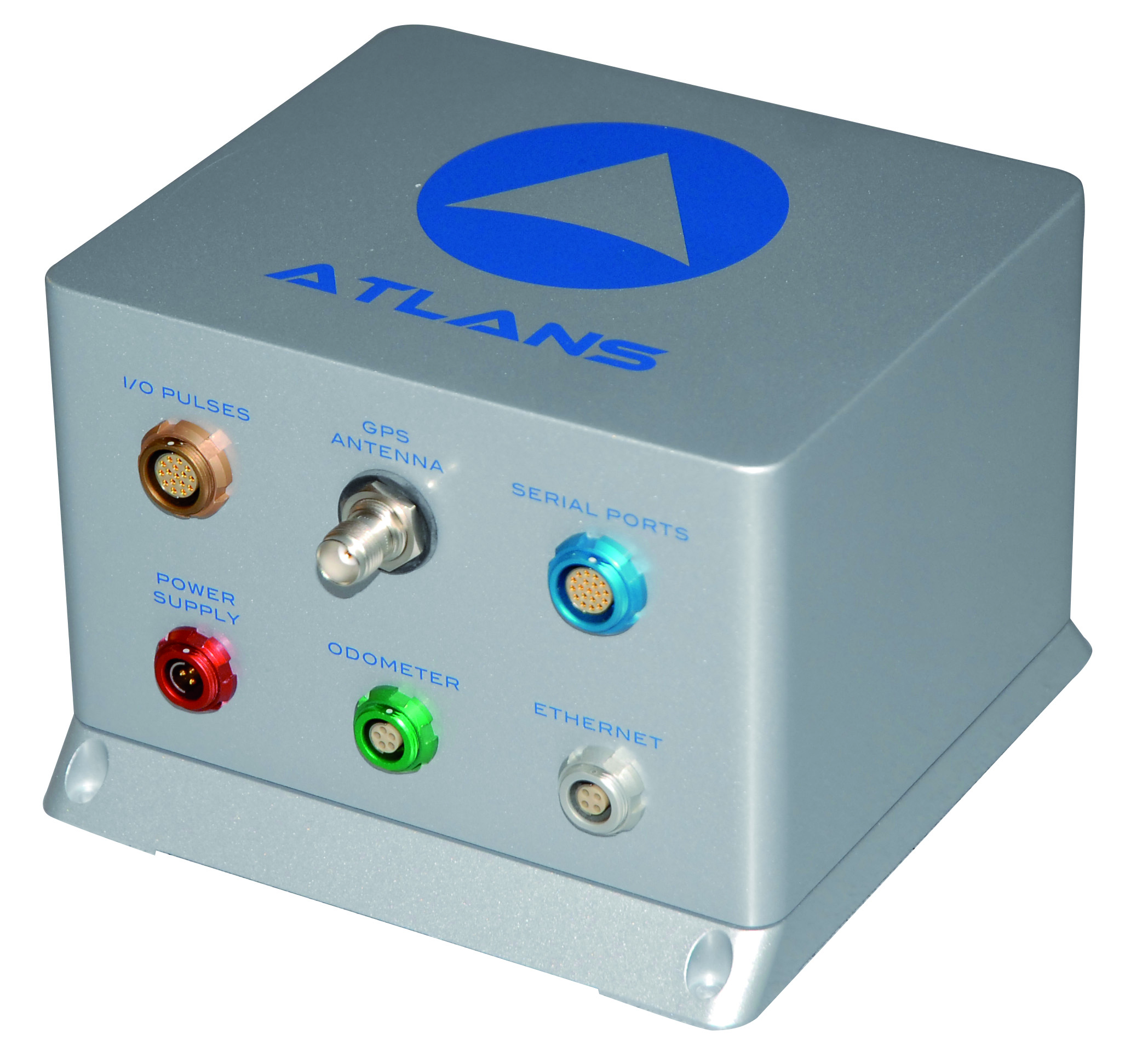
iXBlue, a provider of navigation, positioning, and mapping solutions, has launched its new ATLANS-C position and orientation system, developed in close cooperation with Septentrio Satellite Navigation. The system is designed to provide continuous and accurate positioning in urban environments, where GNSS signals are obscured, intermittent, or possibly distorted by reflective surfaces.
ATLANS-C benefits from the optimized integration of iXBlue’s fiber-optic gyroscope (FOG) based inertial navigation system (INS) and Septentrio’s multi-constellation GNSS receiver technologies. Experts from iXBlue and Septentrio worked closely to develop a “smart” coupling method that combines the advantages of the two companies’ technologies. The result is an easy-to-use, easy-to-integrate, and highly reliable INS-GNSS mobile mapping solution, the companies said.
“The ATLANS-C development was a real team effort,” said Jan Van Hees, head of sales and business development at Septentrio. “Technical trials with leading customers have already demonstrated superior accuracy, continuity, and reliability of positioning and attitude data, even in the most challenging urban environment.”
“The new system’s robustness, compact size, and improved urban-area performance uniquely address more complex mobile mapping market requirements. The ease of use, quick integration, and zero maintenance features are excellent values recognized by original equipment manufacturers (OEM) or mobile mapping system integrators,” explained Xavier Montazel, head of iXBlue inertial products division. “One of ATLANS-C’s many other advantages is its versatility, allowing the same equipment to be used for land and air applications. Configuration of the system is achieved through the use of iXBlue’s innovative web interface, utilized across the complete range of products.”
ATLANS-C has no ITAR components inside, allowing fast and easy global export. Customers will benefit from the industry exclusive five-year warranty and a 24/7 support line. ATLANS-C is available today with a six-week lead time.
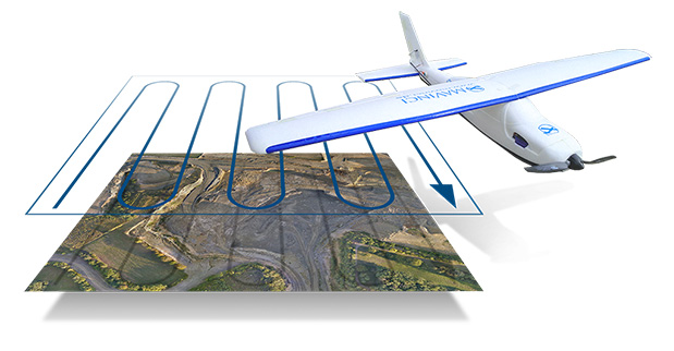
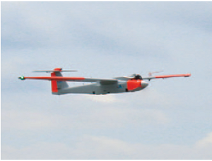
Topcon Positioning Group has released and made available in Europe the Topcon SIRIUS PRO powered by MAVinci, an Unmanned Aerial System (UAS) designed to produce the most accurate solutions for automated mapping of construction sites, pipelines, disaster areas, mines, quarries and myriad sites without regard to terrain.
During October 2013, Topcon Europe Positioning (TEP) entered into a strategic partnership with UAS provider MAVinci GmbH. The result of that partnership is the release of the fixed-wing UAS Topcon SIRIUS PRO powered by MAVinci.
“We are excited to announce our distribution agreement with Topcon. This partnership is the ideal expansion of our global distribution network,” Johanna Claussen, CEO at MAVinci GmbH said. “The simple operation of our UAS from flight planning to the final orthophoto and DEM (Digital Elevation Model), allows flexible use in highly demanding environments. Its flexible assisted auto-pilot landing mode enables navigation around any unforeseen obstacles.”
Based in St. Leon Rot, Germany, MAVinci is a aerial surveying company specializing in the development of UAS technology.
“By adding Topcon’s RTK solutions to the UAS and ground control station, the SIRIUS PRO is the first commercially available UAS that can reach 5-cm accuracy without the need for ground control points,” said Sander Jongeleen, mobile mapping product manager for Topcon Positioning Group. “This leads to an enormous reduction of operational cost and allows mapping of areas that are not easily accessible with high accuracy.”
The SIRIUS PRO is a fixed-wing UAS capable of producing high quality and pre-positioned aerial photography without the need of extensive ground control that is required by competitive products. Key features include:
Work in mountain areas — Flight plan adapts to elevation model
Cover areas that require multiple flights — Flight plan automatically splits and rejoins for post processing
Simple hand launch
Land in areas where automatic landing is impossible with assisted auto-pilot mode
Fly in all weather conditions — wind up to 50 km/h, temperature range of -20º C to 45º C and rain.
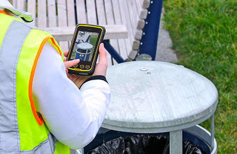
Handheld Group, a manufacturer of rugged mobile computers and smartphones, has launched the Nautiz X4 rugged handheld. The Nautiz X4 is a multipurpose compact handheld computer built for the mobile worker. It enables efficient and reliable data collection in the toughest environments, the company said.
The Nautiz X4 is a compact and lightweight rugged handheld computer that is optimized for efficient field data collection. It has been designed and developed specifically for mobile workers in tough environments in industries such as warehousing, logistics, transportation, utility, field service, security and public safety.
The Nautiz X4 rugged handheld computer has an integrated u-blox GPS receiver that provides professional-grade navigation functionality. It also offers multiple connectivity options, such as high-powered 3G and excellent Wi-Fi capability, the company said. It has a high-speed 1-GHz processor, 512 MB of RAM and 1 GB of flash memory. It runs Windows Embedded Handheld 6.5.
Measuring 156 x 74 x 25.5 millimeters (6.1 x 2.9 x 1.0 inches) and weighing 330 grams (11.6 ounces), the Nautiz X4 is an ergonomic work tool and one of the thinnest and lightest handheld computers in the rugged-device sector, the company said. It features a high-brightness, sunlight-readable resistive touchscreen for reliable computing in challenging worksite environments, and comes with either a high-performance 1D laser scanner or a 2D imager for fast, accurate scanning and barcoding tasks. The device also features a 5-MP camera with auto focus and LED Flash.
The Nautiz X4 has an IP65 Ingress Protection rating, which means that it is impervious to dust and highly resistant to water — the unit can be used in dusty work environments as well as in heavy rain, and can be rinsed off if dirty. It also meets stringent MIL-STD-810G military test standards for overall durability and resistance to humidity, shock, vibration, drops, salt and extreme temperatures.
“Mobile data collection is performed in warehouses as well as outdoors, in all kinds of weather and for long work hours. It may be cold and it may rain or snow. So the field worker needs a computing tool that can not only handle adverse weather conditions, but is also ergonomic and user-friendly,” said Jerker Hellström, CEO of Handheld Group. “For this, we are proud to introduce the Nautiz X4, a new rugged handheld computer that merges ultimate mobility with true field functionality in a handy package and at a very attractive price. We are confident that the Nautiz X4 will be the obvious choice for mobile workers in a wide range of industries.”
Trimble has introduced the Juno T41 rugged handheld computer with integrated Ultra-High Frequency RFID capabilities. In addition to high-speed 1D/2D barcode imaging technology, smartphone capability and enhanced, real-time 1-2 meter GPS accuracy, the Juno T41 series now offers new models that provide more functionality and configuration choices for data collection and mobile workforce management, Trimble said.
“Often the RFID tag is specifically used because the item being tracked is in difficult or harsh environments where a barcode won’t survive,” said Jim Sheldon, general manager of Trimble’s Mobile Computing Solutions Division. “The rugged design of this handheld computer is an ideal solution for reading RFID in outdoor and extreme situations.”
The RFID capability can be combined with Enhanced GPS and/or smartphone connectivity so customers can choose a specific handheld model that meets their needs.
The Juno T41 R will automatically recognize tags across a variety of frequencies and work with any size or style of RFID tag that is designed for customized solutions. UHF RFID is an increasingly commonplace technology using the 860 to 960 MHz frequency range.
Using the latest EPCglobal Gen 2 RFID technology from Trimble’s ThingMagic Division, the device uses two different antenna ranges to read or recognize the unique identification of an asset anywhere in the world.
FCC Certified (North America): 902-928 MHz bands
ETSI Certified (EU): 865.6-867.6 MHz bands
ACMA Certified (AU/NZ): 920-926 MHz bands
Trimble Juno T41 RFID handheld computers feature a 1-GHz processor and 512-MB RAM and 32-GB onboard storage with either Android 4.1 or Microsoft WEHH 6.5 operating systems. Other standard features include an 8-MP integrated camera, multi-touch capacitive 4.3-inch sunlight-readable display, all-day battery life and 2-4 meter GPS accuracy capability. Other features include:
Rapid-read, high-accuracy performance on multiple tags with multiple orientations, even in crowded conditions.
Consistent read-range over 3.5 meters for 5 cm2 (2″) UHF tags in unobstructed space.
Integrated antenna with the ability to transmit up to +30 dBm (1 Watt) power for demanding applications.
>Configurable performance settings and use-case parameters in the pre-loaded Trimble SearchLight application.
Software Development Kit to customize all settings including read-range, power-consumption and other features.
The Juno T41 models are built to meet military-grade standards of ruggedness for drops, temperature, altitude, humidity extremes, vibration, chemical exposure and shock with either an IP65 or IP68 rating for water and dust.
Photo credit: Mark Fisher at www.fishercreative.com, Instagram: @fishercreative; via Juniper.
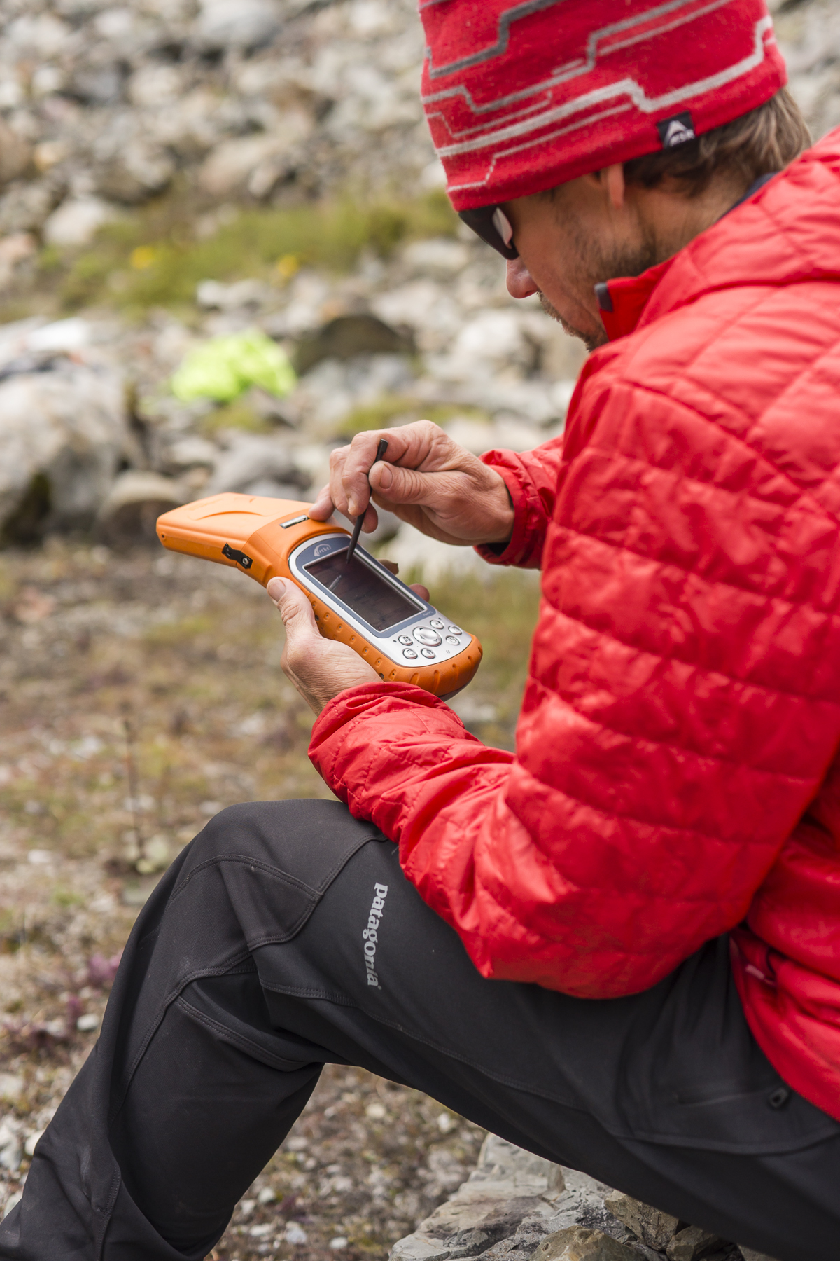
Juniper Systems’ Archer Field PC has beenused to record the elevation of a never-before-climbed peak in the remote Myanmar Himalaya. The peak, Mount Gamlang Razi, has historically been known as the second highest peak in Southeast Asia, but a joint American-Myanmar-led expedition set out on a mission last September to hopefully prove that it is in fact the tallest. Read the whole story on Juniper Systems’ blog.
Standing at a reported 5,881 meters tall, Mount Hkakabo Razi has long been known as Southeast Asia’s highest peak. In recent years, however, the legitimacy of the elevation of Hkakabo Razi has come into question. Current digital analysis suggests that initial surveys of Mount Hkakabo Razi were overstated and its actual elevation is as much as 100 meters lower than originally believed. At the same time, digital analysis suggests that virgin-peak Gamlang Razi may in fact be the taller peak. This controversy prompted Idaho resident and experienced climber Andy Tyson to lead an American-Myanmar expedition team on a three-week approach through 150 miles of cobra-riddled, mosquito-infested jungle, and from there up to the peak of Gamlang Razi to measure its elevation in person.
Tyson needed a device that could accurately record the elevation at the summit, while being able to withstand the extreme conditions of the hot, wet jungle and the frozen mountaintop. With this in mind, Tyson requested from Juniper Systems a top-of-the-line rugged handheld. In response, Juniper Systems provided the team with an Archer Field PC with Hemisphere GPS XF101 receiver, along with training to record the GPS data they needed.
Setting up the Archer Field PC to collect GPS data. Photo credit: Mark Fisher at http://www.fishercreative.com/Instagram: @fishercreative/via Juniper.
After a 35-day journey, Tyson and the team successfully summited Gamlang Razi, with the Archer Field PC in hand. After collecting GPS data at the top, the data was sent via satellite phone to Juniper Systems for analysis. After post-processing the data against terrestrial base stations in Lhasa, Tibet, and confirming the results with Effigis in Montreal, Canada, Juniper Systems concluded that the elevation of Gamlang Razi was 5,870 meters, ±2 meters. This suggests that Gamlang Razi is taller than nearby Hkakabo Razi by approximately 112 meters and should be considered Southeast Asia’s new highest peak.
However, there are many — particularly natives to Myanmar — who are not ready to accept changes to Hkakabo Razi’s original elevation measurement. This was made apparent in a letter Myanmar’s president, Thein Sein, wrote to Tyson and the team after their successful summit, congratulating them for summiting Southeast Asia’s second-tallest peak.
Tyson remains firm in his assertion that Gamlang Razi is the country’s highest peak, but some have suggested that the debate may not be over until someone actually climbs Hkakabo Razi and measures it in person. Juniper Systems said they have a handheld for the job, should that time come.
The expedition team. Photo credit: Mark Fisher at http://www.fishercreative.com. Instagram: @fishercreative/via Juniper.
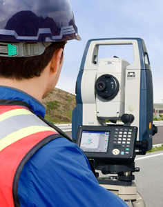
Sokkia Corporation is offering enhanced abilities and versatility to its DX series of total stations with the introduction of the DX-200 in the North American market.
When configured for hybrid positioning, the DX-200 has the ability to use both GNSS positioning and optical positioning data simultaneously. The standard Sokkia Hybrid Robotic System includes the DX, GRX2 GNSS receiver and MESA large-screen tablet controller.
“The DX-200 is ideal for the professional looking for a mid-range, auto-pointing total station that can become a full-robotic instrument with a simple firmware upgrade,” said Ray Kerwin, director of global surveying products. “Advanced functionality such as hybrid positioning can be added to the robotic unit, making the DX-200 a versatile system for multiple applications.”
The DX-200 can be used with the RC-PR5 remote controller for increased Bluetooth wireless operating range. “The remote allows for rapid prism search and lock up to 2,000 feet (600 meters) away,” Kerwin said.
“Hybrid positioning adds a new dimension of versatility,” Kerwin said. “When line-of-sight is blocked, for example, shots can be measured with the GNSS receiver, and the receiver can also be used for quick lock functionality.”
Standard additional features of the DX series include Direct Aiming auto-collimation technology, TSshield security and maintenance technology, MAGNET integrated software onboard and Sokkia’s patented RED-tech reflectorless measurement system.
The DX-200 is available in 1, 3 and 5 arc second accuracy models.
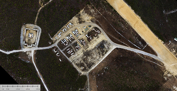
Applanix Corporation and American Aerospace Advisors have completed a successful series of test flights of AAAI’s RS-16 platform equipped with Applanix’ DMS-UAV aerial photogrammetry payload. This is the first successful mission for a long-endurance UAS (unmanned aerial system) capable of producing professional-grade, directly georeferenced mapping imagery for civilian applications such as pipeline monitoring, power line and emergency response mapping.
The RS-16 Unmanned Aircraft System equipped with the Applanix Direct Mapping Solution (DMS).
Tests were conducted over restricted airspace in the state of New Jersey. A joint team from Applanix and AAAI planned and flew a sequence of missions to evaluate the capabilities of the UAS. These include, critically, the ability to provide highly accurate, directly georeferenced and orthorectified aerial imagery without the need for ground control points or aerial triangulation calculations. The system, consisting of the airframe, its avionics, mobile ground control station and the digital mapping payload, performed according to expectations and successfully produced high-quality imagery.
“Performing safe and successful missions with long endurance unmanned aircraft in civilian airspace are a challenge that goes far beyond selecting the right aircraft and payload,” said David Yoel, CEO of American Aerospace Advisors. “Working with Applanix, we have produced an integrated system that is designed from the ground up with civilian mapping operations in mind. We believe this system has the capability to transform the aerial mapping industry.”
The Applanix RS-16 in flight.
The RS-16 DMS is a complete, operational system capable of conducting large area operations within the National Airspace System in the United States, and in other jurisdictions as local regulations allow. Within the USA, AAAI is engaged with several of the recently announced UAS research and test sites, which operate under the auspices of the FAA to develop the certification and operational requirements necessary to safely integrate UAS into the national airspace.
The GNSS-Inertial systems at the core of Applanix’ DMS-UAV aerial mapping payload uses commercial inertial technologies that are offered globally.
“The market for airborne imaging systems is in a state of rapid change,” said Joe Hutton, director of Inertial Technology and Airborne Products at Applanix. “Developments in imaging technology, in processing capability, and in the nature of inertial sensors, make a directly georeferenced UAS a reality today, where it would have been inconceivable even a few years ago. Our ability to take our established market-leading manned solutions, and integrate the technology successfully into an unmanned platform, speaks volumes for the engineering expertise of Applanix and AAAI.”
The regulatory announcement explains that Hexagon, Topcon Europe B.V. and Topcon Corporation have entered into a memorandum of understanding (MoU) related to Veripos, Inc. Hexagon Acquisition Ltd., an indirectly wholly owned subsidiary of Hexagon, has made an unconditional cash offer for all outstanding shares in Veripos not already owned by Hexagon Acquisition Ltd. Hexagon Acquisition Ltd. owns and has received acceptances and pre-acceptances for a total of 9,980,630 shares, representing 30.1 per cent of the outstanding shares in Veripos.
Under the MoU, Hexagon would establish a customer agreement between Topcon and Veripos, under which Topcon will act as a reseller of the satellite broadcast correction signal offered by Veripos. This “TerraStar Agreement” between Veripos and Topcon is intended to be an agreement with TerraStar GNSS Ltd., a wholly-owned subsidiary of Veripos and the contractual partner for all resellers and customers of the on-shore services. Under the TerraStar Agreement, Topcon will be entitled to offer the signal to its customers and to make its products compatible with the signal.
Also under the MoU, Hexagon and Topcon will establish a separate joint venture company on an equal partner basis for the purposes of pursuing joint efforts and cooperation in relation to the future development and direction of the services provided under the TerraStar Agreement.
GNSS receiver manufacturers who are partners with TerraStar include NovAtel, Altus Positioning Systems, and Septentrio Satellite Navigation.
The acceptance period for the unconditional cash offer expires on January 29, subject to further extensions but not beyond February 7.
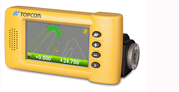
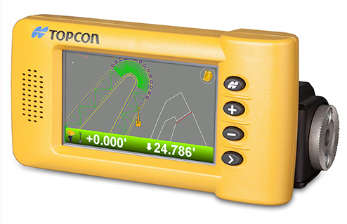
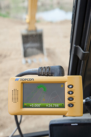
Topcon Positioning Group announces the addition of two new indicate control systems to its excavator control system lineup — the X-32 and X-33. The systems feature Topcon’s new GX-30 control box and TS-i3 sensors.
The GX-30 features a full-color touchscreen display. The TS-i3 sensors have no moving components, offer single and dual-axis measurement modes, and include convenient LED status indicators.
“The X-32 is a versatile and easy-to-use 2D excavator system that includes technology not available on other, more expensive systems,” said Kris Maas, manager for machine control product marketing.
“The X-32 is an excavator grade indication system to fit any budget. With this new system, you have the flexibility to use a wide array of references from which to work: Existing surface, a hub, previous cut, single slopes and dual slopes with the use of a compass or rotating laser. It’s as easy as choosing your reference and entering a cut and/or slope depth,” Maas said.
“The X-32 allows an operator to work faster, with consistency and greater degree of accuracy, and promotes a safer work site by keeping a grade checker out of the trench.”
Additionally, Maas said, “The X-32 grows as your needs expand because it’s easily upgradeable to a 3D system.”
“The X-33 adds Topcon’s industry-leading GNSS satellite technology to create a highly productive 3D indicate excavator grade control system,” Maas said. The system’s MC-i3 GNSS receiver with Vanguard technology provides “maximum flexibility in satellite signal tracking. Additionally, the MC-i3 is Sitelink3D ‘ready’ for integration into Topcon’s real-time 3D management solution,” he said.
The new 3D system is designed to establish grade faster and ensure the operator stays on grade. “The system eliminates over excavation and controls material usage, allowing the user to ‘see’ the exact position of the machine on site and the bucket position at all times,” Maas said. When detailed information is required, the operator can select to visualize the plan, profile, or sectional view and use the dual grade indicators for elevation control.
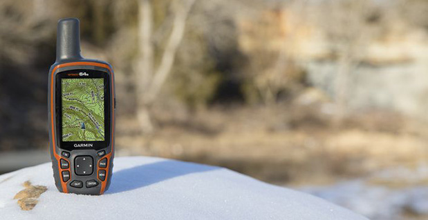
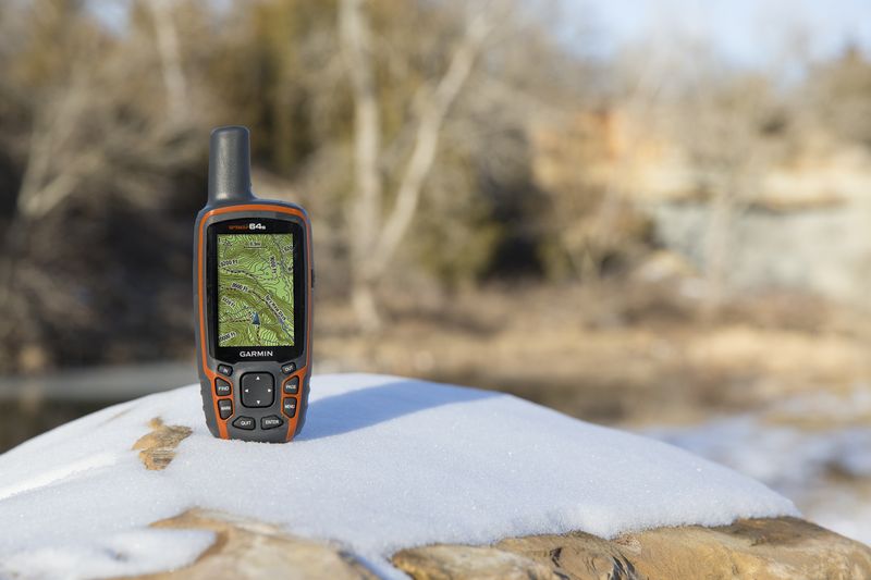
Garmin International Inc., a unit of Garmin Ltd., today announced the GPSMAP 64 series of rugged outdoor handhelds. The GPSMAP 64 series brings a dual GPS and GLONASS receiver, preloaded geocaches and smartphone connectivity for LiveTrack and Smart Notification to its product line for hikers, hunters, and geocachers.
“Building on the popularity of the GPSMAP series, the new GPSMAP 64 series improves functionality to make a top-notch device even better,” said Dan Bartel, Garmin vice president of worldwide sales. “The GPSMAP 64 is ideal for anyone, no matter if it’s their first handheld, or if they’ve used Garmin for years. It combines trusted Garmin technology with the comfort of a device people know and love.”
The GPSMAP 64 series has a 2.6-inch sunlight-readable transflective color display and a high-sensitivity GPS and GLONASS receiver with a quad helix antenna for superior reception. With the addition of GLONASS satellites, the time it takes for the receiver to lock on to a position is (on average) approximately 20 percent faster than using GPS alone. This allows users to get their position quickly and precisely even in heavy cover and deep canyon.
The GPSMAP 64 series features three distinct water-resistant (IPX7) models to suit various activities and interests. The basic GPSMAP 64 includes a built-in worldwide basemap with shaded relief, and supports BirdsEye Satellite imagery and TOPO U.S. 24K maps. The GPSMAP 64s adds a 3-axis electronic compass and barometric altimeter. Additionally, the 64s adds wireless connectivity for data transfer between other compatible Garmin handhelds and mobile apps, and for Smart Notification technology. With this, users can receive emails, texts and alerts on the device (when paired with an iPhone 4S and later). This allows users’ smartphones to be safely protected from the elements. The 64s also comes with a one-year subscription of BirdsEye Satellite Imagery. The GPSMAP 64st includes preloaded U.S. 100K topographic maps. With this, users will be able to search for points of interest by name or proximity to their location and view descriptive details for terrain contours, topo elevations, summits and geographical points.
For outdoor adventurers, the rugged GPSMAP 64 devices are compatible with BaseCamp, a free software download that allows users to view and organize maps, waypoints, routes and tracks. The 64s and 64st models are compatible with the BaseCamp mobile app for data transfer, and the Garmin Connect mobile app, for features such as LiveTrack. With LiveTrack, users can pair their device with the app, and invite friends and family to follow their activity in real time. This provides peace of mind, especially if users are alone. Through ANT+, the 64s and 64st models are also compatible with external sensors such as an external temperature sensor and heart rate monitor. With ANT+, the 64s and 64st models can act as a remote for the new VIRB and VIRB Elite action cameras.
Each device comes preloaded with the locations of 250,000 geocaches from Geocaching.com. Devices store and display key information to find the hidden containers including the geocache coordinates, terrain rating, its difficulty, hints and descriptions, so users no longer have to manually enter coordinates or print out geocache info. By going paperless, users are helping the environment, and improving their efficiency. If users would like to continue geocaching beyond the preloaded geocaches, when they register their device they can sign up for the free premium membership trial through Geocaching.com, and download more geocaches. The GPSMAP 64 devices can store millions more, so users will no longer have to pick and choose which geocaches they want to load on their device.
All of the devices in the GPSMAP 64 series have a dual-battery system, where both standard AA batteries and a rechargeable NiMH battery pack (sold separately) can be used. The devices have internal memory (4GB for 64/64s and 8GB for 64st), and a microSD card slot to store additional data and maps.
The new GPSMAP 64 series will be available this month. The GPSMAP 64 will retail for $299.99, the GPSMAP 64s will retail for $399.99, and the GPSMAP 64st will retail for $499.99.
Trimble has introduced a new version of its smart water and wastewater management software — Trimble Connect version 1.5. The latest release of the cloud-based software includes a suite of applications that help water and wastewater utilities to deploy smart meters, repair leaks and reduce non-revenue water (NRW), locate and map critical infrastructure using geographic information system (GIS) technology, extend the life of aging assets, and improve worker safety and productivity.
Trimble Connect software version 1.5 can be configured and deployed quickly on a variety of rugged mobile devices, laptops, tablets and smartphones to automate field workflows and eliminate paper-based maps and field work tracking and management, the company said.
Over the last decade, water and wastewater utilities have made investments in GIS mapping systems and asset maintenance management databases to manage their pipes and assets that are installed over large geographic areas. A large number of these utilities have implemented the Esri ArcGIS as their primary GIS mapping system. Maintenance of the information is an ongoing task and requires that information about the location of assets and the work performed on these facilities is accurately collected in the field. Trimble Connect helps with this challenge by integrating Esri ArcGIS technology and allowing utilities to view and update maps, assign work, manage workflows and collect field data and mapping updates using a variety of mobile devices. When used with a Trimble GeoExplorer series or Trimble Juno T41G series handheld, workers can map assets with up to decimeter accuracy in the field, helping improve the quality of their critical infrastructure GIS and asset management data.
Trimble Connect integrates the latest Esri ArcGIS Server, mobile and ArcGIS Online map services. The software is designed to automate a variety of specific water and wastewater industry workflows through individual apps offered within the product. The new version provides standard core apps including Map Book, Meter Changeout, Leak Repair, Manhole Inspector, and Pipeline Mapper. In addition, an optional partner app developed for hydrant and valve inspection, called AFC Mapper, can be purchased from American Flow Control (AFC) and their distributors coupled with a Trimble rugged handheld.
In addition to the standard core apps, Trimble Connect version 1.5 includes:
Multi-mobile platform support including Apple iOS, Android, Windows Mobile and Windows 7/8 devices
Offline support for Android, Windows Mobile and Windows 7/8
Esri ArcGIS based Web, mobile GIS mapping and ArcGIS Online basemaps
Work management support for single and multi-asset work orders
Business rules for customer mobile form design
Support for over-the-air network data and background map updates