Michigan Technological University library and department of social sciences are examining 11,000 historical images of Michigan’s Upper Peninsula (Copper Country), to find precisely where a photographer stood to take the photo.
The location will provide richer information about a place’s surroundings, especially in circumstances where structures or environmental landmarks are no longer present.
The project also will transform how people search for historical images, according to Bob Cowling, the school’s geographic information system (GIS) data librarian. Searching by keyword terms relies on accurate metadata. If there isn’t good data governance from the organization managing the images, then the metadata could be missing important fields.
Donated historical images often arrive without any dates or location information attached to them., but now will be easier to find on a map, making it possible to visualize what was there in the past compared to today.
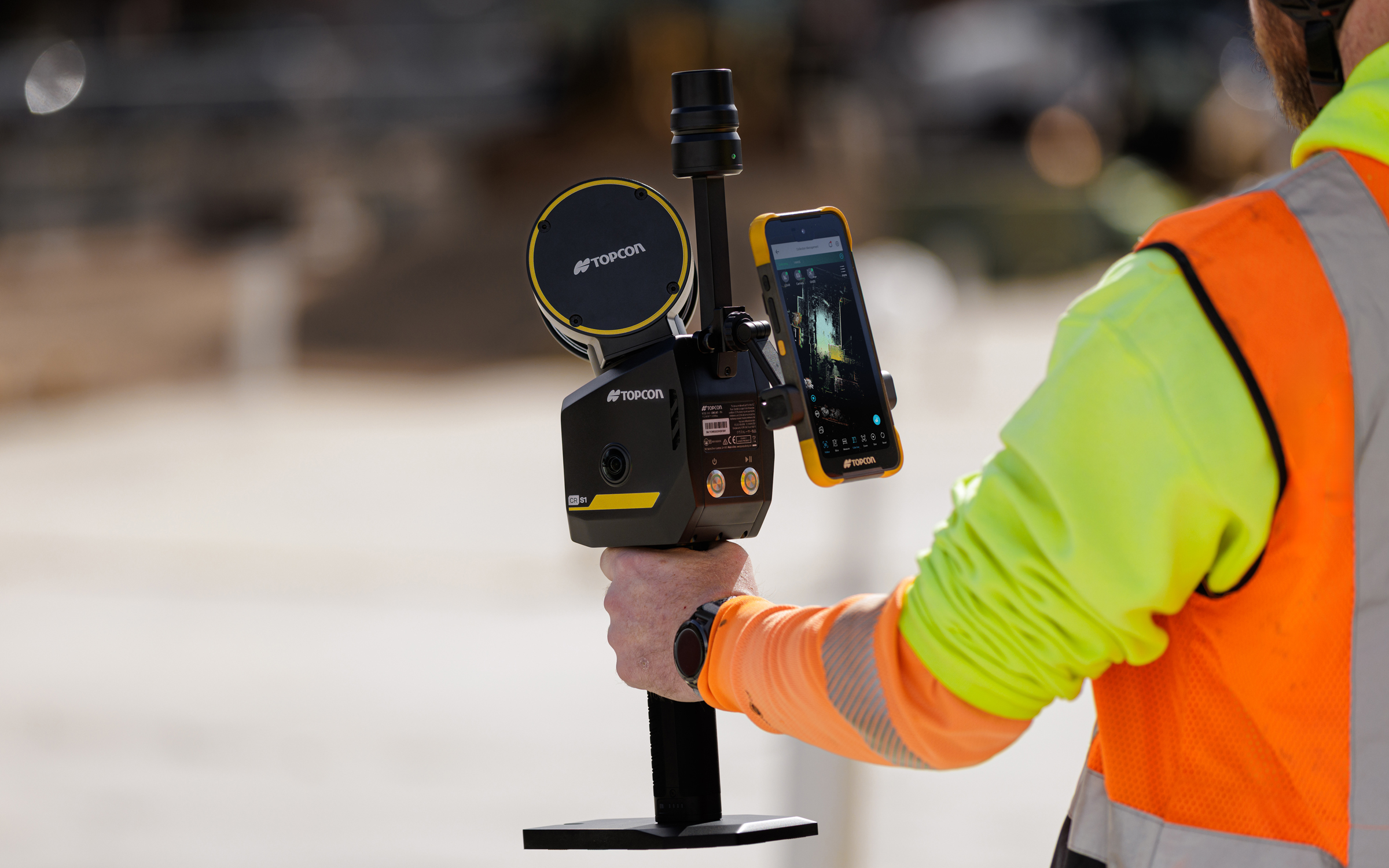
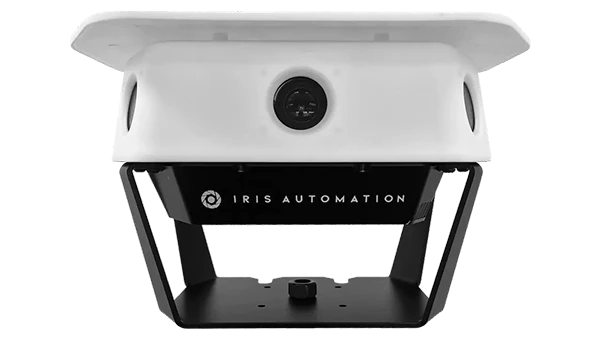
Topcon Positioning Systems has introduced the CR-S1, a handheld scanning system that combines ldar, panoramic cameras, visual SLAM cameras, and a GNSS antenna in a single device.
The CR-S1 expands the company’s Capture Reality portfolio as a higher‑performance option alongside the CR‑S2. It offers increased point‑cloud density, extended scanning range, and upgraded panoramic imaging.
The CR-S1 uses Topcon’s Collage mass-data software ecosystem central to a connected workflow.
For added positioning accuracy, the CR‑S1 can be connected to the Topnet Live RTK GNSS corrections service.
The system is primarily intended for surveying and construction. It is also well-suited for applications such as land surveying, tunnel surveying and modeling, forestry analysis, mining operations, utility mapping, and powerline inspection.
“Customers are looking for flexibility and efficient workflows, and our scanning portfolio and software are designed to support these needs through simplified processes, open integrations and mixed‑fleet compatibility,” said Ron Oberlander, head of the Topcon Geomatics Platform. “With Collage serving as the central data hub supporting inputs from multiple sensors, users can obtain accurate, detailed information for decision‑making.”
Software support includes MAGNET Flow for Android and iOS devices, MAGNET Bridge for SLAM data desktop processing, and Collage Web.
Topcon Collage Web is a cloud‑based platform for fast visualization, exploration, and sharing of 3D point‑cloud data directly in a web browser. It enables users to easily view and inspect datasets while supporting efficient collaboration across projects. Through the Collage Cloud Connector desktop application, projects are seamlessly synchronized with Collage Web, allowing smooth integration with Autodesk and ClearEdge3D software. This workflow supports mixed fleets and diverse industry systems, ensuring efficient data exchange and consistent project access across desktop and cloud environments.
Mounting options include backpack and front‑pack configurations for hands-free, load-bearing scanning while walking, as well as rover–pole operation. An adapter for mounting the CR-S1 on a vehicle for mobile mapping is also available.
The CR‑S1 is being showcased at Geo Week 2026, Feb. 16–18, in Denver, Colorado. It will be available through the Topcon dealer network with training and support.
Autonomous mapping company Emesent has launched the Emesent GX1, an integrated simultaneous localization and mapping (SLAM) and real-time kinematic (RTK) scanner. The company is exhibiting the GX1 at Geo Week 2026 (booth #911).
The product achieves 5-10mm global accuracy to deliver high precision for topographic surveying and building and infrastructure construction. It can reduce the time required to survey a site by up to 95% with a single day of scanning replacing weeks of work, Emensent stated in a press release.
The GX1 is an integrated, all-in-one system where lidar, RTK, cameras and software work together seamlessly from capture to validated deliverable. Its SLAM technology was proven in the world’s most challenging environments to everyday surveying applications, but it also eliminates the longstanding trade-off faced by survey firms and the architecture, engineering and construction (AEC) industry between mobile scanning speed and dependable survey-grade accuracy.
Suited for use cases across topographic and road survey, scan to building information models (BIM), construction progress tracking and more, the GX1 is simple enough for junior surveyors to train on and deploy in a matter of days yet powerful enough to meet the needs of experts in the field.
Accuracy. GX1 is the only SLAM-based mobile scanner system delivering 5-10mm global accuracy combined with rapid scanning capabilities. Incorporating client-first design, integrated RTK and Emesent’s proprietary SLAM algorithm, GX1 offers repeatable results survey firms can rely on.
Proven SLAM algorithm: Emesent’s SLAM technology, which powers its award-winning Emesent Hovermap product, was developed and validated in some of the most extreme real-world environments, includidng GPS-denied underground locations. It delivers repeatable accuracy both indoors and out.
Versatile deployment: GX1 has four purpose-built deployment modes: backpack, survey pole, vehicle mount, and supported handheld. Flexible georeferencing minimizes the risk of having to return to a site for redo – surveyors can capture with RTK in the field or with ground control points and checkpoints in post-processing.
The GX1 is being launched at a pivotal moment for survey firms and the AEC industry, which are grappling with a shortage of experienced surveyors, Emensent stated. At the same time, firms face mounting pressure from clients demanding faster, cheaper and better results without quality compromise, alongside the diminishing competitive advantage of adopting basic mobile scanning technology.
“With the introduction of the GX1, we’ve answered the call we’ve heard echoing throughout the surveying industry to end the tug-of-war between fast and accurate,” said Stefan Hrabar, chief strategy officer and co-founder of Emesent. “By putting the power of SLAM into the hands of the everyday surveyor, the GX1 raises the bar for mobile scanning accuracy and keeps critical projects on track.”
Technical Features
Independently validated 5-10mm global accuracy
Integrated RTK georeferencing with real-time quality monitoring
4 x 20MP cameras for 360° panoramic imagery
Emesent SLAM algorithm
Four deployment modes: backpack, survey pole, vehicle mount, handheld
Integrated batteries for cable-free management
Rapid accuracy validation reports in Aura processing software.
Several interesting things, according to geologists who study data from the global network of geodetic-quality receivers. A team at the University of the Basque Country found the Iberian Peninsula rotating clockwise as Africa closes on Eurasia by 0.2 inches per year (5 mm), near Gibraltar and the Alboran region. Meanwhile, in a process called lithospheric dripping, Earth’s crust is sinking under Central Turkey despite being part of a broader region that has been uplifting for millions of years, according to University of Toronto researchers. Meanwhile, in the U.S. Pacific Northwest, seismic data collected during a National Science Foundation study shows the Cascadia subduction zone actively breaking apart.
Making better robots with GNSS
Image: Robosat Project
Autonomous robot navigation in the wild using satellite-based 3D geographical information (Robosat) aims to provide a scalable multi-GIS high-quality data collection platform through using a quadrupedal robot that can autonomously perform long-distance missions in challenging environments, such as the Alps or Finnish forests. Researchers from Finland, Switzerland, Spain and Romania gathered at Tampere University in Finland to share data, identify relevant GIS and GNSS datasets, and leverage AI for autonomous labeling of large-scale data. Key topics included integrating multi-sensor and multi-GIS data to enhance positioning, planning pilot tests with ETH’s ANYmal robot (pictured) and TAU’s new I/Q GNSS grabber device, and discussing methods for AI-driven data labeling for massive datasets collected in field trials.
It’s all happening downtown
Image: Getty Images / Ivan Pantic
Researchers from Shandong Jianzhu University and the China University of Mining and Technology describe a new smartphone positioning strategy in the Dec. 15, 2025, issue of Satellite Navigation. They use a positioning framework that combines 3D map constraints with multiple GNSS observations. By integrating time-differenced carrier-phase information with probabilistic road matching and factor graph optimization, the approach reduces ambiguity in candidate positions and enhances robustness against non-line-of-sight signals. In field tests, the method outperformed existing smartphone GNSS techniques, delivering more reliable location estimates and smoother trajectories even in severe urban canyon conditions.
2,000 and counting
Image: Getty Images / rvimages
The International Air Transport Association (IATA) has called for vigilance following the increasing number of GNSS spoofing and jamming incidents worldwide. The growing interference poses a significant risk to flight navigation and pilot safety. Of note is a spike in incidents at major Indian airports. Almost 2,000 GNSS interference incidents have been logged at airports in India since 2023, including the airports in Delhi, Mumbai, Kolkata, Amritsar, Hyderabad, Bengaluru and Chennai. IATA represents more than 360 airlines, accounting for 80% of global air traffic.
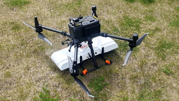
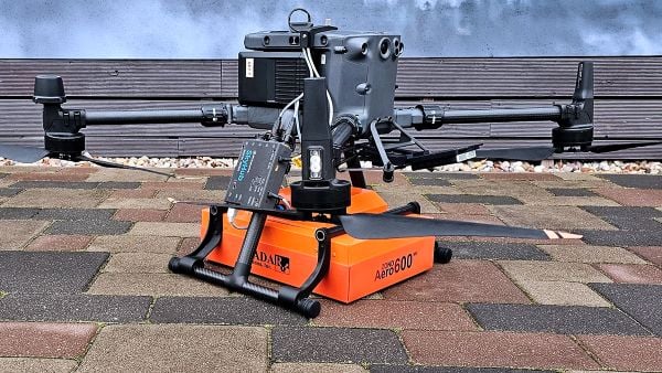
SPH Engineering is offering two new ground-penetrating radar systems optimized for UAV integration: MALÅ GeoDrone 600 and Zond Aero 600 NG.
Both 600 MHz antennas significantly enhance high-resolution subsurface investigations with drones, supporting applications in engineering surveys, utility mapping, archaeology, environmental studies and geophysical research. They enable surveyors to capture consistent, high-quality subsurface data in areas difficult, slow, or unsafe to access with traditional ground instruments.
Operating at 600 MHz, the antennas offer a balance between penetration depth and fine near-surface resolution. Typical penetration from the drone is up to 2 meters, depending on the surface conditions, while SPH Engineering’s True Terrain Following ensures stable antenna height to maintain data quality and repeatability.
Compared to ground-based carts or vehicle systems, the UAV-borne configuration enables operators to:
Survey rocky, uneven, vegetated, or steep terrain
Achieve consistent grid spacing and uniform antenna coupling
Cover large areas significantly faster than manual GPR methods
Improve safety by reducing personnel exposure in risky field conditions
The MALÅ GeoDrone 600 combines the reliability of MALÅ instrumentation with SPH Engineering’s fully integrated drone workflow. Designed for precision engineering, utility detection, and geophysical mapping, the antenna produces clear, high-quality radargrams suitable for detailed structural assessment and shallow subsurface characterization.
Key Specifications
Central frequency: 600 MHz
Operating Bandwidth: 250-900 MHz
Typical penetration: up to 2 m (soil-dependent)
Sampling: MALÅ HDR technology
Antenna design: Shielded
Weight: 2.7 kg
The Zond Aero 600 NG antenna package. (Photo: SPH Engineering)
The Zond Aero 600 NG is a next-generation shielded antenna designed specifically for airborne GPR operations. It offers a strong signal-to-noise ratio, improved ground coupling at low altitudes, and robust performance over natural terrain, making it particularly suitable for geophysical research, archaeology and environmental geoscience.
Key Specifications
Central frequency: 600 MHz
Operating Bandwidth: 300-950 MHz (-12 dB)
Typical penetration: up to 2 m (soil-dependent)
Sampling: Real-Time Sampling (RTS) with high hardware stacking
Antenna type: Shielded
Weight: 1.7 kg
Both antennas are fully compatible with SPH Engineering’s UgCS flight planning software and the SkyHub drone onboard computer, enabling:
Automated terrain-following flights over complex topography
Precise altitude control for optimal GPR signal geometry
Synchronized GNSS + radar trace logging (for Zond Aero 600, MALÅ GeoDrone 600 has built-in data recorder).
JAVAD Data Collector (JDC) is designed to run seamlessly on any Android device and interface seamlessly with JAVAD GNSS smart antennas. JDC features simple, intuitive workflows that require minimal training, making it accessible for users of all skill levels.
The software includes a Signal Bar for a quick view of receiver status, ensuring users can easily monitor their equipment’s performance. Its easy navigation allows users to move through the software efficiently. It is designed to streamline operations of customers ranging from individual surveyors to large surveying firms, making it easier to deploy and manage receivers across teams of any size with minimal training. JDC is available for download through the company website.
The AU20 MMS is a vehicle-mounted mobile mapping system designed for accurate and efficient collection of 3D spatial data. It combines high-performance lidar technology, versatile sensor support and intelligent data processing to provide a practical and flexible solution for professionals in road surveying, asset management and infrastructure documentation. Its lidar system uses fourth-generation real-time waveform processing to achieve a scan rate of 2 million points per second and 200 revolutions per second, producing point cloud data with 5 mm accuracy and 3 mm precision. This level of detail allows for the identification of fine surface characteristics and features, supporting comprehensive asset inventories and condition assessments. The system’s long-range, multi-cycle laser technology enables high-density data capture up to 250 m in vehicle-mounted applications.
Instead, the ANPR-FASTag hybrid system will continue to rely on ground-based high-speed cameras to identify vehicles and radio-frequency-identification FASTag readers to charge them.
The Ministry of Road Transport and Highways is proceeding with corridor projects relying on automatic number-plate recognition (ANPR) and FASTag systems, which don’t require vehicles to stop. A GNSS toll system tracks the exact location of the vehicle and calculates the distance traveled on a toll roll, ensuring that users end up paying for just the distance they actually traveled.
For several years, the Indian government had intended to implement a GNSS-based toll system based on real-time location tracking. Now, it looks like these plans have been scrapped.
Promoting precious pollinators
Washington State University (WSU) is leading the Pacific Northwest Pollen Atlas (bees.wsu.edu) to map and describe pollen. It aims to determine pollinator health and thus food humans eat that depend on pollination. Honey bees and other pollinators collect pollen from plants within a two-mile radius of their hive.
“We hope to create a database of plants and share the nutrient content in their pollen so gardeners can plant a healthy variety,” said Priya Chakrabarti Basu, WSU assistant professor, Entomology.
Researchers will map pollen varieties collected by citizen scientists in every Washington county over a four-year period and colleagues around the Pacific Northwest are also recruiting to increase the project’s scope. Expected to take decades to complete, the efforts are part of Basu’s larger effort to map pollen nutrition across North America.
How’s the weather out there?
High-resolution atmospheric data is the missing link in forecasting weather. A new approach sharpens GNSS tomography, while showing how the model makes decisions — a transparency critical for building trust as AI enters weather forecasting.
By revealing the hidden details of storms and humidity patterns, the new method can give forecasters the tools needed to anticipate extreme events with greater confidence, according to researchers at Wrocław University, Poland. The team described their deep-learning framework in a paper published in Satellite Navigation in August.
With sharper GNSS tomography, meteorologists can feed more accurate humidity fields into both physics-based and AI-driven forecasting models, significantly improving storm prediction and early-warning systems.
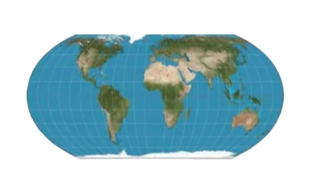
Africa is really huge
Photo: Equal Earth, Strebe / CC BY-SA 4.0
A Correct the Map campaign aims to replace the 16th-century Mercator map because it doesn’t show the true size of Africa, which is three times as large as Europe. Supporters say the historic map — created to guide European explorers — promotes a false view of the continent and its size, fostering a false impression that Africa is “marginal.”
In August, the 55-country African Union endorsed the campaign to have organizations around the world replace the Mercator with alternatives such as the 2018 Equal Earth projection. The African Union is expected to make an official decision to adopt the Equal Earth map in February. The campaign also asks the United Nations and the BBC to adopt the Equal Earth map.
1. Dat Collection Software Intuitive workflows require minimal training
JAVAD Data Collector (JDC) is designed to run seamlessly on any Android device and interface seamlessly with JAVAD GNSS smart antennas. JDC features simple, intuitive workflows that require minimal training, making it accessible for users of all skill levels. The software includes a Signal Bar for a quick view of receiver status, ensuring users can easily monitor their equipment’s performance. Its easy navigation allows users to move through the software efficiently. It is designed to streamline operations of customers ranging from individual surveyors to large surveying firms, making it easier to deploy and manage receivers across teams of any size with minimal training. JDC is available for download through the company website. JAVAD GNSS, javad.com
2. Mobile Mapping System Lidar collects 2 million points per second
Photo: CHC NAVIGATION
The AU20 MMS is a vehicle-mounted mobile mapping system designed for accurate and efficient collection of 3D spatial data. It combines high-performance lidar technology, versatile sensor support and intelligent data processing to provide a practical and flexible solution for professionals in road surveying, asset management and infrastructure documentation. Its lidar system uses fourth-generation real-time waveform processing to achieve a scan rate of 2 million points per second and 200 revolutions per second, producing point cloud data with 5 mm accuracy and 3 mm precision. This level of detail allows for the identification of fine surface characteristics and features, supporting comprehensive asset inventories and condition assessments. The system’s long-range, multi-cycle laser technology enables high-density data capture up to 250 m in vehicle-mounted applications. CHC Navigation, CHCNAV.com
“Seen & Heard” is a monthly feature of GPS World magazine, traveling the world to capture interesting and unusual news stories involving the GNSS/PNT industry.
Free navigation history course
Photo: Harvard University
Harvard University offers PredictionX: Lost Without Longitude, a free online course that examines the evolution of navigation from ancient methods to modern technologies. The program explores the science and history of navigation, focusing on the challenges of determining longitude before GPS existed. It highlights key advancements, such as John Harrison’s marine chronometer and the Longitude Prize. Through multimedia content — including videos, infographics and Worldwide Telescope tours — the course is designed to demonstrate how centuries of advancement in navigation enabled humanity to achieve milestones such as landing on the moon.
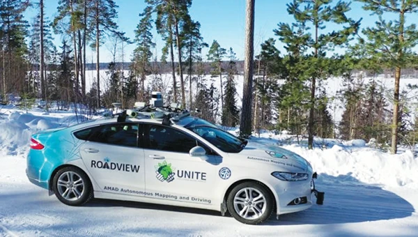
Self-driving cars collect geospatial data
Photo: Finnish Geospatial Research Institute
In Finland, self-driving cars are being used to collect geospatial data to address urban challenges. The ARVO autonomous vehicle from the Finnish Geospatial Research Institute is equipped with high-precision sensors that map its environment in real-time, collecting information on road conditions, urban vegetation as carbon sinks and factors influencing flood risks. In partnership with Aalto University and funded by the European Regional Development Fund, this initiative seeks to explore various uses of this data, such as city planning, environmental monitoring and infrastructure management.
Stopping scammers
Photo: Carlos Alvarez / iStock Editorial / Getty Images Plus / Getty Image
Google has taken legal action against a network of scammers responsible for creating more than 10,000 fake business listings on Google Maps. The scammers fabricated profiles targeting urgent service industries and bolstered them with fake reviews to appear credible. Victims were misled into contacting these fake businesses, which then sold their personal information as “leads” to legitimate service providers without consent. Google has removed the fake listings and is suing individuals involved in the scheme, CBS News reported.
Mapping Uganda’s disappearing tropical glaciers
Photo: guenterguni / E+ / Getty Image
Project Pressure, in collaboration with UNESCO and the Uganda Wildlife Authority, conducted an expedition to the Rwenzori Mountains to map the region’s disappearing tropical glaciers. The team created the first 3D model of Mt. Stanley’s glaciers and installed monitoring equipment, revealing that Mt. Speke and Mt. Baker have lost their glaciers entirely, while the Stanley Plateau Glacier has shrunk by 29.5 percent since 2020 and is heavily fragmented. The project aims to continue monitoring the glacial retreat, develop mitigation strategies and engage the local community in ongoing research.
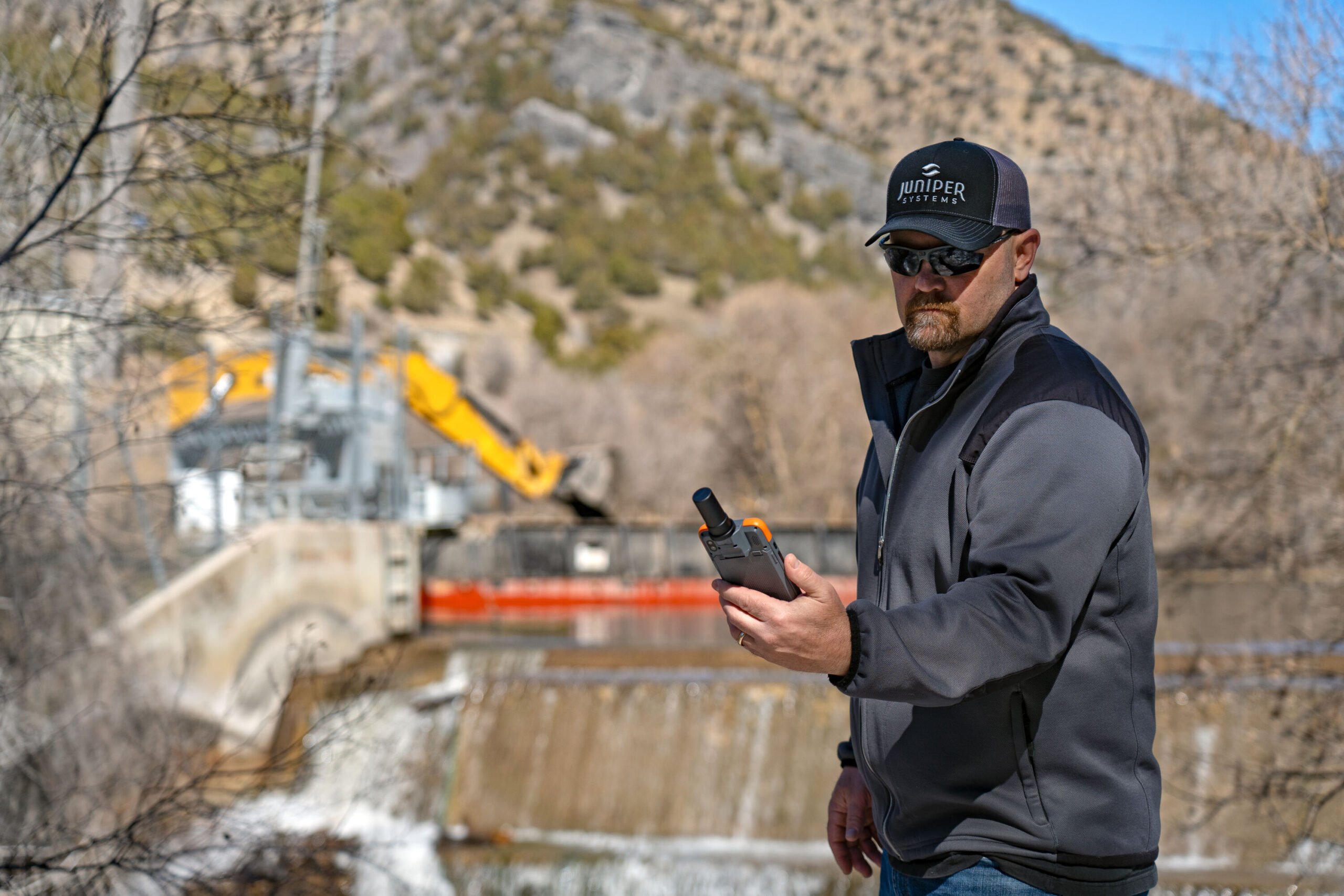
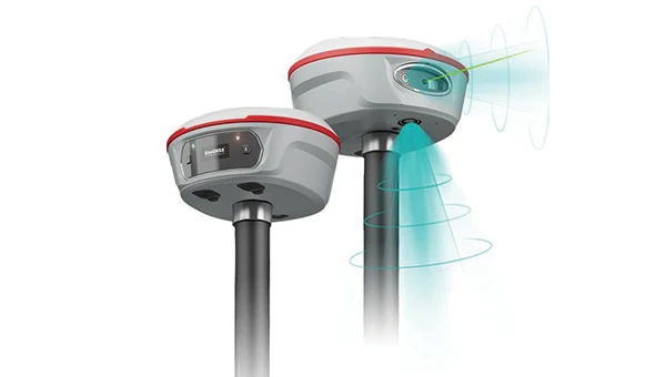
The Archer 4 with GNSS Expansion Pod and RTK connection is now an all-in-one centimeter mapping solution.
Juniper Systems Inc. announces that the GNSS Expansion Pod for the Archer 4 Rugged Handheld is now RTK capable. Juniper Systems is also launching a new application for the Archer 4 called Archer Connect. The Archer 4 with GNSS Expansion Pod and RTK connection is now an all-in-one centimeter mapping solution.
“We are very excited to bring this update to the Archer 4,” said John Florio, senior product manager at Juniper Systems. “The Archer 4 with a GNSS Expansion Pod and an RTK correction is the optimal all-in-one high-precision mapping solution.”
Archer Connect is a utility application that allows users to easily manage their GNSS expansion pod that is attached to their Archer 4. In Archer Connect, users can set up and manage their RTK network connection. Archer Connect is available on the Google Play Store.
The GNSS Expansion Pod attaches and interfaces with the Archer 4 through the Archer’s back contact pads. This allows for a compact one-handed device. The Archer 4 is a rugged handheld device designed to work in extreme environments. Featuring Android 14 and expanded battery options for increased runtimes in the field.
“Seen & Heard” is a monthly feature of GPS World magazine, traveling the world to capture interesting and unusual news stories involving the GNSS/PNT industry.
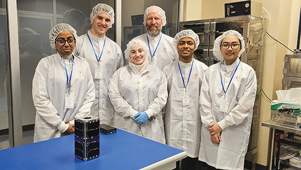
UNB students prepare for second satellite mission
The CubeSat team at the University of New Brunswick (UNB) is developing a second satellite after its first, VIOLET, failed to communicate with Earth. The team is refining its design based on lessons learned from the initial mission. VIOLET, deployed in 2024, was created through a partnership between UNB, the Université de Moncton and the New Brunswick Community College as part of the Canadian Space Agency’s CubeSat Project. This initiative provides students with hands-on experience in designing, building, testing, launching and operating miniature satellites.
GPS technology played a crucial role in preventing disaster during an EasyJet flight, The Daily Mail reported. As the Airbus A320 descended toward Hurghada, Egypt, it approached dangerously close to a mountain range, flying at an altitude of 3,100 ft — just 770 ft above the peak of the mountain. The Ground Proximity Warning System, which relies on GPS-enabled terrain data, alerted the cockpit with warnings such as “pull up, terrain ahead.” This alarm prompted the pilot to perform an emergency maneuver by pulling up the joystick to level off the plane, narrowly avoiding collision and saving all 190 passengers on board.
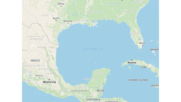
Gulf of America’ name change leaves decisions for map creators
Photo: TomTom
With the U.S. government now recognizing the Gulf waters as the “Gulf of America” and not the “Gulf of Mexico,” TomTom is introducing a U.S. geopolitical view for its users in the United States; they will see “Gulf of America.” Translations will be available in English, Spanish, French and German, and users searching for “Gulf of Mexico” will find the “Gulf of America.” Map users outside of the United States will see the default map view showing the “Gulf of Mexico.” Users searching for “Gulf of America” will find the existing “Gulf of Mexico” feature. All users will be able to change the view based on their preferences
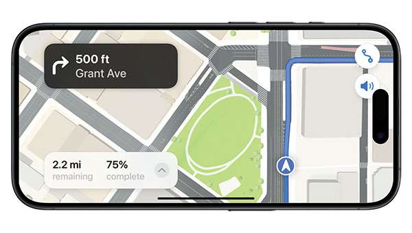
New ‘surveyor’ app for improved mapping accuracy
Photo: Apple
Apple launched the Surveyor app, a tool designed to enhance the accuracy of Apple Maps by collecting real-world mapping data. According to Apple, Surveyor relies on partner companies and users to gather data along assigned routes. The app focuses on capturing detailed information such as street signs, traffic signals and roadside features, which are then transmitted to Apple for precise map updates. By leveraging community-driven data collection, Apple aims to refine its mapping ecosystem and keep critical details current.
Read a roundup of recent products in the GNSS and inertial positioning industry from the April 2025 issue of GPS World magazine.
OEM
INS With three additional GNSS receiver variants
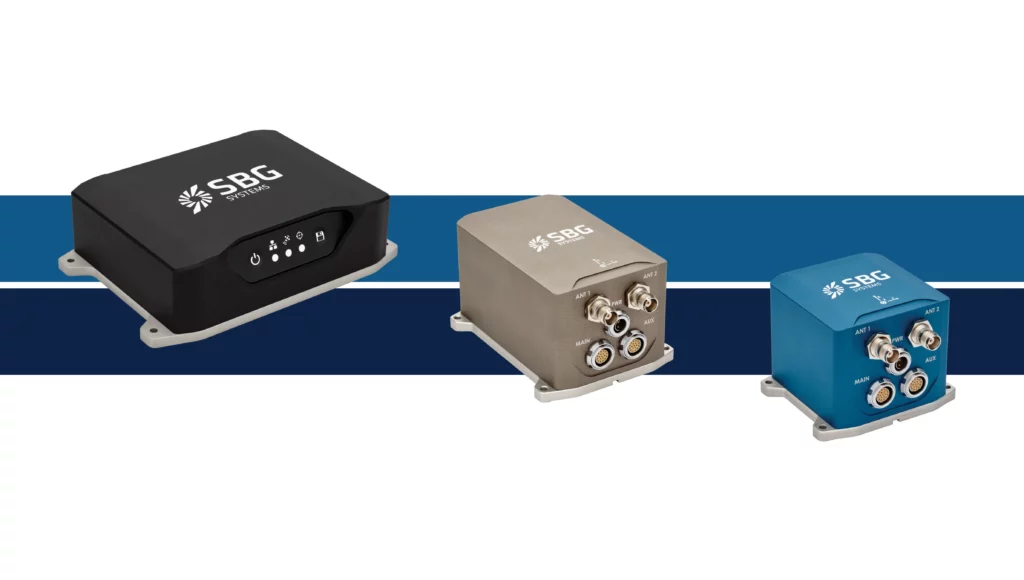
Photo: Topcon
SBG Systems has upgraded its inertial navigation systems — Ekinox, Apogee and Navsight — with new GNSS receiver options. The latest update introduces three additional GNSS receiver variants.
These include:
Marinestar, which supports Fugro Marinestar, delivering precise point positioning (PPP) with centimeter-level accuracy via L-band corrections without requiring a base station. It is optimized for marine applications.
HAS Ready / NavIC, which includes Galileo E6 support for the upcoming Galileo High Accuracy Service (HAS), offering free decimeter-level PPP corrections globally. Additionally, it supports the Indian NavIC system.
Centimeter-Level Augmentation Service, which is tailored for users in Japan; this variant utilizes QZSS L6 signals to provide free PPP corrections without external services.
All GNSS variants integrate seamlessly with SBG Systems’ antenna portfolio and Qinertia post-processing software. Users select the appropriate GNSS variant at purchase to match their operational requirements. These enhancements aim to provide versatile solutions across diverse industries while ensuring reliable performance.
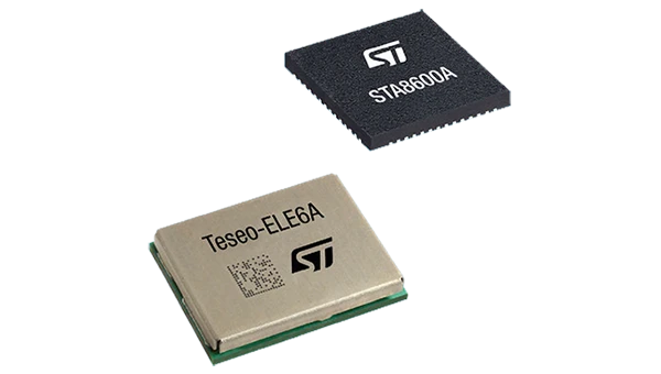
The GNSS receivers in the Teseo VI family use multi-constellation and quad-band signal processing on a single chip, achieving centimeter-level accuracy for various applications. The Teseo VI family includes the STA8600A and STA8610A models. These receivers are designed for automotive applications such as advanced driver assistance systems and autonomous driving, as well as industrial uses, including asset tracking, mobile robots and precision agriculture.
The Teseo VI+ variant can host enhanced positioning engines developed by third-party companies, providing real-time kinematics for centimeter position accuracy.
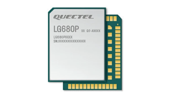
The LG680P is a multi-constellation, quad-band GNSS module designed for high-precision positioning and to enhance signal quality and precision through concurrent reception of L1, L2 and L5 frequency bands. It supports Galileo E6, QZSS L6 and BDS B2b signals for precise point positioning, ensuring horizontal accuracy of up to 0.8 cm + 1 ppm without requiring local or broadband connectivity.
To ensure signal integrity in environments with electromagnetic interference, the module features professional-grade anti-jamming technology, including built-in NIC algorithms that suppress narrow-band interference. It supports external active antennas for enhanced signal reception and positioning accuracy. It is ideal for applications such as autonomous lawnmowers, delivery robots, surveying equipment and precision agriculture. Quectel complements it with two external GNSS antennas: the YEGR001W8AH geodetic antenna and the YEGD006U1A compact patch antenna.
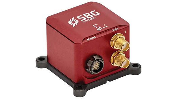
The New Ellipse firmware upgrade for the Ellipse product line allows the system to now be used as an attitude and heading reference system or inertial navigation system. It is designed to enhance navigation, attitude and heave performance for stable and accurate positioning, even in challenging conditions.
It introduces advanced GNSS-denied capabilities, featuring newly integrated flags that trigger when GNSS jamming or spoofing threats are detected. This allows users to reject or re-enable external sensors — such as GNSS — without resetting the filter. The user-friendly interface allows for fast and flexible configuration using simple command lines, enabling users to tailor the Ellipse to their specific needs and applications.
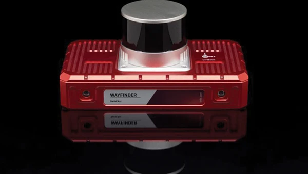
Localization Solution Operates in GNSS-denied environments
Photo: OxTS
WayFinder is a localization solution designed for GNSS-denied environments. It integrates a GNSS/INS system, onboard processor, lidar scanner and two cameras, enabling precise navigation in areas with limited satellite coverage. The system features Lidar Boost, a software technology that enhances GNSS/INS performance by processing lidar data to compensate for missing or inaccurate GNSS updates in real time. This ensures high-accuracy localization and seamless transitions between GNSS-supported and GNSS-denied environments.
WayFinder enables precise navigation for autonomous vehicles in ports, mining and indoor automotive testing without fixed infrastructure. It also provides reliable positioning for surveyors in areas with limited GNSS coverage.
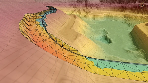
Virtual Surveyor Version 10 introduces Basic Topographic Design tools, allowing users to document terrain changes such as graded roads, water ponds and building surfaces. The software now features four subscription plans — Valley, Ridge, Mountain and Peak.
Ridge plan: Focuses on surveying a single moment in time using one drone data set.
Mountain plan: Adds Timelines to compare surveys across different times, visualizing changes through Time Steps.
Peak plan: Includes advanced Topographic Design tools for planning future structures by creating new Time Steps. These tools allow users to design features such as roads or ponds directly on UAV-derived models, with automated alignment and volume calculations for cut-and-fill operations.
Version 10 introduces drawing guides, available in the Ridge plan and above, enabling precise drawing of points at specific intervals or angles. Walk Mode, included in all plans, allows users to explore 3D terrain at ground level for better visualization. Timelines, featured in the Mountain and Peak plans, facilitate the comparison of multiple surveys conducted at different times and the integration of future designs. These improvements seek to streamline processes for engineering surveyors, supporting applications in construction, mining and water management.
The Jupiter Laser RTK integrates GNSS, auto-IMU, laser and dual camera systems into a single unit. It incorporates a precise green laser that remains visible even in bright daylight. This feature allows for precise measurements of points in hard-to-reach, signal-blocked or potentially hazardous locations. It also features a night vision camera, allowing users to see feature points even in low-light conditions. The RTK system’s laser range is up to 50 m, making it suitable for challenging surveying environments. It incorporates visual technology to offer surveyors an immersive experience during surveying and stakeout operations, improving working efficiency and productivity.
Version 2.1.0 of AgEagle Aerial Systems’ eBee VISION application software introduces circular and grid mapping features, allowing users to generate 2D or 3D maps using external post-processing software for more comprehensive geospatial data.
The eBee VISION 2.1.0 can continue missions in GNSS-denied environments and allows manual deactivation of GNSS to prevent jamming or spoofing. It implements the STANAG 4609 standard, the official format for motion imagery exchange within the NATO nations. This involves embedding UAV position and camera information into the videos recorded by the UAV and those broadcasted by the Ground Control Station. Its inclusion in the system seeks to enhance interoperability with third-party applications, which is key for military-grade UAVs.
It offers enhanced control over the Silent Tactical Landing feature. Users can now manually adjust the landing position on the map, with the system providing range estimates to inform operators of the UAV’s reach. This functionality offers greater flexibility in mission planning and execution, particularly in tactical scenarios requiring precise landing control. The system is ideal for defense, public safety and utilities applications.
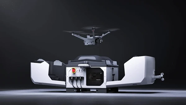
‘Drone-in-a-Box’ Solution Designed for vehicle-mounted deployments
Photo: DJI
The DJI Dock 3 “drone-in-a-box” solution is designed for vehicle-mounted deployments and 24/7 remote operations in various environments. This system is compatible with the Matrice 4D and Matrice 4TD UAVs, which feature advanced cameras and IP-rated protection for challenging conditions. The UAVs are ideal for public safety, emergency response and infrastructure inspection.
This system supports flexible deployment options, including vehicle-mounted setups optimized for emergency operations and long-distance inspections. It enables horizontal calibration and cloud-based dock location adjustments. Two docks can be mounted on a single vehicle to facilitate dual-UAV rotations for enhanced efficiency. In fixed deployments, the D-RTK 3 Relay Fixed Deployment Version can be added to improve video transmission and satellite connectivity.
The Matrice 4D and 4TD UAVs have a wide-angle camera, medium tele camera, tele camera and laser range finder. The Matrice 4D features an advanced camera suite designed for high-precision mapping. The Matrice 4TD includes an infrared thermal camera for public safety and emergency response applications. The system includes a Flight Termination System to support regulatory compliance in strictly controlled airspace. This system can manually or automatically stop drone operations if necessary.
Casia G Release 4.0 is a software update that enables nighttime detection of aircraft, allowing 24/7 beyond visual line of sight (BVLOS) UAS operations. The update supports BVLOS flights up to 400 ft at night without requiring hardware modifications, offering detection of both cooperative and non-cooperative aircraft. The system detects aircraft at distances of up to 16.7 km with 360° coverage, ensuring safe nighttime operations. When multiple units are used, triangulation technology provides accurate range, altitude and satellite data for intruding aircraft. The update leverages existing hardware to detect navigation and anti-collision lights at night.
The MAS10 is a 77 GHz FMCW marine radar system designed to enhance navigation safety in congested environments under all weather conditions. The ultra-high-definition W-band radar provides centimeter-level resolution, enabling vessels to detect and identify small hazards in heavily trafficked waterways.
Unlike optical and infrared sensors, W-band radar technology penetrates fog, heavy rain and snow, ensuring reliable detection. It operates effectively in low-visibility scenarios, including complete darkness, intense sunlight and shadowed areas where cameras and lidar may struggle.
The Eagle Series line of spatial 3D scanners feature lidar and imaging sensors and are designed for various applications, including reverse engineering, digital twinning, asset management, extended reality, precision mapping and 3D printing.
The series offers scanning capabilities with a range of up to 140 m and precision within 2 cm at 10 m. The lightweight scanner is designed for portability, with a built-in battery providing up to one hour of continuous use.
The scanners are available in Standard and Max versions. The Max model features four 48 MP cameras, enhancing scanning efficiency and producing vivid 8 K panoramic photos. With a point cloud frequency of 200,000 points per second, the Eagle Series is designed for applications requiring highly detailed spatial data.
Upgraded Mapping Package With Google Maps downloads
Photo: Golden Software
Golden Software has upgraded its Surfer mapping and 3D visualization software. Users can now directly download georeferenced aerial and satellite imagery from Google Maps into projects. The latest version also improves 3D visualization tools, focusing on faster and more intuitive creation of visual models. Users can now colorize 3D drill hole intervals based on text keywords, making it easier to interpret subsurface data. Additionally, contour slices can now be added to the 3D view, offering a clearer representation of data layers.
Golden Software has released a beta version (30.0.135) that introduces multiple light sources for improved 3D viewing and customizable legends for better map presentation. These updates are designed to streamline workflows for professionals in industries such as environmental consulting, resource exploration and geospatial analysis, simplifying the creation of professional-grade maps and models efficiently.