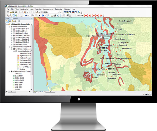
TerraGo has released TerraGo Publisher for ArcGIS version 7.4, which includes the ability to create and share GeoPDFs that convey important changes over time for an area of interest, with any type of map or imagery. The time-enabled visualization can animate geographic changes over time with interactive maps that can be shared with anyone using free Adobe Reader, the company said.
“Our customers can share these time-series map layers as a universally available GeoPDF, enabling non-GIS users to measure past conditions, assess changes over time, analyze trends and even project future scenarios,” said Scott Lee, director of federal programs at TerraGo. “Time-enabled GeoPDFs can help deliver important geographic analysis to the widest audience possible, which is incredibly valuable for sharing information with policy makers, agencies, stakeholders and constituents.”
Time-enabled, interactive maps can be used in any number of different geographic analysis use cases. Here are a few examples.
coastal populations impacted by rising sea levels
progress of recovery efforts for a hurricane disaster zone
forestry and environmental impacts due to policy change
shifting crime patterns in different types of city zones
satellite imagery showing impact of regional military conflicts on local populations
Version 7.4 includes additional enhancements and improvements including support for ArcGIS version 10.6.0.
TerraGo will also be showcasing the latest features at GEOINT 2018, the United States Geospatial Intelligence Foundation Symposium, which takes place April 22-25 in Tampa, Florida.
FoXTEN software product gives soldiers access to real-time intelligence data in the field.
Raytheon Company has been awarded a U.S. Army contract to demonstrate the company’s commercially available mobile intelligence platform that will allow soldiers to quickly collect and access information on the battlefield.
Raytheon’s commercial laptop-based platform, called the FoXTEN, may be considered as a future mobile component of the Army’s Distributed Common Ground System (DCGS).
FoXTEN provides mapping functions in both MIL-STD-2525B and MIL-STD-2525C symbology.
DCGS is an intelligence, surveillance and reconnaissance system that enables deployed soldiers to collect, process and display intelligence information from a variety of sources and sensors. The Army is upgrading its existing DCGS system with a series of new components and capabilities, including the mobile platform.
“Our soldiers need real-time access to intelligence and surveillance data, and FoXTEN is designed to get that information to and from the most remote edges of the battlefield,” said Todd Probert, vice president of mission support and modernization at Raytheon Intelligence, Information and Services. “We’ll be bringing our deep experience integrating the best commercial software into a system our soldiers can trust to keep them constantly aware of threats and give them the advantage they need to win on any battlefield.”
Under the contract awarded by the U.S. Army Contracting Command, Raytheon will demonstrate the company’s FoXTEN software product, which can be loaded onto a commercially procured laptop and easily deployed and used by soldiers operating in the field.
FoXTEN quickly connects warfighters to intelligence from various sources, giving them the real-time information they need to make mission decisions across all battle domains. FoXTEN, when loaded onto a laptop, is lightweight, requires little power and can operate at low-transmission speeds.
“Our system is intuitive, easy to use and only takes eight hours of training compared to the current system,” said Probert. “It’s also completely open, allowing the Army to integrate new capabilities from any developer. The system is designed from the ground up to be easily upgraded so our soldiers always have the best technology and intelligence in their hands.”
The Army will conduct a series of operational tests of the FoXTEN software over the next year before making a final procurement decision.
A roundup of recent products in the GNSS and inertial positioning industry from the April 2018 issue of GPS World magazine.
OEM
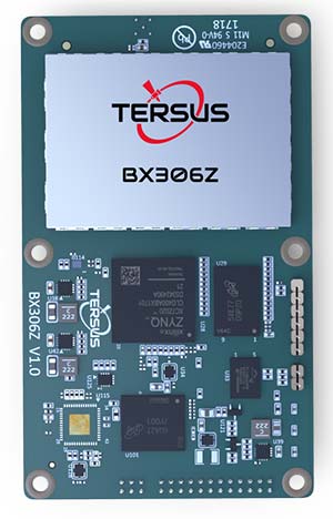
GNSS RTK Board
For OEMs, system integrators
The BX306Z GNSS real-time kinematic (RTK) board has powerful flexibility and compatibility to meet the needs of original equipment manufacturers (OEMs) and system integrators. The BX306Z is a cost-efficient board for positioning and raw measurement output. The board is a compact, multi-GNSS (GPS L1/L2, GLONASS G1/G2, BeiDou B1/B2) RTK module with centimeter-level accurate positioning capability. It is able to integrate with autopilots and inertial navigation units. Log and command is compatible with major GNSS boards.
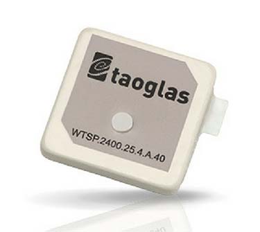
The Taoglas Terrablast antenna line is designed for UAVs and transportation. (Photo: Taoglas)
Rugged antennas
For automotive, drone markets
Terrablast polymer-based patch antennas are 30 percent lighter than their ceramic counterparts and extremely resistant to fracture upon impact. They are designed for the automotive and unmanned aerial vehicle (UAV) markets, where impacts are possible but antenna performance cannot be compromised. The 35-mm GPS/GLONASS/BeiDou patch antenna has high efficiency of more than 70 percent across all bands, improving time to first fix. All Terrablast antennas undergo rigorous temperature, vibration and impact tests, exceed ISO 16750 standards, and are manufactured in Taoglas’ purpose-built facilities in Taiwan and the United States.
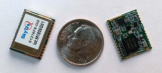
The S1216F8-GI2 is a NavIC + GPS/GAGAN receiver module for emerging intelligent transport systems (ITS) applications requiring NavIC/GPS capability in India. It integrates an L1/L5 RF front-end and baseband processor capable of receiving up to 14 L5 NavIC signals and up to 20 L1 GPS/GAGAN signals simultaneously. With six NavIC signals and three GAGAN signals, it offers 18–23 usable signals, providing improved accuracy in urban canyons. The S1216F8-GI2 is form-factor and pin-out compatible with 12 x 16-millimeter modules, enabling drop-in replacement. NavIC sub-frame data outputs broadcast warning messages for weather alerts and natural disasters. The S1216F8-GI2 is manufactured with ISO/TS 16949 automotive certification.
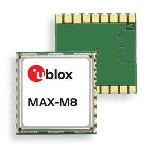
To meet stringent requirements in harsh environments
The automotive-grade MAX‑M8Q‑01A GNSS module measures 9.7 x 10.1 x 2.5 millimeters and has an operating temperature range from –40° C to 105° C. It is designed to meet the stringent requirements of the automotive market, providing superior positioning accuracy even in challenging environments such as urban canyons. Its temperature range ensures reliable performance in harsh environments, such as when mounted in a car‑roof antenna.
The Teseo APP receiver enables safer autonomous driving. The multi-frequency GNSS receiver chipset is suitable for safety-critical automotive applications and high-accuracy positioning at the decimeter and centimeter levels for precise point positioning (PPP) and RTK applications. By tracking satellites of all GNSS constellations simultaneously on at least two of the frequencies used by each system, ST’s automotive-quality Teseo APP (automotive precise positioning) receiver provides high-quality raw GNSS data for PPP and RTK algorithms, which allows accurate positioning and rapid convergence time worldwide. The receiver monitors the integrity of the satellite data to alert the system if accuracy is degraded for any reason. This permits Tier-1 manufacturers to certify safety-critical systems in accordance with ISO 26262.
Qinertia post-processing kinematic software has been designed to help surveyors get the most of their surveys. After the mission, Qinertia gives access to offline real-time kinematic (RTK) up-to-date corrections from more than 7,000 base stations in 164 countries. By creating a virtual base station near a project, the software delivers the highest level of accuracy without having to set up a base station. An advanced tight coupling algorithm delivers high accuracy and maximizes RTK availability. Trajectory and orientation are greatly improved by processing inertial data and raw GNSS observables in forward and backward directions, especially in challenging environments. With Qinertia, surveyors can quickly identify and solve issues such as mechanical installations or sensor alignment.
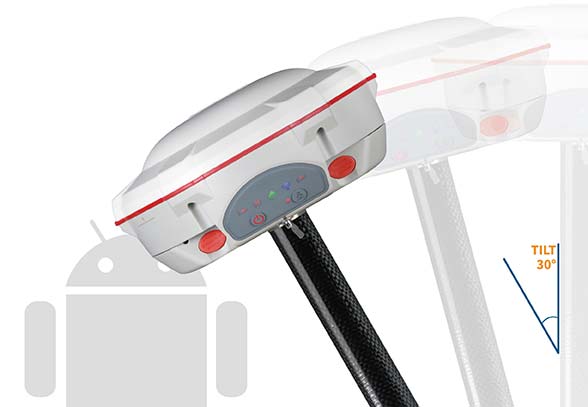
The T300 Plus GNSS receiver is designed for demanding surveying tasks, with full-constellation tracking capability, tilt compensation, 4G/Wi-Fi connection, 8-GB internal memory and an easy survey workflow with Android-based Survey Master Software. It is designed to make collecting accurate data easy and fast, whether done by a beginner or experienced professional surveyor. As an upgrade of the T300, SinoGNSS T300 Plus combines a GNSS board, Bluetooth and adjustable TX&RX UHF, Wi-Fi and 4G modem into one rugged device. Its built-in 4G modem ensures the T300 Plus works with all kinds of continuously operating reference stations (CORS) worldwide. A built-in tilt sensor supports maximum 30° pole tilt and keeps the compensation accuracy within 3 centimeters; the user can check the electronic bubble on the controller for fast surveys in the field.
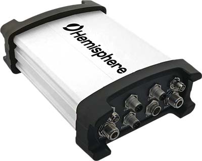
Atlas-capable GNSS receiver for precision 3D applications
The Vector V1000 GNSS receiver is designed for precision marine applications, such as hydrographic and bathymetric surveys, dredging, oil platform positioning, buoys and other applications that demand the highest level 3D positioning accuracies. It provides high-accuracy heading, position, pitch, roll and heave data. The V1000 supports multi-frequency GPS, GLONASS, BeiDou, Galileo, QZSS and IRNSS (with future firmware upgrade and activation) for simultaneous satellite tracking. The receiver is powered by Hemisphere’s Athena real-time kinematic (RTK) engine and is Atlas L-band capable. Based on Hemisphere’s Eclipse Vector technology, the V1000 uses the most accurate differential corrections including RTK and Atlas L-band. It has an integrated display that can be conveniently installed near the operator. The V1000 has heading accuracy of better than 0.01 degree when using a 10-meter antenna separation.
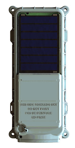
Machine-to-machine (M2M) and internet of things (IoT) device
The SmartOne Solar M2M/IoT device is solar-powered and offers Bluetooth Low Energy connectivity while addressing the growing global demand for reliable and affordable remote monitoring and automated data collection of assets located both within and beyond terrestrial networks. The SmartOne expands the market for remote connectivity to include assets that are otherwise difficult or expensive to reach for power replacement, and lowers the operating cost of monitoring assets being served by legacy SmartOne products. SmartOne Solar’s rechargeable batteries can deliver more than eight years of serviceable life. Without exposure to the sun, a fully charged unit can operate for many months while reporting twice daily. The product’s Bluetooth connectivity allows wireless device configuration and firmware upgrades in the field.
Designed for large-scale surveying and mapping projects
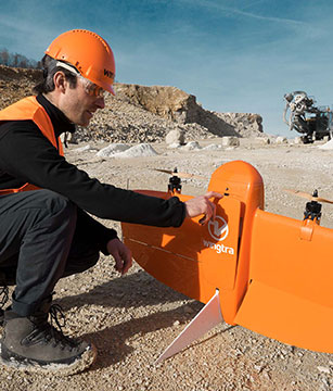
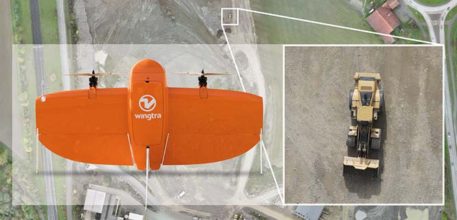
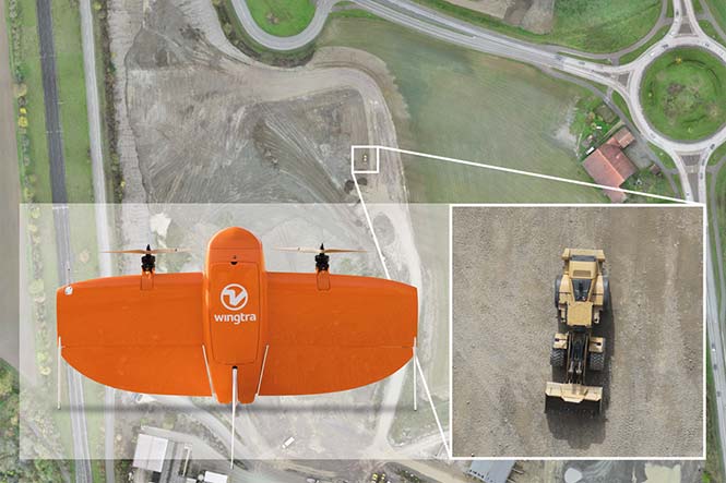
The WingtraOne post-processed kinematic (PPK) drone is the result of collaboration with Pix4D and Septentrio. It is able to deliver orthomosaic maps and 3D models with an absolute accuracy down to 1 centimeter (cm), offering broad coverage and high resolution with ultra-precise accuracy. The WingtraOne can cover 130 hectares (320 acres), equivalent to 240 football fields, in a one-hour flight, and deliver maps at ground sample distances below 1 cm/pixel. Vertical take-off and landing (VTOL) offers hands-free operation and a smoother ride for onboard sensors as well as greater coverage than comparable multi-rotor UAVs. PPK computes ultra-precise geolocations for each image by combining the GNSS data with correction data from a nearby reference receiver. It offers a root-mean-square (RMS) error of 1.3-cm horizontally and 2.3-cm vertically without any ground control points.
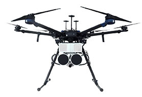
DroneHunter is a fully autonomous UAS airspace defense solution. The intelligent robotic aircraft is enabled with TrueView radar designed and engineered for physical remediation of intruder or threatening drones. DroneHunter is an autonomous UAS perimeter detection and protection solution designed to quickly detect, classify and secure against drones and other UAS. When an intruder drone is discovered, DroneHunter can engage autonomously via artificial intelligence (AI)-directed detection, tracking and guidance. Once the rogue drone is identified and the threat level analyzed, DroneHunter safely remediates the threat day or night, at a safe stand-off distance, with no collateral damage. DroneHunter supports multiple drone platforms based on use-case requirements.
Belgian GNSS receiver manufacturer Septentrio was selected by Swiss drone manufacturer Wingtra to supply GNSS OEM receiver boards and PPK processing software for the recently-launched WingtraOne PPK drone.
The combination of vertical take-off and landing (VTOL) technology and a high-spec post-process kinematics (PPK) brings wide-area coverage at ultra-high precision.
Following a flight, the GNSS data of the WingtraOne is processed offline using Septentrio’s PPK software. This combines the drone data with correction data from a nearby reference receiver to get accurate cm-level geolocations for every photograph.
The on-board high-resolution Sony RX1RII camera, AsteRx-m2 UAS receiver board combined with Septentrio’s PPK library, and Pix4D photogrammetry processing software are together able to produce ground precisions of 1.3 centimeter (cm) horizontal and 2.3 cm vertical.
Image: Wingtra
“With the WingtraOne PPK, we can offer a world first in drone photogrammetry — wide coverage at ultra-high precision,” said Armin Ambühl, CTO of Wingtra. “In a single one-hour flight, the WingtraOne can cover 130 ha (320 acres) delivering mapping with GSDs [ground sample distance] below 1 cm/pixel with absolute accuracy down to 1.27 cm.”
He continued, “WingtraOne’s advantage is twofold: it combines VTOL with the latest PPK technology from Septentrio. With VTOL we can offer the best of both worlds: multirotors and fixed-wings. Vertical take-off and landing means hands-free operation and a smoother ride for the on-board camera payload. Secondly, efficient flying in fixed-wing mode means far greater coverage than any comparable multirotor.”
“We are proud and excited to be part of this innovative project with Wingtra pushing the boundaries of aerial photogrammetry,” said Gustavo Lopez, product manager at Septentrio. “The WingtraOne incorporates our AsteRx-m2 UAS OEM board and, photogrammetry applications requiring high-precision, low-latency positioning are what it does best. The board is specifically designed for quick and easy integration and, with Septentrio’s world-first, multi-frequency PPK, cm-level precision can now reach the parts dual-constellation solutions feared to tread.”
Located in low, gently rolling hills just north of Indianapolis, Carmel, Indiana is one of the fastest-growing communities in the country. It has nearly tripled in population since 2000 and now numbers 91,000 inhabitants.
Considering the growth expected for 2017 and 2018, the City of Carmel needed a visual tool better able to manage the city’s expansion projects across several government departments.
After years of using low-resolution aerial imagery provided by the county, the City of Carmel realized it needed something better for analyzing and displaying accurate information.
The Carmel Storm Water Department turned to Nearmap to provide high-quality aerial images that are frequently updated to integrate with its existing applications, including ArcMap and ArcGIS.
Nearmap now supplies the city with high-resolution imagery that aids data accuracy, verifies customer claims, educates developers, enforces compliance, and prepares presentations for internal government meetings. As an unexpected bonus, since implementing Nearmap, the department has collected $60,000 more in revenue in 2017.
Shane Burnham, a GIS technician, and John Thomas, storm water administrator, both with the City of Carmel Engineering Department, will give a presentation on the city’s use of aerial imagery in a webinar on Thursday, January 18. The webinar is free, but attendees must pre-register.
Burnham provides GIS services for City of Carmel’s Engineering and Planning departments. He serves as departmental Cityworks Administrator and asset management specialist and has published custom GIS web applications during his career. Thomas focuses on impervious surface analysis using aerial imagery and GIS data in support of storm water administration and billing.
“Truth on the Ground is Best Seen from the Air: How aerial imagery is propelling government and commercial organizations to higher levels of operational efficiency” will also feature speakers from Black & Veatch, an engineering, consulting and construction company with more than 100 offices worldwide, specializing in infrastructure development in power, oil and gas, water, telecommunications, government, mining, data centers, smart cities and banking and finance markets; and from Nearmap, an international provider of high resolution aerial imagery.
Carmel Courthouse. (Photo: City of Carmel, Indiana.)
Carmel was named Number 1 among Niche’s “Best Places to Live in 2017”. Niche is a website that analyzes public data sets and reviews to produce rankings, report cards, and profiles for every K-12 school, college, and neighborhood in the U.S.
Advances in aerial imagery including high-resolution maps and a streamlined process to capture, manage and deliver imagery in the cloud is transforming the way governments and businesses operate. In this webinar, you will:
Learn about the latest advances in aerial imagery including how imagery is supporting a variety of government and business applications today.
See real-world use cases of imagery in telecommunication, engineering and city government to improve operational efficiency.
Understand how imagery can be used standalone and within GIS and CAD products.
See the latest demos of Nearmap imagery including vertical, panorama and oblique views.
Tersus GNSS Inc., a GNSS positioning solution provider, has introduced three new GNSS kits. The BX305, BX306 and BX316 HRS kits feature high-precision BX305, BX306 and BX316 GNSS RTK boards.
The HRS kits consist of RTK receivers, GNSS antennas, RS05R radio station modems, radio station antennas, and related cables and converters.
Tersus GNSS BX305-HRS kit.
Tersus GNSS BX306-HRS kit.
Tersus GNSS BX316-HRS kit.
Embedded in the receivers are the Tersus RTK boards. They are compact-design, energy-efficient, centimeter-level accurate GNSS real-time kinematic (RTK) boards, bringing high-precision positioning accuracy to the market, the company said.
Different from the standard BX305/306/316 GNSS kits, the new HRS versions are equipped with RS05R, lightweight and robust UHF, which is a rover radio solution for wireless application.
It provides reliable data communication for demanding conditions that require a combination of stability, high performance and long-range operation.
With complete components and accessories in the kits, they can be used in a variety of applications, such as unmanned aerial vehicle (UAVs), surveying, mapping, precision agriculture, construction engineering and deformation monitoring.
Esri has released GIS Tutorial 1 for ArcGIS Pro: A Platform Workbook, which teaches all the elements of creating and managing data; designing maps; performing spatial analysis; creating 3D scenes; and sharing projects using ArcGIS Pro, Esri’s professional desktop geographic information system (GIS) application.
Work with file geodatabases, spatial data, and geoprocessing tools plus learn digitizing skills and geocoding
Conduct spatial analysis using tools such as ArcGIS Network Analyst; work with raster datasets; and use 3D GIS technology to create scenes, buildings, and bridges
Manage operational systems using GIS, and complete a real-world project that provides hands-on experience in setting up and managing graffiti mapping and graffiti removal systems
Designed for use in a university classroom setting, this workbook includes step-by-step instructions, On Your Own exercises, and in-depth assignments. Instructors can access teaching materials. Self-learners will find this textbook to be an excellent introduction in how to use ArcGIS Pro. Each tutorial includes easy-to follow, step-by-step instructions.
GIS Tutorial 1 for ArcGIS Pro: A Platform Workbook was written by Wilpen L. Gorr and Kristen S. Kurland, the authors of other highly regarded tutorials including GIS Tutorial 1: Basic Workbook, GIS Tutorial for Health and GIS Tutorial for Crime Analysis.
Gorr is a professor of public policy and management information systems at the School of Public Policy and Management, H. John Heinz III College, Carnegie Mellon University, where he teaches and researches GIS applications.
Kurland is a professor of architecture, information systems, and public policy at Carnegie Mellon University’s H. John Heinz III College and School of Architecture. There, she teaches GIS, computer-aided design (CAD), building information modeling (BIM), 3D visualization, and infrastructure management.
GIS Tutorial 1 for ArcGIS Pro: A Platform Workbook is available in print (ISBN: 9781589484665, 480 pages, US$99.99) and as an e-book (ISBN: 9781589484931, 480 pages, US$99.99). The print and e-book editions of the book can be obtained from online retailers worldwide, at esri.com/esripress, or by calling 1-800-447-9778.
Outside the United States, visit esri.com/esripressorders for complete ordering options, or visit esri.com/distributors to contact your local Esri distributor. Interested retailers can contact Esri Press book distributor Ingram Publisher Services.
Two fires erupted Monday in Southern California, fueled by strong Santa Ana winds. The Thomas fire in Ventura County started Monday night and has burned 45,000 acres and destroyed more than 150 structures. The Creek fire is burning near Sylmar and has prompted officials to evacuate more than 8,000 homes.
Now a dramatic new wildfire erupted in Los Angeles early Wednesday. Flames exploded before dawn on the steep slopes of the Sepulveda Pass, which carries heavily traveled Interstate 405 through the Santa Monica Mountains where ridgetops are covered with expensive homes, including Bel Air. It is also the site of the Getty Center arts complex.
More than a third of Ventura, California, residents have been forced from their homes. About 38,000 of the coastal city’s 100,000 residents have been evacuated since the fires started Monday night.
Esri is providing this interactive map to keep up-to-date on events around the fires.
Enabling the future of autonomous transportation by significantly reducing product development time is the shared goal of three presentations to be made on Thursday, Nov. 30 in a free webinar, “High Accuracy for Autonomous Driving.”
The speakers will show how they employ post-processing software to generate accurate and reliable ground reference solutions in vehicle testing. The software enables evaluating potential sensor suites, benchmarking solutions, and generating high-definition maps.
Post-processing the data from autonomous vehicle tests under varying environmental conditions that mirror real-world situations can mitigate GNSS error sources (satellite clock & orbital error, and ionospheric & tropospheric delay); establish an ultra-precise ground truth reference for testing; compare and contrast different sensor packages tested onboard the vehicle; produce customized data formats for exporting information; compare real-time and post-processed quality; transform and translate data between different locations and reference frames; and revisit tests through export to Google Earth. The speakers will show how post-processing forward and back can lead to as much as 40 percent data accuracy improvement.
The software package, Inertial Explorer, offers this capability, whether lower-grade or high-end inertial sensors are employed.
Steven Waslander, associate professor at the University of Waterloo, heads a project collecting 1,000 km of data in all-weather conditions for a new public road driving dataset focused on autonomous driving challenges. He directs the Waterloo Autonomous Vehicle Laboratory (WAVELab), extending the state of the art in autonomous drones and autonomous driving through advances in localization and mapping, object detection and tracking, integrated planning and control methods and multi-robot coordination.
Terry Lamprecht, director of products at AutonomouStuff, a supplier of components, services and software that enable autonomy, will discuss verifying proper installation, and creating a baseline data set to benchmark against data collected on autonomous vehicles in real-time.
Natasha Wong Ken, product manager at Waypoint, will give a high-level technical overview of post-processing techniques and settings, including forward and reverse processing, tightly vs. loosely coupled, PPP vs. differential, and more.
Registration for the November 30 webinar is free. For those not able to attend the live broadcast, all audio and presentation slide components can be downloaded after air date for viewing at convenience.
Remote GeoSystem, North Shore Rescue and Talon Helicopters have successfully deployed a geoDVR Gen2 with a FLIR daylight EO/IR gyro-stabilized video camera on an Airbus TwinStar (AS355) for search-and-rescue (SAR) missions.
NSR and Talon team operate the geoDVR and FLIR during ground training in October 2017.
The geoDVR Gen2 is an advanced mil-spec DVR for recording multiple channels of HD & Standard-Definition geospatial full motion video in airborne and rugged vehicle environments.
The geoDVR’s ability to reliably record HD color and infrared, along with continuous GPS data and Live Moving Maps, make it suited for professional airborne search and rescue, law enforcement and infrastructure inspection applications that utilize multi-sensor gimbal video cameras.
“Remote Geo has a reputation for building one of the industry’s most dependable and user-friendly airborne geospatial video recorders, complete with flexible post-flight mapping tools. So the geoDVR Gen2 was an obvious choice when we were asked to fly the FLIR on the TwinStar for mountain search and rescue,” says Peter Murray, Founder/Operations Manager at Talon Helicopters.
“Adding the FLIR camera to North Shore Rescue’s toolbox has been a great enhancement to NSR’s capabilities,” said Jim Loree, North Shore Rescue SAR manager and air operations coordinator. “Having the ability to record and geo-track the location of the video seemed essential to maximizing the full potential of the FLIR camera. The geoDVR allows searchers to review recorded video for clues that may or may not have been observed during the flight.”
“This feature could also be highly valuable in a large-scale disaster such as an earthquake where widespread areas are surveyed for damage,” Loree said. “Emergency Operation Centers would be able to use the data to help them make decisions on where and how to deploy resources based on the exact location and extent of damages provided by the video recording.”
North Shore Rescue and Talon Helicopters will use the geoDVR with a FLIR generously donated by Port of Vancouver to perform helicopter-based SAR operations with color and infrared. Then, using LineVision™ software post-flight, North Shore Rescue will review the geoDVR videos and flight tracks overlaid on Google Earth and Esri maps for training mission planning and recovery operations.
Because North Shore Rescue is an all volunteer organization, Remote GeoSystems donated 18 LineVision Esri Maps and LineVision Google Earth licenses as part of the implementation.
Protects critical infrastructure from spoofing and jamming
The BlueSky GPS Firewall is designed to provide security protection for GPS-delivered position, navigation and timing (PNT) data. It can be deployed in-line between any standard GPS antenna and stationary GPS receiver to provide protection against GPS signal incidents, both intentional or accidental, before they enter a GPS receiver system. BlueSky GPS Firewall filters the GPS signal in real time, removing anomalies before the signal is consumed by the downstream GPS receiver. This creates an intelligent and secure barrier against jamming and spoofing, and prevents the GPS receiver from being impacted by such incidents. It incorporates an Ethernet interface for remote management and monitoring and includes a secure web interface for configuration and set-up. Evaluation kits are available in advance of full production release, both in response to the growing number of GPS incidents and their potential threat to critical infrastructure.
Four new models of high-performing wideband low noise amplifiers (LNAs) are now available for choke-ring antennas, with options of 35-dB and 50-dB gain. The LNAs are designed for upgrading existing choke-ring antennas with Dorne Margolin/EDO elements to receive new and expanding GNSS signals. The LNAs provide consistent gain across the full bandwidth and include filters for suppression of out-of-band interfering signals, such as cellular LTE and Iridium signals, while maintaining a low noise figure, high third-order intercept point, small group delay and low power consumption. The enclosure is designed to fit a wide variety of currently deployed choke-ring antennas.
OEM boards for high-precision guidance and control
The BD GNSS family of boards includes the BD940 GNSS and GNSS-inertial boards and new BD990 GNSS, GNSS-heading and GNSS-inertial boards. The BX940 and BX992 models are available in a rugged enclosure (pictured) for applications in harsh environments. The BD GNSS boards offer simple connectivity and configuration, allowing system integrators and OEMs to easily add GNSS positioning and orientation — with the ability to upgrade its capabilities — using the same board footprint, connectors and software interface for specialized and custom hardware solutions. The compact boards include a broad range of receiver capabilities, from high-accuracy GNSS-only to full GNSS-inertial features for positioning and 3D orientation. Firmware options are upgradeable, allowing functionality to be added as requirements change. The boards are designed for UAVs, autonomous vehicles, fleet management and aviation.
The Precis-BX306 RTK board (pictured: Precis-BX306 board easy kit) has been upgraded with new and improved GPS and GLONASS functionality. The new version supports up to 20-Hz real-time kinematic (RTK) solution and raw measurement output, which can be integrated with autopilots and inertial navigation units. With improved algorithms, the new Precis-BX306 demonstrates an ability to quickly fix a 30-km baseline. Stable fix rate is achieved when under tree canopy, in urban canyons and other challenging environments. This latest version of Precis-BX306 is pin-to-pin compatible with major GNSS boards in the market, offering a flexible interface. Event mark and PPS are supported as always.
Offers advanced radio connectivity with GNSS receivers
The R4S-BT UHF radio provides an external option for use with the Sokkia GCX receiver line. The UHF multichannel radio modem has a tuning range of up to 70 MHz. It features an IP67 certified housing with internal batteries designed to be easy to carry with versatile mounting options. The radio modem makes the GCX GNSS receiver a more scalable and modular solution for situations without a network connection or when long-range Bluetooth technology is not enough on its own. Survey and mapping professionals can add the radio modem to extend the range between the base and rover. Connectivity options include wireless data transfer and USB connections.
The Triumph-F1 Survey UAV and Receiver is based around a geodetic GNSS receiver with 864 channels. When used on the ground, the receiver can function as base or rover. It includes eight propeller motors, a sim card slot, two micro SD card slots, USB connector, satellite tracking and communications indicators, flight and gyro status indicators, storage and selector for saved flight patterns, up to four antennas including Bluetooth and Wi-Fi, four angled cameras and a downward-facing high-precision camera for photogrammetry.
The S321+ and C321+ smart antennas are upgrades to the previous versions S321 and C321 and offer added benefits. Powered by the Eclipse P326 OEM board, the smart antennas support 394 channels and can simultaneously track all satellite signals including GPS, GLONASS, BeiDou, Galileo and QZSS. The boards come with two hot-swappable lithium batteries providing up to 12 hours of operation. The S321+ and C321+ combine Hemisphere’s Athena GNSS engine and Atlas L-band correction technologies with a new customer-friendly web user interface. Both antennas meet IP67-standard requirements. The S321+ and C321+ come in two versions, with 4G LTE optimized for either North American or international locations. The S321+ is designed for use in land or marine survey, GIS, mapping and construction. With the SureFix advanced processor, the S321+ delivers high-fidelity RTK-quality information. The C321+ is designed for construction environments, and can be paired with Hemisphere’s SiteMetrix software that helps manage construction jobsite activities.
Integrates data from a variety of sensors in one platform
X-PAD Office Fusion is an all-in-one office software combining data from multiple sensors into a single interface. It manages, combines and processes data from GNSS receivers, total stations, laser scanners and other sensors, whether from GeoMax or another provider. There is no need to export the data from one program to another, and X-PAD also offers all CAD features. The program handles a multitude of different types of data: measurements, coordinates, drawings and point clouds. Large quantities of data can be managed in the fastest way with maximum accuracy. The software automatically detects the common points between the point clouds and performs a first rough alignment. The Bundle Adjustment feature performs the final and accurate alignment in order to reduce errors. Personalized reports are then created with little effort.
The TSO Public Tracker provides public transportation riders with a variety of GPS-based monitoring capabilities. Riders can view exact locations and information on a variety of public vehicles. Passengers can view on a single screen the whereabouts of connected-fleet vehicles in real time. The tracker can be used by agencies of all sizes and in different geographical locations. The related TSO Mobile App provides route information, current and historical location updates in different map views through Google Maps, and more. TSO Mobile’s transportation solutions also provide agencies with driver reports based on customized behavior metrics to improve driver behavior.
Omnitracs Virtual Load View (VLV) provides brokers, shippers and carriers with direct access to the position data of assets carrying their freight, allowing them to easily track loads. Position data about the load is either shared from the Omnitracs Intelligent Vehicle Gateway (IVG) or Mobile Computing Platform (MCP) unit, or if no Omnitracs unit is available, through the VLV Mobile smartphone application, which the driver can download from the iOS and Android app stores. VLV can also be directly integrated into a company’s back office system, so employees are not required to learn and access a new platform. Brokers and shippers can identify loads that are behind schedule so they can make the proper adjustments in a timely manner.
The lightweight fixed-wing UX11 UAV combines a powerful integrated onboard system, industry-grade sensors, limitless communication range and PPK centimeter-level positioning. It carries enough onboard computing power to access and process pictures, then send them to the operator in real-time. It will run automated quality checks on the images (such as blur detection or overlap checks) to help ensure the operator is acquiring quality data. Its redundant communications system includes a proprietary line-of-sight radio and 3G/4G connectivity between the ground-control station and the UAV using a worldwide machine-to-machine pre-paid plan. The UX11 is ready for beyond visual line-of-sight (BVLOS) flights with unlimited range and adds a new level of safety with this communication link.
Super 35 Camera for Professional Aerial Cinematography
The Zenmuse X7 UAV camera features superior image quality, interchangeable lenses and a new post-production color system. The Super 35 digital film camera is designed to work with the DJI Inspire 2 drone. The Zenmuse X7 features 14 stops of dynamic range for more detail in low-light conditions. Its low-noise image capture enhances grading flexibility by preserving details in both highlight and dark areas while enabling a shallow cinematic depth of field. It is capable of shooting 6K CinemaDNG RAW or 5.2K Apple ProRes at up to 30 frames per second (FPS), as well as 3.9K CinemaDNG RAW or 2.7K ProRes at up to 59.94 FPS to integrate into industry-standard post-production workflows.
The Atlas NEST smart protective charging station is designed for autonomous beyond visual line-of-sight (BVLOS) operation of the Atlas Pro drone platform. The Atlas NEST is a landing, protective charging station that extends flight range and provides constant drone readiness in remote locations. When the Atlas Pro UAV requires new batteries, it can autonomously land in a NEST charging station where a robotic arm changes the drone’s batteries, allowing the Atlas Pro to continue flying to mission completion. The Atlas NEST can be stationary or motorized.
VTOL lift-off followed by tilt to fixed wing in flight
The WingtraOne vertical take-off and landing (VTOL) UAV bridges the gap between traditional multi-rotors and fixed-wing drones. It takes off and lands vertically like conventional multirotors, but once in flight, the drone tilts forward to fly like a fixed-wing aircraft. Being able to carry a heavy payload such as the Sony RX1RII, the drone offers high mapping accuracy, while covering an area of 980 acres (400 Ha) at 3 cm/px (1.2 in/px) GSD or the equivalent of 570 football fields. The WingtraOne is available in use in Europe, China, the United States and Australia for applications ranging from surveying and precision agriculture to glacier monitoring.
Over the past two years, I’ve been sharing my view on land surveying over a variety of topics. One of the constant themes I try to maintain is technological improvements and how surveyors need to continue to embrace new applications and equipment.
While I will also argue that we cannot forget our surveying roots (see GPS World, March 2017), we still need to keep an eye on future technologies, means and methods to increase our productivity and profitability as well.
With this idea of peeking at the road ahead, I traveled to Berlin, Germany, to cover Intergeo 2017, an international trade show for everything geospatial.
Held every year at different venues around Germany, Intergeo is the world’s largest conference and exhibition for geodesy, geoinformation and land management. The theme of the conference this year was “We are bringing worlds together,” and based upon the number of vendors, new equipment and applications, and record breaking attendance, it was quite evident they hit their mark.
The numbers were astounding: 580 vendors from 37 countries, 18,000+ visitors from 100+ countries, all packed in six interlinking halls covering more than 325,000 square feet (7.5+ acres). When I spoke with several contemporaries who previously attended Intergeo, all warned me to be ready for the size and scale of the facility, the number of vendors, and the large spaces occupied by the big survey players. Truly thinking this rhetoric was hyperbole, I went with guarded expectations. Boy, was I in for big surprise.
Walking up to the entrance, one could sense immediately the size and enormous presence of this conference. The registration lines were easy and efficient, with plenty of entry gates and attendants to help with any information. When I entered the first hall for my initial visit, the prior warnings about the size and scale were quite true. This conference was three days long, and I knew I was going to need every minute to cover all the bases.
My account here is broken into four sections — one hall per day. Leica, NovAtel, Laser Technology and Septentrio were among the first booths I encountered on day one. Javad, ComNav, Hemisphere and Emlid were in the next hall over, and can be found below “Behind Door Number Two.” Day three found me hobnobbing with CHC Navigation, EOS and Swift Navigation; look for them under “I’ll Take Hall Three for $200, Alex.” I topped off my Intergeo experience interviewing NavCom, Tersus and Trimble in “The Big Finish (Or Is It?)”
ENTERING ANOTHER DIMENSION…
Coming into Hall 1.1, the first thing that catches one’s eye besides the vastness of the entire space is the size and depth of the Hexagon exhibit. Hexagon is the parent company of Leica, NovAtel, and several others, and all were there displaying new products and software for a multitude of geospatial needs.
I was introduced to the new Leica GS18T GNSS RTK rover (Leica Geosystems debuts GNSS RTK rover at Intergeo 2017) with many new upgrades, including being able to measure a point while the unit is not being held plumb. Yes, you read that right; the unit has an inertial measurement unit (IMU) built in that compensates for any rod tilt and corrects the location back to the bottom of the rod. Now it is possible to collect a GNSS location to places and objects no longer thought possible.
This feature has been available with the “J-Tip” from Javad for the past year: now Leica has added the capability to the GS18T.
While the demonstration took care of my skepticism of the unit, it raised different concerns with the field personnel using it. This method of “no bubble” is fine for this unit, but I can envision crews getting sloppy with conventional GNSS and total station prism rods when mixed with this new technology. This will increase the need for proper training and trust that the all rod-based equipment is used in its intended manner and procedure.
NovAtel was on hand with presentation of a full line of GPS receivers, boards and peripherals, including its GAJT line of anti-jamming receivers as well as an “interference” toolkit of analyzing software modules. With the solid product line and software, the company motto of “assured positioning” bodes well for its users.
Laser Technology Inc. has provided many measurement breakthroughs over the past few decades, and its introduction of the TruPoint 200h is no exception (see Laser Technology highlights TruPoint 200h at Intergeo 2017). The company has taken the TruPoint 200 line of measuring devices and expanded its capability with phase shift and pulse diode measurements, which means the unit will determine the most accurate method based upon reflectivity. This is also paired with a data collection and reporting application on your Android smartphone to greatly expand your ability to share your data.
Also at Intergeo introducing a new GNSS receiver was Septentrio, a navigation systems developer from Belgium. Septentrio was showing the Altus NR3, a lightweight multi-constellation receiver aimed at the surveying and mapping community. This new unit boasts an AIM+ system designed to monitor and protect the user’s data from jamming and spoofing so the collected data is confidently accurate.
Carlson displayed its new BRx6 multi-GNSS receiver along with the RT3 tablet data collector. The BRx6 receiver expands the Carlson family of GNSS products to include connection to most RTN systems worldwide as well as the Atlas L-band correction service that is beginning to gain many followers. Paired with the new RT3 tablet, these products continue the look, feel and service that Carlson users have enjoyed for many years.
Sokkia was there with a full complement of surveying and monitoring equipment, with the GCX3 GNSS receiver being the main focus of their new products. This unit sets the bar even higher for light and efficient GNSS receivers as it weighs only 440 grams with the batteries, yet is more capable than many similar systems on the market.
Another new GNSS receiver introduction was from Hi-Target, the iRTK-5. This new model is the one of the first units to have an OLED touchscreen on the receiver. It supports reception from all major GNSS constellations as well as the L-band correction service. Hi-Target prides itself on a new proprietary differential correction technology that analyzes the integrity of data from all sources before providing a position. This model also has a 4G LTE chipset that will communicate with almost all cellular systems worldwide.
One thing that stood out to me that differs greatly from surveying in the U.S. is the proliferation of monuments and monitoring points/devices used by surveyors throughout the world. So, the multitude of vendors offering varying kinds of targets, prisms, and survey point markets should not have shocked me, but it still did. It was quite impressive with the walls of targets and prism assemblies for many different applications along with the tables of nails, tablets, monuments and vault systems used by surveyors worldwide. Among the notables were Rothburcher Systeme and Bohnenstingl, who both offer a complete line of products beyond most surveyor’s imaginations.
The Juniper Systems booth showcased the Mesa2 rugged tablet and the Geode sub-meter GNSS receiver, both designed with efficient mapping collection in mind at an affordable price point, yet rugged enough to take on most environments. They were also highlighting their CT5 rugged smartphone and CT7G rugged tablet as solid products for any surveying and mapping data collection need.
BEHIND DOOR NUMBER TWO
After navigating the first of four conference areas, I wondered if all the remaining halls would be just as impressive. Hall 2 did not disappoint, as the exhibit spaces were just as big and remarkable as the first one.
Already a major entity within the GNSS community, Javad came to Intergeo 2017 to introduce its entry into the UAV market, the Triumph F-1. Unlike other UAVs, this unit was designed starting with the GNSS engines Javad is known for; engineers then built the flying craft around the brains of the system. It utilizes the same DNA of the Triumph-LS receiver along with ease of Javad software, all on a multi-rotor platform with hot-swappable batteries.
Aimed for more agricultural users, ComNav introduced a lightweight GNSS receiver, the T30, and a new software guidance system compatible with most tractor configurations. This system is designed to be more efficient and precise than OEM tractor guidance as well as more customizable for the user.
The company behind the new Atlas L-band correction service, Hemisphere GNSS, also provided introductions to several new products at Intergeo. In addition to several navigation chipsets for OEM use, they also introduced the 321+ GNSS Smart Antenna. This new receiver is multi-frequency and multi-GNSS with an Athena RTK engine and Atlas L-band global corrections to cover most positional needs. With hot-swappable batteries, this unit will run over 12 hours on two sets that are provided.
EMLID may be a newcomer to the GNSS environment but they are making noise by offering new products and technology at price points for more consumers. At Intergeo, they were demonstrating the Reach RS GNSS receiver with RTK capability, the Reach GNSS module for UAV systems and the Edge module, an advanced drone controller with HDMI video input and 5.8 GHz data link. These guys are my sleeper pick for becoming a bigger player in the very near future.
Topcon’s space, which included industry partner Intel included an interactive dome using their “Immersive Point Cloud Workspace” software and 3D point cloud data to give attendees a virtual reality tour of sites previously mapped with Topcon equipment and software. This four-meter dome was a popular stop with visitors, as was the product introductions of their SmoothRide software and the MAGNET Collage desktop mass data processing software. In addition, another product showcased in conjunction with Intel was their UAV systems, led by the Sirius Pro fixed wing vehicle and the Falcon 8 multi-rotor vehicle.
The main presentation from Bentley to the surveying/GNSS community was the increased capability of their ContextCapture software module. With 3D point clouds and virtual reality systems become the norm, Bentley has upped their game with visualization tools and features within this module not found in many point cloud software packages. The biggest improvement is the ability for survey-grade data acquired through laser scanning, LiDAR and photogrammetry to be easily input and manipulated for many different uses. From BIM to roadway corridor modeling and asset management, these improvements are making the utilization of 3D data more seamless.
Something that caught my eye initially as a novelty was TinyMobileRobots, a Danish company producing a small unmanned cart for marking surfaces. They currently have three products: the TinySurveyor, the TinyLineMarker, and the TinyPreMarker. All have GNSS receivers that operate autonomously on a predetermined route and carry a paint can for marking specific points. From marking athletic fields to paint striping, they might be on to something quite unique but very cool.
I’LL TAKE HALL THREE FOR $200, ALEX
Hall 3 brought us to CHC Navigation and their full range of surveying and mapping products. Highlighted during our discussions with them was the M6, i70 and i80 GNSS receivers and the Apache 5 USV boat for hydrographic applications. It was quite evident how large of a company CHC is and how vast their global presence is so don’t be surprised to see them in North America soon.
EOS Positioning Systems is another smaller GNSS receiver producer that is targeting the mapping community with the lower entry pricing and smartphone application interfacing. From the basic L1 receiver for mapping to the multi-constellation, triple-frequency model including Atlas L-band corrections, EOS is providing an easy to use package at an affordable price point.
Another entry in the OEM board/system provider of centimeter-level accuracy systems is Swift Navigation and their Piksi line of products. From agricultural applications to autonomous vehicle positioning, they are providing navigational systems that will guide our future. As the surveying community expands its use of unmanned vehicles, I would not be surprised to see Swift at the forefront of this effort.
Another member of the Hexagon family, the Geomax display was loaded with everything imaginable for measuring and remote sensing. The main introduction for Intergeo 2017 was X-PAD Office Fusion, an all-in-one software package that allows the data from various sources to come together in one place for creating and manipulating 3D models. While I was not familiar with Geomax, it was quite evident that their customer base, while European-centric, was big and quite loyal to the brand.
A newcomer to the surveying world is Pix4D and their photo processing software. Used by many UAV enthusiasts and now surveyors, Pix4D has quickly become one of the largest providers of software for creating orthometric photos that are georeferenced to known coordinate systems and GIS databases. Most of their success has been because of ease of use and affordability versus the leading surveying software packages. They are also industry partners with Esri and DJI, so having big friends in popular places has helped their cause. Look for more great stuff from them for surveying applications in the near future.
THE BIG FINISH
As I entered Hall 4, I began to wonder if I was done with the major attractions and getting into the bit players. I was wrong.
The first stop was Geozone, who was introducing a new receiver, Falcon SF, through a collaboration with NavCom. This new unit features multi-constellation and multi-frequency collection, but also includes Starfire, a global system designed and maintained by NavCom that is a satellite-based correction signal and provides accuracy of 5 CM anywhere in the world. This correction system comes standard with a subscription when you purchase the receiver, which is unheard of in most surveying environments. This is another product I predict that will be making more of a global presence in short time.
Tersus GNSS was at Intergeo to introduce many OEM navigation boards and an RTK system for surveyors and autonomous control systems. The Tersus David RTK system is designed to turn your smartphone into a high accuracy GNSS data collector. This system is highly durable and compact so it will accommodate many different mapping needs.
Another company that has global reach but not much exposure to U.S. business, South Surveying & Mapping Instruments, wouldn’t give an attendee the impression that they are a small player in the surveying world. Their exhibit space was impressive, ranging from simple theodolites to high accuracy robotic total stations, RTK GNSS receivers and fixed-wing/multi-rotor UAVs.
As lidar technology becomes more available and affordable, a stop at the Riegl booth was a must. They were introducing many new products at the Intergeo 2017 show, including the miniVUX-1DL UAV laser scanner for multi-rotor and fixed-wing aircraft. This little beauty weighs under 3 kg and fits on most scalable UAV platforms.
Another fun item on display was the VMX-2HA Dual Scanner Mobile Laser Scanner, which looks like a high-tech octopus on top of your vehicle. This unit collects 2 million measurements per second as well as 9 x 12MP camera images at various angles. As the miniaturization of technology continues, I see RIEGL continuing to lead the lidar segment well into the future.
Just when I thought I was almost done, I realized that there was one major player left that I had not seen: Trimble. They were in the back of Hall 4 across almost the entire width of the conference space. Everything geomatics, remote sensing, and navigation; it was here in one of the biggest exhibition spaces at Intergeo 2017.
All the latest surveying instruments were here, including the R10 GNSS receiver and SX10 scanning total station. The new items for surveying at this show were numerous; the C3 and C5 mechanical total stations with autofocus, Catalyst software with GNSS receiver for smartphones, the T10 rugged tablet for survey and GIS applications, and OEM receiver boards (BD940-INS, BD992-INS and BD990).
Also included within the Trimble space were Nikon and Spectra Precision branded instruments as well as the latest acquisition, Applanix GNSS-aided inertial movement systems. While Trimble has grown considerably in the past decade, it seems as nothing will slow them down. If they continue to introduce great products and technology, I wouldn’t bet against them.
BUT WAIT, THERE’S MORE…
There were three more halls, with two of them being organizations and information booths. Hall 6, however, has grown into a standalone space as “Interaerial Solutions,” Europe’s biggest UAV show. All the main players were in here (including DJI, DroneDeploy and over 150 more) so almost everything imaginable with UAVs can be found here.
During the conference, the adjacent courtyard was utilized for UAV demonstrations and product introductions. It will be interesting to see in the coming years if this segment of measurement and remote sensing will continue to expand with number of vendors/suppliers or if it will get absorbed by many of the bigger players within the geomatics community.
INTERGEO 2017, IN RETROSPECT
The common theme/message through this gathering was digitalization, “smart cities” and the evolution of the occupations that work within these environments. Intergeo is an impressive gathering of likeminded people discussing how to manage the increasing waves of data through technology, analyzation and thought processing.
While I can’t say that these types of gathering do not happen in the U.S., it is not as obvious as the annual assembly of Intergeo in Germany. The surveying community in the United States needs to hold a similar “summit” to help guide the profession toward its future goals. The one thing I have always appreciated about surveying is how it does embrace technology and forward thinking yet must rely on the past to tell us where we have been.
Digitalization is here and cities will get smarter with or without us, so it’s up to us as surveyors to keep looking forward with the times. Global measurement and navigation will be a big part of that, so let’s put our thinking caps on to see what we learn next.
Until next time, guten tag und gute gesundheit.
A big thank you also goes out to my fellow Intergeo members Ryan Gerard, Mike Joyce, and Allison Barwacz for making this a wonderful experience.
 “Our customers can share these time-series map layers as a universally available GeoPDF, enabling non-GIS users to measure past conditions, assess changes over time, analyze trends and even project future scenarios,” said Scott Lee, director of federal programs at TerraGo. “Time-enabled GeoPDFs can help deliver important geographic analysis to the widest audience possible, which is incredibly valuable for sharing information with policy makers, agencies, stakeholders and constituents.”