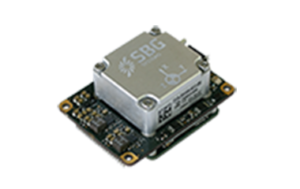
SBG Systems has announced a new inertial navigation system (INS) named Quanta Micro, completing its Quanta product line.
The Quanta Micro GNSS-aided INS offers a unique combination of navigation performance and low size, weight, power and cost (SWAP-C).
Quanta Micro leverages a survey-grade inertial measurement unit (IMU) for optimal heading performance in single antenna applications, and high immunity to vibrating environments. An optional secondary antenna enables fast heading initialization in low dynamic applications.
Main Features
Accuracy: 0.015° roll/pitch, 0.035° heading, 1 cm position (PPK)
Integrates a survey-grade IMU: 0.8°/h gyro bias instability
Versatile INS/GNSS to suit land, air or marine applications
Highly tested and calibrated from -40°C to 85°C
Robust to vibrating environments
Quad-constellation multi-band RTK GNSS receiver
Smooth post-processing workflow with Qinertia software
Major size reduction with no compromise on performance.
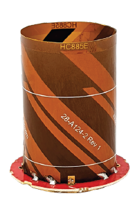
The HC885EXF embedded helical antenna. (Photo: Tallysman)
Tallysman Wireless has added the housed HC885XF and embedded HC885EXF dual-band eXtended Filtering (XF) antennas to its line of helical antennas.
The antennas receive GPS/QZSS L1/L5, GLONASS G1/G3, Galileo E1/ E5a/b, BeiDou B1/B2/B2a and L-band corrections services.
Historically, dual-frequency antennas and receivers commonly supported GPS L1 and L2 and GLONASS G1 and G2. In recent years, GPS, GLONASS, Galileo, BeiDou and NavIC have added GNSS signals in the L5 frequency band (1160-1217 MHz).
As a result, the new dual-frequency GNSS standard has become L1 and L5.
Tallysman’s new HC885XF antenna has been tuned to provide optimal support for the entire L1/G1/E1/B1/L-band correction and L5/G3/E5/B2 bands.
The radio frequency spectrum has become congested worldwide as many new LTE bands have been activated, and their signals or harmonic frequencies can affect GNSS antennas and receivers. In North America, the planned Ligado service, which will broadcast in the frequency range of 1526 to 1536 MHz, can affect GNSS antennas that receive space-based L-band correction service signals (1539-1559 MHz). New LTE signals in Europe [Band 32 (1452-1496 MHz)] and Japan [Bands 11 and 21 (1476-1511 MHz)] have also affected GNSS signals. Tallyman’s XF models mitigate the effects of these new signals.
The Tallysman HC885XF housed helical antenna weighs ~42 g and is enclosed in a robust, military-grade IP67 plastic enclosure. The antenna base has an integrated SMA connector, a water-proofing O-ring, and three screw holes to enable secure attachment.
Tallysman’s embedded HC885EXF helical antenna weighs ~8 g. It is easily mounted with an optional embedded helical mounting ring, which traps the outer edge of the antenna circuit board to the host circuit board or any flat surface. An MCX connector is installed in the base of the antenna.
Tallysman HC885EXF and HC885XF antennas are suitable for a variety of applications, including lightweight unmanned autonomous vehicle navigation (land, sea, and air), land survey devices, automotive positioning, timing and other precise-positioning applications.
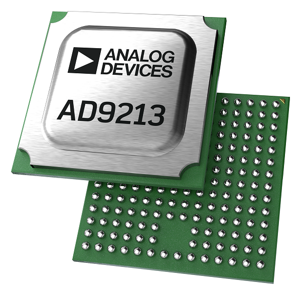
Radio frequency analog-to-digital converter sets performance benchmarks for space and harsh environments
Photo: Analog Devices
Analog Devices has released the AD9213S-CSH, a highly integrated RF analog-to-digital converter (ADC). The ADC is a 12-bit, 10.25 giga samples per second (GSPS) ADC in high-reliability packaging, with advanced production screening and quality inspection.
It is the company’s fastest ADC available for the space environment.
The AD9213-CSH enables the next generation of software-defined systems for satellite communications, radar and remote sensing, driving greater system integration, lower costs, reduced power consumption and decreased size, weight and power (SWaP).
Additionally, a high sample rate and integrated post-processing enable further performance gains for narrow-band applications.
The AD9213-CSH provides space customers with greater flexibility and the ability to process larger sections of the spectrum for electronic support measures, as well as increased-resolution radar designs.
The wider Nyquist bandwidth allows satellite-communications customers to deliver products with increased bandwidth. In addition, wide input bandwidths combined with high sample rates enable new wideband digital predistortion architectures communications applications.
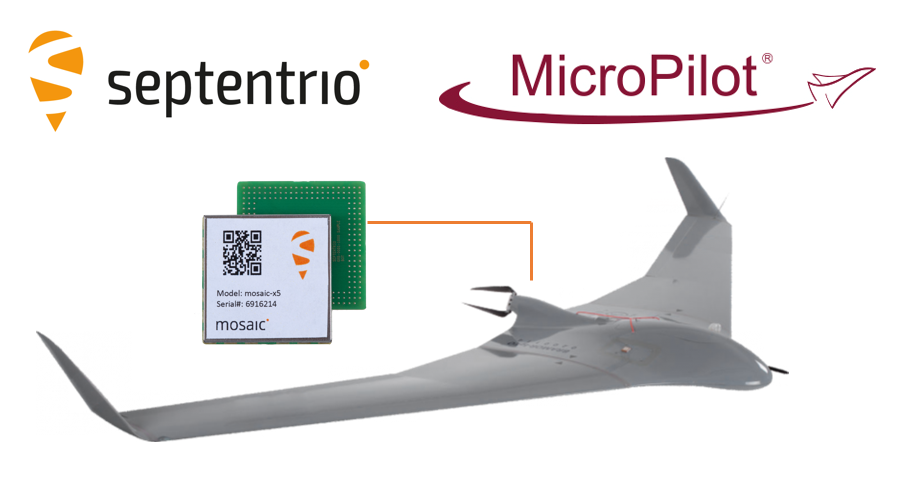
The collaboration ensures smooth and easy integration of high-accuracy GPS/GNSS positioning and professional-level autopilots into control systems where safety and reliability matter
Septentrio is collaborating with MicroPilot, maker of professional UAV autopilots.
Septentrio receivers, including the small form factor mosaic modules, as well as the OEM board AsteRx-m3, will support seamless integration of positioning and orientation into MicroPilot’s autopilot ecosystem.
MicroPilot chose Septentrio GNSS receivers for their resilience to radio interference such as jamming and spoofing, as well as security and robustness with high-accuracy real-time kinematic (RTK) positioning.
Self-interference or self-jamming is a common occurrence in UAVs, where devices such as cameras, servos or antennas, which emit electromagnetic radiation, are located close to the GPS receiver. Incorporating GNSS technology that is resilient to jamming and spoofing, in combination with reliable professional-level autopilots, is key to safe and secure flight navigation, according to Septentrio.
“Adopting new and resilient technology in UAVs is vital, and we want to ensure a smooth integration process into professional drone systems,” said Gustavo Lopez, senior market access manager at Septentrio. “We are very excited about the strong collaboration between Septentrio and MicroPilot, which now provides new alternatives to drone companies looking for safe and reliable flight operations.”
In addition to developing autopilots, MicroPilot provides supporting software and services that enable customers to use development time more efficiently, reducing time to market.
“Working closely with Septentrio gives MicroPilot the ability to better leverage resilient and robust GNSS technologies strengthening our offering to the professional UAV market for safe and reliable flight control,” said Howard Loewen, president of MicroPilot.
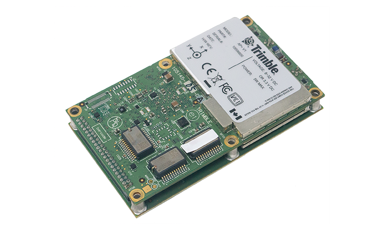
Trimble announced today that it has entered into a definitive agreement to sell its Time and Frequency, LOADRITE, Spectra Precision Tools and SECO accessories businesses to Precisional LLC, an affiliate of The Jordan Company (TJC).
The divestiture is in line with Trimble’s strategy to focus on areas core to its long-term growth and strategic product roadmap. The global transaction is subject to a number of customary closing conditions and is expected to close in the second quarter of 2022. Financial terms were not disclosed.
“We are continually evaluating our product portfolio as we work on the execution of Trimble’s Connect and Scale 2025 strategy,” said Rob Painter, president and CEO of Trimble. “Trimble is focusing its efforts on the company’s connected industry platforms and digital transformation capabilities, making Precisional and TJC an ideal fit for the growth of the businesses.”
TJC, a private equity firm, is completing the acquisition in partnership with industry executive Drew Ladau to form Precisional LLC, a global platform focused on precision measurement and data solutions driving efficiencies in demanding infrastructure end markets.
“The Trimble businesses, which will join Precisional, have a long heritage of innovation, and each is a leader in the markets it serves,” said Drew Ladau, CEO of Precisional. “I’m excited to build upon this strong foundation alongside the dedicated employees that have served their customers so well over the years. In addition, we plan to accelerate the pace of innovation and growth with the focus of resources and investment on these core businesses supported by TJC.”
“The acquisition of four industry-leading businesses from Trimble by Precisional forms the foundation of a new platform focused on precise measurement and analytical insights to improve productivity across a broad range of applications that rely upon accuracy and reliability,” said Erik Fagan, partner at TJC. “By supporting existing management to make investments in Precisional’s operations and product development to integrate precision measurement with data solutions and enhanced connectivity, we intend to accelerate growth opportunities while also pursuing synergistic acquisitions.”
The Time and Frequency products use the accuracy of GNSS clocks to provide precise time, synchronization and frequency reference signals for many industries and applications. Communication systems, data centers, financial networks, utilities, factory automation, security and other infrastructure rely on precise timing for synchronization and operational efficiency.
The Spectra Precision Tools business designs and manufactures high-quality leveling, positioning and alignment instruments used for general, exterior and underground construction. The instruments incorporate laser and optical technology for general contractors and specialty contractors serving large and small commercial jobsites as well as residential builders and remodelers.
The LOADRITE business offers accurate scales for loaders, excavators, conveyor belts, tractors, refuse trucks and forklifts that connect with payload-reporting and monitoring systems for the waste, quarry and aggregates industry. The products improve user efficiency by weighing products while they are on a vehicle or belt, eliminating the need for a separate trip to a fixed-scale location.
The SECO business designs and manufactures a wide variety of accessory products used in conjunction with surveying and construction instruments. The portfolio of accessory products includes tripods, telescopic poles, prisms, carrying cases, GPS antenna poles, safety vests and leveling rods.
LOADRITE, Spectra Precision Tools and the SECO businesses have been reported as part of Trimble’s Buildings and Infrastructure segment. The Time and Frequency business has been reported as part of Trimble’s Geospatial segment.
Orrick acted as legal advisor and Lincoln International acted as financial advisor to Trimble. Mayer Brown acted as legal advisor and BMO Capital Markets acted as financial advisor to TJC.
Septentrio has released Open Service Navigation Message Authentication (OSNMA) functionality on its mosaic GNSS receiver modules. OSNMA offers end-to-end authentication on Galileo’s civilian signals, protecting receivers from OSNMA attacks.
Spoofing is a malicious form of radio interference, where faulty positioning information is sent to a receiver. For the last two years Septentrio has been working closely with the European Space Agency (ESA) during the test phases of OSNMA deployment. The know-how gained during this period is what allowed Septentrio to be one of the first to market with this advanced security feature.
OSNMA’s anti-spoofing capability complements Septentrio’s Advanced Interference Mitigation technology, AIM+, and further strengthens the overall security of Septentrio GNSS receivers, making them suitable for assured PNT solutions as well as critical infrastructure, such as 5G network synchronization.
“We are excited to start offering the OSNMA anti-spoofing technology in our industrial GNSS receivers. Our close collaboration with ESA enabled us to get the expertise needed to implement and validate this functionality in a timely manner,” said François Freulon, head of Product Management at Septentrio. “The addition of OSNMA to Septentrio’s already strong anti-jamming and anti-spoofing technology takes our receivers to a new level as the market leader of resilient positioning and timing solutions for industrial applications and critical infrastructure.”
OSNMA is now supported by the complete mosaic receiver family including GNSS RTK positioning modules, timing modules and heading receiver modules. It will also be rolled out on Septentrio’s latest generation of OEM receiver boards, AsteRx-m3, and subsequently on the ruggedized boxed receivers. Read more here.
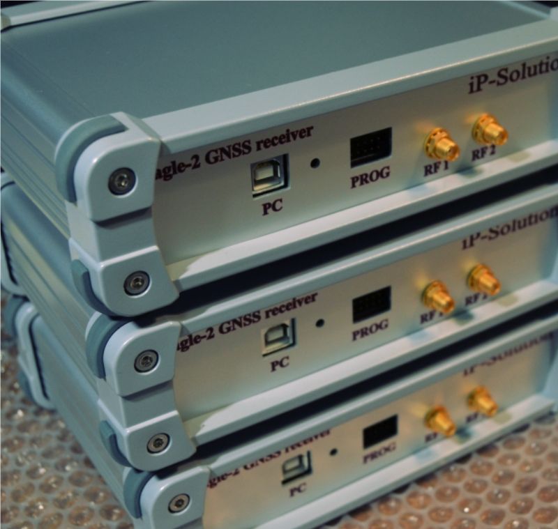
iP-Solutions has added a GNSS receiver to its software-defined-receiver (SDR) front-end family. The new Eagle-2 works with software receivers in real time or records GNSS signals for post-processing.
For post-processing, Eagle-2 it supports most third-party receivers, such as MATLAB and C/C++ receivers.
The front end allows a user to work with two perfectly synchronized channels connected to two antennas.
The Eagle-2 supports GPS, Galileo, GLONASS , BeiDou, QZSS and SBAS.
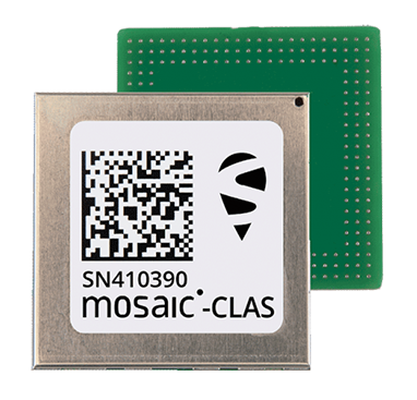
Septentrio, a leader in high-precision GNSS positioning solutions, has launched three new products that support Japan’s high-accuracy Centimeter Level Augmentation Service (CLAS).
The three multi-frequency GNSS receivers support CLAS on a single device, thanks to the latest GNSS technology which receives the L6 signal, which transmits high-accuracy corrections from Japan’s QZSS constellation. This technology was developed in close cooperation with CORE, a leading integrator of high-accuracy positioning technology and services in Japan.
The mosaic-CLAS receiver is a GNSS module with a very small form-factor suitable for high-volume industrial applications.
The AsteRx-m3 CLAS is Septentrio’s best-in-class OEM board combining PPP-RTK CLAS with dual-antenna heading functionality.
The AsteRx SB3 CLAS features a ruggedized IP68 enclosure to protect it in harsh environments.
Septentrio is simultaneously offering various receiver types to the Japanese market ensuring an optimal match between products and customer needs in various applications including robotics, precision agriculture, construction, machine control and UAV.
“We are very pleased to jointly develop CLAS software on a new GNSS module, mosaic-CLAS,” emphasized Takahiro Yamamoto, director, GNSS Solution Business Center at CORE Corp. “This receiver puts CLAS GNSS technology on par with regular RTK receivers in terms of size as well as price. We believe that the realization of CLAS on the Septentrio mosaic platform will significantly promote the use of new QZSS services for industrial applications.”
“The launch of our new module and OEM board with CLAS support opens up new markets and use cases, which will benefit from centimeter-level positioning with fast acquisition time,” commented François Freulon, head of Product Management at Septentrio. “This launch demonstrates the technological leadership of Septentrio and our ability to provide dedicated solutions embedding L6 bands for the Japanese market.”
The CLAS PPP-RTK is the latest generation of GNSS correction services, combining near-RTK accuracy and quick initialization times with the broadcast nature of PPP. Receivers with built-in CLAS functionality offer sub-decimeter positioning accuracy right out of the box. Corrections for high-accuracy positioning are received directly from satellites, reducing the need for additional base stations or service subscriptions.
Find out more about PPP-RTK and other positioning correction methods in the insight article GNSS Correction Demystified.
In our 11th annual Simulator Buyers Guide, we feature simulator tools, devices and software from 11 prominent companies that aid GNSS receiver manufacturers in product design.
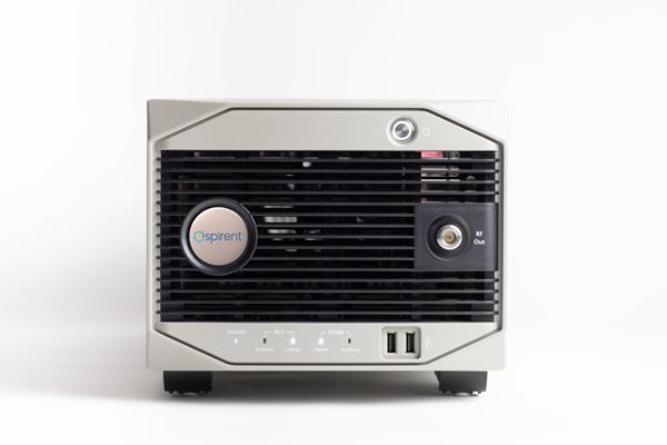
Alternative RF Navigation Simulator (Photo: Spirent Federal Systems)
New Alternative RF Navigation Simulator. Authorized users of Spirent’s alternative PNT simulation system can generate alternative RF navigation signals individually or concurrently with GNSS signals.
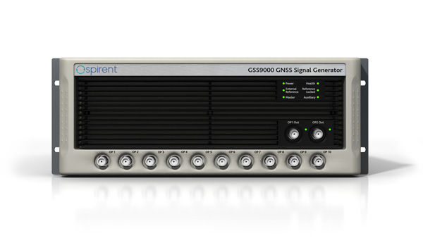
GSS9000. The GSS9000 Series multi-frequency, multi-GNSS RF constellation simulator is Spirent’s most comprehensive simulation solution. It can simulate signals from all GNSS and regional navigation systems and has an unrivaled update rate of 2 kHz (0.5 ms), enabling ultra-high-dynamic simulations with accuracy and fidelity. The GSS9000 supports M-code, Y-code, alternative PNT and non-GNSS sensors, and comes with built-in jamming, spoofing and flex power.
SimMNSA. Spirent Federal has the first fully approved MNSA M-code simulator. Authorized users of the GSS9000 series of simulators will be able to utilize the advanced capabilities of SimMNSA to create robust military GPS user equipment (MGUE) solutions.
Spirent GSS9000 Series constellation simulator (Photo: Spirent Federal Systems)
CRPA Test System. The CRPA Test System is scalable, testing antennas from 4 to 16 elements and beyond. More than 1,000 independent GNSS, jamming and spoofing signals can be generated/simulated across a phase-calibrated precise wavefront.
SimINERTIAL. Supporting the leading embedded GPS/inertial systems (EGI) and inertial measurement units (IMU), SimINERTIAL enables the controllable generation of inertial sensor outputs, synchronous with simulated GNSS, to test integrated GPS/inertial systems in the lab.
Anechoic Chamber Testing. Spirent’s GSS9790 multi-output, multi-GNSS RF constellation wavefront simulator system can be used in both conducted (lab) and radiated (chamber) conditions.
Mid-Range Solutions. Spirent offers solutions for every application and price point. The GSS7000 multi-constellation simulator provides an easy-to-use solution for GNSS testing that can grow with users’ requirements. The GSS6450 RF record-and-playback system enables replay of real-world GNSS tests in the lab.
Based on the Skydel GNSS Simulation Engine, Orolia’s advanced and essential GNSS simulators offer a wide breadth and depth of tools to test mission-critical positioning, navigation and timing (PNT) applications and scenarios.
Skydel Simulation Engine. The highly flexible, high-performance Skydel Simulation Engine transmits GNSS signals in real time to many kinds of software-defined radios. Skydel uses graphics processing units (GPUs) to compute the digital GNSS signal of all simulated satellites, easily scaling from simple to complex use cases. Skydel simulates civil signals from global and regional navigation satellite systems with a 1000-Hz update rate, many kinds of GNSS receiver trajectories with high dynamics, and advanced jamming and spoofing. The Skydel ecosystem also includes features such as open-source plug-ins and API, and the ability to create custom signals. The custom-signal feature allows users to experiment with new signals, such as navigation from low-Earth-orbit satellite systems.
GSG-8. A scalable software-powered turnkey simulation solution, GSG-8 is configurable to meet virtually any testing requirements. It can support multi-constellation, multi-frequency and hundreds of signals with a 1000-Hz iteration rate. This advanced hardware platform is suitable for space trajectories, custom PNT signals, hardware-in-the-loop, multi-antenna simulation, and more. Encrypted EU signals will be available soon.
Skydel CRPA Testing. With self-calibration, integrated advanced jamming and spoofing, and the ability to generate thousands of signals, Skydel CRPA test systems provide everything needed to test CRPA systems, with a focus on ease of use and the testing experience from the user point of view. Two flexible configurations, Skydel Anechoic and Skydel Wavefront, have been carefully designed to provide the advanced simulation features required for CRPA testing in a well-thought-out package. Both provide COTS hardware benefits: configuration flexibility and cost-effectiveness.
GSG-5 and GSG-6. Orolia’s essential simulation platform is a proven, cost-effective simulation solution. Combined with the freely available StudioView software, these simulators provide high-end capabilities in a standalone, portable system that allows operation via a front panel interface. GSG-5 and GSG-6 are available with support for multi-frequency and multi-constellation GNSS signal simulation, pre-built scenarios and test packages, and the features neded to integrate it into ATE systems.
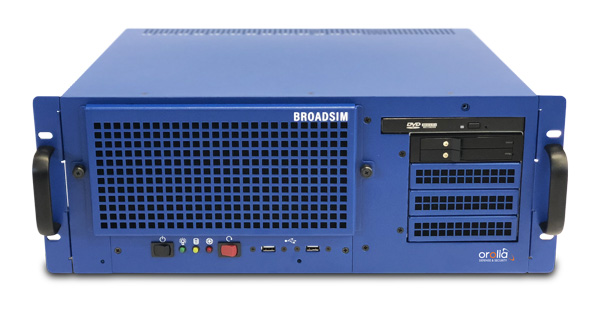
BroadSim 4U, Advanced NAVWAR simulations, MNSA and Y-Code (Photo: Orolia)
Advanced GNSS Simulation for Government & Defense
BroadSim
Powered by the Skydel Simulation Engine, BroadSim provides superior NAVWAR performance, sharing the same benefits and key features of its software-defined platform.
Key Applications
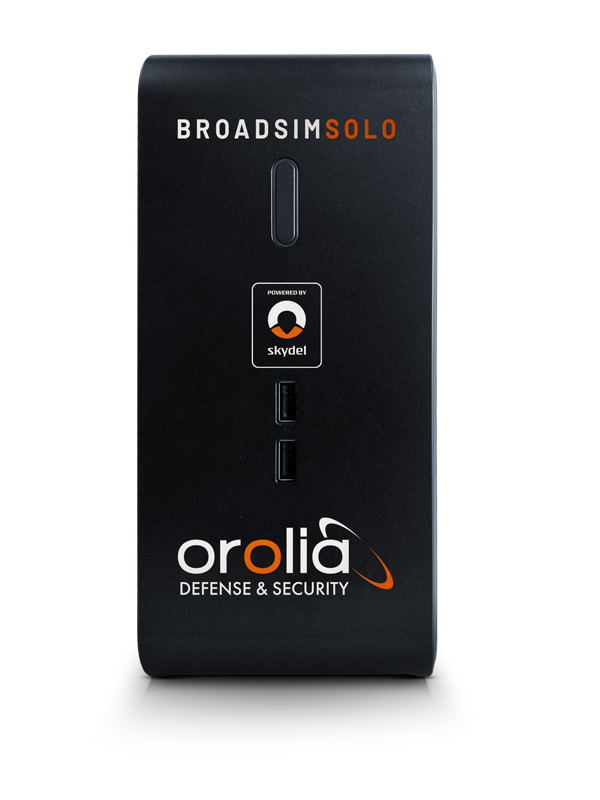
BroadSim Solo: Multi-GNSS simulations on the desktop. (Photo: Orolia)
MNSA M-Code. BroadSim offers a fully flexible implementation of the Modernized NavStar Security Algorithm, giving you full control over scenario settings with the real encryption used on the M-code signal. Any aspect of your scenario can be changed, such as time, date, location, constellation, downlink data, signal configuration, and visible satellites. It is security-approved by SMC Production Corps and shipping as soon as today.
CRPA Testing. BroadSim leverages Skydel’s CRPA testing solution to up the ante for demanding NAVWAR scenarios. BroadSim Anechoic allows you to test an entire system as-is. Skydel auto- calibrates the system, maps the antennas, and is designed to streamline chamber setup and reduce hardware. Broadsim Wavefront tests the antenna electronics, prioritizing the ability to have dynamic trajectories and allowing you to model any scenario with an unlimited number of interferences. The system is scalable from 4 to 16 elements, is phase coherent, performs real-time automated phase calibration, and has built-in jamming and spoofing.
BroadSim Wavefront: Phase-aligned NAVWAR simulator for CRPA (Photo: Orolia)
Advanced Jamming and Spoofing. With Advanced Jamming, users can add ground- and space-based emitters to scenarios, generate an unlimited number of jamming signals on 1 RF output, and simulate flight profiles where interference power levels at the UUT dynamically change depending on the scenario motion. With Advanced Spoofing, users can simulate multiple spoofers simultaneously. Each spoofer can generate any GNSS signal and has an independent trajectory and antenna pattern. Signal dynamics between each spoofer and receiver antenna are automatically determined so no time is wasted.
More Features. Inertial and alternative RF navigation, built-in Flex Power, real-time performance with ultra-low latency of 5ms, high dynamics, terrain modeling, and RMF STIG compliance.
Test Anywhere with LabSat 3 Wideband and SatGen Simulation Software
LabSat 3 Wideband. The LabSat 3 Wideband is a compact yet powerful multi-constellation and multi-frequency GNSS testing solution. The easy-to-use, one-touch record-and-replay function provides an efficient way to test and develop GNSS-based technology without the cost and limitations of live-sky signals.
It is lightweight and portable, enabling easy collaboration with colleagues by sharing scenario files over the internet, and making it a suitable test partner for remote working. Additionally, the removeable solid-state drive (SSD) of up to 7 terabytes and a two-hour runtime provided by an internal battery is ready for field testing in any environment.
LabSat 3 Wideband can record and replay up to three different channels at 56-MHz bandwidth across all major constellations and signals, including:
GPS: L1/L2/L5
Galileo: E1/E1a/E5a/E5b/E6
GLONASS: L1/L2/L3
BeiDou: B1/B2/B3
NavIC: L5/S-band
QZSS: L1/L2/L5
L-band correction services including SBAS
2x CAN and 4x digital input channels tightly synchronized with GNSS data
future signal launches are also supported, including L2C, L5 and L1C
SatGen Simulation Software. SatGen software allows users to quickly create bespoke, accurate scenarios with their own time, location and trajectory that can be replayed via a LabSat GNSS simulator.
The latest version of SatGen can be used to create a single scenario containing all the upper and lower L-band signals for GPS, Galileo, GLONASS, BeiDou and NavIC.
When getting the job done right the first time — and every time — matters, CAST Navigation’s suite of simulator solutions delivers precision, accuracy and repeatability. From simple integration testing to complex mission simulations, CAST Navigation solutions scale to meet user requirements.
Powered by multi-frequency, multi-constellation GNSS and interference signal-generation technology, CAST Navigation simulators provide coherent, highly accurate and fully programmable signals. Advanced, configurable vehicle trajectory capabilities meet project requirements ranging from antenna testing to simulations of squadrons maneuvering in contested environments.
Intuitive Graphical Interface. A comprehensive and intuitive graphical interface unifies all simulator capabilities so users can configure complex simulation scenarios quickly. For example, CAST Navigation simulators can model many vehicle types with static and dynamic motion profiles: airborne, terrestrial, aquatic or space-based. Using configured scenario profiles or vehicle truth data, CAST Navigation simulators create high-dynamic, 6-DOF real-time trajectories.
High-Fidelity Simulations of Real-World Conditions. CAST Navigation solutions can reproduce terrain, sea-state and atmospheric effects to simulate missions with high fidelity. Jamming capabilities recreate natural, urban and hostile interference to produce precisely controlled waveforms with high output power and exceptionally low intermodulation noise.
Multi-Frequency, Multi-Constellation Simulations. The GPS/GNSS simulators generate accurate, programmable signals to each antenna element with up to 16 satellites in view from as many as four constellation types. GPS simulations can generate any positioning signal (C/A-code, P-code, Y-code, SAASM, M-code AES and M-code MNSA).
Modular, Scalable Solutions. Proprietary synchronization technology lets CAST Navigation configure customer solutions with multiple simulator capabilities — GPS/GNSS, inertial, jamming, and CRPA — to meet specific project needs. As those needs evolve, these solutions do not become obsolete. Rather than replace a functioning system, customers can rely on modular architecture to meet their new requirements.
The NCS NOVA GNSS simulator is a high-end, powerful and easy-to-use satellite navigation testing and R&D device. It is fully capable of multi-constellation and multi-frequency simulations for a wide range of GNSS applications. It is one of the leading solutions on the market, providing multiple GNSS frequencies in one box.
Because of the modern and flexible software-defined radio (SDR) design of this simulator, testing requirements will be met with the minimum of equipment, facilitating logistics and reducing the cost of ownership. The innovative multi-constellation and multi-frequency simulation capability sets new standards in the field of GNSS simulation in terms of fidelity, performance, accuracy and reliability. Designed to deliver maximum flexibility, users are no longer faced with configuration limitations.
The NCS NOVA GNSS simulator is also able to coherently generate GNSS RF signals on two independent RF outputs simultaneously. The user may freely allocate GNSS signals and RF channels to each of the RF outputs. This feature allows simulation of GNSS signals at two antenna locations simultaneously (this could be two antennas on a vehicle, two separate vehicles maneuvering independently, or a static location plus a mobile unit).
A new key enhancement to the NCS NOVA GNSS simulator is comprehensive support of new Galileo OS signal message improvements on E1B. By enabling real-time simulation of the Galileo OS message improvements, the NCS NOVA expands a user’s Galileo signal capability.
In the future, the NCS NOVA also will fully support the new Galileo E1B OS Navigation Message Authentication (OS-NMA) and Galileo E6B High Accuracy Service (HAS) capabilities.
The NCS NOVA GNSS simulator is the first choice in signal simulation for a wide range of applications including space, aviation, automotive (including autonomous driving testing) and many others.
About IFEN. IFEN is a leading provider of GNSS navigation products and services. Its technology portfolio includes GNSS RF-signal simulators, GNSS software receivers, simulation and data processing tools. IFEN’s outstanding satellite navigation expertise is provided to customers for services including GNSS system studies, research and development of navigation and integrity algorithms, design and development of GNSS software and hardware, on up to engineering of turnkey facilities and systems.
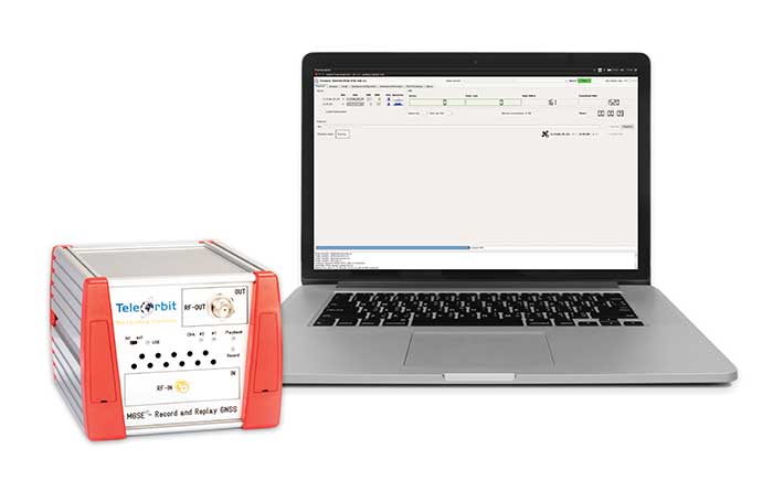
The MGSE product family creates a versatile GNSS test and simulation environment that improves the development, qualification and certification process of GNSS receivers within development phases and for validation and certification in end-to-end tests.
MGSE enables mobile and stationary interference monitoring, for example, for protecting critical infrastructures. It can be used for interference mitigation if combined with TeleOrbit’s GNSSA-6E (six-element antenna array) or its GNSS DCP (dual circularly polarized)antenna.
With MGSE REC-REP 2.0 users can, among other tasks, record Galileo PRS signals in a real user environment and replay them for Galileo PRS receiver testing.
MGSE SIM-REP supports the development of software-defined radios/receivers or specialized algorithms by creating a simulation environment that provides the possibility and flexibility to use synthetically generated GNSS data and recorded real-world samples.
For jamming and spoofing test and evaluation, TeleOrbit offers a sophisticated solution based on the MGSE simulation, recording and replaying product family. For spoofing mitigation, the GOOSE-OSNMA receiver platform is available.
Technical Background
The multi-band RF front-end (MGSE REC) receives the GNSS RF signals in different frequency bands simultaneously to obtain digital IF data, which can be used for GNSS multi-system signal analysis and comparison. All GNSS L-band frequencies and the NavIC S-band are supported.
The MGSE Replay Unit includes a flexible multi-band RF replay device that streams simulated and recorded raw IF data to a digital baseband output or to an analog RF signal. Up to two independent RF channels and up to four GNSS signals (L1, E1, B1, G1) can be provided.
GOOSE is a powerful yet compact GNSS receiver lab and the rapid prototyping solution for leading-edge GNSS receiver development.
The GNSSA-DCP (dual circularly polarized antenna) receives RHCP and LHCP signals simultaneously (full L-band). It clearly detects signals which have been corrupted by diffraction and reflections.
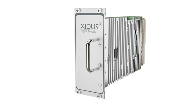
WORK Microwave’s Xidus is well-known for meeting all requirements regarding multi-GNSS; for its multi-frequency and multi-RF signal generation; for its innovative Signal Extension and Enhancements (SEE) technology; for its advanced customization and configurability; and for world-class remote support with updates, training and even scenario execution.
Xidus Signal Module
Compact and powerful, the Xidus Signal Module provides new capabilities of signal generation. Users can perform rigorous and extensive testing of present and future positioning systems when conducting navigation research or developing products.
Possible applications: pseudolite generation, massive multipath or navigation signal generation on various orbits.
Extensive increase of supported channels: >250.
Unlimited number of multipath channels with delay >3,000km.
Interference signal generation on up to four independent frequencies.
Acts as a software-defined radio (SDR) to replay signals.
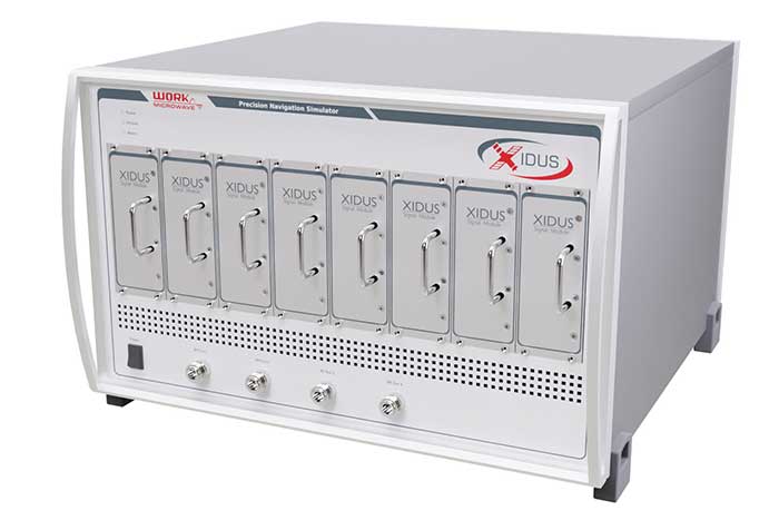
Xidus-648 (Photo: Work Microwave)
Xidus Hardware Series
Xidus-424 GNSS Simulator
Up to 4 signal modules
2 RF outputs
Wide dynamic power range
Xidus-648 GNSS Simulator
Up to 8 signal modules
4 RF outputs
1,000 Hz update rate
Xidus-Studio Client Software
Xidus-Studio provides a user-friendly graphical interface to configure any GNSS scenario. Its advanced and outstanding features include:
QA707 is the cutting-edge solution for global threat GNSS awareness and management. It is a GNSS simulator specifically designed to test cyber-attacks and authentication, and includes the simulation of GNSS interference, deception, jamming, spoofing and advanced cyber-threats such as data- and code-level attacks.
The high flexibility in the creation of the scenarios and the definition of the type of attacker allow cyber-threat and vulnerability testing for several applications,These applications may include, for example, autonomous driving and vehicle tracking, aeronautics and high dynamics applications, space GNSS receivers and timing.
OSNMA Support. The Galileo Open Service Navigation Message Authentication (OSNMA) simulation is an opportunity to test the new Galileo data protected service against several known vulnerabilities in GNSS applications. The OSNMA simulator is also available as a standalone tool, allowing the generation of OSNMA data that can be used with third party simulators.
PC-capable. QA707 runs on a standard PC. It is compatible with several third-party hardware RF up-converters, including National Instruments’ USRP. Additionally, it can support customer-specific hardware through the hardware API interface.
QA707 Main Features
Multi constellation (currently GPS L1, GALILEO E1, SBAS L1)
Galileo OSNMA
RF simulation, binary file dump, signal record and replay
Support to SDR platforms and open API for custom RF upconverters
Runtime streaming of scenario information over UDP (motion, channel data)
Data level cyber-attacks
Accurate spoofing signals control, trajectory spoofing, signal replay attacks
Narrow band, wide band, frequency modulated jamming
Integrity threats (on request): evil waveform, erroneous ephemerides, code/carrier divergence, low satellite signal power, excessive range acceleration
The StellaNGC all-in-one testing platform. (Photo: M3 Systems)
High-end multi-constellation and multi-frequency GNSS Simulator and Record & Playback
M3 Systems offers a fully integrated all-in-one testing solution for GNSS. Thanks to a versatile SDR approach, StellaNGC provides on a single HW platform GNSS simulation and GNSS record & playback functionalities. It answers user challenges from aerospace, defense, ground transportation and telecommunication fields when testing the PNT functions of their GNSS-based systems.
StellaNGC Plug & Play. This fully scalable and customizable simulator is based on a layered architecture to provide PNT data to the user at different levels (RF, IQ, GNSS raw data, trajectory).
Based on COTS platforms from National Instruments (NI), StellaNGC P&P allows the simulation of civil signals from GNSS as well as ground-based and satellite-based augmentation systems. It covers terrestrial, aerial and spatial trajectories (including high dynamics). It also enables assessment of GNSS solution robustness with jamming, meaconing and spoofing capacity.
Multi-antenna (CRPA applications) and multi-trajectories
Jamming and spoofing simulation
Cm-level positioning
Low latency HIL simulation
SBAS and RTK augmentation systems
3D multipath generation
IMU sensors modelization
Configuration of all scenario parameters
Signal control during run-time
Intuitive and easy to use GUI
StellaNGC Record & Playback. As a complement to simulation, StellaNGC RP allows test and validation of PNT functions through high-fidelity record-and-playback of GNSS signals. It allows recording by selection of a center frequency (65 MHz–6 GHz) or with a predefined list of GNSS frequencies for each of its 4 RF channelw, with a bandwidth of up to 120 MHz.
StellaNGC R&P Main Features
Multi-bands record & playback
Programmable center frequency and bandwidth
Single or multi-channel (up to 4) simultaneous records
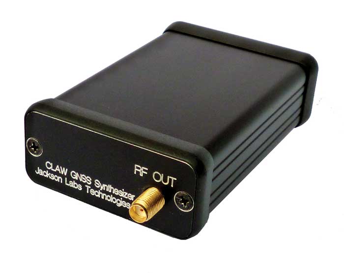
The 18-channel miniature full-constellation CLAW GPS Simulator is a fully self-contained, low size, weight, power and cost (SWaP-C) miniature GPS simulator. It is very popular in manufacturing environments as well as R&D applications that require consistent and repeatable local GNSS signals at low price points.
The CLAW simulator does not require external computers for processing and control — it works fully self-contained by simply applying power, and storing location/time/date data in internal non-volatile memory, or by storing complex vector data to simulate highly dynamic scenarios. The CLAW also can be used to transcode NMEA or SCPI position/velocity/time (PVT) data into GPS RF signals. For 2022, JLT added driver support for a large number of additional GNSS front-end receivers when using the hardware-in-the-loop (transcoding) feature of the unit to, for instance, transcode from one GNSS system to another.
JLT offers an easy-to-use, highly configurable and cost-free SimCon Windows application program that is downloadable from the JLT website. SimCon allows random scenario generation and is thus usable to simulate leap-second events, Week 1023 rollover events, or any other GPS live-sky scenarios, including highly complex yet easy-to-create dynamic vector simulations.
For authorized U.S. government users, a version that does not have altitude and velocity limitations is popular for low-Earth-orbit (LEO) simulations. Multipath simulation allows use of the entire 18-channel simulator capability.
The unit can be field-upgraded with an easy-to-use in-field software upgrade feature. The CLAW is also very useful in GNSS receiver sensitivity testing for R&D or mass-production assembly lines as it allows accurate control of RF output power ranging from –100 dBm to less than –130 dBm with 0.1-dB resolution and typically better than 1-dB accuracy over the controllable power range.
The CLAW GPS Simulator also has a built-in RF signal generator with sweep, CW and random noise functions that are useful in simulating GNSS jamming scenarios, as well as GPS spoofing scenarios. The simulator comes in an FCC-certified metal desktop enclosure with numerous accessories.
The CLAW firmware has been updated to allow live-sky almanac and ephemerides to be automatically uploaded from various externally connected GNSS receivers. This makes simulations using real-time live-sky constellations (such as used in simulating spoofing attacks) an easy task. A free firmware update is available from JLT.
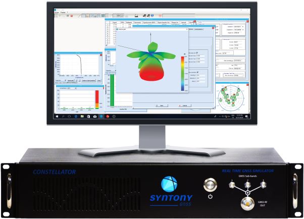
High-end GNSS simulation solutions for R&D, integration and product testing
Syntony GNSS specializes in GNSS/PNT software-defined receiver (SDR) technologies, operating from receivers to test and measurements solutions. Its products and solutions address multiple markets and use cases in the space, defense and transportation industries.
Constellator. (Photo: Syntony)
Constellator GNSS Simulator. Scalable, cost-effective, and high-fidelity SDR software-based platform supporting multi-constellation signals and frequencies (open, restricted and custom), hundreds of signals at 1-kHz iteration rate at zero effective latency, space trajectories and high dynamics. Multiple upgradable hardware configurations are available.
Constellator CRPA. Synchro-phase SDR by design, advanced jamming and spoofing, thousands of signals, 4 to 16 elements.
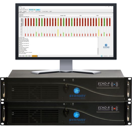
Echo. (Photo: Syntony)
Echo Recorder & Replayer. High-fidelity record-and-replay devices characterizing group-delay, scintillation, and jamming and spoofing interference, from space to ground market segments.
3 RF channels of 200Mhz sampling rate
16 bit I/Q
Up to 1.6 GB/s write/read speed.
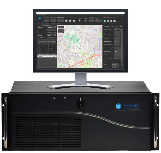
SubWAVE manager. (Photo: Syntony)
SubWAVE GNSS/GPS Coverage Extension. Universal and seamless GPS/GNSS coverage extension for rail, road and mining infrastructures. SubWAVE signals are natively compatible with every GNSS-enabled device, and the solution uses existing telecom infrastructure to broadcast GNSS signals.
A roundup of recent products in the GNSS and inertial positioning industry from the March 2022 issue of GPS World magazine.
OEM
Correction Service
Achieves RTK-level accuracy
Photo: Hexagon
“RTK From the Sky” technology has been integrated into the core of the TerraStar-C PRO corrections service. As a result, TerraStar-C PRO provides centimeter-level accuracy, not just in open-sky environments but also across challenging conditions created by buildings and foliage. TerraStar-C PRO now converges in less than three minutes by utilizing quad-band receiver and antenna technology to leverage modernized BeiDou 3, GPS III and Galileo E6 signals. The resulting process generates state-of-the-art corrections for all GNSS frequencies. The service improvements are accessible through the 7.08.10 firmware release for users of OEM7700, OEM719 and OEM729 cards and their associated enclosures for land and air applications.
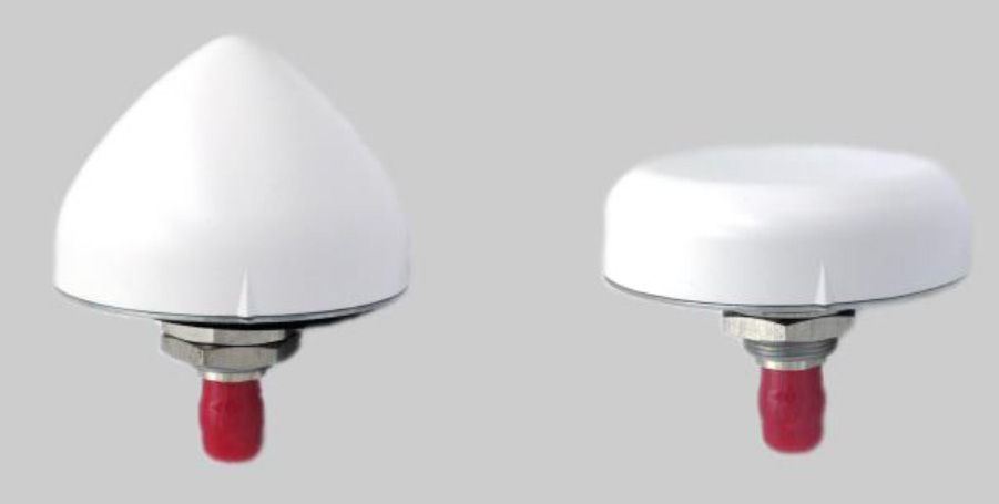
A north orientation mark is being added to the TW3000 family of Accutenna precision antennas and the TW5000 family of smart antennas. The new feature allows customers to align their antennas, standardize radiation patterns, and increase the synchronicity of their azimuth gain readings across multiple devices. The new north mark design has been thoroughly tested to ensure it conforms to or exceeds customer expectations and maintains each antenna’s stringent IP69K rating.
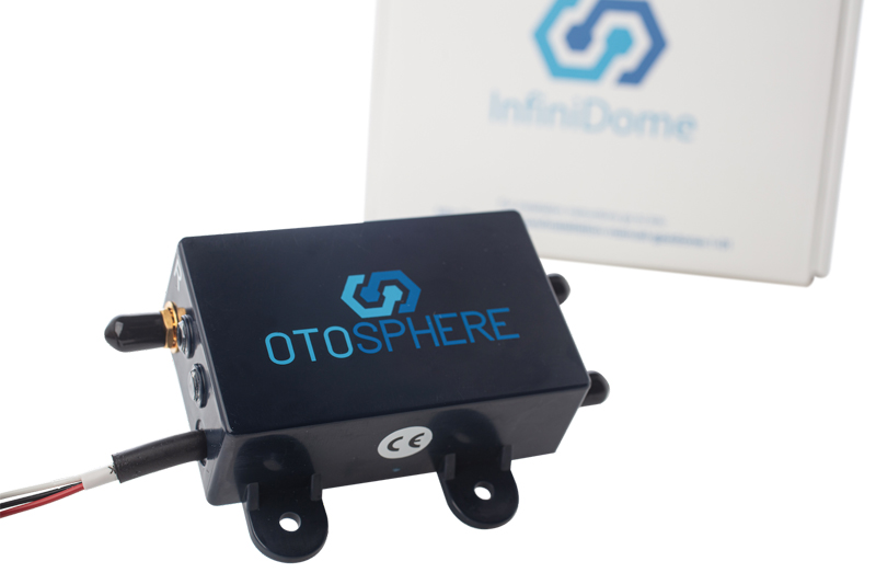
OtoSphere is a small, add-on module to the ViaLite GPS RF over fiber link and any GNSS-based system, providing GNSS protection against GPS jamming attacks, making any receiver more resilient. It ensures continuity of timing and navigation capability and enables normal operation during a jamming attack. According to ViaLite, no other solution that offers such protection is as small, light, affordable, or easy to install. The Otosphere protection module adds resilience to critical GPS timing services.Using OtoSphere, GPS receivers are up to 50 times more resilient to jamming attacks on positioning, navigation and timing (PNT) systems compared with having no protection. The GPS receiver can continue working normally throughout the attack. Timing-critical infrastructures in areas such as defense and cybersecurity can now be protected from these attacks. The Otosphere has a unique interference filtering algorithm that combines patterns from two external omnidirectional antennas that pinpoints the direction of the attack, then directs a null toward the unwanted signal to reject and reduce disruptions.
Infrastructure system for autonomous transportation
Photo: Seoul Robotics
The Level 5 Control Tower (LV5 CTRL TWR)) is a mesh network of sensors and computers on infrastructure that guides vehicles autonomously without requiring that sensors be placed on individual vehicles. The technology is automating last-mile fleet logistics at BMW’s manufacturing facility in Munich. The system has the potential to transform operations for a wide range of business applications, from vehicle distribution centers to car rental companies and trucking logistics.
Savvy Navvy provides essential marine information, allowing boaters to cross-check their traditional navigation plans. It integrates plotting charts, weather and tide data, marina details and passage planning into one app. The app reduces the risk of human error as well as the stress of voyage preparation. It is used by boaters in more than 100 countries around the world, with more than 43 million miles plotted. It works on phones or tablets using Android, IOS, PC or Mac.
The Pix4D viDoc RTK handheld rover attaches to iOS devices to bring RTK accuracy to terrestrial scanning on iPhones and iPads. When paired with the PIX4Dcatch mobile app, the viDoc rover can replace survey tools such as RTK GNSS rovers and terrestrial scanners, the company said. The two products create a workflow that turns iPhones or iPads into an accurate terrestrial scanning device, with centimeter-accurate RTK positioning from an existing NTRIP network. The tools can be used to 3D model small areas or structures.
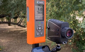
Bad Elf now provides an integrated laser-offset workflow for acquiring high-accuracy field data in GNSS-challenged environments using Esri ArcGIS Field Maps for Android, as well as iOS. The workflow integrates Bad Elf and Laser Tech (LTI) hardware in collaboration with ArcGIS technology from Esri. The Bad Elf Flex connects to any LTI TruPulse rangefinder over a wired or Bluetooth connection to deliver high-accuracy location data to Esri ArcGIS Field Maps. Mobile workers can efficiently complete position and height data collection in access-limited situations, saving time, money and effort.
A free global map created from processed satellite imagery is available. To create the world image, satellite imagery was processed to remove clouds and balance shades and tones, and then carefully stitched together to create a seamless map layer with beautiful colors. The input data is recent, from 2020 and 2021, and rendered as one tiled file with 13 zoom levels 0-13 for use in web applications. It is a viable, up-to-date alternative to Google maps for software developers, without privacy issues.
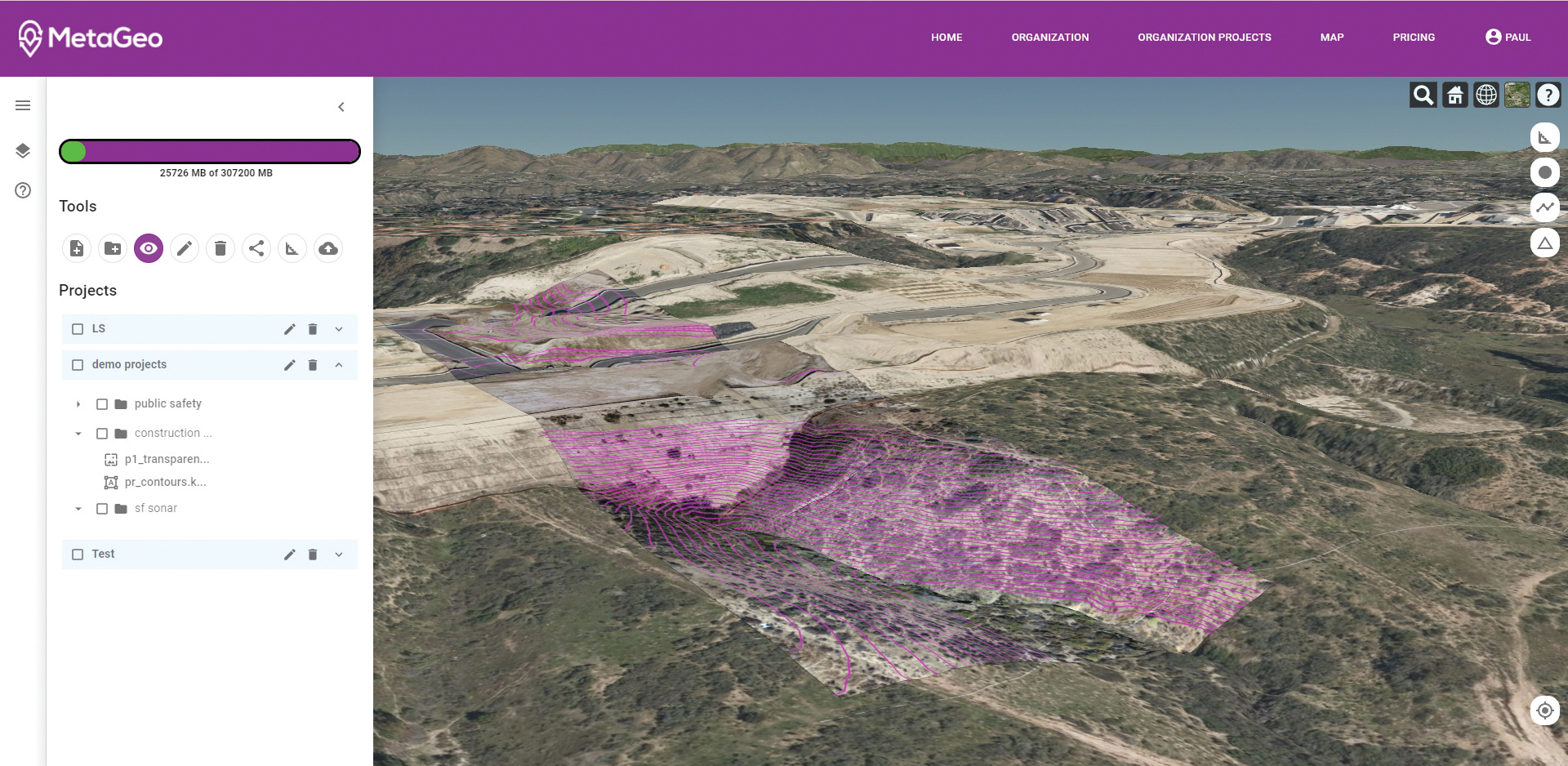
The MetaGeo geographic information system (GIS) platform enables organizations of all sizes to host, analyze, find and share 3D map datasets among any internet-capable devices. The platform processes location-based map or sensor data from the real world, combines it into a single 3D virtual environment, and streams it to any device or mapping platform. The affordable and easy-to-use platform can load data from multiple sources: satellites, drones, mobile devices, public and crowdsourced repositories, internet of things (IoT) sensor data, 3D models and topographic maps. The data is then processed by the MetaGeo platform into a 3D world and streamed to any internet-connected device, enabling live collaboration between the office and field via mobile or augmented reality device. A plug-in software development kit (SDK) allows for third-party tools to scale and fit user needs.
Trimble has launched the Trimble AP+ Land GNSS-inertial OEM platform for accurate and robust position and orientation for georeferencing sensors and positioning vehicles in land mobile-mapping applications. The platform enables users to accurately and efficiently track and monitor fleets and produce high-definition (HD) maps and 3D models. It can also serve as a reference solution for advanced driver-assistance systems (ADAS) testing, even in challenging GNSS environments. The comprehensive Trimble AP+ Land is small enough to integrate into compact mobile-mapping systems. It is compatible with virtually any type of mapping sensor, including single- or multi-lidar systems, video cameras, photogrammetric and panoramic cameras, and similar sensors.
Ronin 4D, a professional cinema camera from DJI, incorporates the full-frame Zenmuse X9 gimbal camera, active four-axis stabilization, lidar focusing, and wireless transmission. Firmware available at launch will allow the remote monitor to view and control the main monitor, interface with mirror control mode, and allow a clean video stream over HDMI and SDI ports on the Remote Monitor Expansion Plate with no overlaid information. It will also support automatic calibration for some third-party auto lenses to realize Lidar Focusing System functions.
Parallel Hybrid Electric Multirotor (PHEM) drone technology improves flight time with a heavy payload, yielding increased efficiency and eliminating the large battery used in other hybrids. It has the potential to extend a UAV’s flight time from 15 minutes to well over an hour and drastically increase range. In the search-and-rescue field, a heavy-lift drone can enhance first responder capabilities by allowing for substantially quicker response times to remote locations. Other applications include military platforms, fighting wildfires, and medical and logistics missions.
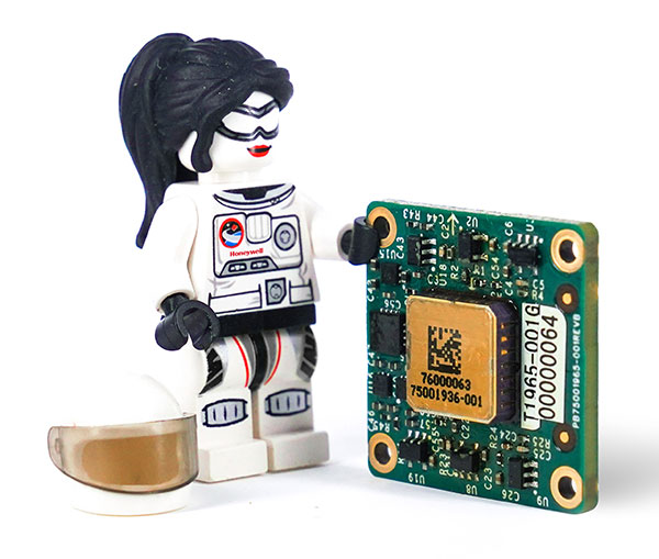
A LEGO Minifigure beside the MV60 shows its small size. (Photo: Honeywell)
Honeywell has unveiled a new accelerometer that delivers high performance and reliability in a small, rugged and low-cost package. The MV60 micro-electromechanical system (MEMS) accelerometer is designed for aerospace and defense, but also has potential uses in industrial and marine applications that require high-precision, navigation-grade accelerometers that are small, lightweight and require little power to operate.
The MV60 measures the acceleration experienced by an object during movement. These types of high-accuracy sensors are mainly used in inertial measurement units and navigation systems deployed on land, air and sea vehicles to measure velocity.
Additionally, inertial systems provide:
key orientation information for drilling operations
precision pointing and altitude determination for vehicles
platform stabilization
target location and surveying.
“The MV60 accelerometer is a technological breakthrough that leverages 50 years of Honeywell inertial sensor and MEMS experience to offer excellent reliability, ruggedness and performance,” said Matt Picchetti, vice president, Navigation and Sensors, Honeywell Aerospace. “Our customers in a wide range of markets will benefit from an accelerometer that is smaller, lighter and requires less power over similar offerings, and they won’t have to sacrifice performance.”
The highly reliable Honeywell MV60 accelerometer features a compact footprint of 1.2 square inches and has shock survivability of up to 5,000 g (g-force). It also offers bandwidth of greater than 300 Hz (hertz) — important for environmentally demanding missions.
The MV60 delivers accuracy and performance that previously had only been available in more expensive solutions. Now, customers have a more affordable, rugged, and small-scale offering suitable for the most demanding navigation applications.
Accelerometers are critical elements of navigation systems, and Honeywell provides a portfolio of precision accelerometers that deliver reliable performance at affordable prices to meet customer needs.
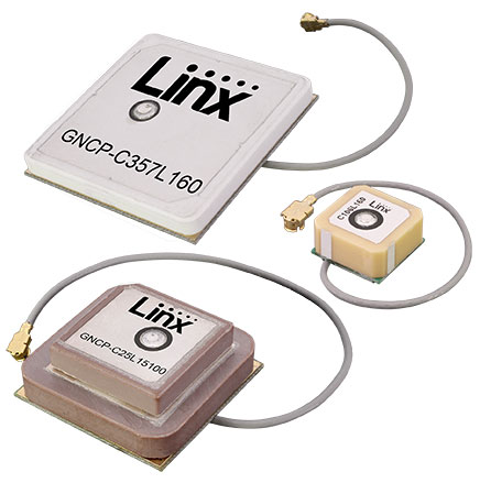
Linx Technologies has introduced seven GNSS active ceramic-patch antennas. These antennas support global GNSS applications including GPS, Galileo, GLONASS, Beidou, NavIC and QZSS systems in the L1/E1/B1, L2/E5/B2B, and L5/E5/B2A bands.
Each antenna integrates a high-gain low-noise amplifier (LNA) and right-hand circular polarization (RHCP) to provide a high-performance solution for GNSS signal reception. Each active GNSS antenna has either a 60-mm or 100-mm coaxial cable terminated in a MHF1/U.FL-type plug (female socket) connector.
“Linx Technologies continues to expand our popular GNSS antenna portfolio by adding more L1 options to serve our customers’ varied size and performance requirements,” said Linx CEO, Tolga Latif. “Our new active ceramic patch GNSS antennas also meet the need for multi-band L1/L2, L1/L5, and L1/L2/L5 GNSS offerings.”
The new active GNSS antennas are available now via Linx Technologies’ distributor and manufacturer representative networks. For larger quotes, contact Linx Technologies at [email protected].