Tag: OEM

  • Skyborg UAV aims to join frontline US fighter aircraft

    Skyborg UAV aims to join frontline US fighter aircraft

    It’s only a few weeks into the new year, yet there’s plenty happening in “UAV land” already. I expect another year of innovations, novel developments and groundbreaking firsts in unmanned aircraft.

    This month’s question: What’s a Skyborg? The U.S. Air Force (USAF) has awarded contracts to Kratos, Boeing and General Atomics to prove their approaches to the UAV program.

    All three have fielded existing, company-developed drones which are intended to fly alongside and be controlled by the latest frontline U.S. fighter aircraft. The idea is to have expendable force-multiplier unmanned aircraft support the capabilities of high tech, hugely expensive aircraft in order to undertake perhaps more risky missions, with the potential improvement acceptable versus unacceptable losses.

    Flying alongside frontline fighter aircraft, these jet-powered unmanned aircraft could undertake more risky close support parts of the mission, where loss of the UAV might be more likely, while the manned aircraft remains outside the high-risk envelope. Hence the term attritable is now being applied to these unmanned accompanying vehicles, which are intended to have a reduced cost profile so that loss of the UAV might be more tolerable.

    The Air Force Life Cycle Management Center (AFLCMC) has awarded Skyborg Vanguard Program contract amounts to Boeing ($25.7 million), General Atomics ($14.3 million) and Kratos ($37.8 million) for initial prototyping. All appear to have Skyborg prototypes in development.

    Kratos has subsequently announced other contract modifications related to the U.S. Air Force Research Laboratory (AFRL) Low Cost Attritable Aircraft Technology (LCAAT) program.

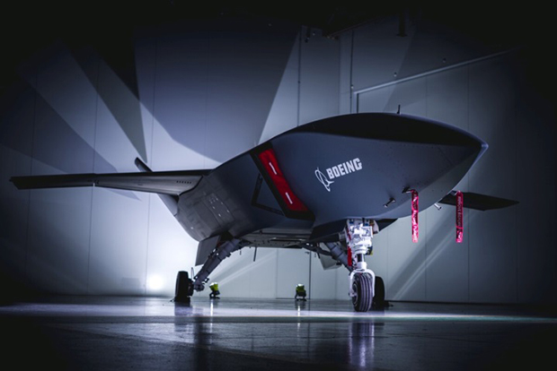
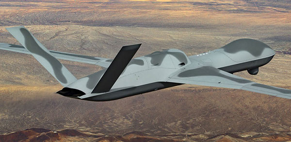
    Boeing will offer a variant of the Airpower Teaming System (ATS) drone being developed in Australia for the Australian Air Force. Engine runs and initial taxi tests were recently completed, however the program went into a short hiatus at the end of 2020 because of high COVID-19 infection rates in and around Sydney.

    Boeing will offer a variant of the ATS drone being developed for the Australian Air Force. (Photo: Boeing)
    Boeing will offer a variant of the ATS drone being developed for the Australian Air Force. (Photo: Boeing)

    General Atomics Aeronautical Systems Inc. (GA-ASI) is in the process of modifying two company-owned Avenger UAVs to incorporate upgraded datalinks and the Skyborg System Design Agent (SDA) software. Flight trials will investigate Artificial Intelligence capability for autonomous control of the UAVs while operating alongside manned aircraft – with the object of demonstrating that “a mix of manned and unmanned aircraft can communicate, collaborate, and operate together,” said David R. Alexander, president of GA-ASI.

    General Atomics Avenger unmanned aircraft. (Photo: GA-ASI)
    General Atomics Avenger unmanned aircraft. (Photo: GA-ASI)

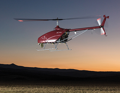
    The jet-powered Avenger aircraft has been under development and evaluation for more than 10 years so it is well characterized, and its performance as a UAV is already understood.

    The XQ-58A Valkyrie UAV has benefited from earlier generations of Kratos high-speed jet-powered target systems — something none of the other Skyborg competitors have in their bag of tricks. Kratos has been providing high-speed target drones to the military for a number of years, so jet powered drones are something they have been developing and fielding for a long time.

    Kratos aerial target drone. (Photo: Kratos)
    Kratos aerial target drone. (Photo: Kratos)
    XQ-58A Valkyrie UAV. (Photo: Kratos)
    XQ-58A Valkyrie UAV. (Photo: Kratos)

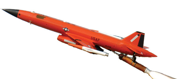
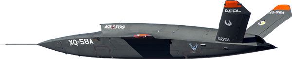
    The Valkyrie UAV was developed under the LCAAT program to demonstrate unmanned low-cost capabilities, and to fly as a stealthy companion to manned aircraft. It is intended to carry internal and wing mounted weapons. The turbine division of Kratos is also investigating lower cost jet engine options for attritable UAVs.

    Meanwhile, continuing developments in detect and avoid (DAA) are progressing, moving towards a solution for one of the main problems holding back integration of unmanned aircraft into controlled airspace.

    A number of these solutions are based on ADS-B or Automatic Dependent Surveillance Broadcast, whereby the UAV location – usually position provided by onboard GPS — is transmitted at a regular interval by an equipped UAV. So any similarly equipped manned or unmanned aircraft can receive the ADS-B signal, has knowledge of where such flying obstacles might be and is therefore able to avoid a potential collision.

    And for pseudo-satellite applications like the Airbus Zephyr which must transition between low-level airspace and the stratosphere, having on-board certified ADS-B is essential so that other aircraft and FAA air-traffic control have full visibility of such a delicate airframe which is lacking great maneuverability during climb-out, on station at altitude and during descent.

    Zephyr pseudo-satellite UAV with uAvionix ADS-B transponder and GPS. (Photo: uAvionics)
    Zephyr pseudo-satellite UAV with uAvionix ADS-B transponder and GPS. (Photo: uAvionics)

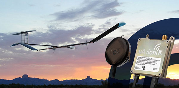
    Since Zephyr transitions through Class A airspace, the manufacturer Airbus decided that it should be equipped with an ADS-B transponder and GPS source which had undergone FAA recognized qualification testing and which meets known Technical Standard Order (TSO) requirements.

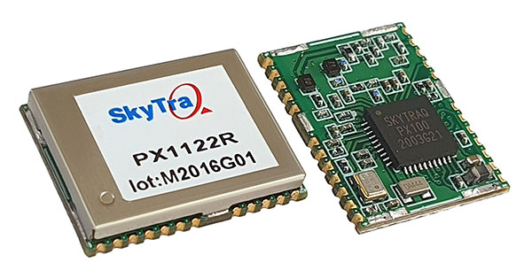
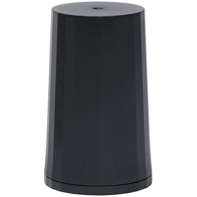
    The equipment also needed to be small and use little power — at 70 grams and using only 2 watts, the uAvionix ping 200X transponder and truFYX GPS provide high power (54 dBm), high integrity transmissions of ADS-B and transponder mode data to Air Traffic Control (ATC) and other suitably equipped aircraft.

    Zephyr is an all-electric vehicle, using sunlight to derive power from large photo-voltaic arrays which cover its upper surfaces. Batteries store surplus energy which is not consumed during daylight and provide power in order to maintain aircraft station through the night hours. From a perch at around 70,000ft, Zephyr is apparently focused on Earth-observation capability with payloads envisaged to include Electro Optical, Infrared, Hyper spectral, Passive Radio Frequency (RF) Radar, Synthetic Aperture Radar (SAR), plus Early Warning, Lidar and Automatic Identification System (AIS).

    The Hover DAA solution. (Photo: Sagetech)
    The Hover DAA solution. (Photo: Sagetech)

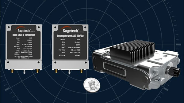
    “Sagetech is another DAA supplier which is currently working with both fixed and rotary wing UAS customers who are incorporating DAA systems in their design and type certification projects,” said Tom Furey, CEO of Sagetech. “Sagetech is providing regulatory guidance, transponders and interrogators, and system design to ensure these UAV systems in development will satisfy the anticipated certification requirements. Sagetech itself, through technology development and partnerships with companies including Hover Inc., expects to offer a complete DAA prototype system by the end of this year.”

    So, lots of progress towards Skyborg drone teaming systems with $78min awards by the Air Force Life Cycle Management Center from an anticipated budget of around $400m, while certified Detect and Avoid solutions help move commercial drones towards potential regular flight in controlled airspace.

  • Launchpad: GNSS chipsets, GIS software

    Launchpad: GNSS chipsets, GIS software

    A roundup of recent products in the GNSS and inertial positioning industry from the January 2021 issue of GPS World magazine.


    OEM

    Receiver board

    Enhanced with corrections

    Photo: Septentrio
    Photo: Septentrio

    The AsteRx-m3 Sx OEM board dual-antenna receiver combines Septentrio’s latest core GNSS technology with the SECORX-S sub-decimeter correction service to enable plug-and-play positioning. High-accuracy positioning is available directly out of the box, GNSS corrections automatically streamed to the receiver. This significantly simplifies the set-up process and eliminates the need for corrections service subscription and maintenance. Corrections are delivered via internet or L-band satellites, ensuring sub-decimeter service even in remote locations where there is no easy internet access.

    Septentrio, septentrio.com

    GNSS antenna

    Smart antenna for 5G timing

    Photo: Tallysman
    Photo: Tallysman

    The new TW5382 smart GNSS antenna is designed for high-accuracy 5G timing. The TW5382 is a multi-band, multi-constellation 5G smart GNSS antenna/receiver that provides 5 ns (1-sigma, clear sky view) timing accuracy. It consists of two components: a Tallysman GNSS Accutenna technology antenna and a professional-grade GNSS timing receiver module. Accutenna supports the full bandwidth of the TW5382 receiver, strong multipath mitigation and deep filtering in a compact IP69K enclosure. These features enable the antenna to provide a strong, pure, in-band, right-hand circular polarized signal to the receiver. The TW5382’s professional-grade multi-constellation and multi-signal timing receiver tracks GPS/QZSS (L1/L2), GLONASS (G1/G2), Galileo (E1/E5b), and BeiDou (B1/B2) signals.

    Tallymatics, tallymatics.com

    IoT GNSS module

    For quick integration of precise positioning

    Photo: Swift Navigation
    Photo: Swift Navigation

    The new Precision GNSS Module (PGM) is designed to offer fast evaluation and a quick path to production for those requiring a precise positioning solution. It is available in a simple-to-use, industry-standard mPCIe (mini peripheral component interconnect express) format and is designed specifically for Swift’s Starling positioning engine running on a host application processor to deliver real-time precision navigation. The PGM utilizes STMicroelectronics’ TeseoV chipset in Quectel’s multi-constellation, dual-band LG69T-AP receiver to create an affordable, easy-to-use solution for customers building industrial, last-mile and internet of things (IoT) platforms. This solution operates with the highest accuracy when used with Swift’s Skylark positioning service.

    Swift Navigation, swiftnav.com

    Inertial navigation system

    Success in ultra-high-altitude flight simulation

    Photo: Systron Donner
    Photo: Systron Donner

    CAST Navigation tested Emcore’s SDN500 inertial navigation system (INS) in an ultra-high-altitude flight simulation and achieved success. The test required simulating performance at an altitude of more than 24,000 meters and velocities over 600 m/s. Only a few aircraft in the world have such capabilities, including the SR-71 Blackbird, but it is not practical to participate in a test flight on the SR-71. Simulating the SDN500 INS test flight to specific customer profiles on a CAST system is straightforward and cost-effective. Emcore relies on GNSS/INS simulators for hardware-in-the-loop testing to verify the expected performance of algorithms. Emcore sought to validate the velocity and altitude limits of a new GNSS receiver along with the algorithm performance in a tactical-grade SDN500 system.

    Emcore, emcore.com
    CAST Navigation, castnav.com

    5G chipset

    Ready for mass-market 5G phones

    Photo: MediaTek
    Photo: MediaTek

    The Dimensity 700 5G smartphone chipset is a system on chip (SoC) designed to bring advanced 5G capabilities and experiences to the mass market. MediaTek’s Dimensity family of 5G chips is designed to give device makers a suite of options for 5G smartphone models. The chips range from flagship and premium to mid-range and mass market devices to make 5G more accessible for consumers everywhere. GNSS signals received include GPS L1CA and L5, BeiDou B1I and B2, GLONASS L1OF, Galileo E1 and E5, QZSS L1C and L5, and NavIC.

    MediaTek, mediatek.com


    UAV

    Inspection software

    For transmission towers

    Photo: Cyberhawk
    Photo: Cyberhawk

    IHawk allows users to inspect sites remotely and then download and view the analysis anywhere in the world. It eliminates the need for engineers to climb towers for inspections or work in hazardous environments. The imagery and information gathered provides a detailed and highly accurate analysis of the condition of power transmission towers.

    Cyberhawk, thecyberhawk.com

    Heavy-lift UAV

    System designed for Turkish rescue and security

    Photo: UAVOS
    Photo: UAVOS

    The Alpin UAS is a long-range, heavy-lift unmanned helicopter capable of carrying up to 160 kg with a range of up to 840 km. The UAS includes a wideband satellite communication channel from its command-and-control station — a valuable feature, particularly for operations in remote areas. The Alpin unmanned helicopter is able to withstand severe weather conditions, carry multiple payloads, and transmit real-time information to defense forces and decision-makers in the field. Its system autopilot has features and advantages such as fully autonomous take-off and landing, remote ground-control network capability, auto-rotation landing capability and high efficiency flight control based on a total energy control system (TECS).

    UAVOS, uavos.com

    Metadata mapping

    Secure web application enhanced for dji drones

    Photo: Remote GeoSystems
    Photo: Remote GeoSystems

    LineVision Online now provides enhanced support for visualizing and mapping DJI drone video camera metadata and field-of-view projections. The secure web application is designed for immersive mapping, analysis, search, sharing and archive of geo-referenced videos, full-motion video, photos and other survey, inspection and surveillance datasets. With enhanced camera metadata mapping in LineVision Online, DJI drone videos can now display a dynamic, field-of-view outline representing where the gimbal camera was looking on the Earth as the video plays in the web-based map interface. Users can select any point along the UAV’s flight track on the map to immediately cue the video to play what was recorded at that location click point.

    Remote GeoSystems, remotegeo.com

    Agriculture drone

    Comprehensive spraying system

    Photo: DJI
    Photo: DJI

    The Agras T20 drone can conduct autonomous operations over a variety of terrains, such as broad-acre farmlands, terraces and orchards. As a comprehensive spraying system, the T20 allows users to easily set flight and operation parameters. With a built-in real-time kinematic (RTK) centimeter-level positioning system and RTK dongles, centimeter-level waypoint recording is enabled, strengthening operations and ensuring precision spraying.The T20 is equipped with eight nozzles and high-volume pumps that can spray at a rate of up to 6 liters per minute. A highly optimized wind field produces droplets of the correct size and consistency. The T20 is also equipped with a new four-channel electromagnetic flow meter, which monitors and controls four hoses individually, ensuring an efficient flow rate for each nozzle.

    DJI, dji.com


    SURVEYING AND MAPPING

    Virtual base station

    New feature in post-processing software

    Photo: SBG Systems
    Photo: SBG Systems

    A new virtual base station (VBS) feature is available in Qinertia, GNSS and inertial navigation system (INS) post-processing software. Trajectory and orientation are greatly improved by processing inertial data and raw GNSS observables in forward and backward directions. The VBS computes a virtual network around a project in which position accuracy is maximized, homogeneous and robust, such as a PPK short baseline. Once surveyors collect data, Qinertia chooses the most relevant reference stations, builds a virtual network and brings the project to centimeter-level accuracy with no convergence effects, even in urban areas.

    SBG Systems, sbg-systems.com

    3d data processing

    Designed to decipher unstructured data

    Photo: Enview
    Photo: Enview

    Enview Explore is a powerful web application that leverages artificial intelligence and cloud computing to automatically process 3D data at a high speed and scale. Enview performs a variety of geospatial operations, including object recognition, feature extraction, feature-based change detection, and 2D/3D measurement. Enview’s technology has been deployed on thousands of square miles worldwide to protect vital infrastructure and support mission-critical operations. Its unique method for classifying 3D data reduces time to action by focusing on finding meaningful insights.

    Enview, enview.com

    Pile installation

    Machine-guidance system ready for solar

    Photo: Carlson
    Photo: Carlson

    PDGrade — a machine guidance and positioning system that uses GNSS for pile driving applications — is now optimized for the solar industry with an increased capability in pile installation and navigation accuracy. It removes the need for surveying piles and reviewing as-built information by centralizing all relevant information and providing necessary details to operators and site supervisors.The system features both software and hardware applications to provide operators with detailed information such as pile navigation, pile location, positioning and height information, project progression tracking, and detailed accuracy. The PD machine is fitted with Carlson sensors and a ruggedized Windows-based MC10 tablet. The entire system is then calibrated within PDGrade.

    Carlson Software, carlsonsw.com

  • New GNSS receiver front-end integrates, simplifies

    New GNSS receiver front-end integrates, simplifies

    Photo: STMicroelectronics
    Photo: STMicroelectronics

    STMicroelectronics’ latest RF front-end for GNSS receivers offers a simplified design and smaller footprint. The BPF8089-01SC6 integrates the impedance-matching and electrostatic discharge (ESD) protection circuitry typically implemented using discrete components.

    The BPF8089-01SC6 provides a 50-ohm matched interface between the receiver’s antenna and low-noise amplifier (LNA), and is ready for plug-and-play with the company’s STA8089 and STA8090 LNAs.

    The BPF8089-01SC6 is suitable for use in portable receivers for the GPS, Galileo, GLONASS, BeiDou and QZSS constellations, which can be used in applications such as consumer satellite navigation, radio base stations, drones and tracking of assets or livestock.

    The BPF8089-01SC6’s compact, integrated front-end can replace a matching network containing up to five capacitors, resistors and inductors, as well as two discrete protection devices, resulting in a much smaller footprint. Designers can also leverage PCB-track specifications provided in the device datasheet to ease design challenges and ensure optimal performance.

    The ESD protection provided complies with IEC 61000-4-2 (C = 150 pF, R = 330 ohm) and exceeds level 4: 8 kV for contact discharge and 15 kV for air discharge. The device also withstands 2 kV pulse voltage in accordance with MIL-STD 883 C (C = 100 pF, R = 1.5k ohm).

    Part of ST’s Application Specific Integrated Passives (ASIP) product range, the BPF8089-01SC6 is housed in a SOT23-6L package compatible with automatic optical inspection.

  • DARPA-funded inertial sensors from Honeywell promise greater accuracy

    DARPA-funded inertial sensors from Honeywell promise greater accuracy

    Findings show accuracy of new sensors is improved by greater than an order of magnitude over current offerings.

    Honeywell, with funding from the U.S. Defense Advanced Research Projects Agency (DARPA), is creating the next generation of inertial sensor technology that will one day be used in both commercial and defense navigation applications.

    The HG1930 IMU. (Photo: Honeywell)
    The HG1930 IMU. (Photo: Honeywell)

    Findings gathered in Honeywell labs have shown the new sensors to be greater than an order of magnitude more accurate than Honeywell’s HG1930 inertial measurement unit (IMU) product, a tactical-grade product with more than 150,000 units currently in use.

    An IMU uses gyroscopes, accelerometers and electronics to give precise rotation and acceleration data to enable a vehicle system to calculate where it is, what direction it is going and at what speed, even when GPS signals aren’t available.

    There are various types of IMUs on the market, and some — like the next-generation version currently under development — use sensors based on micro-electromechanical systems (MEMS) technology to precisely measure motion.

    “Typically, MEMS inertial sensors have been on the lower end of the performance scale, but this latest milestone shows we are changing that paradigm,” said Jenni Strabley, director of offering management for Inertial Sensors, Honeywell Aerospace. “With this next-generation MEMS technology, we’re increasing performance without having to significantly change the size or weight of the IMU. This is a game-changer for the navigation industry, where customers need highly accurate solutions but cannot afford to compromise on weight or size.”

    Over the past few years, Honeywell has been working with DARPA to develop the next generation of high-precision navigation-grade IMU technology, under the Precise Robust Inertial Guidance for Munitions: Thermally Stabilized Inertial Guidance for Munitions program.

    The new MEMS sensors will use different sensor designs and electronics to enable higher performance. They will serve a broad range of applications in autonomous land and air vehicles for both military and commercial customers, including future urban air mobility aircraft.

    “Now that we have demonstrated that MEMS is capable of reaching these incredibly precise performance levels, it is the perfect time to start talking with potential users about how this technology could help their applications,” Strabley said. “We believe this new technology will have a variety of applications, such as onboard future vehicles that will fly in urban environments where lightweight, extremely precise navigation is critical to safer operations. Additionally, there are other applications that haven’t been invented yet but may be enabled by these types of technology innovations.”

    Commercial sales of an IMU containing these next-generation sensors are still several years away, but one of the first products using this new technology is expected to be more than 50 times more accurate while roughly the same size as Honeywell’s IMU.

    Honeywell has long been a pioneer in MEMS-based IMUs, including the HG1930. Honeywell’s lineage in navigation dates to the 1920s and since then Honeywell has developed and manufactured high-performance navigation solutions found on many aircraft and other vehicles worldwide.

  • Use of autonomous vehicles in mining and farming touted at CES 2021

    Use of autonomous vehicles in mining and farming touted at CES 2021

    After years of testing and hype, not a lot of companies can say there are real applications for autonomous technology. However, at this year’s virtual CES 2021 trade show, both Caterpillar and John Deere, two companies known for their tractors and heavy equipment, showcased autonomous machines that are being used worldwide in farming and mining projects.

    Photo: Caterpillar
    Photo: Caterpillar

    Deerfield, Ill.-based Caterpillar, a first-time exhibitor at CES this year, said it has been involved in autonomy and use of GPS for more than two decades. “We were an early adopter of GPS when there were few satellites in the sky,” said Denise Johnson, company group president, resource industries. “We have 350 autonomous trucks operating 24-7 on three continents.”

    The company’s autonomous vehicles, in addition to other technology, are being used around the clock in the Kearl Oil Sands project in Alberta, Canada.

    “We are using autonomy primarily in mining operations in harsh environments. These [vehicles] are operating 24-7, with no loss time incidents,” said Bill Dears, Caterpillar worldwide sales and marketing manager. “We also track people underground with cameras and radar.”

    In addition to production enhancement, safety is a factor in mining operations because of operator fatigue — something that is precluded by autonomous mining equipment, Dears said.

    Agriculture uses variety of sensors, including GNSS

    To Moline, Ill.-based John Deere, exhibiting at the trade show for the third time, agriculture is a high-tech industry that uses GPS, self-driving tractors, artificial intelligence and a multitude of sensors. The company rolled out its first self-driving tractors nearly 20 years ago, said Jahmy Hindman, John Deere CTO.

    Photo: John Deere
    Photo: John Deere

    The company won the CES Innovation Award for one of its tractor and combine product lines. “Both our planter and tractor have GPS and antennas to know where to drive and where exactly fertilizer [is to be placed],” Hindman said. “These tractors are self-propelled, with accuracy augmented with [real-time kinematic] sub-inch accuracy for the planters in a field.”

    Among other requirements, Hindman said that tractors have to drive in a straight line, plant the required amount seeds and position them at the right depth. “When a tractor drives in a very straight line, the burden is off of the farmer. The yields increase—this is the way we see the progression of automation,” he said. “We are excited about 5G and its lower latency and high bandwidth. It opens up a lot of opportunity.”

    Organizers roll out Indy Autonomous Challenge race car

    At the virtual CES, representatives from the Indy Autonomous Challenge unveiled the Dallara IL-15 race car that will be used in a head-to-head race around the famous Indianapolis Motor Speedway on Oct. 23.

    The Indy Autonomous Challenge, organized by Energy Systems Network and Indianapolis Motor Speedway, pits 500 university students, developing autonomous vehicle technology, against each other for a $1.5 million prize.

    Logo: Indy Autonomous Challenge
    Logo: Indy Autonomous Challenge

    Organizers say the speeds are estimated to be as much as 200 mph around the 2.5-mile track, for 20 laps, which enables researchers to evaluate how autonomous vehicle technology works in extreme conditions. They say that the goal of the race is to advance the implementation of autonomous vehicles and advanced driver-assistance systems (ADAS), much like the 2005 Defense Advanced Research Projects Agency (DARPA) Grand Challenge.

    The race track has been the scene of much innovation throughout the years, said Doug Boles, Indianapolis Motor Speedway president. “Firestone tests tire technology there and that data transfers to our cars. One of the first conversations we had with Roger Penske [after Penske Entertainment bought the speedway] was about the autonomous challenge,” he said.

    IAC sponsors include ADLINK, Ansys, Aptiv, AutonomouStuff, Bridgestone, CU-ICAR, Dallara, Indiana Economic Development Corp., Microsoft, New Eagle, PWR, RTI, Schaeffler and Valvoline.

    Mobileye plans to test autonomous fleets in four cities

    Intel subsidiary Mobileye plans to launch autonomous vehicle fleet testing in Detroit, Paris, Shanghai and Toyko. The announcement, made at CES by CEO Amnon Shashua, said that the company also plans to test in New York City, pending regulatory approval.

    The company also plans to use in-house-built lidar sensors, while continuing to champion its camera-based testing. “We are using crowd-sourced data through the Cloud to build high-definition maps at scale,” Shashua said. “Thousands of product vehicles are sending us data.”

    Shashua addressed a moderator’s question that cameras alone cannot be the technology of choice for autonomous vehicles. “The camera first is crucial from a technology and business point of view. We have to find out what is acceptable failure for Level 4 autonomy. Camera-only is ideal, but pushing the envelope for driver-assistance systems,” he said. “Consumer AV will take place in the 2025 timeframe. [Eventually], we can build lidar and radar to the same performance levels as camera systems. Lidar and radar can be added later for redundancy, but only for Level 4.”

    Shashua said getting to Level 4 could take a decade, but that would be unsustainable unless there are government-funded projects to keep companies afloat. “By 2025, a subsystem will be good enough for consumers. Regulation is critical and sometimes it’s difficult to leap to a consumer level,” he said.

    Not everyone believes what Mobileye is testing constitutes “driverless” status. To Alain Kornhauser Princeton University professor and transportation program director, who was head of the university’s team during the 2005 DARPA Challenge, not many companies are capable of full driverless capability.

    “Unfortunately, I still see all of this as simply ‘eye candy’ to sell something that actually has no intention of delivering what it is implying. I still claim that the business case is zero, doesn’t exist, for personally-owned autonomous vehicles,” Kornhauser said in his Smart Driving Cars weekly newsletter. “Mobileye is nowhere close to being able to operate safely on most roads, let alone all roads. Thus, the consumer market has zero opportunity to scale.”

    Kornhauser said that driverless testing is being conducted only in one place, Phoenix, by Waymo. “Neither Tesla nor Mobileye are driverless anywhere. They both require on-board human driver supervision,” he said. “That’s why they are only self-driving [tests].”

    In other CES news:

    • GM CEO Mary Barra unveiled a single-seat electric vertical takeoff and landing (eVTOL) concept aircraft. The aircraft will be developed for future use as an air taxi. Barra briefly mentioned that the company’s Super Cruise self-driving technology will be integrated into 22 car models in a few years. The company also rolled out an electric vehicle for deliveries that can travel 250 miles on a charge and a motorized pallet for deliveries that can be tracked.
    • Photo: Mercedes-Benz
      Photo: Mercedes-Benz
    • The Mercedes-Benz’ MBUX Hyperscreen, rolled out at CES, evaluates map data, surroundings and provides information about landmarks along a route, said Sajjad Khan, company CTO and member of the board of management. The new map feature, called Mercedes Travel Knowledge, allows a passenger or driver to ask a question as they drive by a landmark (“hey, Mercedes, what can you tell me about this building?”). The MBUX Hyperscreen is available in the new S-Class cars.
    • HERE Technologies introduced a mapping-as-a-service platform at CES. The platform is targeted to businesses wanting to create custom map datasets for advanced analytics and services, the company said. Some use cases include industrial yard mapping, leveraging probe data from private vehicle fleets in order to create or update a map.• A virtual CES is hard to get used to. After more than 20 years of covering the massive trade show in person, covering press conferences and conducting interviews online was sometimes a challenge. Sometimes the press conferences did not have question-and-answer sessions, or canned answers given to executives by public relations people. This doesn’t happen much during an in-person interview. In addition, trying to chat with “booth” personnel online was cumbersome and often those requests for information were ignored.
  • SkyTraq offers multi-band GNSS receiver with 1-cm position accuracy

    SkyTraq offers multi-band GNSS receiver with 1-cm position accuracy

    Photo: SkyTraq
    Photo: SkyTraq

    SkyTraq is offering a 12 x 16 millimeter multi-band real-time kinematic (RTK) receiver for centimeter-level accuracy positioning applications. The PX1122R works with all the four GNSS, using GPS L1/L2C, Galileo E1/E5b, GLONASS L1/L2 and Beidou B1I/B2I signals concurrently to maximize positioning availability even in difficult urban environments.

    A single-chip system-on-chip, the PX1122R is designed to deliver reliable, centimeter-level accuracy positioning for autonomous unmanned ground or aerial vehicles, the internet of things, and traditional land surveying and precision farming applications.

    The PX1122R has an RTK initialization time under 10 seconds and a maximum update rate of 10 Hz. Its update rate provides in-time positioning with a fast response time and improved guidance for fast-moving applications, the company said.

    Moving-base RTK for GNSS precise heading is also supported. By using two PX1122R and two antennas with 1-meter separation, highly accurate 1-sigma heading accuracy of 0.13 degree can be obtained; such heading accuracy is immune to magnetic interference and unaffected by the receiver’s speed.

    The PX1122R can serve as a key component to provide precise position and heading information for autonomous applications. PX1122R sample, data sheet and evaluation boards are available now.

    Founded in 2005, SkyTraq Technology Inc. develops high-performance chipset and module solutions for the consumer market. Its initial product is L1-GPS-centric, and now its products cover L1, L2, L5, L6 band GPS/GLONASS /Beidou/Galileo/QZSS/NavIC/SBAS applications.

  • Tallysman’s new antennas designed for Iridium STL signals

    Tallysman’s new antennas designed for Iridium STL signals

    Photo: Tallysman
    Photo: Tallysman

    Tallysman Wireless has introduced two lightweight and compact active Iridium helical antennas designed to receive Iridium Satellite Time and Location (STL) signals.

    The signals are used by STL terminals to provide worldwide position, navigation and timing independent of GPS/GNSS via an encrypted satellite broadcast signal that is strong and secure and can also be received indoors.

    Because GNSS signals may be jammed (intentionally or accidentally) and spoofed, STL signals are a reliable alternative to augment and authenticate time for applications, such as electrical grids, wireless communications networks and financial systems, as well as position for private and public infrastructure.

    The housed HC610 and embedded HC610E active Iridium antennas operate in receive-only mode and enable Iridium terminals to be installed tens of meters away from the antenna.

    Photo: Tallysman
    Photo: Tallysman

    Both antennas are light and compact and feature a precision-tuned helical element that provides an excellent axial ratio and operates without a ground plane. They also feature a low-current, low-noise amplifier (LNA) and pre-filter to prevent harmonic interference from high-amplitude signals, such as 700-MHz band LTE and other nearby in-band cellular signals.

    The housed HC610 weighs 23 grams, is 33 x 54.2 mm, and features an IP67 robust, military-grade plastic enclosure, with a base-mounted male SMA connector and two screw holes for surface attachment.

    At 10 grams, the embedded HC610E is 27.5 x 38.7 mm and can be installed in a custom enclosure. It provides a base-mounted female MCX connector. An optional embedded helical mounting ring is available to attach the antenna to a flat surface.

    Tallysman also provides support for the installation and integration of embedded helical antennas to enable successful implementation and to ensure optimal antenna performance.

  • MediaTek’s newest 5G chipset ready for mass-market 5G phones

    MediaTek’s newest 5G chipset ready for mass-market 5G phones

    Photo: MediaTek
    Photo: MediaTek

    MediaTek’s Dimensity 700 5G smartphone chipset is a system on chip (SoC) designed to bring advanced 5G capabilities and experiences to the mass market.

    The Dimensity 700 joins MediaTek’s Dimensity family of 5G chips, which is designed to give device makers a suite of options for 5G smartphone models. The chips range from flagship and premium to mid-range and mass market devices to make 5G more accessible for consumers everywhere.

    GNSS signals received include GPS L1CA and L5, BeiDou B1I and B2, GLONASS L1OF, Galileo E1 and E5, QZSS L1C and L5, and NavIC.

    “With our expanded Dimensity portfolio, we’re bringing the latest 5G capabilities to every smartphone tier so more people can enjoy 5G experiences,” said JC Hsu, corporate vice president and general manager of MediaTek’s Wireless Communications business unit. “The Dimensity 700 has an impressive mix of 5G connectivity features, advanced camera capabilities like night-shot enhancements, and multiple voice assistant support, all in a super power-efficient design.”

    Advanced connectivity features include 5G carrier aggregation (2CC 5G-CA) and 5G dual-SIM dual-standby (DSDS), giving users access to the fastest speeds and 5G-exclusive Voice over New Radio (VoNR) services from either connection, the company said.

    On the processing power side, the chip integrates two Arm Cortex-A76 big cores in its octa-core CPU and operates at up to 2.2GHz.

    MediaTek’s Dimensity 5G family of chips are designed for 5G devices across all tiers, and with the Dimensity 700 5G devices will now be accessible to even more consumers.

    For full specifications and further details on MediaTek’s Dimensity 700 series and 5G portfolio are on the MediaTek website.

  • ADVA launches edge and access clocks for 5G network timing

    ADVA launches edge and access clocks for 5G network timing

    Photo: ADVA
    Photo: ADVA

    ADVA has launched a set of edge and access network synchronization devices with enhanced capabilities for next-generation applications such as 5G. These latest Oscilloquartz solutions address key challenges for a wide range of industries by bringing new levels of timing accuracy and resilience to edge networks.

    The OSA 5412 and 5422 offer precise phase, frequency and time-of-day synchronization and can be used for time-as-a-service applications. Communication service providers, enterprises, broadcast networks and power utilities can deploy synchronization technology at the edge that features multi-band for nanosecond accuracy.

    The OSA 5412 and 5422 utilize in-service sync probing and assurance as well as innovative GNSS assurance capabilities. The products also provide support for eight field-upgradeable 10Gbit/s ports, ensuring the scale and efficiency needed for next-generation smart grids, industrial IoT applications and 5G connectivity.

    The OSA 5412 is a highly flexible access network synchronization solution that offers compact and cost-effective timing distribution and assurance. The OSA 5422 is engineered for the most extreme conditions. It meets stringent frequency and phase synchronization requirements, delivers the best holdover performance of any edge device on the market, and supports multiple legacy interfaces such BITS and IRIG.

    Both solutions address new ITU-T specifications, including for class A and B PRTCs, ePRTCs with strict holdover requirements, and the newly improved class C and D boundary clocks. They also feature onboard multi-band, multi-constellation GNSS receivers that overcome ionospheric delay variation far more cost-efficiently than rival solutions using high-end rubidium oscillators.

    The OSA 5412 and 5422 support multiple PTP profiles, NTP and SyncE with a high number of 1/10GbE ports. Both devices are engineered with optional OLED display and with hot-swappable modules and power supplies to be easily upgraded in the field.

    “Our latest solutions build on the great success we’ve had with our access synchronization product line. Now operators can harness the power of multi-band GNSS receivers to deliver highly accurate, UTC-traceable timing at the network edge. That enables the availability and precision that will be essential for tomorrow’s services,” said Nir Laufer, senior director, product line management, Oscilloquartz, ADVA.

    “By extending the feature set of our edge technology, we’re empowering CSPs to smoothly transition to the reliability and accuracy required for 5G and, at the same time, enabling our unique innovation to be used across a wide range of verticals,” Laufer said. “With support for 10Gbit/s and 1Gbit/s interfaces as well as hardware timestamping, our access timing products are the ultimate in future-proof, space-efficient synchronization.”

    “Access grandmaster clocks need to meet stricter demands for accuracy and reliability than ever before, and many industries have their own specific set of stringent timing requirements. That’s why we’ve evolved our portfolio of edge and access network synchronization solutions for the specific challenges of the 5G era,” said Gil Biran, general manager, Oscilloquartz, ADVA.

    “Our OSA 5412 and 5422 answer the most urgent timing needs of mission-critical infrastructure in multiple verticals,” Biran said. “They provide nanosecond precision, an abundance of fan-out interface options and operational simplicity thanks to the management and monitoring capabilities of our Ensemble Controller with Sync Director. Operators of broadcast, healthcare, financial networks and more now have a straightforward and affordable path from legacy to next-generation timing.”

    More information on the OSA 5412 and 5422 is available in these slides.

  • Swift Navigation offers IoT GNSS module with Quectel, STMicroelectronics components

    Swift Navigation offers IoT GNSS module with Quectel, STMicroelectronics components

    Photo: Swift Navigation
    Photo: Swift Navigation

    Swift Navigation‘s new Precision GNSS Module (PGM) is now available. The PGM module is designed to offer fast evaluation and a quick path to production for those requiring a precise positioning solution.

    The PGM is available in a simple-to-use, industry-standard mPCIe (mini peripheral component interconnect express) format and is designed specifically for Swift’s Starling positioning engine running on a host application processor to deliver real-time precision navigation.

    The PGM utilizes STMicroelectronics’ TeseoV chipset in Quectel’s multi-constellation, dual-band LG69T-AP receiver to create an affordable, easy-to-use solution for customers building industrial, last-mile and internet of things (IoT) platforms, Swift Navigation said.

    The LG69T family of products, based on the ST TeseoV, is an designed for demanding precision applications that require centimeter accuracies. The LG69T-AP — supporting L1/L5 bands — has an integrated ST inertial measurement unit and processor to support dead reckoning for signal-compromised areas such as urban canyons, parking lots and underground structures.

    According to Swift Navigation, this proven solution is ready for fast and easy integration and deployment — using industry-standard protocols — to reduce customer engineering investment and enable quick time to market.

    This solution operates with the highest accuracy when used with Swift’s Skylark cloud-based, wide-area precise positioning service. Skylark delivers accuracy down to 10 cm. The solution supports standard RTCM OSR (Observation Space Representation) and SSR (State Space Representation) correction formats.

    Skylark is available for integration into wide-area, high-precision positioning applications across the continental United States and Europe and is available in Japan, South Korea and Australia, with plans underway to expand globally. Skylark is an ever-expanding service and is scalable to service millions of users.

    “We are excited to be offering the PGM utilizing the Quectel LG69T-AP receiver,” said Dave Huntingford, staff product manager at Swift Navigation. “The ability to provide a cost-effective, easily integrated solution, complete with corrections, opens up a host of opportunities for IoT, last-mile and industrial customers to benefit from precise positioning.”

    “Quectel is delighted to be working with Swift Navigation to provide the market with an easy-to-use precision GNSS solution,” said Mark Murray, vice president of sales for GNSS and automotive at Quectel Wireless Solutions. “The LG69T-AP, together with Swift’s Starling positioning engine and Skylark corrections, is perfect for supporting applications and markets where <10-cm accuracy is required.”

    This product is available today with full production by the first quarter of 2021;  an evaluation kit is available. Contact Swift Navigation or Quectel.

  • Tallymatics introduces smart GNSS antenna for 5G timing

    Tallymatics introduces smart GNSS antenna for 5G timing

    Image: KENGKAT/iStock/Getty Images Plus/Getty Images
    Image: KENGKAT/iStock/Getty Images Plus/Getty Images

    The new TW5382 smart GNSS antenna by Tallymatics Inc. is designed for high-accuracy 5G timing. Tallymatics focuses on GNSS timing antennas; it is a division of the Calian Group of Companies, along with Tallysman Inc.

    The TW5382 is a multi-band, multi-constellation 5G smart GNSS antenna/receiver that provides 5 ns (1-sigma, clear sky view) timing accuracy. It consists of two components: a Tallysman GNSS Accutenna technology antenna and a professional-grade GNSS timing receiver module.

    Accutenna supports the full bandwidth of the TW5382 receiver, strong multipath mitigation and deep filtering, in a compact IP69K enclosure. These features enable the antenna to provide a strong, pure, in- band, right-hand circular polarized signal to the receiver.

    Photo: Tallysman
    Photo: Tallysman

    The TW5382’s professional-grade multi-constellation and multi-signal timing receiver tracks GPS/QZSS (L1/L2), GLONASS (G1/G2), Galileo (E1/E5b), and BeiDou (B1/B2) signals. Dual-frequency GNSS enables the receiver to minimize ionospheric delay and enhances multipath mitigation.

    Other key features of the GNSS receiver include support for anti-jamming and anti-spoofing, Timing-Receiver Autonomous Integrity Monitoring (T-RAIM), and GNSS augmentation systems: WAAS (USA), EGNOS (Europe), MSAS (Japan), and GAGAN (India), all of which provide orbit and clock corrections, a well as health and integrity information.

    Multi-constellation tracking enables the GNSS receiver to report the Coordinated Universal Time (UTC) estimated by each constellation. The receiver can be configured to output either the GPS, GLONASS, Galileo, or BeiDou realization of UTC. The timing pulse can also be configured to suit the user’s requirements.

    The TW5382 supports an RS-485 communication interface, which enables the receiver to be configured and monitored.

    Lastly, combining the GNSS antenna and receiver in a single package ensures that each smart antenna will produce precisely the same timing signal, as each smart antenna cable delay will be virtually identical. Only the user’s time pulse cable length (smart antenna to user equipment) will have to be considered, which simplifies the operator’s installation.

    Contact Tallymatics for more information concerning the ultra-precise TW5382 High Accuracy 5G Timing Smart GNSS antenna.

  • Septentrio opens R&D center in Espoo, Finland

    Septentrio opens R&D center in Espoo, Finland

    Aerial shot of Espoo, Finland, from a drone. (Photo: izhairguns/iStock/Getty Images Plus/Getty Images)
    Aerial shot of Espoo, Finland, from a drone. (Photo: izhairguns/iStock/Getty Images Plus/Getty Images)

    Expansion enables company to further accelerate cutting-edge GNSS/INS solutions for professional and industrial applications

    Septentrio has opened a new Research & Development center in Espoo, Finland, to support the strong growth and ambitious expansion plans for its GNSS/INS solutions for professional and industrial applications.

    The new office is strategically located in Espoo, well known as a high-tech hub with a long history of state-of-the-art GNSS and INS development, housing many leading technology companies as well as Aalto University.

    “This new R&D center will support our strong growth and further accelerate our strategic agenda of becoming the leading independent GNSS/INS supplier for demanding applications in industrial, scientific and infrastructural domains,” said Antoon De Proft, CEO at Septentrio. “We also welcome Stefan Söderholm, who brings a wealth of experience to our team and will lead the new R&D center in Finland.”

    “I am really excited to join Septentrio,” added Söderholm. “I have always been impressed by its technology and I look forward to be part of this great team that develops unique positioning solutions for the industry.”

    Septentrio will be expanding its R&D team in the coming months with enthusiastic and highly qualified GNSS and INS engineers as well as software engineers. Stefan Söderholm will spearhead the establishment of the new R&D center and the recruitment efforts.