Tag: PNT

  • Spirent doubles update rate of flagship GNSS simulator

    Spirent doubles update rate of flagship GNSS simulator

    Photo: Spirent
    Photo: Spirent

    Spirent Communications plc has added premium enhancements to its GSS9000 Series of GNSS constellation simulators.

    Among the enhancements, a doubling of the update rate means the GSS9000 series now offers the ability to recreate operations more precisely and realistically, reducing uncertainty in positioning, navigation and timing (PNT) testing.

    The latest developments provide the GSS9000 series with the ability to run simulations at a software and hardware update rate of up to 2 kHz, improving accuracy of the simulated trajectory without compromising performance. This is of particular benefit to high-dynamics applications, such as space missions and hypersonic vehicles. The increased update rate also delivers lower latency for hardware-in-the-loop (HIL) testing, further reinforcing the GSS9000’s position as the industry’s most accurate and realistic test instrument.

    “Our dedicated hardware and powerful software solutions are built specifically with PNT test in mind — to improve accuracy, increase flexibility and provide high-performing systems to meet customer needs,” said Adam Price, Spirent director of PNT simulation. “These latest enhancements to the GSS9000 continue to raise the bar for highly flexible and scalable solutions that enable our customers to stay ahead of their competition.”

    Other enhancements to the GSS9000 Series include:

    Extended Scenario Duration. In a simulation environment, where control and repeatability are key for a realistic representation of the mission, reducing the number of user inputs is essential. The new update will extend the available scenario duration to 65 days, using the same initial conditions for the simulation throughout the duration of testing to deliver uninterrupted high-performance simulation for longer.

    Enhanced Embedded Interference Capabilities. To provide greater power and flexibility in interference testing, Spirent has improved support for interference testing on wide spectrum signals, increased bandwidth resolution and repetition rates, and added variable bandwidth control on additive white Gaussian noise (AWGN).

    “Spirent’s leadership in GNSS testing comes from the combination of our unrivalled heritage and deep understanding of the PNT market, alongside our continuing commitment to improving test capabilities for customers,” said Ricardo Verdeguer Moreno, product line manager for high-end applications. “By working closely with customers, we are able to better understand the challenges they face, and these latest enhancements to the GSS9000 series demonstrate how we are continuing to help customers reduce uncertainty by providing more accurate operations, without impacting system performance.”

    The enhancements to the Spirent GSS9000 series will be available to new and existing customers at the beginning of the second quarter of this year. For more information, visit the GSS9000 Series product page. U.S. government and prime contractors should contact Spirent Federal for details.

  • Federal policy aimed at GPS interference, critical infrastructure

    Federal policy aimed at GPS interference, critical infrastructure

    In its closing days, the Trump administration issued several new policy documents affecting positioning, navigation and timing (PNT) issues.

    Some have questioned the long-term impact of these, given the significant policy differences between the previous and current administrations. Yet policies in relatively non-controversial areas such as PNT are generally developed by career personnel who tend to remain in place from administration to administration. While they must adhere to the philosophical tenets of extant elected officials, these policies tend to endure longer than others.

    Even if this weren’t the case, considering the wealth of other issues the new administration is grappling with, these new policies could remain in force for some time, even if the new regime ultimately decides to change them.

    Several themes run through many of the documents. These include:

    • Space-based PNT is vulnerable and must be protected.
    • America needs to monitor for GNSS disruption.
    • More sources of PNT than just GPS are needed.

    National Space Policy

    The first of these late-term documents to be published was the National Space Policy issued on Dec. 9, 2020. Highlights and possible impacts for the PNT community include:

    • A goal to “Promote and incentivize private industry” could have implications for low-Earth orbit (LEO) PNT services.
    • A goal to “Increase the assurance of national critical functions” could include GPS/PNT resilience.
    • A pledge to “Safeguard space components of critical infrastructure” undoubtedly includes GPS. The section also has ominous statements about U.S. responses to purposeful interference and tasks the Defense and Homeland Security secretaries with having those responses ready.
    • Another pledge to “Maintain and Enhance Space-based Positioning, Navigation and Timing (PNT) Systems” is followed by eight explanatory paragraphs, many of which repeat previous policy. One new item is a promise to invest in detection and mitigation of harmful interference. A mention is also made of the need for multiple and diverse PNT sources, and responsible use of PNT, echoing the February 2020 Executive Order on the subject. Both of the latter two mentions were in the context of critical infrastructure and mission essential functions versus the security of the nation and economy as a whole.

    Report to Congress: GPS Backup Tech Demo

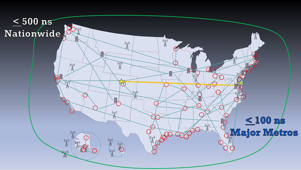
    Congress mandated a GPS backup technology demonstration in 2017, and $10 million was subsequently provided for that purpose. Various internal government delays resulted in the project not getting underway until March 2019. It concluded about a year later.

    On Jan. 14, the Department of Transportation (DOT) posted its 457-page “Complementary PNT and GPS Backup Technologies Demonstration Report” to Congress on its website.

    While some people have been critical, it is important to remember the report documents 11 vendor demonstrations, not engineering tests. Technologies were demonstrated in different locations and under differing conditions.


    There is no silver bullet for meeting the nation’s needs. It must be a system of systems.


    Also, the amount of effort and equipment in the demonstrations depended in some cases upon infrastructure available and the amount of money the government and vendors were able to spend. This meant that at least one technology was “demonstrated” mostly by explaining the concept, and other vendors were able to only partially demonstrate their technologies.

    All of that said, the report offers valuable information about how America should make its national PNT much more resilient and reliable. First, it reinforces DOT’s message that there is no silver bullet for meeting the nation’s needs. It must be a system of systems. Second, the report goes further and says what that system of system should look like: “Those technologies are LF and UHF terrestrial and L-band satellite broadcasts for PNT functions with supporting fiber-optic time services to transmitters/control segments.”

    From a policy perspective, this is a huge step forward. It resolves previous ambiguity and positions the nation to establish a resilient PNT architecture, one that will do more than be a “GPS backup.” It will be an architecture that will better support current applications and better enable emerging ones like autonomy, 5G and “NextG.”

    National Research and Development Plan for Positioning, Navigation, and Timing Resilience

    Published one hour and fourteen minutes before the end of the administration on inauguration day, this plan was mandated as part of the February 2020 Executive Order on responsible use of PNT. By taking a comprehensive look at how we can do better, it provides an interesting outline of the challenges associated with America’s current over-reliance on GPS. While not a policy or directive document, it does suggest two or three departments and agencies that might be tasked with addressing each challenge.

    It also addresses the need for interference detection and monitoring, and diverse sources of PNT.

    U.S. Space-Based PNT Policy (Space Policy Directive 7)

    This directive was published five days before the end of the administration and replaced the previous policy, 2004’s NSPD-39.

    While the old policy calls for performance monitoring of GPS signals, the new one also has investment in interference detection and monitoring as a goal.

    Perhaps the most significant change in the new policy was the absence of the words “backup capability” and the lack of a mandate for DOT to lead its establishment. Yet the policy hammers home multiple times the need for more than GPS as a source of PNT. And it doesn’t abandon the idea of government involvement in making that happen.

    In addition to reinforcing Executive Order 13905 on responsible use of PNT, the directive defined a new (for presidential policies) term. “Alternative PNT Service” was described as “a PNT service that has the capability to operate completely independent of, or in conjunction with, other PNT services.” The directive goes on to say that “Multiple, varied PNT services used in combination may provide enhanced security, resilience, assurance, accuracy, availability and integrity. An alternative PNT service allows a user to transition from the primary source of PNT signals in the event of a disruption or manipulation.”

    And while the policy does not say the government will establish or support an alternative PNT service, it comes pretty close. One of its goals is “Invest in… as appropriate, alternative sources of PNT for critical infrastructure, key resources, and mission-essential functions.

    It goes on to task the departments of Defense, Homeland Security and Transportation with making that happen.

    So “backup” is out, “alternative PNT” is in. We agree words are important and are happy to have the new words. Let’s hope the new administration will match the new words with action (as appropriate).


    Feature image: niarchos/DigitalVision Vectors/Getty Images

  • Editorial Advisory Board PNT Q&A: GPS in popular culture

    Editorial Advisory Board PNT Q&A: GPS in popular culture

    Photo: KenWiedemann/iStock/Getty Images Plus/Getty Images
    Photo: KenWiedemann/iStock/Getty Images Plus/Getty Images

    What is your pet peeve about how GPS/GNSS is portrayed or discussed in the media and popular culture?

    Headshot: Terry Moore
    Terry Moore, professor emeritus, University of Nottingham

    “What really annoys me is the misinformed assumption that SatNav and GNSS are one and the same. There is now a proliferation of ‘Do Not Follow SatNav’ signs [in the United Kingdom], and so many anecdotal stories about accidents caused by drivers blindly following SatNavs in their vehicles. These are almost always due to the deficiencies of the mapping and the route guidance components of the SatNav systems and not due to any problem with GNSS whatsoever. Nevertheless, it is GNSS that takes the blame.”

    Terry Moore
    University of Nottingham


    Headshot: Julian Thomas
    Julian Thomas
    Managing Director

    “In films, you often see what looks like the tracking of a person inside a building using GPS. Yet, this cannot be done currently with satellites and the kind of technology that can track people or objects indoors is highly specialized and localized to that environment.”

    Julian Thomas
    Racelogic Ltd.


    Headshot: Stuart Riley
    Stuart Riley, vice president of GNSS technology, Trimble

    “My pet peeve is the oversimplification of consumer navigation issues. I ran a few searches for ‘GPS fails’ and almost immediately saw images of cars in water and stuck in narrow streets. All too often, this is attributed to a GPS issue or failure. From a consumer perspective, the overall system from maps to satellites is considered GPS. The reality is that GPS (the satellites and control segment) is extremely reliable. Historically, satellite issues have been minimal. The most likely navigation errors are routing errors and old or erroneous maps, coupled with users blindly following the directions, and, to a lesser extent, receiver design issues (e.g., lack of ICD compliance) and harsh conditions (deep urban canyons).”

    Stuart Riley
    Trimble


    Mitch Narins
    Mitch Narins

    “For many, GPS/GNSS remains the miracle cure for all that ails you — for position/surveillance (e.g., ADS-B), for navigation (RNAV and RNP), and for the largest user base, time and frequency. Even while acknowledging the risks, many still treat GPS/GNSS interference as the 500-year flood that will ‘never’ happen in their lifetimes and, if it does, can be excused away as force majeure. It seems that in most of the articles I read it is always a sunny day and GPS/GNSS works perfectly. The need to incorporate resiliency is never emphasized. Nobody would buy a car without a spare tire. Isn’t it time for GPS/GNSS users to recognize the need and insist that an appropriate PNT ‘spare’ be included in the deal?”

    Mitch Narins
    Consultant


    Headshot: F. Michael Swiek
    Headshot: F. Michael Swiek

    “We can chuckle while watching spies, super sleuths, and adventurers receive GPS positions in incredibly challenged environments — even in caves. My main beef is that nowhere is any mention made of who operates GPS. Instead, GPS is treated as an assumed given, embedded in a smart device, constantly and reliably available on demand anywhere and under all conditions. It is about time recognition and credit is given to those who actually make the miracle of GPS happen.”

    Michael Swiek
    GPS Alliance

  • LORAN-5G: Paper envisions new use for venerable tech

    LORAN-5G: Paper envisions new use for venerable tech

    Image: KENGKAT/iStock/Getty Images Plus/Getty Images
    Image: KENGKAT/iStock/Getty Images Plus/Getty Images

    A new paper by two Qualcomm engineers imagines restructuring Loran technology to more easily incorporate timing signals into telecommunication systems.

    The paper, titled simply “LORAN-5G,” was authored by Guttorm Opshaug and Dave Tuck. It envisions moving away from legacy pulsed signals to a more continuous wave form which would allow significantly lower power transmissions.

    According to Opshaug, “Another big advantage that may not be as apparent, is the built-in orthogonality in the signal structure of OFDM. This means that a receiver would be able to detect very weak signals from distant towers at the same time as receiving signals from a very strong close tower. Such robustness towards near-far effects is critical for terrestrial navigation use.”

    Another change would be a marked increase in the capacity of the Loran data channel to more than 2.6kbps. “This could open opportunities for additional service options and/or reduce latency of existing ones,” according to Tuck.

    UrsaNav CEO, Charles Schue, expressed great interest in Qualcomm’s paper. UrsaNav is a long-time provider of Loran equipment and consulting. “The intersection of PNT and communications discussed in the Qualcomm paper is exactly what is needed to ensure that PNT systems evolve and stay relevant,” he said. “In fact, we build our software defined transmitter and receiver solutions to specifically include the ability to produce and use these types of signals.” A Cooperative Research and Development Agreement between UrsaNav and the Department of Homeland Security demonstrated these type of potential upgrades in 2012.

    This paper is the first publicly released effort examining the use of Loran technology to support 5G telecommunications. The general concept was discussed in a 2016 paper by the Alliance for Telecommunications Industry Solutions’ (ATIS) Synchronization Committee. Based on the paper, ATIS in 2017 encouraged members of Congress to pass legislation that would become the National Timing Resilience and Security Act of 2018 (NTRSA).


    There are tradeoffs. Opshaug and Tuck’s proposal would replace the legacy Loran standard signal with a new one.


    “I was in the midst of developing proposals for the 3GPP standards organization when I first heard about the NTRSA,” said Opshaug. “5G seemed like exactly the kind of critical infrastructure that could benefit from a backup timing solution.”

    “We wanted to bring some of the ideas used to develop 5G position and timing to Loran,” said Tuck. “Using Loran as the timing synch could enable 5G to improve overall infrastructure resilience.”

    Yet, as with most things, there are tradeoffs. Opshaug and Tuck’s proposal would replace the legacy Loran standard signal with a new one. This would require redesign of receivers and some transmitters. The proposal could support denser deployments to further improve resiliency.

    “The new signals seem incompatible with existing receivers and Loran networks,” according to Professor Jiwon Seo of South Korea’s Yonsei University. South Korea is upgrading its Loran-C network to the eLoran standard. The new South Korean system will be compatible with neighboring Russian and Chinese Loran systems, so users will be able to benefit from signals anywhere in East Asia. Until 2010 signals from the U.S. Loran system cooperated with these networks as part of the Far East Radionavigation Service (FERNS).

    Navigation expert Logan Scott is intrigued by the proposal but observes that more work needs to be done. “This is an interesting waveform,” he said, though he had questions about the propagation channel, antennas, and possible distortion.

    The authors acknowledge that much more needs to be done, including better determining timing and positioning accuracy.

    Yet they and others see potential in combining the very different phenomenologies of low frequency, 100KHz Loran and 5G telecommunications which typically operate in the gigahertz range.

    Opshaug and Tuck’s paper LORAN-5G can be accessed here.

  • DSI to host 2021 Assured PNT Summit in April

    Logo: Defense Strategies Institute

    The Defense Strategies Institute’s (DSI) Assured Positioning, Navigation & Timing (PNT) Summit will take place April 14-15 at the Mary M. Gates Learning Center in Alexandria, Virginia.

    According to DSI, the event will bring together members of the military services, Department of Defense (DoD), federal government, industry and academia in a “town hall” style forum to discuss how important GPS and space-based PNT systems are to the overall resilience of the warfighter, as well as critical infrastructure across the United States and abroad.

    The 2021 Assured PNT Summit also will offer senior-level insight into how the U.S. military has been a leader in integrating PNT into its everyday operations and how such capabilities have become vital to the military’s ability to shape the global arena, deter aggression, and fight and win wars.

    Confirmed speakers for this year’s event include William Nelson, SES, director, APNT CFT, Army Futures Command; Brig. Gen. Heather L. Pringle, USAF, commander, Air Force Research Laboratory; Anthony C. Smith, SES, director, C3I, DoD CIO; Richard De Fatta, SES, director, U.S. Army Space & Missile Defense Center of Excellence; Cordell “Del” DeLaPena, SES, program executive officer for Space Production Space & Missile Systems Center, USAF; Harold W. Martin III, SES, director, National Coordination Office for Space-Based Positioning, Navigation and Timing; and Col. Jason Joose, USA, chief of staff/APNT signature effort lead, Army Futures Command.

    A number of topics will be covered at the 2021 Assured PNT Summit, including:

    • Leading current DoD initiatives toward integrating new PNT capabilities to help the Warfighter remain resilient in a dynamic threat environment;
    • Synchronizing PNT, navigation warfare and space capability development efforts across the Army to help reduce key capability gaps;
    • Delivering resilient, affordable and sustainable space capabilities such as modernized GPS to enhance warfighter superiority;
    • Providing alternate PNT for potential GPS-denied environments;
    • Accelerating the implementation of cutting-edge Air Force research projects such as NTS-3 GPS Satellite to provide the most value to the warfighter;
    • Developing critical PNT-related products to enable a Soldier’s PNT capabilities in all warfighting domains;
    • Overseeing the collection of GPS-related information from multiple federal agencies in an effort to improve and maintain space-based PNT capabilities;
    • Advancing efforts to provide GPS protection for all naval air platforms; and
    • Detailing the Department of Homeland Security plan to test the vulnerabilities of critical infrastructure systems, networks and assets if PNT services were to be disrupted or manipulated.

    Register for the event here.

  • NovAtel ships GPS anti-jam GAJTs worldwide

    NovAtel ships GPS anti-jam GAJTs worldwide

    NovAtel’s GPS Anti-Jam Technology (GAJT) product lines achieved a milestone of thousands of units shipped worldwide in 2020. Despite COVID-19, 2020 has proven to be one of NovAtel’s most successful years in protecting positioning, navigation and timing (PNT) from cyber electromagnetic activities (CEMA) for military and civil organizations, the company stated in a press release.

    Jamming and interference are growing threats, from a crowded RF spectrum to malicious jamming attempts. However, the GNSS market is responding with anti-jam technologies. Across the world — on land, in the air and at sea — NovAtel customers use GAJT to protect their GNSS navigation and precise timing receivers from intentional jamming and unintentional interference.

    The GAJT portfolio includes commercial off-the-shelf solutions with short order lead times for rapid deployment. The range of products can be readily integrated into new platforms or retrofitted into legacy fleets.

    Photo: Hexagon | NovAtel
    Photo: Hexagon | NovAtel

    The GAJT-710, its smaller counterpart GAJT-410 and the GAJT-AE variants are used worldwide to protect PNT against jamming and interference no matter the environment.

    Beyond defense, GAJT enables users to be proactive against cyber electromagnetic activities using situation awareness technology to indicate the presence and direction of jamming signals.

    “Jamming and interference are growing threats worldwide. GAJT protects our customers no matter where they operate,” said Steve Duncombe, executive VP of Aerospace and Defense at NovAtel. “We’re proud to achieve this milestone during a challenging 2020 and will continue delivering assured positioning in our customers’ critical applications with extremely short delivery times.”

  • ION changes date for 2021 Joint Navigation Conference

    ION changes date for 2021 Joint Navigation Conference

    Logo: ION JNC

    The Institute of Navigation (ION) has changed the dates for the 2021 Joint Navigation Conference (JNC) to Aug. 24-27 at the Northern Kentucky Convention Center in Covington, Kentucky.

    The conference will be hosted by the Military Division of the Institute of Navigation for the Department of Defense and Department of Homeland Security. Its theme will be “Enhancing Dominance and Resilience for Warfighting and Homeland Security PNT.”

    The FEDCON U.S.-only sessions will take place at the Northern Kentucky Convention Center in Covington, Kentucky, Aug. 24-26; and the U.S.-only secret sessions will be held at the Air Force Institute of Technology, WPAFB in Dayton, Ohio, Aug. 27. The JNC 2021 exhibit hall will be open Aug. 25-26.

    This decision to change the date and host the conference in person was made in consideration of the forecasted Spring 2021 global accessibility of the COVID-19 vaccine.

    “We have made this decision to ensure our attendees feel safe gathering at ION events,” said Lisa Beaty, executive director at ION. “There appears to be good reason for optimism that our military PNT community will be able to gather again soon.”

    According to ION, JNC is the largest U.S. military positioning, navigation and timing (PNT) conference of the year with joint service and government participation. The event focuses on technical advances in PNT with emphasis on joint development, test and support of affordable PNT systems, logistics and integration.

  • MGUE Increment 2 contracts awarded to BAE, L3 and Raytheon

    MGUE Increment 2 contracts awarded to BAE, L3 and Raytheon

    The United States Space Force’s Space and Missile Systems Center awarded the Military Global Positioning System User Equipment (MGUE) Increment (Inc) 2 Miniature Serial Interface (MSI) with Next-Generation Application Specific Integrated Circuit (ASIC) to BAE Navigation & Sensor System, L3 Technologies (now L3Harris) and Raytheon Technologies.

    According to the U.S. Space Force, the three MSI contracts are valued at $552 million and will be executed as Middle Tier Acquisition rapid prototyping efforts. The first delivery is scheduled for early fiscal year 2026.

    Enhanced processing and security features associated with M-code drove the decision to develop a smaller and more powerful receiver card for handheld and dismounted applications, the U.S. Space Force said. The MSI with Next-Generation ASIC will enable Military-Code GPS receiver production, mitigating the obsolescence issue of current ASICs and providing significant security and performance improvements for GPS-enabled weapons systems. MGUE Inc 2 will be compatible with all existing and future spacecraft and ground systems, it added.

    MGUE Inc 2 enables military GPS user equipment to receive allied GNSS positioning, navigation and timing (PNT) signals to increase both the resilience and capability of military PNT equipment, and deter attacks on GPS, the U.S. Space Force said. These signals will supplement GPS-based PNT in accordance with Department of Defense policies regarding usage of allied GNSS signals, ensuring identification and mitigation of cyber risks, and compatibility with existing PNT equipment.


    Feature photo: EvgeniyShkolenko/iStock / Getty Images Plus/Getty Images

  • Orolia unveils M-code-enabled mobile timing and sync solutions

    Orolia unveils M-code-enabled mobile timing and sync solutions

    Flexible, resilient military PNT designed for every military environment

    Photo: OroliaOrolia, through its Orolia Defense & Security business, has announced the availability of M-code military GPS receivers in its resilient PNT products and solutions, including M-code-enabled mobile mission timing and synchronization platforms.

    M-code capabilities further enhance Orolia’s Versa mobile PNT platform for rugged, small SWaP-C requirements and Orolia’s flagship SecureSync resilient time and frequency reference solution — the first Defense Information Systems Agency (DISA) approved time server.

    M-code is a military signal used in the L1 and L2 GPS bands and is required by congressional mandate for U.S. Department of Defense (DoD) military operations. It is designed to enhance positioning, navigation and timing (PNT) capabilities and improved resistance to existing and emerging GPS threats, such as jamming and spoofing.

    M-code offers several operational benefits, including a higher power signal with improved resistance to jamming and interference; advanced security features to prevent unauthorized access or exploitation; and improved message formats and signal modulation techniques for faster and more accurate performance.

    “As threats against GPS increase, military forces will need M-code capabilities on mobile PNT systems to ensure continuous operations wherever they go,” said Hironori Sasaki, president of Orolia Defense & Security. “Orolia is proud to continue to support Department of Defense initiatives to ensure that warfighters have the most secure, reliable and accurate positioning, timing and synchronization solutions in any environment.”

    From resilient PNT solutions to GPS/GNSS simulation, interference detection and mitigation, Orolia provides end-to-end NAVWAR and resilient PNT solutions to protect, augment and strengthen military systems for GPS-denied environments.

  • CGI to develop service to alert UK of GNSS disruption

    CGI to develop service to alert UK of GNSS disruption

    The European Space Agency (ESA) has awarded a contract to London-based CGI to develop a GNSS Event Notification Service (GENS) capable of monitoring the United Kingdom (U.K.) GNSS spectrum to enable effective alerting and reporting of position, navigation and time (PNT) disruption.

    GENS will integrate CGI’s PNT Incident Event Monitoring (PNTIEM) system with existing U.K.-developed sensors from Ordnance Survey’s network (OS NET) of GNSS receivers and GMV NSL’s Detector, GISMO and Strike 3 interface technologies.

    Bringing together existing systems will build on proven technologies, reducing the cost of development of a large-scale monitoring network while providing the ability to introduce new services for detecting GNSS events and disruption, according to a CSI press release.

    Supported by the OS and GMV NSL, CGI will lead the delivery of GENS using an agile software delivery experience, supported by system design and DevSecOps development and integration skills. An open interface will be offered for future providers of GNSS measurements or spectrum event data.

    Alongside the GENS system technical delivery, the National Physical Laboratory (NPL) will develop a GNSS guidance document in partnership with U.K. government departments, agencies, CNI operators, professional institutes, academic institutes and commercial organizations to enable informed requirements development, procurement, deployment and support of HMG GNSS-reliant services.

    Reviewed alongside events identified by GENS, the combined offering will highlight and inform stakeholders on risks posed by the loss of PNT services as identified by the PNT Strategy Group Interim Report in April 2020.

    GENS will also respond to HMG’s “Satellite-derived time and position: a study of critical dependencies” report which identified the need for mitigation to GNSS disruption and estimated the economic impact to the U.K. economy of a five-day disruption to GNSS at £5.2 billion.

    The full GENS system will enable users across both commercial and public sector services to subscribe to be informed of both GNSS quality and interference events for regions of interest. By focusing on these events and the improved understanding of the risk posed by disruption, stakeholders will be better informed to enable them to build system resilience or to respond to the disruption of GNSS within the U.K.

    ‘‘Detecting and monitoring GNSS is core to better understanding the scale and risk posed by PNT disruption in the U.K. and across all ESA member states,” said Rafael Lucas Rodriguez, technical officer for GENS, European Space Agency. “ESA is supporting CGI to develop effective tools enabling a system to be created utilizing previous ESA and UK HMG work. This will bring direct benefits for U.K. public and private stakeholders.”

    “The U.K. is a leading investor in GNSS research,” said Andy Proctor, U.K. lead delegate to the ESA Programme Board for Navigation. “Understanding GNSS spectrum quality is vital for the stability of PNT services in the U.K. This program will help promote and address GNSS disruption affecting PNT services while supporting the U.K.’s thriving space sector and the wider economy.”

    “This is an exciting project that brings together CGI’s navigation and spectrum domain expertise supported by scaled agile and DevSecOps delivery experience,” said John Hanley, vice president of secure and assured space solutions at CGI in the U.K. “After talking to both public and private stakeholders for GNSS, it became clear that one of the initial challenges is understanding the scale of PNT disruption. GNSS services touch every part of society across finance, utilities, transport and defense and need to be protected.”

    CGI has been delivering complex, mission-critical space software systems for clients across Europe, Asia and North America, supporting satellite navigation, communications, operations and space enabled applications for more than 40 years.


    Feature photo: alice-photo/iStock/Getty Images Plus/Getty Images

  • Precise time for all: Paper calls for resilient national timing

    Precise time for all: Paper calls for resilient national timing

    Image: RNT Foundation
    Image: RNT Foundation

    A new white paper sponsored by the Resilient Navigation and Timing Foundation (RNT Foundation) discusses the need and implementation of a reliable and resilient national timing architecture that will include space-based assets. This system-of-systems architecture — GNSS, terrestrial eLoran broadcasts and fiber — is essential to underpin today’s technology and support development of tomorrow’s systems, according to the executive summary of A Resilient National Timing Architecture.

    “Everyone in the developed world needs precise time, all the time, whether they know it or not,” said Marc Weiss, one of the paper’s authors and an internationally recognized expert on timing and synchronization. “It is a foundation of every networked technology, digital broadcast, and most navigation systems, to name just a few critical uses.”

    Three Paths to Precise Time

    “Precise time is so important that everyone needs at least three independent methods of getting it. So, if one, or even two, fail it is not a national disaster,” said Pat Diamond, co-author of the paper. “Our proposed architecture calls for precise time via GNSS, terrestrial eLoran broadcasts and fiber.” Diamond is a long-time network designer, developer, and entrepreneur. He is also a member of the U.S. National Space-Based Positioning, Navigation, and Timing Advisory Board.

    Diamond also pointed out that these three methods should be the backbone for timing distribution in the U.S., but won’t be the only methods. “What we are describing is a baseline architecture that will be added to,” he said. “It is a starting point. We envision in the paper additional distribution methods like time from other satellites, user clocks, and so on, all being part of the mix.”

    Government Leadership

    The U.S. federal government has a leadership interest and responsibility in all of this, according to the paper. Nations have long recognized the military and commercial advantages of determining and distributing precise time. Great Britain’s Longitude Act of 1714 was really about developing a chronometer to support safe navigation of Royal Navy and British merchant fleet. In the United States, the U.S. Naval Observatory has been keeping and distributing a national time scale time since 1845.

    “Just because the feds have an important leadership role, doesn’t mean they have to build and own a bunch of systems,” said Dana A. Goward, the paper’s third co-author and executive director of the RNT Foundation. “There are a variety of ways these systems can be established. Public-private-partnerships, subscription contracts like the FAA did with their air traffic ADS-B system, and cooperative agreements are all examples. As we move forward with 5G telecommunications and perhaps even timing and navigation, it will be increasingly important to have a rock solid timing infrastructure to support it all.”

    The National Timing Resilience and Security Act of 2018 requires the U.S. Department of Transportation to establish a terrestrial system to backup GPS timing services by December of this year. While the department does not appear to be on track to meet that goal, it completed a technology demonstration program for GPS backup technologies earlier this year. Two companies demonstrated timing distribution by fiber. Another two demonstrated eLoran.

    Many Pieces Already in Place

    One of the benefits of the proposed architecture is that much of what is called for is already in place, according to the paper. “We already have fiber networks, NAPs (network access points). eLoran is mature and has been deployed by the Brits. And the U.S. government owns enough former Loran-C sites to establish a nationwide eLoran network,” Diamond said. “All we need is a bit of money and some engineering work to put this all together.”

  • GPS/GNSS industry recollections and predictions from the GPS World Editorial Advisory Board

    GPS/GNSS industry recollections and predictions from the GPS World Editorial Advisory Board

    Members of the GPS World Editorial Advisory Board share their memories and thoughts about the GPS industry over the past 30 years.

    Find out what they had to say.

    Stuart Riley: GPS: Obscurity to ubiquity
    John Fischer: Modern miracle brings timing to the ‘Information Superhighway’
    Terry Moore: Transiting to GPS and beyond
    Ellen Hall: History of the GNSS industry and milestones ahead
    Jules McNeff: GPS and GNSS: confronting dual-use realities
    Miguel Amor: Four decades of leadership
    Julian Thomas: From racecars to boundless opportunities
    Alison Brown: NAVSYS’ role in WAAS
    Ismael Colomina: Discovering a new GPS journal
    Greg Turetzky: Putting GPS in smartphones
    Clem Driscoll: The evolution of GPS
    Mitch Narins: What it means to be a Gold Standard
    F. Michael Swiek: Behind GPS is the people


    Feature image: Smithsonian; Charlie Trimble provides the 4000A GPS Locator to the Smithsonian Museum. Introduced in 1984, the Trimble 4000A was the first commercial GPS positioning product.