Tag: PNT

  • World-renowned PNT expert David Last presumed lost at sea

    World-renowned PNT expert David Last presumed lost at sea

    UPDATE: The search was called off on Tuesday afternoon. Additional information is available in this Evening Standard article.


    David Last (Photo: @harriethallphoto via Dana Goward)
    David Last (Photo: @harriethallphoto via Dana Goward)

    Just before 13:00 GMT on Nov. 25, a private plane piloted by David Last, former president of the Royal Institute of Navigation, disappeared from radar and hit the sea approximately two miles off the coast of Wales.

    On-going search and rescue efforts have recovered pieces of wreckage and personal effects.

    “Last was one of the most respected and well-loved figures in the worldwide positioning, navigation, and timing community. His loss creates a hole that cannot be filled,” said Dana Goward, president of the Resilient Navigation and Timing Foundation. “David was a close personal friend. Our grieving will not be brief.”

    According to BBC News, the search for the missing plane and its pilot off the Welsh coast resumed on Nov. 26. North Wales Police said the light aircraft was flying from Caernarfon Airport to the Great Orme, Llandudno, and back on Monday when it disappeared. There were no other passengers and officers were supporting the missing pilot’s family.

    The Maritime and Coastguard Agency said the search has resumed around Puffin Island, near Penmon, Anglesey. A plane carrying a sonar technology camera is searching the area as well as a lifeboat, helicopter and coastguard teams on foot.

    David Last was a U.K. consultant engineer specializing in radio navigation and communications systems, professor emeritus at the University of Bangor, Wales, and past president of the Royal Institute of Navigation.

    He also was a member of the expert panel and co-author of the January 2018 Blackett Report.

  • U.S. Air Force to put NTS-3 into geostationary orbit

    U.S. Air Force to put NTS-3 into geostationary orbit

    History of the program: NTS-1, 2 and 3. (Illustration: Lt. Jacob Lutz, AFRL Space Vehicles Directorate)
    Satellites NTS-1, 2 and 3. (Illustration: Lt. Jacob Lutz, AFRL Space Vehicles Directorate)

    The Air Force seems to be on track to experiment with positioning, navigation and timing (PNT) satellites in geostationary orbit.

    The idea for Navigation Technology Satellite 3 (NTS-3) has been around for a while, and notionally scheduled for launch in 2023.

    Recently, the Air Force announced it will engage in the Vanguard science and technology program to quickly bring capabilities to the service. It is unclear whether or not this will ensure the 2023 launch takes place, or if the program will be accelerated for an earlier launch.

    NTS-3 will include:

    • Experimental antennas
    • Flexible and secure signals
    • Increased automation
    • Use of commercial assets
    • A new digital signal generator that can be reprogrammed on-orbit, enabling it to broadcast new signals
    • Digital signatures for detecting spoofing attacks
    • Steerable regional beams in multiple frequencies and signal codes
    • “Bounce-Back” capabilities for recovery from attack, solar and other disruptions

    The NTS-3 marks the first time in 40 years the service has launched such a pioneering effort, following GPS.

    The Department of Defense PNT Strategy calls for future military efforts and the results to be classified, making it unlikely that NTS-3 experiments will benefit the majority of PNT users in the civil sector.

    NTS-3 Fact Sheet from ARFL.

  • China leads world with plan for ‘comprehensive’ PNT

    China leads world with plan for ‘comprehensive’ PNT

    Speaking at the annual Stanford Positioning, Navigation, and Timing (PNT) Symposium, a Chinese representative described how her nation is building the world’s first resilient and robust, and, in her words, “comprehensive” PNT architecture.

    Xiaochun Lu presents at Stanford PNT Symposium on Oct. 30, 2019. (Photo: Stanford University)
    Xiaochun Lu presents at Stanford PNT Symposium on Oct. 30, 2019. (Photo: Stanford University)

    Xiaochun Lu of China’s National Timing Service Center described a multi-source PNT system that will be “more ubiquitous, more integrated, more intelligent.”

    Centered around continually upgraded BeiDou GNSS at medium earth orbit (MEO), it will incorporate a wide variety of other PNT sources. These will include a PNT constellation at low earth orbit (LEO), Loran-C, inertial sensors, and systems like quantum navigation that have yet to be developed.

    A new PNT constellation at LEO was mentioned several times in the presentation according to Rich Lee, CEO of iPosi, who attended the symposium. Lee has advocated the benefits of LEO PNT and suggested the U.S. should pursue such a system to augment GPS.

    Research has shown that received signals from PNT constellations at LEO will be stronger and more difficult to disrupt than those from MEO. When combined with MEO PNT signals, they will also enable much more precise positioning.

    In discussions after her presentation, Lu indicated that China has an application pending at the ITU for 120 LEO PNT satellites flying at 700 km.

    Also noteworthy was inclusion in the architecture of China’s existing Loran-C terrestrial PNT system. China has operated this system for decades and regularly coordinates its integrated use with Russian and South Korean systems as part of the Far East Radio Navigation Service (FERNS).

    Xiaochun Lu discusses China’s Comprehensive PNT Plan with Rich Lee of iPosi and Logan Scott of Logan Scott Consulting at 2019 Stanford PNT Symposium. (Photo: Stanford University)
    Xiaochun Lu discusses China’s Comprehensive PNT Plan with Rich Lee of iPosi and Logan Scott of Logan Scott Consulting at 2019 Stanford PNT Symposium. (Photo: Stanford University)

    The United States terminated Loran-C service in 2010 over the objection of its national PNT advisory board. Europe’s Loran system was taken off the air at the end of 2015. This was despite the United Kingdom’s implementation of a more accurate and automated eLoran version at the beginning of that year.

    Today the United States is in the process of establishing a terrestrial backup system for GPS timing that could be expanded to include positioning and navigation services.

    Europe has acknowledged that GNSS alone is insufficient for critical and safety of life applications. Officials are examining what that means in terms of systems required.

    China”s announcement at Stanford is the first for a plan to build a comprehensive national PNT architecture.

    Graphic: Xiaochun Lu, China National Timing Center
    Graphic: Xiaochun Lu, China National Timing Center

    Both Europe and the United States have published radionavigation plans, though these tend to be more descriptions of current systems than forward looking and actionable plans.

    The United States published a “National Positioning, Navigation, and Timing Architecture Study” in 2008. Little action was ever taken to implement its recommendations. A graphic from this document was included in Lu’s Stanford presentation indicating that the U.S. study may have helped inspire and motivate China’s plan.

    Xiaochun Lu presents at Stanford PNT Symposium on Oct. 30, 2019. (Photo: Stanford University)
    Xiaochun Lu presents at Stanford PNT Symposium on Oct. 30, 2019. (Photo: Stanford University)

    In August 2019, the U.S. Department of Defense publicly released its PNT strategy. It is similar in many ways to the Chinese plan described by Lu, calling for the use of multiple and diverse sources of PNT. As part of this, Army Futures Command is working with the University of Texas to leverage for PNT thousands of yet-to-be-built communications satellites planned to be deployed at LEO.

    U.S. military PNT efforts, though, are unlikely to help protect the American populace. The defense department strategy says that civil use of GPS has hindered the ability to leverage it for military purposes. Future U.S. military PNT systems will be “increasingly classified” and therefore not available for civil use.

  • First Fix: The PNT enterprise is real

    First Fix: The PNT enterprise is real

    Jules McNeff
    Jules McNeff

    Guest column by Jules McNeff
    Consultant and GPS World Editorial Advisory Board member

    GPS World publications are evolving, as this new column confirms. And the PNT world itself is evolving, first with the emergence of GPS in the 1990s, next with its universal adoption and duplication by others, and now with its foundational role in PNT-enabled applications for technologies of the 2020s and beyond.

    Millions of people have grown up in a world where GPS-enabled PNT applications pervade their daily lives, and mostly for the better. But GPS is no longer the only face of PNT around the world, though it is still the best known even as other space-based systems from international providers have joined the party.

    From its infancy, GPS was married with inertial systems and clocks. For a short time, GPS emergence stymied the commercial development of both, but as the viability of the marriage was validated, development turned toward miniaturization of the combination and adding more pieces as well.


    It is now clear that GPS was the spark, and a multi-faceted PNT enterprise is the new reality.


    Because of its free availability, GPS has been the foundational element in most of these integrated applications, and without GPS, many will not work as well — or at all. Consequently, dependence on GPS for efficient operation of many PNT-related activities has become a de facto reality. GPS timing is at the heart of interoperable telecommunications and data networks (most notably the internet) and of modern power grids. GPS positioning was the catalyst for adoption of the U.S. National Grid as a federal spatial interoperability standard for search-and-rescue and emergency response and by the SAE as a standard for commercial land mobility as well.

    However, dependencies create vulnerabilities, and over-reliance on GPS has been cited as a potential Achilles heel for both national security and economic critical infrastructure. Efforts have been under way for several years by the U.S. Air Force to strengthen all aspects of GPS and, more recently, much attention has focused on making use of complementary technologies to increase the resilience and performance of integrated PNT devices.

    Smartphone and autonomous vehicle developers have used such techniques for years to augment GPS for their applications. The awareness of value from ubiquitous access to precise position and time that was awakened by GPS in 1995 has now evolved into an understanding that diverse services from a broader PNT enterprise are necessary to preserve that access with assurance into the future.

    Congress and the DoD have recognized that reality, with Congress directing and DoD implementing a DoD PNT Enterprise Oversight Council to manage future acquisition of PNT capabilities for the military. In August, the Department of Defense (DoD) also released a public version of its Strategy for the DoD PNT Enterprise, highlighting the processes it has created to implement resilient PNT for the Joint Force. Congress and the White House both have also recognized that the imperative for resilient PNT must be extended to domestic critical infrastructure, and this has resulted in direction to civil federal agencies to both strengthen and back up GPS use for their constituencies. It is now clear that GPS was the spark, and a multi-faceted PNT enterprise is the new reality.

  • Satelles completes funding round for secure PNT platform

    Satelles Inc., provider of highly secure satellite-based time and location services, has raised $26 million in Series C funding. C5 Capital led the round, with participation from Iridium Communications and existing investors.

    The new investment brings Satelles’s total funding since the launch of its platform to $39 million and will help the company expand its sales and marketing efforts, broaden its partner network, and accelerate product development.

    In 2016, Satelles demonstrated sub-microsecond timing using its Satellite Time & Location (STL) service with a stand-alone TCXO-based receiver. In February 2018, the company released new tests using configurations with a differential source and with a more accurate OCXO clock, producing timing accuracy of 160 nanoseconds.

    Industry and government requirements for positioning, navigation, and timing (PNT) are expanding at a rapid pace, and the Satellite Time and Location (STL) broadcast signal from Satelles provides assured PNT across a range of applications and at scale.

    “Today’s world runs on systems requiring trusted time and location information, and C5 Capital shares our commitment to make it a more secure and better place,” said Michael O’Connor, CEO of Satelles. “We are delighted that C5 led this latest investment round because they bring great insight into cybersecurity, and their international network is unparalleled.”

    Attacks such as jamming and spoofing — where a radio transmitter near the target is used to interfere with legitimate GPS or GNSS signals — and hacking are becoming more of a threat because of the key role that GPS and GNSS play in the operation of critical infrastructure.

    The STL signal strength is much greater than GNSS because the LEO satellites are much closer. (Slide: Satelles)
    The STL signal strength is much greater than GNSS because the LEO satellites are much closer. (Slide: Satelles)

    According to the company, the Satelles STL platform brings security to telecommunications networks, financial exchanges, electrical grids, maritime transportation systems, and many other sectors that depend on timing or location information.

    Downtime or malfunctions in these systems due to such attacks would be very costly. A June 2019 report sponsored by the National Institute of Standards and Technology estimated a $45 billion loss to the U.S. economy if GPS were to experience a 30-day service disruption.

    The Satellite Time and Location broadcast service from Satelles is encrypted to thwart malefactors aspiring to spoof or otherwise disrupt the STL signal, which is delivered via the low-Earth-orbit (LEO) satellite constellation operated by Iridium, an investor in this financing round.

    “STL addresses a critical and growing need across many applications and industries, so Iridium’s investment in Satelles aligns with our strategic vision,” said Matt Desch, CEO of Iridium Communications. “Satelles’s technology is unique and powerful, and we are proud to host such an innovative service that solves important problems and leverages the unique capabilities of our network.”

    The Iridium satellite constellation-based system offers many advantages:

    • A signal 1,000 times stronger than GPS/GNSS is better at reaching users and facilities in GPS/GNSS-challenged environments such as inside buildings, underground locations, and urban canyons.
    • Overlapping and constantly moving spot beams enable revolutionary cybersecurity solutions that can rely on trusted time and location for authentication and data access.
    • Polar-orbiting, cross-linked satellites ensure truly global coverage.
    • The L-band frequency range allows small, low-cost equipment to receive the Satelles STL signal.

    “The capabilities of Satellite Time and Location are enhanced by the technical and service delivery attributes of low-Earth-orbit satellites,” said Dr. Gregory Gutt, President and CTO of Satelles. “An extraordinary constellation such as Iridium’s gives us an incredible platform from which to deliver our trusted PNT solutions, so we remain committed to LEO technologies going forward.”

    Commenting on the closure of the Series C investment in Satelles, Andre Pienaar, Managing Partner of C5 Capital, said, “Space is a rapidly developing battleground for cyber threats to critical infrastructure, and GPS is unable to meet all these challenges. Satelles has developed a powerful solution which not only prevents attacks but provides a stronger and more effective service through STL. We are pleased to have led this funding round and look forward to working closely with this remarkable business.”

  • US Department of Defense PNT strategy: ‘GPS is not enough’

    US Department of Defense PNT strategy: ‘GPS is not enough’

    • DOD report coverGPS might be interfered with globally
    • Multiple, diverse PNT sources, modular open system needed for receivers
    • Civil use hampering military efforts to leverage GPS for military advantage
    • DoD PNT efforts to be increasingly classified, not shared with civil users

    In August, the United States Department of Defense (DoD) publicly released a version of its “Strategy for the Department of Defense Positioning, Navigation, and Timing (PNT) Enterprise” with the tagline “Ensuring a U.S. Military PNT Advantage.”

    Calling PNT “foundational,” the strategy observes that the U.S. military has over the years structured its weapons systems and business processes around GPS PNT. This has created a tremendous dependence and associated vulnerability.

    Added to this threat is the realization that “At the same time, it is increasingly clear… GPS will be targeted and will not always be available in contested military operating areas, or perhaps globally.”

    Multiple diverse sources of PNT

    One of the primary ways DoD will deal with is this is to access multiple diverse sources of PNT. These will be in a multi-layered architecture of global, regional and local services.

    DOD report figure-architecture

    The strategy envisions GPS, paired with military-grade receivers, as the primary global layer source. It recognizes that allied GNSS will be available, but observes that DoD has not done any accuracy and integrity assessments to determine their usefulness. And, since “…all are vulnerable to the same interference and jamming effects” as GPS, “…other sources of PNT information with different characteristics are necessary.”

    The regional layer is defined by systems that service large areas such as a few countries or even continents. Recognizing that regional sources can be in space, the strategy discusses two low-frequency ground-based systems with characteristics much different from satellites — enhanced Loran (eLoran) and spatial, temporal and orientation information in contested environments (STOIC).

    “Their high power and low frequency enable regional/nationwide coverage, spectrally separate from GPS services, accessible in buildings and under water, and transmitted from dispersed terrestrial locations. Each can be considered as a possible complement to GPS, depending upon operational circumstances and requirements.”

    Short-range radio frequency systems, clock, inertial, sensory and hybrid PNT services integrated with wireless networks are all cited as possible contributors to the local layer of DoD’s PNT architecture.

    Modular, open-systems approach

    Receivers that employ a modular, open-systems approach that can ingest and integrate the various sources of PNT information are needed to take advantage of this multi-source, multi-layer strategy. And integration of the various sources must be seamless and invisible to the user, unless they decide otherwise.

    “The employment of multiple PNT sources should not require user awareness or intervention to switch among alternatives during mission execution unless the user elects that option.”

    A critical need for implementing this approach, according to the strategy, is the establishment of PNT input/output standards. The document notes that candidate standards have been developed, and it is vital to finalize and approve the standards and bring them into operational service as soon as possible.

    Other provisions

    The strategy includes a number of other provisions regarding internal DoD processes, the complicated governance process for PNT within the department, and some complex graphics that may be of interest to the larger PNT community.

    It also sends several messages about the department’s desires, intent and concerns in the world of PNT that are worth noting.

    NAVWAR. The department’s main defensive capability during navigation warfare will be the use of its layered architecture of PNT information and modular, open-systems integration. For offensive operations, it cautions warfighters to not shoot themselves in the foot. PNT is so vital to a wide variety of allied systems, it warns, that denying it to hostiles could do as much damage to friendly forces.

    PNT dominience/superiority. At at time when there are more of China’s brand new BeiDou satellites in the skies of many cities, and China is negotiating with Russia for closer BeiDou/GLONASS integration, the strategy calls for the U.S. DoD to achieve PNT dominance. To date, U.S. PNT leadership has been a big contributor to the nation’s political and military leadership in the world. The strategy seeks to continue this.

    DOD report figureAccelerate M-code receivers. The need to get more M-code GPS receivers into the hands of warfighters is mentioned several times. GPS III satellites have been transmitting M-coded signals that are much more resilient to jamming and spoofing than civil signals since late 2018. These are useless, though, without properly equipped receivers in the field.

    Future support to Civil PNT. The strategy also seems to show the department is distancing itself from support of future civil PNT endeavors. While GPS has been an incredible economic engine and boon to civil users, this has not always been in DoD’s best interests.

    “It must also be recognized that in this context growing civil dependence on GPS services for critical infrastructure and public use will continue to constrain the ability of the DoD to maintain a military PNT advantage from GPS.”

    It goes on to warn that future DoD PNT systems and efforts will not follow the same path to civil-military use as was taken by GPS.

    “DOD must take steps to ensure the civil agencies are aware of and are sensitive to the dual-use implications inherent in GPS and other PNT Enterprise applications. From this point forward, many of the specific PNT capabilities and combinations of PNT capabilities employed by the DoD for military purposes will increasingly be classified.”

    The way ahead for the 99%

    It is clear that the Department of Defense, through the very capable leadership of its CIO, Dana Deasy, has a clear idea of where it is with PNT, its critical challenges, and how to overcome them.

    This does not appear to be the case for those in the federal government charged with safeguarding the interests of civil users. With responsibilities fragmented across a host of departments and agencies, efforts on behalf of the public at large are barely visible compared to those the Defense Department is taking to protect itself.

    According to officials, this may change. They report that leadership of civil PNT within the executive branch is under review with an eye to making it more efficient and effective.

    Perhaps it will result in a PNT strategy for the 99% of GPS users who are not connected with the Defense establishment, making them safer and more secure as well.


    “Strategy for the Department of Defense Positioning, Navigation, and Timing (PNT) Enterprise” is available online.

  • Editorial Advisory Board PNT Q&A: How mapping improves PNT tech

    Editorial Advisory Board PNT Q&A: How mapping improves PNT tech

    How have improvements in mapping data-collection advanced other PNT technologies?

    Photo: Nearmap
    Tony Agresta

    “Real-time positioning, navigation and timing (PNT) benefit from high-resolution aerial maps captured and published on a consistent basis. With sub 3-inch aerial photographs streamed through custom applications or instantly accessible solutions, governments and commercial use cases apply these maps for emergency 9-1-1 dispatch, routing guidance, and new information applications to inform citizens.”
    Tony Agresta
    Nearmap


    Ismael Colomina
    Ismael Colomina

    “In principle, PNT shall be based on linear/angular motion sensors. However, since the origins of aerial triangulation down to contemporaneous hybrid multi-sensor systems, mapping and motion sensors have cooperated in PNT tasks. Current visual- and lidar-odometry are brilliant examples thereof.”
    Ismael Colomina
    GeoNumerics


    Members of the EAB

    Tony Agresta
    Nearmap

    Miguel Amor
    Hexagon Positioning Intelligence

    Thibault Bonnevie
    SBG Systems

    Alison Brown
    NAVSYS Corporation

    Ismael Colomina
    GeoNumerics

    Clem Driscoll
    C.J. Driscoll & Associates

    John Fischer
    Orolia

    Ellen Hall
    Spirent Federal Systems

    Jules McNeff
    Overlook Systems Technologies, Inc.

    Terry Moore
    University of Nottingham

    Bradford W. Parkinson
    Stanford Center for Position, Navigation and Time

    Jean-Marie Sleewaegen
    Septentrio

    Michael Swiek
    GPS Alliance

    Julian Thomas
    Racelogic Ltd.

    Greg Turetzky
    Consultant

  • SMDC takes lead in Army’s navigation and PNT operations

    SMDC takes lead in Army’s navigation and PNT operations

    News from the U.S. Army Space and Missile Defense Command/Army Forces Strategic Command

    The secretary of the United States Army has designated the U.S. Army Space and Missile Defense Command/Army Forces Strategic Command as the Army’s representative to identify and advocate for positioning, navigation and timing (PNT) information as well as establish and formalize joint navigation warfare, or NAVWAR, requirements.

    “Navigation warfare is really about taking a look at different position, navigation, and timing signals and figuring out how the signals flow; the potential for adversaries to disrupt our ability to use them in the future; and how can we not only protect ourselves from the enemy denying us with those abilities, but also how can we do the same to our enemies and affect them and disrupt them in a multi-domain operational environment,” said Col. Timothy G. Dalton, USASMDC/ARSTRAT U.S. Army Training and Doctrine Command, or TRADOC, Capabilities Manager for Space and High Altitude, or TCM SHA.

    Soldiers in the field learn how to operate in a NAVWAR environment. (Photo: U.S. Army)
    Soldiers in the field learn how to operate in a NAVWAR environment. (Photo: U.S. Army)

    What NAVWAR Does. NAVWAR allows the Army to take deliberate defensive and offensive actions to assure U.S. forces PNT information through coordinated employment of space, cyberspace and electronic warfare operations. PNT data enables the Army to precisely move, shoot and communicate; extend its operational reach; control the tempo of operations; and perform mission command, all without adversarial interruption.

    NAVWAR capabilities include electronic protection which includes systems and capabilities required to defend platforms and systems against electronic acts in the GNSS electromagnetic spectrum.


    The Army has more than 250,000 GPS-dependent systems.


    Additionally NAVWAR provides electronic support to sensors and software used to search for, intercept, identify, locate or localize, and report sources of intentional and unintentional radiated GNSS electromagnetic interference for mitigation and planning future operations.

    NAVWAR can also provide electronic attack with capabilities to seize and sustain the initiative by actively degrading or denying the GNSS electromagnetic spectrum to adversaries in multi-domain operations.

    The Army is dependent on the use of this data with a typical brigade combat team depending on more than 28 different systems and 600 total systems that leverage PNT. The Army has more than 250,000 GPS-dependent systems.

    “As the Army goes forward in multi-domain operations, what we see the battlefield becoming is a contested environment,” Dalton said. “What that means is there are adversaries that will look to challenge the United States across all operational phases and domains. These enemies will have the capability to disrupt signals, like GPS, that can impact a wide range of military and civilian activities.

    New NAVWAR Concept. SMDC is developing a TRADOC-sponsored Army NAVWAR concept that will be used to establish a baseline for how the Army will execute the NAVWAR fight.

    The Army is highly dependent on the use of GPS-delivered PNT data. NAVWAR prevents the use of GPS by hostile forces while ensuring unimpeded use for U.S. forces and allies.

    “In the command’s advocacy role we work with the joint and Army communities to examine what the Army needs to be able to accomplish the mission through navigational warfare,” Dalton said. “We work with a community of interest to determine the requirements that will build capability and reduce shortfalls in this mission area.

    “This includes activities like updating doctrine, our organizational structure, ability to train the force, and ultimately determine if we need additional equipment, or holistic solutions to protect capabilities and disrupt the enemy on the navigation warfare side,” he added.

    Training and Research. SMDC, in conjunction with U.S. Forces Command and the Joint Navigation Warfare Center, supports training events under degraded GPS conditions. The goal is to enable tactical formations to develop and train tactics, techniques and procedures that enable Army formations to work.

    “We help develop and focus the capability requirements for the Army,” Dalton said. “But we are integrating with a larger community, led by the Assured Positioning, Navigation and Timing Cross-Functional Team that is focused on modernizing the Army in this mission area.”

    SMDC is the Army lead for institutional unity of effort on NAVWAR with several research, development, test and evaluation and capability integration efforts working on the issue independent of one another.

    “It is definitely an exciting time for NAVWAR,” Dalton said. “The Army, services and Department of Defense, as a whole, have started to embrace the importance of this mission area and understand the competitive advantage the U.S. and our partners can gain while denying the adversary the ability to conduct operations with respect to navigational warfare.”

  • How resilient PNT protects global networks from attack or failure

    How resilient PNT protects global networks from attack or failure

    Time, time, time… See what resiliency brings

    With the smartphone revolution, we are increasingly reliant on today’s global technology networks. The importance of protecting data centers and mobile devices with resilient PNT can’t be overstated. But what is the best way to accomplish this?

    By Rohit Braggs, Orolia

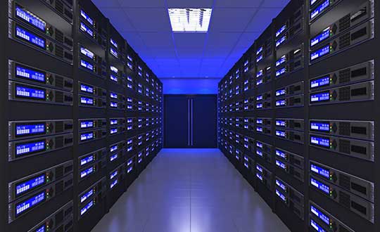
    Connected devices and cloud applications are the primary technology sources for most people today, and an exponentially growing number of those devices are connected to data centers in some way. Across the world, you can drive past countless acres of data centers that are storing, updating and retrieving the world’s data.

    [Editor’s note: A complimentary webinar on Thursday, June 27, “Advanced Simulation Test Systems for Controlled Reception Pattern Antennas,” covers much of this material in greater technical detail. The full webinar is also available for download and viewing after that date.]

    GNSS signals localize and timestamp the data collected from connected devices scattered across the world in diverse time zones and locations. They also provide the critical time synchronization that supports high-efficiency data storage, routing and exchanges across multiple data centers in various locations.

    It is essential to protect data centers and their GNSS signal connections from system failure, jamming, spoofing, interference and denial of service. As the reliance on GNSS signals and the number of connected devices grow, so too does the threat of GNSS failure. False or unavailable positioning, navigation and timing (PNT) information at any point within this network can compromise security and completely disrupt user service.

    This article explores the role of data centers and how their constant connection to devices enables almost every digital technology that we use today. It identifies key reasons why we should protect this interconnected data system from GNSS signal interference and disruption, in addition to providing information on how to ensure continuous signal monitoring and protection with a practical, cost-effective approach.


    See also:

    The latest tech fights for GNSS resilience

    Is internet time good enough for cybersecurity?


    Global Technology Networks

    Data centers and connected devices affect nearly every aspect of our digital lives, from cloud software and applications to mobile phones and laptops. They store our personal documents, photo libraries and other priceless personal data. They also keep track of business documents, software licenses and other essential business information. In critical infrastructure, they support the daily operations of society’s most important services such as public utilities, banking and financial transactions, telecom, security, medical and defense systems, among others.

    Data centers use timestamps as a key mechanism to store, organize and retrieve data. In addition to categorizing data by authorized users and other relevant identification information, the timestamp enables data centers to monitor revisions and retrieve the most recent version of the data.

    A good example of timestamped data use is in cloud-based applications, accessed simultaneously by hundreds of thousands of users. In such environments, data is dynamic and changing frequently, which can lead to data conflicts. With accurate, reliable timestamps, a cloud-based application can resolve such conflicts to determine the order in which the data was received.

    Why do we need to protect data centers and connected devices from GNSS signal interference?

    GNSS signals are the quiet facilitators of many of our day-to-day tasks. In discussing why it is important to protect these signals, it is often easier to imagine what would happen without the accurate, reliable PNT information that these signals provide.

    We need to understand two key pieces of information to operate systems: location and time. We need to know exactly where data or assets are located, and we need reliable, consistent time references to synchronize the movement of data and assets for system operations.

    There are many documented examples of GNSS signal jamming, spoofing and denial of service attacks worldwide, and these are easy to find with a simple internet search. Here are a few examples of what can happen when the signal is compromised at a mobile or fixed location, but not taken offline. The user might still see that the signal is working, with no indication that the two critical pieces of information, location and time, are being disrupted:

    • Imagine that the timestamp on a security camera system was spoofed to show a different time than the actual time. Incorrect or missing timestamps on video from surveillance systems is the most common reason for video evidence being deemed as inadmissible in a court of law. A bad timestamp corrodes the credibility of the video as irrefutable evidence and makes it easy to dispute.
    • Imagine that a bad actor spoofed the time used by financial trading systems. Since these critical systems rely on GNSS-based time and synchronization, an attack on their underlying timing infrastructure could significantly impact the market and cause billions of dollars in damage.
    • What if the GPS guidance system on your phone or vehicle gave you wrong directions? You could get lost in a wilderness or encounter dangerous driving conditions by trusting the route shown on your device.
    • What if more people started using commercially available jammers? Some truck drivers have already been caught using unauthorized GPS jammers in their vehicles to avoid monitoring by their employers. In many cases, these deevices have affected nearby critical systems such as air traffic control, financial data centers, and other critical operations simply by being driven past with active jammers. The incidence of these disruptions is on the rise.
    • Imagine a secure facility using an access control system that is set to automatically lock and unlock doors at a specific time. If someone spoofed the time used by that system, they could trick the doors into unlocking and gain entry.

    We are also seeing an uptick in unintentional or environmental signal interference, which can occur in high-density development areas where various wireless transmitting systems can interfere with GNSS reception.

    Which technology solutions are best suited to protect data centers and GNSS signals?

    The first step toward protecting a GNSS-reliant system is to test the system for vulnerabilities. GNSS simulators and testing protocols can simulate a spoofing, jamming or denial of service attack to evaluate how the system responds to each situation. Knowing the system’s unique challenges and weaknesses can help resilient PNT experts design the best solution for that system.

    One of the most common configurations for a fixed site location includes a highly reliable network time server to ensure that accurate timestamps are applied to each data point. A time server that can identify erroneous or spoofed GNSS signals is recommended for any critical application. In addition, a time series database could be installed to categorize and organize the time-stamped data, while identifying any irregularities in the data.

    Once you have reliable timestamps and time server management systems, you also need to continuously monitor the signal to detect interference and raise an alarm. A GNSS signal monitoring system can let you know the minute your system is under attack. A GNSS threat classification system can identify the type of threat and mitigate it, depending on the nature of the threat, by filtering the signal to neutralize the interference.

    The best way to prevent GNSS jamming is to deny interfering signals access to the receiver in the first place. Smart antenna technology focuses antenna beams to track the good signals from the satellites and reject the bad signals from interferers. Less sophisticated solutions such as blocking antennas can be employed to reject terrestrial-based interference, which is where most GNSS interference sources exist, and they provide a good first-level protection.

    Continuous PNT access can also be achieved by using an alternative signal that operates separately from GPS/GNSS and is less vulnerable to the signal attacks that plague GNSS signals.

    Emerging PNT Technologies

    Over the next few years, new applications of mobile PNT data will further emphasize the need to maintain system integrity against threats. Here are a few examples of emerging technologies.

    5G is here for mobile Internet and telecom service, yet with the specific need for microsecond-level synchronization, the challenge to protect the fidelity of the time used in these systems will become more important.

    With rising awareness of the need to protect GNSS signals against threats, individuals will need to determine how they can protect their own GNSS-reliant systems as they navigate the Internet of Things and GIS enabled e-commerce. Personal PNT protection is an emerging technology area that could help protect people and their mobile devices on an individual basis, to ensure GNSS is there when it matters. Whether you are embarking on a remote hiking or sea expedition, sharing your coordinates with an emergency dispatcher after an accident, or simply trekking your way through a new city late at night, having resilient GNSS signal support is becoming a necessity.

    Alternative signals are now available, and these new signal options, such as STL (Satellite Time and Location), could play an important role in providing better privacy and security functionality. This signal diversity will help protect against threats and interference by adding resilience to the device’s ability to receive reliable PNT data.

    Another exciting technology development is the concept of smart cities, where technology has the opportunity to increase efficiency, reduce waste and provide many conveniences for the public. As we automate more city systems, it is essential to protect these systems from both accidental and malicious GNSS-based interference to ensure that these systems can make decisions based on reliable, precise PNT data.

    Intelligent Transportation Systems (ITS) have the capacity to transform how people and freight travel today, saving lives and bringing goods to market more efficiently than ever. The need to know exactly where a driverless vehicle is in relation to other vehicles at any moment in time is just one of the resilient PNT technology requirements that will rely on GNSS signals.

    Finally, authenticated time and location information can help increase cybersecurity for many applications, by limiting data access to a very specific window of time and only in a precise location. This is an area of cybersecurity which has the potential to add new layers of authentication to protect users and their data. With connected devices at the forefront of our access to the world, secure and reliable PNT technologies are more critical than ever.

    These are just a few examples among many of the new technology innovations that are in the works to provide us with new benefits in leaps and bounds.

    Protecting Our Virtual Brain

    Data centers are the technology hubs of today, and their constant connection to devices fuels our ability to access critical information instantly. This networked system serves as a virtual brain that holds our personal memories, charts our progress, enables us to share results and helps us deliver new technology advancements faster than we could ever do before.

    As we prepare to embrace our new technology, we should first address the PNT technology challenges of today and ensure that our GNSS signals are resilient and reliable. With this strong foundation in place, we can better protect our current systems and keep pace with evolving threats that would otherwise jeopardize the functionality, safety and security of these new capabilities.


    Rohit Braggs is the chief operating officer at Orolia. Based in Rochester, New York, he is responsible for the development and execution of the company’s global business strategy and corporate initiatives. He also serves on the board of directors for Satelles Inc., which provides time and location solutions over the Iridium constellation of low-Earth-orbiting satellites.

  • ESA focuses on PNT vs GNSS, wants proposals

    ESA focuses on PNT vs GNSS, wants proposals

    Logo: ESA

    OK, perhaps the headline is a tad misleading. But in addition to its natural preoccupation with Galileo, the European Space Agency (ESA) has begun thinking and talking about PNT as a service and user needs. In 2018, the European Commission issued a memo saying that GNSS alone was not sufficient for many critical and fail-safe operations.

    ESA is now seriously considering how Galileo and other systems can provide users the PNT services and resilience they need, regardless of whether the signals come from space.

    They have also issued a permanent Request for Proposals in this area. From their website:

    The goal is to maintain and improve the capability and competitiveness of the industry of the participating States in the global market for Satellite Navigation, and more broadly PNT technologies and services. In this context, the wider ambition towards the overall PNT sector is justified by the necessity to facilitate cross-fertilisation between space-based and terrestrial positioning technologies.

    This programmatic action will ensure the readiness of the industry to effectively respond to emerging market opportunities by focusing its activities on products ready for the commercial or institutional market.

    The development of ad hoc technologies and product development activities along the whole Satellite Navigation value chain and more broadly PNT products can be proposed by industry to develop products aligned with their plans for future exploitation.

    Activities therefore shall have been identified by industry as having clear potential for being applied in the area of PNT. The activities may address completely new products of a disruptive nature, may be an upgrading or improvement of an existing product or may address a continuation of an activity funded in another framework within another European institutional programme, a national programme or an industrial/academic research programme. The activities shall aim at resulting in a product ready for commercial exploitation.

    Implemented through a continuous open call capable of stimulating unsolicited proposals, the eligibility of which will be indicated by the relevant participating State (i.e. support letter). The pre-commercial nature of this programme element will call for a co-funding approach to be envisaged.

    Proposals must be from companies in the EU states of AT, CA, CH, CZ, DK, ES, FR, FI, UK, IT, IE, NO, NL, PL, PT, RO, SE and DE.

    Proposers must first establish a ESA-STAR/EMITS username and password. More information can be found here.


    Dana A. Goward is the president of the Resilient Navigation and Timing Foundation, and is a regular contributor to GPS World.

  • Quantum magnetometer senses its place

    Quantum magnetometer senses its place

    Scientists continue to search for new technologies to serve the PNT mission. One novel way to augment GPS comes from a newly developed technology involving a quantum magnetometer.

    Researchers at Lockheed Martin call it Dark Ice; it uses magnetic sensing as an alternative means of determining location without use of satellite signals.

    Mike DiMario and his team have developed a prototype magnetometer that uses a synthetic diamond the size of a salt crystal to measure the direction and strength of nearly imperceptible magnetic field anomalies. They overlay that data with maps of Earth’s magnetic field, supplied by the National Oceanic and Atmospheric Association, to produce precise location information.

    Special quantum-level impurities in the molecular structure of the diamond, where intermittently a carbon atom drops out and its neighbor is a nitrogen atom, enable the detection of magnetic field waves. These nitrogen vacancy (NV) centers are hyper-sensitive magnetic sensors. When illuminated by a laser, the diamond emits more or less light depending on the surrounding magnetic field’s strength.

    The Dark Ice quantum magnetometer measures about 31 centimeters in length. (Image: Lockheed Martin)
    The Dark Ice quantum magnetometer measures about 31 centimeters in length. (Image: Lockheed Martin)

    Position + Direction. Dark Ice differs from current magnetic sensors aboard ships and planes in that it can measure both the field strength and the direction the field is pointing. “The real advantage of this quantum-based technology is its ability to produce a true magnetic field vector, while at the same time having a very large dynamic range and bandwidth,” DiMario explained.

    Project development “was like peeling an onion: with each new layer removed, the team advanced. We had no idea of the expected outcome, other than what system modeling, the laws of physics and good engineering could predict. There was always something we could not have predicted or even thought of.”

    In addition to developing this navigational capability, the team has also demonstrated that Dark Ice can harness Earth’s magnetic field to transmit communications across barriers intended to block all traditional signals, and track moving vehicles in real time.

    Unjammable. “This project was designed for times when extenuating circumstances might prohibit your use of traditional GPS signals, and you need something that is unjammable, passive and always available. The Earth’s magnetic field meets this description if we can adequately sense and make use of it,” DiMario said.

    He wants to downsize Dark Ice to hockey-puck size for convenient use on multiple platforms. “In real-world conditions, if I can get within 200 meters of GPS accuracy, that would be a huge success,” he claimed. Such precision would serve as a backup or verification to GPS, not a sole-means navigation system.

    With its powerful sensing capabilities and small size, Dark Ice could function as the most reliable way to do things like identify hard-to-find watercraft in search-and-rescue missions and fly aboard aircraft in the battlefield. Navigation, search and communications — all in one compact sensor.

    Earth’s magnetic fields. (Image: Lockheed Martin)
    Earth’s magnetic fields. (Image: Lockheed Martin)
  • Year-long ocean cruise finds GNSS interference…everywhere

    Year-long ocean cruise finds GNSS interference…everywhere

    A year-long project aboard a commercial cargo ship collected tens of thousands of snapshots of radio-frequency interference in the GNSS band on a passage from Spain to Korea and back. Most interference was detected in busy port areas, less interference while transiting along coasts, and while least frequent, interference was still found in the open ocean.

    Researchers at the German Aerospace Center (DLR) are still analyzing the vast amount of GNSS disruption data collected during the year-long project. Two papers have already been published about this project, and more are on the way, according to principle researcher Emilio Pérez Marcos.

    In a paper presented at the Institute of Navigation last year, Marcos and his co-authors outlined the results of the last five months of this unique sampling experiment. Detection equipment was mounted on a large Hapag-Lloyd container ship. The antenna was mounted about 50 meters above the water line and provided a line-of-sight of 25km or more. The L1/E1 and L5/E5a frequency bands were continuously monitored. In addition to a “Snapshot” recording device used to save raw data samples (time snapshots), a more resilient DLR multi-antenna receiver was used to assess the impact of interferences in beamforming array GNSS receivers (semi-resilient).

    As might be expected, the most interference was detected in busy port areas. Less interference was experienced while transiting along coasts. While it was the least frequent, interference was still detected during open ocean transits.

    Table: Emilio Pérez Marcos and co-authors
    Table: Emilio Pérez Marcos and co-authors

    Of the 39,045 snapshots recorded, 6,632 contained radio frequency interference at 1dB or higher. Separate tests have shown that many single antenna GNSS receivers begin to perform poorly with interference signals greater than 1dB. The other 32,413 snapshots could represent interference signals that may have come from weaker transmitters, sources more distant from the ship, been the result of adjacent band transmissions, or other phenomena.

    Three particularly strong and persistent interference incidents were noted in the paper.

    The first was detected when the vessel was transiting the Suez Canal northbound. The interference lasted around five hours and 60km. At several points the interference prevented the DLR semi-resilient GNSS receiver from working properly, which would mean that any single antenna GNSS receiver would cease to function completely.

    Vessel going north in Suez Canal. RFI detectable during approx. 60 km. Inset: Eigenvalues during the 5 hours that the RFI was detectable. Graphic: Emilio Pérez Marcos
    Vessel going north in Suez Canal. RFI detectable during approx. 60 km. Inset: Eigenvalues during the 5 hours that the RFI was detectable. (Graphic: Emilio Pérez Marcos)

    The second caused the DLR receiver to fail when the vessel was entering Jebel Ali, the port of Dubai in the United Arab Emirates. The DLR receiver provided some resilience thanks to its beamforming capabilities; again any other receiver would have suffered the interference effects earlier being unable to provide any PVT. The receiver did not return to proper operation for 11 days and 5,000km. The reason for this is uncertain and under investigation.

    Particularly strong interference (45dB) caused the third incident and resulted in the DLR receiver failing for three days. It began when the ship was entered the highly trafficked Malacca Straits.

    The equipment used also allowed researchers to determine direction of arrival for the interfering signals and to evaluate whether the interference was a spoofing signal.

    For the reported strong interference events, DLR consulted the captain of the ship, who attested and confirmed the loss of PVT in the ship’s own GNSS receiver, with all the consequences that this implies for the systems that rely on it.

    The paper, “Interference and Spoofing Detection for GNSS Maritime Applications,” was presented at the ION GNSS+ conference in Miami in September of 2018. It described the last phase of a yearlong measurement effort aboard the ship by DLR. An earlier phase of the campaign has also been published in E. P. Marcos et al., “Interference awareness and characterization for GNSS maritime applications,” 2018 IEEE/ION Position, Location and Navigation Symposium (PLANS), Monterey, CA, 2018.

    The authors are preparing additional papers to describe more of the results from the larger project.


    Feature image: Emilio Pérez Marcos