Tag: product showcase

  • Qualcomm launches 3 dual-frequency + NavIC smartphone modules

    Qualcomm launches 3 dual-frequency + NavIC smartphone modules

    New modules enable entertainment, advanced connectivity features and next-generation artificial intelligence

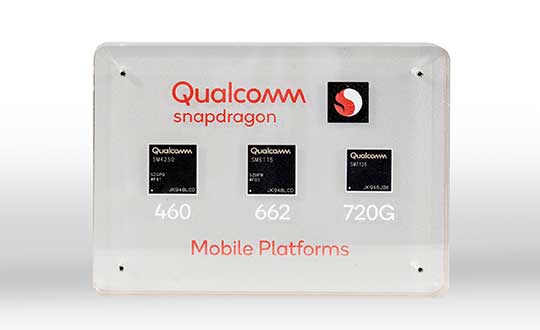
    Qualcomm Technologies has launched three new mobile platforms — the Qualcomm Snapdragon 720G, 662 and 460 — to enable enhanced user experiences across connectivity, gaming and entertainment.

    The new mobile platforms support dual-frequency (L1 and L5) GNSS to improve location positioning accuracy and robustness. The system-on-chip solutions also support the Indian NavIC (Navigation with Indian Constellation).

    Seven constellations. For the first time supported on mobile, the Qualcomm Location Suite now supports up to seven satellite constellations concurrently, including the use of all of NavIC’s operating satellites for more accurate location performance, faster time-to-first-fix (TTFF) position acquisition, and improved robustness of location-based services.

    “ISRO is satisfied with the efforts of Qualcomm Technologies Inc. towards incorporating NavIC and we urge OEMs to leverage it for future handset launches in India,” said K. Sivan, chairman, ISRO. “The availability of NavIC across multiple mobile platforms will help enhance the geolocation capabilities of smartphones in the region and bring the benefits of this indigenous solution to Indian consumers for their day-to-day use.”

    The new modules also enable fast 4G connectivity speeds, deliver key Wi-Fi 6 features and integrated Bluetooth 5.1 with advanced audio via the Qualcomm FastConnect 6-series subsystems.

    Artificial Intelligence. Designed to deliver new and improved AI user experiences across photography, voice assistants and virtually always-on scenarios for increased contextual awareness, the new platforms also feature the Qualcomm AI Engine and Qualcomm Sensing Hub.

    “While we see a fast adoption of 5G across geographies globally, we do recognize the phenomenal boost that 4G has given towards enabling broadband connectivity for Indian consumers. 4G will continue to remain a focus area for Qualcomm Technologies for regions like India, where it will stay a key technology for connectivity,” said Rajen Vagadia, vice president and president, Qualcomm India Pvt. Ltd. “Our goal is to enable our partners to continue creating solutions that offer seamless connectivity access and exceptional mobile experiences, that consumers can count on.”

    “Today’s smartphone users want fast, seamless connectivity, advanced features and long-lasting battery life,” said Kedar Kondap, vice president, product management, Qualcomm Technologies, Inc. “This expansion of our 4G lineup enables our partners to offer sophisticated solutions that meet global demand and enable a remarkable gaming experience across multiple tiers and price segments.”

    Photo: Qualcomm
    Photo: Qualcomm

    Snapdragon 720G

    Snapdragon 720G reimagines extraordinary gaming and entertainment experiences with select Qualcomm Snapdragon Elite Gaming features, striking capture capabilities, and intelligent performance. Leveraging select Snapdragon Elite Gaming features from premium-tier mobile platforms, Snapdragon 720G delivers smooth HDR game play, dynamic color range and contrast, realistic and immersive in-game environments, and high-quality, synchronized sound with Qualcomm aptX Adaptive.

    In addition to gaming, users will have a “home theater in their pocket” with HDR viewing and super-smooth video streaming with the Qualcomm Spectra 350L ISP, Qualcomm said. They can also capture 4K video or snap massive 192-megapixel photos.

    Snapdragon 720G also features the latest fifth-generation Qualcomm AI Engine with the improved Qualcomm Hexagon Tensor Accelerator that will enable a host of new AI experiences for gaming, photography, voice assistants and virtually always-on contextual awareness.

    The integrated Snapdragon X15 LTE modem supports 3-carrier aggregation, 4×4 MIMO on two carriers and 256-QAM modulation for fast download speeds up to 800 Mbps — allowing for quick app downloads and smooth video streaming and sharing.

    In addition, Snapdragon 720G, with the FastConnect 6200 subsystem, virtually doubles Wi-Fi speed and range for online gaming and web browsing, compared to single antenna devices, while also delivering key Wi-Fi 6 features such as 8×8 sounding with multi-user MIMO for up to 2x improvement over competitive Wi-Fi 6 devices, Target Wake Time for up to 67% better power efficiency and the complete WPA3 security suite, as well as integrated Bluetooth 5.1 with advanced audio capabilities.

    Finally, users will experience power savings and improved performance due to the Snapdragon 720G’s 8-nm process technology and upgraded CPU architecture.

    Snapdragon 662

    Snapdragon 662 brings astonishing camera and AI capabilities to the 6-series for the first time. It will feature the new Qualcomm Spectra 340T, which supports triple camera configurations and smooth switching between them — a first in the 6-series. A more robust ISP will enable support for photo capture in the HEIF file format for stunning image quality at half the file size.

    The addition of the third-generation Qualcomm AI Engine with Hexagon Vector Extensions and the Qualcomm Spectra 340T will enable AI-based user experiences such as avatars, night photography, and face and voice authentication.

    Snapdragon 662 also features the new Snapdragon X11 LTE modem with peak download speeds up to 390 Mbps thanks to 2-carrier aggregation, 2×2 MIMO and 256-QAM modulation, along with 150 Mbps peak uploads to support a snappy web browsing and social media experience.

    Snapdragon 460

    Snapdragon 460 boasts a gigantic leap in performance across the board in the 4-series, as well as significant boosts in connectivity, AI and camera improvements[1] for the next-generation of mass market smartphones. For the first time in the 4-series, Snapdragon 460 features performance CPU cores and an updated GPU architecture that translates into up to 70% and 60% increase in performance, respectively.

    Overall system performance, meanwhile, delivers a 2x increase compared the previous generation. The Hexagon processor with Qualcomm Hexagon Vector eXtensions (HVX) is also introduced into the 4-series for the first time, thereby equipping it with a 3rd generation Qualcomm AI Engine and the Qualcomm Sensing Hub for new AI experiences for photography and voice assistance.

    The Qualcomm Spectra 340 ISP is also among the many new additions to the 4-series, enabling the platform to capture stunning photographs and support for triple cameras. An integrated Snapdragon X11 LTE modem allows for download speeds up to 390 Mbps and uploads up to 150 Mbps.

    To date, more than 85 commercial devices based on Snapdragon 7-series mobile platforms, more than 1600 commercial devices based on Snapdragon 6-series mobile platforms, and more than 2,500 commercial devices based on Snapdragon 4-series mobile platforms have been announced by global OEMs. Together, the 7-, 6- and 4-series amount to over 4,000 designs — an impressive feat for these segments.

    Devices based on Snapdragon 720G are expected to be commercially available in Q1 2020 and devices based on Snapdragon 662 and 460 are expected to be commercially available by the end of 2020. For more information, please visit the product details pages for the Snapdragon 720G Mobile Platform, Snapdragon 662 Mobile Platform, and Snapdragon 460 Mobile Platform.

  • Janam unveils rugged tablet with u-blox inside

    Janam unveils rugged tablet with u-blox inside

    The HT1 is a slim, light, powerful “Android Enterprise Recommended” tablet

    Photo: Janam
    Photo: Janam

    Janam Technologies, a provider of rugged mobile computers that capture data and communicate wirelessly, has introduced a powerful and advanced 8-inch rugged tablet. The HT1 is designed to improve line of business applications including put-away and replenishment, cross docking, shipping and receiving, inventory management, merchandising and clientele management.

    Besides a stylish design paired with military-grade ruggedness, the HT1 offers dual-frequency GNSS using the u-blox M8 chip. It can provide accuracy within three feet in open skies and 15 feet in denser environments.

    Janam introduced the tablet at the National Retail Federation Annual Conference and Expo (NRF 2020), taking place Jan. 11-14 in New York City.

    As part of Google’s Android Enterprise Recommended (AER) program, Janam’s HT1 completed rigorous testing and is guaranteed to meet the most demanding enterprise-level requirements. AER certification also ensures a seamless deployment, familiar user experience and secure managed updates to deliver immediate improvements in productivity.

    HT1 Facts

    • The HT1 rugged tablet provides latest-generation speed and performance and is purpose-built to thrive in any industry including retail, warehousing, manufacturing, field service, transportation, construction, law enforcement, hospitality and other tough work environments.
    • As a rugged tablet running Android 9 (with ability to be upgraded to future generations of Android) in Google’s AER program, the HT1 delivers a premium experience for mobile workers. Timely security updates extend the HT1’s product lifecycle while providing IT teams with more control to keep business-critical data safe and secure.
    • With LTE speeds up to three times faster than most 4G LTE devices, advanced Wi-Fi and Bluetooth technology, Janam’s HT1 provides robust connectivity and lightning-fast voice and data inside four walls and out on the road.
    • The versatile HT1 features a 14-pin pogo connector to easily attach accessories such as Janam’s optional 2D imager module to provide high-performance scanning of printed and mobile barcodes. High-resolution front and rear cameras provide HT1 users with additional data capture support for proof-of-delivery, proof-of-condition, proof-of-service and more.
    • Sealed to IP67 standards, the HT1 provides reliable operation in the rain, snow or dust. It is MIL-STD-810G certified to withstand tumbles, vibration, ballistic shocks and repeated drops to concrete across a wide temperature range.
    • Equipped with an 8200 mAh hot-swappable and rechargeable battery, as well as a low-power Qualcomm octa-core processor with efficiency-boosting features, the HT1 provides all-day battery life for uninterrupted usage and maximum productivity.
    • A standard two-year warranty provides customers with both peace of mind and the level of service they expect, at no additional cost, with optional comprehensive service plans available to those that want to further extend their mobile computing investment.
  • Carlson releases Scan2K terrestrial scanner

    Carlson Software has released its Scan2K Laser Scanner, a versatile, fast, easy-to-use solution for the creation of accurate 3D survey data up to a range of 2K (2,000) meters. Carlson introduced the product at the Pennsylvania Society of Land Surveyors’ 2020 Conference.

    Carlson’s Bradley Husack, Special Projects Engineer, and Michael Hyman, Regional Director with the Scan2K at the Pennsylvania Society of Land Surveyors’ conference. (Photo: Carlson)
    Carlson’s Bradley Husack, Special Projects Engineer, and Michael Hyman, Regional Director with the Scan2K at the Pennsylvania Society of Land Surveyors’ conference. (Photo: Carlson)

    Built with surveyors in mind, the Scan2K is at home in the field with its weather-proof housing, user-friendly sunlight-visible touch screen interface with simple, menu-driven operations for quickly collecting and georeferencing point cloud data. With an integrated high-resolution camera, inclinometers, a compass, and an L1 GNSS receiver, the Scan2K can be deployed in many environments and orientations, including mobile operations.

    Carlson’s partner on the Scan2K project is Teledyne Optech, a world leader in 3D survey systems. Carlson will be the exclusive global distributor of the OEM Scan2K solution.

    “The Scan2K addresses the diverse range of applications for a laser scanner in the surveying and mining industries,” said Bradley Husack, a Special Projects Engineer at Carlson. “Carlson is bringing to market an all-in-one solution that now leads the market in versatility, speed, and value.”

    The Carlson Scan2K has a simple, sunlight-visible touchscreen interface. (Photo: Carlson)
    The Carlson Scan2K has a simple, sunlight-visible touchscreen interface. (Photo: Carlson)

    Beyond its impressive 2,000 meter range, the Scan2K also has short- and medium-range modes, as well as the capability to record over 500,000 points per second, all within the chosen scanning target window.

    Additionally, each laser pulse from the Scan2K records up to four returns, providing the capability to record the first return for a blocking object (such as a leaf) as well as the last return for an object behind it (such as a wall), and the versatility to exclude one or the other.

    The Carlson Scan2K comes bundled with ATLAScan software, a powerful yet simple solution for registering the point cloud, as well as Carlson Point Cloud Advanced for feature extraction into Carlson’s suite of CAD office products.

    The Scan2K comes ready to be equipped with an additional external camera, an external GNSS receiver, or for mobile operation.

    Whether on a tripod, a vehicle, or another moving platform, the performance offered by the Scan2K easily makes it a versatile terrestrial laser scanner for the market.

  • Launchpad: Handheld and UAV receivers, GNSS antennas

    Launchpad: Handheld and UAV receivers, GNSS antennas

    A roundup of recent products in the GNSS and inertial positioning industry from the January 2020 issue of GPS World magazine.


    OEM

    Heavy-duty antenna

    For challenging environments

    AT311 antenna. (Photo: CHC Navigation)
    AT311 antenna. (Photo: CHC Navigation)

    The heavy-duty CHCNAV AT311T is designed for demanding applications subject to shocks and vibrations. With advanced filtering and robust signal tracking, it provides survey-grade GNSS signals to enhance position reliability for marine applications, machine control, precision agriculture and industrial automation. Features include multi-constellation GNSS tracking using GPS, GLONASS, BeiDou, Galileo, QZSS, IRNSS and SBAS. Its IP68 water-resistant design makes it safe to use in extreme conditions with a wide temperature range (–40° C to +85° C). Its internal stacked structure enhances performance in high-interference environments, and the 40-dB signal gains, advanced signal filtering and multipath rejection design provide superior and robust GNSS signal tracking in challenging surroundings.

    CHC Navigation, www.chcnav.com

    UAV GNSS board

    Compact, high-precision for UAS

    The UAS1 GNSS receiver module has been designed for UAV/UAS applications requiring centimeter accuracy in a small package.(Photo: Trimble)
    The UAS1 GNSS receiver module has been designed for UAV/UAS applications requiring centimeter accuracy in a small package.(Photo: Trimble)

    The UAS1 compact, high-precision GNSS board was designed for unmanned aerial systems (UAS). It allows UAS system integrators to add upgradeable GNSS-based positioning using rugged connectors and Trimble’s software interface. Its 336-channel GNSS engine is capable of tracking L1/L2 frequencies from GPS, GLONASS, Galileo and BeiDou for centimeter-level, real-time kinematic (RTK) positioning. The compact board provides capabilities from high-accuracy GPS-only to full GNSS features. The receiver supports fault detection and exclusion (FDE) and receiver autonomous integrity monitoring (RAIM). System integrators also have the ability to detect interference with an RF spectrum monitoring and analysis tool embedded in the receiver.

    Trimble, trimble.com

    Upgradeable OEM board

    Offers software-enabled features

    Photo: NavCom
    Photo: NavCom

    The Onyx multi-frequency GNSS OEM board offers integrated StarFire/real-time kinematic (RTK) GNSS capabilities. It features 255-channel tracking, including multi-constellation support for GPS, GLONASS, BeiDou and Galileo. It provides high performance in GNSS receiver sensitivity and signal tracking as well as patented multipath mitigation, interference rejection and anti-jamming capabilities. Through software options, the Onyx ,allows upgrades from free differential GPS signal sources such as WAAS, to increased accuracy services such as StarFire and RTK Extend. The software-enabled features are sold in bundles, but can also be purchased individually to suit changing application needs.

    NavCom Technology, www.navcomtech.com

    Network timing

    Sub-microsecond synchronization

    The OSA 5401 and OSA 5405 now enable power utility and broadcast networks to achieve sub-microsecond synchronization. (Photo: Business Wire)
    The OSA 5401 and OSA 5405 now enable power utility and broadcast networks to achieve sub-microsecond synchronization. (Photo: Business Wire)

    The OSA 5401 and OSA 5405 upgraded PTP grandmaster clocks deliver precise, robust timing in a compact form factor. Oscilloquartz PTP timing technology enables power utility and broadcast networks to achieve sub-microsecond synchronization. The pluggable OSA 5401 is a small PTP grandmaster clock, and the OSA 5405 is an integrated PTP grandmaster with dual GNSS antenna and receiver. With spoofing and jamming detection capabilities, they also provide high availability. The OSA 5401 and 5405 provide new levels of accuracy and resilience for infrastructure and support emerging bandwidth-intensive, latency-sensitive applications. With sub-microsecond synchronization, smart grids can perform flexible, real-time decision making, as well as monitoring and automated maintenance. The OSA 5401 and OSA 5405 comply with the latest PTP profiles for time, frequency and phase synchronization in both power utility and broadcast networks. These include the IEC/IEEE 61850-9-3 Power Utility Profile for precise time distribution and clock synchronization in electrical grids with an accuracy of 1μs, and SMPTE 2059 for synchronizing video and audio equipment over packet networks.

    Adva, www.adva.com


    TRANSPORTATION

    Aircraft GPS

    Helps with ADS-B Out compliance

    CMA-5024. (Photo: CMC Electronics)
    CMA-5024. (Photo: CMC Electronics)

    The SBAS-capable CMA-5024 GPS has received U.S. Federal Aviation Administration (FAA) approval for installation on Boeing 737 Next-Generation aircraft. It enables B737NGs to comply with worldwide ADS-B Out mandates as well as SBAS/GPS navigation, enabling the first localizer performance with vertical guidance (LPV) approaches for B737NGs. The CMA-5024 GPS is a cost-effective alternative to replace a multi-mode receiver (MMR). The approved DO-260B ADS-B Out positioning source can be paired with any DO-260B compliant transponder, allowing operators to meet FAA and EASA ADS-B Out requirements, the UAE’s ADS-B Out and RNP requirements mandated by GCAA as well as India’s GAGAN requirements.

    CMC Electronics, www.cmcelectronics.ca

    ADS-B transmitter

    Receives FAA approval

    Photo:
    Photo: uAvionix

    The U.S. Federal Aviation Administration (FAA) has approved the VTU-20 automatic dependent surveillance – broadcast (ADS-B) transmitter for airport surface management. Adhering to the performance and design assurance specifications of FAA-E-3032, the externally mounted VTU-20 ensures integration and interoperability with Airport Surface Detection Equipment, Model X (ASDE-X), Airport Surface Surveillance Capability (ASSC) and ADS-B receiver surveillance solutions for airport. The VTU-20 can be permanently or magnetically mounted to all airside vehicles, including utility, emergency, snow-removal and maintenance equipment. Each vehicle is clearly and uniquely identified, providing an essential addition to any surface movement guidance and control system.

    uAvionix, uavionix.com


    UAV

    Airspace Intelligence

    Provides critical safety data to drone pilots

    Image: Skyward
    Image: Skyward

    Skyward’s Advanced Airspace Intelligence drone airspace maps provide airspace data combined with essential ground intelligence including 3D views of key structures, transmission lines, and more than a million vertical obstacles. The platform also provides access to LAANC, the Low Altitude Authorization and Notification Capability program provided by the U.S. Federal Aviation Administration. Data available for situational awareness includes vertical structure obstacles, power lines, airports, runways, national parks, stadiums, hospitals and schools.

    Skyward, skyward.io

    PPK for Phantom 4 RTK drones

    Provides reliable camera positioning data

    Screenshot: Hi-Target
    Screenshot: Hi-Target

    Hi-Target PPK GO precision add-on enables Phantom 4 RTK drones to achieve the accurate and reliable camera positioning data in any coordinate system without measure targets or ground control points. With 2-centimeter accuracies on XYZ, the output text file with position information or geotagged images can be used directly in major photogrammetric mapping or 3D survey software. The add-on allows selection of GPS/GLONASS/Beidou/ Galileo L1+L2+L5 and further parameter adjustments for position calculation in the PPK process to ensure the most reliable and accurate camera positioning even in poor single satellite system signals.

    Hi-Target, en.hi-target.com.cn


    SURVEYING & MAPPING

    GNSS Receiver

    Full-featured positioning system

    The R620 GNSS receiver is a complete refresh of Hemisphere's previous version, the R330. (Photo: Allison Barwacz)
    The R620 GNSS receiver is a complete refresh of Hemisphere’s previous version, the R330. (Photo: Allison Barwacz)

    The next-generation R620 receiver is designed for land and marine applications requiring high-precision positioning. It is a complete refresh of the previous version (R330) and has a new low-profile ruggedized enclosure. Customers can start with sub-meter positioning accuracy and upgrade the receiver through activations and subscriptions to add functionality and improve performance capability to centimeter-level accuracy. Powered by the Vega series, the R620 GNSS receiver processes and supports more than 1,100 channels. It simultaneously tracks GPS, GLONASS, BeiDou (including Phase 3), Galileo, QZSS, IRNSS, SBAS and Atlas L-band corrections. It has status LEDs , a powerful WebUI, UHF (400-MHz and 900-MHz) radio, cellular modem, Bluetooth, Wi-Fi, Ethernet (including power over Ethernet), CAN, serial and USB.

    Hemisphere GNSS, hemispheregnss.com

    Rugged data collector

    For land surveying and geospatial information systems (GIS)

    Photo: Geneq
    Photo: Geneq

    The rugged SXPad 1500 data collector features an alphanumeric keypad and long-range Bluetooth, and was designed to meet the rigorous IP67 standard for challenging field conditions. It has a 5-inch sunlight-readable touchscreen. The SXPad 1500 can be connected to any GNSS receiver or compatible robotic total station. Driven by a 1-GHz processor and the Windows Mobile 6.5 operating system, providing the power to work with maps and large data sets in the field. Its integrated cellular modem and Wi-Fi provides wireless connectivity for internet access and GIS data transfer — helpful for configuring a real-time kinematic (RTK)-compatible GNSS receiver. Equipped with an internal memory of 1 GB (memory can be expanded to 16 GB with an SD card), the SXPad 1500 provides enough storage space for data recording. Its high-performance lithium battery allows uninterrupted field operation for up to eight hours.

    Geneq, sxbluegps.com

    GNSS RTK tablet

    Receives 184 channels

    Photo: CHC Navigation
    Photo: CHC Navigation

    The LT700H RTK Android tablet is designed to increase efficiency and productivity of the mobile field workforce in applications requiring centimeter-to-decimeter positioning accuracy. Portable, rugged and versatile, the LT700H enables precision GIS data collection, forensic mapping, construction site layout, environmental surveys, landscaping and earthmoving jobs. Powered by 184-channel high-performance GPS, GLONASS, Galileo and BeiDou module and a superior tracking GNSS helical antenna, the LT700H provides position availability in demanding environments. Its integrated 4G modem ensures seamless communication from field-to-office and robust connectivity to RTK correction networks.

    CHC Navigation, www.chcnav.com

    Reference receiver

    Now supports BDS-3 signals

    Photo: Trimble
    Photo: Trimble

    The Trimble Alloy GNSS reference receiver now supports BeiDou Generation III (BDS-3) signals. This will enable operators to meet the ongoing demand from surveyors, mapping professionals and precision farmers for accurate, reliable corrections derived from real-time networks. Released in 2018, the Alloy has the processing power needed for high-quality data from multiple constellations. Alloy version 5.42 firmware tracks all available and planned GPS Block IIIA L1C and BDS-3 signals.

    Trimble, www.trimble.com

    Utility mapping

    Ground penetrating radar

    Hexagon showcased the Leica DSX utility detection solution at Intergeo 2019. (Photo: Allison Barwacz)
    Hexagon showcased the Leica DSX utility detection solution at Intergeo 2019. (Photo: Allison Barwacz)

    The Leica DSX utility detection solution can be used together with Leica GPS/GNSS systems to generate highly accurate, georeferenced maps. The DSX uncovers utilities for repair and maintenance, civil engineering and surveying projects. The ground-penetrating radar system includes portable hardware and software that automates data analysis and creates a 3D utility map.

    Hexagon, hexagon.com

  • DroneSentry-X counter UAV system mounts on vehicles

    DroneSentry-X counter UAV system mounts on vehicles

    Photo: DroneShield
    Photo: DroneShield

    DroneShield has released a vehicle-mounted drone detection and defeat product, DroneSentry-X.

    Lightweight at about 10 kilograms, it can be easily mounted on most vehicles. DroneShield expects the product to be of interest to military, law enforcement, security and VIP the markets. The product is suitable for both vehicle/convoy and fixed site installations. The product was developed in response to substantial customer interest, according to the company.

    “Vehicle market for counterdrone protection is rapidly rising,” said DroneShield’s CEO Oleg Vornik. “In addition to catering for that segment, DroneSentry-X provides a more affordable detect-and-defeat solution for price-sensitive customers as an alternative to purchasing full-functionality DroneSentry product from us. DroneShield offers a complete suite of detection and defeat solutions to our customers, and this new product covers the customer need which we identified in our recent engagements.”

  • Broadcom’s second-generation dual-frequency GNSS uses new L5 signals

    Broadcom’s second-generation dual-frequency GNSS uses new L5 signals

    BCM4776 chip utilizes 30 new L5 signals to deliver higher navigational accuracy and yield

    Photo: Broadcom
    Photo: Broadcom

    Broadcom introduced in 2017 the first mass-market implementation of dual frequency: BCM4775. This chip makes use not only of the classic L1 frequency broadcast by every satellite, but also of the more advanced L5 signal broadcast by a subset of the satellites.

    The use of this enhanced L5 signal improves the accuracy of GNSS in an urban scenario, as it mitigates the main source of error: the reflections in the nearby buildings, also known as multipath. It also improves GNSS in an open-sky scenario, allowing submeter accuracy, a previously unmet performance bar in smartphones until now. Ever since, the BCM4775 has been adopted in flagship smartphones, smartwatches and fitness devices.

    Given the unabated need for better precision and accuracy, Broadcom has introduced its second-generation dual-frequency GNSS solution — the BCM4776.

    The new chip is capable of using the new BeiDou-3 constellation’s B2a signals (the Chinese indicator for L5). It will be able to track 30 new L5 signals (60 percent more) with a significant impact on accuracy. End users will experience much higher reliability of the submeter accuracy inherent to dual-frequency L1-L5.

    Image: Broadcom
    Image: Broadcom

    Second generation dual-frequency GNSS will be used for innovative lane-level driving navigation instructions, allowing driving applications to know which highway lane the vehicle is in. Expect instructions like “move one lane to the right so you don’t miss your next highway exit” or “move one lane to the left to take the pool lane and save 10 minutes.”

    The BCM4776 is now in production.

  • HERE’s new HD GNSS enables sub-meter positioning for mass market

    HERE’s new HD GNSS enables sub-meter positioning for mass market

    The company also announces that HERE Navigation On-Demand is OEM-ready with APCOA as partner

    HERE Technologies has introduced at CES 2020 its High Definition Global Navigation Satellite System (HD GNSS) positioning, a cloud-based solution that enables mass-market devices to achieve sub-meter accuracy across the globe.

    CES 2020, the massive annual consumer electronics show, is taking place Jan. 7-10 in Las Vegas. Here’s booth is at Central Plaza, Tech East.

    HD GNSS enables new user experiences with lane-level navigation, augmented and virtual reality. It combines precise point positioning (PPP) and real-time kinematic (RTK) positioning methods, allowing for fast convergence time, high availability and global coverage.

    It also supports off-the-shelf mobile devices and internet of things (IoT) trackers equipped with dual frequency chipsets such as the Broadcom BCM47765 and BCM47755.

    Photo: HERE
    Photo: HERE

    More mass-market devices and vehicles are being equipped with dual-frequency GNSS receivers. With the HD GNSS service, the receivers enable high-precision positioning, HERE said, a capability that was cost and geographically prohibitive less than two years ago.

    HERE HD GNSS accelerates chipset, hardware and software makers’ ability to offer a step change in what can be delivered to consumers in new product capabilities, features and user experiences, the company said.

    HERE HD GNSS data delivery is optimized for mobile devices, requires no additional hardware and comes equipped with spoofing detection and phone sensor integration. It provides global coverage (including China and Japan), with single-frequency mobile device support in the future.

    HERE is also working across a partner ecosystem — including reference station operators, chipset manufacturers, module makers, hardware vendors, mobile network operators and system integrators — to jointly improve the positioning accuracy to centimeter levels, and in more challenging environments such as urban canyons.


    Automotive use cases

    Autonomous driving. For safety, it’s critical that automated vehicles are designed with high levels of redundancy in positioning systems. If an automated vehicle gets caught in bad weather conditions which are degrading optical sensor operations, <0.2m positioning accuracy available via HD GNSS increases safety and operation time in autonomous mode.

    Assisted driving. In case of an obstacle on the road, HD GNSS combined with HERE HD maps provide obstacle indication and avoidance functionality.

    Mobile device use cases

    Road lane guidance and improved ETAs on mobile devices. If a driver is unfamiliar with the roadway, HERE HD GNSS, combined with precision HERE map data, shows the driver the correct lane and path to navigate to the destination fast and safely.

    Improved gaming and augmented reality experience. Location-based games are growing and widely popular, however they currently rely on less accurate positioning technologies that inhibit next generation use cases. HERE HD GNSS bring exciting opportunities to design the next version of games with sub-meter positional accuracy.


    HERE Navigation On-Demand is OEM-ready with APCOA as partner

    HERE Navigation On-Demand is now available for integration in OEM infotainment programs. APCOA Parking is the first non-automotive company to use the Service Package SDK to make its parking services available on HERE Navigation On-Demand.

    HERE Technologies’ software-as-a-service solution HERE Navigation On-Demand is available for integration in OEM infotainment programs. With HERE Navigation On-Demand, OEMs and Tier 1 vendors get to deliver both connected services and expandable navigation experiences on both embedded and mobile platforms.

    The connected solution cuts development and lifecycle costs by offering cutting-edge, off-the-shelf functionalities while enabling OEMs and Tier 1 vendors to use an SDK to build their own features or integrate third party services.

    As a software-as-a-service offering, HERE Navigation On-Demand enables OEMs to remotely configure and monitor the deployed navigation solution making it possible to update and upgrade the experience anytime, even after the sale of the vehicle.

    OEMs can further offer any functionality as a subscription option and thus generate new, recurring revenue streams. The end-user accesses the navigation experience through client software which downloads the Service Packages from the cloud.

    The highly modular Service Packages include map data, software features, UX elements and references to Cloud Service APIs. Smart caching of these Service Packages ensures that HERE Navigation On-Demand also works offline.

    Alexa, Amazon’s cloud-based voice service, is pre-integrated into HERE Navigation On-Demand, making it faster and easier for automakers to deliver an intuitive, voice-first navigation experience to customers in the car.

  • NovAtel delivers signal generators to modernize FAA’s WAAS

    NovAtel delivers signal generators to modernize FAA’s WAAS

    Next-generation NovAtel ground uplink station signal generators delivered for SBAS modernization

    Photo: NovAtel
    Photo: NovAtel

    Hexagon/NovAtel announced that shipments of next-generation ground uplink station (GUS) signal generators have commenced in fulfillment of its contract with the United States Federal Aviation Administration (FAA) to support the FAA’s safety of life wide-area augmentation system (WAAS) navigation service.

    Developed by the FAA for civil aviation, WAAS is a safety-critical navigation aid that provides integrity monitoring and differential corrections for all phases of flight. The next-generation NovAtel GUS signal generator replaces the legacy product that has operated successfully for more than 15 years and ensures continued operation for years to come.

    Along with the GUS signal generator modernization, the contract includes ongoing engineering support services for the complete portfolio of NovAtel ground reference receiver products deployed by the FAA.

    “We have a long-standing relationship with the FAA and worked very closely with the WAAS program team to deliver this critical next-generation technology for SBAS modernization,” stated Jonathan Auld, NovAtel Vice President of Engineering and Safety Critical Systems. “We’re very pleased to continue our commitment to support the FAA and their safety of life WAAS service.”

  • Launchpad: 3D data, Ford telematics

    Launchpad: 3D data, Ford telematics

    A roundup of recent products in the GNSS and inertial positioning industry from the December 2019 issue of GPS World magazine.


    OEM

    GNSS simulator

    Testing for signals and sensors

    Photo: Orolia
    Photo: Orolia

    The GSG-8 is an advanced software-defined simulator that offers ultra-high performance and flexibility in an easy-to-use format. It was developed to deliver the highest standard of GNSS signal testing and sensor simulation performance in an upgradable, scalable platform. The GSG-8 uses the robust 1000-Hz Skydel software engine. It is designed for customers who require complex capabilities to validate product and program performance in harsh, high-risk environments where failure is not an option, such as government agencies, space programs and specialized commercial programs.

    Orolia, www.orolia.com

    GNSS module

    cm-level GNSS positioning for IoT

    Photo: Taoglas
    Photo: Taoglas

    The Edge Locate GNSS L1/L2/E5 module combines antenna, RF electronics and receiver technology to deliver reliable centimeter-level positioning for the internet of things (IoT). It provides 1- to 3-centimeter-level accuracy using multi-band GNSS technology. With Edge Locate, manufacturers can quickly and effectively build devices with centimeter-level positioning technology. Its multi-band GNSS positioning can be used in conjunction with real-time kinematic (RTK) positioning capability. It uses a common connector for integration into any electronics device. It also connects directly to the Taoglas Edge board for immediate connectivity options.

    Taoglas, www.taoglas.com

    Precision antenna

    Offers strong multipath rejection

    The VSP600L VeroStar supports the full GNSS spectrum, as well as L-band correction services. (Photo: Allison Barwacz)
    Photo: Allison Barwacz

    The VSP600L VeroStar precision antenna supports the full GNSS spectrum, as well as L-band correction services, and provides low-elevation satellite tracking with a high-efficiency radiating element. It is suitable for real-time kinematic (RTK) and precise point positioning (PPP) applications, and features a light, compact and robust design. It also has a low axial ratio through all elevation angles, providing strong multipath rejection. The VSP600L VeroStar provides high receive gain over the full GNSS spectrum: low GNSS band (1164 MHz to 1300 MHz), L-band correction services (1539 MHz to 1559 MHz) and high GNSS band (1559 MHz to 1610 MHz).

    Tallysman, www.tallysman.com

    L1 + L5 chip

    Suitable for IoT and auto OBD

    Photo: OriginGPS
    Photo: OriginGPS

    The ORG4600-B01, OriginGPS’ first dual-frequency GNSS module, is supported by the BCM47758 chip, enabling ultra-accurate GNSS positioning. It was developed for solutions requiring super-precision GNSS and a dual-frequency combination. The module enables customers to build solutions with sub-1-meter accuracy without implementing external components. Measuring 10 x 10 millimeters, the ORG4600-B01 supports L1 + L5 GNSS reception with one RF port, enabling use of a low-cost, dual-band antenna delivering sub-1-meter accuracy performance in real-world conditions. An alternate build option allows for separate L1/L5 RF outputs when dual antennas are required. The module is suitable for solutions requiring ultra-accurate positioning, such as telematics, the internet of things (IoT) and auto OBD applications.

    OriginGPS, origingps.com; Broadcom, www.broadcom.com

    OEM receiver

    All-constellation, multi-frequency positioning

    Photo: NovAtel
    Photo: NovAtel

    The PwrPak7-E2 contains an advanced Epson G370N MEMS inertial measurement unit (IMU) to deliver NovAtel SPAN technology in an integrated, single-box solution. It has a powerful OEM7 GNSS engine, built-in Wi-Fi, onboard NTRIP client and server support, and 16 GB of internal storage with higher performance and INS data rate. Connection options include serial, USB, CAN and Ethernet. Features include a 555-channel, all-constellation, multi-frequency positioning solution and multi-channel L-band that supports TerraStar correction services. It can be paired with an external receiver to support ALIGN GNSS azimuth aiding for low dynamic applications.

    NovAtel, www.novatel.com


    Surveying & Mapping

    GNSS smartphone

    Collects geospatial data

    Photo: Spectra Geospatial
    Photo: Spectra Geospatial

    The MobileMapper 60 is a durable, efficient and accurate handheld device for geographic information system (GIS) and professional data-collection applications. The all-in-one GNSS receiver and smartphone offers 2-4 meter positioning accuracy in an all-weather design with a hand strap. It operates in extreme temperatures and rugged field conditions. It features a 6-inch high-resolution screen, large capacity all-day battery, Android 8.0 operating system and 2.2-GHz processor. Its 4 GB of memory and 64 GB of storage can manage large data sets with ease and speed. Bluetooth 4.1, 4G LTE and Wi-Fi capable, the MobileMapper 60 is suitable for cadastral, survey, topography and forestry.
    Spectra Geospatial, spectrageospatial.com

    Outdoor AR

    Enables visualization of 3D data

    Photo: Trimble
    Photo: Trimble

    The SiteVision outdoor augmented reality (AR) system enables users to visualize 2D and 3D data with cellular or internet connectivity for planning, collaboration and reporting. Combining hardware and software in an integrated, lightweight handheld or pole-mounted solution, users can view 3D models and assets in a real-world environment at a 1:1 scale, from any angle or position. SiteVision integrates a Trimble Catalyst DA1 antenna, electronic distance measurement (EDM) rangefinder and power management into a lightweight, handheld device that connects to a user-supplied Android mobile phone. The SiteVision subscription is available monthly or yearly, and combines Trimble’s high-accuracy positioning services and cloud-based processing technology to create a centimeter-accurate AR system. Users can visualize digital models from a wide range of data collection, design and constructible modeling tools in open industry-standard formats, including IFC and LandXML. For civil projects, SiteVision accurately visualizes data from Trimble’s Quantm, Business Center and Novapoint; design data from Civil 3D and Bentley OpenRoads; and GIS data from Esri ArcGIS software.

    Trimble, trimble.com

    Smart antenna

    Tracks all channels

    The S621 GNSS survey smart antenna is a complete redesign of Hemisphere's previous generation version, the S321+. (Photo: Allison Barwacz)
    Photo: Allison Barwacz

    The S621, powered by the Phantom 40 GNSS OEM board, is a redesign of Hemisphere’s previous S321+. It processes and supports more than 800 channels with flexible and scalable simultaneous tracking of every modern and planned GNSS constellation and signal including GPS, GLONASS, BeiDou (including Phase 3), Galileo, QZSS, IRNSS, SBAS and Atlas L-band. The S621 combines Hemisphere’s Athena GNSS engine and Atlas L-band correction technologies with a new web user interface. It meets IP67 requirements and is immune to magnetic interference. It is designed for use in land or marine survey, GIS, mapping, construction or other applications requiring high-performance precision and positioning.

    Hemisphere GNSS, hemispheregnss.com

    iOS application

    Records and transfers raw data for post processing

    Photo: Geneq
    Photo: Geneq

    The SXblue ToolBox is now available for iOS-compatible devices. The application was developed with special interest paid to raw data recording and NTRIP service connection. The Android application debuted in 2018. With the new iOS application, iPhone and iPad users can analyze the position data provided by the SXblue receiver, as well as location metadata. The application can record, save and transfer raw data from the GNSS receiver, thereby allowing post-processing activities. The application also acts as an NTRIP client, capable of connecting to an NTRIP server for real-time kinematic (RTK) corrections, and thus allows the receiver to issue very accurate location information. Receiver configuration is easy through the application, with the ability to set up and save user-defined commands for subsequent use. The settings include constellation to be used, differential source, NTRIP login credentials list and more.


    TRANSPORTATION

    Telematics for Ford

    Simplifies mixed-fleet management

    Geotab Integrated Solution for Ford Vehicles offers fleet managers the ability to incorporate Ford vehicle data into the MyGeotab platform for single view of entire fleet. (Photo: Ford)
    Photo: Ford

    The Geotab Integrated Solution for Ford Vehicles integrates Ford vehicle data into the MyGeotab platform to give fleet managers a dedicated portal to process data. Ford Data Services securely transfers data from Ford vehicles with a factory installed or plug-in modem to Geotab’s cloud environment. It provides access to the Geotab Marketplace, a portfolio of mobile apps, hardware add-ons and software add-ins.

    Geotab, www.geotab.com

    Positioning platform

    Enhanced GNSS for autos

    Photo: u-blox
    Photo: u-blox

    The M9 platform is designed for demanding automotive, telematics and UAV applications. With the u-blox UBX-M9140 GNSS chip, the M9 technology platform and the NEO-M9N (the first module based on the platform) can receive signals from GPS, GLONASS, BeiDou and Galileo concurrently. It can achieve high positional accuracy in difficult conditions such as deep urban canyons. The M9 offers a position update rate of up to 25 Hz, enabling dynamic applications to receive position information with low latency and has special filtering against RF interference, jamming and spoofing. U-blox also provides Explorer Kit M9 (XPLR-M9) for developers.

    u-blox, www.u-blox.com

    GPS tracker

    For light- to medium-duty vehicles

    Photo: SkyBitz
    Photo: SkyBitz

    The SA2012 GPS tracker is equipped with the latest 4G LTE with 3G fallback. It is designed for customers looking for a scalable vehicle telematics solution. The hardware can be installed using the SkyBitz Ops Center mobile device, either directly plugging it into the vehicle diagnostic port or covertly installing it behind the dashboard. Once installed, the device feeds into the Ops Center platform, where users can manage the new device and others via a single interface. Coverage is across North America.

    SkyBitz, www.skybitz.com

  • Trimble provides precision controller and display to farmers

    Trimble provides precision controller and display to farmers

    Trimble has introduced the GFX-350 display and NAV-500 guidance controller, providing a cost-effective option for farmers seeking to adopt the latest precision agriculture technology for their daily operations.

    The GFX-500 display. (Photo: Trimble)
    The GFX-500 display. (Photo: Trimble)

    The GFX-350 Android-based touchscreen is a cost-effective way to introduce auto-steering and application control to the farm. The 7-inch (18-centimeter) screen is easy to read and can be used to control most field operations with a few taps.

    The display is compatible with both the NAV-500 and the NAV-900 guidance controllers, satisfying different user accuracy needs. The simple and intuitive Precision-IQ operating system speeds up field work and makes equipment configuration a breeze. Once vehicles, fields, implements and materials are set up during the first use, they are saved and can be re-used with a couple of clicks.

    The NAV-500 controller. (Photo: Trimble)
    The NAV-500 controller. (Photo: Trimble)

    In addition, the GFX-350 display is fully ISOBUS compatible, offering plug-and-play capability for ISO-enabled implements with native task controller and universal terminal functionality. The display also features onboard Wi-Fi and Bluetooth connectivity, allowing seamless sharing of data between the office and the field via optional Trimble Connected Farm solutions. General record keeping and proof of placement reporting has never been easier.

    The NAV-500 guidance controller features a low-profile rugged housing capable of receiving signals from five different GNSS satellite constellations — GPS, Galileo, GLONASS, BeiDou and QZSS. This precision solution offers sub-meter repeatable accuracy and full-farm coverage ideal for tillage, broad-acre seeding, spraying and harvest operations.

    By using Trimble’s ViewPoint RTX satellite-delivered correction service with the NAV-500, operators can consistently achieve 15 centimeter pass-to-pass accuracy. Paired with either the new GFX-350 display or larger 10-inch (25.4-centimeter) GFX-750 display, the NAV-500 can provide roll-corrected manual guidance or can automatically control steering with the EZ-Steer assisted steering system and EZ-Pilot® Pro steering system.

    “Connectivity and interoperability are very important to the future of agriculture and Trimble has made these features a cornerstone of our product portfolio,” said Abe Hughes, general manager of Trimble’s Agriculture Division. “Customers can select from a range of hardware and software options to meet their specific needs and budget. And the true beauty of this flexible product integration is that it can grow with the farmer’s operation. Upgrades can be as simple as moving to a higher precision correction signal or using existing mounts to install a larger and more capable receiver or display. Ease of installation and operation are key with the GFX-350, which can reduce barriers to entry for farmers new to precision agriculture.”

    The GFX-350 display and NAV-500 guidance controller are designed for clean and simple installation that can typically be completed in half a day, getting farming equipment back in the field faster. The display uses a quick release RAM mount for easy transfer between vehicles, and typically requires only two cables to be attached, reducing clutter in the cab.

    Trimble’s GFX-350 display and NAV-500 guidance controller are expected to be available for order in the fourth quarter 2019 from the Trimble dealer and Vantage distribution networks.

  • uAvionix receives FAA qualification for ADS-B transmitter

    uAvionix receives FAA qualification for ADS-B transmitter

    Photo:
    Photo: uAvionix

    uAvionix has received U.S. Federal Aviation Administration (FAA) approval for the Vehicle Tracking Unit (VTU-20) Automatic Dependent Surveillance – Broadcast (ADS-B) transmitter for airport surface management.

    uAvionix is a designer and manufacturer of communications, navigation and surveillance (CNS) equipment for unmanned and manned aircraft.

    Adhering to the performance and design assurance specifications of FAA-E-3032, the externally mounted VTU-20 ensures integration and interoperability with Airport Surface Detection Equipment, Model X (ASDE-X), Airport Surface Surveillance Capability (ASSC) and ADS-B receiver surveillance solutions for airport
    surface control and situational awareness.

    The VTU-20 can be permanently or magnetically mounted to all airside vehicles, including utility, emergency, snow-removal and maintenance equipment. Each vehicle is clearly and uniquely identified, providing an essential addition to any surface movement guidance and control system.

    The VTU-20 implements FAA-approved Squitter Transmission Maps to automatically enable transmission on airport movement areas and disable transmission in low-risk areas or outside airport airside operations.

    “Ground vehicle incursions into critical safety and movement areas is on the rise. With this achievement, uAvionix continues to promote safety and common situational awareness not only in the airspace but also on the airport surface,” states Christian Ramsey, uAvionix president.

    This recent uAvionix achievement will be made available through an exclusive relationship with L3Harris Technologies, Inc., a leader in surveillance and air traffic management known for the Symphony product line of airport operations and environmental compliance solutions — to promote and sell the VTU-20 in the United States.

    For sales inquiries or questions, contact L3Harris Symphony VTU-20 sales at [email protected], or uAvionix at [email protected].

  • Orolia Maritime reveals new PLB with Return Link System for 2020

    Orolia Maritime reveals new PLB with Return Link System for 2020

    Photo: Orolia
    Photo: Orolia

    Orolia Maritime has revealed the FastFind ReturnLink PLB with Return Link System (RLS) life-saving beacon system.

    Orolia worked closely with the European GNSS Agency (GSA) on the Galileo satellite system since the company was selected to lead development of next-generation search-and-rescue (SAR) distress beacons. Earlier this year, Orolia introduced the first Galileo-enabled personal locator beacons (PLBs).

    Building upon this, the new FastFind ReturnLink transmits the user’s unique ID and GNSS location via the global network of Cospas-Sarsat search-and-rescue satellites, and then uses Galileo’s Return Link Service to transmit a return signal back to the user’s device to confirm the alert has been received and location has been detected.

    The PLB displays a blue light to inform the user that search-and-rescue professionals are aware of their situation and location and that they are not alone.

    “We are dedicated to producing SAR products that keep people safe on land and sea, and the FastFind ReturnLink PLB is Orolia Maritime’s most advanced search and rescue beacon to date,” said Chris Loizou, vice president of Maritime at Orolia. “The psychological impact of knowing that help is on the way cannot be underestimated, and this PLB will provide invaluable peace of mind for those in distress.”

    The FastFind ReturnLink PLB uses the latest SAR technology, packed into a simple, rugged and lightweight palm-sized unit. Features include:

    • Multi-constellation GNSS — both Galileo and GPS receivers.
    • Belt-attachable buoyancy pouch and life-jacket oral tube clip attachments.
    • No subscription.
    • Five-year battery life.
    • Waterproof to 10 meters.
    • SOS Morse LED flashing light and RLS Reassurance blue flashing light.
    • Safe-stow antenna and three-stage activation.

    Galileo’s RLS is expected to be fully operational in January 2020.