Airbus Defence and Space and The Climate Corporation, a subsidiary of Bayer, have announced a global agreement to deliver frequently updated satellite imagery from Airbus to farmers through Climate FieldView, a digital agriculture platform.
Farmers who use Climate FieldView can access high-resolution data of their fields from the Airbus SPOT 6, SPOT 7 and Pléiades satellites throughout the growing season. This gives FieldView customers the ability to more precisely monitor crop health and performance, helping them take action in the field before yield is impacted at the end of the season.
They will also be able to visualize this satellite imagery alongside other data layers in their FieldView account, including planting and yield data, to unlock new insights about crop health.
The large swath and coverage capabilities of the SPOT satellites enable mapping at a national level down to individual farmland parcels, while the Pléiades satellites can be used to pinpoint details in specific areas, thanks to its combination of sub-meter resolution and multispectral bands.
The complementarity between SPOT and Pléiades resolutions, swaths and revisits is crucial for effectively monitoring crops more precisely and helps enable more-informed decision-making.
“We are very pleased to be working with The Climate Corporation to enhance FieldView by providing them with access to updated, cloud-free images within the time frame required to efficiently monitor crops at each key growth stage,” said François Lombard, head of Intelligence Business at Airbus Defence and Space.
“High-quality satellite imagery integrated into a farmer’s Climate FieldView account can bring in more consistent and invaluable field-level insights,” said Steven Ward, Senior Director of Geospatial and Weather Sciences at The Climate Corporation. “This partnership with Airbus supports Climate’s commitment to deliver the most robust imagery ecosystem on the farm, helping farmers make important decisions tailored precisely to their individual fields.”
The Climate Corporation’s mission is to help the world’s farmers sustainably increase their productivity through the use of digital tools. First launched in the United States in 2015, the company’s Climate FieldView platform gives farmers a deeper understanding of their fields so they can make more informed operating decisions to optimize yields, maximize efficiency and reduce risk.
FieldView is currently on more than 60 million paid acres across the United States, Canada, Brazil and Europe.
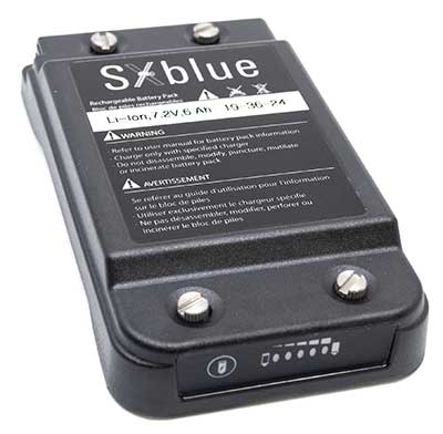
Geneq inc. has released a redesigned, ultra-efficient battery for its SXblue receivers.
The new battery is equipped with 4 Li-ion rechargeable cells that boost its capacity from 3900 mAh to 6000 mAh. The upgrade boosts the receiver’s autonomy by up to 50 percent, greatly increasing its field work efficiency, the company said.
When fully charged, the battery can last up to 16 hours depending on the SXblue model and Bluetooth connectivity.
Photo: Geneq
The colored LEDs for the battery charge indicator have been enhanced for a better contrast even when working under sunny conditions. Like previous versions, the new battery is field replaceable and can be charged separately or while it is connected to the receiver. With only a 6-mm increase in thickness and the same weight as previous models, the user will not notice any change in handiness and ergonomics, Geneq added.
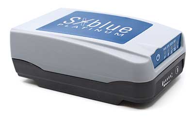
The new battery is compatible with all past SXblue II and III models and current iSXblue II+ GPS, SXblue II+ GPS, iSXblue II+ GNSS, SXblue II+ GNSS and SXblue Platinum. It is also compatible with the new pole clamp accessory for the survey kit.
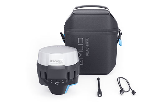
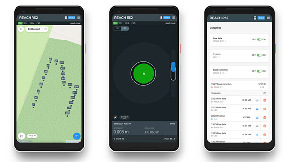
Emlid, the creators of Reach, centimeter-accurate RTK GNSS receiver, is now taking pre-orders for its multi-band GNSS receiver Reach RS2. The new receiver features a built-in LoRa radio, a 3.5G modem, and a survey app for iOS and Android.
Photo: Emlid
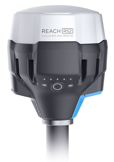
L1/L2/L5 RTK GNSS receiver with centimeter precision. Reach RS2 determines a fixed solution in seconds and provides positional accuracy down to several millimeters. The receiver tracks GPS/QZSS (L1, L2), GLONASS (L1, L2), BeiDou (B1, B2), Galileo (E1, E5) and SBAS (L1C/A), and reliably works in RTK mode on distances up to 60 kilometers and 100 kilometers in PPK mode. A multi-feed antenna with multipath rejection offers robust performance even in challenging conditions.
RINEX raw data logs are compatible with OPUS, CSRS-PPP, AUSPOS and other PPP services so users can now get centimeter-precise results any place on Earth.
Built-in 3.5G modem and UHF LoRa radio. The Reach RS2 features a power-efficient 3.5G HSPA modem with 2G fallback and global coverage. The corrections can be accessed or broadcast over NTRIP independently, without relying on internet connection on a smartphone.
For remote areas, the Reach RS2 has a built-in LoRa radio that has proven to be a reliable link for RTK corrections for distances up to 8 kilometers.
Designed for Tough Conditions. The Reach RS2 is engineered to be waterproof and impact-resistant. Its body is manufactured in a two-step injection process and is made out of shockproof polycarbonate covered in a special elastomer for extra protection. The receiver has an industry-standard 5/8-inch mounting thread.
The LiFePO4 battery of the Reach RS2 is designed for 16 hours of work as a 3.5-G RTK rover on one charge regardless of weather conditions. It can charge from a USB wall charger or a power bank over USB-C.
A RS232 interface allows users to connect the Reach RS2 directly to external hardware and output position in NMEA.
Photo: Emlid
ReachView App. The Reach RS2 comes with a mobile app, ReachView for iOS and Android, that is used to control all the features of the device. Users can create projects, collect and stake-out points, and import and export geodata in industry-standard formats such as CSV, DXF and Esri Shapefile.
The Reach RS2 comes in a carrying bag with a USB-C cable and a LoRa radio antenna. The ReachView app is available for download from Play Market or App Store.
Shipping of the first batch starts in mid-June 2019.
A roundup of recent products in the GNSS and inertial positioning industry from the March 2019 issue of GPS World magazine.
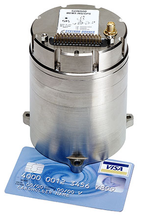
MEMS INS/GPS
Update improves heading performance and reduces jitter
Photo: Systron Donner
The SDN500 digital quartz micro-electro-mechanical systems (MEMS) GPS inertial navigation system (GPS/INS) has been updated. Model SDN500-xE provides a newer generation JF2 (C/A) code GPS receiver and tightly couples the 1 PPS GPS signal to the SDI505 IMU synch pulse to improve heading performance and reduce jitter after long periods of operation without dynamic inputs. The 25-inch-square SDN500 provides for maximum packaging flexibility in dense systems and delivers accuracies to within 1.0 mrad in attitude, 0.1 m/s in velocity and 3.9 meters spherical error probability (SEP). It offers tactical-grade performance, integrating SDI’s latest quartz gyros capable of 0.5°/hr. bias in-run stability and low angular random walk (ARW, 0.02°/√ hr), quartz accelerometers delivering 0.5 milli-g in-run bias stability and low velocity random walk (VRW, 80 µg/√ Hz), plus high-speed digital signal into a tightly coupled GPS/INS for tactical navigation and geo-location applications.
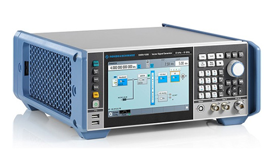
Testing location accuracy performance of mobile devices
Photo: Rohde & Schwarz
To create test concepts for over-the-air (OTA) antenna measurements, Rohde & Schwarz and Bluetest have integrated the R&S LBS Server, a software component running on the R&S CMW500 wideband radio communication tester, and the Bluetest over-the-air (OTA) test solution for A-GNSS systems based on Bluetest’s RTS65 reverberation chamber and Bluetest’s Flow measurement software. The R&S LBS Server controls the Rohde & Schwarz base-station simulator R&S CMW500 for LTE, WCDMA and GSM, and uses the R&S SMBV100B vector signal generator for simulation of GNSS and metropolitan beacon systems (MBS) signals. An upgrade for 5G will be available soon. The R&S LBS Server is an essential part of the R&S TS8991 OTA Performance Test System.
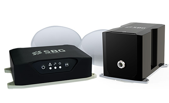
Brings Navsight technology to the most demanding environments
Photo: SBG Systems
The Horizon IMU adds a third choice to SBG System’s Navsight Land/Air Solution. It is a FOG-based high-performance inertial measurement unit (IMU) designed for highly demanding surveying applications such as high-altitude data collection or mobile mapping in dense areas such as urban canyons. The Horizon IMU joins the Ekinox and Apogee IMUs as options for Navsight. The different levels of accuracy enable the solution to meet various application requirements and can be connected to various external equipment such as odometer, lidar and more. The Horizon IMU allows customers to use Navsight in high-altitude and highly dense areas, as well as where only a single antenna can be used. It is based on closed-loop FOG technology that enables ultra-low bias and noise levels. The Navsight solution can be installed in a plane or car — the sensor alignment and lever arms are automatically estimated and validated. The Navsight unit also integrates LED indicators for satellite availability, real-time kinematic (RTK) corrections and power. Qinertia post-processing software provides access to offline RTK corrections from more than 7,000 base stations in 164 countries.
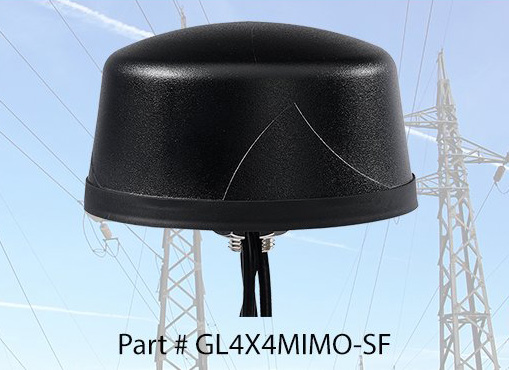
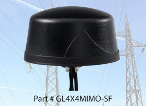
The Coach 4×4 Wi-Fi/DSRC GNSS multi-band antenna enables smart grids, mobile workforce communications, and advanced automation technologies. The dual-band 802.11ac/p MIMO antenna helps boost data rates and reliability for utility networks, intelligent transportation systems and other industrial internet of things (IoT) applications. The low-profile antenna features four-port 2.4/5-GHz coverage along with PCTEL’s high-rejection GPS/GLONASS technology for network timing and tracking in a single IP67-rated housing.
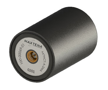
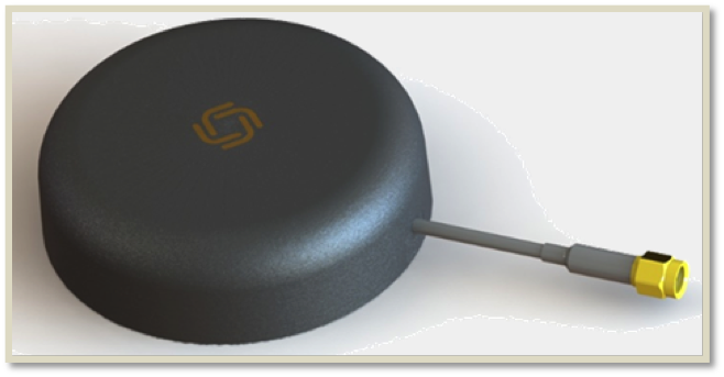
Maxtena Inc. has introduced a patented GNSS antenna designed for high-precision and autonomous multi-frequency applications. The M7HCT-A-SMA antenna is a high-accuracy, multi-frequency active quadrifilar helix GNSS antenna.
Photo: Maxtena
Maxtena is a U.S.-based antenna design and manufacturing company and inventor of the patented Dynamic Aperture Technology.
The new design will offer concurrent GNSS reception on L1: GPS, GLONASS, Galileo, Beidou and L2: GPS L2C, Galileo E5B and GLONASS L3OC in a rugged, compact and ultra lightweight form factor.
The antenna is designed for GIS, RTK and other high-accuracy GNSS applications such as the drone and automotive markets, where high performance and low weight are driving features in antenna selection.
The M7HCT-A-SMA active helix design features Maxtena’s patented compact and lightweight Helicore technology. This technology provides exceptional pattern control, polarization purity and high efficiency in a very compact form factor.
The antenna offers up to 30-dB gain for GNSS applications that utilize GPS, GLONASS, Galileo and Beidou, in one radome housing with a single SMA connector.
The M7HCT-A-SMA will join Maxtena’s line of rugged GNSS helix antennas that are ultra lightweight, small, and precise. The M7HCT-A-SMA weighs 25 grams and is housed in automotive grade PCB plastic with automotive grade electronics and is rated IP67 when mounted.
It is ground plane independent and offers extremely low power consumption and minimal phase-center variation over azimuth. The antenna offers superb axial ratio ensuring multipath error is mitigated.
“Maxtena is very excited to be launching a game-changing antenna for the UAV, drone, and automotive markets, and really for any application requiring a high performance, lightweight antenna that can cover so many frequencies. It is the most robust antenna solution on the market,” said Maxtena Vice President of Sales and Marketing Vanja Maric.
Airbus Defence and Space has launched The OneAtlas Platform, a collaborative environment to access premium imagery, perform large-scale image processing, extract insights and benefit from Airbus assets for solution development.
OneAtlas is offering a 30-day free trial, giving customers streaming access to imagery, sample change detection reports, and global imagery and data layers, including the basemap and the WorldDEM.
Besides access to a comprehensive archive with premium imagery, users can try services such as:
Ocean Finder for the maritime industry
Verde for precision agriculture
Starling for forest management
Earth Monitor for tracking changes over an area of interest
The developer portal provides more information through API documentation and discusses how to benefit from the imagery either in streaming or download format.
The Ocean Finder provides a satellite-based maritime ship detection service. (Photo: OneAtlas)
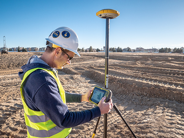
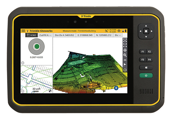
Trimble has introduced its T7 Tablet, a rugged, lightweight and versatile device designed for construction surveying applications.
Using Trimble Siteworks Software for construction surveying, the Trimble T7 provides real-time data to visualize cut/fill levels, calculate material volumes, check grade and communicate work orders to increase productivity and enable better decision-making.
The T7 brings powerful processing to the field — a sunlight readable 7-inch touchscreen that supports pinch, tap and slide gestures and a digital keyboard. Users can interact with the T7 intuitively — zooming, panning and selecting items on the touchscreen.
The T7 also leverages the power of Windows 10 Professional, driven by an Intel Pentium 64-bit quad-core processor. The processor and operating system make it easy to process data in spreadsheets and run office software programs. Using third-party apps, front- and rear-facing cameras allow contractors to video conference from the field for on-the-job support and capture of high-definition videos and images, the company said.
The Trimble T7 tablet. (Photo: Trimble)
The lightweight T7 is built to withstand the wear-and-tear of daily construction work in various weather conditions. It meets stringent MIL-STD-810G for drops, vibration, immersion and temperature extremes and with IP65 and IP68 ratings, is sealed against water and dust. The full-color, 7-inch screen uses a Gorilla Glass display that is scratch and impact resistant.
“The Trimble T7 Tablet is the next step in the evolution of our data collection portfolio,” said Scott Crozier, general manager for Trimble’s Civil Engineering and Construction Division. “Surveyors, supervisors and inspectors can complete tasks with less downtime, combining Trimble reliability with the flexibility to adapt to a variety of configurations and jobsite conditions.”
Optional, user-interchangeable Trimble Empower modules make the T7 a flexible solution for a variety of applications. The Empower platform is a modular expansion system that gives users the power to customize their mobile computing solution to their workflow. Optional modules such as barcode imager, a barcode imager/RFID combo and sub-meter GNSS give users the confidence of knowing that that their investment is scalable for future needs.
The T7 is optimized for use with Trimble Siteworks Software, survey software tailored for construction workflows. Siteworks Software features an interface optimized for ease-of-use and productivity. Configurable views, colorful graphics and natural interactions and gestures make Siteworks Software intuitive and easy to learn. The release of the T7 increases the available hardware configuration options for Siteworks users.
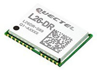
The L26-DR dead-reckoning GNSS module is a multi-GNSS receiver embedded with a dead-reckoning solution to greatly improve positioning accuracy and speed while simplifying customer designs. The dead-reckoning capability ensures the module delivers the highest performance positioning solution available, even when GNSS signals are absent or compromised. Equipped with six-axis sensor MEMs and a powerful GNSS core, the module provides high sensitivity, fast GNSS signal acquisition and tracking with low system integration effort. The L26-DR can acquire and track any mix of GPS, GLONASS, BeiDou, Galileo and QZSS signals.
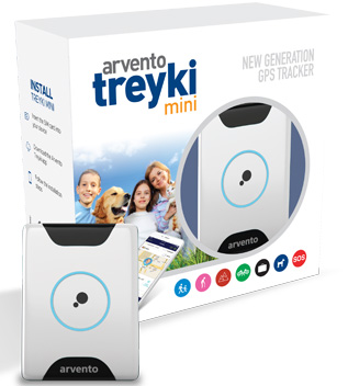
The Arvento Treyki Mini is a compact people and asset tracking device with eight operating modes, including special settings for tracking children (with geofencing) and senior citizens (with an integrated fall sensor). It is also suitable for use in sports, racing and asset management and can be used as an emergency beacon. It has an onboard positioning receiver, and reports its location using an internal GSM/GRPS modem. It can operate for up to seven days from its 900mAh LiPo rechargeable battery before it needs to be recharged. It uses the u-blox ZOE-M8Q concurrent multi-GNSS module, which is able to receive 72 channels simultaneously.
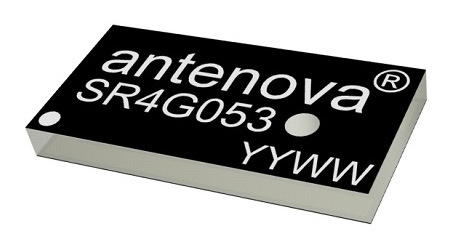
The new Antenova Raptor achieves high accuracy using the L2 1200-MHz GNSS bands. The L2 band combines multi-band satellite signal reception and GNSS correction data, helping to mitigate position errors. The antenna is the latest addition to Antenova’s lamiiANT range of rigid FR4 antennas designed for easy insertion onto a printed circuit board (PCB). It is a GPS single-feed antenna in surface mount (SMD) form, measuring 16.0 x 8.0 x 1.6 millimeters, suitable for small PCBs within all kinds of small electronic devices. Raptor is supplied in tape and reel for ease in high-volume manufacturing applications.
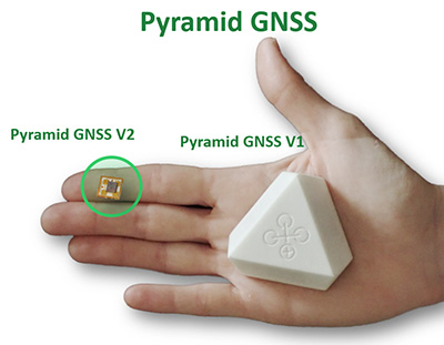
The Regulus Pyramid is a fully functional GNSS receiver fortified with spoofing detection capability. The receiver contains patented technology that enables it to differentiate between real GNSS signals and fake ones generated by an attacker. It is availble both as a fortified GNSS receiver (v1), capable of detecting spoofing attacks, and at the chip level (v2), allowing mobile phones, cars and internet of things (IoT) devices to receive GNSS spoofing protection. A Pyramid GNSS Add-On can be integrated with another satellite receiver to enable spoofing detection capabilities for any GNSS board.
The AGR6302 and AGR6303 GNSS patch antennas are designed for precision dual-frequency positioning. The AGR6302 is capable of receiving L1/L2 bands, and the AGR6303 is capable of receiving L1/L5 bands. They are designed for UAVs, precision agriculture, autonomous vehicles and other applications where precision matters. The AGR6302/AGR6303 active antenna is designed to cover GPS, BDS, Galileo, GLONASS, IRNSS and the QZSS system. It employs a stack four-feeds architecture with hybrid to achieve the multi-band operation, lower axial ratio, wider half-power beamwidth and excellent right-hand circular polarization. It is housed in a compact, industrial-grade waterproof and magnet mount enclosure.
The Alta 8 Pro multi-rotor drone includes waypoint technology to allow preprogrammed movements and autopilot functionality. The Alta Pro flight controller runs open PX4 flight stack for quick and powerful interfacing. The Alta 8 Pro fuses readings from accelerometers, barometer, and GPS to create high-bandwidth height control flight mode. By fusing GPS data with an IMU and barometer, the drone is able to hold position even in difficult weather conditions.
DJI Phantom 4 Pro with Loki PPK system. (Photo: GeoCue)
The DJI Phantom 4 Pro RTK (P4R) drone is now integrated into the AirGon Sensor Processing Suite (ASPSuite). ASPSuite is a post-processing solution for GeoCue’s Loki direct geopositioning system for DJI and other drones. The ASPSuite enables integration of the P4R with third-party L1/L2 GNSS base stations such as systems from Septentrio, Leica, Trimble, Topcon, CHC and others in a high-accuracy PPK workflow. It includes support for engineering-grade survey options such as vertical transforms, creation of and transformation between collection datums and local coordinate systems, application of antenna static and dynamic lever-arm corrections, and full support for Loki direct geopositioning systems.
The Insta360 Titan is an eight-lens cinematic virtual reality (VR) camera that captures 360-degree photos and video at up to 11K resolution. The Titan uses eight micro four thirds (MFT) sensors, the largest sensors available in any Insta360 standalone VR camera. It has a GPS signal antenna and a Wi-Fi signal antenna. The sensors maximize image quality, dynamic range, low-light performance and color depth, increasing realism in high-end professional VR capture.
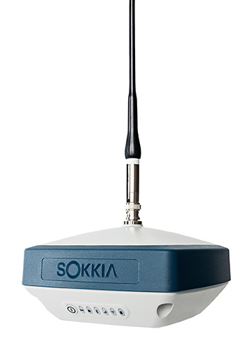
The GRX3 is designed to provide a smaller, lighter and fully integrated GNSS solution to Sokkia’s GNSS receiver line. Its compact and lightweight housing has been tested to meet IP67 certification for protection against harsh weather. The receiver features Sokkia Tilt technology, which includes a nine-axis inertial measurement unit (IMU) and compact eCompass designed to compensate for misleveled field measurements by as much as 15 degrees. UTC technology automatically tracks signals from all available and planned constellations, including GPS, GLONASS, Galileo, Beidou, IRNSS, QZSS and SBAS.
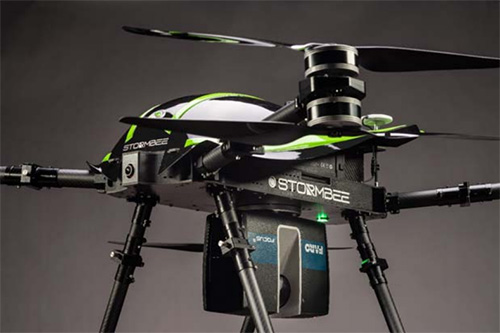
The Faro Focus scanner attached to a Stormbee UAV. (Photo: Stormbee)
The Faro–Stormbee airborne solution includes the Faro Focus laser scanner, the Stormbee S series UAV and the Beeflex software suite. It enables wide-area scanning missions such as highways, train infrastructure and buildings. It allows users to capture complex environments traditionally inaccessible to ground-based scanning. It has no need for control points. Users can create centimeter-level accurate point clouds directly from the in-flight data.
Experts discuss value of automation and new technology
Screenshot: Topcon
The new Infrastructure and Technology series of documentary videos is designed to foster awareness of growing global infrastructure demands and the technology that can help meet them. Experts interviewed include representatives from Intel, SAP, Industry Consultants, Constructech, Solar City and Topcon. They discuss how, by adopting technology, the construction and agriculture industries can increase productivity and help address infrastructure needs now and in the future.The series was filmed globally in the U.S., the Netherlands, the United Kingdom and Germany.
Updated to latest intellicad technology consortium release
Photo: Carlson Software
The specialized drafting package Carlson iCAD 2019 allows technicians to supplement the finished product in their project deliverables. New additions and functions to the iCAD 2019 release are new tool palettes, new 3D solid commands, additional DGN support, and new express tools. iCAD features Google Earth import and export KML/KMZ, standard CAD entities and the drawing inspector tool.Carlson iCAD 2019 has been built with and updated to the IntelliCAD 9.0 engine from the previous IntelliCAD Technology Consortium 8.3 release. IntelliCAD 9.0 supports direct read of DGN files, allowing users to make edits without converting drawing formats, and features a CUI interface for custom workspaces, toolbars and ribbons.
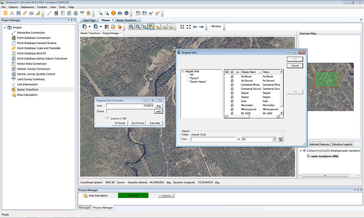
The 2019 Geographic Calculator features a universal copy and paste function, a new angular unit conversion tool, support for NADCON 5.0 and updated seismic survey conversion functionality. The foundation of the calculator’s geodetic data-processing functionality is the embedded GeoCalc datasource, which is continually revised and improved with updates through the online GeoCalc Geodetic Registry. The datasource included in the 2019 release mirrors the most current EPSG database definitions. The calculator’s copy and paste function can be used to quickly capture data for use in a third-party application or to insert new coordinate values in an existing job.
The InvenSense Coursa Drive software is an inertial-aided positioning solution for autonomous vehicle platform developers. It is a high-performance extension of the InvenSense Positioning Library (IPL), which has provided sensor-aided positioning to more than 50 million devices worldwide. Coursa Drive enhances inertial-only vehicle positioning to <0.2 percent of distance traveled, accuracy critical to maintaining decimeter lane-level vehicle positioning in challenging GNSS/perception system environments. Coursa Drive’s inertial navigation system (INS) calibrates using absolute position inputs from either high-accuracy GNSS receivers or from perception-based systems (camera, radar, lidar) with high-definition (HD) maps. In real time, Coursa Drive provides high-rate, 100-Hz delta positions and orientation to the autonomous vehicle system, complementing the lower rate position references from GNSS and perception systems. For non-real-time applications such as HD map creation and maintenance, Coursa Drive’s offline mode reprocesses INS data at two to three times higher accuracy than real-time mode, providing HD map companies alternative position references to verify HD map accuracy, even without GNSS, for up to 60 seconds.
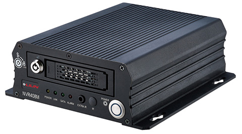
The mobile NVR408M with GPS navigation is designed for use in moving vehicles, remote locations or rugged environments. The rugged compact design works in harsh and demanding conditions to deliver quality video surveillance. Typical applications are in law enforcement or public transportation, using vehicles such as trains, buses, trucks, cars, airplanes and ships. NVR408M is an EN50155-certified product, able to withstand severe vibration and shock and making it suitable for railway applications.
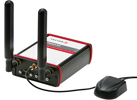
The VN4610 is a powerful interface for accessing IEEE 802.11p and CAN (FD) networks for Car2X/V2X communication using a USB PC connection. The VN4610 provides precise position, time and speed information that can be used by the application as test stimulus or for documentation. The absolute GNSS timestamps can be used to synchronize recordings of distributed measurements for subsequent analysis. The u-blox NEO-M8U supports GPS, GLONASS, Beidou and Galileo — up to three systems simultaneously. The IEEE 802.11p-based dedicated short-range communication (DSRC) communicates in the 5.9-GHz range. The VN4610 supports the unfiltered receiving and sending of IEEE 802.11p frames used for the implementation of Car2X/V2X applications. The received IEEE 802.11p radio-signal-based frames are transferred to the application synchronously to the CAN (FD) messages.
With enhanced ADS-B, SBAS and georeferenced charts
Photo: Collins Aerospace
The Pro Line Fusion avionics upgrade for Pro Line 4-equipped Bombardier Challenger 604 series aircraft has been certified by the U.S. Federal Aviation Administration (FAA). The all-in-one upgrade complies with pending mandates while modernizing the flight experience for pilots. The upgrade includes ADS-B mandate compliance, SBAS-capable GNSS, localizer performance with vertical guidance (LPV) approaches, radius-to-fix (RF) legs, geo-referenced electronic navigation charts, widescreen LCD screens and synthetic vision.
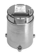
Systron Donner Inertial (SDI) has released an update to its SDN500 digital quartz MEMS GPS inertial navigation system (GPS/INS).
Introduced in 2011, the SDN500 is a platform extension of SDI’s proven, tactical-grade SDI500 IMU.
The modular, compact, 25 in3 SDN500 provides for maximum packaging flexibility in dense systems and delivers accuracies to within 1.0 mrad in attitude, 0.1 m/s in velocity and 3.9 meters spherical error probability (SEP), the company said.
The SDN500-xE product update provides a newer generation JF2 (C/A) Code GPS receiver and tightly couples the 1 PPS GPS signal to the SDI505 IMU synch pulse to improve heading performance and reduce jitter after long periods of operation without dynamic inputs. The specifications for the updated SDN500-xE will remain the same as the current SDN500-xD INS/GPS device.
The SDN500 offers superior tactical-grade performance integrating SDI’s latest generation quartz gyros capable of 0.5°/hr. bias in-run stability and exceptionally low ARW (0.02°/√ hr.), quartz accelerometers delivering 0.5 milli-g in-run bias stability and low VRW (80 µg/√ Hz.), plus high speed digital signal into a tightly coupled GPS-aided Inertial Navigation System for tactical navigation and geo-location applications.
PCTEL Inc. released at DistribuTECH a new dual-band 802.11ac/p MIMO antenna that helps boost data rates and reliability for utility networks, intelligent transportation systems and other industrial IoT (IIoT) applications, according to the company.
PCTEL’s Coach 4×4 Wi-Fi/DSRC GNSS multi-band antenna is designed for both mobile and fixed deployments, enabling smart grids, mobile workforce communications, and advanced automation technologies across a variety of industries.
The antenna also supports Dedicated Short Range Communications (DSRC), a common interoperable safety standard for vehicles.
“PCTEL’s latest antenna will enable the future of the IIoT,” said Rishi Bharadwaj, PCTEL COO. “For example, advanced smart grids utilizing Coach antennas could reduce outages and efficiently manage alternative energy sources.
“Coach antennas also provide mobile connectivity for applications such as DSRC, which has the potential to revolutionize road safety. Those are just some of the possibilities. PCTEL’s advanced RF design and environmental testing capabilities enable us to deliver superior 4×4 MIMO performance and exceptional durability for the most demanding applications,” added Bharadwaj.
This new low-profile antenna features four-port 2.4/5-GHz coverage along with PCTEL’s unique high rejection GPS/GLONASS technology for network timing and tracking, all in a single IP67-rated housing.
It supports a variety of wireless technologies, including broadband mesh networks, 802.11ac Wi-Fi and 802.11p DSRC Wireless Access in Vehicular Networks (WAVE) standards for direct vehicle-to-vehicle (V2V) and vehicle-to-infrastructure (V2I) communications.
This is the latest in PCTEL’s Coach antenna series. Coach antennas have been deployed in a variety of mobile and IIoT applications around the world. Their UV-stable design facilitates maximum installation flexibility without antenna orientation restrictions, the company said.
PCTEL is displaying its Coach4x4 Wi-Fi/DSRC GNSS multi-band antenna Feb. 5-7 at DistribuTECH, booth 11750, in New Orleans. It is available now to order using part #GL4X4MIMO-SF.
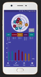
Global GNSS, a subsidiary of Polosoft Technologies, has launched a new mobile application named GNSS Surveyor, which is designed for the geospatial industry.
The application GNSS Surveyor provides location information and quality position data in real-time with sub-meter to centimeter accuracy. It needs to be connected to any external GNSS receiver via Bluetooth.
Features of the application include:
A one-touch configured command to communicate directly with the GNSS Bluetooth device.
Location information and quality of the position data in real-time with centimeter accuracy.
GPS data such as position, height, satellites and velocity.
Constellation information for GPS, GLONASS, Galileo, BeiDou, QZSS and SBAS satellites in the orbit.
Direct IP feature for RTK corrections data.
DMS to DD conversion or vice versa.
Real-time kinematic (RTK) correction data can be forwarded to a high-accuracy external device. The internal NTRIP client loads the RTCM data from the internet.
With GNSS Surveyor, location information is collected as latitude and longitude, altitude, speed or pace, bearing and UTC time.
GNSS precision includes global coverage, centimeter-level accuracy, fast time to first fix, multi-constellation and multi-band, and highest security, the company said.
Navigation uses include ground robotics navigation, lane-level navigation, heavy machine navigation, industrial navigation and tracking and commercial UAV.
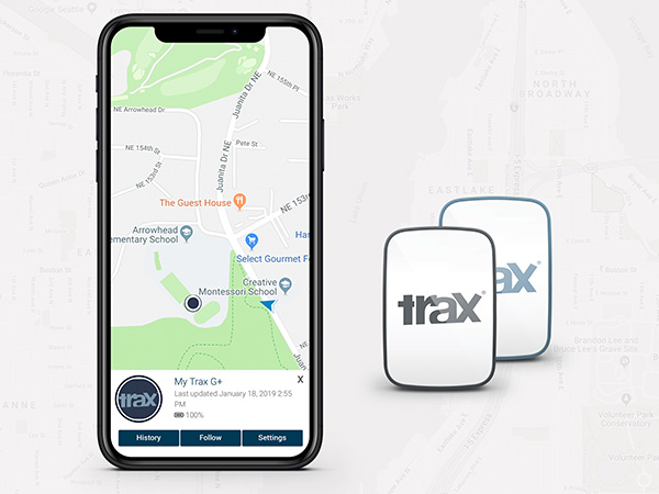
WTS Positioning Solutions, a Swedish GPS tracking company, has released its next generation of smart GPS trackers: the Trax G+ series.
At the top of the range is Trax G+ 4G LTE-M, one of the first LTE trackers commercially available on the market, the company said. It supports 4G LTE-M and NB-IoT standards, with both European and U.S. models available.
WTS has also released two new, improved GPS models using 3G and 2G standards, to complete the new Trax G+ range.
Trax G+ tracker. Trax G+ is a small GPS tracker for personal use. It has real-time tracking capability with update rates of up to every 10 seconds. For customised industrial applications, the new Trax G+ can support up to two updates per second. It also comes with wireless charging and IP68 water resistance.
The Trax G+ App, available in the App Store and Google Play, has a wide range of features including Unlimited Geofences, Augmented Reality Tracking, Speed Alerts, Location History, the possibility to track multiple devices and device sharing.
WTS works closely with brands across several consumer markets, including sports gear, event management, security, search and rescue, homecare and telecommunications.
Photo: WTS Positioning Solutions
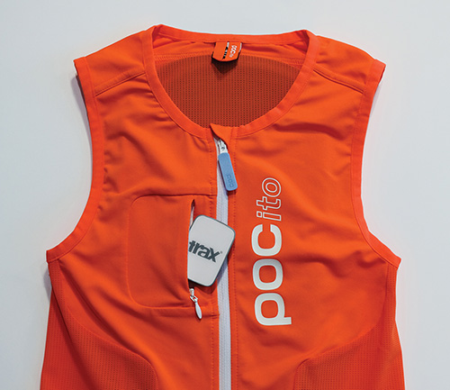
Tracking vest. A special collaboration with POC sports brand, manufacturer of helmets, body armour and sports apparel, resulted in an ISPO Gold Winner award for the POCito VPD Air Vest + TRAX POC edition.
The vest provides a child with back protection for winter sports and is designed to store a TRAX POC Edition device. It is an integrated protection, alert and tracking system that allows parents to monitor and keep children safe on the slopes.
POC will present the vest at ISPO Munich, held Fe.b 3-6, in Hall B6, Booth 414.
Trax G+ data plans are offered in 6-, 12- and 24-month pre-paid packages and offer international coverage and free roaming in all supported countries.
WTS Positioning Solutions are specialists within the GNSS industry, supplying personal GPS trackers, plus customised hardware, software, server and data solutions for high-precision real-time location and tracking information.