Esri has launched two new ArcGIS apps for field operating efficiency at the Esri User Conference, being held June 27–July 1 in San Diego. Attendees can see live demonstrations and experiment with Drone2Map for ArcGIS and Survey123 for ArcGIS.
“These two apps are already becoming game changers,” said Esri President Jack Dangermond. “What we’ve done is make it much easier for our users to collect data, including imagery, and then right away start working with that data — mapping, analyzing, sharing—in ArcGIS.”
Drone2Map for ArcGIS provides safe and affordable imagery on demand—a benefit especially useful to people who work in land analysis or infrastructure inspection and those monitoring events such as natural disasters and environmental change. Drone2Map takes still imagery captured by a drone and quickly turns it into high-quality 2D and 3D products in ArcGIS.
The app detects camera and sensor parameters and intelligently applies appropriate defaults. Its rapid-process capability allows teams in the field to be sure they’ve captured everything they need to avoid costly return trips. The imagery products created using Drone2Map can be used for analysis in ArcGIS Online and ArcGIS Pro to support informed decision-making.
Esri Survey123.
Survey123 for ArcGIS is a simple yet powerful form-centric field data gathering solution that makes it possible to create, share, and analyze surveys in three easy steps. With Survey123, paper forms are effectively transformed into digital surveys. Surveys, from simple to sophisticated, are authored and then shared in ArcGIS.
Using the Survey123 mobile app for iOS, Android or Windows, teams in the field capture survey results with their smartphones and tablets, even in disconnected environments. Data captured in the field is immediately available for analysis in ArcGIS to help users make better decisions. Survey123 is a versatile data collection solution already popular with people in public health, education, public works, disaster response, and humanitarian agencies.
Attendees of the Esri User Conference can see live demos and get hands-on experience with both of these new apps along with hundreds of other solutions designed to enable a smarter world.
]The annual event attracts 16,000 geographic information system (GIS) users, managers, and developers. It offers 300 moderated sessions, 450 hours of technical training, access to 300 software vendors, inspirational keynotes, and one-on-one sessions with Esri technical and professional support staff. See more of GPS World’s coverage.
Laser Technology Inc. (LTI) is offering a close-up look at its new geospatial information systems (GIS) technology at the 2016 Esri User Conference, which is being held June 27 to July 1 in San Diego, California.
Attendees are invited to stop by booth #2525 to discover how LTI can help professionals stay connected and map smarter by using its lasers and a personal smart device. The company will be handing out vouchers for a complete mapping solution, which could save GIS professionals hundreds of dollars.
The New TruPoint 300 with MapSmart on Android, by LTI.
The company’s MapSmart on Android software combines all of the sophisticated technology that is typically required to collect field data and puts it into a straightforward app for smart devices. The software simplifies the mapping process by allowing users to establish an origin quickly and begin mapping in minutes, LTI said.
With MapSmart now available on Android, users gain an improved workflow that includes wireless data transfer, a larger display and built-in help support. Users also have the ability to integrate location data by utilizing the GPS from a smart device or improve accuracy with an external antenna.
LTI is redefining the traditional total station with its brand-new TruPoint 300. A lightweight, compact, simple point-and-shoot laser with survey-grade accuracy, the TruPoint 300 costs a fraction of alternative technology. The unit measures the distance between two remote points and has onboard solutions for volume, heights and 2D and 3D areas.
Users can collect 3D measurements from a single location using a personal smart device and capture a photo of every shot taken. With the ability to collect on-site, extremely precise data in half the time, the modern total station is a go-to tool for collecting measurements quickly, easily and safely, LTI said.
“Achieving survey-grade accuracy with a compact and affordable unit is very exciting,” says Derrick Reish, senior product manager for Laser Technology’s Professional Measurement division. “Having the TruPoint 300 and our flagship TruPulse laser products communicate with MapSmart on Android allows us to offer a complete solution for field measurement and mapping.”
Imagine if you didn’t have to occupy the location you needed to map. LTI has made this possible with LaserGIS for Esri’s ArcPad data-collection software. This software allows users to fully maximize field work productivity. Working seamlessly with the current ArcPad platform, LaserGIS improves the data-collection process by making laser integration faster and easier. Users can now cover more ground in less time and measure the slope distance, inclination, azimuth and position remote features with one, simple shot.
Laser Technology Inc. is a Colorado-based designer and manufacturer of reflectorless laser measurement devices for GIS, forestry, natural resource management, general construction, utilities, mining and telecommunication applications.
Spirent Communications plc, a manufacturer of test equipment and services for improving positioning, navigation and timing (PNT) system performance, today announced the new Spirent GSS6450 RF record and playback system.
RF record and playback systems capture the rich, real-world radio frequency environment and bring it into the lab. This enables receiver, system and application technology developers to optimize performance and robustness.
The GSS6450 uniquely combines high-resolution, 16-bit-wide band sampling in a highly portable unit measuring 22 x 20 x 7.3 centimeters and weighing only 2 kilograms. The high-resolution capability means it can capture a more detailed RF environment, including RF interference, complex atmospheric scintillation and space weather impacts on the GNSS signal, so users can improve receiver performance against these signals.
With its compact size, the GSS6450 is designed for capturing data in the field such as on foot or in vehicles, and easily portable when traveling.
“The GSS6450 offers high resolution in a small self-contained battery powered unit,” said Rahul Gupta, commercial segment lead for Spirent’s positioning division. “Until now, high-resolution record and playback systems have been mains powered and not designed for in-field use. The GSS6450 changes that, enabling a range of signal powers and characteristics to be sampled, recorded, brought into the lab and replayed.”
It offers a choice of 4-, 8- or 16-bit I/Q quantization, and a 10-, 30- or 50-MHz recording bandwidth. Up to four GNSS frequency bands can be recorded simultaneously, making the GSS6450 suitable for a wide range of applications, from testing new devices, such as wearable tech and unmanned vehicles, to chipset development using new GNSS frequencies, and high-end system test.
The 16-bit I/Q quantization option gives up to 96 dB of dynamic range, so it also can be used for interference analysis and improving receiver resilience to GPS jamming.
The GSS6450 is also capable of recording additional non-RF sources including inertial sensor outputs, dead reckoning, and up to four video streams. Long recordings are achieved using up to 4 terabytes of on-board storage. An additional 8 terabytes of RAID storage can be added externally.
Harxon, a high-precision GNSS antenna manufacturer in China, has released a new GNSS + L-band antenna.
The GPS1000 receives GPS L1/L2/L5, BDS B1/B2/B3, GLONASS L1/L2, Galileo E1/E2/E5a/E5b and L-band frequencies, which can be used in land survey, marine survey, channel survey, seismic monitoring, bridge survey, container operation and agriculture applications. Customers can use the same antenna for GPS only or dual-constellation applications.
It has high gain and wide beam width to ensure the signal receiving performance of satellite at low elevation angle. The phase center of this antenna remains constant as the azimuth and elevation angle of the satellites change. Signal reception is unaffected by the rotation of the antenna or satellite elevation, so placement and installation of the antenna can be completed with ease.
The GPS1000 is housed in a IP67 waterproof enclosure for permanent installation, and maintains good performance in a variety of harsh environments. Plus, it can be customized by Harxon for the best solution for customers. Orders can be placed at www.harxon.com.
CEE HydroSystems has released a new single beam echo sounder survey system designed for shallow water unmanned surface vehicle (USV) survey applications, using both commercially available and one-off custom manufactured vessels.
The CEESCOPE-USV is a waterproof echo sounder, GNSS and broadband radio telemetry package that can be installed on remotely-operated crafts. It is a self-contained unit requiring no interface with the USV.
The CEESCOPE-USV uses real time broadband radio telemetry, detailed 20-hertz dual frequency soundings, up to 20 hertz RTK GNSS and a 3,200 sample per ping digital echogram, which are available on shore via the CEE-LINK radio base station. Using software packages such as HYPACK and Eye4Software Hydromagic data from the CEESCOPE-USV telemetry link, the operator can steer the USV along the survey line like in any manned boat survey.
“By removing the requirement for the vehicle to also handle data telemetry, total system costs may be reduced, and the separation of the instrument and vehicle electronics offers advantages for obtaining clean data, our main concern as an instrument manufacturer,” says Adrian McDonald, CEE Hydrosystems. “By giving surveyors a complete data package designed for USV surveying, we have made it a little easier for firms to create their own USV designs as they no longer have to worry about how to handle their data. Additionally, users wishing to add real time video or side scan capability to their USV simply plug the data output from these devices into the CEESCOPE-USV and those data are relayed to the shore with the GNSS and bathymetry data. Similarly, navigation data may be exported from the CEESCOPE-USV to vehicle control systems if needed, such as for waypoint guidance.”
Size, weight and power designed for smaller unmanned platforms
MB-Two module by Trimble.
The MB-Two GNSS module delivers highly accurate GNSS-based heading plus pitch or roll in an advanced industry standard form-factor for system integrators. The module’s embedded Z-Blade GNSS technology uses all available dual-frequency GNSS signals equally, without any constellation preference, to deliver fast and stable centimeter-accurate position and heading information. The MB-Two is designed for a wide variety of applications such as unmanned, agriculture, automotive, marine and military systems. The MB-Two features an enhanced dual-core GNSS engine with 240 channels capable of tracking L1/L2 frequencies from the GPS, GLONASS, Galileo and BeiDou constellations. The GNSS engine supports Trimble RTX correction services, including CenterPoint RTX and RangePoint RTX, delivered worldwide via L-Band satellite. The MB-Two combined with CenterPoint RTX delivers centimeter-level positioning without requiring a local base station or VRS network.
High performance, uninterrupted positioning for vehicle applications
The S1722DR8 GNSS dead-reckoning receiver, compared to a U.S. penny.
The S1722DR8 GNSS dead-reckoning receiver integrates a three-axis gyroscope/accelerometer and barometric pressure sensor with a GNSS receiver. Using wheel speed data from a vehicle, the S1722DR8 achieves 100-percent coverage. It can be flexibly mounted in any orientation, and does not have to be placed horizontally as do conventional dead-reckoning solutions that use a single-axis gyroscope. Its auto-calibration feature simplifies installation, while the short calibration time upon first use improves the user experience. The barometric pressure sensor provides highly accurate altitude information, which is useful for differentiating floor levels of multi-story parking garages or stacked highways.The S1722DR8 measures 17 x 22 millimeters. It offers continuous navigation even in GPS-signal-denied environments such as tunnels or underground parking lots.
The HX-DU1603D rover radio is an advanced, high-speed, Bluetooth-enabled wireless data link designed for GNSS/RTK (real-time kinematic) surveying and precise positioning. It is a lightweight, ruggedized UHF receiver for digital radio communications between 410 and 470 MHz in either 12.5- kHz or 25-kHz channels, which can be widely used in GNSS/RTK surveying and GNSS precise positioning systems. The HX-DU1603D is equipped with a Bluetooth transceiver for cable-free communications with external devices. It features an internal, rechargeable battery for ease of use and portability that allows long operational hours. Its display screen and buttons can be used to configuration parameters such as frequency, protocols, power display, serial port baud rate and air baud rate. By deploying the technology, users can instantly communicate with GNSS precise positioning receivers that share the same protocols throughout the world. The rover radio HX-DU1603D joins the line of Harxon products that include 25W base radio HX-DU8602T with simplex and 35W base radio HX-DU8608D with Duplex.
EyesMap3D generates accurate 3D models and point clouds, measured directly from images. It allows users to create high-density points clouds with textures achieving a realistic 3D model appearance. It is able to measure accurately on the images to generate true orthophotos, and geo-reference and scale the results. eyesMap3D users can use their cameras, mobile phone or camera drone to capture images. The program is compatible with most popular software packages on the market. The goal of maker eCapture is to allow the user to easily generate and work with 3D models and photogrammetric tools, while maintaining data quality.
Spectracom’s VelaSync time server and grandmaster clock.
Spectracom’s VelaSync high-speed time server offers high-performance synchronization for time-sensitive networks. It is designed for high frequency trading and other low-latency network applications.
Matching network speeds between timing and data on a single low-latency high-throughput network enhances synchronization accuracy and eliminates queuing delays and hidden time errors caused by slower connections. The availability of a network timing appliance with 40 GbE interfaces benefits deployment of critical network infrastructure at high-speed data rates.
When the VelaSync time server platform was introduced in 2014, it met the needs of financial trading networks’ move to 10 gigabit-per-second networking. Spectracom’s precision GPS timing technology, software from its partner FSMLabs and modular server hardware enable it to meet the needs of high-frequency trading and other low-latency network applications.
VelaSync Features
PTP + NTP on all ports
Low hundreds of nanoseconds accuracy
1G/10G/25G/40G Ethernet solves network queueing problems (silent time errors)
High-quality GPS-disciplined clock source
Rubidium atomic clock option
Single-pane-of-glass enterprise sync management
Time Intelligence Platform gathers statistics from clients, detects problems
Septentrio has introduced its next-generation high-precision Altus APS3G real-time kinematic (RTK) receiver, which brings technology only previously available in scientific receivers into the field for professional surveyors.
The new multi-constellation APS3G addresses major concerns about compatibility with new satellite constellations, as well as interference and jamming, according to Neil Vancans, vice president of Septentrio Americas.
Built on Septentrio’s AsteRx4 engine, the APS3G tracks all-in-view GPS, GLONASS, BeiDou, IRNSS, SBAS, Galileo and QZSS, including E6/L6, and all other signals known to be available in the medium term.
The APS3G incorporates Septentrio’s AIM technology with three notch filters for in-band jamming and chirp jammer resistance, ensuring the highest possible levels of accuracy and resilience under all conditions. This technology is proven in Septentrio’s reference station and scientific products, which are acknowledged as technology leaders and deployed by major research institutions all over the world.
With two hot-swappable batteries, the APS3G provides up to 14 hours of operation without recharging, the longest endurance of any high-precision GNSS receiver in the surveying industry, maximizing uptime in the field.
The APS3G provides optimum GSM signal reception, as well as a built-in advanced UHF receiver for reliable performance on longer baselines, yielding real-time 25 Hz RTK. It also supports TERRASTAR L-band corrections for sub decimeter-level accuracy.
The flexible APS3G receiver can function as either a rover or base station, providing maximum versatility in the field.
“The Altus APS3G with embedded AsteRx4 technology brings what has previously been available only in high-priced scientific GNSS receivers to the workplace of the average surveyor,” said Vancans.
“With 544 channels capable of tracking all known and foreseen satellite signals and bands, the all-in-one unit is future proof, and Septentrio’s open architecture makes the APS3G compatible with most other hardware and software solutions, driving down the lifetime cost of ownership. In addition, with its extremely low power consumption, no other survey receiver on the market gives as much battery life, saving time and money on the job.”
Trimble has introduced the MB-Two GNSS module, which delivers highly accurate GNSS-based heading plus pitch or roll in an advanced industry standard form-factor for system integrators.
The module’s embedded Z-Blade GNSS technology uses all available dual-frequency GNSS signals equally, without any constellation preference, to deliver fast and stable centimeter-accurate position and heading information, the company said.
The MB-Two is designed for a wide variety of applications such as unmanned, agriculture, automotive, marine and military systems.
The announcement was made at AUVSI’s Xponential 2016, the largest trade show for the unmanned systems and robotics industry.
“System integrators demand high performance, reliability and support for their positioning solutions,” said Elmar Lenz, general manager of Trimble’s Integrated Technologies Division. “The MB-Two is designed for easy integration and rugged dependability. The size, weight and power specifications of the unit make it the ideal choice for smaller unmanned platforms.”
The MB-Two features an enhanced dual-core GNSS engine with 240 channels capable of tracking L1/L2 frequencies from the GPS, GLONASS, Galileo and BeiDou constellations. The GNSS engine supports Trimble RTX correction services, including CenterPoint RTX and RangePoint RTX, delivered worldwide via L-Band satellite. The MB-Two combined with CenterPoint RTX delivers centimeter-level positioning without requiring a local base station or VRS network.
The Trimble MB-Two module is available now through the Trimble GNSS OEM international network of representatives and authorized dealers.
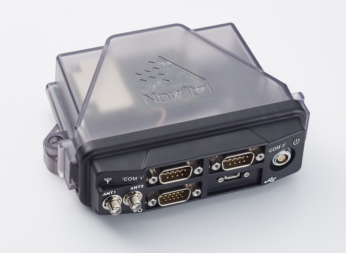
The compact FlexPak6 receiver houses NovAtel’s OEM628 triple-frequency plus L-band GNSS receiver board. It tracks all current and future GNSS constellations, with a highly configurable interface designed to meet current and future positioning and integration needs. The FlexPak6 is a GPS and GLONASS receiver that is also Galileo and Compass ready. Upgradable receiver firmware ensures easy updating to future signals. While multi-constellation tracking provides higher solution availability and reliability, its flexible communication interface broadens deployment options. It provides 100-Hz measurements for high dynamic applications. Signals tracked include L1, L2 and L2C and L5. It also has RT-2, ALIGN, GLIDE, RAIM firmware options.
Single- or dual-antenna receiver with latest algorithms
AsteRx-U dual-antenna receiver.
The AsteRx-U receiver incorporates the latest GNSS tracking and positioning algorithms, such as LOCK+ technology to maintain tracking during heavy vibration machine use and IONO+ technology to assure accuracy in regions of elevated ionospheric activity. Interference mitigation counteracts ambient and deliberate RF interference. The AsteRX-U is built around Septentrio’s latest application-specific integrated circuit (ASIC), the GReCo4, and incorporates built-in jamming detection and countermeasures, multipath rejection and fast acquisition. More than 500 hardware channels track all available constellations (GPS, GLONASS, Galileo, Beidou, IRNSS and QZSS).
For applications requiring both RTK and orientation
The Trimble BD935-INS delivers GNSS and inertial technology in an easy-to-integrate form factor for demanding conditions and applications such as lightweight robotic or unmanned vehicles. It features precision GNSS with an integrated 3D micro-electro-mechanical systems (MEMS) inertial sensor package, triple frequency for both GPS and GLONASS constellation, and dual frequency for BeiDou and Galileo. The compact module augments real-time precise positioning with 3D orientation. Connectivity and configuration allow system integrators and OEMs to add GNSS and attitude to specialized or custom hardware solutions. By integrating inertial sensors onto the GNSS module, users receive more robust performance in challenging environments. The module delivers fast and reliable real-time kinematic (RTK) initialization for 1–2 centimeter positioning. The integrated GNSS-inertial engine delivers high-accuracy GNSS and DGNSS positions in challenging environments such as urban canyons, tunnels and heavy canopy.
With its robust 555-channel engine, the new Leica Viva GS16 receiver is empowered by RTKplus to access all known and current signals while intelligently distinguishing which ones are the optimal combination to lock onto for accurate positioning adapting to any environmental conditions. There is also capacity for future signals, such as the full deployment of BeiDou and the expected progress of Galileo and QZSS. Thanks to SmartLink, the precise point-positioning technology, uninterrupted positioning continues even when local corrections services are unavailable due to obstructions or lack of cellular coverage. When no reference data is available, SmartLink continues to enable fully remote work. On a field tablet or controller, users can interact with immersive 3D models directly in the field, ensuring all data is collected and linked to the office.
SurphSLAM combines the new Surphaser 10 laser scanner and GeoSLAM’s new RealTime SLAM registration software. SurphSLAM can be used for extremely accurate high-resolution 3D mobile mapping without the need for GPS. The integration of technologies allows for the resulting point cloud to be registered and displayed in real time, facilitating the performance and speed of the survey. Surphaser scanners produce high-accuracy data sets with ultra-low noise levels. The combination of speed, low range noise, sub-millimeter accuracy and reduced size of the scanner make it suitable for a versatile mobile mapping system such as SurphSLAM. The custom-designed trolley is lightweight and collapsible.
OGC GeoPackage enables platform-independent data exchange
TerraGo Edge 3.9.3 features full support for OGC GeoPackage, a universal format for sharing maps and geographic data across mobile devices and platforms. TerraGo Edge enables users to import and export OGC GeoPackage as a SQLite database optimized for performance on iOS and Android devices. Release 3.9.3 closes the loop for a complete GeoPackage collaboration workflow by allowing Edge app users to import GeoPackage data from a mobile device, collect location-tagged field data, and roundtrip the information back to the GIS or other enterprise systems of record.
Open-source client extended with full galileo support
BNC on a Mac system for static real-time precise point positioning with Google Maps, such as for early warning of natural hazards.
Version 2.12 of the BKG NTRIP Client (BNC) real-time software for Windows, Linux and Mac now comes with complete command line interface and considerable post-processing functionality. RINEX Version 3 file editing and quality check with full support of Galileo, BeiDou and SBAS — besides GPS and GLONASS — are also among the new features. BNC version 2.12 allows simultaneous multi-station precise point positioning (PPP) for real-time displacement monitoring of entire reference station networks. Comparison of satellite orbit/clock files in SP3 format is another new feature, along with a large set of examples for various applications. BNC software was originally developed bythe Federal Agency for Cartography and Geodesy (BKG) and Czech Technical University.
The Leica GMX910 smart antenna is desgined for static, long-term projects requiring a high number of sensors. It can enable dynamic monitoring with up to 10-Hz data streaming and advanced multi-frequency, multi-constellation tracking. Starting with the basic GPS single-frequency receiver and adding multiple upgradable options, the antenna adapts to a wide range of GNSS monitoring applications, from complex manmade to natural structures. The smallest movements of bridges, dams or high-rise buildings are detected in real-time. The antenna supports multiple GNSS satellite systems and signals, tracking up to 555 channels. An IP67 rating against dust and water, extended temperature ranges and low power consumption enables installation of the device in remote areas and severe conditions.
For disaster monitoring, traffic patrol, security monitoring
The 25-gram HX-CH6601A GNSS helix antenna for UAV and geospatial applications receives GPS L1/L2, GLONASS L1/L2 and BeiDou B1/B2. It offers exceptional pattern control, polarization purity and high efficiency in a compact form factor. The antenna is equipped with a high-quality, durable IP65 sealed radome housing and terminated with a subminiature version A (SMA) connector, which has high gain and wide beam width to ensure the signal-receiving performance of satellites at a low-elevation angle.
The pingRX ADS-B (automatic dependent surveillance – broadcast) receiver requires 1/100th the power of conventional ADS-B receivers. It implements sense-and-avoid capabilities for small drones operating in the National Airspace. pingRX measures 32 x 15 x 3 millimeters, which is a fraction of the size of earlier units. It receives ADS-B information broadcast by other aircraft on two frequencies approved by the U.S. Federal Aviation Administration (978 MHz and 1090 MHz.) This allows the unit to detect commercial aircraft threats within a 100-statute-mile radius in real time.
Available as turn-key sUAS or as standalone gimbal
The U1 is a professional-grade unmanned aerial vehicle for the industrial survey and surveillance markets, as well as for cinematographers. Features include redundant flight control and battery systems, customized downlink with two high-definition (HD) video feeds, stability even at full zoom with a gyro-stabilized gimbal system, and remote camera control.
Car & Driver branded dash cam includes built-in GPS
The dash camera CDC-601 is equipped with built-in GPS and motion detection. Media shortcut keys allow the driver to manage settings and view their recordings. The camera automatically records when the driver starts the engine and shuts down when the ignition turns off. The 1080p high-definition camera has a 120-degree wide-angle lens, loop recording, time stamp and accident detection. An 8-GB card is included, but it can support up to a 32-GB card.
A science ROV being retrieved by an oceanographic research vessel.
The Rovins Nano is a new inertial navigation system for the offshore industry. Based on iXBlue’s fiber-optic gyroscope technology, the Rovins Nano is designed for for remotely operated underwater vehicle (ROV) pilots performing maintenance and construction operations. It offers the stability and accuracy of the inertial position, outputting true north, roll, pitch and rotation rates. It can directly transmit the ROV’s position with extreme accuracy because of its integrated INS algorithm capable of collecting acoustic data, regardless of the depth. Rovins Nano adapts itself to the user with easy configuration, installation and use. The goal is for the pilot to forget the existence of the product when maneuvering. Because of its compactness, lightness and open architecture with all third-party sensors, Rovins Nano is easy to integrate into existing ROVs.
New platform optimzed for transportation departments modernizing aging CORS installations
The Septentrio PolaRx5 GNSS receiver.
A new PolaRx5 Continuously Operating Reference Station (CORS) platform has been optimized for state departments of transportation (DOTs) and other real-time-kinematic (RTK) network operators. The PolaRx5 is powered by Septentrio’s AsteRx4 next-generation multi-frequency engine. It offers 544 hardware channels and supports all major satellite signals including GPS, GLONASS, Galileo and BeiDou, as well as regional satellite systems such as QZSS and IRNSS. Septentrio’s Advanced Interference Mitigation (AIM+) technology enables the PolaRx5 to filter out both intentional and unintentional sources of radio interference, from narrowband signals over high-powered pulsed signals to chirp jammers and Iridium transmitters. In addition, Septentrio’s patented APME+ multipath mitigation technology guarantees superior measurement quality by eliminating short-delay multipath errors without introduction of bias. The PolaRx5 leverages Septentrio’s web interface and built-in Wi-Fi and Bluetooth interfaces to give users complete control and visibility of the receiver. The user interface integrates into existing network management systems. The web browser provides secure access to all receiver settings and status, data storage and firmware upgrades as well as a built-in spectrum analyzer for system monitoring.
The Omata One speedometer displays essential information to cyclists in a classic form. The GPS computer inside the speedometer records with high precision so that cyclists can download their activity data to their preferred training applications or websites. On the outside, Omata One has a legible and mechanical analog movement that shows riders the speed, distance, ascent and time. The product displays only these four core pieces of information so the cyclist can focus on the ride. Omata plans to offer additional GPS speedometers for other sports.
Adds LTE, Wi-Fi and cloud-based diagnostics to older cars
Samsung Connect Auto plugs directly into a car’s OBD II port underneath the steering wheel. It uses real-time alerts to help users improve their driving behavior, including increased fuel efficiency, while offering a Wi-Fi connection for passengers. The connection is kept secure using Samsung KNOX , the company’s mobile security platform. The backbone of Samsung Connect Auto is KNOX security and Tizen OS for interoperability. Developers can leverage Tizen and Samsung’s software development kit (SDK) to further evolve additional services. Samsung also encourages safe driving behavior by using geofencing and driver rating algorithms. In the event of an accident, emergency alerts notify the driver’s contacts, and accident concierge services are provided. A “Find My Car” app also helps in locating a car in real time using LTE and GPS. Samsung Connect Auto will initially be available in the second quarter in the U.S., with AT&T the first wireless provider.
Tallysman, a manufacturer of high-performance GNSS antennas, has added two triple-band GNSS antennas to its multi-band antenna line.
The antennas are designed for precision agriculture, autonomous vehicles and other applications where precision matters. The ability of the antennas to access L-band correction services extends its utility to a wider range of applications.
The TW3970 is a pole mount, or through-hole mount antenna, which is also available in an embeddable form as the TW3965. Both employ Tallysman’s Accutenna technology and are capable of receiving GPS L1/L2/L5, GLONASS G1/G2/G5, BeiDou B1/B2, Galileo E1/E5a+b plus L-band correction services (1164MHz to 1254MHz + 1525MHz to 1606MHz).
The TW3970 is housed in a through-hole mount, weather-proof enclosure for permanent installation, with (L braacket, pipe mount or pole mount. The antenna is available with either a flat radome (pictured) or a conical radome. The conical radome is used in permanent mount locations to ward off birds and shed ice and snow.
The TW3965 is an embeddable antenna available with a wide selection of connectors and custom cable lengths. It can be custom-tuned by Tallysman to ensure optimum performance within the customer’s enclosure.
Both versions have superior cross polarization rejection to enhance multi-path signal rejection, tight phase center variation (PCV), and an excellent axial ratio.
SkyTraq Technology Inc., a fabless GNSS positioning technology company, has introduced the S1722DR8 GNSS dead-reckoning receiver, integrating a 3-axis gyroscope/accelerometer and barometric pressure sensor with a GNSS receiver.
Using wheel/speed data from vehicle to perform sensor-fused solution, S1722DR8 achieves 100-percent coverage. It is designed for vehicles applications requiring high performance and reliable uninterrupted positioning.
The S1722DR8 can be flexibly mounted in any orientation, and does not have to be placed horizontally as in conventional dead-reckoning solutions using single-axis gyroscope. The auto-calibration feature of S1722DR8 greatly simplifies installation procedure; the short calibration time upon first use also improves user experience.
The S1722DR8 GNSS dead-reckoning receiver, compared to a U.S. penny.
The on-board barometric pressure sensor provides highly accuracy altitude information, useful for differentiating floor levels of multi-story parking garages or stacked highways.
The S1722DR8 is compact, measuring 17 x 22 millimeters. It offers continuous navigation even in GPS-signal-denied environments such as tunnels or underground parking lot. Augmented by gyroscope and accelerometer sensor data, it is also designed for vehicle insurance accident-reconstruction applications.
An S1722DR8 engineering sample, evaluation kit and datasheet are available now. Volume delivery to customers begins in June. The S1722DR8 is manufactured in ISO/TS 16949 automotive-certified factory.