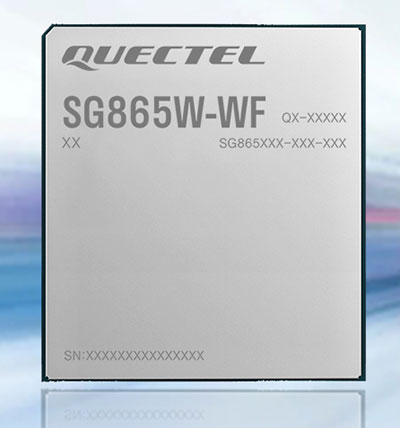
Quectel Wireless Solutions has launched the SG865W-WF, a new generation of flagship Android smart module. The module is equipped with Qualcomm’s QCS8250 system-on-chip (SoC), which offers powerful performance and rich multimedia functions to meet industrial and consumer artificial intelligence IoT (AIoT) scenarios.
Quectel made the announcement at the Consumer Electronics Show (CES) taking place this week in Las Vegas.
With various peripheral interfaces such as dual USB, multiple PCIe and UART, the product can seamlessly integrate with cellular and GNSS modules such as Quectel’s EC20 LTE module, and the RG500Q 5G module, allowing customer terminals to be connected flexibly to 4G/5G networks and achieve faster and more accurate positioning.
The SG865W-WF module will accelerate the efficient deployment of high-end AIoT applications such as video conferencing, cloud gaming, digital signage, unmanned aerial vehicles (UAVs), robots and smart retail.
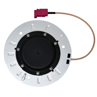
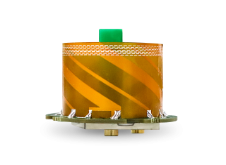
Tallysman Wireless Inc. has added the low-profile triple-band HC997EXF to its line of embedded helical GNSS antennas, and the TWA928LXF to its AccuAuto line. Both feature the company’s eXtended Filtering (XF).
Designed for UAVs and Other Applications
Photo: Tallysman
The HC997EXF is designed for precise positioning, covering the GPS/QZSS-L1/L2/L5, GLONASS-G1/G2/G3, Galileo-E1/E5a/E5b, BeiDou-B1/B2/B2a, and NavIC-L5 frequency bands. It also covers the satellite-based augmentation system (SBAS) available in the region of operation — WAAS (North America), EGNOS (Europe), MSAS (Japan) or GAGAN(India) — as well as L-band correction services.
The low-profile helical antenna is packaged in a light (11 g) and compact form factor (60 mm wide and 25 mm tall). Its precision-tuned, high-accuracy helical element provides an excellent axial ratio and operates without a ground plane. These features make the HC997EXF suitable for lightweight unmanned aerial vehicle (UAV) navigation and a wide variety of precision applications.
The HC997EXF antenna base has a flying lead and a variety of connectors. To facilitate installation, Tallysman provides an optional embedded helical mounting ring that traps the outer edge of the antenna circuit board to the host circuit board or any flat surface. Tallysman provides support for installation and integration of its embedded helical antennas to ensure optimal performance.
New Vehicle Antenna Launched
Photo: Tallysman
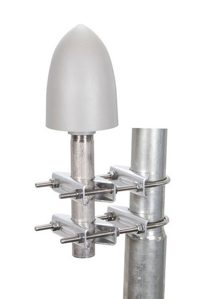
Another new XF antenna, the TWA928LXF, is part of Tallysman’s AccuAuto autonomous vehicle family of compact and rugged embedded antennas.
The triple-band TWA928LXF supports GPS/QZSS-L1/L2/L5, GLONASS-G1/G2/G3, Galileo-E1/E5a/E5b, BeiDou-B1/B2/B2a, and NavIC-L5 signals and frequency bands, including L-band correction services.
The TWA928LXF vehicle antenna features a patented Tallysman Accutenna technology antenna element, an integrated ground plane, radome and underside cover that provides mist and condensation protection. The bottom cover also supports the antenna cable and mitigates cable vibration to ensure that the antenna has a long service life, while the ground plane improves antenna performance.
All AccuAuto antennas are built with Automotive Electronics Council (AEC) certified electronic components designed to perform under the most challenging environmental conditions, such as extreme temperatures, shock and vibration.
XF Coming to All Lines
eXtended Filtering enables the HC997EXF antenna to mitigate new and existing radio frequency bands that interfere with GNSS signals. The custom XF filtering has been tested to mitigate new (Europe and Japan) and existing LTE signals, enabling the XF antennas to produce clean and pure GNSS radio frequency data.
For example, in North America, the planned Ligado service, which will broadcast in the frequency range of 1526 to 1536 MHz, could affect GNSS antennas that receive space-based L-band correction service signals (1539–1559 MHz).
Similarly, LTE signals or their harmonics, such as the new LTE bands in Europe–Band 32 (1452–1496 MHz)–and Japan–Bands 11 and 21 (1476–1511 MHz)–have affected GNSS antennas and receivers.
Lastly, the Inmarsat satellite communication uplink (1626.5–1660.5 MHz), commonly used on maritime vessels, can also affect nearby GNSS antennas.
Tallysman Wireless also has added eXtended Filtering (XF) to its TW3800 series of Accutenna precision antennas, and will be rolled out to all of Tallysman’s product lines.
A roundup of recent products in the GNSS and inertial positioning industry from the December 2021 issue of GPS World magazine.
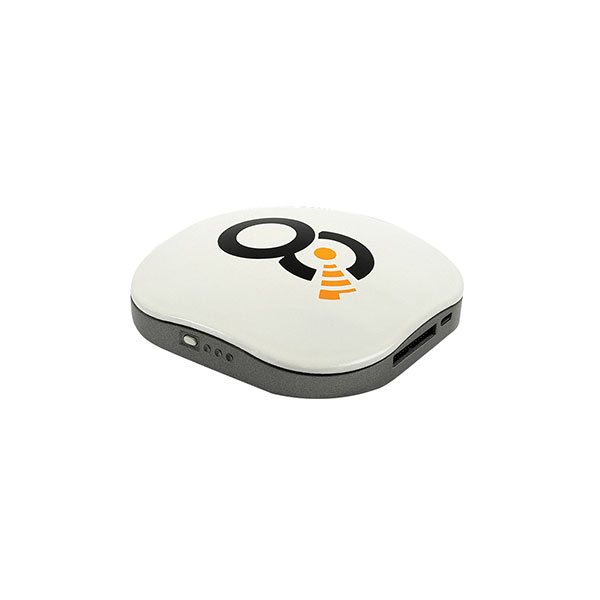
OEM
Satellite-cell terminal
With built-in GPS receiver
Photo: OQ
OQ Technology’s dual-mode satellite-cellular IoT modem and tracker is a plug-and-play, small, low-cost and low-power solution that can collect data from more than 1,000 sensors. It has a built-in GPS receiver and supports 5G NB-IoT, GSM, LTE-M and bi-directional satellite links. The flexible, robust and programmable dual-mode terminal has pre-paid data packages suitable for remotely monitoring and controlling fixed and mobile assets in industries such as transportation, oil and gas, utilities, and maritime.
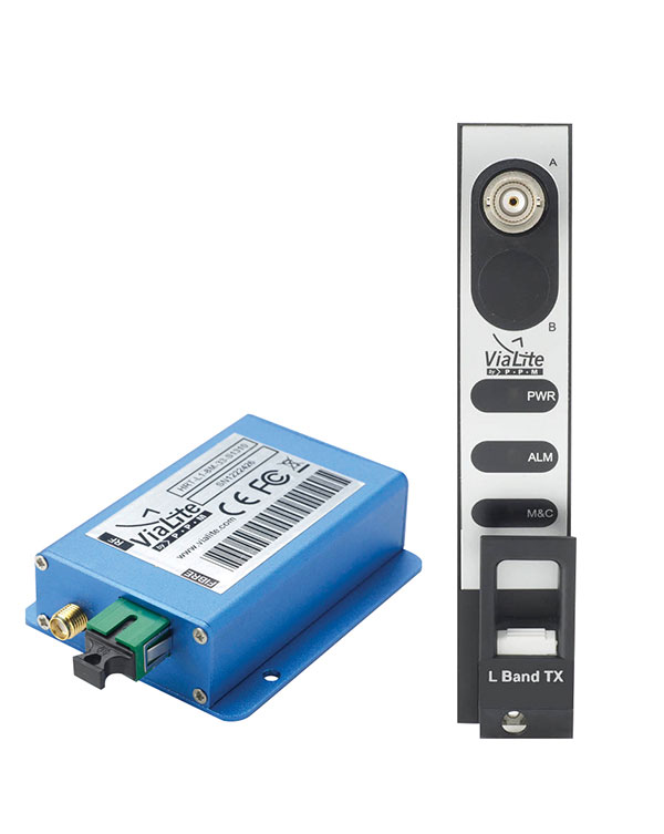
Provides mission-critical, extended length GPS over fiber
Photo: ViaLite
ViaLite’s GPS over Fiber Extension Kit for Microchip/Microsemi GPS timing servers provides mission-critical GPS timing and synchronization for systems requiring extremely accurate clock signals. Standard transmission distances for the extension kit can be up to 10 km, while solutions are available for distances as long as 50 km. The ViaLite kit was chosen for its unique performance with Microsemi’s S650 timing server. The ViaLite GPS link is designed to provide a remote GPS/GNSS signal or derived timing reference to equipment located where no signal is available, such as inside buildings or tunnels. By using optical fiber instead of traditional coaxial cable, extreme distances are possible with no radio frequency loss and zero introduction of noise.
The RELY-MIL-TIME-SERVER, which complies with MIL-STD-810G and MIL-STD-461G, embeds the latest timing, networking and security technology in a single SWaP platform. The all-in-one rugged edge computing device acts as a high-performance master clock and serves secure accurate timing distribution (PTP, NTP, GNSS). The timing feature is combined with high-bandwidth and high-availability Ethernet switching and L2/L3 cybersecurity services in a unique commercial-off-the-shelf device. At its heart is a Xilinx Ultrascale+ MPSoC device powered by SoC-e hardware IP cores for PTP and high-availability low-latency Ethernet networking.
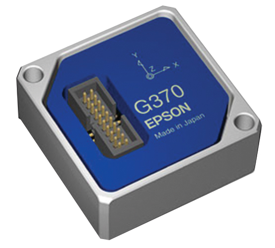
The M-G370PDS0 inertial measurement unit (IMU) is equipped with a high-performance six-axis sensor. It has an angle random walk (short-term variation in output) of 0.03°/√h, which is half that of its predecessor, and can more accurately detect very slight changes in the attitude of equipment and systems, since they do not get lost in sensor noise. The small size, light weight and low power consumption will help customers make their own products smaller and lighter. It also maintains compatibility with earlier products (the M-G370/365/364/354), making performance upgrades easy.
The OSA 5400 SyncModule enables technology suppliers to integrate precise synchronization into their hardware. Its M.2 form factor can add timing capabilities to switches, routers, open compute servers and other IT devices. The SyncModule provides GNSS, precision time protocol (PTP) and network time protocol (NTP) engines as well as comprehensive PTP and GNSS monitoring and assurance functionality. It can enable assured sub-microsecond timing in public and private networks as well as critical infrastructure. Featuring multiple interface options for easy integration, the OSA 5400 SyncModule comes with an open API. It also can be managed by ADVA’s proven Ensemble Sync Director management system.
Running on Microsoft Windows, u-center 2 offers anyone working with 10th-generation (M10) u-blox GNSS technology a highly intuitive interface to configure GNSS products, evaluate their performance, improve the quality of their software, and experience the performance boost achieved using GNSS-related services. The software is the successor to the u-center GNSS evaluation software, which has been used by design engineers for almost two decades to develop GNSS receiver applications. Compatible with u-blox M10 GNSS technology, u-center 2 is designed to offer improved performance over its predecessor. New features in u-center 2 simplify configuration, evaluation and software development of GNSS-based solutions. It is free for download.
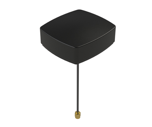
The MEA-1227-SM is a GNSS/L1 and L2 low-profile screw-mount antenna. It has high performance suitable for maintaining constant network connectivity. The MEA-1227-SM covers all GPS/GLO/BEI/ QZSS/Galileo/SBAS/L1L2 standard frequencies. It is designed for telematics systems, remote surveillance, asset tracking and any internet of things (IoT) system applications. This screw mount antenna is easy to install, with a low profile suitable for challenging installations. It has a IP67-rated housing and anti-rotation mounting.
The Cowboy e-bike solution provides riders with high-performance, real-time GNSS accuracy, enabling them to map their own paths and those of the cities in which they live. It uses smart road-companion applications to ensure riders get precise information, regardless of the route they travel. The positioning component uses Taoglas’ Accura GVLB258.A, a multi-band GNSS L1/L5, high-performance stacked patch antenna, in conjunction with u-blox’s SAM-M8Q GNSS positioning module. The combination allows for extremely low power and high accuracy. The solutions works with “micromobility” services offered by Cowboy, such as Easy Rider for theft detection, bike insurance and crash detection notifications.
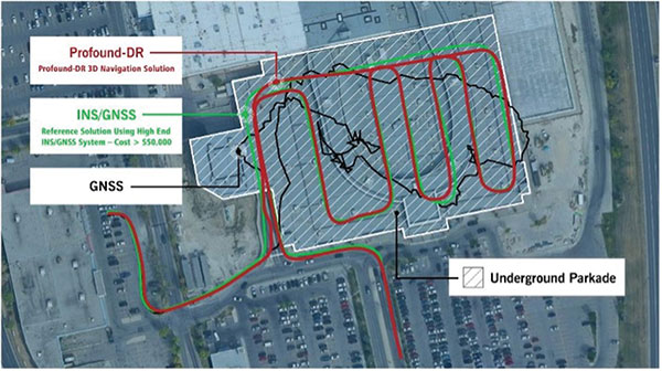
Instant decimeter-level accuracy with automotive sensors
Photo: Profound Positioning
The Profound-IVT (instant vehicle tracking) provides cost-effective vehicle navigation. Based on a firmware library, and rapidly adaptable to any navigation platform, IVT combines precise point GNSS positioning (PPP), dead reckoning and radar technologies in an integrated solution to provide decimeter-level positioning accuracy plus orientation and velocity. IVT performs in tunnels, dense urban environments, multi-level highway junctions and parking garages. With errors <1% of distance travelled, resolution is extremely rapid. Base stations are not required and there are no operating range limitations. Applications include driver assistance, mobility and taxi, autonomous vehicles, geofencing, fleet tracking, insurance, driving and safety management, and connected driving.
Off-the-shelf map data through the HxGN Content Program
Photo: Hexagon
Metro HD city data is a new offering of ultra-high-resolution 2D and 3D digital twins of major cities. Metro HD expands the data stack to include high-definition true orthophotos, obliques, digital terrain models, lidar point clouds, 3D building models (LOD2), 3D meshes and land-use maps. Cities captured in 2021 include Munich, Cologne, Vienna, Milan, Amsterdam, Stockholm, Tokyo, Dallas, New York, Stuttgart and Frankfurt. More cities will be added in early 2022. The program uses a hybrid urban mapping sensor, the Leica CityMapper-2, that concurrently collects lidar and aerial imagery. The derived products, based on the strength of each subsystem, result in superior accuracy and temporal consistency across all three data dimensions.
Bad Elf LLC and Laser Tech are providing an integrated laser offset workflow for acquiring high-accuracy field data in GNSS-challenged environments. The new workflow integrates Bad Elf and LTI hardware in collaboration with ArcGIS technology from Esri. The Bad Elf Flex GNSS receiver connects to any LTI TruPulse rangefinder over a wired or Bluetooth connection to deliver high-accuracy location data to Esri ArcGIS Field Maps. Field workers can now efficiently complete position and height data collection in access-limited situations, saving time, money and effort. The Bad Elf app workflow runs on Android and iOS.
Geo-genie is a cloud-based collaborative and professional mapping and surveying platform enabling customization and creation of geocentric information systems. Teamed with Handheld’s Algiz RT8 rugged field tablet, it streamlines work and allows non-professionals to perform accurate geodetic mapping, guiding and monitoring of their data collection. The platform enables organizations to have an advanced, professional surveying and GIS platform with customized procedural workflows, management of user hierarchies, and integration with other organizational information systems. Geo-genie can connect with professional surveying equipment, such as GPS and total stations, and integrates data into a cloud-based central database with no restriction for specific data-collection hardware.
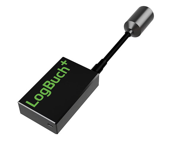
The wireless GNSS amplifier LogBuch+ increases the accuracy of location data with the cloud-based LogBuch application. The app enables voice-based digital mapping via a smartphone app, such as for the maintenance of trees. The compact device receives satellite signals on several radio frequencies, delivering significantly more precise data than a smartphone alone. Foresters can carry the GNSS amplifier in a pocket and digitally mark trees for felling using the LogBuch app.
The YellowScan Explorer lidar can be mounted on a light manned aircraft or helicopter, as well as a UAV platform such as the DJI M300. This versatility allows the end user to tackle a wide range of projects with the same unit. It uses an Applanix APX-20UAV GNSS/inertial solution and has a precision of 2.6 cm and an accuracy of 2.2 cm. Its high-power laser scanner can catch points up to 600 meters away. Flight operation speed is 5–35 m/s; it is capable of above-ground-level altitude up to 300 m. The low-weight unit (2.3 kg without battery) can be combined with YellowScan’s suite of software to extract and process point cloud data for surveying, forestry, environmental research, archaeology, industrial inspection, civil engineering and mining sectors.
The DJI Mavic 3 improves on its predecessor with better sensors, a dual-camera system, omnidirectional obstacle sensing, smarter flight modes and longer flight times. A powerful positioning algorithm improves hovering precision with signals from GPS, GLONASS and BeiDou satellites, enabling the drone to lock onto multiple satellite signals faster. The increased positioning precision also makes the drone less likely to drift in the air and more stable when shooting long exposures and time lapses. The Advanced Pilot Assistance System (APAS) 5.0 combines inputs from six fish-eye vision sensors and two wide-angle sensors to sense obstacles in all directions and plan safe flight routes.
Conduct missions, manage fleets and view video feeds
Photo: SkyGrid
SkyGrid’s autonomous remote UAV operations solution enables drone operators to remotely conduct missions, control flights, manage fleets and view live video feeds. Using artificial intelligence and airspace-related data feeds, SkyGrid enables safe remote operations, whether conducting routine inspections or generating optimal flight paths. Advanced route generation capabilities create the safest route for each drone based on the flight plan, environmental conditions, the vehicle’s performance, and the mission criteria with minimum on-site support required. SkyGrid Launch allows video feeds from drones to be consolidated to a remote central location, such as a ground station.
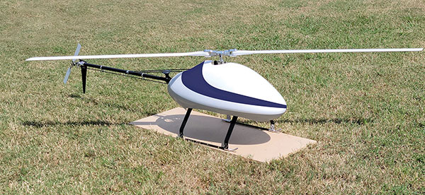
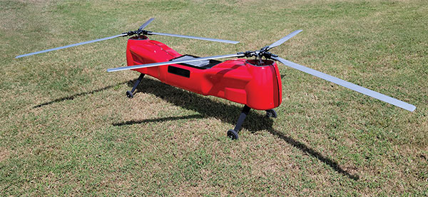
The Sicura EG-1100 is a heavy-lift, long endurance, single-rotor helicopter. Now in its third generation, the helicopter can haul 15 pounds. It cruises at 55 knots. The EG-1100 is available in both electric and gas engine configurations, with an endurance at 3.5 hours on gasoline and 1 hour on electric power. The new gas engine is the high-performing and efficient Skypower 110, tuned to the craft’s internally developed chassis and rotor blades. It offers stable performance in challenging environmental conditions, exceptionally stable flight and immediate flight response for image capture and lidar operations. Multiple payload sets can be carried in one flight.
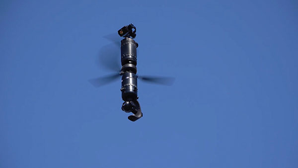
The Spirit dual-rotor coaxial unmanned aerial system (UAS) is a versatile and durable system for mission-critical operations. Combined with a fully modular, plug-and-play payload design, the Spirit’s open architecture allows operators to easily add or upgrade software to unlock new operating capabilities without the need to design or develop a new aircraft. It has an all-weather airframe. With nearly 10 pounds available for batteries and payloads, Spirit sets the new standard for performance in its weight class. Setup is quick and easy, allowing for takeoff from any type of terrain. The highly streamlined all-weather airframe has a top speed of 60 miles per hour and can operate in high winds. Payloads and batteries can be mounted or stacked on the top or bottom point.
Harxon has introduced the HX-CUX005A to its family of helix antennas.
The HX-CUX005A is an embedded helix antenna designed for high-precision positioning. It offers superior satellite signal tracking, including GPS, GLONASS, Galileo and BeiDou as well as L-band correction service.
Upgraded with Wi-Fi and Bluetooth tunable (BT) for better integration, the HX-CUX005A is designed to be an all-in-one solution for surveying, unmanned aerial vehicles (UAVs), personnel and vehicle monitoring, and many more applications.
The powerful antenna has Harxon’s patented D-QHA technology and multi-point feeding technology. It is able to provide reliable and consistent signal tracking with centimeter-level accuracy by exhibiting a stable phase center, 2.5-dBi high gain with ultra-low signal loss, wide beam width and exceptional low-elevation satellite tracking.
In addition, the HX-CUX005A is optimized in circuit layout and equipped with robust pre-filtered low noise amplifier that guarantees excellent out-of-band rejection performance and strong multipath reduction capacity. In this way, unwanted electromagnetic interference is restrained for improved signal filtering over all GNSS frequency bands.
The integration of Wi-Fi and Bluetooth (2.4 GHz/5.8 GHz) provides 1-dBi gain (typical value) to enable easy connection and configuration for mobile device users. Its highly integrated design simplifies development process and reduces costs for device engineers, Harxon said.
Key Features of the HX-CUX005A
Comprehensive GNSS support: GPS, GLONASS, Galileo, BeiDou and L-band correction service
Centimeter phase-center repeatability, high gain at low elevation
Improved signal filtering and excellent multipath rejection
Weighs 10 grams in small form factor to facilitate integration
Integrated with Wi-Fi and Bluetooth tunable (2.4 GHz/5.8 GHz).
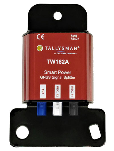
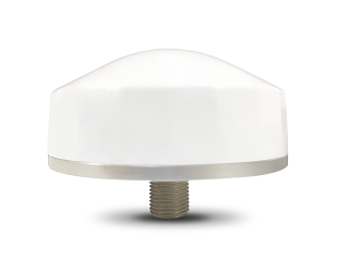
Tallysman Wireless Inc. has added the TW162A automotive-grade smart power GNSS signal splitter to its line of GNSS accessories.
The Tallysman TW162A signal splitter supports the full GNSS spectrum: GPS/QZSS-L1/L2/L5, QZSS-L6, GLONASS-G1/G2/G3, Galileo-E1/E5a/E5b/E6, BeiDou-B1/B2/B2a/B3, and L-band correction service frequency band.
Vehicle rooftop antenna space is often at a premium, and mission applications often require more than one GNSS receiver. The TW162A supports this use case where one GNSS antenna provides the signal to two GNSS receivers.
It also offers key fail-over and fault-identification features.
First, the splitter accepts power from all attached GNSS receivers; if one receiver fails, the next attached receiver automatically provides power to the splitter and antenna.
Second, if the antenna fails and does not draw current, all connected receivers will sense a current draw lower than 1 mA, indicating an antenna fault.
The TW162A offers high performance in terms of noise figure, isolation and linearity. TW162A is built with Automotive Electronics Council AEC-Q100 certified components, ensuring a wide operational temperature range and a long service life. It has been rigorously tested and is packaged in a durable, compact and lightweight aluminum housing.
The TW162A is available with three Z or A+B+C FAKRA connectors.
The GP-L1-32-T-MNT GPS timing antenna with mount included, RHCP polarized, 1.571 to 1.61 GHz. (Photo: RadioWaves)
RadioWaves, an Infinite Electronics brand and a manufacturer of high-quality microwave antennas and accessories, has released a new series of GPS/GNSS timing antennas that cover L1 and L5 GPS bands.
The new series of GPS/GNSS timing antennas provide axial ratio and higher accuracy for the reception of satellite timing signals and reference frequencies for enhanced phase synchronization in precision network deployments.
The high gain, low noise figure of 2 dB and high out-of-band rejection provided by these antennas allows for the use of longer and cost-effective cables for easy and flexible installs. They also feature a VSWR less than 1.8:1 and are compatible with several existing mounting brackets. In addition, thee fully ruggedized, weather-sealed antennas are IP67 compliant for use in outdoor and marine environments.
The antennas come equipped with built-in surge protection and support a wide range of GNSS including GPS, GLONASS, BeiDou and Galileo, as well as Iridium. Increased position accuracy in densely populated urban areas, flexible installation, and improved system security make RadioWaves’ latest antenna offering a valuable system component, the company said.
Models include
GP-L1-L5-40-N, an L1+L5 GPS timing antenna, 1.166 to 1.218 GHz and 1.559 to 1.606 GHz
GP-L1-32-T, a L1 GPS timing antenna, RHCP polarized, 1.574 to 1.61 GHz
GP-L1-32-T-MNT, an L1 GPS timing antenna with mount included, RHCP Polarized, 1.571 to 1.61 GHz.
DJI Mavic 3 has better sensor, dual-camera system, omnidirectional obstacle sensing, smarter flight modes and longer flight times
Mavic 3 drone. (Image: DJI)
The new DJI Mavic 3 is an update of the company’s folding camera drone, providing comprehensive improvement and boosting performance for aerial photography.
The Mavic 3 has improved navigation and obstacle sensing systems. A powerful positioning algorithm improves hovering precision with signals from GPS, GLONASS and BeiDou satellites. This enables Mavic 3 to lock onto multiple satellite signals faster. The increased positioning precision also makes the drone less likely to drift in the air and more stable when shooting long exposures and time lapses.
For its obstacle sensing system, Advanced Pilot Assistance System (APAS) 5.0 combines inputs from six fish-eye vision sensors and two wide-angle sensors, which seamlessly and continuously sense obstacles in all directions and plan safe flight routes to avoid them, even in complicated environments.
The obstacle-sensing system also enables more intuitive subject tracking with the upgraded ActiveTrack 5.0. Previous iterations of ActiveTrack enabled the camera to follow a subject as it moved directly toward and away from the drone while remaining largely stationary as well as fly alongside a moving subject. ActiveTrack 5.0 allows Mavic 3 to move with the subject as it moves forward, backward, left, right and diagonally, and fly alongside as well as around a moving subject.
If the subject moves too fast and temporarily goes out of frame, visual sensors on the aircraft will continue to track and frame the subject intelligently and pick it back up when it reappears. These new directions enable much more fluid and diverse drone and camera movement while using ActiveTrack.
Other safety features include geofencing, which alerts drone pilots when they fly near sensitive locations; altitude limits to ensure pilots are aware of altitude restrictions; and the AeroScope Remote ID system that allows authorities to identify and monitor airborne drones in sensitive locations.
Mavic 3’s integrated AirSense system, first widely introduced in DJI Air 2S, warns drone pilots of nearby airplanes and helicopters transmitting ADS-B signals, so they can quickly fly to a safer location.
Hasselblad camera
Mavic 3 has a 4/3 CMOS Hasselblad camera and 28x hybrid zoom camera. Omnidirectional obstacle sensors have a 200-meter range, and redesigned batteries provide up to 46 minutes of flight time.
Upgraded hardware and software can process 5.1K video at 50 frames per second and support 4K/120 fps for high-quality results for slow-motion footage. An enhanced Mavic 3 Cine edition offers Apple ProRes 422 HQ encoding for richer video processing, with an internal 1TB SSD onboard for high-speed data storage.
DJI Mavic 3’s customized L2D-20c aerial camera embeds a professional-grade 4/3 CMOS sensor with a 24 mm prime lens in a sleek and compact form. Rigorous Hasselblad standards for hardware performance and software algorithms allow it to shoot 20-MP still images in 12-bit RAW format and videos in 5.1 K at 50 fps and 4 K at 120 fps. The higher video definition creates smoother footage and more generous cropping possibilities and allows for slow-motion video at 120 fps.
The larger image sensor gives Mavic 3 higher video resolution and dynamic range and more effectively suppresses noise in low-light environments. A native dynamic range of 12.8 stops helps retain more details in highlights and shadows, preserving rich visual information with a greater sense of depth and elevating imagery to a professional level. An adjustable aperture of f/2.8-f/11 is available to meet the needs of aerial photographers in a wide variety of lighting scenarios to get sharper and clearer images.
A roundup of recent products in the GNSS and inertial positioning industry from the November 2021 issue of GPS World magazine.
OEM
Simulator
Designed for desktop convenience
Photo: Orolia
The BroadSim Solo has a compact form factor designed to fit comfortably at a typical desk or workstation. It shares the same Skydel simulation engine that runs on a standard BroadSim, BroadSim Anechoic and BroadSim Wavefront. It supports advanced scenario creation features and the benefits provided by a software-defined architecture such as high dynamics, a 1000-Hz iteration update rate and ultra-low latency of 5 ms. Nearly all civilian GNSS signals can be generated through the Solo’s single RF output (one frequency band at a time), along with jamming or spoofing signals, and GPS AES M-code.
Series offers GNSS, 5G NR, and wifi-6E combination
Photo: 2J Antennas
The Stellar series of antennas is designed for a large suite of devices with a focus on GNSS, sub-6 GHz, 5G NR, 4G LTE, 3G, 2G and WiFi-6E technologies. The series is suitable for law enforcement, medical transportation, fire rescue and other mission-critical applications. The series includes single or up to 9-in-1 configuration choices within the range of 617 MHz to 7125 MHz frequency bands. The patent-pending technology reduces the antenna footprint by 55% while implementing a new double trifilar design and longitudinal resonances for MIMO/ARRAY configurations that traditionally have more complex size restrictions (such as B71 band/600 MHz). Each antenna configuration uses symmetrical or asymmetrical resonators for negative sections of the antenna, resulting in maximum performance at low and mid frequencies.
The full-band GNSS HC990E embedded helical antenna is designed for precise positioning, covering the GPS/QZSS-L1/L2/L5, QZSS-L6, GLONASS-G1/G2/G3, Galileo-E1/E5a/E5b/E6, BeiDou-B1/B2/B2a/B3, and NavIC-L5 frequency bands, including the satellite-based augmentation system (SBAS) available in the region of operation [WAAS (North America), EGNOS (Europe), MSAS (Japan), or GAGAN (India)], as well as L-band correction services. The HC990E embedded helical antenna is designed and built for high-accuracy positioning. It is packaged in a very light and compact form factor, making it suitable for a wide variety of applications, especially lightweight UAV navigation. The HC990E is 60-mm wide and 25-mm tall, weighing 12 grams. It features a precision-tuned helical element that provides an excellent axial ratio and operates without the requirement of a ground plane. The HC990E also features a low-current, low-noise amplifier (LNA) and pre-filter to prevent harmonic interference from high-amplitude signals, such as 700 MHz band LTE and other nearby in-band cellular signals.
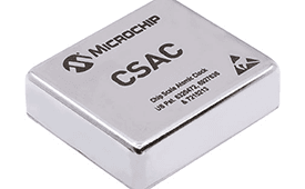
The SA65 chip-scale atomic clock (CSAC) provides precise timing accuracy and stability in extreme environments. Designed for military and industrial systems, it features ultra-high precision and low power consumption. The SA65 CSAC delivers higher performance than the previous SA.45s CSAC, including double the frequency stability over a wider temperature range and faster warm-up from cold temperatures. It has an operating temperature range of –40° C to 80° C and a storage temperature range of –55° C to 105° C. The warm-up time of two minutes at –40° C is 33% faster than that of the SA.45s. These performance improvements benefit designers of highly portable solutions for military applications such as assured positioning, navigation and timing (A-PNT) and C5ISR (command, control, communications, computers, cyber, intelligence, surveillance and reconnaissance).
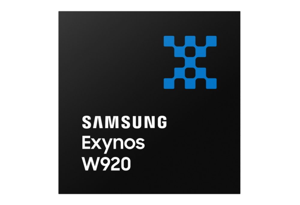
Samsung Electronics is offering a new processor for wearables, the Exynos W920. The new processor integrates an LTE modem and is built with an advanced 5-nanometer (nm) extreme ultraviolet process node, offering powerful yet efficient performance demanded by next-generation wearable devices. The Exynos W920 is embedded with a GNSS L1 receiver (GPS, GLONASS, BeiDou, Galileo) for tracking speed, distance and elevation during outdoor activities. It also has a 4G LTE Cat. 4 modem. It has two Arm Cortex-A55 cores for high-performing, power-efficient processing and an Arm Mali-G68 GPU with CPU performance improved by 20% and 10 times better graphics performance than its predecessor. The Exynos W920 supports a new unified wearable platform that Samsung built jointly with Google, and will be first applied to the upcoming Galaxy Watch model.
The Arrow Gold+ and Arrow 100+ expand upon the features of the Arrow Gold and Arrow 100. The Arrow Gold+ has a battery life 3.5 hours longer, for a total of 11 hours of field autonomy. It supports concurrent use of BeiDou B3 and GPS L5 signals when using RTK corrections, and the upcoming Galileo E6 High-Accuracy Service (HAS). The Arrow 100+ has a battery life 6 hours longer than the Arrow 100, for a total of 18 hours of field autonomy. It also supports Atlas H50 (Basic) service subscriptions, which provide 30-50 cm positioning accuracy worldwide when no SBAS or RTK network is available. Both the Arrow Gold+ and Arrow 100+ use Eos Bridge to connect with external sensors — multiple mobile devices can connect to a single Arrow GNSS receiver via Bluetooth.
EagleView’s high-resolution ortho and oblique imagery now can be converted into 3D mesh layers with Skyline’s PhotoMesh and viewed, edited and analyzed on Skyline’s TerraExplorer platform. EagleView customers will be able to use Skyline’s TerraExplorer web-based GIS viewer and editor to see, analyze and share their imagery in an immersive environment. Accurately measuring distance, area and volume is now easier than ever, which is critical for planning and zoning to verify regulations or estimate the costs of flattening a site. With floodplain analysis, disaster management can identify flood risks before they happen, and with viewshed calculations E911 can pre-plan for high-profile events. Other key analytic features for customers include the ability to analyze shade, view contour and slope maps, and view in underground mode. The additional 3D Mesh capability is available as an add-on to any new Reveal Essentials+ Property or Neighborhood image capture.
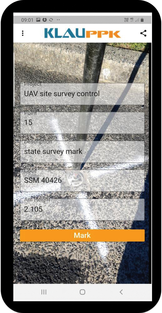
The KlauPPK Phone App, designed for use on drones with KlauPPK hardware and software, enables users to collect ground survey points with a name, description, feature code and antenna height like a traditional survey controller. The app sends the information to the operator’s computer for processing with the raw GNSS data logged in the KlauPPK unit on the pole. After post processing, the accurate survey data can be brought into CAD software to create points and line strings. The app takes a photo of the point being captured, and metadata is collected in the project. Users can place ground control points or check points, pick up as-built data like roads and utilities, and perform basic surveying. The system is compatible with the hybrid PPP/PPK MakeItAccurate post-processing service.
TerraLens 9.3 is a real-time software development toolkit for geospatial visualization. This release improves performance for 3D visualization for large viewports and multi-domain visualization features for command-and-control applications. It is significantly faster to enhance situational awareness. With increased multithreading in its map handling, TerraLens can load and display vector, raster and elevation formats smoothly without pre-processing, suitable for applications with disk size constraints or customers with a short turn-around time. A pre-processing option is still included. Improved data culling ensures only visible items will be rendered — especially noticeable when displaying large numbers of dynamic tracks and objects. New tools and features including support for OGC 3D Tiles for cityscapes, and a new API to control resolution of terrain mesh. Elevation warnings can now be displayed.
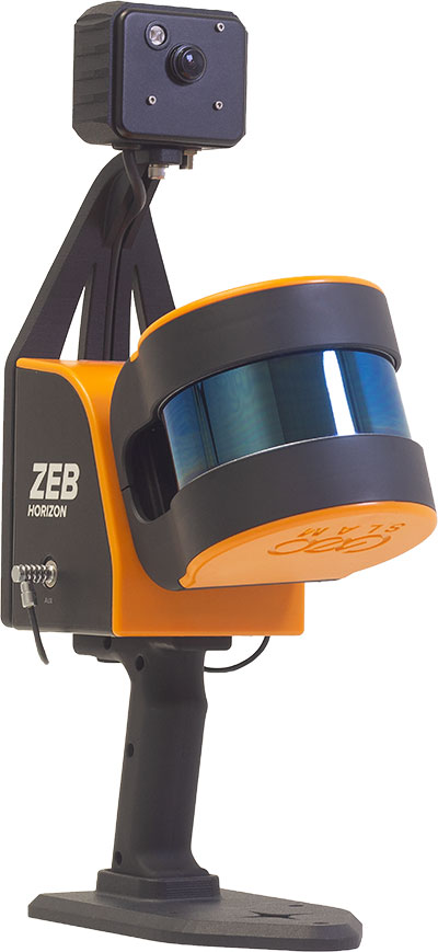
The ZEB Vision 16MP panoramic camera is now available for pre-order. Suitable for any ZEB Horizon, the new camera provides better colorization, image walkthroughs and point-cloud measurements using optional Draw software. Further updates mean GeoSLAM customers now can take a ZEB Horizon from handheld to UAV usage to get a more complete picture of projects. ZEB Horizon is compatible with the DJI Matrice 300 UAV.
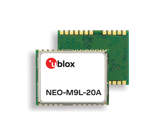
A new series of automotive-grade positioning modules are operational up to 105° C (221° F). The NEO-M9L modules and the M9140-KA-DR chip are built on the u-blox M9 GNSS platform and use dead-reckoning techniques to provide accurate position data when satellite signals are compromised or unavailable. The NEO-M9L-20A and NEO-M9L-01A modules, as well as the M9140-KA-DR chip, are specially designed for first-mount automotive solutions. The NEO-M9L-01A variant offers an extended operational temperature range up to 105° C, making it suitable for integration on the roof, behind the windscreen, or inside hot electronics control units. Applications include integrated navigation systems such as in-vehicle infotainment (IVI) and head units, integrated telematics control units and V2X.
Provides positioning accuracy in tunnels, parking garages
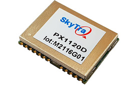
Photo: SkyTraq
The PX1120D GNSS/inertial measurement unit (IMU) is suitable for both automotive pre-installation and aftermarket. The robust dead-reckoning module integrates a six-axis IMU and a concurrent quad-GNSS chipset. It receives signals from GPS, GLONASS, Galileo and BeiDou, as well as QZSS. The sensor-fusion module maximizes positioning accuracy in challenging environments, providing continuous navigation in tunnels and underground parking lots. For automotive pre-installation applications where vehicle wheel-tick signals are available, the PX1120D provides wheel-tick sensor fusion with automotive dead-reckoning. In aftermarket applications where wheel-tick signals are unavailable, the PX1120D provides an untethered dead-reckoning sensor-fusion solution. A single PX1120D module provides both automotive and untethered dead-reckoning functionality, simplifying logistics. It is suitable for infotainment systems, telematics control units, vehicle tracking, and advanced driver-assistance systems.
The Trooper Max 5G FR1 antenna platform is a 5G configurable and low-profile antenna platform for intelligent transportation and public safety applications. Configurable and optimized for multiband applications, the platform includes an option to add land mobile radio connectivity through an external whip port. With a slender shark-fin form factor, the Trooper Max is recommended for installation on public safety fleets. It is compatible with cellular routers supporting 600-MHz to 6-GHz frequencies. It also covers Wi-Fi 6 frequency ranges.
Version 7.9 of the CompassTrac fleet and asset management solution provides winter fleets with more detailed spreader controller information and greater insight through enhanced dashboard and reporting functions. Features include integration of numerous spreader controllers for granular, pre-wet and liquid materials; a snow-fighting dashboard consolidating key performance indicators; and a snow materials report that delivers historical reporting of granular, pre-wet and direct liquid material application rates and totals, including air and road temperature (where available). The fleet-management solution integrates GNSS, GIS and wireless networks, enabling end users to view the real-time locations and status of vehicles, people, and other high-value assets for full situational awareness.
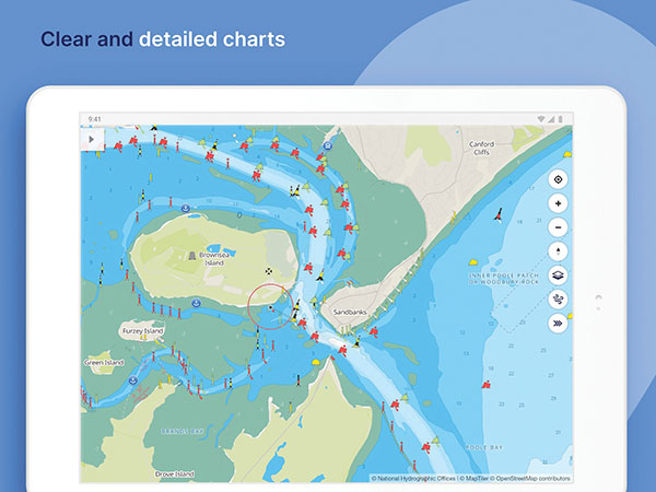
New departure scheduling charts route, wind, tides
Photo: Savvy Navvy
Smartphone app Savvy Navvy now allows boaters to plan better by visually showing the best time to depart given wind and tidal implications, leading to more informed and cost-saving decisions for journeys. By comparing passage times, as well as weather and tide information, boaters can immediately make crucial decisions based on safety, comfort, time and cost. Savvy Navvy is available on Android, iOS, PC and Mac and can be used on an unlimited number of devices simultaneously. It charts, weather, tide, marina details and passage planning with full tidal vectors. Active GPS tracking shows vessel position and enables boaters to instantly check course over ground (COG) and speed over ground (SOG). The app uses UKHO, NOAA and other official hydrographic charts from around the globe, as well as tide data from 8,000 tidal stations.
The Anzen EG-1250 provides a heavy lift, multi-drop, long endurance and flexible platform, expanding the services and operational support offerings from UAS Global Services. With an endurance of six hours, the EG-1250 can carry 75 pounds, cruise at 65 knots, in any weather day or night. The EG stands for an electric and gas dual-engine configuration, with the secondary engine able to power the aircraft or act as a power boost for the primary Skypower rotary SP-180 SRE engine. The Anzen EG-1250 is auto-rotation capable and offers an optional safety parachute system. The flexible platform can support industries such as maritime, agriculture, oil and gas, utility, cargo delivery and intelligence, surveillance and reconnaissance (ISR).
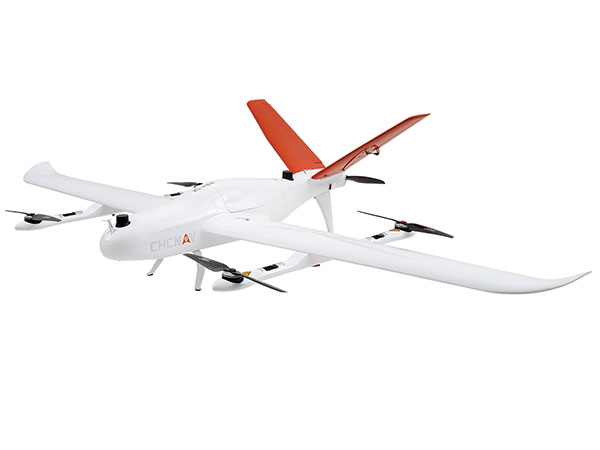
The P330 Pro is a high-performance vertical takeoff and landing (VTOL) fixed-wing UAS for aerial surveying and mapping. It provides high accuracy, long endurance and multiple payloads. It features a 100-Hz differential module, which allows aerial mapping operations at the centimeter level, and a flight endurance with payload reaching more than 150 minutes. The P330 Pro can be used to conduct small- and large-scale aerial surveys with extreme data quality, and is an alternative to manned aircraft for surveying and mapping, mining, construction and infrastructure, environmental monitoring and agriculture.
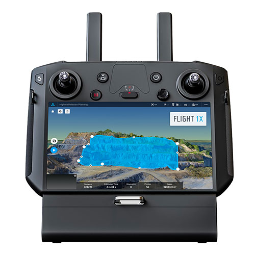
Capability expansion enables M300 for data capture
Photo: Skycatch
Flight1x software now provides data-capture capabilities for the DJI Matrice 300. The Skycatch High Precision Package provides mining operations with cloud or edge-based data processing that enables viewing terrain in 4D, automated RTK/PPK industrial drone management, and fast edge processing with data visibility in minutes. Built on technology adopted by large mining companies, Flight1x includes purpose-built flight automation software for the M300, leveraging DJI’s L1 and P1 sensors. Flight1x is part of the Skycatch High Precision Package, which provides mining operations with cloud or edge-based data processing that enables viewing terrain in 4D, automated RTK/PPK industrial drone management, and fast edge processing with data visibility in minutes.
Offers 5G and artificial intelligence capabilities
Photo: Qualcomm
The Flight RB5 5G platform is designed to accelerate development of commercial, enterprise and industrial drones. Powered by the Qualcomm QRB5165 processor, it condenses multiple complex technologies into a tightly integrated drone system. With 5G and Wi-Fi 6 connectivity, the platform enhances critical flying abilities beyond visual line-of-sight to support safer, more reliable flight. High-performance computing provides power efficiency for artificial intelligence and machine learning, enabling fully autonomous drones. A secure processing unit supports cybersecurity protections. New camera capabilities deliver premium image capabilities and performance. The Flight RB5 5G drone reference design is available through ModalAI. Use cases include mapping, inspection, film and entertainment, defense, security and emergency response, and delivery.
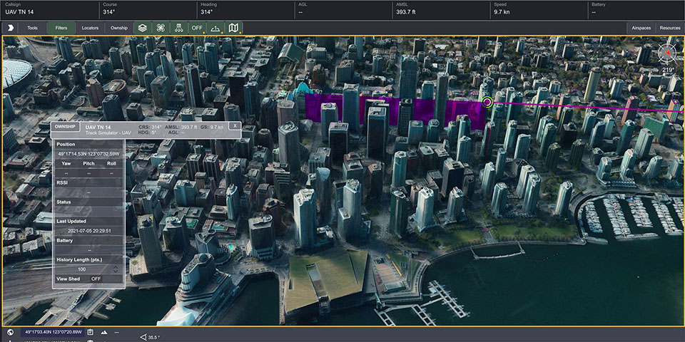
Spirent GNSS Foresight lets operators know where and when unmanned vehicles, air taxis and drones can operate safely and dependably beyond visual line of sight, especially in urban areas where buildings frequently obstruct GNSS signals. The cloud-based solution can produce forecasts using data from any of the world’s satellite constellations, and is of particular interest to the aviation, UAS and automotive industries. Spirent GNSS Foresight’s ability to accurately predict where and when autonomous systems will perform enables users to scale operations or services by expanding operational areas, reducing the number of system disengagements, and providing a greater level of safety and reliability assurance when reducing — or ultimately removing — human involvement in the driving or piloting task.
Harxon is offering two new GNSS antennas for intelligent connected vehicles (ICV). ICVs are equipped with advanced sensors, controllers, actuators and other devices. They are enabled for intelligent information exchanges between the vehicle and everything (car, road, people, cloud), technology known as V2X.
The Harxon HX-AUST002. (Photo: Harxon)
The Harxon HX-AULT002. (Photo: Harxon)
The ICV antennas connect autos with GNSS, 5G, Wi-Fi, ultra-wideband and more. Both highly integrated high-performance multiband automotive antennas provide swift, reliable connectivity to meet the increasing demands of seamless communication experience for intelligent transportation system (ITS) applications.
The integrated antennas support dedicated short-range (DSRC) and cellar vehicle-to-everything (C-V2X) communication. The antennas embed a premium GNSS antenna with high gain for consistent and reliable precise positioning service. They also allow for multiple input and output of data to achieve swift internet download speed in 5G networks.
HX-AULT002. (Photo: Harxon)
The Harxon HX-AUST002 is designed to connect unmanned passenger vehicles to networks, clouds, other vehicles, and ITS roadside infrastructure.
The Harxon HX-AULT002 is designed for unmanned commercial vehicles, including short-distance delivery vehicles, mainline logistic heavy-duty trucks, and intercity shuttle buses.
The versatile antennas are suitable for integration in on-board units (OBU), intelligent roadside units, chipsets and Tier 1 automobiles.
A roundup of recent products in the GNSS and inertial positioning industry from the October 2021 issue of GPS World magazine.
MOBILE
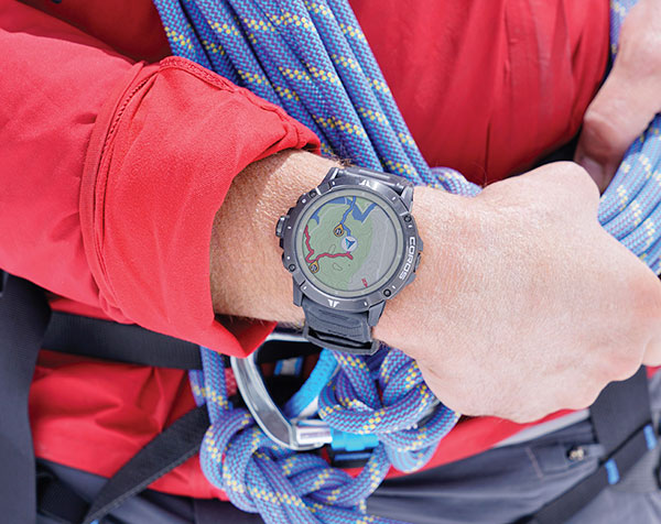
Smartwatch
Provides dual-frequency and topo maps
Photo: Coros
The Vertix 2 GPS “adventure watch” is equipped with a dual-frequency GNSS chipset for high accuracy. It communicates with all global navigation satellite systems simultaneously, and has a battery life of 140 hours while using GPS — otherwise, the battery extends to 60 days. Global offline maps include landscape, topography and hybrid views. The watch includes an Insta360 action camera and has 32 GB of internal storage.
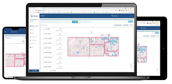
AirFinder helps companies locate, monitor and manage business assets indoors and outdoors. The quickly deployable, massively scalable platform does not require an IT infrastructure or extra components or hardware. Rather than using an internal Wi-Fi system, AirFinder operates on Link Labs’ patented and secure Symphony Link network. Location data from each AirFinder device securely flows to the AirFinder web app or directly to customer databases via extensible APIs, which enable users to monitor assets in real time, analyze asset history, add rules and alerts, establish geofences and more.
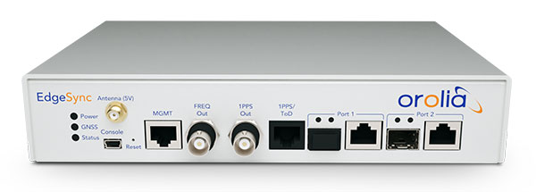
The EdgeSync network timing platform provides NTP and PTP grandmaster and boundary clock functionality for real-time edge applications. High performance, scalability, ease of use and manageability make EdgeSync suitable for data centers, finance, mobile edge computing, enterprise, smart grid, industrial IoT, process control and telecommunications. EdgeSync uses a multi-GNSS receiver (GPS, Galileo, GLONASS, BeiDou and QZSS), PTP and Synchronous Ethernet (SyncE) as input references and generates PTP, SyncE, NTP and timing signals (10 MHz, 1 PPS and time-of-day message) as outputs. It features dual 1-GbE ports for both copper RJ45 and optical network timing connections. EdgeSync also can provide IEEE 1588-2008 (PTP) grandmaster and boundary clock functionality.
CompassOne provides real-time military-grade location, orientation and direction sensing for deployed static and on-the-go assets. It receives all GNSS, ensuring uninterrupted operation. The device can be used both in counter UAV operations and general situations requiring satellite navigation. With a strong focus on durability and ruggedness, CompassOne is suitable for installation and operation in harsh environments. Military-grade connectors and high-end stainless-steel hardware ensure uninterrupted connection and protection from the elements, while the aluminum underside provides exceptional impact resistance and rigidity while keeping overall weight low. CompassOne can operate alone or be integrated with DroneShield’s DroneSentry system.
The Snapdragon 888+ 5G mobile platform is expected to power commercial smartphones from ASUS, Honor, Motorola, vivo and Xiaomi in the second half of this year. Satellite systems supported include all four constellations (GPS, BeiDou, Galileo, GLONASS) with dual-frequency GNSS. Additional systems supported include NavIC, QZSS and SBAS. Snapdragon 888+ provides AI-enhanced gameplay, streaming, photography and premium connectivity. Compared to its predecessor (the 888), Snapdragon 888+ provides an increased Qualcomm Kryo 680 CPU Prime core clock speed at up to 3.0 GHz and the sixth-generation Qualcomm AI engine with up to 32 TOPS AI performance, an improvement of more than 20%.
The Skydel Real-Time Performance graphs illustrate the software-defined engine’s low latency during a GNSS simulation. (Screenshot: Orolia)
A new real-time performance capability, now standard on all Skydel-powered GNSS simulators, achieves an ultra-low latency of 5 milliseconds. Skydel’s software-defined architecture is designed to meet the demanding GNSS simulation testing requirements in the automotive, military, space and other high-tech industries. Skydel also supports hardware-in-the-loop simulations without sacrificing ultra-low latency and high-end performance. A dashboard shows real-time performance graphs and enables users to grade the simulator’s performance, interpret data, diagnose inefficiencies, and optimize scenarios on the fly. As the system reaches its limits, it remains stable and fully operational, preserving the integrity of the simulation.
PointMan software is now integrated into the Vivax Metrotech vLoc3 with a GNSS real-time kinematic (RTK) receiver to create a utility-locate device. Using the RTK-Pro internal cellular module with 4G LTE capabilities, the operator can connect to the NTRIP RTK caster that provides RTCM 3 corrections. With the integration of PointMan with the vLoc3 RTK-Pro, critical buried infrastructure can be captured, recorded and displayed at survey-grade accuracy without additional external equipment or post-processing. The integration provides centimeter accuracy of the precise location of buried utilities in real time. Data collected includes the type of utility, the depth of cover and the utility’s precise location.
Geospatial and location intelligence for smart cities
Screenshot: Hexagon Geospatial
M.App Enterprise 2021 is a significant update to the platform for creating geospatial and location intelligence applications. The latest release features new browser-based 3D capabilities and enhanced visual effects, plus the ability to create and configure custom applications more easily. It allows users to access LuciadRIA’s 3D features with support for panoramic imagery, shading, ambient occlusion and other visualization effects to build browser-based solutions. It also features a new browser app configurator that makes it easier to create spatio-temporal dashboards, or Smart M.Apps. Feature Analyzer now allows users to add and manage multiple datasets on the fly and set up workflows.
Skycatch is offering new data-capture capabilities for the DJI Matrice 300 through its proprietary Flight1x software — a key component of the company’s High Precision Package.
The High Precision Package provides mining operations with cloud or edge-based data processing that enables viewing terrain in 4D, automated RTK/PPK industrial drone management, and fast edge processing with data visibility in minutes.
Built on technology adopted by companies Komatsu Mining and AngloAmerican, Flight1x outperforms traditional off-the-shelf data mapping tools by including purpose-built flight automation software for the M300, leveraging DJI’s L1 and P1 sensors.
The solution delivers data and network security via Skycatch servers in the United States, coupled with advanced automation features like a 3D first-mission planner, mining-focused workflows and deep integration into Skycatch’s data analytics platform Datahub.
The Flight1x software will work with the M300 to help mining engineers quickly extract data. Features include:
fully automated capture, extraction and processing of high-precision 3D point clouds
highly specialized mission-planning automation to extract data from complex terrains such as high walls
complete industrial data capture and processing for repeatable and automated spot inspection
consistent data-retrieval analysis of thousands of terrain spots in a single location by an automated industrial drone
fully automated aerial robot technology built on Skycatch’s automation platform, eliminating the need for manual pilots and reducing risk of human error.
2J Antennas has introduced the Stellar series, antennas designed for a large suite of devices with a focus on GNSS, sub-6 GHz, 5G NR, 4G LTE, 3G, 2G and WiFi-6E technologies.
The Stellar Series is suitable for law enforcement, medical transportation, fire rescue and other applications where mission-critical communication is a requirement. The antennas are designed to reliably provide real-time connectivity in a small size.
This series includes single or up to 9-in-1 configuration choices within the range of 617 MHz to 7125 MHz frequency bands.
The patent-pending technology reduces the antenna footprint by 55% while implementing a new double trifilar design and longitudinal resonances for MIMO/ARRAY configurations that traditionally have more complex size restrictions (such as B71 band/600 MHz).
Each antenna configuration uses symmetrical or asymmetrical resonators for negative sections of the antenna, resulting in maximum performance at low and mid frequencies. The Stellar series offers magnetic and adhesive mounting choices, making them suitable for temporary installations.
For permanent installation, 2J Antennas also offers the screw mount option in its roof series. The low-profile and lightweight housing introduces a new design that offers a more cost-effective solution for suppliers and distributors.
“We are excited to reinvent antenna designs to meet the fast-growing global markets and offer antenna solutions with the highest quality while reducing antenna sizes as much as possible,” said Ruben Cuadras, director of engineering. “We are proud to continue to bring antenna solutions to customers that require small device integration, reliability and new designs.”