Tag: product showcase

  • Trimble introduces high-accuracy GNSS module for autonomous applications

    Trimble introduces high-accuracy GNSS module for autonomous applications

    Photo: Trimble
    Photo: Trimble

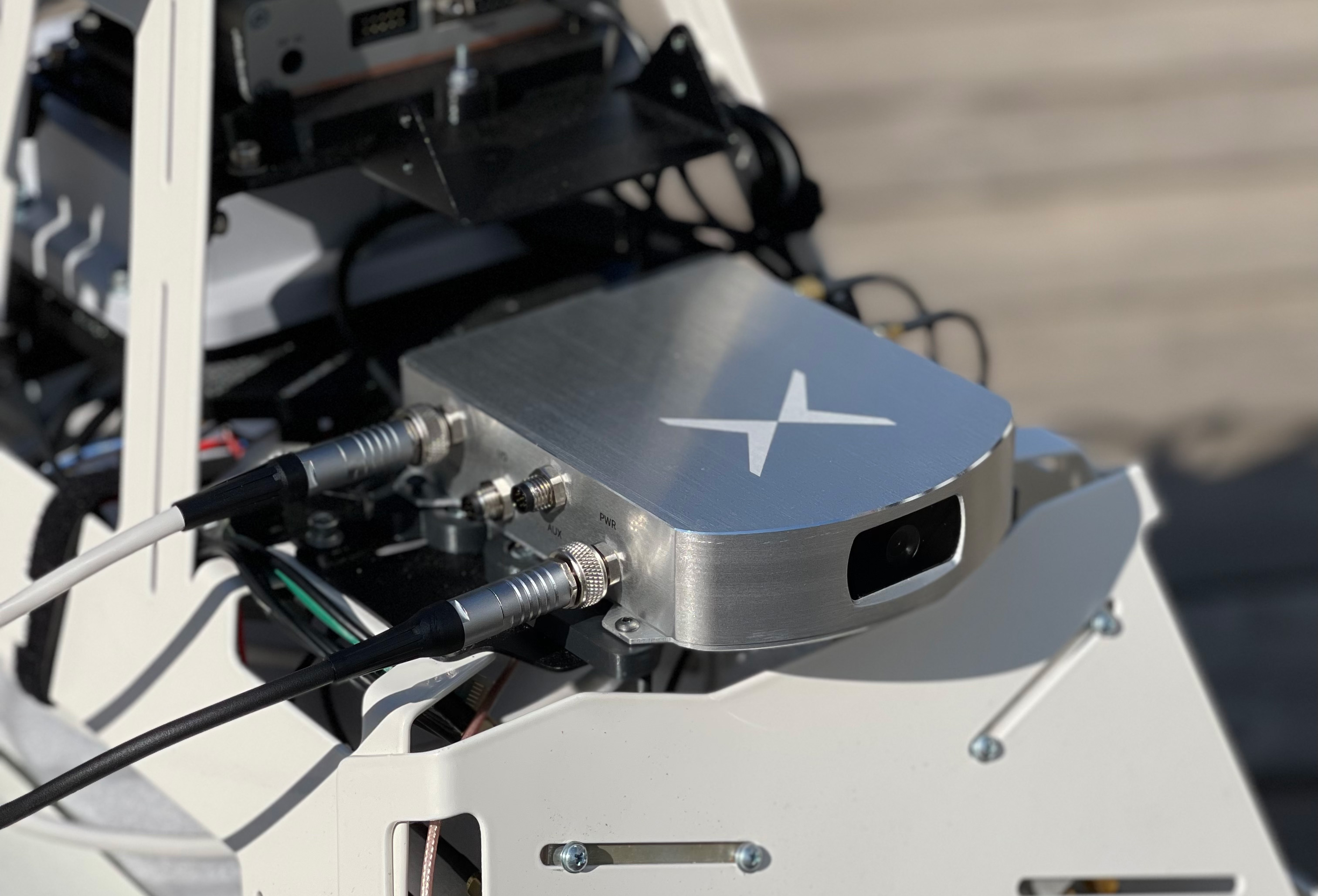
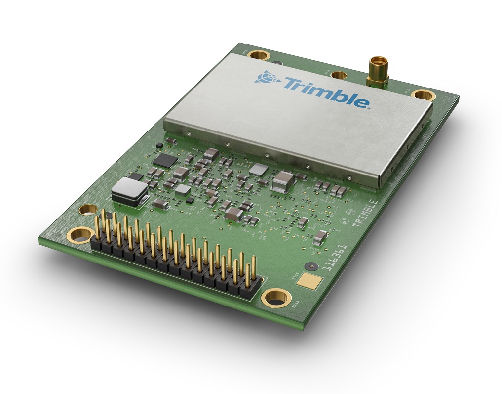
    Trimble Autonomy has introduced the Trimble BD9250, a dual-frequency OEM GNSS receiver module that supports Trimble RTX correction services.

    The receiver is designed to deliver high-accuracy positioning for a range of high volume, autonomous-ready applications used in the agriculture, construction, robotics and logistics industries worldwide.

    The BD9250 is a compact receiver with an industry-standard form factor and pinout, allowing for easy system integration and configuration. Equipped with Trimble’s advanced ProPoint positioning engine, the BD9250 delivers robust and accurate positioning.

    The BD9250 receiver is compatible with Trimble RTX correction services or real-time kinematic (RTK) and supports all major GNSS constellations, including GPS, Galileo, GLONASS, BeiDou, QZSS and NavIC. Support for the Indian NavIC S-Band signal is also available with the Trimble BD9250s version.

    The receivers include the capability to enable system integrators to choose either the L2 orL5 frequency to optimize signal performance and maximize the number of measurements available to the GNSS engine.

    “The BD9250 provides centimeter-level RTX accuracy without the need of a base station,” said Finlay Wood, general manager, off-road, Trimble Autonomy. “This OEM GNSS board is ideal for high-volume autonomy applications that require precise positioning, without sacrificing accuracy, availability or integrity — enabling integrators to bring systems to market faster.”

    The Trimble BD9250 and BD9250s evaluation receiver modules and the Trimble RTX correction service subscription are available now through Trimble’s OEM GNSS sales channel.

  • Mayflower receives FAA approval for GPS anti-jam antennas

    Mayflower receives FAA approval for GPS anti-jam antennas

    FAA TSO-C190 authorization makes multi-platform anti-jam GPS navigation antenna (MAGNA) systems available for both military and commercial aviation use

    MAGNA-F anti-jam system. (Photo: Mayflower)
    MAGNA-F anti-jam system. (Photo: Mayflower)

    Mayflower Communications Company Inc. has received technical standard order Mayflower Communications (TSO-C190) authorization from the U.S. Federal Aviation Administration (FAA) for both models of its MAGNA GPS anti-jam product.

    Mayflower’s MAGNA GPS anti-jam products — MAGNA-Federated (MAGNA-F) and the MAGNA-Integrated (MAGNA-I)— can be installed on both military and civilian aircraft. Both MAGNA products offer simultaneous L1/L2 protection and can protect commercial and military GPS receivers.

    Mayflower’s MAGNA products build on Mayflower’s SWaP-optimized GPS anti-jam antenna technologies, which are optimized for small size, weight and power (SWaP), including small antenna systems. The MAGNA products were developed with sponsorship by the U.S. Navy SPAWAR and further improved under the U.S. Army PEO AVN to support GPS protection requirements for SWaP-constrained air, sea and ground platforms, such as fixed-wing/rotary aircraft, ships, UAVs and tactical vehicles.

    MAGNA-I anti-jam system. (Photo: Mayflower)
    MAGNA-I anti-jam system. (Photo: Mayflower)

    The MAGNA-F (NavGuard 710) has been extensively integrated, tested and flown in navigation warfare (NAVWAR) operational environments by the U.S. government on multiple aircraft platforms. MAGNA-F is the highest performance and smallest federated GPS anti-jam solution on the market in its class, utilizing a 3.5-inch diameter controlled reception pattern antenna (CRPA) compatible with existing fixed radiation pattern antenna (FRPA) footprints.

     The MAGNA-I (NavGuard 730) is a high-performance yet small GPS anti-jam integrated solution on the market, with a 4.5-inch diameter FRPA-compatible footprint. MAGNA-I simplifies platform integration and reduces lifecycle costs.  The MAGNA-I integrated anti-jam solution (antenna array integrated with antenna electronics in a single module) is designed for platforms with difficult integration challenges.   

    “The MAGNA GPS protection system provides pilots with improved GPS availability in a global environment with disrupted GPS signals,” said Triveni Upadhyay, Mayflower’s founder and president. 

    Mayflower Communications management team will be participating in the upcoming Joint Navigation Conference (JNC).

    Mayflower Communications is exhibiting its MAGNA suite of products at booth #216 at ION’s 2022 Joint Navigation Conference, which takes place June 6-9 in San Diego, California. Also at the conference, Naresh Jarmale, Mayflower vice president of engineering, will present a paper during Session B4: Military PNT User Equipment 2 – EGI and Platform Integrated PNT.

  • DJI introduces Mini 3 Pro camera drone

    DJI introduces Mini 3 Pro camera drone

    The DJI Mini 3 Pro is the high-end product of the DJI Mini series

    DJI Mini 3 Pro. (Photo: DJI)
    DJI Mini 3 Pro. (Photo: DJI)

    DJI has introduced the DJI Mini 3 Pro, its most powerful lightweight and portable camera drone. Weighing less than 249 grams — making it policy-friendly in many regions and countries — it delivers advanced features such as 4K/60 fps video, ActiveTrack, tri-directional obstacle sensing, and 90° gimbal rotation to shoot high-quality vertical imaging for social media. Its flight time extends past 30 minutes.

    According to the regulations of many countries and regions, drones under 250 grams have been placed in the safest drone category. At under 249 grams, Mini 3 Pro’s weight, safety and performance is a new resource for content creators and new pilots.

    Like its predecessors — Mavic Mini, Mini 2 and Mini SE — the Mini 3 can be folded for packing. Built-in features include enhanced flight performance, camera system, battery life and intelligent features previously available only in the Air and Mavic series.

    New structural design. The arms and propellers have been adjusted for more aerodynamic flight, increasing flight time. Forward and backward dual-vision sensors broaden the sensing range for safer flight. A complete gimbal redesign unlocks more camera angles, enabling movements such as tilt-up shots and vertical shooting.

    The Mini 3 Pro features tri-directional obstacle sensing, consisting of forward, backward and downward visual sensors. The forward and downward sensors have a wider field of view, providing seamless coverage for better route planning and environmental awareness. These sensors also enable Advanced Pilot Assistance System (APAS) 4.0, which automatically detects and finds a safer path around obstacles during flight.

    In addition, these sensors enable the FocusTrack suite, which allows users to select a subject that the drone automatically keeps within the center of the frame during flight while automatically planning a safe flight route.

  • PassTime launches Encore 3 for long-life asset tracking

    PassTime launches Encore 3 for long-life asset tracking

    Photo: PassTime
    Photo: PassTime

    PassTime asset-tracking company has launched Encore 3, the third-generation of its wireless GNSS tracking platform.

    Encore 3 builds upon the device platform introduced in 2019. It’s low power consumption results in extensive battery life, as much as several years. It can select and switch among four power modes so that customers can choose the features and reporting frequency they desire while balancing the battery-life options that meet their business objectives.

    The compact Encore platform is self-powered, offering customers the ability to place an Encore device on an endless number of mobile assets within seconds. An optional, external power cable can be used  to enhance the device’s functionality even further. Encore 3 features an updated, modern USB-C connector for the optional external cable, for improved ease of use and connectivity.

    Encore 3 is built with Cat-M1 LTE cellular technology for connectivity and provides 5G compatibility.

  • Tallysman adds XF antennas to helical line

    Tallysman adds XF antennas to helical line

    The HC885EXF embedded helical antenna. (Photo: Tallysman)
    The HC885EXF embedded helical antenna. (Photo: Tallysman)

    Tallysman Wireless has added the housed HC885XF and embedded HC885EXF dual-band eXtended Filtering (XF) antennas to its line of helical antennas.

    The antennas receive GPS/QZSS L1/L5, GLONASS G1/G3, Galileo E1/ E5a/b, BeiDou B1/B2/B2a and L-band corrections services.

    Historically, dual-frequency antennas and receivers commonly supported GPS L1 and L2 and GLONASS G1 and G2. In recent years, GPS, GLONASS, Galileo, BeiDou and NavIC have added GNSS signals in the L5 frequency band (1160-1217 MHz).

    As a result, the new dual-frequency GNSS standard has become L1 and L5.

    Tallysman’s new HC885XF antenna has been tuned to provide optimal support for the entire L1/G1/E1/B1/L-band correction and L5/G3/E5/B2 bands.

    The radio frequency spectrum has become congested worldwide as many new LTE bands have been activated, and their signals or harmonic frequencies can affect GNSS antennas and receivers. In North America, the planned Ligado service, which will broadcast in the frequency range of 1526 to 1536 MHz, can affect GNSS antennas that receive space-based L-band correction service signals (1539-1559 MHz). New LTE signals in Europe [Band 32 (1452-1496 MHz)] and Japan [Bands 11 and 21 (1476-1511 MHz)] have also affected GNSS signals. Tallyman’s XF models mitigate the effects of these new signals.

    The Tallysman HC885XF housed helical antenna weighs ~42 g and is enclosed in a robust, military-grade IP67 plastic enclosure. The antenna base has an integrated SMA connector, a water-proofing O-ring, and three screw holes to enable secure attachment.

    Tallysman’s embedded HC885EXF helical antenna weighs ~8 g. It is easily mounted with an optional embedded helical mounting ring, which traps the outer edge of the antenna circuit board to the host circuit board or any flat surface. An MCX connector is installed in the base of the antenna.

    Tallysman HC885EXF and HC885XF antennas are suitable for a variety of applications, including lightweight unmanned autonomous vehicle navigation (land, sea, and air), land survey devices, automotive positioning, timing and other precise-positioning applications.

  • Analog Devices converter sets performance benchmarks for harsh environments

    Analog Devices converter sets performance benchmarks for harsh environments

    Radio frequency analog-to-digital converter sets performance benchmarks for space and harsh environments

    Photo: Analog Devices
    Photo: Analog Devices

    Analog Devices has released the AD9213S-CSH, a highly integrated RF analog-to-digital converter (ADC). The ADC is a 12-bit, 10.25 giga samples per second (GSPS) ADC in high-reliability packaging, with advanced production screening and quality inspection.

    It is the company’s fastest ADC available for the space environment.

    The AD9213-CSH enables the next generation of software-defined systems for satellite communications, radar and remote sensing, driving greater system integration, lower costs, reduced power consumption and decreased size, weight and power (SWaP).

    Additionally, a high sample rate and integrated post-processing enable further performance gains for narrow-band applications.

    The AD9213-CSH provides space customers with greater flexibility and the ability to process larger sections of the spectrum for electronic support measures, as well as increased-resolution radar designs.

    The wider Nyquist bandwidth allows satellite-communications customers to deliver products with increased bandwidth. In addition, wide input bandwidths combined with high sample rates enable new wideband digital predistortion architectures communications applications.

  • Bad Elf unveils base/rover feature for survey-grade GNSS accuracy anywhere

    Bad Elf unveils base/rover feature for survey-grade GNSS accuracy anywhere

    Photo: Bad Elf
    Photo: Bad Elf

    Bad Elf has introduced a base/rover feature built upon its Bad Elf Flex GNSS receiver. The new base/rover feature brings affordable centimeter-level accuracy to surveyors and geospatial professionals working anywhere in the world.

    The solution consists of two Flex GNSS receivers and two UHF radios, allowing customers to perform high-accuracy field data collection in areas where traditional real-time kinematic (RTK) corrections or cellular coverage is not available. Existing Flex customers can upgrade by adding Flex radio kits.

    Bad Elf designed the base/rover feature with emphasis on accuracy, affordability and versatility. The Bad Elf Flex enables reliable data collection either as a standalone receiver or paired with apps on iOS or Android phones and tablets. A checklist-based workflow ensures consistent results and eliminates many common issues associated with setup and deployment of a base/rover solution.

    Photo: Bad Elf
    Photo: Bad Elf

    “The Bad Elf app walks the user through these steps and more, and it doesn’t let the project proceed until each checklist is complete,” said Larry Fox, vice president of Marketing and Business Development at Bad Elf. “The automated checklists simplify every process, so that geospatial professionals and surveyors of every experience level get reliable results.”

    The base feature requires only one Flex Extreme and a radio kit. Customers may choose to use either Standard or Extreme Flex with a radio kit for rovers. Using Flex Standard and one daily token provides access to the rover feature.

    Bad Elf’s flexible hardware-as-a-service model provides a mechanism for customers to further reduce the capital cost of a complete base/rover system. In addition, customers can deploy multiple rovers in either configuration for larger projects.

    “For about one-third of the purchase price of competing products available today, our base/rover feature makes survey-grade one-centimeter accuracy a reality worldwide,” said Fox. “And our pay-as-you-go Flex Token model dramatically reduces operating expenses by allowing users to activate — and pay for — just the service levels needed on a given day.”

    Complete base/rover kits are available immediately, along with à la carte options for existing Flex customers. The Flex base/rover solution is compliant with FCC operating standards in the United States. Bad Elf provides customers with complete instructions for acquiring a radio operator license and call-sign designation.

  • U-blox tech applied in Japan and Oceania for high-precision positioning

    U-blox tech applied in Japan and Oceania for high-precision positioning

    Photo: u-blox
    Photo: u-blox

    BizStation,  a database company based in Japan, and u-blox have announced a highly accurate, compact and low-cost high-precision positioning solution for markets in East Asia and Oceania.

    Featuring two u-blox modules, the solution delivers centimeter-level positioning accuracy where mobile network service is unavailable, including in maritime offshore surveying, agricultural and industrial vehicle guidance, and UAVs.

    BizStation’s precise point positioning (PPP) system covers all territories served by Japan’s Quasi-Zenith Satellite System (QZSS) MADOCA correction service.

    The solution leverages the strengths of two u-blox components. The first, a u-blox ZED-F9P multi-band high precision GNSS receiver module, is at the heart of BizStation’s DG-PRO1RWS GNSS receiver.

    The second, a u-blox NEO-D9C correction-data receiver module specific to Japan, enables their virtual reference station to receive data on the QZSS L6E-band used by MADOCA.

    The PPM (PPP positioning by MADOCA) Android application developed by BizStation then determines the location of the tracked device using the high-precision positioning data transferred via Wi-Fi from BizStation’s DG-PRO1RWS GNSS receiver as well as GNSS correction data from the virtual reference station. The PPM application performs all required calculations using the MADOCA positioning library developed by NEC Solution Innovators Co., Ltd.

    The high-precision GNSS solution can be deployed either using a static or a mobile virtual reference station for a wide range of applications such as agriculture, drones, motor sports or surveying systems.

  • CHC Navigation introduces AlphaAir 1400 and AlphaAir 2400 airborne lidar series

    CHC Navigation introduces AlphaAir 1400 and AlphaAir 2400 airborne lidar series

    CHC Navigation (CHCNAV) has released the AlphaAir 1400 (AA1400) and AlphaAir 2400 (AA2400) lidar systems.

    Both lightweight, compact airborne laser scanners are easily installed on various UAV platforms or small survey aircraft and helicopters. They are adapted to high-density point corridor mapping applications, day or night, under leaf-on and leaf-off conditions or with dense vegetation to provide reliable results.

    “Nowadays, it is critical to obtain the highest data quality for the majority of aerial survey projects,” said Andrei Gorb, product manager of CHC Navigation’s Mapping and Geospatial Division.

    Combining with industrial-grade GNSS receivers and high-precision inertial measurement units (IMUs), the AA1400 and AA2400 provide 2 to 5 cm survey-grade accuracy.  They also  integrate Riegl’s VUX lidars with waveform-lidar technology, allowing echo digitization and online waveform processing.

    “Multi-target resolution is the basis for penetrating even dense foliage,” Gorb said. “The continuously rotating polygonal mirror wheel enables scanning speed of up to 400 lines per second, allowing for effective coverage of large areas when used from fast drones or aircraft.”

    Figure 1. The BB4 UAV equipped with the AA2400 scanner for the city mapping task. (Photo: CHCNAV)
    The BB4 UAV equipped with the AA2400 scanner for the city mapping task. (Photo: CHCNAV)

    Their built-in premium Riegl VUX-120 and VUX-240 lidar sensors feature a high-speed data acquisition rate of up to 1.8 MHz and a scan speed up to 400 lines per second. This provides a linear accuracy of 1cm to 2 cm on long-range scanning, suitable for fixed-wing UAV corridor mapping.

    CHCNAV offers several external cameras for add-ons to the AlphaAir. Setups can include nadir or nadir and oblique cameras from Sony or PhaseOne. By obtaining high-resolution geo-referenced and oblique imagery, more applications can be supported, increasing the return on investment for the client.

    The scanning results of the AA1400 and 2400 lidar series. (Photo: CHCNAV)
    The scanning results of the AA1400 and 2400 lidar series. (Photo: CHCNAV)

    The one-click connection of the AlphaPort to the power source and camera makes the installation of the AA1400 and AA2400 quick and easy, eliminating the need for additional accessories and time for camera calibration. The AA1400 and AA2400 reduce the risk of cable damage caused by aircraft vibration and acceleration during takeoff and landing.

    CHCNAV provides a full range of solutions that allows a complete lidar solution to be added to the users’ geomatic services. The software suite includes CoCapture UAV field application for fully automated reality capture and real-time mission tracking, and the CoPre desktop software for semi-automated point cloud processing.

    The AA1400 and AA2400 lidar series solutions are available worldwide today through the CHCNAV distribution network.

  • Fixposition releases Vision-RTK 2 centimeter-level positioning sensor

    Fixposition releases Vision-RTK 2 centimeter-level positioning sensor

    Photo: Fixposition
    Photo: Fixposition

    Fixposition, a Swiss technology company providing high-precision positioning solutions, has released a centimeter-level positioning sensor, the Vision-RTK 2.

    The low power and compact, industrial-grade device is suitable for autonomous delivery and logistics vehicles, agriculture, mowing and landscaping machines, as well as any other application where precise, uninterrupted positioning must always be available everywhere.

    “As vehicles and machines become increasingly autonomous, they must safely and precisely negotiate complex routes, even where GNSS visibility is degraded or blocked,” said Zhenzhong Su, CEO and co-founder of Fixposition. “With Vision-RTK 2, these applications are becoming possible. Our deep sensor-fusion technology combines GNSS technology with advanced computer vision and machine learning.”

    “We are using a global optimization-based sensor fusion technique that is much more robust and powerful than traditional Kalman filters,” said Lukas Meier, CTO and co-founder of Fixposition. “Our computer vision-based dead-reckoning technology has clear advantages over purely IMU-based products.”

  • CHC Navigation introduces i83 IMU-RTK GNSS receiver

    CHC Navigation introduces i83 IMU-RTK GNSS receiver

    Photo: CHCNAV
    Photo: CHCNAV

    CHC Navigation (CHCNAV) has announced the availability of the i83 GNSS receiver, an addition to its premium GNSS receiver series for surveying, mapping and construction professionals. The i83 GNSS is powered by a 1408-channel multi-band GNSS receiver, the latest iStar technology, and a calibration-free, high-end inertial measurement unit (IMU) for faster and reliable field GNSS surveying.

    “The i83 receiver combines GNSS and IMU into one single receiver to provide optimal automatic pole-tilt compensation that requires no calibration and is fully immune to magnetic interference. Operators just need to focus on their tasks and no longer need to level their pole vertically,” said Rachel Wang, product manager of CHC Navigation’s Surveying and Engineering Division. “In addition, we designed a high-resolution color display where users can clearly and intuitively get the GNSS receiver status to take full control of their survey operation.”

    The third-generation high-gain antenna with the latest advanced CHCNAV iStar algorithm improves GNSS satellite signal tracking efficiency by more than 30%. The i83 GNSS receiver features 1,408 GNSS channels for high performance across GPS, GLONASS, BeiDou, Galileo and QZSS constellations. Its onboard GNSS technology delivers centimeter-level positioning, maintains reliable fixed real-time kinematic (RTK) accuracy, and collects points faster than previous models, even in demanding conditions.

    Automatic compensation for pole tilt

    The i83 receiver’s built-in IMU automatically compensates for pole tilt, increasing surveying, engineering and mapping efficiency by 30% over conventional GNSS RTK surveying methods. In less than 5 seconds, the 200-Hz inertial module is initialized to ensure survey-grade accuracy over a pole tilt range of up to 30 degrees. Productivity is dramatically increased, RTK usability greatly improved, and potential human error reduced, whether you are an engineer, site foreman or surveyor.

    Integrated Wi-Fi, Bluetooth and near-field communication (NFC) modules provide seamless connection to field data controllers or tablets. Integrated 4G and UHF modems enable any GNSS survey mode, from RTK network NTRIP connections to UHF base-rover configurations. GNSS RTK corrections can be accessed or broadcast continuously for accurate positioning in all circumstances.

    Users do not need to carry backup or external batteries in the field because of the i83 GNSS’ ultra-low-power system-on-chip (SoC) electronic design and smart power management. The i83 GNSS can operate for up to 18 hours as a GNSS RTK network rover or more than 8 hours as an RTK base station.

    The i83 GNSS receiver is available worldwide through the CHCNAV distribution network.

  • IP-Solutions adds Eagle-2 receiver to SDR lineup

    IP-Solutions adds Eagle-2 receiver to SDR lineup

    iP-Solutions has added a GNSS receiver to its software-defined-receiver (SDR) front-end family. The new Eagle-2 works with software receivers in real time or records GNSS signals for post-processing.

    For post-processing, Eagle-2 it supports most third-party receivers, such as MATLAB and C/C++ receivers.

    The front end allows a user to work with two perfectly synchronized channels connected to two antennas.

    The Eagle-2 supports GPS, Galileo, GLONASS , BeiDou, QZSS and SBAS.

    Photo: IP-Solutions
    Photo: IP-Solutions