Tag: sensor fusion

  • Jackson Labs Delivers Low Phase-Noise Frequency and Timing Reference

    Jackson Labs Delivers Low Phase-Noise Frequency and Timing Reference

    The DROR-II by Jackson Labs.
    The DROR-II by Jackson Labs.

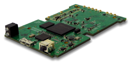
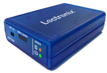
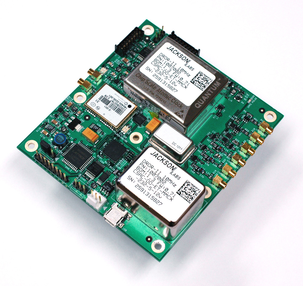
    Jackson Labs Technologies, Inc., a designer and manufacturer of GPS, timing and frequency equipment, is offering the DROR-II, a 10-MHz/5-MHz/1-PPS GPS-Disciplined Atomic Frequency and Timing Reference (GPSDO).

    The DROR-II is a ruggedized frequency and timing reference with a Cesium Vapor Atomic Oscillator followed by a precision SC-cut Crystal Double-Oven Oscillator and an actively vibration-compensated VCXO oscillator, with specific emphasis on ultra low phase noise performance under extreme vibration and acceleration such as could be encountered in aircraft, tracked vehicles, and wheeled vehicles.

    The DROR-II unit is optimized for operation in high-vibration and high-acceleration environments that require ultra-low phase noise performance and high frequency stability under extreme conditions. The DROR-II combines the strengths of three different on-board oscillators to provide an overall performance that has not been achievable with legacy products, at a steady-state power consumption of less than 3.85W, the company said.

    The DROR-II uses a GPS receiver to provide long-term phase and frequency accuracy of the built-in CSAC atomic oscillator which is followed by an SC-cut, Double Oven OCXO (DOCXO) for very high short-term stability and low phase noise, which is itself followed by a three-axis electronically vibration-compensated crystal oscillator for ultra-low-noise under high vibration. Using these four signal sources cascaded to each other allows unmatched Phase Noise and Short Term Stability (ADEV) while also providing long-term atomic holdover, very fast warmup, and long-term phase-lock to UTC. Short term stability of 1E-012 (1ppt), and phase noise floors of -162dBc/Hz are achieved. Frequency stability over 24 hours is better than 5E-013 (0.5ppt) typically when locked to GPS.

    The DROR-II supplies three isolated 10-MHz Sine Wave outputs, two CMOS 1PPS, and one 5-MHz output that is phase-synchronized to UTC via the internal GPS receiver. DROR-II contains a 50-channel WAAS/EGNOS/MSAS-enabled GPS receiver that provides support for avionics systems through integrated three-axis gyro-accelerometers and a -160-dBm GPS tracking capability. DROR-II power requirements are less than 3.85W steady-state, and only a single supply of between 11.0V to 32V is required. Support for an external LCD display is standard.

    The unit can be monitored and controlled by an RS-232 port or a USB port via industry standard SCPI-99 Commands (GPIB commands), and is capable of generating numerous NMEA-0183 output sentences for easy integration into existing infrastructure. The DROR-II can be ordered with various OCXO options and with different temperature ranges.

  • u-blox Introduces 3D Automotive Dead Reckoning

    u-blox Introduces 3D Automotive Dead Reckoning

    The u-blox ADR chip.
    The u-blox ADR chip.

    u-blox has introduced its next-generation semiconductor technology dedicated to advanced in-dash navigation, emergency call (including eCall, a European rapid response initiative, and ERA-GLONASS, Russia’s Government Accident Emergency Response System), usage-based insurance, road-pricing, and stolen-vehicle recovery systems.

    The UBX-M8030-Kx-DR chip integrates 3D Automotive Dead Reckoning (3D ADR) technology, which enables it to calculate a vehicle’s position, speed, and elevation in areas of poor or no satellite visibility, a common scenario in high-density urban environments, stacked highways, or parking garages.

    Here is a two-minute YouTube video demonstration.

    “Drivers expect car navigation systems to be fast, accurate, and work everywhere, regardless of satellite visibility. As cities expand, construction of more tunnels, multi-level overpasses and park garages is increasing,” said Thomas Nigg, VP Product Marketing at u‑blox. “Our solution meets this challenge head-on; regardless of satellite visibility, our 3D ADR chip shows movement in three dimensions to maintain continuous and accurate positioning in tunnels, stacked highways, multi-level or underground parking facilities.”

    The technology aids traditional GNSS navigation systems such as GPS, GLONASS and BeiDou by blending them with individual wheel speed, gyroscope and accelerometer information to maintain accurate 3D positioning even when satellite signals are completely lost.

    The UBX-M8030-Kx-DR chip is self-calibrating to compensate for sensor aging and temperature effects. It is compatible with virtually all vehicles and drive trains (i.e. front-, rear-, all-wheel drive), and supports a variety of sensor combinations. Sensor information can be derived from the vehicle’s sensors for the most cost-efficient implementation, or from external sensors for after-market solutions.  The chip is AEC-Q100 qualified and is produced in ISO/TS Automotive certified production sites.

    The chip requires minimum host integration or customization resulting in no risk, low cost, and fast time-to-market, u-blox said. Installation is uncritical thanks to automated software calibration. 3D ADR is accurate even at low speeds.

    The chip allows for easy testing, simple and modular production set-up, and minimal BOM. The chip comes in a 40-pin QFN package measuring only 5 x 5 mm and includes I2C, SPI, UART and USB interfaces.

  • SkyTraq Seeks Crowdfunding for Location-Sensing Development Board

    SkyTraq Seeks Crowdfunding for Location-Sensing Development Board

    NavsparkSkyTraq Technology, Inc., a fabless GNSS positioning technology company, is undertaking a crowdfunding campaign on Indiegogo to explore if there is sufficient interest in applying GPS/GNSS processor technology beyond traditional ways by offering NavSpark, a small, powerful, thumb-sized, 32-bit, microcontroller development board with GPS/GNSS receiver as onboard peripheral. With price approaching an 8-bit microcontroller development board, the GPS/GNSS receiver is effectively provided to users free of charge. They are seeking $27,000 in funding until February 6, 2014.

    NavSpark features:

    • 100MHz 32bit RISC Processor with 16Kbyte I-Cache and 2Kbyte D-Cache

    • IEEE-754 Compliant Floating Point Unit

    • 1MByte Flash Memory

    • 212Kbyte SRAM

    • GPS Receiver

    • UART x 2

    • SPI x 2

    • I2C x 1

    • 17 Digital I/O (shared with above functional pins)

    • 1 Pulse Per Sec Timing Reference with +/-10nsec Accuracy

    • Customized Arduino IDE with GPS SDK Seamlessly Integrated

    NavSpark-BD model has a GPS/Beidou receiver onboard, enabling users to use the latest GPS/Beidou navigation technology just as large smartphone makers are beginning to adopt this new technology. The NavSpark-GL model has GPS/GLONASS receiver onboard, enabling users to use dual-satellite navigation technology, GPS/GLONASS as used in high-end smartphones, in their hardware projects. The NavSpark development board makes the latest global navigation satellite technology easily accessible.

    SkyTraq’s 7mm x 7mm QFN56 Venus822 quad-mode GPS/GNSS processor with extended I/O pins is used on NavSpark. Venus822 is designed to simultaneously process 34 GPS/GLONASS/Beidou/Galileo/QZSS/SBAS signals in parallel, thus having much higher computation power and larger memory than conventional 8-bit or 32-bit microcontrollers. Without using GPS/GNSS function, all the 100 MIPS RISC/FPU processing power and 1 MB Flash + 212 Kb RAM memory capacity is available for user application. When just using GPS-only mode or GPS/GLONASS, GPS/Beidou dual-satellite navigation mode, the remaining MIPS and memory still far exceeds what’s available on similar small, low-cost development boards on the market.

    With average price of different model variants plus active antenna in range of $15 ~ $20, NavSpark’s goal is to provide the makers an alternative powerful, small development board with location-sensing capability, and at the same time making latest GPS/Beidou or GPS/GLONASS dual-satellite navigation technology as easily accessible as GPS to the users worldwide.

    NavSpark is low cost enough to leave in small hardware projects. For higher volume projects such as asset tracker, GPS fitness product, sports performance logger, toy quad-copter autopilot, etc., after rapid prototyping using NavSpark, volume usage can later change to 10mm x 10mm x 1.3mm Venus838FLPx module, a miniaturized LGA version of NavSpark. For applications benefiting from NavSpark’s high processing power and large memory without using GPS/GNSS, volume usage can later change to Venus822 chip to lower cost.

    For further information on NavSpark, visit http://bit.ly/1dBpits.

  • Loctronix Ships ASR-2300 Software-Defined Radio Module for Indoor/Outdoor Positioning

    Loctronix Ships ASR-2300 Software-Defined Radio Module for Indoor/Outdoor Positioning

    Loctronix ASR2300 module.
    Loctronix ASR-2300 module.

    Loctronix Corporation, a provider of unified positioning solutions for GNSS-challenged environments, announced that it has begun shipments of its new software-defined radio (SDR) module, the ASR-2300, for developing high-performance positioning, navigation and timing (PNT), and communication applications.

    “The ASR-2300 delivers advanced SDR capabilities in a small, mobile form-factor enabling developers to readily create and field complex SDR-based solutions. Featuring a 2×2 multiple-input, multiple-output (MIMO) RF transceiver and an array of inertial sensors, the open-source ASR-2300 is an ideal platform for tapping advanced, multi-sensor/signals of opportunity for high-performance PNT,” said Michael Mathews, Loctronix’ CEO and founder.

    Loctronix ASR-2300 kit.
    Loctronix ASR-2300 kit.

    “Unique amongst the growing number of SDRs, Loctronix’ ASR-2300 provides multiple, fully-integrated RF paths supporting reception of GNSS, cellular, ISM band, and UHF signals of opportunity, making it well-suited for demanding scientific, military, aerospace and commercial/industrial applications, such as UAV/UAS navigation, GPS-challenged or -denied tracking and navigation, combined communications and navigation radios, and GPS integrity monitoring and validation,” Mathews noted.

    The MIMO transceiver module incorporates two wideband Field Programmable RF (FPRF) transceivers (300 MHz to 3.8 GHz), 10-axis accelerometer/gyro/compass/barometer sensors, and a large programmable FPGA capable of over 300 MiB/sec sustained communications with a host processor via USB 3.0 interface.  The module’s nine integrated RF path options and low size, weight, and power characteristics contribute to ease of integration and portability, Loctronix said.  Accommodating both internal 1 PPM TCXO or external frequency reference, multiple ASR-2300s can be inter-connected via an expansion port and/or UART interface, supporting real-time reception / transmission of 4, 6, 8 or more signals without the need for significant additional hardware.

    Developers looking to create solutions for demanding military, scientific and industrial applications will realize greater functionality with the ASR-2300, thanks to its multiple sensor and multiple frequency capabilities, Loctronix said. Additionally, access to a variety of user-friendly development tools facilitates waveform experimentation and helps speed the creation of these new solutions, resulting in shorter development times and lower development costs for high-performance PNT applications.

    Bundled kits, which include the module, housing, and power/data communications/RF interfaces, are priced at $1,600 with a special educational discount available for qualified institutions.  The ASR-2300 SDR is available directly from Loctronix.

  • 1 Billion Smartphones with Location-Based Sensor Fusion Expected by 2016

    As smartphones embrace always-on, ubiquitous location, location-based sensor fusion will become a standard feature. ABI Research’s report, “Location-based Sensor Fusion: Companies, Technologies, and Revenue Opportunities,” outlines how sensor fusion will evolve to support indoor location and the companies best placed to succeed in this space. Location-based sensor fusion will enable the dawn of the quantified self, ambient intelligence, as well as provide huge potential around advertising and retail, ABI Research said.

    Senior analyst Patrick Connolly comments, “Sensor fusion is vital in enabling a consistent location experience, RF mapping, and the industry to scale rapidly. Unfortunately, it is not just a case of putting in a 9-axis sensor to achieve this. Highly complex algorithms are required to optimize sensor outputs, integrate with other location technologies and combine with machine learning and data-fusion algorithms. Sensor fusion will surpass Wi-Fi and BLE as the most important handset-based indoor location technology by 2017.”

    ABI Research has forecast the adoption of different indoor location technologies, and the companies best placed to be successful. “We see a significant trend towards hybridization, with Wi-Fi, BLE, and senor fusion proving to be vital. By 2014, hybrid solutions will have already surpassed standalone indoor location technologies on smartphones. Longer term, technologies around optical light, object recognition, and LTE-direct are all forecast to offer differentiation,” continues Patrick Connolly.

    VP and practice director Dominique Bonte adds, “The market is largely divided between Sensor IC OEMs, GPS/connectivity IC OEMs, and a group of really interesting start-ups. Companies like Movea, HillCrest, indoo.rs, and Senionlab are creating some intriguing solutions and will represent the next generation of acquisitions and partnerships in indoor location.”

    These findings are part of ABI Research’s Location Devices Research Service, which includes Research Analyses, Market Data, Insights, Presentations, and Competitive Assessments focused on the indoor location market.

  • ABI Research: MEMS Sensors and Hands-Free Interfaces Will Revolutionize Mobile Devices

    ABI Research: MEMS Sensors and Hands-Free Interfaces Will Revolutionize Mobile Devices

    Photo: ABI Research

    Accelerometers, gyroscopes, near field communications (NFC), and gesture recognition are predicted to be the big winners in mobile devices. These mobile technologies are projected to make the greatest penetration gains over the coming years, according to a recent study by market intelligence firm ABI Research.

    “Hands-free operation or gesture recognition is soon going to become a key differentiator in high-end flagship smartphones, media tablets, and smart glasses,” says senior analyst Joshua Flood. “Samsung’s latest Galaxy S4 has already incorporated the technology within its handset and has received significant plaudits for its new innovative user experience. Furthermore, with a host of new smart glass products soon to be released, it is easy to imagine the usefulness of the interface with this product.” In 2013, almost 12% of smartphones shipped will have vision-based gesture recognition capabilities.

    Accelerometers and gyroscopes play a crucial role with today’s mobile devices, enabling devices to be more intuitive and take action without a user pressing a button. Simple actions like switching from portrait to landscape when a smartphone is tilted are made possible by including these components. Additionally, the fast growing mobile gaming market is highly dependent upon smartphones including gyroscopes, which enhance gaming experience. Nearly half of the smartphones shipped this year will include these MEMS sensor types.

    NFC has been one of the most talked about mobile technologies that has not quite taken off. The technology has primarily been focused around mobile payments; however, mobile OEMs have begun to see other potential capabilities for the technology such as photo-sharing and location information tag points that could open a huge market for advertising and marketing campaigns. Within three years, it is anticipated one in two smartphones shipped will include NFC and have gesture recognition capabilities. Furthermore, accelerometers and gyroscopes will be the “norm” with most smartphones.

    These findings are part of ABI Research’s Next Generation Mobile Devices and Mobile Handset Go-to-market Strategies Research Services.

  • Northrop Grumman Offers Open Architecture Solutions for Enhanced Avionics Capabilities

    Northrop Grumman Offers Open Architecture Solutions for Enhanced Avionics Capabilities

    Logo: FACENorthrop Grumman Corporation is applying a modular, open architecture approach throughout its product portfolio, allowing for rapid addition of new avionics capabilities for warfighters. Northrop Grumman is already applying the FACE Reference Architecture and interfaces to existing programs and products, including an embedded GPS/inertial navigation system for the Joint Precision Approach and Landing System and a highly adaptable mission equipment package.

    As a founding principal member of The Open Group Future Airborne Capability Environment (FACE) Consortium, Northrop Grumman was an early advocate of establishing open architecture standards to support software portability and interoperability across avionics systems.

    Northrop Grumman will leverage the corporation’s expertise in open architecture to implement FACE requirements for both current and future programs, including the Black Hawk H-60L Digital Performance Plan program and Tech-Refresh Mission Computers for the H-1 Upgrade program.

    The company plans to participate in demonstrations that will promote maturation of the FACE Reference Architecture by enabling companies to deploy their products in a functional, standardized FACE software environment.

    Also, the company’s Transport Services Segment aligns with the FACE Technical Standard requirements and provides a standard interface that allows portable avionics applications to be integrated with a variety of architectures and aviation platforms.

    “An open architecture approach is critical to the affordability, innovation and effectiveness of avionics systems,” said Ike Song, vice president of Northrop Grumman’s Situational Awareness Systems business unit. “We are using performance-proven solutions from across our corporation to offer highly flexible, affordable products that support reuse on various platforms.”

    Northrop Grumman’s Common Mission Management System (CMMS) establishes a common foundation for affordable control systems to support a variety of the company’s unmanned products. Based upon open architecture standards and standard off-the-shelf commercial hardware and software infrastructures, the Northrop Grumman CMMS product line avoids the need for dedicated, custom-built command and control systems for individual platforms. Also, the Northrop Grumman CMMS product line enables pilots to operate a variety of dissimilar unmanned platforms using the same informational displays and control features, thereby improving mission effectiveness while reducing training requirements.

    With its expertise in unmanned aerial systems (UAS), the Northrop Grumman team was instrumental in leading the FACE Consortium’s effort to align with the UAS Control Segment (UCS) information model, establishing a common conceptual data model and metamodel as a framework that defines rules and conventions for developing interoperable software components for unmanned aerial system ground control stations. Further collaboration under the UCS/FACE Memorandum of Agreement is anticipated in aligning the FACE and UCS standards.

    Northrop Grumman is a leading global security company providing innovative systems, products and solutions in unmanned systems, cyber, C4ISR, and logistics and modernization to government and commercial customers worldwide.

  • Rakon Launches Low Voltage Miniature TCXO

    Rakon Launches Low Voltage Miniature TCXO

    Photo: Rakon
    Photo: Rakon

    Rakon has launched the RIT2016C model TCXO for GPS applications. The RIT2016C minimizes power consumption in portable devices to extend the battery life while still delivering performance.

    Operating at a 1.2V supply voltage, the RIT2016C reduces power consumption even further with the additional benefit of the enable-disable mode to deliver better power management, the company said.

    The RIT2016C is available in the small form factor 2.0 x 1.6 millimeters.

    Current available frequencies are 19.2MHz, 26.0MHz and 38.4 MHz; other frequencies are available upon request.

    The RIT2016C also has the following features:

    • Frequency ranges available from 19 to 40 MHz.
    • Frequency versus temperature stability as tight as ±0.5 ppm over -40 to 85°C.
    • Low start-up drift rate.
    • Excellent phase noise performance.
    • Low aging: Long term stability better than ±1ppm/year.
    • Low profile: Height less than 0.8mm.

    The high performance of the RIT2016C establishes it as the perfect solution for applications with stringent battery life requirements. It is suitable for smart meters, personal navigation devices, smartphones, tablets, and fitness watches.

  • Linx Releases New Multi-Constellation Receiver

    Linx Releases New Multi-Constellation Receiver

    Photo: Linx TechnologiesLinx Technologies has launched its GM Series GNSS receiver module. The module is an autonomous, high-performance GNSS receiver designed for navigation, asset tracking and positioning applications of all kinds. Based on the MediaTek chipset, it can simultaneously acquire and track several satellite constellations. These include GPS, Europe’s Galileo, Russia’s GLONASS, and Japan’s QZSS.

    The GNSS receiver module provides exceptional sensitivity, even in dense foliage or urban canyons, Linx Technologies said. Hybrid ephemeris prediction can be used to achieve cold start times of less than 15 seconds. By combining this feature with the module’s very low power consumption, battery life is maximized in battery-powered systems.

    With an output of standard NMEA data, the GM Series GNSS receiver is self-contained and only requires an antenna. It powers up and outputs position data without any software set-up or configuration, making the GM Series easy to integrate, even by engineers without previous RF or GNSS experience. However, if technical support is needed, our knowledgeable team of engineers can provide guidance.

    The GM Series module operates at a low 16mA tracking supply current. This is less than half the supply current of competitive modules.

    In addition, the available GPS Master Development System connects a GM Series Evaluation Module to a prototyping board with a color display that shows coordinates, speedometer and compass for mobile evaluation. A USB interface allows simple viewing of satellite data and Internet mapping, as well as custom software application development.

    For more information about the GM Series GNSS receiver module, call Linx at +1 800 736 6677 (+1 541 471 6256 outside the United States) or visit www.linxtechnologies.com.

  • Rx Networks Announces Zed, a Precise Indoor Vertical Location Service for Mobile Devices

    Rx Networks, Inc., a mobile location technology and services company, today announced a new z-axis determination capability called Zed. This new solution, comprised of a client software library and associated cloud-based data services, is targeted at chipset vendors, device OEMs and application developers seeking to integrate reliable floor-level detection. The announcement came at ION GNSS 2013 in Nashville, Tennessee.

    Whether for emergency or consumer applications, the determination of a mobile device’s vertical position while indoors presents unique challenges. Given the environment, even when a GNSS receiver attains a fix, a mobile device cannot reliably use the reported altitude. Beacon-based techniques, such as those derived from Wi-Fi or Bluetooth, remain challenging as they often rely on GNSS-based crowd sourcing or costly venue characterization. The built-in barometric pressure sensors in recent  smartphones bring a new ability to estimate altitude, but they have  unique and variable characteristics that prevent floor-level accuracy without further assistance.

    Rx Networks’ new Zed solution combines accurate geo-reference barometric pressure data (from Custom Weather, a global provider of real-time weather information), automatic device characterization, and pressure crowdsourcing along with existing location services to determine a device’s altitude within 1 to 3 meters.

    The Zed solution will be commercially available at the start of 2014 and will be available either on its own, or as an optional feature alongside Rx Networks’ GPStream Assisted-GNSS and XYBRID hybrid location solutions.

    For more information a demonstration of Zed, visit Rx Networks booth at ION GNSS+ 2013.

  • PCTEL Launches Antennas for GPS, GLONASS, BeiDou, and Galileo Apps

    PCTEL's new timing antenna, the GNSS1-TMG-26N.
    PCTEL’s new timing antenna, the GNSS1-TMG-26N.

    PCTEL, Inc. announced the launch of its next generation multi-band GNSS antennas for global timing and precision tracking applications at the ION GNSS Conference being held this week in Nashville, Tennessee.

    The new antennas, which are designed for use with GPS, GLONASS, BeiDou, and Galileo systems, are being showcased along with other PCTEL antennas at the PCTEL booth in the Exhibit Hall, Booth 318/320. All models of the new antennas are available for sale.

    Equipment providers for carrier network timing, precision agriculture, and global asset tracking applications need a single antenna solution for global deployment. PCTEL’s new GNSS1-TMG-26N and GPS-LB12GL-MAG antennas address global compatibility issues for two of the industry’s most crucial applications.

    For critical timing applications for macro and small cell deployments, PCTEL has developed the GNSS1-TMG-26N antenna. The GNSS1-TMG-26N is a fixed mount network timing antenna covering GPS, GLONASS, Beidou, and Galileo system frequencies in one single unit, making it a true global solution.

    PCTEL's  GPS-LB12GL-MAG antenna is designed for precision agriculture.
    PCTEL’s GPS-LB12GL-MAG antenna is designed for precision agriculture.

    For global precision navigation applications, PCTEL has developed the GPS-LB12GL-MAG to cover GPS L1, GPS L2, GLONASS, and L-BAND constellations. The GPS-LB12GL-MAG’s multi-band coverage addresses the precision market in the USA as well as differential correction signals needed across Europe and Asia.

    “PCTEL will meet the GNSS market requirements for our global customers while maintaining PCTEL’s high standards for quality and performance,” said Jeff Miller, president of PCTEL Connected Solutions. “We understand that our products need global compatibility to support our customers around the world. We are proud to showcase our design excellence in this highly technical area,” added Miller.

  • SBG Systems Releases Ekinox Land Solution

    SBG Systems Releases Ekinox Land Solution

    The Ekinox Land Solution by SBG Systems.
    The Ekinox Land Solution by SBG Systems.

    At ION GNSS+ this week, SBG Systems announced the release of the Ekinox Land Solution, an all-in-one solution combining the cost-effective inertial navigation system with an odometer, and a GNSS RTK reference station for smooth positioning in land applications. GPS positioning in urban canyons, forests, or tunnels has always been challenging. By taking the best of these complementary technologies, Ekinox Land Solution provides reliable positioning in an affordable package, the company said.

    SBG Systems is exhibiting the system Wednesday through Friday at Booth 519/521 at ION GNSS+ in the Nashville Convention Center.

    The combination of the Ekinox inertial navigation system with complementary technologies such as wheel-speed sensor (DMI) and RTK GNSS is the key to providing smooth vehicle positioning, even during GPS outages, SBG Systems said. To save users and integrators both time and money, the best equipment has been tested and selected to build a cost-effective and all-in-one package — Ekinox Land Solution.

    Ekinox Land Solution is an integrated package built from the Ekinox Series, a range of inertial navigation systems based on robust and cost-effective MEMS technology. Mounted on a vehicle, Ekinox Land Solution provides real-time roll, pitch, and true heading (0.05° accuracy) while delivering a smooth position (2 cm). Data is output at 200 Hz and recorded in an 8-GB datalogger. Post-processing software is offered to increase attitude accuracy (up to 0.02°).

    Ekinox Land Solution is designed to answer the growing need of vehicle real-time positioning, imagery sensor triggering, and data georeferencing at an affordable price. Examples of applications include mobile mapping, machine control, car motion analysis, and unmanned ground vehicle navigation.

    The Ekinox series includes the Ekinox-A, and Attitude and Heading Reference System; the Ekinox-E, an Inertial Navigation System (INS) whose position feature depends on aiding equipment; the Ekinox-N, an INS with an embedded L1/L2 GNSS receiver; and the Ekinox-D, an INS with an integrated Dual Antenna GNSS receiver.

    SBG Systems is a French supplier of MEMS-based inertial motion sensing solutions. The company provides a wide range of inertial solutions from miniature to high accuracy. Combined with calibration techniques and advanced embedded algorithms, SBG Systems products are designed for defense, industrial and research projects, such as unmanned vehicle control, antenna tracking, camera stabilization, and surveying applications.