Tag: tracking

  • Magellan Launches Switch Series GPS Fitness Watches in Europe

    Magellan Launches Switch Series GPS Fitness Watches in Europe

    Magellan today announced that it has expanded the worldwide availability of the Magellan Switch Series of crossover GPS watches to Europe for athletes who run, bike, swim or participate in a variety of outdoor activities. The Magellan Switch and Switch Up watches are available this month from select retailers and through Magellan’s European distribution network.

    To support its European users, Magellan has also expanded its Magellan Active website with additional languages including French, Spanish, German, Italian and Dutch as well as English. Magellan Active makes it convenient for multisport athletes who record their performance data on Magellan’s Switch Series to easily upload and track data online with intuitive charts, maps and metrics, from a single location, Magellan said.

    “Magellan is continuing to further enrich the lives of multi-sport athletes worldwide with best-in-class fitness watches and innovative tools to help them take control of their active lifestyles,” said Clark Weber, Senior Director of Fitness Products for Magellan. “The Switch Series is rapidly gaining popularity with fitness enthusiasts, and we are pleased to work with our European distribution partners to make our GPS watches available to consumers throughout Europe.”

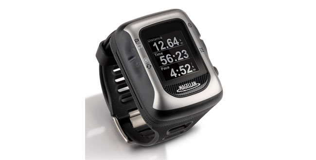
    Both Switch watches include features such as an Activity Pacer that shows runners if they are on target with their goal, and provides specific targets to attain the desired result. The Switch GPS watch, designed primarily for runners, includes nine customizable sport profiles, high-resolution display, eight hours of battery life, a high-sensitivity GPS receiver, 50-meter water resistance, and compatibility with ANT+ sensors. The Switch Up GPS watch has the same features as the Switch GPS watch but includes a barometric altimeter for precise elevation data, a thermometer to monitor and capture outside temperature, vibration alerts for notification in louder environments, and a quick-release mounting system to transition between sports.

    The Magellan Switch Series is available from Magellan’s European distribution partners serving UK, France, Germany, Turkey, Spain, Italy, Austria, Switzerland and Benelux.

    Developer API Program. Magellan also is making available its Magellan Active Developer API program. Third-party websites and applications can now access activity data from Magellan Active and import data into their websites once customer permission has been granted. A Magellan Active Web Widget can be embedded in any website for uploading activities and gives users the ability to upload activities and perform device software updates from within a personal website or HTML Widget/Gadget.

  • Bryton Enhances Sports Monitoring Equipment with u-blox GPS

    bryton

    Bryton Incorporated has chosen to integrate u-blox’ UBX-G6010 GPS single chip to give its sports electronics products location-aware features. Founded in 2009, Taiwan-based Bryton has established a brand of GPS-enabled sports monitoring devices dedicated to four main activities: cycling, fitness, outdoor adventure and athletic training.

    “At Bryton, we understand the mindset of sport enthusiasts, and know exactly what they are looking for when they shop for electronic equipment to enhance their exercise experience: it must be smart, small, attractive, accurate, dependable, and packed with interesting and useful features that make their workouts more fun and informative,” said Wolf Lin, President at Bryton Inc.

    “u-blox’ extremely small GPS chip solution requires very few external components, meaning we don’t need to allocate much space in our products to achieve state-of-the-art, extremely sensitive GPS positioning capability,” added Lin. “Another primary feature is long battery life. Thanks to u-blox’ low power chip design with sophisticated power saving modes, the GPS receiver, which must be active much of the time, requires only a small fraction of the device’s power.”

    Bryton evaluated leading vendors of GPS technology and selected u‑blox’ GPS single-chip based on four key product features: small size, high sensitivity, low-power consumption, and upgradability.

    Bryton markets its products under two main product categories:

    Rider. An extensive line of waterproof bike computers that provide navigation while monitoring location, distance, elevation, route history as well as heart rate and calories usage.

    Cardio. Smart sports watches for runners with integrated GPS that delivers accurate time, pace, distance, stride, lap information and much more.

  • GPS Module

    The Jupiter SE880 by Telit Wireless Solutions is a small, ultra sensitive 48-channel GPS module that features an advanced 3D technology that improves time to first fix and brings indoor location fix to reality with cold start and tracking sensitivity down to -148 dBm and -165 dBm. The turnkey solution enables the design of ultra-compact applications, requiring minimal external BOM and a footprint of less than 40 millimeters compared to conventional PCB technology.

    The Jupiter SE880 is designed for high-volume GNSS ultra-compact mobile / tracking devices as well as advanced consumer devices such as sport watches and cameras.

  • GPS Pill Bottles to Be Placed in NYC Pharmacies

    Take two in the morning and we’ll catch up with you.

    Pill bottles fitted with GPS trackers are going to be used by the New York Police Department to combat the theft of painkillers and other addictive prescription medicines, according to the Associated Press. Pharmacies will be asked to hide the GPS bottles amid the legitimate supplies on their shelves. If stolen, the “bait bottles” could help investigators track stolen drugs and locate suspects.

    The plan will be unveiled today at a La Quinta, California, conference on health issues hosted by former President Bill Clinton’s foundation, the AP reports.

    The GPS bait-bottle initiative is an effort to curb crimes associated with the black market for prescription drugs. Similar attempts to track prescription drugs on a limited basis have been undertaken before, but the NYPD said this would be the first widespread effort.


  • Skyhook, Philips Lifeline Develop Location Platform for Emergency Response

    Skyhook and Philips Lifeline have announced a collaboration to incorporate Skyhook’s hybrid location positioning platform into Philips’ Lifeline GoSafe mobile personal response services. Skyhook’s hybrid location service will be part of a suite of locating technologies used with the new GoSafe system and designed to help provide the call center with the location information needed to support locating of users in the event of an emergency.

    “Accurate location information is of critical value to ensuring the quick dispatch, arrival and delivery of what is often life-saving assistance,” noted Rob Goudswaard of Philips Home Monitoring. “After reviewing the market, we concluded that Skyhook’s location network and technology capabilities were consistent with our requirements for enabling timely and accurate response.”

    “If an individual experiences a fall or other emergency, quickly getting help to the right location is of vital importance,” said Michael Shean of Skyhook. “Skyhook is proud to partner with Lifeline, the leading medical alert service, in order to enhance the safety and care that Lifeline provides to all of its customers.”

  • GPS Plotter iPhone App Enables Quick Plotting

    GPS Plotter makes it easy to plot longitude and latitude coordinates using iPhone, according to app developer Make It Digital. Using the mobile phone’s in-built GPS system, users can plot their current location at the touch of a button. Multiple sessions can be used to create maps plotting anything, and easy export of longitude and latitude coordinates is made possible by utilizing the universal CSV data format.

    GPS Plotter is designed for:

    • Orienteering
    • Outdoor wayfinding
    • Tracking unmarked trails
    • Detailing longitude and latitude on the move

    The app is available for 69p ($0.99 US) in the App Store and is compatible with iPhone 4, 4S and 5 running iOS 5 or later.

  • Researchers Use Traffic App Data to Identify Accident Hotspots

    Researchers at Israel’s Ben-Gurion University of the Negev (BGU) say reveal that data culled from geosocial networks like the GPS traffic app Waze can help prevent traffic incidents with better deployment of police resources at the most accident prone areas.

    “Only now are we beginning to discover the potential in the huge amount of data collected daily,” explains BGU researcher and Ph.D. student Michael Fire. “Studies of this kind, which monitor events such as traffic accidents over time, can help the police identify dangerous sections of roads in real time, or alternatively, locations where few police are needed.”

    The paper, “Data Mining Opportunities in Geosocial Networks for Improving Road Safety,” was presented at the IEEE 27th Convention of Electrical and Electronics Engineers in Israel.

    Waze records location data and enables users to upload and share comments on any detail, including traffic alerts, accidents or police presence. According to its website, Waze has 30 million worldwide users and describes itself as “a community-based traffic and navigation app whose users share real-time traffic and road info, saving time and gas money.”

    Using Waze data and Google Earth, the BGU researchers determined that three-quarters (75 percent) of the locations in Israel with the highest number of accidents were intersections. They then analyzed references to a police presence to determine if the police were present at the spots that had the worst traffic accidents.

    “There were numerous instances where the police were manning quieter intersections, while busier intersections went unmonitored,” Fire explains.  “According to the data, police response time varied from 20 minutes to 40 minutes in some situations.”

    Using Waze, data from May and June 2012 was collected and analyzed on accident reports, police presence, traffic jams, and speed traps. BGU researchers identified 579 different locations in Israel that had at least five reoccurring accidents during this time where 5,156 reported accidents occurred. Police were reported at least 15 times at more than 3,500 locations.

    Other researchers involved with the study from BGU’s Department of Information Systems Engineering and BGU’s Telekom Innovation Laboratories include Prof. Yuval Elovici, head of the lab, as well as Dr. Rami Puzis, Prof. Lior Rokach as well as student Dima Kagan.

  • Medical Alert System to Have u-blox GPS and 2G/3G GPS

    u-blox, the Swiss positioning and wireless chip and module company, has been chosen for global positioning and embedded 2G/3G wireless technologies by MobileHelp, an American provider of M-PERS (Mobile-Personal Emergency Response System) technology. Based on u-blox’ LISA 2G/3G wireless modem and MAX GPS modules, the comprehensive system includes compact, portable alert devices that function in and around the home, and while traveling.

    “As the population ages, more and more people are choosing to remain independent for as long as possible” said Robert Flippo, President of MobileHelp. “With the help of u-blox’ reliable, low-power positioning and wireless technologies, our MobileHelp medical alert systems are giving a whole generation of people the freedom to live in their homes and travel independently knowing that simple and fast emergency assistance is just a push-button away.”

    Unlike traditional 911 direct dial services, MobileHelp devices deliver instant positional information as well as personalized medical data to an emergency response center at the touch of a button. The system is integrated with nationwide wireless voice, data and satellite GPS technology to provide real-time medical monitoring services, location tracking, and instant voice contact with trained emergency response operators. MobileHelp also offers Caregiver Tools, an innovative event notification and online tracking platform that keeps families and caregivers informed of an emergency event. With AT&T as connectivity partner, the devices work in 97 percent of the inhabited areas of the USA.

    MobileHelp comes in three configurations, “Classic” for home-monitoring over fixed line telephone, “Solo” for travelling and at homes without a fixed line telephone connection, and “Duo,” for travelling and at homes that have a fixed line telephone connection.

    MobileHelp’s alert products have been developed with Singapore-based Daviscomms, a design and manufacturing partner providing advanced engineering services to customers in the consumer and industrial markets worldwide.

  • Navman Wireless Debuts Professional Services for Fleet Tracking

    Navman Wireless today announced the availability of two professional services packages designed to expedite, optimize and provide problem resolution for 100+-vehicle implementations of its OnlineAVL2 fleet management platform. Going beyond basic customer support, the new services can reduce rollout and configuration time by up to 80 percent, produce a 50 percent faster return on investment, and help corporate and construction fleet managers derive maximum value from the system by doubling the number of features used.

    “Most fleet tracking vendors say they provide support services, but usually those services are limited to basic phone assistance and coordination of system installation with a third-party vendor. Through our work with customers who track hundreds of on- and/or off-road vehicles, we recognized that large installations need substantially more assistance for timely deployment as well as to take full advantage of system capabilities to reduce costs and streamline operations,” said Nels Erickson, field services manager at Navman Wireless. “We launched our professional services packages specifically to meet these needs.”

    Both the Standard and Turnkey professional services bundles entitle customers to a dedicated project and account team, including a field services engineer serving as a single point of contact and project manager, plus the use of a dedicated phone line staffed with support specialists assigned exclusively to handle larger accounts.

    The Standard package includes installation support, basic OnlineAVL2 configuration, a training website and weekly group training webinars, priority issue escalation, and a yearly account review to evaluate the customer’s use of the system and identify opportunities to realize greater benefits from the deployment.

    The Turnkey package includes all Standard features plus 80 hours of project management time for on-site project planning and user training as well as weekly update calls and advanced OnlineAVL2 configuration for features such as geofences, maintenance module setup, report scheduling, and email and text alerts. This premium package also includes ongoing best practice guidance, regular on-site business reviews, API-based integration into backend systems, and guaranteed 45-day implementation with appropriate advanced notice and asset availability.

    Optional add-on services include custom training and documentation, installation and training at additional depots or terminals, and advanced project management for complex implementations.

  • LandAirSea Systems Trackers Announce Redesigned Online Store

    Vehicle-Tracking.com has been redesigned. Vehicle-Tracking.com is the official online e-commerce site of LandAirSea Systems, a provider of consumer and business-to-business GPS tracking devices since 1994.

    Vehicle-Tracking.com provides passive and real-time GPS tracking devices and systems designed for a wide-range of applications, including fleet management, law enforcement surveillance, asset monitoring and personal vehicle tracking. Vehicle-Tracking also offers the full-line of accessories, replacement parts, services and software for all of LandAirSea’s tracking systems.

    With more than 15 years of experience in the field of GPS tracking, LandAirSea’s support staff is available 24 hours a day, seven days a week, to assess and assist with any questions or purchases made from Vehicle-Tracking.com.

  • China Industry Report: “Amazing Growth” in Mobile Market

    A new China Navigation Map Industry Report, 2012-2014, released by Sino Market Insight, predicts that the revenue of Chinese navigation electronic  map industry will reach RMB 2.1 billion in 2014.

    Started in 2002, the navigation industry in China is still in the  initial stage of development compared with the international market, the report says. China’s car navigation market, PND navigation market and mobile phone navigation market are in the stage of rapid development, while the markets of LBS service, real-time traffic information service and value-added electronic map application services based on mobile communication technology are still in the initial stage of development.

    From 2006 to 2011, the sales volume of car navigation in China maintained high-speed growth, with CAGR hitting 47.5%. However, the penetration rate of car navigation is still low, so China’s car navigation  market still embraces huge space. Meanwhile, the growth speed of GPS mobile phone market in China is amazing, the report says. The sales volume of GPS mobile phone in China approximated 100 thousand sets in 2006, and skyrocketed to more than 50 million sets in 2011. Mobile Internet is an important development direction for the navigation map industry in future.

    According to the report, the global electronic navigation map market presents distinct regional and local characteristics. Major navigation application markets around the world, such as USA, Europe, Japan and South Korea, all have many regional electronic map suppliers which have competitive advantages in diversified segments and possess stable client groups.

    The navigation map market in China is led by AutoNavi and NavInfo. In particular, NavInfo is the pioneer, for it got approved to do navigation map business in the early 21st century. Joining the competition after 2006, AutoNavi captured the high-end brand automobile market quickly by virtue of advanced technologies, and penetrated into the medium-end automobile market thereafter. After 2010, the two companies launched fierce competition in the emerging mobile phone navigation market. In future, the competition in China’s car navigation and mobile phone navigation market will be fiercer, and the collision among navigation map enterprises in different sectors will be more frequent.

    China Navigation Map Industry Report, 2012-2014 covers the following contents:

    • Current status of China navigation map industry;
    • Development of China navigation map market;
    • Market status of navigation map in major regions worldwide;
    • Brief introduction, financial highlight, revenue structure by segment and by region, prospects and performance prediction, clients, etc. of 15 leading navigation map enterprises in China and around the globe.
  • License Plate Geo-Tracking: We Know Where You’ve Been

    Janice Partyka
    Janice Partyka

    It’s all about knowing where people are located. The government and private companies are taking hundreds of millions of geo-coded photos of license plates creating huge databases of where you’ve been. Meanwhile, hyper local mobile ads don’t work when ad networks sometimes receive grossly inaccurate locations of targeted consumers. Xad has developed a way to evaluate and score the accuracy of location positions they get from publishers. Also, mobile ad spending may reach $2.6 billion by year’s end, and Nokia is fighting back against rivals with a new mapping solution for Apple users and automating 3D mapping collection through a purchase of Earthmine. Keep reading for details.

    License Plate Snapshots. There hasn’t been much of an outcry over privacy from a huge location tracking operation that doesn’t require consent of the subject. Hundreds of millions of geo-coded photos are being taken of license plates throughout the country. These databases are being created by private companies and the government who use vehicle-mounted cameras. Records include a photo of the vehicle, license plate numbers/letters, time and location. Over two years the Riverside California police have collect two million unique license plate pictures using 49 camera-equipped vehicles. A citizen filed a California Public Record Act request and received a report containing 112 images of his cars. In some of the pictures he can identify car occupants and even the clothes they are wearing.

    Private companies that started photographing license plates were initially in the business of repossessing vehicles. With a mounted license plate camera, they drive as many miles as possible through back alleys, parking lots and streets. An alert sounds when a license plate matches the repossession database. Some of these companies are evolving to focusing solely on license plate data collection and have gathered hundreds of millions of photographs. One of the companies, MVTrac , claims to have geo-coded photos of the majority of U.S. registered vehicles.

    The data can be used for ill purposes. It can show who may be present at a political gathering, parked at a rehab center, or located at a cancer treatment center. In 1998 a police officer in Washington D.C. pled guilty for extorting owners of vehicles parked at a gay bar. The databases will grow. The Department of Homeland Security has provided more than $50 million in federal grants to police for more cameras.

    A Drop in the Advertising Bucket. Advertisers will pay out $2.6 billion for ads on phones and tablets in 2012, predicts eMarketer. This is a small fraction of total ad revenue, less than two percent of advertisers’ overall spend. Yet, mobile ad spending is growing; it is currently triple 2010 spending. The king of mobile advertising is Google, which receives 56 percent of all mobile advertising.

    Disparity among Apps. The amount of revenue from mobile advertising varies greatly among applications. Facebook reported 14 percent of its total ad revenue in the third quarter came from mobile. Almost 60 percent of Pandora’s ad revenue came from mobile in the second quarter. Twitter indicates that some days the majority of its ad revenue has come from mobile.

    Problematic Location Accuracy. One of the issues of mobile advertising is the accuracy of the mobile user’s location. It is problematic to send a hyper local ad if the ad network receives a grossly inaccurate location position, perhaps a geo-code at the center of a zip code. xAd, a local mobile advertising network, has developed a technology that analyzes the multitude of location signals being passed by each publisher and scores them according to accuracy and performance. “The industry cannot take location signals at face value,” said Chi-Chao Chang of xAd. “What we have found through our SmartLocation technology is that location inputs are often inconsistent on a per ad request basis. In fact, some of these signals are just plain wrong.” As a result, ad campaigns may be running on inventory that is not suitable for granular targeting, resulting in wasted ad impressions and overall lackluster performance.

    Automated 3D Mapping. Nokia, fighting to get back to the top of the heap, is acquiring 3D map-technology maker Earthmine and revamping Nokia’s mapping tools to win back customers from its rivals. The company announced a new mapping app for Apple mobile devices and unveiled the new brand name “Here” for its location services and website. Earthmine will provide Nokia with a complete solution for collecting, processing, managing, and hosting 3D street-level imagery. “This will add competitive advantages and increased differentiation to HERE‘s Location Content and Location Platform, sustaining competitiveness in B2B (e.g., data for in-car navigation systems) and drive highly engaging user experiences,” reads a blog on the Nokia website. The company believes that the Earthmine data collection vehicles are massively scalable and expect to be using them in 31 countries next year.