Tag: Trimble

  • Trimble Announces New RFID Accessory for Nomad Handheld

    Trimble announced a new UHF RFID Reader accessory for its Nomad rugged handheld computer. 

    The Trimble ThingMagic Reader supports reading and writing of EPC Global Gen2 tags which are commonly used for asset and inventory management. The UHF RFID Reader accessory is designed to withstand drops, vibration, humidity, extreme temperatures and immersion, making it ideal for challenging environments.

    Nomad RFID Reader

    "The Nomad has been a very successful rugged mobile platform, supplying field workers with a robust tool for data capture and navigation," said Jim Sheldon, general manager of Trimble's Mobile Computing Solutions Division. "The RFID Reader further extends the Nomad's capabilities and offers enterprise management more options in its use."

    "Similar to the widespread integration of GPS into today's positioning solutions, we believe RFID is a natural complement to many asset management applications and Trimble solutions," said Tom Grant, general manager of Trimble's ThingMagic Division. "Integrating high-performance RFID technology into high-value products like the Nomad delivers a strong platform for next generation productivity applications."

    The UHF RFID Reader is available in two variations: one for use in Europe, and the other for use in the U.S., Canada and most of South America. The Reader is based on the best-in-class ThingMagic M5e Compact UHF RFID module, and includes device drivers and a Software Development Kit to enable systems integrators to add RFID capabilities to their mobile applications.

  • Trimble Expands Its Positions Software to Streamline Esri Workflows for Mapping and GIS Applications

    Trimble introduced today the Trimble Positions Mobile extension — a new streamlined choice for integrating Trimble’s GNSS professional field solutions and data verification into the Esri ArcGIS for Windows Mobile environment.

    The Trimble Positions software was first introduced as a development kit to Trimble’s GIS developer community in late 2011. Today, the software suite has expanded to provide a streamlined option for users who wish to work directly with Esri’s ArcGIS for Windows Mobile technology.

    “Now, common Trimble and Esri users have a streamlined workflow between their Trimble devices and the Esri mobile software environment,” said Daniel Wallace, general manager of Trimble’s GIS Data Collection Division. “Because all data is verified and validated before it reaches Esri’s Enterprise GIS, each update adds value, making the geodatabase more reliable and more useful.”

    Using Trimble GNSS receivers, field workers can collect reliable GNSS data for all feature geometries while leveraging the high performance features of Trimble handhelds such as Trimble Floodlight for better productivity in tough GNSS environments. Data can be automatically posted to the enterprise server from the field where Trimble Positions Desktop add-in is used to process and validate the data coming in from field crews. Office administrators can easily check for new sessions, differentially correct the data, and verify that the data meets accuracy requirements before updating the enterprise database at the touch of button, Trimble said.

    This release adds real time and postprocessed corrections support for Trimble’s market-leading GNSS receivers, including the Trimble GeoExplorer, Juno, Nomad and Pro series receivers and is available to order now through authorized Trimble Mapping and GIS resellers. For more information, visit www.trimble.com/positions.

  • Trimble to Deliver High-Accuracy CenterPoint RTX Correction Service to Farmers in Latin America

    Trimble announced today that its high-accuracy, satellite-delivered CenterPoint RTX correction service is now available for farmers in Latin America.

    Trimble CenterPoint RTX can deliver better than 3.8-centimeter (1.5-inch) accuracies in real time without the use of traditional reference station RTK infrastructure, the company said. Initially, the CenterPoint RTX satellite-delivered correction service covered approximately a 1.8 billion-acre swath of central North America, extending from Canada into northern Mexico. The new coverage area has been expanded to include all of Mexico, Central America, and South America, where farmers can use the GNSS correction service for cultivating, planting, pest and nutrient management, harvesting and water management.

    "The expanded coverage of Trimble's satellite-delivered CenterPoint RTX service into Latin America further extends our broad portfolio of correction services, which also includes OmniSTAR VBS, HP, XP and G2; Trimble CenterPoint VRS; and the CenterPoint RTX service delivered via cellular communications," said Patricia Boothe, general manager of Trimble's Positioning Services Division. "By offering a suite of correction technologies and services, we can satisfy a variety of accuracy, delivery and budget requirements."

    "We're committed to expanding the services and software applications that we provide to the global farming community.  Increasing the coverage area for high-accuracy GNSS correction services for Trimble's agriculture customers around the world is an example," said Erik Arvesen, vice president of Trimble's Agriculture Division. "In 2011, we offered real-time, satellite-delivered corrections over a central swath of North America where it was well received. Now, farmers in Latin America can also benefit from CenterPoint RTX services to perform precision agriculture operations. Our customers want a broad range of solutions and with CenterPoint RTX, we're delivering those options."

    Trimble CenterPoint RTX real-time corrections are satellite delivered directly to the GNSS receiver, so there are no additional costs for mobile data plans or hardware such as radios and antennas. The CenterPoint RTX service is compatible with the Trimble CFX-750 display, FmX integrated display, and the AG-372 GNSS receiver. The service is expected to be available by mid-July. For more information, visit www.trimble.com/agcorrectionservices.

  • Trimble Launches New Mapping App for Kindle Fire and Android Tablets

    Trimble released the Trimble Outdoors MyTopo Maps app for the Kindle Fire and other Android-powered tablets. Outdoor enthusiasts can now view detailed topo and aerial maps and plot their next outdoor adventure on large tablet screens.


    MyTopo Maps provides access to over 68,000 detailed topo maps in the U.S. and Canada, in addition to aerial photos, street maps, terrain maps and hybrid maps.

    MyTopo Map on Kindle Fire

    "Our ecosystem of apps continues to grow and now Android tablet users can plan outdoor trips at home using MyTopo Maps," said Rich Rudow, general manager for Trimble Outdoors. "We provide best-in-class topographic and aerial maps, and tools to answer the specific demands of hikers, off-roaders and other outdoor enthusiasts."

    The app was originally released as a beta app in the Amazon AppStore last December. It immediately generated buzz among outdoor and map enthusiasts, and over the past four months features were added and tweaked based on community feedback up to the official launch this week.

    Trimble Outdoors released the iPad version of this app in November 2011. All apps are available in a Free and Pro versions on the Apple App Store, Google Play and Amazon AppStore. To download and for more details, go to: http://www.trimbleoutdoors.com/Products/TrimbleOutdoorsMyTopoMaps.

  • Trimble Introduces Receivers for GIS and Mobile Mapping

    Trimble has introduced the next-generation of its Trimble GPS Pathfinder family — the Trimble Pro 6H and Pro 6T receivers for GIS and mobile mapping. The Trimble Pro series with advanced features allows mobile workers to configure a solution for a wide range of applications, delivering flexibility in professional GIS data collection, Trimble said. The series offers a new streamlined form-factor and dramatic productivity improvements in difficult GNSS environments with Trimble Floodlight technology.

    The modular Trimble Pro series receiver gives users the flexibility to choose their setup configurations:

    • Optimized for use with Trimble data collection devices such as the Trimble Juno or Nomad G series handhelds, or Yuma tablet computer, the Trimble Pro series can also be used with other tablets and handhelds with NMEA output.
    • Real-time or postprocessed GIS workflows.
    • The receiver can be deployed in a backpack, on a pole or mounted on a vehicle.
    • Two models are available: the Trimble Pro 6H delivers decimeter accuracy, while the Pro 6T is the submeter model for standard GIS applications.

    “With the availability of the new Pro series receivers, data collection professionals now have access to the productivity-enhancements of Floodlight technology in both integrated and modular configurations,” said Daniel Wallace, general manager of Trimble’s GIS Data Collection Division. “While some prefer the convenience of an integrated, all-in-one handheld, others will appreciate the Pro series’ flexibility to choose from a range of data collection devices such as a high-resolution tablet or lightweight Trimble Juno.”

    Trimble Floodlight technology allows users to collect decimeter accuracy data in tough GNSS environments, Trimble said. Buildings and trees can cause satellite shadow and limit the environments where high-accuracy GNSS data collection can be performed. Trimble Floodlight technology combines a range of techniques to increase the availability of positions and boost accuracy in areas affected by satellite shadow. Using Floodlight technology, the Pro series can keep teams productive without compromising on accuracy. Users can work with fewer disruptions and ensure better data, faster data collection and higher field efficiency.

    Trimble Pro series receivers are rugged and built to withstand the rigors of long hours in tough outdoor conditions, yet optimized for high-accuracy GIS data collection workflows, Trimble said. For applications such as utilities inspections and timber stand valuations, Trimble Pro receivers provide long battery life and tough construction for dependable service over the course of rigorous data-collection projects.

    With its IP65 rating, the receivers offer reliable operation, even after prolonged exposure to water and dust, Trimble said. An integrated antenna reduces the complexity of the system for fast setup and swift data collection campaigns. Field workers can be up and running with minimal training, saving time and money. Combined with a Trimble handheld solution and Trimble TerraSync software, the complete system provides dedicated field workflows to simplify data collection and improve integration with the GIS for total workflow improvements.

    The new Trimble Pro 6H and 6T receivers are available from Trimble’s worldwide Mapping & GIS authorized distribution channel.

  • Trimble Introduces New DR+GPS Module for Vehicle and Asset Tracking Applications

    Trimble has introduced the Aardvark DR+GPS module that combines dead reckoning (DR) with GPS technology on a single, compact board. The Trimble Aardvark DR+GPS module provides positioning information when GPS signals are limited or not available, such as in urban canyons and tunnels. The Aardvark DR+GPS module is being marketed as a solution for system integrators or OEMs who are adding dead reckoning capabilities to vehicle navigation, fleet management and asset tracking systems.

    Dead reckoning estimates position based on heading and distance traveled since the last known position. The more accurate the speed, time and heading inputs, the more accurate the dead reckoning. GPS contributes to accuracy by continuously calibrating the gyro and speed sensors to produce optimal dead reckoning.

    The 19 x 19 millimeter surface-mount module has an on-board gyro and collects speed and forward/reverse data from the vehicle’s sensors. Its DR+GPS algorithm automatically calibrates the gyro and external sensors’ inputs and blends this information with GPS measurements to produce accurate position and velocity outputs in hostile GPS environments such as urban canyons.

    The Aardvark DR+GPS module is available in two configurations: model number 88788-30 for flat installations; and model number 88788-50 with a feature supporting variable mounting installations. The 88788-50 self-determines the module’s orientation allowing the ultimate in installation flexibility.

  • Trimble Releases DDS300 Depth Display System for Construction

    Trimble introduced a new version of the Spectra Precision Laser DDS300 Depth Display System, a laser-referenced grade control solution targeted for compact machines. The DDS300 version 3.0 introduces a new environmentally-rated control box and new level of productivity for mini-excavators and backhoe loaders used for excavation and trenching work for basements, footers, utility lines and conduit. Cable-free components, simple installation and an affordable price make the DDS300 system ideal for contractors who want to improve accuracy, fuel usage and safety of their excavation operations.

    According to the announcement, the DDS300 system utilizes wireless communications, a laser receiver and angle sensors to provide dynamic positioning information for the excavator or backhoe bucket at all times. Real-time grade guidance is displayed on the 7-inch in-cab display, allowing the operator to work faster and with better accuracy. Accurate positioning of the bucket also improves the safety of excavation by eliminating the need for a grade checker to work in the trench or machine swing area.

    The new waterproof and sunlight-readable CB310 Control Box display is included in the DDS300 system and is rated IP-64, making it suitable for use in bright sun or inclement weather.

  • Trimble Acquires Google’s SketchUp 3D Modeling Platform

    Trimble announced that it has entered into a definitive agreement to acquire SketchUp, one of the most popular 3D modeling tools in the world, from Google. The transaction is expected to close in the second quarter of 2012, subject to customary closing conditions and expiration of the waiting period under the Hart-Scott-Rodino Antitrust Improvements Act. While financial terms are not being disclosed the transaction is not expected to be material to 2012 earnings per share.

    According to the announcement, as part of the SketchUp platform, Trimble will also partner with Google on running and further developing SketchUp’s 3D Warehouse, an online repository where users can find, share, store and collaborate on 3D models. The site enables users to create collections of models, including 3D Buildings, and share them with fellow modelers around the world. Individual models can be loaded, saved and viewed in 3D from within SketchUp or a web browser. For the foreseeable future, Google will host and operate the 3D Warehouse for Trimble and together the companies will continue to offer the same capabilities, functions and services that are offered today. The ability for users to submit 3D Buildings for potential acceptance and viewing in Google Earth will be maintained. Currently the 3D Warehouse has almost two million user-generated models.

    “SketchUp and the corresponding 3D Warehouse provide an important element of our long term strategy by enhancing the integration of our field presence with the wider enterprise,” said Bryn Fosburgh, Trimble vice president. “Trimble has already created the de-facto standard for field data models and project management tools for our key markets. SketchUp, together with these existing capabilities, will provide a stand-alone and enterprise solution that will enable an integrated and seamless workflow to reduce rework and improve productivity for the customer. Users will be able to collect data, design, model, and collaborate on one platform. The combined capability will enhance our ability to extend our existing market applications including the cadastral, heavy civil, and building and construction industries. In addition, the SketchUp platform will enable Trimble, third-party developers and our distribution partners to efficiently develop new applications.”

    “Since its inception, the SketchUp team has been committed to providing a robust, user-centric solution to its community and we look forward to engaging their talent and expertise. Beyond extending the reach of the product into Trimble’s commercial markets, we are committed to continuing to provide SketchUp as a free version to millions of users. Trimble and Google will also continue to collaborate on utilizing other Google tools for Trimble’s markets that, along with SketchUp, will provide our customers innovative and productive tools that transform their work,” concluded Fosburgh.

    “In Trimble, we found a partner that will grow SketchUp in a way that best supports the SketchUp team and our users,” said Brian McClendon, Google’s vice president of engineering. “While at Google, the SketchUp community grew significantly because the team put users first, and we are confident they will continue to do so at Trimble. We at Google look forward to a continued partnership with Trimble and the SketchUp team.”

    Trimble reports that SketchUp will continue to support all of its current users through its Web site at: http://sketchup.google.com. Concurrently, the SketchUp engine will be integrated into Trimble’s current solutions in its Engineering and Construction, Field Solutions and Mobile Solutions segments.

  • Trimble Introduces New Versions of their Business Center and Access Software

    Trimble introduced new versions of its office and field surveying software—Trimble Business Center Software version 2.70 and Trimble Access software version 2012.10. The software is part of Trimble’s portfolio of Connected Site survey solutions. The new software enhancements allow surveyors to collect, share and deliver data faster to improve accuracy, efficiency and productivity.


    “Trimble is focused on providing Connected Site solutions that minimize rework and improve productivity. Workflow integration and connectivity provide surveyors with the day-to-day flexibility to adapt to a variety of situations in the field and office,” said Anders Rhodin, director of Trimble’s Survey Business. “Trimble’s portfolio of software solutions gives surveyors improved workflows for field data collection and enhance collaboration between the field and the office.”

    Trimble Business Center Software Version 2.70

    Version 2.70 advances the capabilities of surveying offices with key new functionality, including:

    Photogrammetry – When a surveyor’s project contains images from Trimble VISION™ Total Stations or Trimble VX Spatial Stations, users can make photogrammetry measurements and calculate points with three-dimensional (3D) coordinates.

    Support for Polygon Features – Using the Feature Definition Manager application, surveyors can create and edit polygon feature definitions for inclusion in a library (.fxl) file. Polygon features are useful for modeling real world terrain features such as bodies of water, building footprints, and parcel boundaries.

    New GNSS Baseline Processor – The baseline processor has been enhanced to provide improved accuracy and support for RINEX 3.0 and ANTEX antenna model formats. Users can post-process GNSS observables faster by taking advantage of multi-core computer processing. By decreasing the time it takes to process baselines, the software enables office surveyors to spend more time analyzing results and creating deliverables.

    Trimble Access version 2012.10 offers new functionality, including:

    Volume Calculation and Surface Creation – Surveyors can now compute volumes and create surfaces in the field on any of the following: Trimble Tablet, TSC3, TSC2, or Trimble CU Model 3 Controllers, plus the Trimble S3 and Trimble M3 Total Stations.

    Panorama Image Capture – All Trimble S Series total stations equipped with Trimble VISION technology can now take multiple images seamlessly using the panorama function.

    Target Interrupted Measurements – A new “Interrupted Target Measurement” feature is now available on all Trimble VX Spatial Stations and Trimble S8 and S6 Total Stations. This feature allows successful measurements in difficult environments where a measurement is likely to be interrupted – for example, when surveying across a busy road.

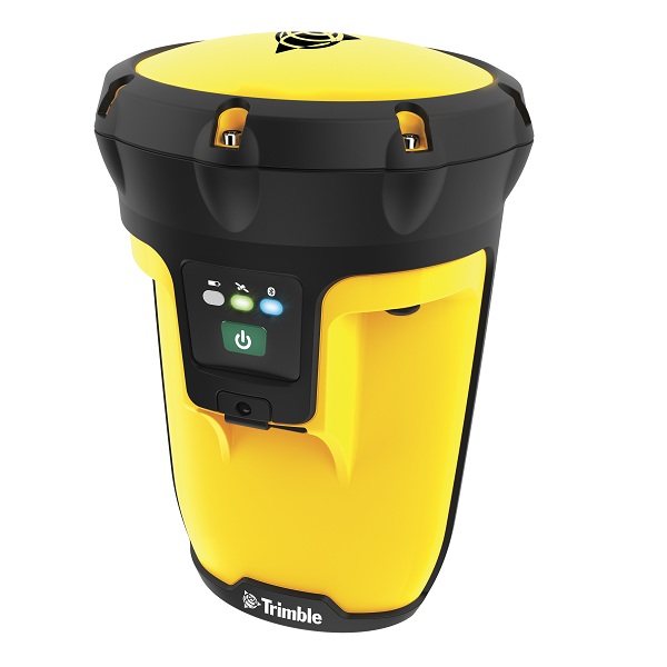
    OmniSTAR Support – Customers with a Trimble R7 GNSS System, the latest version of Trimble Access and a subscription to OmniSTAR corrections signals, can now take advantage of real-time, differential positioning without a radio link. OmniSTAR services can be used for real-time differential surveys or as a fallback for RTK surveys when a ground-based radio link is down or unavailable.

    Trimble’s Connected Site Solutions

    Trimble’s Connected Site solutions for surveyors create seamless working relationships among Trimble products, technologies and services. Through the Connected Site, Trimble is focused on providing solutions that address the customers’ full work processes. By carefully combining technology innovation with a deep understanding of the users’ workflows, data integration and maintenance across the lifecycle of projects, Trimble helps surveyors reach new levels of productivity for their businesses.

    Availability  

    Trimble Business Center Software version 2.70 and Trimble Access software version 2012.10 are available now through Trimble’s Survey Distribution Channel.

  • Trimble Introduces Ultra Rugged GNSS Smart Antenna for Heavy Civil Construction

    Trimble Introduces Ultra Rugged GNSS Smart Antenna for Heavy Civil Construction

    Photo: TrimbleTrimble has introduced the ultra-rugged Trimble SPS985 GNSS Smart Antenna for performing high-accuracy construction site measurements. The new smart antenna is made of a specially developed alloy that combines unprecedented strength and durability into a compact form to withstand the daily abuse of construction work, Trimble said.

    With its enhanced internal shock isolation, the SPS985 is suited for high-vibration use on an all-terrain vehicle (ATV) or supervisor truck. User-friendly features such as a quick release connector and smartphone configuration make it easy to deploy and use as a base station or rover, mounted on a range pole or truck roof, Trimble said. Advanced communications including Wi-Fi, Bluetooth, and optional wideband radio integrate the receiver into the connected construction site.

    “The Trimble SPS985 was engineered to be the toughest, smallest and easiest to use GNSS receiver we’ve ever built,” said Chuck Maniscalco, director of engineering for Trimble. “We listened to customer feedback and built the housing 50 percent stronger than any previous Trimble antenna, because we wanted it to perform ideally under extreme conditions — such as being dropped, tossed in a truck bed, rained on and otherwise abused in the construction setting. Contractors will likely never treat their SPS985 antennas as harshly as the Trimble engineering team has, but we intended to take rugged GNSS to the next level and we certainly achieved that.”

    When used as a rover, the SPS985 allows for maximum flexibility for use on a wide variety of site measurement tasks. For initial site reconnaissance, it can be deployed with satellite-delivered GNSS corrections without a base station. For higher accuracy site measurements, it can receive Real-Time Kinematic (RTK) corrections via the internal wideband radio, Wi-Fi or the Internet.

    An SPS985 unit can be easily moved from carrying case to range pole, tripod, t-bar, or vehicle with a single click — making it faster to begin working and allowing for more flexibility of operation techniques. For example, a grade checker can mount the SPS985 to an ATV and easily conduct site topos, check as-builts and verify road centerlines where it is not easy or safe to walk with a range pole. Extending its productivity, the same unit can then be mounted on the roof of a supervisor’s truck roof to collect and manage progress data.

    As a base station, the SPS985 incorporates Wi-Fi communications for small site projects and optional wideband radio for long-range operations on large projects. Designed for ease of use, it will automatically establish a radio or Wi-Fi connection and transmit RTK corrections to another rover or machine control system, Trimble said. Construction crews can spend more time doing the work and less time setting up and maintaining the equipment.

    As a component of the Trimble Connected Site solutions portfolio, the SPS985 also offers connectivity features that save administrative time and increase working productivity. When used with a Connected Controller such as the Trimble TSC3 or Trimble Tablet, job crews can connect to a mobile hotspot in the site trailer or supervisor’s truck and receive GNSS corrections via VRS network or Trimble Internet Base Station (IBSS). They can also save considerable time by wirelessly synchronizing progress data and as-built information to the job supervisor or head office and receiving updated design information back without ever leaving the job site.

    Quick start technology and the ability to set up and configure the receiver using a smartphone increases flexibility and eliminates the need to use a more expensive controller for daily setup. The Trimble Web UI is optimized for small screen devices, allowing a GNSS manager to monitor base station performance, availability and configuration without visiting the job site to set up each day.

    The new Trimble SPS985 GNSS Smart Antenna is available now through Trimble’s worldwide SITECH Technology Dealer Channel.

  • Rugged Trimble Pro Series GNSS Receivers Provide Flexibility for GIS and Mobile Mapping

    Pro20Series20Cover20View Trimble
    Trimble

    Trimble introduced today the next-generation of its Trimble GPS Pathfinder family — the Trimble Pro 6H and Pro 6T receivers for GIS and mobile mapping. The Trimble Pro series with advanced features allows mobile workers to configure a solution for a wide range of applications, delivering flexibility in professional GIS data collection, Trimble said. The series offers a new streamlined form-factor and dramatic productivity improvements in difficult GNSS environments with Trimble Floodlight technology.

    The modular Trimble Pro series receiver gives users the flexibility to choose their setup configurations:

    • Optimized for use with Trimble data collection devices such as the Trimble Juno or Nomad G series handhelds, or Yuma tablet computer, the Trimble Pro series can also be used with other tablets and handhelds with NMEA output.
    • Real-time or postprocessed GIS workflows.
    • The receiver can be deployed in a backpack, on a pole or mounted on a vehicle.
    • Two models are available: the Trimble Pro 6H delivers decimeter accuracy, while the Pro 6T is the submeter model for standard GIS applications.

    With the availability of the new Pro series receivers, data collection professionals now have access to the productivity-enhancements of Floodlight technology in both integrated and modular configurations,” said Daniel Wallace, general manager of Trimble’s GIS Data Collection Division. “While some prefer the convenience of an integrated, all-in-one handheld, others will appreciate the Pro series’ flexibility to choose from a range of data collection devices such as a high-resolution tablet or lightweight Trimble Juno.”

    Trimble Floodlight technology allows users to collect decimeter accuracy data in tough GNSS environments, Trimble said. Buildings and trees can cause satellite shadow and limit the environments where high-accuracy GNSS data collection can be performed. Trimble Floodlight technology combines a range of techniques to increase the availability of positions and boost accuracy in areas affected by satellite shadow. Using Floodlight technology, the Pro series can keep teams productive without compromising on accuracy. Users can work with fewer disruptions and ensure better data, faster data collection and higher field efficiency.

    Trimble Pro series receivers are rugged and built to withstand the rigors of long hours in tough outdoor conditions, yet optimized for high-accuracy GIS data collection workflows, Trimble said. For applications such as utilities inspections and timber stand valuations, Trimble Pro receivers provide long battery life and tough construction for dependable service over the course of rigorous data-collection projects.

    With its IP65 rating, the receivers offer reliable operation, even after prolonged exposure to water and dust, Trimble said. An integrated antenna reduces the complexity of the system for fast setup and swift data collection campaigns. Field workers can be up and running with minimal training, saving time and money. Combined with a Trimble handheld solution and Trimble TerraSync software, the complete system provides dedicated field workflows to simplify data collection and improve integration with the GIS for total workflow improvements.

    The new Trimble Pro 6H and 6T receivers are available from Trimble’s worldwide Mapping & GIS authorized distribution channel.

  • Trimble GCSFlex Offers GPS Guidance for Flexibility in Excavation

    Trimble today introduced a new system configuration for its GCSFlex Grade Control System. The addition of GPS guidance extends the system’s functionality and allows a contractor to work faster and with more freedom than other traditional laser-referenced grade control systems for excavators, Trimble said. With the benefit of GPS guidance and in-field design templates created directly from the cab on the Trimble CB450 Control Box, an excavator operator can accurately dig to a desired depth, slope or alignment without creating a digital design in the office, Trimble said. There’s little prep work before the job and no grade checking after.

    The new GCSFlex system with GPS guidance allows users to create in-field designs in the cab and take advantage of GPS guidance in 2D mode rather than 3D. This capability adds more flexibility to the system without adding additional complexity in its use. Where traditional excavator grade-control systems have used a laser plane as a reference for these tasks, the new GCSFlex replaces the laser plane with GPS guidance for position and orientation of the excavator. This configuration gives the operator maximum freedom to move the machine without being tethered to a bench point on the ground or a laser transmitter with range limits, Trimble said.

    The latest system configuration comprises a CB450 Control Box in the cab; angle sensors on the boom, stick and bucket; a MS972 GNSS Smart Antenna on the cab roof; and a Trimble SNM940 Connected Site Gateway for receiving GPS corrections. Subscription services such as Trimble VRS Now Service or Trimble Internet Base Station Service (IBSS) communicate GPS corrections via a cellular connection to the SNM940 and eliminate the need for a base station.

    User-friendly menus on the CB450 Control Box allow the operator to create an in-field template for a particular excavation task and begin working on that project immediately, Trimble said. The display software provides step-by-step instructions to create an in-field design template for excavating to a fixed depth, a depth with slope, an alignment or a profile. For operators with little to no experience with machine control, it is an easy way to create an alignment similar to traditional methods that use staking and stringlines, Trimble said.

    Trimble introduced GCSFlex for excavators in 2011 as an affordable, easy-to-use machine control system for owner operators and small- to mid-sized contractors who want to increase their productivity and become more competitive. With several flexible system configuration options available, contractors can select the sensor options that fit their job site needs at a price point that fits their budget.

    The new Trimble GCSFlex Grade Control System is expected to be available in the second quarter of 2012 through Trimble’s worldwide SITECH Technology Dealer Channel.