Tag: utilities

  • PenBay Solutions Launches InVision 1.5 for Facilities Management

    PenBay Solutions Launches InVision 1.5 for Facilities Management


    Photo: PenBay Solutions

    PenBay Solutions, a developer of GIS-based facility management and public safety software, is introducing InVision 1.5 in booth #F116 at the Esri User Conference in San Diego, July 14-17. The new technology will also be featured at the InVision Special Interest Group Lunch in room 28B at 12 p.m. on July 16 at the conference.

    InVision software is built on the Esri ArcGIS platform to help users visualize, analyze and interpret data in ways that reach beyond individual buildings and site maps. InVision bridges the gap between managing exterior and interior built environments by aggregating all facility and infrastructure data from various sources into a single, comprehensive, visual system for portfolio management, operations, and safety and security.

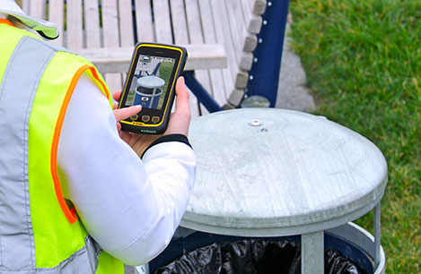
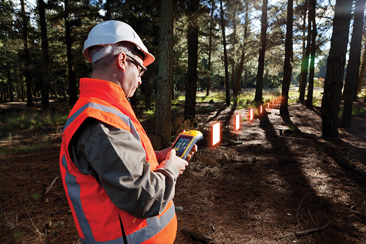
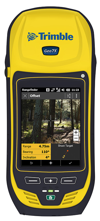
    The 1.5 release of InVision software introduces several new features and enhancements with an emphasis on mobile capabilities. InVision 1.5 introduces mobile viewers for:

    • Space Management: view space types, uses and assignments while in the field to more easily find and understand space use and classification.
    • Asset Management: remotely view utility and asset types, statuses and conditions to more quickly locate and evaluate assets.
    • Campus Viewing: provide information about campus points of interest so employees, residents and visitors can easily find what they are looking for.
    • Security Planning: view security plans – including both indoor and outdoor environments – and share that security information via mobile devices with outside public safety agencies and response personnel.
    • Security Operations: view critical building, floor, space and security asset information in the field to better understand the location and status of security assets in real time.

    “Mobility is critically important to our customers,” said Stu Rich, Chief Technology Officer at PenBay Solutions. “These new InVision Mobile Viewers are just the beginning. We’re in the process of developing mobile applications designed for data collection, data editing and inspection workflows as well. Watch for announcements around those exciting new applications in the coming months.”

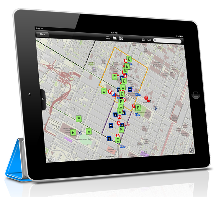
    The InVision Secure Event Management Solution supports a range of activities and users throughout event planning, coordination, and operations. With InVision Secure, users can coordinate plan creation, manage the review and approval process, and securely share information that is relevant to the safety and security of events. The solution helped make Super Bowl XLVIII a safe and successful event, according to PenBay Solutions.

    “PenBay Solutions was instrumental in helping us with all the agencies we worked with to gather data, and for implementing a public safety system that met our needs for the Super Bowl,” said Captain Steven Pollackov of FDNY’s GIS Unit. “As we move forward, we will be utilizing this platform more and more.”

  • New Pole-Staking Juniper App with Archer 2 Boosts Efficiency


    Juniper Systems and Futura Systems have partnered to provide enterprise utility GIS solutions for the electric and utilities industries. This August, Futura Systems will be launching at its user conference a new pole-staking application called GPSStaker.

    Staking, or line design, is performed when new locations need to be added to an existing electric line. It involves mapping a new utility pole run, ensuring that the distance between each pole is up to code and geolocated, and then recording the GPS coordinates of where each pole should be placed. GPSStaker was optimized for Juniper Systems’ Archer 2 rugged handheld, and works with Esri ArcMap.

    Using GPSStaker, stakers — or field engineers — can GPS-stake a job on the Archer 2 using ArcPad 10. The data is then automatically synced back into a main database.

    “The people in the field want lighter hardware and more efficient staking processes,” said Doug Malinowski, CIO of Futura Systems. “With Futura GPSStaker and the Archer 2, we’ve designed a promising solution that combines the accuracy they need with the design quality they want.”

  • Applanix, American Aerospace Partner on Mapping for UAVs

    Applanix, American Aerospace Partner on Mapping for UAVs

    AAAI-Applanix-system
    photo: AAAI

    Applanix Corp. and American Aerospace Advisors, Inc. (AAAI), have agreed on an OEM supply agreement that will incorporate Applanix direct georeferencing technology into AAAI’s unmanned aerial platforms. The collaboration creates a commercially available professional-grade mapping UAV system for civilian applications such as pipeline monitoring, power line surveys and emergency-response mapping.

    The availability of the system follows a series of successful test flights of AAAI’s RS-16 Unmanned Aircraft System equipped with Applanix’ DMS-UAV aerial photogrammetry payload with commercially available inertial technology. Joint teams from Applanix and AAAI planned and flew a sequence of missions to evaluate the capabilities, including the ability to provide highly accurate, directly georeferenced and orthorectified aerial imagery without the need for ground control points or aerial triangulation calculations.

    The system — consisting of the airframe, its avionics, mobile ground control station, telemetry systems and the digital mapping payload — performed according to expectations and successfully produced high-quality imagery.

    The announcement was made at AUVSI’s Unmanned Systems 2014 Conference in Orlando Florida, where the most comprehensive collection of unmanned systems for every domain – air, ground and marine – are on display. A video of the system can be watched here.

    “The OEM supply agreement with Applanix formalizes our plans to transform the aerial mapping industry by creating an integrated, professional-grade mapping system for unmanned flight,” David Yoel, CEO of American Aerospace Advisors, said. “For civilian aerial survey projects, this can mean safer operations, lower costs and more efficient deployments while still delivering very high accuracy. We are very pleased to announce the availability of the RS-16 Direct Mapping Solution.”

    “We believe this is a ground-breaking development for the airborne imaging systems market,” Joe Hutton, Director of Inertial Technology and Airborne Products at Applanix, said. “There has been a lot of attention on developing a commercial, directly georeferenced mapping solution for UAVs, and now it is a reality.”

    The RS-16 with the Applanix DMS payload is available through American Aerospace Advisors directly, for sale to jurisdictions where it is permitted to fly civilian UAV systems.

  • Trimble Adds Ultra High-Frequency RFID to Juno T41 Rugged Handhelds

    Trimble Adds Ultra High-Frequency RFID to Juno T41 Rugged Handhelds

    Juno-T41_Local-Govt_asset-W

    Trimble has introduced the Juno T41 rugged handheld computer with integrated Ultra-High Frequency RFID capabilities. In addition to high-speed 1D/2D barcode imaging technology, smartphone capability and enhanced, real-time 1-2 meter GPS accuracy, the Juno T41 series now offers new models that provide more functionality and configuration choices for data collection and mobile workforce management, Trimble said.

    “Often the RFID tag is specifically used because the item being tracked is in difficult or harsh environments where a barcode won’t survive,” said Jim Sheldon, general manager of Trimble’s Mobile Computing Solutions Division. “The rugged design of this handheld computer is an ideal solution for reading RFID in outdoor and extreme situations.”

    The RFID capability can be combined with Enhanced GPS and/or smartphone connectivity so customers can choose a specific handheld model that meets their needs.

    The Juno T41 R will automatically recognize tags across a variety of frequencies and work with any size or style of RFID tag that is designed for customized solutions. UHF RFID is an increasingly commonplace technology using the 860 to 960 MHz frequency range.

    Using the latest EPCglobal Gen 2 RFID technology from Trimble’s ThingMagic Division, the device uses two different antenna ranges to read or recognize the unique identification of an asset anywhere in the world.

    • FCC Certified (North America): 902-928 MHz bands
    • ETSI Certified (EU): 865.6-867.6 MHz bands
    • ACMA Certified (AU/NZ): 920-926 MHz bands

    Trimble Juno T41 RFID handheld computers feature a 1-GHz processor and 512-MB RAM and 32-GB onboard storage with either Android 4.1 or Microsoft WEHH 6.5 operating systems. Other standard features include an 8-MP integrated camera, multi-touch capacitive 4.3-inch sunlight-readable display, all-day battery life and 2-4 meter GPS accuracy capability. Other features include:

    • Rapid-read, high-accuracy performance on multiple tags with multiple orientations, even in crowded conditions.
    • Consistent read-range over 3.5 meters for 5 cm2 (2″) UHF tags in unobstructed space.
    • Integrated antenna with the ability to transmit up to +30 dBm (1 Watt) power for demanding applications.
    • >Configurable performance settings and use-case parameters in the pre-loaded Trimble SearchLight application.
    • Software Development Kit to customize all settings including read-range, power-consumption and other features.

    The Juno T41 models are built to meet military-grade standards of ruggedness for drops, temperature, altitude, humidity extremes, vibration, chemical exposure and shock with either an IP65 or IP68 rating for water and dust.

  • Applanix Conducts Successful Test Flight of Professional Mapping UAS

    Applanix Conducts Successful Test Flight of Professional Mapping UAS

    Applanix_UAV3

    Applanix Corporation and American Aerospace Advisors have completed a successful series of test flights of AAAI’s RS-16 platform equipped with Applanix’ DMS-UAV aerial photogrammetry payload. This is the first successful mission for a long-endurance UAS (unmanned aerial system) capable of producing professional-grade, directly georeferenced mapping imagery for civilian applications such as pipeline monitoring, power line and emergency response mapping.

    The RS-16 Unmanned Aircraft System equipped with the Applanix Direct Mapping Solution (DMS).
    The RS-16 Unmanned Aircraft System equipped with the Applanix Direct Mapping Solution (DMS).

    Tests were conducted over restricted airspace in the state of New Jersey. A joint team from Applanix and AAAI planned and flew a sequence of missions to evaluate the capabilities of the UAS. These include, critically, the ability to provide highly accurate, directly georeferenced and orthorectified aerial imagery without the need for ground control points or aerial triangulation calculations. The system, consisting of the airframe, its avionics, mobile ground control station and the digital mapping payload, performed according to expectations and successfully produced high-quality imagery.

    “Performing safe and successful missions with long endurance unmanned aircraft in civilian airspace are a challenge that goes far beyond selecting the right aircraft and payload,” said David Yoel, CEO of American Aerospace Advisors. “Working with Applanix, we have produced an integrated system that is designed from the ground up with civilian mapping operations in mind. We believe this system has the capability to transform the aerial mapping industry.”

    The Applanix R16 in flight.
    The Applanix RS-16 in flight.

    The RS-16 DMS is a complete, operational system capable of conducting large area operations within the National Airspace System in the United States, and in other jurisdictions as local regulations allow. Within the USA, AAAI is engaged with several of the recently announced UAS research and test sites, which operate under the auspices of the FAA to develop the certification and operational requirements necessary to safely integrate UAS into the national airspace.

    The GNSS-Inertial systems at the core of Applanix’ DMS-UAV aerial mapping payload uses commercial inertial technologies that are offered globally.

    “The market for airborne imaging systems is in a state of rapid change,” said Joe Hutton, director of Inertial Technology and Airborne Products at Applanix. “Developments in imaging technology, in processing capability, and in the nature of inertial sensors, make a directly georeferenced UAS a reality today, where it would have been inconceivable even a few years ago. Our ability to take our established market-leading manned solutions, and integrate the technology successfully into an unmanned platform, speaks  volumes for the engineering expertise of Applanix and AAAI.”

  • Topcon Unveils 2D, 3D Excavator Control Systems

    Topcon Unveils 2D, 3D Excavator Control Systems

    X-32_studio_Topcon-W

    Topcon Positioning Group announces the addition of two new indicate control systems to its excavator control system lineup — the X-32 and X-33. The systems feature Topcon’s new GX-30 control box and TS-i3 sensors.

    The GX-30 features a full-color touchscreen display. The TS-i3 sensors have no moving components, offer single and dual-axis measurement modes, and include convenient LED status indicators.

    “The X-32 is a versatile and easy-to-use 2D excavator system that includes technology not available on other, more expensive systems,” said Kris Maas, manager for machine control product marketing.

    X-32_cab_Topcon-W“The X-32 is an excavator grade indication system to fit any budget. With this new system, you have the flexibility to use a wide array of references from which to work: Existing surface, a hub, previous cut, single slopes and dual slopes with the use of a compass or rotating laser. It’s as easy as choosing your reference and entering a cut and/or slope depth,” Maas said.

    “The X-32 allows an operator to work faster, with consistency and greater degree of accuracy, and promotes a safer work site by keeping a grade checker out of the trench.”

    Additionally, Maas said, “The X-32 grows as your needs expand because it’s easily upgradeable to a 3D system.”

    “The X-33 adds Topcon’s industry-leading GNSS satellite technology to create a highly productive 3D indicate excavator grade control system,” Maas said. The system’s MC-i3 GNSS receiver with Vanguard technology provides “maximum flexibility in satellite signal tracking.  Additionally, the MC-i3 is Sitelink3D ‘ready’ for integration into Topcon’s real-time 3D management solution,” he said.

    The new 3D system is designed to establish grade faster and ensure the operator stays on grade. “The system eliminates over excavation and controls material usage, allowing the user to ‘see’ the exact position of the machine on site and the bucket position at all times,” Maas said. When detailed information is required, the operator can select to visualize the plan, profile, or sectional view and use the dual grade indicators for elevation control.

  • GE and ikeGPS Offer Mobile MapSight Device for Utility Workers

    GE and ikeGPS Offer Mobile MapSight Device for Utility Workers

    GE MapSight combines GPS, laser rangefinder, digital camera, and a digital compass into an all­-in-one field data collection device.
    GE MapSight combines GPS, laser rangefinder, digital camera, and a digital compass into an all­-in-one field data collection device.

    GE’s Digital Energy business is branding ikeGPS’ field measurement product as MapSight. The product integrates laser, camera and GPS technologies, enabling utilities to quickly and accurately collect measurement and location data on any of their joint-use utility poles or field assets, ikeGPS said in a statement announcing the partnership.

    The MapSight solution addresses many complexities of field data collection, the company said. It dramatically reduces the time required and cost incurred to collect joint-use pole data such as wire heights, widths, clearances, attachment points, diameters and span heights. The MapSight solution — which provides front-end remote measurement and data collection for utility assets — works seamlessly with GE’s SmallWorld Electric Office to provide an end-to-end data collection solution for utility workers. Once collected, the MapSight device can feed data directly into GE’s FieldSmart mobile applications and SmallWorld technology suite. Using the device, utility workers can greatly improve field data collection efficiency, typically reducing the time required to collect utility asset data by more than 50 percent, ikeGPS said.

    The MapSight handheld.
    The MapSight handheld.

    “ikeGPS is proud to announce that our solutions to the electric utilities segment have been integrated with GE’s software and branded as MapSight,” said Glenn Milnes, CEO, ikeGPS. “This agreement further validates the one-of-a-kind measurement capabilities that our solution offers GE and its utility customers.”

    MapSight enables field utility workers to remotely capture the location of their utility assets and every necessary measurement from a single photograph. This ability enables utility workers to measure the height of a span, the height of an object when the base is not visible and the distance between any two poles or points in the field and in real time. The geo-located photo provided by MapSight allows for further measurements to also be performed in the field. Another advantage of MapSight is that the unit provides field workers with consistent data, taking the guesswork out of measuring utility poles and assets. With the unit’s ability to geo-locate and time stamp photos, utility workers can easily verify when and where a measurement was made.

    “Together, GE and ikeGPS have created an end-to-end solution set for field utility data collection and analyzation,” said Bryan Friehauf, product line leader–software solutions, GE’s Digital Energy business. “Previously, data had to be collected manually using analog tools such as hot sticks, measuring wheels and a pen and paper. Our MapSight device streamlines the data collection and analyzation processes for field utility workers by enabling the collection of joint-use utility pole data quickly, digitally and remotely on a single, easy-to-use platform.”

  • Trimble Updates Cloud-Based Software, App for Wastewater Management

    Trimble has introduced a new version of its smart water and wastewater management software — Trimble Connect version 1.5. The latest release of the cloud-based software includes a suite of applications that help water and wastewater utilities to deploy smart meters, repair leaks and reduce non-revenue water (NRW), locate and map critical infrastructure using geographic information system (GIS) technology, extend the life of aging assets, and improve worker safety and productivity.

    Trimble Connect software version 1.5 can be configured and deployed quickly on a variety of rugged mobile devices, laptops, tablets and smartphones to automate field workflows and eliminate paper-based maps and field work tracking and management, the company said.

    Over the last decade, water and wastewater utilities have made investments in GIS mapping systems and asset maintenance management databases to manage their pipes and assets that are installed over large geographic areas. A large number of these utilities have implemented the Esri ArcGIS as their primary GIS mapping system. Maintenance of the information is an ongoing task and requires that information about the location of assets and the work performed on these facilities is accurately collected in the field. Trimble Connect helps with this challenge by integrating Esri ArcGIS technology and allowing utilities to view and update maps, assign work, manage workflows and collect field data and mapping updates using a variety of mobile devices. When used with a Trimble GeoExplorer series or Trimble Juno T41G series handheld, workers can map assets with up to decimeter accuracy in the field, helping improve the quality of their critical infrastructure GIS and asset management data.

    Trimble Connect integrates the latest Esri ArcGIS Server, mobile and ArcGIS Online map services. The software is designed to automate a variety of specific water and wastewater industry workflows through individual apps offered within the product. The new version provides standard core apps including Map Book, Meter Changeout, Leak Repair, Manhole Inspector, and Pipeline Mapper. In addition, an optional partner app developed for hydrant and valve inspection, called AFC Mapper, can be purchased from American Flow Control (AFC) and their distributors coupled with a Trimble rugged handheld.

    In addition to the standard core apps, Trimble Connect version 1.5 includes:

    • Multi-mobile platform support including Apple iOS, Android, Windows Mobile and Windows 7/8 devices
    • Offline support for Android, Windows Mobile and Windows 7/8
    • Esri ArcGIS based Web, mobile GIS mapping and ArcGIS Online basemaps
    • Work management support for single and multi-asset work orders
    • Business rules for customer mobile form design
    • Support for over-the-air network data and background map updates
    • Advanced spatial asset searching
  • Trimble’s GeoExplorer GNSS Data Collection Adds Remote Positioning Capability

    Trimble’s GeoExplorer GNSS Data Collection Adds Remote Positioning Capability

    Photo: Trimble

    Trimble has introduced the next generation of its Trimble GeoExplorer data collection solution. The new Geo 7X includes an integrated laser rangefinder module, extended GNSS capabilities and improved hardware performance. Together with robust field and office software, the new Trimble Geo 7X handheld can enhance productivity in difficult physical conditions and challenging GNSS environments.

    When faced with either obstructed satellites or inaccessible locations, GIS professionals now have the geospatial data collection tools they need in a single package, Trimble said. For times when occupying a position isn’t possible, users can take advantage of Trimble’s new Flightwave technology. With Flightwave technology, users can capture offset measurements from the Geo 7X’s rangefinder module for direct integration with Trimble data collection software. Users point and shoot to log the position, avoiding dangerous conditions or right-of-way challenges. In addition, Trimble’s field-proven Floodlight technology enhances field productivity when heavy overhead cover obstructs satellite signals.

    Photo: TrimbleThe Geo 7X is compatible with existing and planned GNSS satellite systems — including GPS, GLONASS, Galileo, QZSS and BeiDou — to maximize productivity with additional satellites and ranging signals.

    Featuring a new 1 GHz processor and 4 GB of memory running Microsoft Windows 6.5 Professional operating system, the Geo 7X offers enhanced computing performance. Other standard features include a 4.2 inch sunlight readable LED touch display and a 5 MP camera for geo-tagging assets. For wireless connectivity, the integrated modem allows users to send and receive data via GSM networks as well as Verizon’s CDMA network in the U.S. And with its IP65 rating, the rugged handheld GNSS receiver is sealed against water and dust.

    With the introduction of the Geo 7X, Trimble also delivers updates to its field and office software portfolio to extend Trimble’s end-to-end data collection solutions with new software workflows and compatibility. In addition to the field-proven Trimble TerraSync and Positions software, the Geo 7X now supports the customizable data collection workflows of Trimble TerraFlex software. Consisting of mobile software and Cloud services, TerraFlex offers a fast and efficient way to collect, process and manage data. Field data is automatically synced with a central server to streamline office operations and drive higher productivity.

    ”We believe that true productivity is being able to map assets — the first time, every time and anywhere. We’ve built upon our productivity-enabling Floodlight technology and pushed it forward several steps,” said Alain Samaha, business area director of GIS and geospatial software solutions for Trimble’s Geospatial Division. “Users now can position themselves in the optimal location and accurately measure assets remotely with a single, integrated device together with simple software workflows. The Trimble Geo 7X allows mobile GIS users to be productive wherever they need to work.”

    Photo: TrimbleThe Trimble Geo 7X and supporting software are expected to be available in fourth quarter of 2013 through Trimble’s authorized GIS Distribution Channel.

  • Symmetricom Expands SyncWorld Program to Power Utilities

    Symmetricom Expands SyncWorld Program to Power Utilities

    SyncWorld will enable power utilities to react in real time to outages and alert users to contingency plans.
    SyncWorld will enable power utilities to react in real time to outages and alert users to contingency plans.

    Symmetricom has introduced a new category to its SyncWorld Ecosystem Program dedicated to the power utility industry. Developed to support integration and interoperability among power utility and Symmetricom solutions, the SyncWorld Power Ecosystem aims to facilitate unified deployments of timing and synchronization in substation modernization and synchrophasor applications.

    As power utilities shift to the Smart Grid, they gain the ability to monitor in real time, allowing for proactive operations control. Advanced synchronization and timing enable power equipment to operate more efficiently and closer to its operational limits.

    For example, one microsecond accuracy is required by the phasor measurement unit (PMU) for real-time network situational awareness and overall operational efficiency. Without accurate time stamps, PMU data has limited value. For power utility companies, that translates into enhanced network utilization rates as well as smarter management and mixing of renewable and traditional power sources.

    Symmetricom also introduced the SyncServer SGC-1500 Smart Grid Clock to provide power utility companies accurate, secure and reliable timing.

    The introduction of the SyncWorld power segment is expected to drive collaboration and innovation among the industry’s leading power utility vendors. To participate in the program, vendors work with Symmetricom to develop a joint solution, complete successful solution testing, and commit to ongoing technical and business activities to ensure joint success.

    Interoperability is a key requirement to join the program. Using various test cases with a defined standard for testing, Symmetricom focuses its assessment on the performance of a product’s IEEE 1588 power profile. During testing, Symmetricom clocks act as the master clocks, switches act as transparent clocks, and IED/PMU products act as slave clocks.

    Watch a video about the program here.

  • Geneq Introduces Sub-Meter GNSS Receiver for iPad, iPhone

    Geneq Introduces Sub-Meter GNSS Receiver for iPad, iPhone

    iSXBlueIIGNSS_ensemble_apple.jpg
    The iSXBlue II from Geneq works with the Apple iPad and iPhone.

    Geneq Inc. announces the iSXBlue II GNSS, a sub-meter GNSS receiver that is Bluetooth-compatible with Apple iPads and iPhones.

    Fully authorized and approved by Apple, the iSXBlue II GNSS implements an Apple proprietary Bluetooth authentication feature allowing the NMEA GNSS data to replace the internal GPS location of the iPad or iPhone. A free SDK (software development kit) is available from Geneq to further utilize all the features of the iSXBlue II GNSS.

    The iSXBlue II GNSS uses both GPS and GLONASS with SBAS (WAAS/EGNOS/MSAS/GAGAN) to attain 30-cm/1-foot (RMS) accuracy in real time using free SBAS corrections. In addition to Apple iPads and iPhones, it connects wirelessly to any smartphone, handheld, tablet computer or notebook computer that is Bluetooth- compliant.

    “The iSXBlue II GNSS is the first high-accuracy GNSS receiver in the world for the Apple iPad and iPhone,” said Jean-Yves Lauture, product engineer, “and by implementing both GPS and GLONASS with SBAS, it provides iPad and iPhone users real-time, sub-meter accuracy around the world.”

    The iSXBlue II GNSS builds on the success of the proven SXBlue II GNSS that was designed to optimize SBAS performance under tree canopy and in rugged terrain. With the ability to track 55 satellites (31 operational GPS, 24 operational GLONASS), the SXBlue II GNSS uses between 12 and 19 satellites in view at any time, providing superior performance when working under and around tree canopy, buildings and rugged terrain.

    The next-generation iSXBlue II GNSS is the same, small, palm-sized unit as the SXBlue II GNSS and utilizes a small 2.7” diameter GNSS antenna. The unit is waterproof (submersible), dustproof and ruggedized, with an IP-67 rating. Its Class 2 Bluetooth 2.0 has a typical range of 15 meters, and is Apple-approved. The internal, rechargeable, field replaceable Li-Ion battery has on-board LEDs let the user know how much battery life is left. The operating temperature range of the iSXBlue II GNSS is -40°C (-40°F) to 85°C (185°F).

    In addition to the built-in long-range Bluetooth transceiver, the iSXBlue II GNSS also has a standard DE-9 RS-232 port and a USB Type B port whose outputs are fully programmable up to 10-Hz standard, and a 20-Hz option. Other optional features are L1 RTK for <2-cm real-time accuracy and base-station RTCM output.

    There is no need for post-processing or other sources of differential corrections as the iSXBlue II GNSS uses WAAS (North America), EGNOS (Europe), MSAS (Japan) and GAGAN (India) satellite corrections. Users receive real-time, 30-cm/1-foot positioning all day long.

    The iSXBlue II GNSS is targeted at GPS/GIS mapping professionals in industries such as forestry, utility, agriculture, environmental and other natural resource industries in addition to local, state and federal government users.

  • Hemisphere GNSS Launches GeoMapper Mobile Handhelds and GIS Software

    Hemisphere GNSS Launches GeoMapper Mobile Handhelds and GIS Software

    Photo: Hemisphere GNSS
    Photo: Hemisphere GNSS

    Today, Hemisphere GNSS announced an all-new series of rugged mobile handheld devices with application software options to support survey, GIS, and mapping professionals. GeoMapper handhelds are designed to work in harsh outdoor environments and features an intuitive and scalable software package.

    The GeoMapper family of products (GM100, GM200, GM300, and GM500) offers a variety of features also suitable for forestry, public safety, asset management, utilities, meeting a variety of field data collection requirements. GeoMapper 100, GeoMapper 200, and GeoMapper 300 feature a Windows Mobile operating system. The GeoMapper 500 tablet offers added flexibility and functionality on the Android OS platform. All GeoMapper models provide high-resolution and direct-sunlight-readable display technology for ease of visibility in all situations.

    The GeoMapper 300 has dual cameras and a unique built-in laser range capability for acquiring instant geo-referenced images and target location data. Both GeoMapper 300 and GeoMapper 500 feature Hemisphere’s high-accuracy, multi-GNSS, multi-frequency Eclipse RTK technology as standard. All GeoMapper handhelds are IP65 rating or higher for their enclosures to ensure durability in most outdoor environments.

    All GeoMapper handhelds feature a newly developed, user-friendly, and scalable GeoMapper Mobile software package designed for professional Field Mapping and GIS applications. GeoMapper Mobile and GeoMapper Office products feature optional post-processing and RTK positioning capabilities to meet the needs of the most demanding professionals.

    “Hemisphere has made substantial investments in expanding our Survey and GIS product portfolio, leveraging our unique capabilities of designing GNSS receivers, antennas, and handheld computing technology from our parent company, providing our customers with exceptional value,” said Phil Gabriel, president of Hemisphere GNSS. “Leveraging our 23 years of GNSS development experience with the latest in handheld technology is a natural and exciting next step for us.”

    In February 2013, Hemisphere GPS changed its name to Hemisphere GNSS Inc. after parting ways with the Agriculture business unit (Now AgJunction Inc.). While both Hemisphere names are owned by the company, in order to reflect the company’s support of all Global Navigation Satellite Systems (GNSS) and update the company’s image, Hemisphere GNSS Inc. has adopted the use of a new logo and launched a new website.

    Hemisphere GNSS will be introducing the new GeoMapper series at the annual Intergeo conference in Essen, Germany, October 8-10, 2013 at booth #A3.070.