Tag: utilities

  • Trimble Expands Geospatial Portfolio to Increase Productivity


    Trimble-S9-Total-Station-Application-W

    Trimble has expanded its portfolio of geospatial solutions for surveyors, engineers and mapping professionals. Highlights include new total stations, a new GNSS receiver and new field and office software features. The solutions save time, reduce costs, streamline workflows and produce high-quality geospatial deliverables across a wide range of industries, Trimble said.

    “Trimble’s portfolio expansion will enable our customers to work in a more efficient, seamless and collaborative manner,” said Chris Gibson, vice president of Trimble. “Trimble’s solutions are best known for quality, dependability and performance. Our vision is to equip customers with the most innovative tools, which includes a focus on offering new software applications that streamline and elevate the value of geospatial data to guide smart decision-making and transform the way organizations work.”

    The expanded portfolio of productivity solutions include:

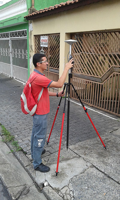
    Total Station Solutions

    Trimble-totalstations-W

    A range of new and enhanced robotic total stations — the Trimble S5, S7 and S9 — improve project efficiencies, productivity and deliverables. Times saving enhancements include improved Trimble VISION technology, SureScan technology included in the S7 and optional in the S9 total station, and the DR Plus electronic distance measurement technology as a standard feature.

    Theft and loss risks are also minimized now with Locate2Protect technology embedded in each instrument, allowing users to remotely track the location of their equipment in real-time using Trimble InSphere Equipment Manager.

    In the office, Trimble Business Center software can be used to create high-dynamic-range (HDR) images using data captured with total stations. A new total station data editor enables fieldwork to be rapidly reviewed and allows surveyors to create deliverables with confidence, Trimble said.

    Scanning Solutions

    Trimble continues to blend powerful 3D laser scanning and imaging hardware with workflow-based software to drive new efficiencies for survey applications and construction planning and design.

    The Trimble TX8 3D laser scanner now offers greater accuracy (down to 1 mm) and streamlined onboard operation when measuring to longer ranges, decreasing the field time required for capturing reliable high-accuracy data.

    Enhanced tools in Trimble RealWorks software version 9.1 further reduce the time to produce high-quality deliverables from Trimble TX8 data. The new version of Trimble RealWorks software includes improved workflows for creating floor settlement plans and 3D pipeline models as well as complete storage tank inspection and reporting capabilities.
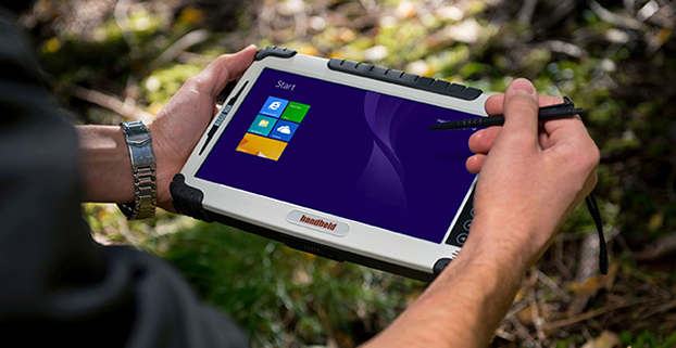
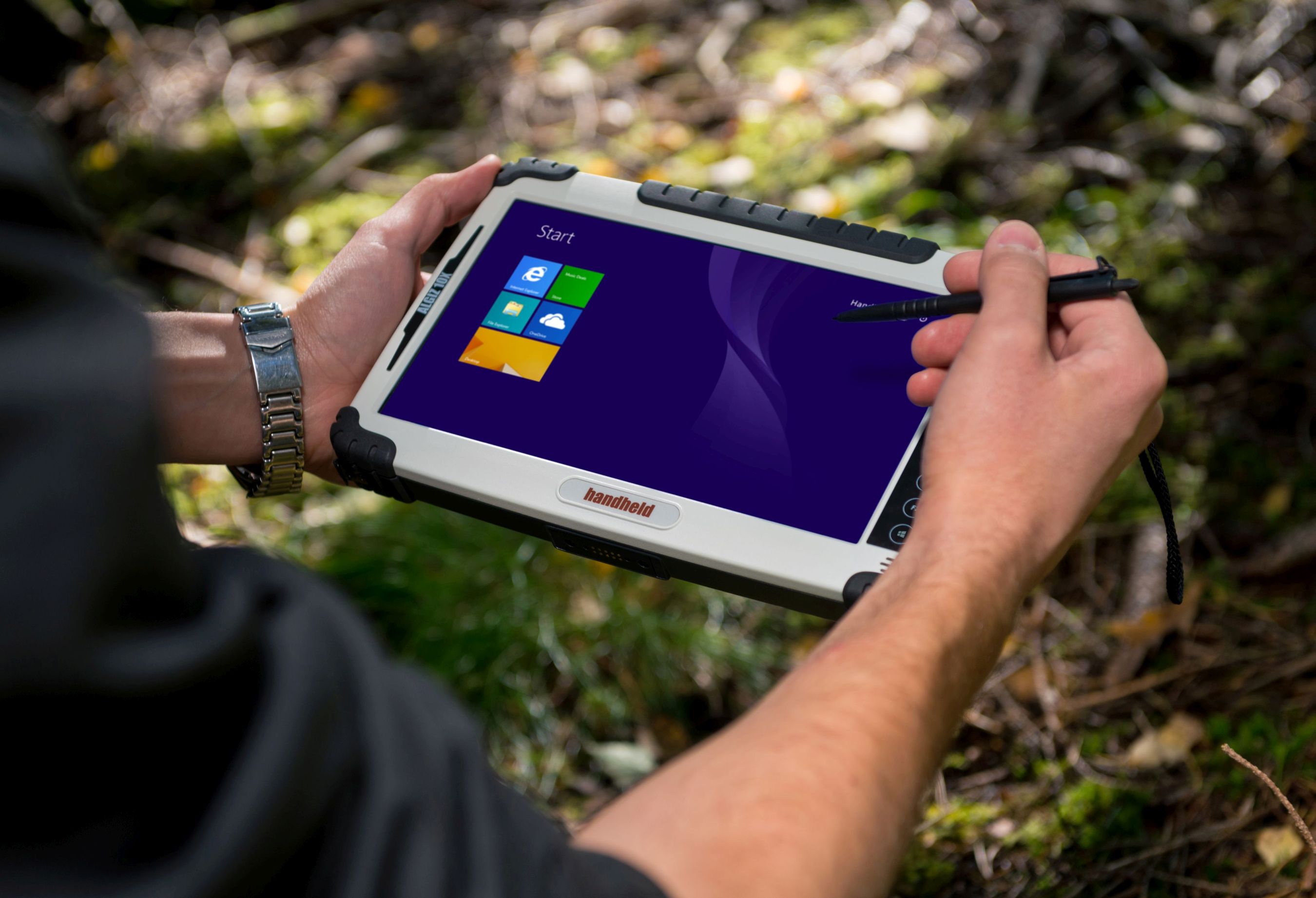
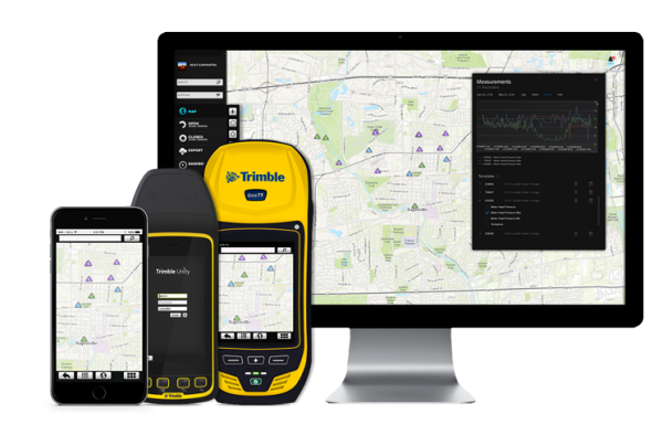
    GNSS Solutions

    The new Trimble R8s Integrated GNSS receiver and updated version of Trimble Access field software combine to offer configurable and scalable settings. Surveyors have the flexibility across their workflows by being able to tailor the Trimble R8s receiver with the updated field software for their specific application. The ability to customize provides flexibility for future business requirements and allows customers to maximize efficiencies across their workflows.

    cameraSightImage_S6-W

    Imaging Solutions

    Trimble enhancements to Trimble VISION workflows increase the value of highly accurate image data. Survey, engineering and civil infrastructure professionals can now generate dense point cloud deliverables in Trimble Business Center from images captured using the Trimble V10 Imaging Rover. Users can also quickly generate 2D CAD and 3D real-world models from images captured with Trimble total stations using the streamlined workflows created within Trimble Business Center and SketchUp software.

    Availability

    Trimble Access field software, Trimble Business Center version 3.50 office software, the Trimble R8s GNSS receiver, Trimble S5, S7 and S9 Total Stations and TX8 3D Scanner are available now through Trimble’s Geospatial Distribution Channel.

  • Getmapping Partners with PlanetObserver on Satellite Imagery

    PlanetObserver-GetMapping-O

    Getmapping has partnered with PlanetObserver to offer customers a full range of global and regional Earth satellite imagery along with global height data. The partnership is in line with Getmapping’s wider strategy to extend its reach beyond its established markets in the UK and Africa and signals an intention to provide a global capability in geospatial products and services. 

    The key PlanetObserver offerings available from Getmapping include PlanetSAT 15, 15-m resolution global satellite imagery and two height data products, PlanetDEM 30 and PlanetDEM 90 with resolutions of 30 m and 90 m respectively. 

    The satellite imagery is the most up to date satellite dataset currently available and provides natural colour (RGB) imagery free from clouds. Available from a few square kilometers to global coverage, the data is especially suited to a wide range of sectors, including energy and utilities, tele-communications and smartphone apps, visualization and simulation, plus mapping and illustration.

    The PlanetDEM height datasets are seamless global digital elevation models at 30m and 90m resolution and are derived from a combination of SRTM (Shuttle Radar Topography Mission v4.1) data corrected with multi-source cartographic data, and are perfect for 3D simulation and visualisation applications, base mapping, energy and geological surveys.

    All PlanetObserver data is delivered in a range of standard formats, and is also available via WMS and as an additional layer in the Getmapping Online GIS software.

    “We have been providing high-quality aerial imagery and elevation data across the UK and Africa for a number of years and it has always been our intention to provide our customers with a global offering,” said Pete Bonham, Getmapping’s Business Manager. We expect satellite imagery and DEMs to be particularly popular with our Online GIS customers who can subscribe to access the data from within the application. The high quality data from PlanetObserver covers the entire surface of the Earth, and provides excellent base layers for our expanding Online GIS application, it really adds value to our offering.” 

    Laurent Masselot, CEO of PlanetObserver added, “Our new cooperation with Getmapping is a major step forward to efficiently supply our geospatial data to a large user community. We’re particularly excited to reach out to users of Getmapping online GIS software and have them take advantage of our value-added products.”

  • Esri Offers Data Reviewer for Electric Utilities

    Data Reviewer for Electric Utilities provides more than 40 out-of-the-box checks that users can run individually, group into batch jobs (as .rbj files), or run as a scheduled service.
    Data Reviewer for Electric Utilities provides more than 40 out-of-the-box checks that users can run individually, group into batch jobs (as .rbj files), or run as a scheduled service.

    Esri has released a Data Reviewer for Electric Utilities. It provides the preconfigured ArcGIS Data Reviewer for Desktop to be used to validate, maintain and improve the integrity of electric distribution data.

    Data Reviewer for Electric Utilities provides a set of tools to simplify many aspects of automated and visual data quality control. The solution provides more than 40 out-of-the-box checks that users can run individually, group into batch jobs (as .rbj files), or run as a scheduled service.

    “As utilities continue to collect more information about their electric network, it’s imperative that this information be validated to ensure accuracy and completeness of the overall content,” Esri solutions team lead Patrick Dolan said. “The release of Data Reviewer for Electric Utilities allows utilities to automate the way they validate and measure the overall health of their electric distribution network, providing them with greater insurance that the electric network is accurate and complete.”

    Download the Data Reviewer for Electric Utilities solution for free, including a demonstration and sample electric dataset.

    Learn more about Esri solutions for utilities at esri.com/electric.

  • Esri, Safe Software Release Common Framework for Electrical Utilities

    Esri and Safe Software have paired to develop and openly share a Common Information Model (CIM) template for data exchange. The template demonstrates one approach to translating network data from an Esri ArcGIS database into CIM XML format. The XML can then be shared with other enterprise systems.

    “The power behind a CIM is to provide a common language to share messaging among an electric utility’s information systems,” said Bill Meehan, Esri director of utility solutions.

    The CIM comes in the wake of power industry deregulation and smart grid emergence. Utilities now share core network data more frequently than ever, and a CIM facilitates this. With a common format, a utility can share information internally across its enterprise systems, externally with other utilities, and externally with organizations such as regulators and independent system and regional transmission operators.

    A CIM is based on the International Electrotechnical Technical Commission (IEC) family of standards, IEC 61970.

    The Esri-Safe Software model also promotes faster decision making internally when data can be moved quickly from geographic information system (GIS) technology — the system of record for network data at many utilities — to destination enterprise systems, such as DMS, AMI, SCADA, OMS, and WMS, the companies said.

    Users can download the template and test CIM XML data structures with their own data or a sample dataset that Esri and Safe Software provide. “With this template, we are providing another way for electric utilities to leverage their investment in Esri technology,” Meehan said.

    The template works off of Esri’s ArcGIS (version 10.1 service pack 1 [SP1] or higher) and Safe Software’s FME software (version 2013 or higher). The sample template consists of an FME workspace; an ArcGIS Data Interoperability extract, transform and load (ETL) tool; and a sample dataset to guide users through testing how the translation process works. All the tools are provided as open source so users can adapt them to their needs.

    “Utilities can use the template as a starting point for understanding how to translate data from an Esri database to the CIM XML structure to share with other enterprise systems,” Meehan said.

    After exploring the sample dataset, users can also work to configure the template to work with their own network data.

    Download the CIM translation template on GeoNet.

  • Latin America Sanitation Company Goes with ProMark

    Photo: Saneamento Basico do Estado de São Paulo (SABESP)Saneamento Basico do Estado de São Paulo (SABESP), a Brazilian water and sewage collection utility owned by São Paulo state and Latin America’s largest water company by market capitalization, has selected Spectra Precision ProMark 120 and 220 GNSS receivers to assist in gathering the geographic location of all SABESP network assets and the location of all customers.

    SABESP provides water to more than 28.7 million customers, or 67 percent of the population of São Paulo state. Water loss due to leakage in the SABESP network is a significant problem. The biggest reason behind water loss is leaks in the network; additional factors include sub-metering, caused by low water pressure; unauthorized consumption; and fraud. 

    Improving water management, recovering lost revenue and improving the quality of the customer experience is a priority for SABESP, Spectra Precision said. To help improve revenue generation and reduce water loss, SABESP developed two projects: LigGeo, to geo-reference the water meter location of approximately 4.8 million SABESP customers; and CadGeo, to geo-reference and register the location of the SABESP water and sewage network infrastructure.

    According to Marcos Almir, sanitation systems analyst for the metropolitan department of development and management of SABESP, the twin projects of LigGeo and CadGeo were motivated by SABESP’s desire to improve productivity and competitiveness. “We created an innovative GIS effort to geo-reference and register SABESP distribution networks and buried assets. Tests showed the technical feasibility of using ProMark GNSS receivers and collectors with NTRIP technology to efficiently and effectively register all SABESP equipment in real time with geo-referenced attributes connected to the technical and commercial enterprise systems to optimize processes and reduce costs.”

    To implement the LigGeo and CadGeo projects, SABESP purchased 50 ProMark 120 and 220 GNSS receivers from Hezolinem Equipamentos Topograficos, Spectra Precision’s Brazil dealer. Both SABESP technicians and outsourced service providers will use the receivers.

    ProMark 120/220 GNSS receivers were chosen for their multiple advantages: They could be purchased as rovers only; they could run LigGeo and CadGeo proprietary software; they are compatible with local third-party networks, including CEGAT, Brazil’s largest private RTK geodetic base network, that delivers RTK network corrections enabling real-time accuracy of less that 20 cm; and they offered direct two-way 3G communication of information with the SABESP central cartographic base raster files.


  • Handheld Makes Algiz 10X Rugged Tablet More Powerful

    Handheld Makes Algiz 10X Rugged Tablet More Powerful

    Handheld's Algiz 10X rugged tablet now has Windows 8, a faster processor.
    Handheld’s Algiz 10X rugged tablet now has Windows 8, a faster processor.

    Handheld Group is upgrading its Algiz 10X tablet. With the upgrade, the rugged tablet for field professionals now features the Windows 8.1 Pro operating system, which is downgradable to Windows 7. Windows 8.1 Pro offers enhanced features to help users connect to company networks, access one PC from another, encrypt data and more.

    The upgraded Algiz 10X also has a more powerful processor that speeds startup and operation, increases software compatibility and doubles processor performance. Its has an integrated u-blox GPS receiver with WAAS/EGNOS/MSAS capability.

    Like all of Handheld’s rugged PDAs, smartphones and mobile computers, the Algiz 10X is specifically developed for field workers in industries such as geomatics, logistics, forestry, public transportation, utilities, construction, maintenance, mining, military and security. It is IP65-rated and meets stringent MIL-STD-810G military standards — protected against dust, water, vibrations, drops and extreme temperatures. It has a 10.1-inch touchscreen, weighs 1.3 kilograms (2.9 pounds) and is 32 millimeters (1.2 inches) thick.

    “By using the very latest operating system available from Microsoft, customers can now enjoy quicker startup and operation, increased software compatibility and improved support for touchscreen-based tablets, among other benefits,” said Johan Hed, Handheld’s director of product management.

    The new Algiz 10X also has the powerful Intel quad-core N2930 1.83 GHz processor with 2.16 GHz boost. This processor allows for both higher performance and cooler running temperatures. Compared to the Algiz 10X’s previous processor, the N2930 more than doubles performance benchmarking, RAM support, number of cores and performance per watt.

    “We have dramatically increased performance levels without sacrificing operating time or mechanical design,” Hed concludes. “We have also improved our wireless communication support. Besides 802.11 b/g/n on 2.4 GHz, we now support both 802.11ac and 802.11a on 5 GHz. The upgraded Algiz 10X also supports LTE, which provides substantially faster data speeds, both up- and downstream, and increased overall network coverage.”

    Key features of the Algiz 10X version 2:

    • Powerful Intel quad-core N2930 1.83 GHz processor
    • 128 GB SSD, expandable via microSD
    • 4 GB of DDR3 RAM
    • Windows 8.1 Industry Pro (downgradeable to Windows 7)
    • 10.1-inch touchscreen with high-brightness MaxView screen technology
    • IP65 rating and conformity to stringent MIL-STD-810G test standards
    • LTE capability with a fully integrated modem and antennas
    • Integrated u-blox GPS receiver and WAAS/EGNOS/MSAS capability
    • Antenna pass-through connectors for both GSM and GPS
    • Several connectivity options, including WLAN and BT, USB 2.0 and USB 3.0, VGA and RS232 ports

    The upgraded Algiz 10X is available now and orders can be placed immediately.

    Below is a video about the new Algiz 10X.

  • Rextorm Rugged Tablet Designed for Field Work

    RuggON-tablet
    Photo: RuggON 

    Taiwan-based company RuggON is launching the Rextorm series of rugged tablets. With an ultra-bright 1000 Nit optically bonded display, high speed 802.11ac connectivity, hot swappable dual-battery design, and capacitive glove touch capability, the 10.1-inch fully ruggedized tablets are ready for use in the field.

    With the latest communication technology including GNSS Positioning (GPS/GLONASS/Beidou), 802.11 ac, Bluetooth 4.0 and optional 4G LTE, mobile workers can experience precise positioning, fast processing, broad coverage and more stable data transfer even around buildings or trees, RuggON said. For in-vehicle usage, a dual pass-through port allows users to connect via vehicle dock for improved GNSS, WLAN, or WWAN reception. Standard I/O ports include USB 3.0, 2.0, RS232, RJ45, Micro-HDMI, and Micro-SD.

    The Rextorm series is a fully ruggedized tablet that meets and exceeds MIL-STD-810G standards for shock and vibration, offers IP65 rating, wide operating temperature range and superior drop resistance of 5 feet on to a concrete surface.

    Using the Intel Core i5 Haswell processor, the PX-501 has the fastest processor of the series and is a rugged workstation that can be taken to the field. High-capacity 120GB or 240GB SSDs are available, as well as 4GB or 8GB of DDR3 RAM. A precision digitizer allows accurate input for illustrations and technical work in the field. Windows 7/8 Pro as well as Windows Embedded 7/8 are available.


  • Trimble Unity Replaces Connect for Water, Wastewater and Stormwater Utilities

    Trimble Unity Replaces Connect for Water, Wastewater and Stormwater Utilities

    Trimble-unity-Hardware
    Photo: Trimble

    Trimble introduced today its next generation suite of software applications for water, wastewater and stormwater utilities — Trimble Unity. Trimble Unity replaces Trimble Connect for Water and offers a unified cloud-based and mobile collaboration platform for smart water mapping and work management.

    Trimble Unity applications, or “apps,” support the following workflows:

    • Mapping: Field and office GIS visualization and mapping of assets with up to centimeter-level accuracies
    • Maintenance: GIS-based asset maintenance and inspection forms and business processes
    • Service: Customer field service work order and mobile workforce management
    • Metering: Smart water meter deployment, installation and maintenance
    • Monitoring: Visual and real-time monitoring of field operations and utility networks
    • Analytics: Dashboards and performance management reporting

    Trimble Unity represents a unified collaboration platform for managing critical utility assets and the work of water industry professionals. By integrating GIS and field operations, sensors and wireless communications, mobile workers and office professionals, field and back office enterprise systems, and utilities with their contractors, Trimble Unity provides the water industry with a comprehensive solution for regulatory reporting, improving operations, reducing cost and enhancing customer service, the company said.

    Trimble Unity is designed to automate a variety of industry workflows through individual “apps” offered within the software suite, enabling utilities to deploy smart meters, assess the condition of assets, repair leaks and reduce non-revenue water (NRW), and locate and map critical infrastructure using Trimble high-accuracy GNSS mapping technologies. The software can also assist utilities in reducing spills and environmental damage, extending the life of aging assets and helping improve worker safety and productivity.

    Through a Trimble Unity software-as-a-service (SaaS) subscription, organizations can provide a single solution for the office and the field, choosing any combination of Trimble and non-Trimble mobile devices, including iOS, Android, Windows Mobile and Windows 7/8 smartphone, tablets and laptops. The software also integrates the latest Esri ArcGIS Server, mobile and ArcGIS Online map services enabling organizations to leverage their existing investments in GIS technology.

  • Eos Positioning Launches Arrow High-Accuracy GNSS Receiver

    Eos Positioning Launches Arrow High-Accuracy GNSS Receiver

    ipad-iphone-samsung-arrow-O Photo: Eos Positioning Systems
    Photo: Eos Positioning Systems

    Eos Positioning Systems has introduced a new line of high-accuracy GNSS receivers for smartphones and tablet computers, including both sub-meter and RTK performance for all mobile platforms: iOS, Android, and Windows.

    Eos’s entry-level product, the Arrow Lite, is Bluetooth compatible with all mobile devices.

    The Arrow 100 is Eos’s advanced real-time, sub-meter GNSS receiver that utilizes both GPS and GLONASS, and is expandable to Galileo, Beidou and QZSS. It offers superior tracking under tree canopy, around buildings and in rugged terrain, the company said. In addition to supporting SBAS in North/Central America, Europe, Northern Africa, Japan, India and Russia, the Arrow 100 also supports OmniSTAR’s worldwide, real-time sub-meter service.

    The most advanced Arrow receiver is the Arrow 200, a dual-frequency, multi-constellation RTK GNSS receiver capable of 1-cm accuracy in real time. The Arrow 200 is an iOS-compatible RTK and OmniSTAR receiver that works with all models of iPads and iPhones via wireless Bluetooth connection. An iOS NTRIP app that allows the user to log into any available RTK network. The Arrow 200 will provide quality RTK performance for years to come because it supports current and future satellite constellations: GPS, GLONASS, Galileo, BeiDou and QZSS, the company said. It also supports OmniSTAR’s G2, XP and HP real-time worldwide decimeter services.

    “After spending more than 12 years designing high-accuracy Bluetooth GNSS receivers, I believe Eos has set the new standard for high- accuracy GNSS receivers that work across all mobile platforms, no matter if it’s iOS, Android or Windows,” said Chief Technology Officer Jean-Yves Lauture.

    All Arrow receivers employ long-range (1-km) universal Bluetooth connectivity so the user can interface to any brand of smartphone or tablet, whether it’s iOS, Android, or Windows-based. A variable-power Bluetooth implementation allows the Arrow receivers to communicate up to one kilometer from the mobile device.

    Arrow receivers have been optimized to run all day on battery power. The battery pack is field-replaceable and rechargeable separately. It contains smart charging logic so expensive battery chargers are not needed.

    All Arrow receivers have been designed to meet IP-67 specifications for immersion in water and are completely dust-proof so they will survive in the harshest environments.

    The Arrow receiver product line is targeted at high-accuracy applications like GIS, environmental, agriculture, electric/gas/water utilities, surveying, machine control, and federal/state/local government.

  • Carlson GIS360 for Android Gives 3D Views on Site

    Carlson GIS360 Android app.
    Carlson GIS360 Android app.

    Carlson GIS360 for Android, new from Carlson Software and Carlson EMEA, is a mobile field GIS-GPS tool that uses both GIS and surveying technologies for field data collection. The app is designed to be easy to learn and easy to use, Carlson said.

    “Taking advantage of the graphics processing power of Android devices, GIS360 now includes an innovative 3D viewer so the user can see data and models in 3D on site,” said David Loescher, Carlson U.K. sales director and director of GIS360 development.

    In addition to allowing field crews to navigate maps and collect and report data in the field, GIS360 provides the data and fully rendered models of mines, earthworks and pipe networks that can be viewed in 3D. The software’s Siteview function uses the Android devices’ built-in GPS, compass and gyros to give the user the view of the site in front of him.

    Carlson GIS360 provides a wireless connection to any map server of choice, so users are never without a map. This saves considerable time and effort as field crews can verify that all of the data collected is accurate before leaving the site, Carlson said. No costly site revisits are necessary and no office work is needed.

    The software’s cloud options provide backup for users’ data, enabling it to be shared between field and office in real time. GIS360 goes beyond positioning with a range of tools for mobile workforce management, GPS data collection, tracking and asset maintenance.

    On an Android tablet or smartphone, Carlson GIS360 for Android can take GIS data anywhere. The built-in GPS and compass instantly calculate what the user is looking at and then displays the data automatically.

    “The GIS360 development team set out to make the collection of asset information easier and more efficient by combining the power of GIS360 with affordable Android devices,” added Loescher. “The result not only saves a lot of field time, but also makes the process far easier for everyone concerned.”

  • Trimble’s Smart Water Software Adds GNSS for 3D Accuracy

    Trimble has introduced the latest version of its smart water infrastructure mapping and work management cloud software — Trimble Connect for Water version 1.9.

    The latest release of the geographic information system (GIS) centric software-as-a-service (SaaS) adds real-time, high-accuracy centimeter-level horizontal and vertical GNSS accuracy for capturing 3D asset positions. The new release includes a suite of applications that allow water, wastewater and stormwater utilities to accurately locate, inventory and visualize their infrastructure assets and increase operations and maintenance efficiency.

    The announcement was made at Trimble Dimensions.

    Trimble Connect for Water cloud software leverages Trimble’s GNSS rugged mobile devices and Esri’s GIS technologies to accurately map, locate and assess the condition of critical infrastructure assets, allowing utilities to keep their field infrastructure data up-to-date and accurate.

    The new release now supports Trimble’s Geo 7 Centimeter Edition rugged handheld, integrating 3D mapping into utility field workflows and enabling mobile workers to precisely locate and map the horizontal position and elevation of buried infrastructure.

    Trimble Connect for Water version 1.9 can be configured and deployed quickly on a variety of Trimble and non-Trimble mobile devices, laptops, tablets and smartphones, including Apple iPads, iPhones, Android, Windows and Windows Mobile devices to automate fieldwork and eliminate paper-based maps.

    Trimble Connect uses the latest Esri ArcGIS for Server, Mobile and ArcGIS Online basemap services. The software is designed to automate a variety of specific water, wastewater and stormwater industry workflows through individual pre-configured “apps” offered within the product and as part of a subscription.

    The new version provides standard core apps including Map Book, Manhole Inspector, Leak Repair, Hydrant Inspector, Valve Inspector, Meter Changeout, Incident Repair, Water Mapper, Wastewater Mapper and Stormwater Mapper. In addition, an optional partner app developed for American Flow Control (AFC) hydrant and valve data collection, “AFC Mapper,” can be purchased from AFC and their distributors for use with Trimble rugged handhelds.

    Trimble Connect for Water version 1.9:

    • Offers centimeter-level real-time GNSS accuracy to improve the quality and accuracy of the utility’s GIS data to precisely locate hard to find assets.
    • Allows capturing accurate vertical elevations in real-time. Combined with horizontal precision, the solution provides high-accuracy GIS data that can be used to measure pipeline slopes, perform flow analysis and generate 3D and hydraulic models.
    • Supports the Trimble Geo 7 Centimeter edition with an integrated laser rangefinder.
    • Offers pre-configured Water, Wastewater and Stormwater mapping apps, allowing utilities to quickly start mapping network infrastructure and updating their asset data.
    • Provides the capability to export data in a variety of formats including Esri File Geodatabase, Shapefiles and MS Excel, which allows users to update the utility’s enterprise GIS or visualize and analyze the collected data using third-party systems.

    Trimble Connect for Water version 1.9 is expected to be available in December 2014 from Trimble’s Water Division and its authorized distribution partners.

  • Trimble’s Smart Water Software Adds GNSS Capabilities

    Trimble has introduced the latest version of its smart water infrastructure mapping and work management cloud software — Trimble Connect for Water version 1.9.

    The latest release of the geographic information system (GIS) centric software-as-a-service (SaaS) adds real-time, high-accuracy centimeter-level horizontal and vertical GNSS accuracy for capturing 3D asset positions. The new release includes a suite of applications that allow water, wastewater and stormwater utilities to accurately locate, inventory and visualize their infrastructure assets and increase operations and maintenance efficiency.

    The announcement was made at Trimble Dimensions.

    Trimble Connect for Water cloud software leverages Trimble’s GNSS rugged mobile devices and Esri’s GIS technologies to accurately map, locate and assess the condition of critical infrastructure assets, allowing utilities to keep their field infrastructure data up-to-date and accurate.

    The new release now supports Trimble’s Geo 7 Centimeter Edition rugged handheld, integrating 3D mapping into utility field workflows and enabling mobile workers to precisely locate and map the horizontal position and elevation of buried infrastructure.

    Trimble Connect for Water version 1.9 can be configured and deployed quickly on a variety of Trimble and non-Trimble mobile devices, laptops, tablets and smartphones, including Apple iPads, iPhones, Android, Windows and Windows Mobile devices to automate fieldwork and eliminate paper-based maps.

    Trimble Connect uses the latest Esri ArcGIS for Server, Mobile and ArcGIS Online basemap services. The software is designed to automate a variety of specific water, wastewater and stormwater industry workflows through individual pre-configured “apps” offered within the product and as part of a subscription.

    The new version provides standard core apps including Map Book, Manhole Inspector, Leak Repair, Hydrant Inspector, Valve Inspector, Meter Changeout, Incident Repair, Water Mapper, Wastewater Mapper and Stormwater Mapper. In addition, an optional partner app developed for American Flow Control (AFC) hydrant and valve data collection, “AFC Mapper,” can be purchased from AFC and their distributors for use with Trimble rugged handhelds.

    Trimble Connect for Water version 1.9:

    • Offers centimeter-level real-time GNSS accuracy to improve the quality and accuracy of the utility’s GIS data to precisely locate hard to find assets.
    • Allows capturing accurate vertical elevations in real-time. Combined with horizontal precision, the solution provides high-accuracy GIS data that can be used to measure pipeline slopes, perform flow analysis and generate 3D and hydraulic models.
    • Supports the Trimble Geo 7 Centimeter edition with an integrated laser rangefinder.
    • Offers pre-configured Water, Wastewater and Stormwater mapping apps, allowing utilities to quickly start mapping network infrastructure and updating their asset data.
    • Provides the capability to export data in a variety of formats including Esri File Geodatabase, Shapefiles and MS Excel, which allows users to update the utility’s enterprise GIS or visualize and analyze the collected data using third-party systems.

    Trimble Connect for Water version 1.9 is expected to be available in December 2014 from Trimble’s Water Division and its authorized distribution partners.