Expanded Construction One Portfolio enables an end-to-end digital experience for heavy civil and infrastructure contractors to enhance productivity, profitability and sustainability
Trimble has acquired privately held B2W Software, a provider of estimating and operations solutions for the heavy civil construction industry. Financial terms were not disclosed.
With the passage of the U.S. Infrastructure Investment and Jobs Act (IIJA) and other infrastructure legislation across the globe, construction organizations are fast-tracking the digitization of their processes and operations. As infrastructure projects become increasingly complex, data-driven insights and analytics will be imperative to improve productivity, increase efficiency and drive sustainability.
“Seamlessly connected workflows are key to unlocking the true potential of an organization’s data,” said Elwyn McLachlan, vice president of Trimble’s Civil Solutions Division. “With the acquisition of B2W, Trimble will be able to provide an unparalleled end-to-end digital experience — connecting the digital to the physical — for heavy civil and infrastructure contractors.”
The addition of B2W’s comprehensive suite of pre-construction and operations capabilities will expand Trimble’s already extensive civil infrastructure portfolio and Trimble Construction One, a purpose-built connected construction management platform.
Photo: Trimble
B2W’s integrated suite of applications includes estimating, scheduling, field tracking, equipment maintenance, data capture and business intelligence. By combining these capabilities with Trimble’s field data, project management, finance and human capital management solutions, civil contractors will be able to bridge the gap between office and field in new ways, promoting transparency, efficiency and ultimately profitability.
“B2W has helped thousands of heavy civil contractors increase their bid accuracy and operational efficiency,” said Paul McKeon, B2W founder and CEO. “Now with Trimble, we can realize the next chapter of our story. By linking the planned with the executed, we will provide civil contractors with a truly connected construction experience, unlocking valuable new insights for our customers across their entire operation.”
B2W will be reported as part of the Buildings and Infrastructure segment.
Perkins Coie LLP acted as legal advisor to Trimble. Piper Sandler & Co. acted as a financial advisor and Foley Hoag LLP acted as legal advisor to B2W Software.
An interview with Fergus Noble, CTO at Swift Navigation about recent GNSS receiver innovations.
Noble
What was the most significant technical innovation in your GNSS receivers in the past five years?
At Swift Navigation, our mission has been to bring precise positioning technology to the mass market. We focus on the applications that touch our everyday lives — automotive, transportation, robotics and mobile devices. To realize that mission, we have had to innovate beyond traditional GNSS techniques. There are three areas where Swift has had to push the boundaries of GNSS technology: scalability, affordability and safety.
To meet the scalability needs of applications — such as automotive ones, which require continental-scale coverage for millions of devices — we have had to develop new techniques for providing GNSS corrections. We have developed new algorithms to precisely model the Earth’s atmosphere and other sources of GNSS error over wide areas in real-time and deliver them via scalable state-space representation (SSR) format.
To make the technology affordable, we have partnered with GNSS chipset providers to bring precise positioning performance to vehicles and consumer devices that was previously only achievable using expensive industrial receivers.
Swift brings to vehicles precise positioning that was previously only achievable with expensive industrial receivers. (Photo: metamorworks/iStock/Getty Images Plus/Getty Images)
To make the technology safe, we have developed the most sophisticated end-to-end positioning integrity system available today. This integrity provides our customers with the guarantee of safety needed for autonomous and industrial applications, as well as certifying to industry safety standards such as ISO-26262 (ASIL).
What has it enabled users to do that they could not do before?
Previous precise positioning solutions did not apply to applications such as autonomous driving as they were too costly to go into a vehicle, had the required accuracy only in limited coverage areas, and could not provide the guarantees of integrity such that they could be relied upon as a safety-critical sensor. The same limitations applied to last-mile transportation, consumer robotics — such as lawnmowers — and even mobile applications.
Swift’s technology enables our customers to unlock these use cases by providing reliable and seamless precise positioning to our users at continental scale.
What is a good example of this?
Swift’s technology is now powering one of the largest vehicle fleets on the road today equipped with advanced driver-assistance systems (ADAS). It improves vehicle positioning for an enhanced user experience when navigating, as well as to upgrade the ADAS functionality.
We also have customers using our technology to track and improve safety across a continent-wide rail network, provide precise position to improve the efficiency of last-mile delivery fleets, and a host of other applications across both emerging and traditional GNSS markets.
An interview with Rachel Wong, product manager, surveying and engineering division at CHC Navigation about recent GNSS receiver innovations.
Wong
What was the most significant technical innovation in your GNSS receivers in the past five years?
CHC Navigation is a technology enabler for geospatial professionals in more than 120 countries. End users of geospatial data increasingly come from diverse backgrounds. This forces us to invest heavily in simplifying data-acquisition processes by focusing on the user friendliness and positioning reliability of our GNSS receivers.
The latest technological developments in GNSS real-time kinematic (RTK) rovers are based on the maturity and improvement of satellite navigation systems, as well as on the integration of IMU sensors in the receivers — the latter being certainly the most important innovation.
In addition, the latest generation of our GNSS rovers, such as the CHCNAV i83, is based on the sophisticated iStar algorithm, which significantly improves the efficiency of tracking GNSS satellite signals for unmatched performance in GPS, GLONASS, BeiDou, Galileo and QZSS constellations, using all available frequencies including BeiDou 3. This goes hand-in-hand with the integration of the IMU as it helps to ensure increased GNSS positioning accuracy through optimized satellite geometry.
What has it enabled users to do that they could not do before?
A utility worker uses the tilt-pole-compensation feature to measure a manhole. (Photo: CHC Navigation)
The integration of GNSS+IMU modules allows surveyors to survey points without the need to level the range pole, accelerating the adoption of GNSS technologies for early adopters by simplifying work processes. For example, our i83 GNSS is powered by a 1,408-channel multiband GNSS receiver, the latest iStar technology and a high-end, calibration-free IMU sensor for faster, more reliable GNSS field surveys.
The i83 GNSS’ integrated IMU automatically compensates for pole tilt, increasing surveying, engineering and mapping efficiency by 30% over conventional RTK GNSS surveying methods. In less than 5 seconds, the 200-Hz inertial module is initialized to ensure survey-grade accuracy over a pole-tilt range of up to 30 degrees that meets the real-world operational needs of our users.
What is a good example of this?
Surveyors can extend their working boundaries near trees, walls and buildings without the need for a total station or offset measuring tools. This can be illustrated in sewer and drainage applications, such as measuring the bottom of manholes for water, utilities or sewers, which was barely feasible in terms of GNSS measurement before the advent of hybrid GNSS + IMU positioning.
Operators only need to concentrate on their tasks and no longer need to level their pole vertically. They are now able to perform many measurements without compromising accuracy and reliability. Productivity is greatly increased, RTK usability is greatly improved, and potential human error is reduced, whether you are an engineer, foreman or surveyor, and whether you are an experienced or new user.
News from the European Space Agency (ESA). Europe’s first generation Galileo constellation is already the world’s most precise satellite navigation system — delivering meter-scale positioning to more than 3.5 billion users worldwide. The Galileo Second Generation will enable even better performance and an expanded range of services.
Essential elements of the G2 system are being evaluated in ESA laboratories, including key algorithms to synchronize satellite timing and determine orbits, as well as test versions of a GNSS receiver and emergency beacon.
Two independent families of satellites, totaling 12 G2 satellites, are being procured by Thales Alenia Space in Italy and Airbus Defence & Space in Germany. With their first launches due in the middle of this decade, G2 satellites will be much larger than existing Galileo satellites, and they represent a major technical step forward.
Backwards-compatible with the current constellation, the G2 satellites will incorporate numerous technology upgrades, developed through EU and ESA research and development programs. They will employ electric propulsion for the first time and host an enhanced navigation antenna. Their fully digital payloads are being designed to be easily reconfigured in orbit, enabling them to actively respond to the evolving needs of users with novel signals and services.
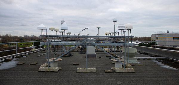
The GNSS antenna farm on the ESTEC roof for live signal reception. (Photo: ESA)
Algorithms at the heart of G2
At the heart of satellite navigation is the ability of the satellites to determine where they are in space and the precise time down to a few billionths of a second as they transmit their navigation signals. The greater the precision of these factors, the greater the accuracy of the positioning for users, because Galileo receivers take the time between the signals being transmitted and received and turn it into a measurement of distance. Signals from four or more satellites are used to pinpoint the receiver’s location.
The Advanced Orbit Determination and Time Synchronisation (ODTS) Algorithms Test Platform evaluates the advanced software that will perform these calculations for G2. Developed by Thales Alenia Space through an EU Horizon 2020 project coordinated by ESA, the platform is now installed and running in ESA’s Navigation Laboratory. The laboratory is based at ESA’s technical heart, the ESTEC establishment in the Netherlands, where it is helping simulate how the G2 satellites will operate in practice.
“This platform represents a dynamic, highly-performing environment for algorithm experimentation in both real-time and post-processing modes, using either real or simulated data,” said Francisco González, the project’s technical officer. “It contains the algorithmic core of Navigation for Earth Orbit Determination and Identification Segment, NEODIS, which is the suite of algorithms developed by Thales Alenia Space for precise orbit determination of the satellite constellation. These algorithms allow the real-time estimation of orbits and clocks, as well as the generation of Galileo navigation messages, with an estimated accuracy in the tens of centimeters.”
“Important evolutions aimed at improving the estimation of clocks and orbits are being incorporated,” said Gustavo Lopez-Risueno, head of ESA’s Galileo G2 System Engineering Unit. These improvements include:
integration of composite clock algorithms for a stable and robust reference timescale
the dynamic modeling of satellite and station clocks based on their known behavior
the processing of auxiliary measurements such as laser range measurements, in which lasers are reflected off of satellites to measure their orbital position, delivering a ranging accuracy down to under a centimeter —significantly better than the half-meter or so available from radio ranging
intersatellite links.
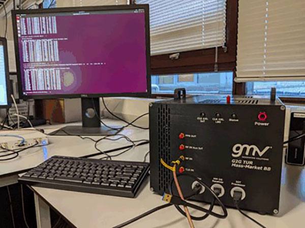
The first G2 receiver prototype “breadboard” is now running in ESTEC’s Navigation Lab. (Photo: ESA)
First G2 receiver up and running
Another outcome of ESA-led H2020 research is also up and running in the lab: the first G2 receiver prototype “breadboard,” developed by GMV.
“Its development has been key to supporting the fine-tuning and assessment of some signal design options we are considering,” said Jose A. Garcia-Molina, who leads the G2 signal-in-space design at ESA. “Representative mass-market receiver processing architectures and techniques have been considered to assess the final benefits a user would receive.”
“This first G2 receiver breadboard allows us to better understand the performance G2 can achieve in different user conditions, such as the urban environments in which many Galileo users are based today,” said Miguel Manteiga Bautista, who leads ESA’s G2 Programme.
Meanwhile, two parallel activities have been started for development of the G2 test user receiver. The receiver will be taken outside the lab for various test activities ahead of the first G2 launches, and then again for in-orbit testing and validation.
Arctic Mass Rescue Operation in 2021 tested the rescue of 200 cruise-ship passengers using Galileo SAR. (Photo: EUSPA)
Search-and-rescue system also being updated
Nearby, in ESTEC’s Telecommunications Lab, is the G2 search and rescue test beacon simulator, now operational following site acceptance testing.
Like their first-generation predecessors, the G2 satellites will pick up emergency signals from beacons on Earth and relay them to a ground station, which will forward them to local emergency services. This contributes to emergency response saving more than 2,000 lives annually.
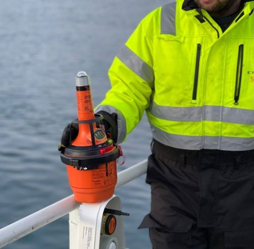
Emergency position-indicating radio beacon (EPIRB). (Photo: ESA)
The new simulator to model the performance of these emergency beacons was developed over three years by Thales Alenia Space, under ESA leadership through a G2G System Engineering Technical Assistance Activity.
“Equipped with state-of-the-art signal generation and processing capabilities, coupled with a 200 W amplifier, this new simulator offers several enhanced functionalities over first-generation simulators, including the transmission of the new G2 beacons developed by the Cospas-SARSAT organization and the simulation of complex operational scenarios of up to 15 parallel distress beacons,” said Eric Bouton, ESA’s Galileo search and rescue engineer.
“Its development is really a crucial step to gaining a better understanding of the in-orbit behavior of Galileo’s First and Second Generation search-and-rescue payloads with the new waveforms of the G2 beacons and with the growing beacon population and associated alert traffic,” Bouton said. “It will be used for an initial test campaign already in preparation, and in the future to support the commissioning of all new Galileo search-and-rescue systems.”
According to Fact.MR, a market research and competitive intelligence provider, the global surveying and mapping services market was worth US$9 billion in 2021 and is expected to expand at a CAGR of 3% during the forecast years of 2022-2032.
The survey and mapping industry has significantly benefited from drone technologies, because UAVs are less expensive and more accessible compared to traditional methods. Conventional surveying methods require rental aircraft and trained pilots, along with attached recording instruments — a costly and resource-intensive process. The introduction of UAVs has substantially created a future opportunity for surveying and mapping services to gather spatial information in a tighter structure. This also allows the collection of geospatial information with easy storage, processing and sharing capabilities.
For instance, in May 2022, India-based software company PDRL introduced a software-as-a-service platform — DroneNaksha — under the Svamitva Yojana scheme by the government of India for mapping land parcels using drone technology across the country. Similarly, in March 2022, Australia-based Emesent introduced Hovermap ST autonomous drone lidar mapping and surveying payload.
The integration of advanced technologies such as Wi-Fi, first-person view cameras, and GPS technology to make UAVs highly flexible and eliminate the need for a skilled pilot is expected to stimulate the demand for drones for survey and mapping activities, thereby driving market expansion.
Key Takeaways
The global surveying and mapping services market is projected to expand at a CAGR of 3.4% and reach US$13 billion by 2032.
Over the 2017-2021 historical period, the market evolved at 3.2% CAGR.
Forestry and agriculture account for a leading share in the market at a valuation of US$1.80 billion in 2021.
North America and East Asia account for leading shares in the global mapping services market at 24% and 32%, respectively.
Experts at u-blox discuss how they’re creating a hybrid positioning system for automated vehicles using GNSS and terrestrial radio ranging
By David Bartlett, senior principal engineer, Product Center Positioning, and Stefania Sesia, head of Application Marketing, Automotive, u-blox
There’s so much discussion around automated vehicles in the mainstream press these days, that it’s easy to forget some of the critical enabling technology needs to mature significantly before large numbers of people are being whisked from A to B by completely driverless cars.
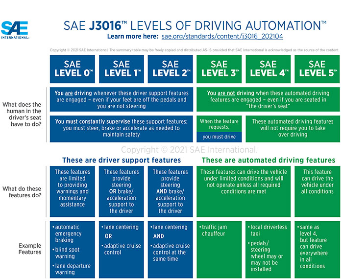
An area demanding particular attention is high-precision positioning. The Society of Automotive Engineers published a six-level automation scale. For vehicles at the higher end of the scale to become reality, they need to be able to reliably pinpoint their location to within centimeters, at all times.
Society of Automotive Engineers’ six-level automation scale. (Image: SAE International)
The positioning systems in most modern cars — which typically use GNSS receivers coupled with an inertial measurement unit (IMU) and the odometer — can’t get close to this level of accuracy. Even in the most favorable conditions for GNSS satellite signal reception, accuracy is between 2 and 5 meters horizontal circular error probable (CEP) without a correction service. In more challenging environments, such as urban areas or indoors, this is significantly reduced.
Using UWB and V2X to complement GNSS
Various solutions are being developed to address this GNSS shortcoming, but all currently have their limitations or don’t offer a solution that’s workable in all environments. Future autonomous vehicles will therefore invariably need to rely on hybrid solutions that blend multiple technologies.
One area where relatively little research has been done to date is in combining GNSS with terrestrial radio signals to enhance automotive positioning accuracy. Cellular vehicle-to-everything (C-V2X), IEEE 802.11p V2X, its successor 802.11bd and ultra-wideband (UWB) can all be used for short-range distance measurements. V2X ITS communications technology is listed as a potential positioning solution in EN 302890 (Intelligent Transport Systems), while UWB technology is gaining momentum for indoor applications, as well as by vehicle manufacturers for keyless entry.
These technologies are all ripe for further investigation as complements to GNSS and IMUs, to ultimately support higher levels of vehicle autonomy. U-blox recently ran a study to evaluate the terrestrial-ranging strengths and weaknesses of IEEE 802.11p V2X and UWB as part of a hybrid solution with GNSS for automotive navigation. Our aim was to establish their feasibility for this application, and identify where further research needs to happen for this type of hybrid navigation solution to become part of future autonomous vehicles.
A terrestrial-ranging system requires a network of fixed ground stations (typically referred to as roadside units, or RSUs, in V2X systems) at known locations. V2X or UWB signals sent out by the vehicle are returned by the RSUs, enabling the vehicle to measure the roundtrip time, and consequently calculate the distance between itself and the anchor point. Do this for three or more RSUs that are geometrically dispersed relative to the vehicle, and you can determine its position.
The need to simulate
Mass deployment of the RSUs required for this type of solution has not yet happened. Installing a suitable network of ground stations in an urban setting on public land wasn’t feasible for our research, in part because the regulatory landscape around UWB in this context is still evolving.
Instead, we set up anchor points around various private estates, from open fields to areas representative of urban environments, such as a business park. We took extensive measurements of the UWB and V2X signals’ behavior in these environments, which enabled us to extract performance statistics such as noise, and subsequently create a behavioral simulation model for the ranging performance.
Our test methodology
Having established our behavioral simulation model for different types of environments, rural, urban and indoor settings, we did a number of real-world test drives. These covered a wide range of driving conditions. We took in high-speed sections of open road, dense urban areas, start-stop congested traffic, numerous corners, and places with limited or no GNSS reception such as tunnels.
During these drives, we collected both GNSS measurements and ground truth. For the former, we used a u-blox NEO-M8L module with built-in IMU. To establish the ground truth, we used a high-grade real-time kinematic (RTK) receiver, GNSS augmentation data service and a high-spec IMU.
We classified each section of the test drives based on the environment — dense urban, tunnel, open countryside and so on — to enable us to apply the appropriate noise models in our simulation.
Next, we allocated RSU positions based on chosen density and placement rules, and added 2 m of random height variation, to ensure we avoided a fully planar deployment. We tested with various numbers of RSUs, to help understand how many would be required to achieve the necessary levels of location precision.
We then set additional simulator variables, such as the accuracy of the timestamp on the ranging measurements.
Having done all of this, we generated simulated ranging measurements between the RSUs and the truth position for every ranging epoch. To these, we added noise on a sample-by-sample basis, and merged the resulting noisy simulator measurements with the GNSS measurements we recorded en route.
Key findings
The output of the simulator enabled us to generate performance statistics that facilitated a comparison between the hybrid GNSS + V2X and GNSS + UWB solutions and a conventional GNSS + IMU solution, similar to those found in mainstream vehicles today.
The table below shows performance of the three solutions.
UWB
V2X (IEEE 802.11p)
GNSS+IMU
Ranging update rate
0.67 Hz
(1.5 s interval)
10 Hz (0.1 s interval)
n/a
Horizontal accuracy
0.1 – 2.5 m (Hybrid)
1.1 – 4.2 m (Hybrid)
1.2 – 5.5 m
Height accuracy
0.4 – 5 m (Hybrid)
5 – 10 m (Hybrid)
2 – 7 m
Frequency of operation
6.5 GHz
5.9 GHz
n/a
Signal bandwidth
500 MHz
10 MHz
n/a
Performance of the three navigation solutions on test.
At a very high level, we found that the GNSS+V2X (IEEE 802.11p) system achieved performance similar to a conventional GNSS+IMU(DR) solution using standard positioning. In situations where there is no GNSS reception, or where this is seriously degraded, an IMU also loses its value, given its reliance on continual GNSS reception to remain aligned. Here, a V2X-based positioning solution would be of value for navigation guidance.
However, more work will need to be done, including into the role of the IMU in high-integrity, high-accuracy positioning, to achieve the levels of accuracy and integrity that autonomous applications require.
The GNSS + UWB hybrid system delivered significantly better performance, approaching the levels that can be achieved using an RTK-based GNSS augmentation service. Our test system ran at 0.67 Hz, and was able to deliver precision close to 10 cm, though we would expect future production systems to align with the more common 10-Hz refresh rate broadly used in V2X.
By pairing a 10-Hz UWB ranging system with a high-accuracy GNSS system using correction data, it should be possible to achieve 10 cm-level accuracy in most situations. GNSS with correction data is already proven to be capable of delivering this level of precision in open areas and motorways. A network of RSUs deployed in urban environments would enable UWB to complement high-accuracy GNSS in situations where satellite reception is challenging.
However, the limited range of UWB, coupled with current regulatory restrictions around outdoor use, limit its usefulness at the present time. That said, micro-navigation in indoor areas, such as parking garages, could be a good fit for this technology.
Other lessons learned
The research brought to light a number of other important findings. First, having even just two RSUs visible, in addition to GNSS, provided significant benefit in the hybrid solution.
Second, height variation in the RSUs is essential if the navigation system is to determine the vehicle’s height accurately, particularly with V2X technology. This will be particularly important when it comes to enabling vehicles to safely operate where there are different levels of road one above the other, such as at multi-level junctions.
Third, we were successfully able to build a hybrid filter to process the signals from the V2X, UWB and GNSS systems, and seamlessly handle the transition between areas with GNSS only (where there were no RSUs deployed) and terrestrial ranging only (such as tunnels).
Fourth, despite the promise it showed for this application, terrestrial ranging is far from immune to environmental effects and multipath. Even UWB would sometimes suffer from non-line-of-sight signal propagation.
Finally, accurate time alignment between the GNSS and terrestrial ranging measurements also emerged as a critical factor. Where we had initially anticipated that alignment to within a few milliseconds would be sufficient, in reality we found we needed to be below 100 microseconds.
What next?
This research has shown the potential of using terrestrial-radio ranging to complement the existing positioning technologies and services being deployed in vehicles today. That said, more needs to happen, not least on the regulatory front, for this technology to genuinely become one of the enablers of future autonomous vehicles.
Outdoor UWB use needs to be permitted for this application, for example, and there needs to be widespread deployment of UWB-capable RSUs. Moreover, when RSUs of any kind are being deployed, thought needs to be given to their possible use as positioning anchors, rather than simply as communication devices.
In addition, more spectrum and wider channels need to be allocated to V2X. And we need to see positioning primitives and signals incorporated into the V2X standards. (Positioning primitives allow a car to know in what direction it is headed — up/down/left/right — relative to a point of reference. It uses signals from the sensors to calculate these values.)
A related area that merits further investigation is the use of UWB ranging to protect vulnerable road users such as people walking, wheeling and cycling. With modern smartphones and cars both now including UWB technology, there are opportunities to use this to make autonomous vehicles more aware of the position of people in their surroundings.
If you’d like to find out more about the research, our methodology, or the results, we’d be delighted to discuss these with you. Please email [email protected] to get in touch.
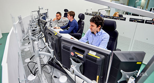
Galileo Control Centre in Oberpfaffenhofen, Germany. (Photo: ESA)
News from the European Space Agency (ESA)
Europe’s Galileo satellite navigation system continues to evolve. For the first time, end-to-end testing of the Galileo system demonstrated signal acquisition of an improved version of the Public Regulated Service (PRS), the most secure and robust class of Galileo services.
The system test extended from the Galileo Security Monitoring Centre in Spain and the Galileo Control Centre in Germany to a Galileo satellite at ESA’s ESTEC technical heart in the Netherlands, which then broadcast in turn to a user receiver.
Galileo’s PRS is an encrypted navigation and timing service for governmental authorized users and sensitive applications intended to remain available even in scenarios where other Galileo services might be degraded or jammed.
An initial version of the PRS signal has been broadcast by the satellites up to now, but as of next year the signals will evolve into an enhanced version known as Full Operational Capability Public Regulated Service (FOC PRS), which has been defined in close collaboration with the European Commission, the European Union Agency for the Space Programme (EUSPA) and the EU Member States.
The system’s FOC PRS capability is being enabled by an expansion of the Galileo ground mission segment — important upgrades of the Galileo Security Monitoring Centres (GSMCs) in St. Germain-en-Laye, France, and Madrid, Spain. These two sites oversee PRS provision and monitor its performance.
This coming version of the security monitoring centers, set for the following year, is being developed by an industrial consortium led by Thales Alenia Space in France.
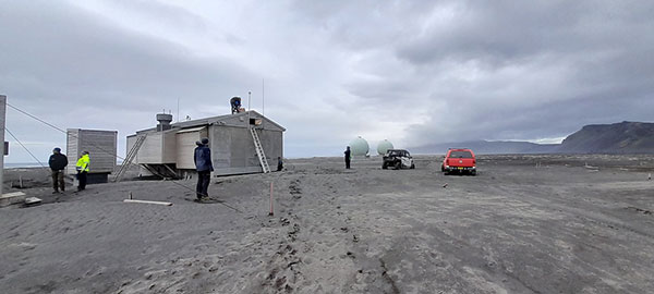
Meanwhile the progressive deployment of remote system infrastructure is taking place over the course of this year, readying Galileo sensor stations to receive the upgraded PRS signals.
Upgrade of Galileo Sensor Station on Norway’s remote Jan Mayen Island in the Arctic Ocean. (Photo: ESA)
“To qualify, the FOC PRS Signal in Space required a major Galileo end-to-end test, demonstrating the compatibility of the space segment with the ground and user segments, called the System Compatibility Test Campaign (SCTC),” explained Federico Di Marco, ESA SCTC test director. “This test involved all Galileo key players spread across Europe, requiring close cooperation between the teams and months of preparation.”
The SCTC was led by an ESA engineering team from the agency’s ESTEC technical center in Noordwijk, the Netherlands supported by the System Engineering Technical Assistance industrial team led by Thales Alenia Space in Italy and in close collaboration with the operations team supervised by EUSPA.
“The testing involved three centers across Europe: the GSMC in Madrid, the Galileo Control Centre in Oberpfaffenhofen, and ESTEC hosting an actual Galileo satellite plus FOC PRS user receivers,” added Edward Breeuwer, who is in charge of Galileo system qualification at ESA.
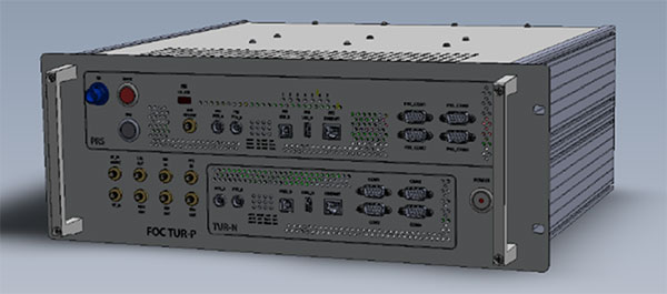
FOC PRS test receiver developed by Antwerp Space under ESA contract. (Photo: ESA)
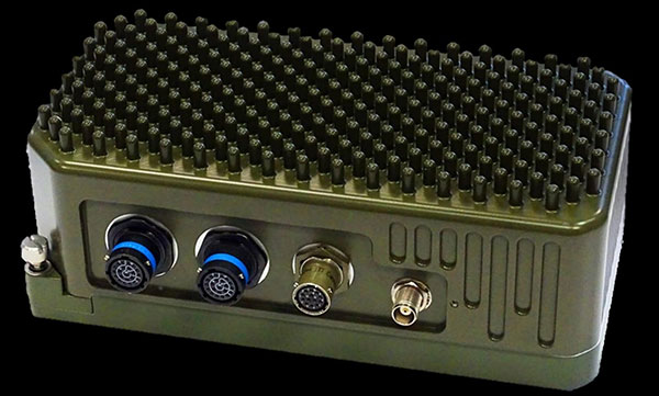
The FOC PRS signal was generated at the GSMC, sent to the German control center, then uplinked to the Galileo satellite at ESTEC, where the satellites are tested for space in advance of launch. The Galileo satellite then broadcast the FOC PRS signal in turn, to be picked up by a pair of receivers also on site: one developed by Antwerp Space under ESA contract and the other developed by Leonardo as part of a national development undertaken by Italy’s Competent PRS Authority, charged with overseeing the country’s PRS use.
“This marks the first time we have integrated such a nationally developed receiver within a system test activity,” said Fabio Covello, who oversees system security for ESA. “Having achieved this for PRS makes us very proud. We are confident that this experience can pave the way for future fruitful collaborations between the Galileo Programme and EU Member States, in the frame of specific tests to guarantee compatibility between the ESA-developed system and nationally developed PRS receivers.”
This successful outcome sets the scene for the PRS qualification at ground segment and system level, followed by operational validation planned in coming months, culminating in the first FOC PRS Signal In Space operational broadcast, in the course of next year.
FOC PRS test receiver developed by Leonardo as part of a national development undertaken by Italy’s Competent PRS Authority, charged with overseeing the country’s PRS use. (Photo: ESA)
“The new LightSquared business plan and the new FCC rules significantly expand the terrestrial transmission increasing the potential for interference to GPS receivers,” the U.S. departments of Defense and Transportation (DOD and DOT) wrote to the Federal Communications Commission in 2011 after the FCC granted the company permission to offer broadband via its satellite and base station networks to a wide variety of mobile broadband partners. The move — heralded by supporters as hastening the advent of 4G services across the country, especially in underserved communities — sent shockwaves across the GNSS/PNT community, which opposed the plan forcefully for the threat it posed to GPS.
Reborn in December 2015 as Ligado Networks, the company obtained the FCC’s unanimous approval in April 2020 for the use of spectrum near the L-bands used by GPS for its 5G network. It is scheduled to launch its first deployment at the end of September.
Nearly all the federal government, including DOD and DOT, as well as most manufacturers of GNSS receivers, are very strongly opposed. On September 9, the National Academies of Science, Engineering and Medicine’s Committee to Review FCC Order 20-48 will release its independent evaluation of the issue, as mandated by the 2021 National Defense Authorization Act.
The study, begun in May 2021, considered three issues:
1. Which of two prevailing proposed approaches for evaluating harmful interference is most effective to mitigate the risk of harm.
2. The potential for harmful interference from Ligado to mobile satellite services — such as Iridium.
3. The feasibility and practicality of the remedies proposed by the FCC.
I am very pleased to announce that Prof. Penina “Penny” Axelrad has joined GPS World’s Editorial Advisory Board.
Penny is a University of Colorado (CU) Distinguished Professor in the Ann and HJ Smead Department of Aerospace Engineering Sciences. She received her B.S. and M.S. degrees in Aeronautical and Astronautical Engineering from MIT and her Ph.D. in Aeronautics and Astronautics from Stanford University. She has been a member of the faculty at CU since 1992, serving as primary advisor for 25 Ph.D. graduates and many M.S. and undergraduate research students.
Penny has been active in research on GPS and PNT technology and applications for aircraft, spacecraft and remote sensing, as well as estimation of satellite orbits and attitude, since 1985, co-authoring more than 60 journal papers and 130 conference papers. She has served as principal investigator or co-investigator on grants and contracts totaling $17 million. She is a Fellow of the Institute of Navigation and the American Institute of Aeronautics and Astronautics, and a member of the National Academy of Engineering. Since 2013 she has served as a member of the National Space-Based Positioning, Navigation and Timing (PNT) Advisory Board.
I overlapped with Penny at MIT in the mid-1980s. Now, nearly 40 years later, I look forward to her contributions to this magazine.
A roundup of recent products in the GNSS and inertial positioning industry from the September 2022 issue of GPS World magazine.
OEM
Receiver Upgrade
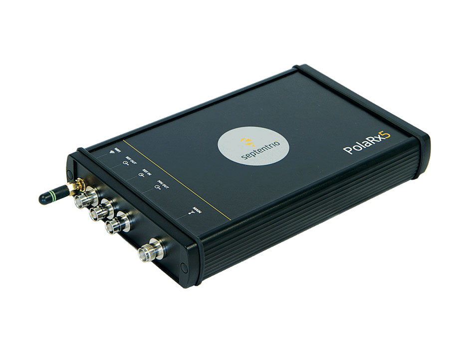
OSNMA anti-spoofing tech now on PolaRx5 GNSS reference receivers
Photo: Septentrio
Open Service Navigation Message Authentication (OSNMA) is now available on the high-end PolaRx5 reference receiver series. OSNMA offers end-to-end authentication on Galileo’s civilian signals, protecting receivers from GNSS spoofing attacks. OSNMA adds another layer of security to the receivers’ existing AIM+ anti-jamming and anti-spoofing technology. The PolaRx5 product range also now supports RINEX format versions 3.05 and 4.0.
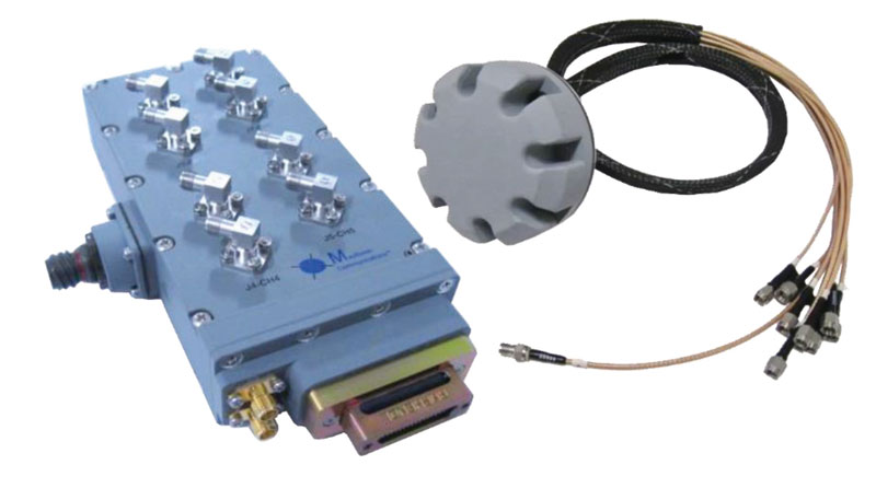
The MAGNA-F and MAGNA-I GPS anti-jam antennas provide simultaneous L1/L2 protection and can protect commercial and military GPS receivers on aircraft. The MAGNA products were developed with sponsorship by the U.S. Navy and further improved by the U.S. Army to support GPS protection requirements for air, sea and ground platforms, such as fixed-wing/rotary aircraft, ships, UAVs and tactical vehicles. The MAGNA-F uses a 3.5-inch-diameter controlled reception pattern antenna (CRPA) compatible with existing fixed radiation pattern antenna (FRPA) footprints. The MAGNA-I (NavGuard 730) is a high-performance yet small GPS anti-jam integrated solution with a 4.5-inch diameter FRPA-compatible footprint.
Centimeter-level GNSS for mass-market applications
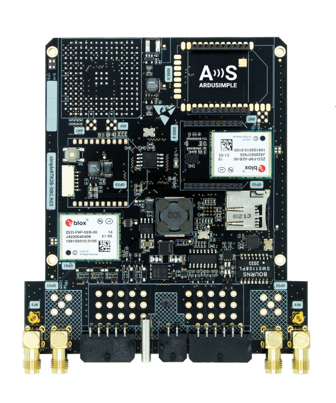
Photo: ArduSimple
The SimpleRTK2B single-board computer (SBC) is built around up to three u-blox ZED-F9P high-precision GNSS receivers. It simplifies development of centimeter-level positioning solutions supporting real-time kinematics (RTK), making the technology accessible to broader audiences. The SimpleRTK2B-SBC was developed to make RTK technology as close to plug-and-play as possible. In addition to working as a stand-alone solution, customers can program their own applications with the company’s microPython API. The SimpleRTK2B-SBC delivers mechanical integration with centimeter position on three axes (heading, pitch and roll), outputting on NMEA, RTCM, RS232 and CANBus interfaces via Ethernet, Bluetooth, Wi-Fi and 2G/3G/4G communication. It offers configurable input/output and an inertial measurement unit.
For assured positioning, navigation and timing (PNT)
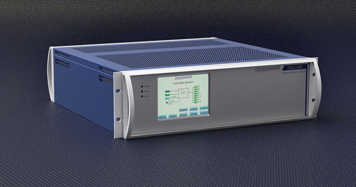
Photo: ADVA
The OSA 3300-HP is a high-performance optical cesium clock with a 10-year lifetime compared to the five-year lifetimes of high-performance magnetic clocks. It provides the resilience required for PNT assurance in critical infrastructure and empowers service providers to deliver differentiated service-level-agreement timing offerings with integrated GNSS backup. The OSA 3300-HP has embedded Ethernet- and IP-based management as well as a user-friendly touchscreen graphical user interface.
With M-Code capabilities and upgrade paths for other GNSS systems
Photo: Collins Aerospace
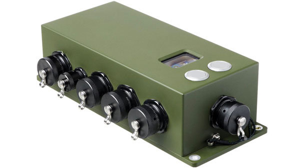
NavHub-200M is a vehicle navigation system for the international market with military code (M-code) receiver capabilities. NavHub-200M provides assured positioning, navigation and timing (APNT) while improving overall resistance to threats to GPS, such as jamming and spoofing. Its message formats and signal modulation techniques ensure faster and more accurate performance for ground vehicles on the connected battlespace, while advanced security features prevent unauthorized access or exploitation. NavHub-200M also includes the open interface standards and sensor-fusion capabilities required for a GNSS upgrade path, such as that for Europe’s Galileo constellation, as well as the ability to interface with key vehicle sensors such as the inertial measurement unit (IMU) and odometer.
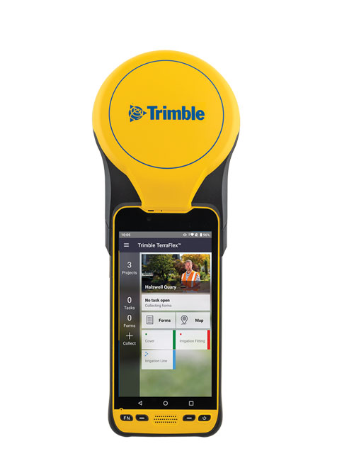
The Trimble TDC650 handheld is built for data collection, inspection and asset management activities. The rugged solution provides scalable high-accuracy GNSS positioning for professional field workflows, including apps such as Esri ArcGIS Field Maps and Trimble TerraFlex software. The TDC650 is scalable, allowing customers to choose their desired accuracy down to the centimeter level.
Powerful solution for manned and unmanned aircraft
Photo: YellowScan
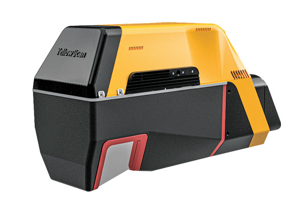
The Voyager long-range lidar scanner has a wide field of view, with all points collected oriented toward the ground so there is no loss of points. In all, 1.5 million points per second will be usable. Voyager combines a Riegl VUX-120 laser scanner with a Trimble Applanix AP+ 50 AIR or Applanix AP+ 30 AIR GNSS-inertial board, providing a precision of 0.5 cm and an accuracy of 1 cm. Voyager’s detection and processing of up to 15 target echoes per laser pulse allows for excellent vegetation penetration. It has an extremely fast data-acquisition rate of up to 1,800 kHz, suitable for projects requiring the highest point density. The laser scanner’s specifications can be customized and can be combined with YellowScan’s software solutions.
Extends 3D Tiles Next workflow into Esri ArcGIS Pro
Photo: ArcGIS
The 3D Environments Add-In application for Esri ArcGIS Pro allows ArcGIS users to rapidly transform 3D Tiles Next data formats, such as One World Terrain, into ArcGIS Pro projects to create 3D scenes from 2D vector data and 3D models. The add-in leverages Presagis’ building templates and texture libraries that analysts use to create enhanced 3D visualizations of GIS environments, helping increase collaboration across the enterprise. The 3D Environments Add-In contains tools to create, transform and extract a wide variety of 3D formats to provide seamless interoperability between ArcGIS Pro and modeling and simulation applications. It is available on the Esri ArcGIS Marketplace.
Energy performance data helps tackle climate change
Photo: XMAP
Municipal geographic information system XMAP can now incorporate the energy-performance ratings of individual properties to help local authorities tackle climate change, improve housing standards, and ensure landlords comply with legislation. The Energy Performance Certificate (EPC) data layer uses a rating system similar to the one used on new appliances, ranging from A (very efficient) to G (inefficient). It allows tenants and house buyers to make informed decisions. In addition to a color-coded visualization of current ratings, the XMAP EPC layer contains enhanced analysis including generalized ratings and the potential for improvement. Bath and North East Somerset Council, UK (pictured), has embraced this resource and is looking at how the data can be used to raise housing standards.
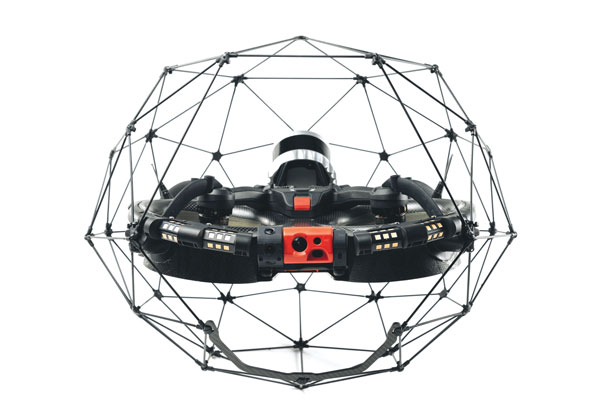
The Elios 3 is a collision-tolerant drone equipped with a lidar sensor for indoor 3D mapping. The drone is powered by a new SLAM engine called FlyAware that lets it create 3D models as it flies. It also hosts a new version of Flyability’s software for inspectors, Inspector 4.0. The Elios 3 comes with an Ouster OS0-32 lidar sensor, allowing inspectors to collect data for the creation of survey-grade 3D models using Connect software from Flyability’s partner GeoSLAM. Protected by a cage, the Elios 3 has advanced collision-tolerance features that allow inspectors to fly it inside dangerous confined spaces such as boilers, pressure vessels and mines.
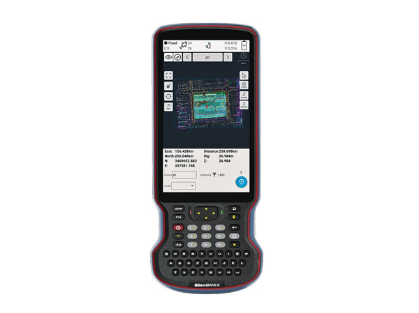
The R60 is a powerful handheld with an ergonomic design. It runs on Android 12 OS, providing a suitable workhorse for surveying professionals in the field. Survey Master field software works seamlessly on the R60, which features a Qualcomm 8-core processor for massive data processing. Its 64-GB memory allows ample data storage and enables the opening of CAD drawings in seconds. Other features include a QWERTY keyboard, a 5.5-inch sunlight-readable high-resolution screen, an IP67 rating (dustproof and waterproof), and a 9,000 mA Li-ion battery for more than 30 hours of continuous functioning.
The Mobile Centimeter (MobileCM) Space Weather Station is a ready-to-use GNSS device that will act as a real-time kinematic (RTK) base station and collect space weather data. The device is pre-configured to securely connect with the Global Earth Observation Decentralized Network (GEODNET) using a home Wi-Fi network. The full four-constellation GNSS base station has built-in NTRIP server functionality and is packaged with a survey-grade triple-band roof antenna and required cables.
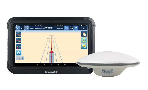
The SAgro10 GNSS guidance system is an entry-level guidance system for precision agriculture, providing users with higher navigation precision and higher productivity, which can be upgraded to an automatic steering system. Embedded with a high-precision GNSS module, the SAgro10 system tracks all four global constellations. For users with network coverage or a UHF base station, the system provides centimeter-level accuracy navigation in real-time kinematic mode. In the absence of base stations, the SAgro10 system provides sub-meter navigation accuracy in single-point smoothing mode. Compatible with most agricultural tractors, its components can be installed within 15 minutes. The 10-inch sunlight-readable touchscreen has a clear and simple graphic interface.
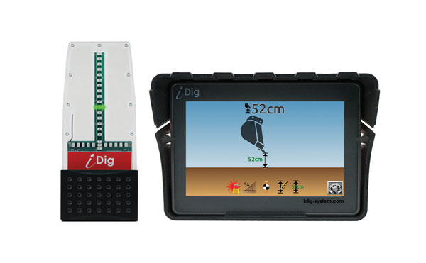
iDig 3D Connect is a solar-powered excavator guidance system with a GNSS receiver that can be removed and used as a rover, rather than permanently installed on the machine. 3D excavator guidance has seldom been used for small projects such as house foundations because of the need for a surveyor to stake out points and map a site. The removable receiver enables contractors to complete these tasks. The software provided creates a GNSS-generated site map, enabling precision digging relative to the area and making the process quicker, simpler and more eco-friendly than with 2D.
The Cloud Locator service takes data from LoRa Edge-enabled devices and uses Semtech’s LoRa Cloud Geolocation and Modem services for asset tracking both indoors and outdoors. It features built-in serverless technology and enables testing of ultra-low-power asset tracking on either a private or public LoRaWAN network. It is designed to work with trackers using Semtech’s LoRa Edge LR-series chips. The LR-series chips combine Wi-Fi and GNSS to obtain the latitude and longitude of devices in any indoor or outdoor location. Once configured on the service, together with Semtech’s LoRa wireless radio frequency technology for transmission to the cloud, customers can view the tracker location on a map in less than 15 minutes.
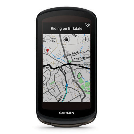
The Edge 1040 bike computer features solar charging and multi-band GNSS technology. Its multi-band GNSS receiver (GPS, GLONASS and Galileo) provides accurate positioning in challenging ride environments, such as dense urban areas or under deep tree cover. Advanced navigational tools help cyclists stay on track, such as turn-by-turn navigation and alerts that notify riders of sharp curves ahead. Route guidance and off-course notifications can be paused for exploring and turned back on for return to the original route. When using the Trailforks app, Forksight mode automatically displays upcoming forks in the route and where a rider is within a trail network.
Skydel 22.5 is a significant software upgrade to the Skydel simulation product line. It features advanced hardware-in-the-loop (HIL) testing solutions providing very low to zero effective latency. Enhanced visualization tools can monitor internal latency through real-time curves showing when the data is generated and sent to the RF signal. Users can also review the transmission of HIL packets for optimizing the entire network’s latency, checking its stability (jitter), and that data is available and used at the right time in Skydel. HIL testing is an essential step in the verification process of the model-based design approach because it involves all the hardware and software that will be used operationally.
The Time-Loader is designed for defense and mission-critical applications, for deployment in environments where GNSS signals are denied or disrupted. It supports any ground, naval or airborne system that needs real time of day (TOD) and 1PPS external synchronization aligned to the UTC or GNSS. It generates a GPS L1 C/A code RF output as if the signal were coming from a live-sky GPS antenna. It provides full-constellation GPS output and is compatible with external GNSS receivers. Its GPS-disciplined oscillator (GPSDO) is the Microsemi MAC-SA53/55, which provides excellent UTC accuracy with outstanding hold-over rubidium clock performance. A self-contained, miniature GPS simulator provides real-time extremely accurate signals. The 18-channel full-constellation simulator stores location/time/date data in internal memory and stores complex vector data to simulate dynamic scenarios. The simulator also can be used to transcode NMEA or SCPI position/ velocity/time (PVT) data into GPS RF signals.
The National Academies of Sciences, Engineering and Medicine (NASEM) has issued a report discussing whether a terrestrial wireless network proposed by Ligado Networks — and approved by the Federal Communications Commission (FCC) in April 2020 —will cause widespread interference to millions of GPS receivers.
The 77-page report reviews order FCC 20-48, which authorized Ligado Networks LLC to operate a low-power terrestrial radio network adjacent to the GPS frequency band. It considers how best to evaluate harmful interference to civilian and defense users of GPS, the potential for harmful interference to GPS users and DOD activities, and the effectiveness and feasibility of the mitigation measures proposed in the FCC order.
Section 1663 of the Fiscal Year 2021 National Defense Authorization Act called on the Department of Defense (DOD) to enter into an agreement with the NASEM to carry out “an independent technical review of the order and authorization [of FCC 20-48] to the extent that such Order and Authorization affects the devices, operations or activities of the Department of Defense.”
The committee formed in response met weekly from September 2021 to April 2022 to plan the study; receive briefings from experts and stakeholders; and review relevant reports, technical literature, and written submissions to the committee. In addition, a cleared subset of the committee received a set of classified briefings.
Most receivers in the clear,
high-precision and Iridium vulnerable
The committee found that most commercial and certified aviation GPS receivers will not experience significant harmful interference from Ligado emissions as authorized by the FCC.
However, high-precision receivers are vulnerable. That said, the committee claims current technology enables building a receiver robust to Ligado signals for any GPS applications.
“All GPS receiver manufacturers could field new designs that could coexist with the authorized Ligado signals and achieve good performance even if their existing designs cannot,” the report states.
For Iridium, the report states, “Iridium terminals will experience harmful interference on their downlink caused by Ligado user terminals operating in the UL1 band while those Iridium terminals are within a significant range of a Ligado emitter — up to 732 meters.”
For defense devices, operations and activities, the committee acknowledged that proposed mitigation procedures may be effective, but “may be impractical without the extensive dialog among the affected parties,” and mitigation “may not be practical at operationally relevant time scales or at reasonable cost. ”
This report concludes, “Spectrum real estate is a living asset and approaches must allow not only for a degree of confidence that a deployed system will not be compromised by future, unforeseen entrants, for a period of time, but also must recognize that capabilities will evolve.
“Some form of more definitive receiver standards and establishment of set time periods where adherence to those receiver standards will ensure successful operation for a frequency band’s incumbents and new entrants seem to be important tools in this regard.”
Responses to the Report
Ligado Networks
“Ligado’s licensed and authorized operations can co-exist with GPS. As the report concludes, the technology to enable compatibility has been in use for over a decade, and most consumer equipment, commercial general navigation, timing, cellular and aviation receivers will not experience harmful interference from Ligado’s operations.
“The NAS found what the nation’s experts at the FCC already determined: A small percentage of very old and poorly designed GPS devices may require upgrading. Ligado, in tandem with the FCC, established a program two years ago to upgrade or replace federal equipment, and we remain ready to help any agency that comes forward with outdated devices. So far, none have.
“Now that the review is completed, it is our sincere hope the DOD and the NTIA will stop blocking Ligado’s license authority and focus instead on working with Ligado to resolve potential impacts relating to all DOD systems, including but not limited to GPS. We will continue working with all involved stakeholders to determine a mutually beneficial way forward.”
U.S. Department of Defense
“National security missions that our service men and women execute every day are of the utmost importance and require a solution that ensures continued operations of critical systems.
“The NASEM study confirms that Ligado’s system will interfere with DOD GPS receivers, which include high-precision GPS receivers. The study also confirms that Iridium satellite communications will experience harmful interference caused by Ligado user terminals. Further, the study notes that when DoD’s testing approach, which is based on signal-to-noise ratio, is correctly applied, it is the more comprehensive and informative approach to assessing interference. The study also concludes that the Federal Communication Commission’s (FCC) proposed mitigation and replacement measures are impractical, cost prohibitive, and possibly ineffective.
“These conclusions are consistent with DoD’s longstanding view that Ligado’s system will interfere with critical GPS receivers and that it is impractical to mitigate the impact of that interference.
“DoD looks forward to continuing to work with the National Telecommunications and Information Administration, FCC and Ligado on this complex and important issue.”
GPS Innovation Alliance
Acting Executive Director of the GPS Innovation Alliance (GPSIA), Alex Damato, issued the following statement on the release of the National Academies of Sciences, Engineering, and Medicine study on reviewing the FCC’s Ligado Order:
“GPSIA and the GPS industry applaud the National Academies of Sciences, Engineering, and Medicine’s reaffirmation that Ligado’s terrestrial operations would have a harmful, real-world impact on the millions of federal and commercial users that rely on GPS, satellite communications, and weather forecasting services every single day. The report’s evaluation of the materials, developed over years of extensive and technically rigorous testing, demonstrates that Ligado would pose an unacceptable risk to services critical to safety-of-life operations, our national security, and our economy. It also builds on the broad consensus, including within fourteen federal agencies and departments, that Ligado’s proposed deployment would result in widespread interference to a substantial number of GPS receivers.
“Following the release of this study, GPSIA urges government action to address the imminent, but preventable, harm that would result from Ligado’s deployment.”
**Consistent with the terms of their litigation settlements with Ligado, GPSIA members Deere & Company and Garmin International, Inc. do not affirmatively endorse or oppose the deployment of Ligado’s proposed communications network.**
Keep GPS Working Coalition
The Keep GPS Working Coalition was formed in response to the FCC order. Spokesperson Dale Leibach issued the following statement.
“The NAS report, which follows the analysis of an immense amount of technical information and review by experts from a broad range of disciplines, highlights the fundamental flaws in the FCC’s Ligado decision. The order must therefore be vacated in its entirety, so that millions of GPS devices are protected from harmful interference caused by Ligado’s planned network.
“It is important to note that the potential for interference arises because Ligado proposed, and the FCC approved, a fundamental change in the use of the spectrum adjacent to the band used by GPS. With this approval, the FCC essentially authorized terrestrial operations in a satellite band without adequately considering the impact Ligado’s proposed operations would have on countless consumers, farmers, ranchers, pilots, boat owners, surveyors, construction companies and others.
“Furthermore, the FCC’s decision failed to take into account that there are more than a billion GPS receivers in use in the United States. The NAS report notes, and the Keep GPS Working Coalition acknowledges, that the majority of GPS receivers will not be harmed by Ligado’s operations. However, the massive GPS user base means that tens of millions of devices will suffer harmful interference if Ligado deploys its network. And, as stated in the report, the risk of interference is greatest for high precision receivers used in some of the most significant sectors of the U.S. economy.
“Lastly, the NAS report describes in detail the fundamental flaws in the safeguards the FCC adopted to address harmful interference where it occurs. It is simply not feasible, nor reasonable, to force first responders, farmers, boat owners, and the many other owners of equipment and machines that rely on GPS to police interference and bear the costs of addressing it. The best approach is to avoid interference altogether by rescinding Ligado’s authorization to conduct terrestrial operations under its satellite license.
“While Ligado may seek to cherry pick details to fit its misleading narrative, the truth is that this report validates the concerns raised by virtually everyone who has taken a position on this matter other than the FCC and Ligado itself. In particular, the report highlights significant national security concerns raised by the U.S. Department of Defense, which has said the FCC Ligado order will put missions and troops at risk. Likewise, the National Telecommunications and Information Administration, the Departments of Homeland Security, Transportation, Interior and Justice, the Federal Aviation Administration and other expert agencies all opposed the FCC order because of the substantial harm it would cause to critical civilian industries and users.”
Iridium
“The findings from NAS are consistent with the opposition from 14 federal agencies, more than 80 stakeholders, and Iridium’s concerns that Ligado’s proposed operations will cause harmful interference. The NAS study clearly demonstrates what the rest of the industry has known for years: the prior FCC order failed to fully consider the risk of harmful interference posed to mission-critical satellite systems. Iridium urges the FCC to take swift action to reverse the order before Ligado starts its technical demonstrations this fall.”
Satellite Safety Alliance
“The Satellite Safety Alliance applauds NAS for its comprehensive review of the record and findings that Ligado’s plan threatens vital GPS and satellite communications services. These findings align with the concerns across the vast federal and commercial user base of GPS, satellite communications, and weather forecasting services.
“This study is a reminder to our nation’s leaders and the Federal Communications Commission that Ligado’s harmful interference will disrupt day-to-day operations and cost billions of dollars to the consumers of these mission-critical services. The FCC must stay or reverse the Ligado order to address the imminent — but preventable — harm from the company’s proposed terrestrial network that it intends to deploy a test network this fall.”
National Telecommunications and Information Administration, U.S. Department of Commerce
“The Report from the National Academies indicates that Ligado’s terrestrial operations would cause harmful interference to GPS devices and that a number of the FCC’s mitigations would be practically unworkable. NTIA will review this detailed report more carefully, but we believe this offers the commission an important opportunity to reconsider Ligado’s authorization.”
BAE Systems has received a $13 million contract for advanced GPS technology to protect U.S. F-15E aircraft from GPS signal jamming and spoofing. The company’s Digital GPS Anti-jam Receiver (DIGAR) will ensure the reliability of military GPS systems for aircraft operating in challenging signal environments.
DIGAR uses advanced antenna electronics, high-performance signal-processing and digital beamforming — a capability that combines 16 steered beams — for better GPS signal reception and superior jamming immunity. These capabilities are critical for high-speed aircraft as they maneuver through the battlespace.
The F-15 Eagle is the second U.S. Air Force fighter platform to receive DIGAR GPS upgrades, following the F-16 Fighting Falcon. DIGAR also provides advanced GPS capabilities for intelligence, surveillance and reconnaissance aircraft as well as multiple unmanned aerial vehicles.
Two U.S. Marine Attack Squadron 211 F-35B Lightning IIs and two U.S. Air Force F-15 Eagles assigned to the 67th Fighter Squadron, fly over United Kingdom aircraft carrier HMS Queen Elizabeth over the west Indo-Pacific region in August 2021. (Photo: USAF/Staff Sgt. Kyle Johnson)
“Modern airborne missions require accurate positioning and navigation data, and GPS systems must be able to withstand adversaries’ best disruption efforts,” said Greg Wild, Navigation and Sensor Systems product line director at BAE Systems. “Our DIGAR antenna electronics are trusted to protect these platforms in contested environments.”
BAE Systems’ family of military GPS products offer size, weight and power characteristics suitable for a variety of applications, including handheld electronics, vehicles, unmanned aerial vehicles, aircraft and precision-guided munitions. In addition to GPS anti-jam products, the company is delivering advanced GPS products compatible with the next-generation M-code satellite signal, and is developing the next generation of receivers to ensure dependable GPS for warfighters across land, air and sea domains.
BAE Systems work on military GPS technology takes place in Cedar Rapids, where the company is investing more than $100 million to build a 278,000-square-foot, state-of-the-art research and manufacturing center.
An F-15 Eagle with the 159th Fighter Wing, Louisiana. (Photo: USAF/Tiffany A. Emery)
Partnership will test future eVTOL flight routes and concept of operations in the Kansai region
Photo: Airbus
Airbus is partnering with Japanese helicopter operator Hiratagakuen to develop advanced air mobility services in the Kansai region and beyond. Through this agreement, the companies will tackle crucial aspects required to launch a commercial transportation service with CityAirbus NextGen.
As a first step, the partners’ joint project to organize a simulation of ideal routes, concepts of operations, and necessary equipment for safe electric vertical takeoff and landing vehicle (eVTOL) flights in the Kansai region. Kansai was selected by the Osaka prefecture for the project. A demonstration flight is scheduled for later this year.
With the aim to implement air mobility services beyond urban environments, the joint work of Airbus and Hiratagakuen will support the development of advanced air mobility solutions with CityAirbus NextGen for use cases ranging from air medical services to commercial air transport and ecotourism in a variety of operational contexts.
Airbus and Hiratagakuen will use an H135 helicopter to test advanced navigation and communication technologies for safe operations of eVTOLs in urban environments, while simulating CityAirbus NextGen’s flight configuration.
Hiratagakuen is a Kansai-based helicopter operator that specializes in helicopter emergency medical services (HEMS), transportation of personnel, flight training and maintenance. The company’s fleet includes 14 H135 and two H145 helicopters.
In September 2021, Airbus unveiled its eVTOL prototype CityAirbus NextGen to explore advanced air mobility technologies. The company plans to construct a dedicated center to test the aircraft’s systems in the lead-up to its maiden flight. Airbus is also working closely with industrial and institutional partners to lead the development of urban air mobility ecosystems, including ITA Airways in Italy and launch of the Air Mobility Initiative in Germany.