The commercially available L5-only GNSS solution includes machine-learning algorithms to leverage increased L5 signal-ranging precision in challenging signal conditions.
OneNav has announced performance results from field testing its latest pureL5 customer evaluation system (CES) software in both open-sky and challenging signal environments.
The patent-pending oneNav GNSS system, including a custom array processor and a library of machine-learning algorithms, demonstrated consistent sub-meter accuracy and rapid time-to-first-fix (<2 sec) in open-sky testing.
In very challenging urban and deep urban canyon environments, the pureL5 CES field-test equipment outperformed the commercial precision L1 GNSS unit against which it was compared, demonstrating tracking of satellite signals as weak as –160 dBm.
The oneNav system was able to acquire directly and track L5 signals in all environments with no L1 receiver present, greatly simplifying the RF front end and antenna subsystem and making the pureL5 solution suitable for space- and power-constrained mobile and internet of things (IoT) devices requiring reliable high performance.
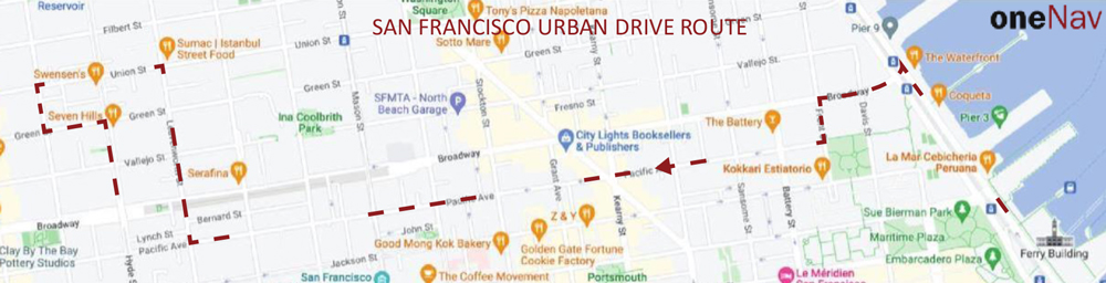
Results of a representative urban drive test route are shown below (the map describes the route driven). During this test, the CES and the commercial precision L1 receiver were both connected to a common antenna, fixes were taken once/second, and the results were compared to a common ground truth position. On average, the oneNav system demonstrated a 55% improvement in accuracy over the precision.
Image: oneNav
OneNav’s family of algorithms improves pureL5 system performance by predicting whether the received signal is line of sight (LOS) and correcting non-line-of-sight (NLOS) signals to increase the number of measurements available for accurate positioning.
The pureL5 algorithms characterize signal and multipath environments. Accordingly, algorithms developed in one deep urban area can be used to mitigate multipath in areas geographically different, but that present similar multipath signatures. This obviates the need for field-test teams to collect data in thousands of urban areas around the globe.
The PTSS is designed to give nations, institutions, critical infrastructure operators and scientific labs control over the time source for their critical infrastructure systems. It provides a high-quality back-up or alternative to GNSS as a source of time, which can be distributed through eLoran, IEEE 1588 over fiber, two-way time transfer, and other methods.
Core products integrated into the PTSS:
SyncSystem 4380A Time Scale Edition generates an autonomous time scale derived from combining several highly accurate independent clocks with a multi-channel instrument for measuring and comparing clock performance.
Time Scale Orchestrator is a software platform providing a unified view with a built-in database that integrates the management, monitoring, alarming and reporting functions of the individual products that form the time scale system.
5071A Cesium Clock Primary Frequency Standard and MHM 2020 Active Hydrogen Maser are Microchip’s atomic clocks that provide accurate and stable frequencies continuously measured against each other to compute and generate the ensemble time-scale frequency.
The PTSS integrates the new portfolio of time scale products into a turnkey solution, available in a single rack and guaranteed by a complete factory acceptance test (FAT) that exceeds the most stringent requirements.
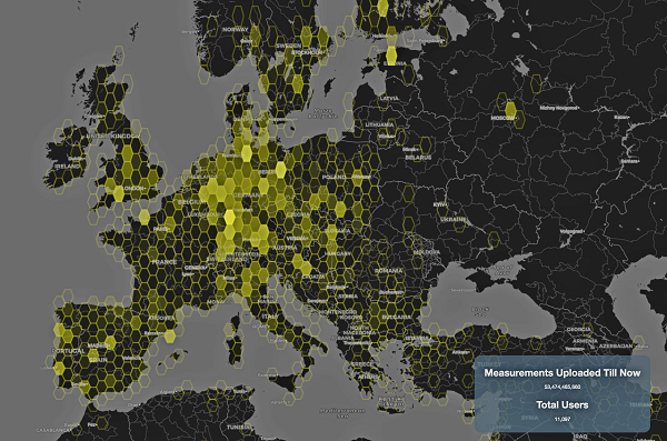
This graphic represents measurements uploaded via the CAMALIOT app by thousands of volunteers. (Image: ESA)
More than 11,000 people around Europe and the world have turned their smartphones into GNSS monitoring tools by downloading the CAMALIOT app, so far delivering more than 53 billion measurements of meteorology and space weather patterns to researchers, according to the European Space Agency (ESA).
ESA asks CAMALIOT volunteers to leave their smartphones by a window each night with GNSS on. The phones record small variations in satellite signals, gathering data for machine-learning analysis. More than 50 smartphone models with dual-frequency receivers can use the app.
CAMALIOT was developed through ESA’s Navigation Innovation and Support Programme (NAVISP) with the support of the agency’s Navigation Science Office through its GNSS Science Support Centre. The combination of GNSS data, smartphone access and machine learning in support of science is a priority research line of ESA’s Navigation Science Office.
GNSS signals undergo scintillation as they pass through irregular plasma patches in the ionosphere. This electrically charged upper atmospheric layer is continuously changing, influenced by solar activity, geomagnetic conditions and the local time of day. Dual-frequency GNSS receivers can compensate for this effect by comparing their two frequencies.
As these signals head to Earth, they are also modified by the amount of water vapor in the lower atmosphere, helping to forecast rainfall in particular.
“Fixed satnav stations already monitor these effects, but these smartphone-based measurements are boosting our coverage hugely. We’re very gratified by all the support we’ve received,” said Vicente Navarro, ESA navigation engineer. ”These results will then undergo a Big Data machine-learning analysis, seeking out previously unseen patterns in both Earth and space weather.”
Formally known as the Application of Machine Learning Technology for GNSS IoT Data Fusion project, CAMALIOT is run by a consortium led by ETH Zurich in collaboration with the International Institute for Applied Systems Analysis.
Leveraging Orolia’s HATI core in combination with Arista MetaWatch, the integration provides sub-nanosecond timestamping with accurate, precise and reliable timing
The collaboration between Orolia and Arista sets a new standard in time synchronization for FPGA-based network devices with the support of native White Rabbit capabilities to achieve sub-nanosecond time synchronization using optical fibers across multiple points in the network.
This integration is factory-supported in combination with the MetaWatch application in the Arista 7130LB platform, enabling distributed traffic capture with high-resolution timestamping, buffering and de-duplication, to provide advanced network monitoring and detailed network analytics. Deep buffering, time-ordered aggregation and de-duplication reduce the load on downstream packet capture and analysis devices.
“One key feature of this important collaboration is the simplification of the overall network architecture by eliminating coaxial cabling and PPS distribution equipment,” said Francisco Girela, White Rabbit application engineer with Orolia. “This integrated solution eases the adoption of White Rabbit, leading to cost savings, reduced footprint and better scalability.”
White Rabbit is an ultra-accurate IEEE 1588 Precision Time Protocol (PTP) implementation that achieves sub-nanosecond accuracy over optical fiber links. Designed for use in avionics, telecommunications, space, defense and scientific applications, White Rabbit has become the gold standard for time distribution within electronic trading networks.
Arista’s MetaWatch is a powerful FPGA-based network application designed for Arista’s 7130 platform and combines several components of a traditional network monitoring solution into one device, which simplifies network data capture, monitoring and analytics.
“Moving from analog time synchronization to fiber-based White Rabbit will allow our customers to improve their network analytics while improving the overall synchronization accuracy across a large estate,” said David Snowdon, engineering director, Arista. “The combination of MetaWatch and White Rabbit allows for less than a nanosecond of error on any timestamp taken in a wide-area network — a crucial feature for trading firms optimizing their latency, or for exchanges guaranteeing fairness.”
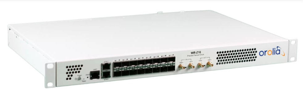
The Orolia White Rabbit Z16. (Photo: Orolia)
Orolia’s WR Z16, a reliable and precise time fan-out solution for White Rabbit distribution on 1G Ethernet-based networks, is a standalone device with 16 SFP connectors that provide sub-nanosecond accuracy over the plug-and-play optical fiber links. The HATI core requires an activation license generated by Orolia to be loaded in the reference WR-Z16 device paired with it to be functional.
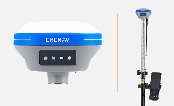
CHC Navigation (CHCNAV) has launched the i73+ pocket-sized GNSS receiver. The i73+ is a compact, powerful and versatile receiver with an integrated UHF modem that can be used either as a base station or rover. Powered by 624 GNSS channels and the latest iStar technology, the i73+ delivers survey-grade accuracy in all jobsite configurations.
“Building on the legacy of the i73 GNSS receiver, the new i73+ receiver is designed to maintain its proven compact and lightweight concept, but adds the ability to be operated as either an RTK base station or a rover,” said Rachel Wang, product manager, Surveying and Engineering Division, CHCNAV. “To enable this extra feature, we have built in the latest UHF modem technology, allowing the reception and transmission of RTK corrections without sacrificing receiver size and power consumption.”
Integrated Tx/Rx UHF modem extends capacity
The i73+ has a built-in transceiver radio module compatible with major radio protocols, making it a suitable portable built-in UHF base and rover kit with fewer accessories. The i73+ is a highly productive NTRIP rover when used with a handheld controller or tablet and connected to a GNSS RTK network via CHCNAV LandStar field software.
The integrated, advanced 624-channel GNSS technology takes advantage of GPS, GLONASS, Galileo and BeiDou, in particular the latest BeiDou 3 signal, and provides robust data quality at all times. The i73+ extends GNSS surveying capabilities while maintaining centimeter-level survey-grade accuracy.
The i73+ GNSS receiver. (Photo: CHCNAV)
Built-in IMU technology
With its inertial measurement unit (IMU) compensation ready in 3 seconds, the i73+ delivers 3-cm accuracy at up to 30º pole tilt, increasing point measurement efficiency by 20% and stakeout by 30%. Surveyors are able to extend their working boundary near trees, walls and buildings without the use of a total station or offset measurement tools.
The i73+ is the lightest and smallest receiver in its class, weighing only 0.73 kg including battery. It is almost 40% lighter than traditional GNSS receivers and easy to carry, use and operate without fatigue. The i73+ is packed with advanced technology, fits in hands and offers high productivity for GNSS surveys.
The i73+ includes a built-in UHF modem. (Photo: CHCNAV)
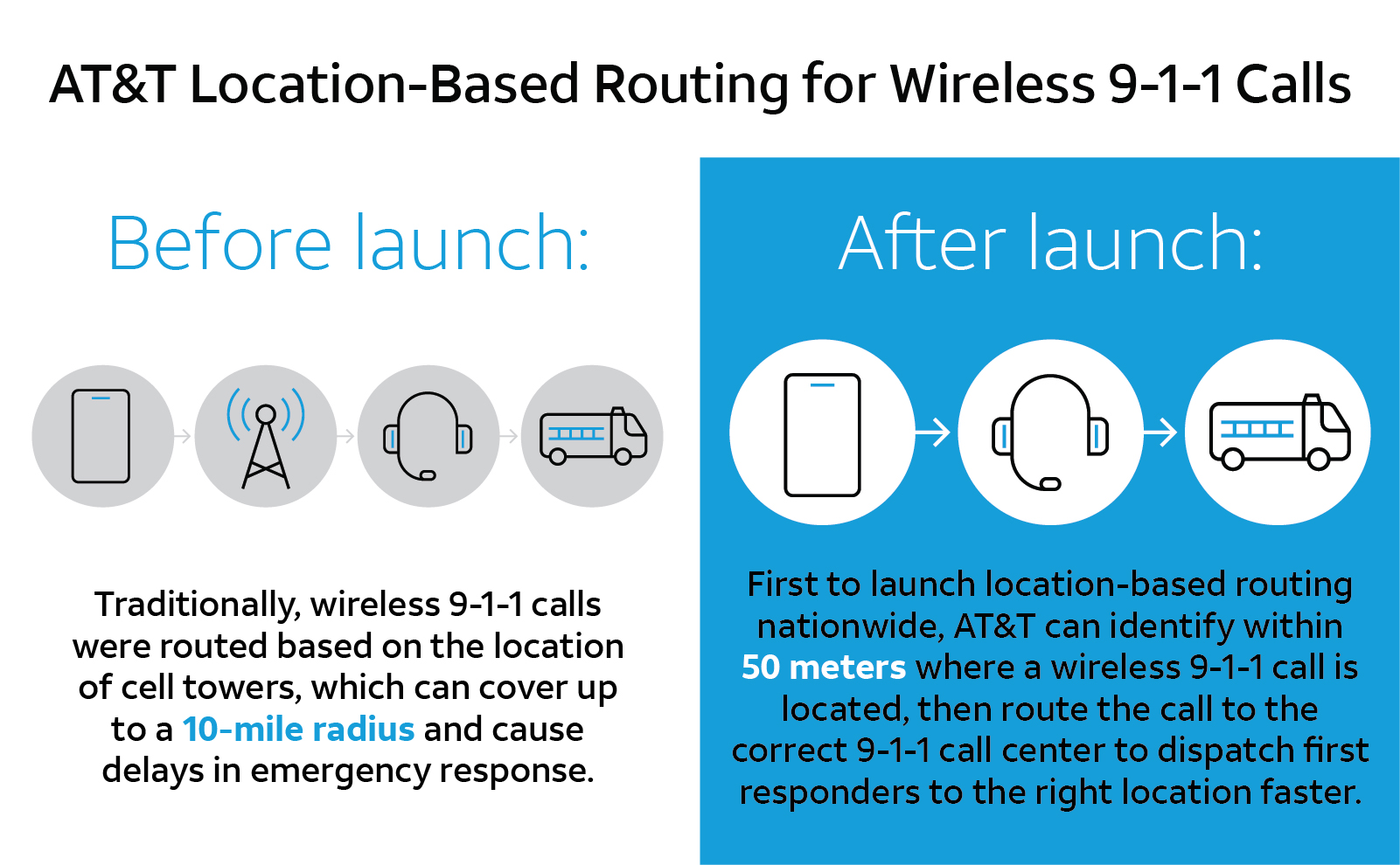
U.S. cellular carrier AT&T is rolling out location-based routing to automatically transmit wireless 9-1-1 calls to the appropriate call centers.
Traditionally, wireless 9-1-1 calls were routed based on the location of cell towers, which can cover up to a 10-mile radius. This can cause delays in emergency response, especially when a call is made where state, county or city boundaries overlap.
With location-based routing, a device can be located and routed within 50 meters of the device location. Through a new “Locate Before Route” feature from Intrado, AT&T can quickly and more accurately identify where a wireless 9-1-1 call is coming from using device GNSS and hybrid information to route the call to the correct 9-1-1 call center.
Graphic: 911
The nationwide rollout has started and is available in Alaska, Colorado, Hawaii, Idaho, Montana, Oregon, Washington, Wyoming, Kansas, Illinois, Iowa, Minnesota, North Dakota, Missouri, Nebraska, South Dakota and Guam. Additional regions will be rolled out over the next several weeks. The nationwide rollout is scheduled to be completed by the end of June.
A roundup of recent products in the GNSS and inertial positioning industry from the May 2022 issue of GPS World magazine.
SURVEYING
Measurement Workflows
Field-to-office inspection with survey-grade accuracy
Photo: Trimble
Trimble Access field software now connects with Infotech’s Appia service to streamline the workflow from survey to construction. Aimed at the inspection process for civil infrastructure projects, the software provides high-accuracy measurement workflows for daily work reports and inspection reporting for engineering, construction and public agencies. By streamlining the connection between data collected by Trimble GNSS rovers and simultaneously syncing Trimble Access, Infotech Mobile Inspector and Infotech Appia, inspectors can now complete their daily work reports more efficiently in the field and reduce errors. With manual processes removed, inspectors can more accurately represent infrastructure assets.
For surveying, mapping and construction professionals
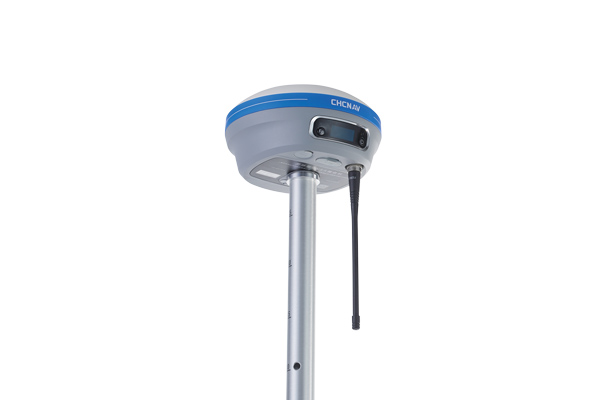
Photo: CHCNav
The i83 GNSS receiver is powered by a multi-band GNSS receiver, iStar technology, and a calibration-free, high-end inertial measurement unit (IMU) for faster and reliable field GNSS surveying. The third-generation high-gain antenna with advanced CHCNAV iStar algorithm improves GNSS satellite signal tracking efficiency by more than 30%. The i83 GNSS receiver features 1,408 GNSS channels for high performance across GPS, GLONASS, BeiDou, Galileo and QZSS constellations. Its onboard GNSS technology delivers centimeter-level positioning, maintains reliable fixed real-time kinematic (RTK) accuracy, and collects points faster than previous models, even in demanding conditions. The i83 receiver’s built-in IMU automatically compensates for pole tilt. In less than 5 seconds, the 200-Hz inertial module is initialized to ensure survey-grade accuracy over a pole-tilt range of up to 30 degrees. Productivity is dramatically increased, RTK usability greatly improved, and potential human error reduced, whether you are an engineer, site foreman or surveyor.
Simplifies surveying with both GPS and total station
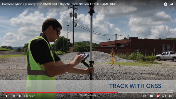
Photo: Carlson Software
SurvPC Hybrid+ is a module for SurvCE version 6 software that enables surveying with mixed brands of GNSS receivers and total stations. SurvCE is a data-collection software package from Carlson Software. SurvPC Hybrid+ provides driver support for numerous devices, allowing the surveyor to interface with both types. Features include Follow Me, Smart Lock, Smart Staking, Cross Check, Backup Tracking, Hybrid-Resection, Auto-Localize, and Easy Setup Wizard.
SurPad 4.2 is designed to help surveyors work efficiently at all types of land surveying and road engineering projects in the field. It runs on eSurvey handhelds, Android smartphones and tablets, and third-party Android devices. It integrates with professional receiver control, point collection, stakeout, geographic information system (GIS) data collection, road measurement, road design, cross-section measurement and railway stakeout. SurPad 4.2 provides multiple operation and communication systems, has mapping and CAD functions, and has a coordinate system. It also includes a survey mode encompassing topo, control, quick point and COGO civil engineering programs.
The Leica AP20 AutoPole provides tilt compensation, automatic pole-height readings and unique target identification for automated total stations. It combines an intelligent sensor module with the AP Reflector Pole and operates with existing Leica Geosystems’ automated total stations to create a solution for autonomous workflows. Tilt compensation decreases measurement time and increases flexibility and safety on site by enabling measurement of points in inaccessible or risky locations. By updating the pole height automatically in the field software, the system ensures that the height on record is always correct.
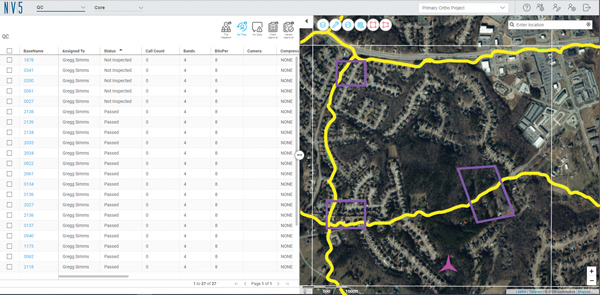
INSITE Data Reviewer moves geospatial data validation to the cloud, giving key stakeholders the ability to collaborate in real time. The third module in the INSITE Lifecycle suite of products, INSITE Data Reviewer provides reviewers real-time access to aerial imagery, lidar data and geographic information system (GIS) layers via the cloud to standardize quality control. This increases data validation speed and reduces costs of geospatial projects. The INSITE Lifecycle suite combines Project Tracker, Data Delivery and Data Reviewer modules through which users can see their projects executed on a map, from data acquisition through processing.
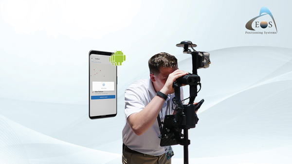
Eos Laser Mapping for ArcGIS is now available on Android devices. It allows mobile crews to capture high-accuracy laser offsets directly into ArcGIS Field Maps with Arrow Series GNSS receivers. The solution combines technology from geographic information system (GIS) provider Esri, laser rangefinders from Laser Tech, and Eos’ own Arrow Series GNSS receivers. The release supports three workflows: standard laser offset (range-azimuth), range-range (range-intersect) and range-backsight (a total station-like method).
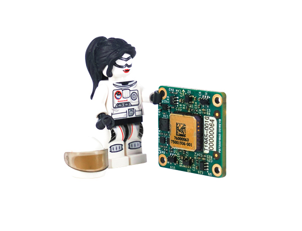
The MV60 micro-electromechanical system (MEMS) accelerometer delivers high performance and reliability in a small, rugged and low-cost package. The MV60 measures the acceleration experienced by an object during movement and is designed for use in inertial measurement units and navigation systems deployed on land, air and sea vehicles to measure velocity. It has a compact footprint of 1.2 square inches and shock survivability of up to 5,000 g. It also offers bandwidth of greater than 300 Hz — important for environmentally demanding missions.
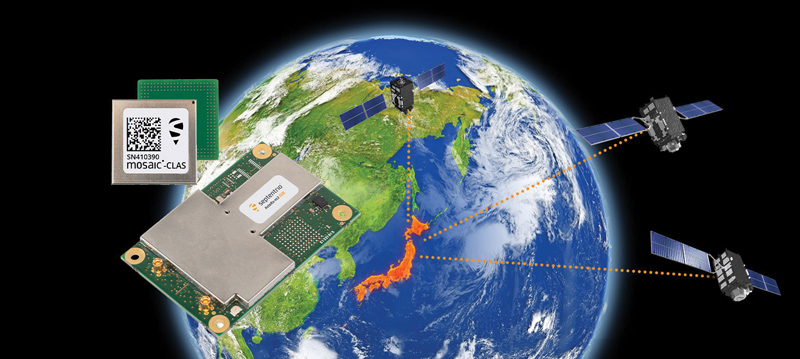
Receivers support Japan’s cm-level augmentation service
Photo: Septentrio
Three multi-frequency GNSS receivers now support the Centimeter-Level Augmentation Service (CLAS), receiving the L6 signal that transmits high-accuracy corrections from Japan’s QZSS constellation. The mosaic-CLAS receiver is in a small form-factor suitable for high-volume industrial applications. The AsteRx-m3 CLAS OEM board combines PPP-RTK CLAS with dual-antenna heading functionality. The AsteRx SB3 CLAS features a ruggedized IP68 enclosure to protect it in harsh environments.
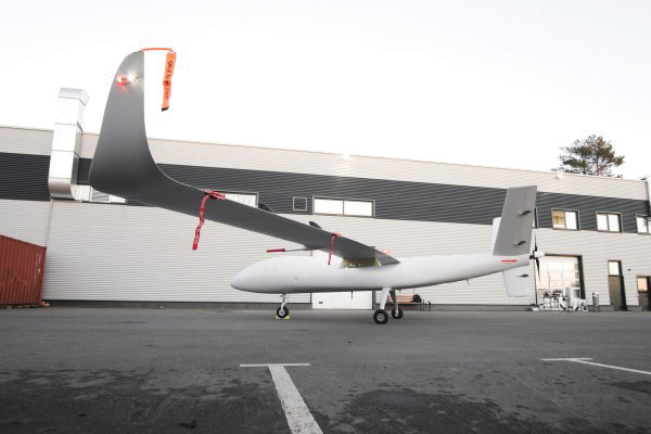
The S1-V300 medium-altitude long-endurance (MALE) unmanned aerial system (UAS) prototype is based on the Saker MALE UAS design that achieved operational capability in 2020. The prototype features a new design and a more powerful heavy fuel engine with 260 HP, offering greater speed, payload and endurance of 28 hours with a range of 4,020 km. The aircraft features unique UAVOS avionics solutions and a redundant flight control system that will enable complex missions, including overland and maritime intelligence, surveillance and reconnaissance (ISR) missions. The improved S1-V300 prototype is equipped with both line-of-sight and beyond-visual-line-of-sight (BVLOS) datalink systems for over-the-horizon operations. It can be integrated with multiple ISR sensors, including electro-optical infrared cameras and a synthetic aperture radar that offers all-weather, day/night performance for a wide-area search capability.
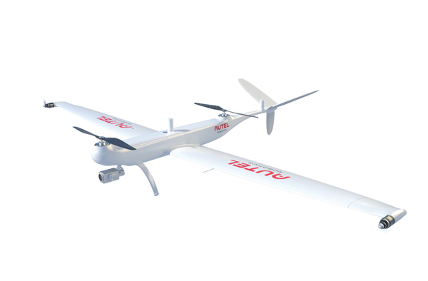
Dragonfish Lite and Pro now available in United States
Photo: Autel Robotics
The rugged Dragonfish UAVs are capable of vertical takeoff and landing (VTOL) with both multi-rotor and winged flight, with an endurance of up to 180 minutes. They are suitable for professional applications such as energy, mining, defense and surveillance. Maximum winged flight speed is 30 m/s (108 km/h, 67 mph), and maximum video transmission range is 30 km (18.6 miles) with a base station. The aircraft can make a smart decision to either land or return to base in case of issues such as loss of GPS signal, loss of operator communications, or low battery power. The tilt-rotor system will automatically transition to multi-rotor mode if adverse conditions cause fixed-winged flight to stall or become unsustainable. The Dragonfish battery, barometer, positioning system, compass and inertial measurement unit all have backup modules to ensure flight safety.
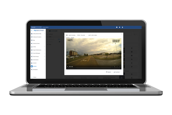
The SureCam connected dash camera system now features a method for capturing video footage from SureCam cameras using Geotab’s telematics device and rule-based system. This results in a seamless display of video within the MyGeotab platform. The enhanced SureCam fleet video solution leverages Geotab’s numerous data-based rules, such as improper seat belt usage and speeding. It also uses G-force triggered alerts that detect unsafe driving behaviors and automatically captures video footage that can be reviewed later. A new Video Request feature in GeoTab enables fleet managers to preview and download additional SureCam video, enabling them to investigate call-ins and other minor incidents that may not have been triggered by an event-based rule.
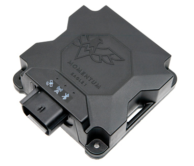
Momentum IoT’s long-life Eagle 1 tracker works without external power for more than six months after a single charge. The device switches on-the-fly between narrowband internet of things (NB-IoT) and LTE Cat-M. The Eagle 1 leverages Telit’s dual-mode ME310G1 module, which delivers low power consumption in a small footprint. The Eagle 1 detects movement with a built-in accelerometer. Using movement and signals from its GPS receiver to determine vehicle trip starts and stops, the device can go into hibernation mode during periods when the vehicle is not in use, further reducing power consumption. Applications include garbage and storage bins, portable toilets, roll-off containers, message-boards, coolers, and other equipment typically stationed in non-powered, remote places for extended periods.
The largest source of error in GNSS positioning is the delay suffered by the signals as they pass through the ionosphere traveling from the satellites in orbit to receivers on or near Earth’s surface. That is because the ionosphere is full of free electrons stripped from atoms and molecules by ionization and this plasma refracts the signals, changing their speed. Normally, models compensate for this. However, geomagnetic storms wreak havoc on the free electrons in the ionosphere, making it difficult to accurately determine the signal delay.
That is why space weather matters for GNSS and for the myriad human activities that have come to depend on it.
So, here’s the good news. “On a scale of one to five, the geomagnetic storm on April 14 was a three,” Bill Murtagh told me. Murtagh is the Program Coordinator and Space Weather Forecaster at the Space Weather Prediction Center (SWPC) of the National Oceanic and Atmospheric Administration (NOAA). He was referring to the third rung of NOAA’s space weather scales, which were introduced to communicate to the public the current and future space weather conditions and their possible effects on people and systems.
NOAA has three space weather scales, one each for geomagnetic storms (G scale), solar radiation storms (S scale), and radio blackouts (R scale). The steps on the scales, ranging from “minor” to “extreme,” are analogous to those NOAA uses to classify hurricanes, tornadoes and earthquakes. They describe the environmental disturbances for each of these events and list their possible effects at each level.
Solar activity runs in 11-year cycles. A G5 event happens two or three times per cycle, and the last one was in October 2003, Murtagh told me. “I can only remember a handful of occasions over the past 20 years when ionospheric activity has significantly impacted users,” told me Gavin Schrock, PLS, manager of the Washington State Reference Network, a regional cooperative of GPS reference stations and data. According to Rick Hamilton, the GPS Information Analysis Team Lead at the U.S. Coast Guard Navigation Center, it “did not receive any reports of interference related to the geostorm” and “there was no significant increase in reports that we might attribute to geomagnetic activity.”
Now, the bad news. We are heading for a maximum in solar activity, expected to occur in 2025. The Sun is “already quite active,” Murtagh pointed out, and recently there has been an increase in the number of R1 and R2 storms. Solar coronal mass ejections (CMEs), which launch plasma and magnetic fields into space, also have become more frequent. When a CME hits the Earth, its collision with the Earth’s magnetic field causes a geomagnetic storm.
So, the GNSS constellations and the GNSS industry should be preparing now. Fortunately, improvements in GNSS software and receiver technology, plus corrections and integrity information and the much larger number of satellites, make us better prepared than we were during the last cycle. On the other hand, the stakes also are much larger, due to our ever-greater reliance on GNSS.
As a sailor, I rely on NOAA nautical charts and marine weather forecasts. GNSS users can thank NOAA for its space weather forecasts.
An MQ-9 Reaper on patrol. (Photo: Lt. Col. Leslie Pratt)
Contract to provide geospatial intelligence, infrastructure support and training for the Air Force Distributed Common Ground System
Raytheon Intelligence & Space (RI&S), a Raytheon Technologies business, has been awarded a five-year indefinite delivery, indefinite quantity contract to continue geospatial intelligence (GEOINT) system mission support and training for the U.S. Air Force’s Distributed Common Ground System (DCGS).
Under the DCGS GEOINT Field Support contract, RI&S will provide mission support and engineering services for the current DCGS weapon-system baseline as well as partnering with the Air Force to facilitate the transition to an open architecture.
Open architecture will enable DCGS to more readily integrate data from the intelligence community and commercial providers, with the goal of using artificial intelligence to create multi-intelligence analysis.
DCGS draws in data from airborne sensors aboard the RQ-4 Global Hawk, Mq-1 Predator, MQ-9 Reaper and other intelligence, surveillance and reconnaissance platforms all over the globe.
Under the contract, RI&S will leverage its mission domain knowledge to ensure high mission availability to support end-to-end operations, from mission planning for an airborne sensor to data collection, processing and data discoverability for the DCGS Analysis Exploitation Teams in support of theater and National Command Authority.
This month our UAV and GNSS news ranges from a drone diving into the Boston subway to a GNSS receiver designed for Moon orbit. We also look at the types of drones heading to Ukraine to help fight the Russian invasion and rescue citizens from demolished buildings.
Boston cleanup
Bostonians’ morning commutes were disrupted at the end of March after 100 tons of demolition debris fell nine stories onto ground directly above subway tunnels, and the Massachusetts Bay Transport Authority (MBTA) closed the Orange and Green lines as a precaution.
The bad news got worse. A construction worker was killed when part of a parking garage under demolition collapsed. Apparently his jackhammer-construction vehicle — in the midst of demolition work — fell nine stories when the floor near the edge of the building buckled and crumbled away.
MBTA was concerned that damage could have occurred to the subway under the building from the huge amount of debris that fell on the ground above a tunnel. The agency closed the line passing through that section of the system. Hundreds of morning commuters were turned away from the subway at nearby station entrances and were directed to buses hastily brought on as temporary shuttles around the closed subway sections.
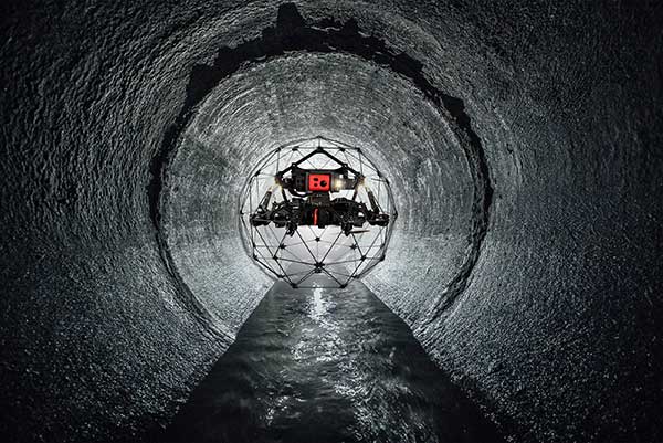
MBTA wanted to immediately, but carefully, inspect the tunnel for damage, but was concerned for the safety of its inspection personnel. As news of the disaster circulated, the Massachusetts Department of Transportation (MassDOT) Aeronautics Division became aware of the subway issue, and proposed a rapid solution to the dilemma — to fly a drone through the tunnel. The drone would transmit high-resolution video and gather data on the status of both tracks and tunnel structure.
Soon after, Bostonians were able to watch a 29-second video collected by the drone that was sent into the subway tunnel.
“As we work to safely restore service following the Gov Center Garage accident, we teamed with @MassDOT Aeronautics to scan Orange & Green Line tunnels with a drone. This allowed us to safely assess tunnel conditions before sending engineers in for in-depth structural inspections.” pic.twitter.com/LHGUfiou9r
MBTA was then able to gauge that live inspections would be safe. The tunnel was ultimately assessed as being sound and, following test trains being run, service was restored.
It has been difficult to establish which drone was used for these initial visual tunnel inspections, but in 2021 the Aeronautics Division was operating multiple drones, including the DJI Matrice, Inspire, Phantom and Mavic, as well as a few fixed-wing and multi-rotor models manufactured by Yuneec, SenseFly and Delair.
Flyability provides the Elios 2 drone, specifically built for indoor inspection, for such places as inside underground tunnels. Similar “caged” inspection drones include Droneball 360 by Imaze, the Skycopter Cobra drone, the Asio Caged Inspection Drone and several others.
Turning our attention to space, the European Space Agency (ESA) will conduct a mission to place a refrigerator-sized satellite in orbit around the Moon. Of course, there have been many successful efforts to put things in lunar orbit since Russia first achieved the feat with Lunar 10 in 1966. NASA’s Lunar Reconnaissance Orbiter followed in 2009, along with India’s Chandrayaan-2 orbiter and its failed lander.
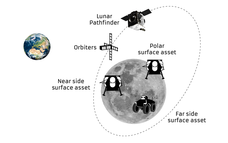
ESA has contracted Surrey Satellite Technology Ltd. (SSTL) in Guildford, UK, to develop the Lunar Pathfinder communications relay satellite — the first part of a project to provide communications and navigation for the Moon. This capability will enable assets on the lunar surface to communicate directly with the Pathfinder via S-band and UHF, which will then relay their signals onwards to Earth using X-band.
The satellite will also carry a laser retro-reflector and a space-weather payload designed to assess the radiation environment in orbit. This should help support landers carrying astronauts, such as the NASA Artemis, by broadcasting radiation intensity to the surface.
Artist illustration of the Pathfinder mission. (Image: SSTL)
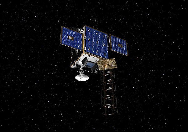
The Lunar Pathfinder satellite. (Image: SSTL)The Pathfinder satellite will carry a few passenger payloads, but the most interesting to us might be the highly sensitive GNSS receiver, which will attempt to make position fixes from lunar orbit using GPS and Galileo satellites in Earth orbit.
The NaviMoon receiver designed by SpacePNT in Switzerland was implemented and tested by European Engineering & Consultancy, which added a special low-noise amplifier of its own design — essential for detecting minute satnav signals at 20 times the distance they usually travel to Earth’s surface from Earth orbit. In addition, antennas on GNSS satellites are designed for transmissions towards the Earth’s surface, not out toward space, further decreasing the signal strength in the vicinity of the Moon.
As you might expect, the view of the various constellations of GNSS satellites from orbit around the Moon is extremely limited. To give the NaviMoon receiver any sort of chance of picking up signals when they are in view, an onboard dynamic force model provides the receiver with its anticipated location along its orbit, and also derives the apparent direction from which signals should be observed. Even detecting a single satnav signal could assist the receiver in creating a position fix. SSTL will also reorient the Lunar Pathfinder satellite from time to time to enable the receiver to gain access to GNSS signals from Earth.
Measurements from Earth using laser ranging, aimed at the laser retro-reflector on the satellite, will be used as “truth” against which the position fixes by the NaviMoon receiver will be verified.
UAVs for Ukraine
Meanwhile, as the war in Ukraine continues to rage on, AeroVironment has been contracted by the U.S. Army to supply its RQ-20 Puma AE for use in Ukraine for almost $20 million. The package includes reconnaissance/surveillance and target acquisition kits, spares, logistics support and training for operators in Ukraine.
The Puma has an endurance of about three hours, carries a gimbaled visual/IR camera and is equipped with dual GPS receivers.
AeroVironment’s Puma is hand-launched. (Photo: Lance Cpl. Frank Cordoba/U.S. Marine Corps)
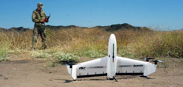
U.S. drone manufacturers have donated hundreds of other recon drones to Ukraine. The AeroVironment Quantix Recon drone takes off and lands vertically, but flies rapidly as a fixed-wing observation platform. While its endurance is not as long as the Puma’s, it flies faster so it can return with information more quickly.
Quantix lands vertically, but flies fixed wing. (Photo: AeroVironment)
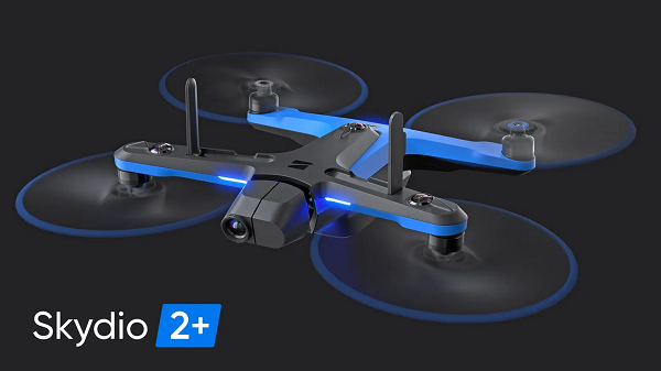
Brinc has also donated and sold its Lemur tactical drones to Ukraine for use in disaster recovery work in devastated buildings throughout the country. The rugged quadrotor drone has two-way voice communications, video and lidar, and has proven itself in difficult building-collapse search and recovery operations in confined spaces. Skydio has apparently donated and sold quadrotor drones to Ukraine with multi-view video from six 200-degree color cameras, also for use in collapsed building search and recovery.
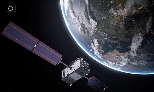
After a challenging Launch and Early Orbit Phase (LEOP) and testing campaign during the COVID-19 pandemic, Galileo satellite “Nikolina” (GSAT0223) entered service on May 5. The satellite will reinforce the performance and robustness of the Galileo satellite.
GSAT0223 was launched Dec. 5, 2021 with Galileo launch L11 after the usual design, acceptance, validation, launch and early orbit preparation and operations phases.
This was the first Early Orbit Operations phase conducted directly from the operational center in Germany, under the responsibility of EUSPA.
GSAT0223 and its launch companion GSAT0224 (Shriya) are the first pair of the third batch of Galileo First Generation satellites to reach space. GSAT0223 will fill the last empty slot in Galileo’s orbital plane B.
Shriya will soon complete its in-orbit validation and will then join the operational constellation. Ten additional satellites of the same batch are continuing assembly, acceptance and launch preparations.
Topcon Positioning Germany is one of 22 partners involved in CampusOS, a research project with the goal of developing a modular ecosystem for open 5G campus networks based on open radio technologies and interoperable network components.
As part of the German technology program “Campus networks based on 5G communication technologies,” innovative solutions for open 5G networks are being developed and tested in conjunction with the German Federal Ministry for Economic Affairs and Climate Protection. The program was launched at the beginning of 2022 and will run through 2025.
The use of artificial intelligence in the operation of autonomous plants and construction machinery requires the highest level of digital sovereignty. If Construction 4.0, including far-reaching automation, is to become a reality in Germany and the rest of the world, the processes of such data-driven solutions must run reliably, quickly and autonomously.
The German Federal Ministry for Economic Affairs and Climate Protection is providing €18.1 million in funding for the technology program over the next three years, which will cost €33 million total. The Fraunhofer Institutes FOKUS and HHI are coordinating the project. 22 partners from industry and research are involved, including Deutsche Telekom, Siemens, Robert Bosch and more.
“To enable companies to operate their own campus networks, certain requirements must be met; from standardized technology building blocks to network structures,” explained Ulrich Hermanski, chief marketing officer of the Topcon Positioning Group. “As the sole representative of the construction industry, Topcon will test the technologies on reference test sites and, therefore, will help shape the solutions for the future. We look forward to working with our research partners to take the digital construction site to the next level.”
With this research project, construction companies will one day be able to operate plants and machinery autonomously in open campus networks. This will allow the fluid and uninterrupted monitoring of construction sites in real time, as well as the networking of all sensors and construction machines in use on construction sites.
Autonomous from public networks, 5G technology guarantees seamless machine-to-machine communication and transmits data 10 times faster than 4G.
 OneNav has announced performance results from field testing its latest pureL5 customer evaluation system (CES) software in both open-sky and challenging signal environments.