Given that space is increasingly a congested and contested arena, should the U.S. government establish a new office to manage both space-based and terrestrial-based PNT systems?
John Fischer
“The U.S. government already has the National Executive Committee for Space-Based PNT (see gps.gov), which coordinates policy among all the branches of government. There is also a PNT Advisory Board, which includes some international members to inform the committee, and a National Coordination Office to execute the policies. This is in addition to the new U.S. military’s Space Command under which GPS operates. So, space-based issues are being addressed, but maybe more could be done to coordinate terrestrial-based PNT systems with space-based ones.” — John Fischer
Ellen Hall
“As new technology advances, government, along with its policies and laws, struggles to keep pace. This was certainly true of the internet and cybercrime. This is also true of terrestrial-based PNT, where new technology emerges in areas not currently covered. Policy gaps and overlapping technologies need to be addressed and coordinated. It certainly seems that this would be one of those areas that could benefit from oversight. Space-based PNT is currently addressed by the National Executive Committee for Space-Based PNT, among others.” — Ellen Hall
Bernard Gruber
“The threat to U.S. space-borne assets and the signals they generate is very real. Both commercial and military users of GPS continue to seek independent alternatives to current PNT systems that are diverse and robust. The National Coordination Office supports the National Executive Committee (NEC) for Space-Based PNT. I believe the role of the NEC should be broadened to include terrestrial and alternative PNT as a first step to charter/secure a new or expanded program office.” — Bernard Gruber
Editorial Advisory Board
Tony Agresta, Nearmap
Miguel Amor, Hexagon Positioning Intelligence
Thibault Bonnevie, SBG Systems
Alison Brown, NAVSYS Corporation
Ismael Colomina, GeoNumerics
Clem Driscoll, C.J. Driscoll & Associates
John Fischer, Orolia
Bernard Gruber, Northrop Grumman
Ellen Hall, Spirent Federal Systems
Jules McNeff, Overlook Systems Technologies
Terry Moore, University of Nottingham
Mitch Narins, Consultant
Bradford W. Parkinson, Stanford Center for Position, Navigation and Time
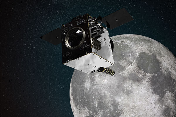
Artist’s impression of the Lunar Pathfinder satellite built by Surrey Satellite Technology Ltd. (SSTL) that will provide communications and navigation services for the Moon.
NASA and its international partners are planning a return to our natural satellite. The following three papers — presented at the Institute of Navigation (ION) GNSS+ conference Sept. 20–24, 2021 — discuss the role of GNSS in lunar exploration. The full papers are available at www.ion.org/publications/browse.cfm.
Using GPS for Time Transfer
NASA and the European Space Agency have conceptualized the initial framework for a GPS-like constellation for the Moon, which will ensure uninterrupted navigation and communication services for future lunar missions. The authors designed a smallsat-based Lunar Navigation Satellite System (LNSS) with time-transfer from Earth-GPS to alleviate the size, weight and power (SWaP) and timing stability requirements of the onboard clocks. A timing filter corrects the lower grade clock when Earth-GPS signals are available and propagates these clock estimates forward in time when no Earth-GPS signals are available. The authors analyzed their proposed time-transfer technique using high-fidelity simulations of an LNSS satellite with an onboard chip-scale atomic clock for three cases of elliptical lunar frozen orbits.
Bhamidipati, Sriramya, Mina, Tara, Gao, Grace, “Design Considerations of a Lunar Navigation Satellite System with Time-Transfer from Earth-GPS,” https://doi.org/10.33012/2021.18021
GNSS Nav for Moon Missions
The authors show the potential of autonomous GNSS signal-based navigation for a set of Moon scenarios. This technology could be a game changer for the future of lunar exploration, representing an extremely low cost and effective alternative for Moon navigation. Results show that not only autonomous GNSS navigation for lunar orbiters is possible, but it also delivers good navigation performance. In fact, navigation with root-mean-square (RMS) errors on the order of 50–100 meters were obtained for scenarios of high interest, such as for the planned Lunar Pathfinder and near-rectilinear halo orbit of the Lunar Gateway space station around the Moon.
Mangialardo, Marco, Jurado, María Manzano, Hagan, David, Giordano, Pietro, Ventura-Traveset, Javier, “The full Potential of an Autonomous GNSS Signalbased Navigation System for Moon Missions,” https://doi.org/10.33012/2021.18040
Finding the best lunar orbit
A continuous and reliable lunar positioning and timing system, such as a GNSS-like constellation, is considered essential infrastructure for lunar exploration. The authors focus on halo orbits with the aim of defining an optimal halo constellation for supporting and delivering a navigation service on the Moon. This paper shows the performance of a GNSS-like constellation deployed in Halo orbits around Earth-Moon L1 and L2 collinear libration points. Different phases have been considered, from a minimum number of satellites able to provide a local PNT service on the South Pole (Initial Operational Capability), to a final, extended constellation able to cover the whole lunar surface (Final Operational Capability).
Musacchio, Daniele, Iess, Luciano, Carosi, Mattia, Capolicchio, Jacopo, Eleuteri, Massimo, Stallo, Cosimo, Di Lauro, Carmine, “Design of Earth Moon Halo Orbits for a Global Lunar PNT Service,” https://doi.org/10.33012/2021.18020
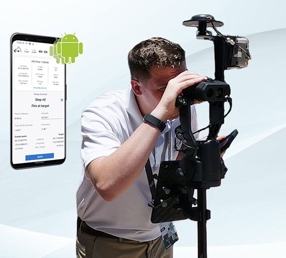
Professionals can capture high-accuracy laser offsets directly into ArcGIS Field Maps on Android devices with Arrow Series GNSS receivers
Image: Eos Positioning
Eos Positioning Systems Inc. announces the release of its Eos Laser Mapping for ArcGIS solution on Android devices. Previously, the free solution was available only on iOS. It allows mobile crews to capture asset locations from a distance with survey-grade accuracy.
“We are excited to provide this already popular iOS solution also to our customers using Android devices,” Eos Chief Technology Officer Jean-Yves Lauture said.
The solution combines technology from geographic information system (GIS) provider Esri, laser rangefinders from Laser Tech, and Eos’ own Arrow Series GNSS receivers.
“The Eos Laser Mapping solution was extremely well-received with its initial release, so we are excited to see the same features now available for ArcGIS Field Maps users on Android devices,” Esri Field Apps Engineering Lead Jeff Shaner said.
The Eos Laser Mapping release on Android supports three workflows, or mapping methodologies: Standard Laser Offset (sometimes called Range-Azimuth), Range-Range (or Range-Intersect), and Range-Backsight (a total station-like method).
The original laser offset solution was released in 2018 by Eos in partnership with Esri and Laser Tech.
The Autel Robotics Dragonfish Lite and Pro UAVs are now available in the United States, joining the Dragonfish Standard and providing more options and choices for UAV pilots.
The rugged Dragonfish UAVs are capable of vertical takeoff and landing (VTOL) with both multi-rotor and winged flight, with an endurance of up to 180 minutes. They are suitable for professional applications such as energy, mining, defense and surveillance. Maximum winged flight speed is 30 m/s (108 km/h, 67 mph), and maximum video transmission range is 30 km (18.6 miles) with a base station.
The 1-tap take-off and landing capability point-and-click user interface, and other smart autonomous features make the Dragonish simple for anyone to operate, according to maker Autel Robotics. The aircraft can make a smart decision to either land or return to base in case of issues such as loss of GPS signal, loss of operator communications, or low battery power.
The Dragonfish tilt-rotor system will automatically transition to multi-rotor mode if adverse conditions cause fixed-winged flight to stall or become unsustainable. The Dragonfish battery, barometer, positioning system, compass and inertial measurement unit all have backup modules to ensure flight safety.
Dragonfish UAVs can carry a variety of payloads, including standard high-resolution cameras, 50x optical zoom cameras, 12-megapixel wide-angle cameras, 1280 x 1024 high-resolution infrared cameras, and laser rangefinders for various imaging, surveillance and mapping tasks.
All Dragonfish UAVs are built from tough carbon-fiber and fiber-glass composite, providing excellent IP43 wind and weather resistance. Despite the strong construction, these aircraft are designed to be easily disassembled for space-saving transport. They can be assembled in three minutes without tools. Disassembled, Dragonfish fits in the back of any car or SUV.
The larger Dragonfish Pro provides the longest flight time of the series, 180 minutes with payload, and has a 6,000-m (19,685-ft) flight ceiling, making it suitable for applications such as discreet long-endurance surveillance and wide-area mapping. The maximum payload capacity is 2.5 kg.
Compact and lightweight at 4.5 kg (including two batteries) with a 1,600-mm wingspan, the Dragonfish Lite can carry a 1-kg payload up to its service ceiling of 4,000 m, and has 75 minutes’ flight endurance.
Dragonfish Standard is already available. Dragonfish Lite and Dragonfish Pro will be available in the U.S. starting in April.
Firmware Release
The company also announced that pilots of Autel Robotics’ EVO Nano and EVO Lite series drones can download a firmware update that adds features including Dynamic Track 2.1 (person only), SuperDownload, 8-bit Log video, HDR video and other improvements. Some of these new firmware features are available now for selected models, and other features will become available for the EVO Lite, Lite+, Nano and Nano+ series in the near future.
Cooperative agreement expands precision timing distribution options for critical infrastructure and verifies STL’s agreement with UTC via UTC(NIST)
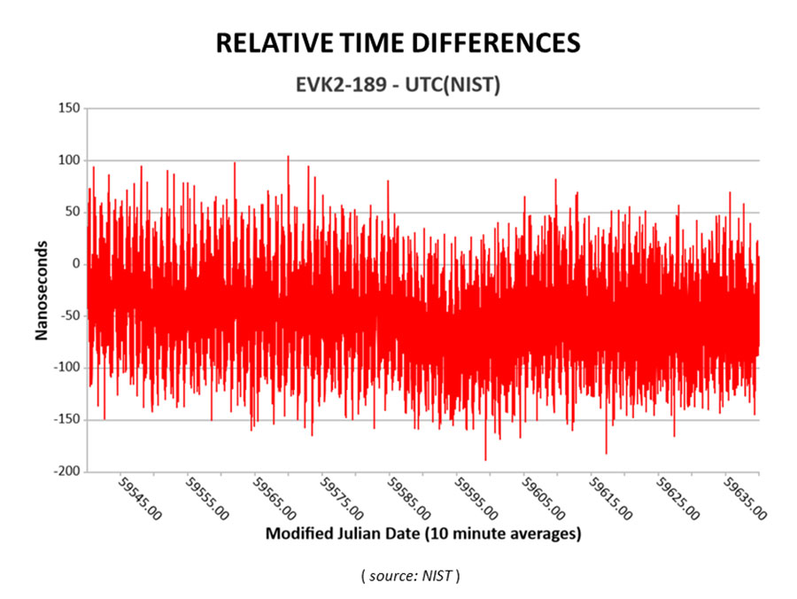
This March 30, 2022, chart of Satelles and NIST testing verifies that STL timing agrees with UTC. (Chart: Satelles)
Satelles Inc., provider of highly secure satellite-based time and location services, has entered a cooperative agreement with the U.S. National Institute of Standards and Technology that directly connects STL’s operational infrastructure to the source of UTC(NIST), the national standard for time and frequency in the United States produced in coordination with the U.S. Naval Observatory.
The agreement calls for Satelles to provide its STL service to NIST. Reciprocally, the agreement includes the introduction of a connection between an STL Ground Monitoring Station (GMS) provided by Satelles to the NIST collection of extremely accurate atomic clocks that maintains the official time scale for UTC(NIST).
The Cooperative Agreement was described in NIST Technical Note 2187, “A Resilient Architecture for the Realization and Distribution of Coordinated Universal Time to Critical Infrastructure Systems in the United States,” published in November 2021.
In February 2021, Satelles delivered and configured an STL GMS at NIST’s Time and Frequency Division in Boulder, Colorado. This facility is home to the ensemble of high-precision cesium beam and hydrogen maser atomic clocks that maintains UTC(NIST).
After conducting a series of successful preliminary tests in the spring of 2021, NIST then directly connected the STL GMS to its primary clock ensemble in June 2021. Comparing timing provided by STL to UTC(NIST), the testing confirmed STL’s long-term stability of better than 25 nanoseconds with short-term time deviation of 50 nanoseconds.
STL from Satelles is a resilient, alternative PNT service from low-Earth-orbit (LEO) satellites that enterprise customers rely on as a primary timing source. Telecom operators, for example, use STL for 5G wireless network deployments where GPS is unavailable indoors or when other timing solutions cannot provide the required level of accuracy.
STL’s agreement with UTC also is important for critical infrastructure and other applications that require an essential contingency capability to protect the operations of PNT-dependent systems and ensure survivability and resilience.
“Satelles has a network of GMS nodes positioned around the world to receive STL signals and calculate the position and timing of the satellites for purposes of producing timing corrections, and
now we are fortunate to have a GMS connected inside NIST’s main time lab,” said Gregory Gutt, president and CTO of Satelles. “It’s an honor to be given direct access to UTC(NIST), especially in an arrangement that delivers benefit to both our customers and NIST.”
Visit satelles.com/nist for more information about NIST reports that detail the performance of STL and collaborations between Satelles and NIST.
eSurvey is a specialized manufacturer of GNSS receivers and rugged handheld collectors founded in 2018 and part of the UniStrong Group. Based in Shanghai, eSurvey is serving OEM and survey companies throughout North America, as well as many other countries.
“We deliver our products to more than 50 countries, but we are relatively unknown in North America, where we are looking to develop long-term partnerships,” said Jorge Visoso, International Sales Manager. He said the company is prepared to furnish demonstrations to any interested party.
The name “eSurvey” was inspired by the philosophy of making the surveying job easier by using the best technologies, according to Visoso. eSurvey also aspires to be the confluence between high value and affordable cost.
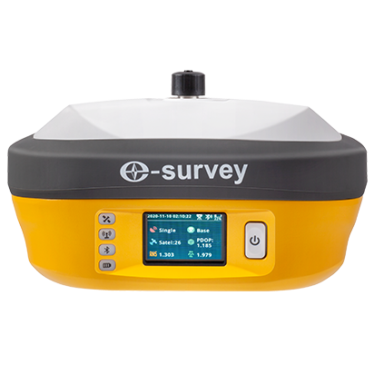
The E800 high-precision receiver. (Photo: eSurvey)
As the international brand of the UniStrong products, eSurvey leverages the resources and the expertise of a family of companies with many years of accumulated experience. One strength of the company lies in its significant research and development advantages.
In contrast to many competitors that only supply receivers, eSurvey has a footprint in the entire value chain and is one of the few manufacturers with its own boards and chips, which translate to a more stable supply and reliable quality, Visoso said.
The company’s portfolio of GNSS receivers is highly diversified. Several models have been highly successful in South Korea and Poland, where the brand has become well known over the past years.
The most advanced and comprehensive eSurvey receiver is the E800 model, a multi-constellation and multi-frequency receiver with a micro-electromechanical (MEMS) dynamic tilt system and a 5-watt internal radio. Various engines available for this and other receiver models.
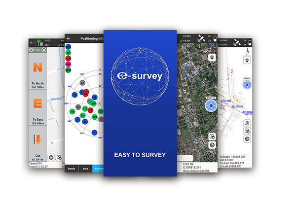
SurPad4.2 software for surveyors. (Photo: eSurvey)
eSurvey also offers its own surveying and mapping software, SurPad4.2. SurPad4.2 provides multiple operation and communication systems, has MAP and CAD functions, and has a coordinate system. It also includes a survey mode encompassing TOPO, Control, Quick Point and COGO.
Besides GNSS receivers, the company supplies precision agriculture and machine control systems as well as USV and UAV systems, which are now selling in markets such as Turkey and Spain.
Artist’s impression of SSTL’s Lunar Pathfinder satellite that will provide communications services around the Moon. (Image: SSTL)
News from the European Space Agency (ESA)
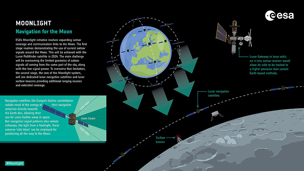
ESA is going to the Moon — in collaboration with its international partners — and seeks to build a lasting lunar link to enable sustainable space exploration.
The agency has now evaluated initial ideas to create a network of lunar telecommunications and navigation satellites.
Creating a commercial telecommunications and navigation service for the Moon will allow many of the dozens of planned lunar missions to share the same infrastructure to communicate with Earth, as well as to find their way on the lunar surface.
The service is needed because the planned missions are becoming regular trips to Earth’s natural satellite rather than one-off expeditions.
Using a shared telecommunications and navigation service will reduce the design complexity and weight of individual missions, making them more cost-efficient.
Lowering the ticket price to lunar exploration could also empower a wider group of ESA member states to launch their own national lunar missions, inspiring the next generation of scientists and engineers.
Call for Ideas
The call for ideas for how to use a lasting link with the Moon is open until April 30. People working for commercial companies, universities or governmental organizations are welcome to suggest how they would like to use a lunar communications and navigation service.
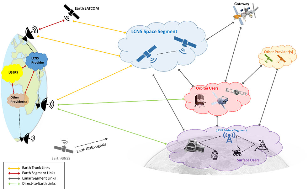
This diagram presents a notional preliminary top-level system concept for a lunar communications and navigation service. (Image: ESA)
Concept Reviews Completed
Two consortia of companies have now completed their system concept reviews, which set out how to create the lunar constellation, under ESA’s Moonlight initiative to identify the best way to create a lasting link with the Moon. The reviews set out the business and technical analysis needed to identify and justify a number of feasible system concepts for creating the lunar network.
The next step will be to define a detailed system architecture and identify the most suitable partnership models between private space companies and ESA.
Telespazio leads the first consortium. The consortium includes:
satellite operators Inmarsat and Hispasat
manufacturing companies such as Thales Alenia Space Italy, OHB System in Germany and Canadian space technology company MDA
Italian Aerospace Logistics Technology Engineering Company (ALTEC)
small and medium-sized enterprises such as Nanoracks Europe and Argotec
universities and research centers such as SEE Lab, SDA Bocconi and Politecnico di Milano.
The second consortium is spearheaded by Surrey Satellite Technology Limited, both in the service prime capacity through its lunar services brand SSTL Lunar and as the satellite manufacturer. The consortium includes:
satellite manufacturer Airbus
satellite network providers SES, based in Luxembourg, and Kongsberg Satellite Services, based in Norway
the Goonhilly Earth Station in the UK
British satellite navigation company GMV-NSL.
Artemis Program and Pathfinder
NASA’s Artemis program will use several of ESA’s service modules to return humans to the Moon, including the ESPRIT communications module for the lunar Gateway’s living quarters for astronauts. With its European industrial partner, ESA is helping to build the Lunar Pathfinder, showcasing lunar communications service provision by providing initial services to early lunar missions, including a complete lunar navigation in-orbit demonstration.
The Moonlight initiative builds on both the ESPRIT communications module and the Lunar Pathfinder.
A roundup of recent products in the GNSS and inertial positioning industry from the March 2022 issue of GPS World magazine.
OEM
Correction Service
Achieves RTK-level accuracy
Photo: Hexagon
“RTK From the Sky” technology has been integrated into the core of the TerraStar-C PRO corrections service. As a result, TerraStar-C PRO provides centimeter-level accuracy, not just in open-sky environments but also across challenging conditions created by buildings and foliage. TerraStar-C PRO now converges in less than three minutes by utilizing quad-band receiver and antenna technology to leverage modernized BeiDou 3, GPS III and Galileo E6 signals. The resulting process generates state-of-the-art corrections for all GNSS frequencies. The service improvements are accessible through the 7.08.10 firmware release for users of OEM7700, OEM719 and OEM729 cards and their associated enclosures for land and air applications.
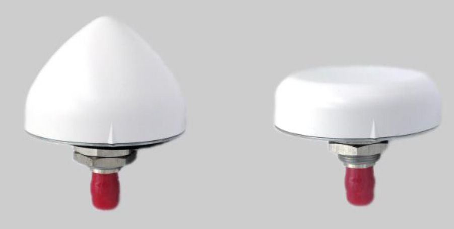
A north orientation mark is being added to the TW3000 family of Accutenna precision antennas and the TW5000 family of smart antennas. The new feature allows customers to align their antennas, standardize radiation patterns, and increase the synchronicity of their azimuth gain readings across multiple devices. The new north mark design has been thoroughly tested to ensure it conforms to or exceeds customer expectations and maintains each antenna’s stringent IP69K rating.
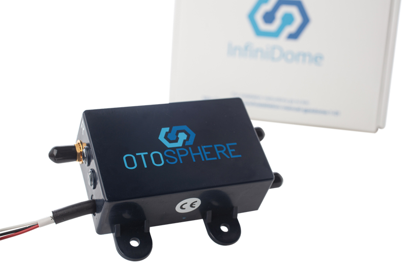
OtoSphere is a small, add-on module to the ViaLite GPS RF over fiber link and any GNSS-based system, providing GNSS protection against GPS jamming attacks, making any receiver more resilient. It ensures continuity of timing and navigation capability and enables normal operation during a jamming attack. According to ViaLite, no other solution that offers such protection is as small, light, affordable, or easy to install. The Otosphere protection module adds resilience to critical GPS timing services.Using OtoSphere, GPS receivers are up to 50 times more resilient to jamming attacks on positioning, navigation and timing (PNT) systems compared with having no protection. The GPS receiver can continue working normally throughout the attack. Timing-critical infrastructures in areas such as defense and cybersecurity can now be protected from these attacks. The Otosphere has a unique interference filtering algorithm that combines patterns from two external omnidirectional antennas that pinpoints the direction of the attack, then directs a null toward the unwanted signal to reject and reduce disruptions.
Infrastructure system for autonomous transportation
Photo: Seoul Robotics
The Level 5 Control Tower (LV5 CTRL TWR)) is a mesh network of sensors and computers on infrastructure that guides vehicles autonomously without requiring that sensors be placed on individual vehicles. The technology is automating last-mile fleet logistics at BMW’s manufacturing facility in Munich. The system has the potential to transform operations for a wide range of business applications, from vehicle distribution centers to car rental companies and trucking logistics.
Savvy Navvy provides essential marine information, allowing boaters to cross-check their traditional navigation plans. It integrates plotting charts, weather and tide data, marina details and passage planning into one app. The app reduces the risk of human error as well as the stress of voyage preparation. It is used by boaters in more than 100 countries around the world, with more than 43 million miles plotted. It works on phones or tablets using Android, IOS, PC or Mac.
The Pix4D viDoc RTK handheld rover attaches to iOS devices to bring RTK accuracy to terrestrial scanning on iPhones and iPads. When paired with the PIX4Dcatch mobile app, the viDoc rover can replace survey tools such as RTK GNSS rovers and terrestrial scanners, the company said. The two products create a workflow that turns iPhones or iPads into an accurate terrestrial scanning device, with centimeter-accurate RTK positioning from an existing NTRIP network. The tools can be used to 3D model small areas or structures.
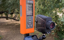
Bad Elf now provides an integrated laser-offset workflow for acquiring high-accuracy field data in GNSS-challenged environments using Esri ArcGIS Field Maps for Android, as well as iOS. The workflow integrates Bad Elf and Laser Tech (LTI) hardware in collaboration with ArcGIS technology from Esri. The Bad Elf Flex connects to any LTI TruPulse rangefinder over a wired or Bluetooth connection to deliver high-accuracy location data to Esri ArcGIS Field Maps. Mobile workers can efficiently complete position and height data collection in access-limited situations, saving time, money and effort.
A free global map created from processed satellite imagery is available. To create the world image, satellite imagery was processed to remove clouds and balance shades and tones, and then carefully stitched together to create a seamless map layer with beautiful colors. The input data is recent, from 2020 and 2021, and rendered as one tiled file with 13 zoom levels 0-13 for use in web applications. It is a viable, up-to-date alternative to Google maps for software developers, without privacy issues.
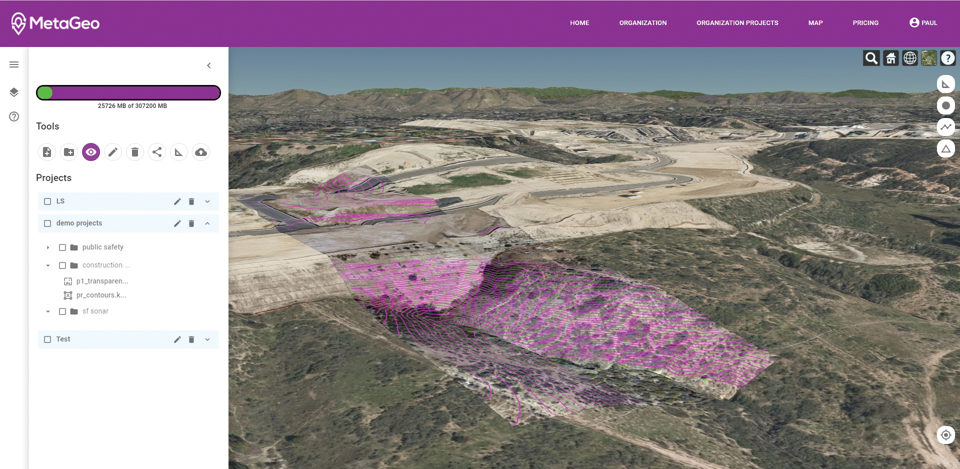
The MetaGeo geographic information system (GIS) platform enables organizations of all sizes to host, analyze, find and share 3D map datasets among any internet-capable devices. The platform processes location-based map or sensor data from the real world, combines it into a single 3D virtual environment, and streams it to any device or mapping platform. The affordable and easy-to-use platform can load data from multiple sources: satellites, drones, mobile devices, public and crowdsourced repositories, internet of things (IoT) sensor data, 3D models and topographic maps. The data is then processed by the MetaGeo platform into a 3D world and streamed to any internet-connected device, enabling live collaboration between the office and field via mobile or augmented reality device. A plug-in software development kit (SDK) allows for third-party tools to scale and fit user needs.
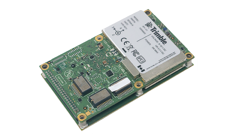
Trimble has launched the Trimble AP+ Land GNSS-inertial OEM platform for accurate and robust position and orientation for georeferencing sensors and positioning vehicles in land mobile-mapping applications. The platform enables users to accurately and efficiently track and monitor fleets and produce high-definition (HD) maps and 3D models. It can also serve as a reference solution for advanced driver-assistance systems (ADAS) testing, even in challenging GNSS environments. The comprehensive Trimble AP+ Land is small enough to integrate into compact mobile-mapping systems. It is compatible with virtually any type of mapping sensor, including single- or multi-lidar systems, video cameras, photogrammetric and panoramic cameras, and similar sensors.
Ronin 4D, a professional cinema camera from DJI, incorporates the full-frame Zenmuse X9 gimbal camera, active four-axis stabilization, lidar focusing, and wireless transmission. Firmware available at launch will allow the remote monitor to view and control the main monitor, interface with mirror control mode, and allow a clean video stream over HDMI and SDI ports on the Remote Monitor Expansion Plate with no overlaid information. It will also support automatic calibration for some third-party auto lenses to realize Lidar Focusing System functions.
Parallel Hybrid Electric Multirotor (PHEM) drone technology improves flight time with a heavy payload, yielding increased efficiency and eliminating the large battery used in other hybrids. It has the potential to extend a UAV’s flight time from 15 minutes to well over an hour and drastically increase range. In the search-and-rescue field, a heavy-lift drone can enhance first responder capabilities by allowing for substantially quicker response times to remote locations. Other applications include military platforms, fighting wildfires, and medical and logistics missions.
Spire Global Inc., a provider of space-based data, analytics and space services, is using its constellation of about 40 geolocation satellites to detect GPS jamming. Spire is collecting data for use by the U.S. Space Force, a particularly important task in light of Russia’s invasion of Ukraine.
“All of our fellow space companies… everyone is playing a vital role for humanity in this battle for freedom and democracy,” Spire CEO Peter Platzer told analysts March 9 in an earnings call, according to Space News.
In September 2021, Spire won a contract to supply Slingshot Aerospace with GPS telemetry data. Slingshot’s pLEO Data Exploitation and Enhanced Processing (DEEP) prototype will automate manual data exploitation techniques to deliver intuitive, easily digestible data products at low latencies for military operations.
The DEEP prototype contract is funded through the the Commercially Augmented Space Inter-Networked Operations (CASINO) program of the Space Systems Command (SSC), which develops and demonstrates the military utility of proliferated LEO satellite architectures.
Identifying and mitigating ground-based radio-frequency (RF) and GPS interferences is a critical component of national security and U.S. Space Force operations. RF signals intercepted in open airspace are liabilities that directly threaten on-orbit space assets and military missions.
Even in the absence of enemy interference and intentional jamming, RF signals from radio stations, cell phones, and various electronics cause interruptions and interferences — a problem exacerbated by the growth of modern communications technology.
The DEEP prototype is an effort by the U.S. military to take advantage of existing commercial satellite telemetry data to readily identify these sources of interference and correct any potential problems before they become a threat.
Spire’s cubesats use GPS radio occultation, a remote sensing technique that measures properties of the Earth’s atmosphere from space.
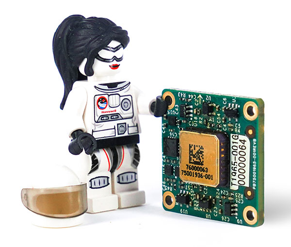
A LEGO Minifigure beside the MV60 shows its small size. (Photo: Honeywell)
Honeywell has unveiled a new accelerometer that delivers high performance and reliability in a small, rugged and low-cost package. The MV60 micro-electromechanical system (MEMS) accelerometer is designed for aerospace and defense, but also has potential uses in industrial and marine applications that require high-precision, navigation-grade accelerometers that are small, lightweight and require little power to operate.
The MV60 measures the acceleration experienced by an object during movement. These types of high-accuracy sensors are mainly used in inertial measurement units and navigation systems deployed on land, air and sea vehicles to measure velocity.
Additionally, inertial systems provide:
key orientation information for drilling operations
precision pointing and altitude determination for vehicles
platform stabilization
target location and surveying.
“The MV60 accelerometer is a technological breakthrough that leverages 50 years of Honeywell inertial sensor and MEMS experience to offer excellent reliability, ruggedness and performance,” said Matt Picchetti, vice president, Navigation and Sensors, Honeywell Aerospace. “Our customers in a wide range of markets will benefit from an accelerometer that is smaller, lighter and requires less power over similar offerings, and they won’t have to sacrifice performance.”
The highly reliable Honeywell MV60 accelerometer features a compact footprint of 1.2 square inches and has shock survivability of up to 5,000 g (g-force). It also offers bandwidth of greater than 300 Hz (hertz) — important for environmentally demanding missions.
The MV60 delivers accuracy and performance that previously had only been available in more expensive solutions. Now, customers have a more affordable, rugged, and small-scale offering suitable for the most demanding navigation applications.
Accelerometers are critical elements of navigation systems, and Honeywell provides a portfolio of precision accelerometers that deliver reliable performance at affordable prices to meet customer needs.
Leica Geosystems, part of Hexagon, has introduced the Leica AP20 AutoPole — a solution for automated total stations that boosts productivity with tilt compensation, automatic pole-height readings and unique target identification.
The AP20 AutoPole combines an intelligent sensor module with the new AP Reflector Pole and operates with Leica Geosystems’ existing automated total stations to create a solution for autonomous workflows.
It is designed to solve three workflow challenges:
holding the pole vertical and stable
entering the pole height manually into the field software
locking to a foreign target on a site with multiple reflectors.
The tilt compensation of the AP20 AutoPole increases efficiency when working with total stations. It is no longer necessary to level the pole for measurements and stakeout. Tilt compensation decreases measurement time and increases flexibility and safety on site by enabling the measuring of points in locations that are inaccessible or put the user at risk. By updating the pole height automatically in the field software, the system ensures that the height on record is always correct, which avoids errors, time-consuming postprocessing and returning to the field to remeasure.
Additionally, the AP20 AutoPole’s target identification ensures the user’s instrument will always lock to the correct target.
“At Leica Geosystems, we understand that tight time schedules, growing expectations for accurate on-demand data and budget constraints put a lot of pressure on surveyors and construction professionals,” said Hans-Martin Zogg, business director, Total Stations, Leica Geosystems. “The AP20 AutoPole is a game changer because it solves several challenges simultaneously. Its tilt compensation and automatic pole height readings are absolutely unique in the industry and will transform how professionals measure with total stations.“
“As a surveying company, the only way we can stay competitive and profitable is to acquire spatial data simply, quickly and efficiently,” said Clifton Webb, director of Warner Surveys. “The Leica AP20 helps us stay ahead of the curve by increasing our productivity and flexibility. It allows us to measure points that were impractical or unsafe to measure before.”
GNSS jamming and possible spoofing has intensified in areas surrounding Ukraine, according to the European Union Aviation Safety Agency (EASA).
The agency issued a bulletin on March 17 warning of a GNSS outage leading to navigation and surveillance degradation. According to the bulletin, which was directed at national aviation authorities and airlines, reports analyzed by EASA indicate that, since Feb. 24, GNSS spoofing and jamming has intensified in four key geographical areas:
the Kaliningrad region, surrounding Baltic Sea and neighboring states
Eastern Finland
the Black Sea
the Eastern Mediterranean area near Cyprus, Turkey, Lebanon, Syria and Israel, as well as Northern Iraq.
“The effects of GNSS jamming and/ or possible spoofing were observed by aircraft in various phases of their flights,” the bulletin stated, “in certain cases leading to rerouting or even to change the destination due to the inability to perform a safe landing procedure.”
Potential issues include:
loss of ability to use GNSS for waypoint navigation
loss of area navigation (RNAV) approach capability
triggering of terrain warnings
inconsistent aircraft position on the navigation display
loss of ADS-B, wind shear, terrain and surface functionalities
failure or degradation of ATM/ANS/ CNS and aircraft systems that use GNSS as a time reference
airspace infringements and/or route deviations due to GNSS degradation.