Blog

  • Boat owners use drones to create global database on plastic pollution

    Boat owners use drones to create global database on plastic pollution

    AnimaMundi Ocean Data Solutions, DJI and Lagoon are using drones to build a comprehensive database of plastic waste on coastlines throughout the world.
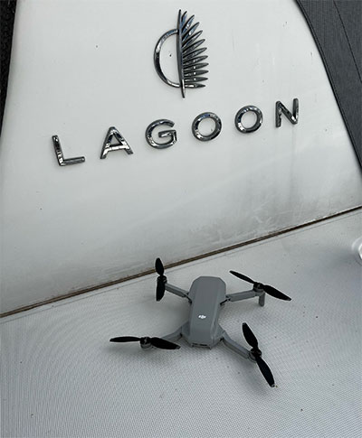
    Photo: Matt Cooper/AnimaMundi
    Photo: Matt Cooper/AnimaMundi

    AnimaMundi is a not-for-profit organization based in Geneva, Switzerland. Its proprietary technology interprets photo and video records to extract a single-use plastic bottle count. The information can be captured via an app using still photography as well as images from drones. The data is automatically uploaded, processed and stored on the company’s servers. The data will enable decisions to facilitate environmental investments and measure the impact of waste-management initiatives.

    The process begins with DJI drones piloted by sailors taking place in the Atlantic Rally for Cruisers (ARC), which started from Las Palmas in the Canary Islands, on Nov. 21. DJI provided drones to Lagoon, a sailing catamaran cruiser maker, to measure plastic waste on beaches around the Caribbean.

    Of the more than 300 million tons of plastic produced every year, at least 8 million tons end up in the ocean, making up 80% of all marine debris, from surface waters to deep-sea sediment. About 33,000 single-use plastic bottles are dumped in the ocean every minute of every day, affecting every coastline.

    Matt Cooper, founder and CEO, AnimaMundi is driven by the need for accurate real time data to ensure investment decisions are made correctly with measurable impact. “Just before COP26 began, world leaders admitted that an annual $100-billion climate finance goal will not be reached until 2023,” Cooper said. “The need for urgent climate action is met with the need to ensure adequate and effective financing solutions. Big data like this will help to determine priorities for action.”

    Lagoon has been a partner of the ARC rally since 2005. Through its Club Lagoon, the company encourages its owners to sign up to this program aiming at reducing plastic waste in our oceans thanks to data collected by drones.

    “Lagoon is proud to be partnering with AnimaMundi in this exciting data collection initiative using our ‘Club Lagoon’ as part of the solution,” said Thomas Gailly, Lagoon brand director. “We have more than 6,000 of our catamarans sailing around the world, and we can feel that our customers are more and more willing to play a role in such initiatives. It’s stimulating to think that the Lagoon owners’ community could be involved in capturing this much needed data in a highly efficient way. This partnership is the perfect complement to our own policy of respect for the environment and all the work undertaken to reduce the environmental impact of our activities.”

    DJI, the global leader in developing and manufacturing civilian drones and aerial imaging technology for personal and professional use, has provided repurposed drones to capture images of the Caribbean coastline that would otherwise be out of reach. “Our drones and cameras empower people to capture amazing photos, video, and high-end professional imagery in every corner of the world,” said Olivier Mondon, senior communication manager at DJI Europe. “Each day, we learn how drones benefit society as a whole, and we are proud to have our drones embark on this environmental journey with experienced sailors who will be able to work using repurposed products to enable invaluable data capture.”

    Initially targeting the Caribbean islands, AnimaMundi is also finalizing a partnership with the International Union for Conservation of Nature (IUCN) and its Plastic Waste-Free Islands (PWFI) initiative to generate weekly total island coastal plastic waste profiles covering Grenada, St. Lucia, Antigua and Barbuda.

    In 2019, with the support of the Norwegian Agency for Development Cooperation, IUCN launched the PWFI project in the Caribbean, the Mediterranean and Oceania, seeking to promote a circular economy and demonstrate effective, quantifiable solutions to address plastic leakage from small island developing states.

  • GNSS Frame Network completed for Italian Space Agency

    GNSS Frame Network completed for Italian Space Agency

    Construction of the New National GNSS Frame Network of the Italian Space Agency (ASI) has been completed. The new network, built by e-GEOS, will provide up-to-date, high-precision geodetic information via GNSS signals for the scientific community and professional and entrepreneurial operators. E-GEOS is a company belonging to Telespazio (80%) and an investee of ASI (20%).

    There are 46 stations distributed evenly across the Italian peninsula that will acquire the signals from GPS, GLONASS, BeiDou and Galileo.

    ASI’s GNSS network, which was designed and developed to provide indispensable support for the global geodetic networks—such as the International GNSS Service (IGS) and the EUropean REference Frame (EUREF)—will produce data for the management of the International Terrestrial Reference Frame (ITRF).

    It will make a variety of products and services possible, such as determining the orbits of GNSS satellites with an accuracy to the nearest centimeter. It will also time-synchronize the satellites to better than one nanosecond, useful both for on-site applications as well as to support satellites equipped with GNSS receivers.

    The new network will enable ASI and e-GEOS to intensify and fine-tune the joint scientific and operational development underway for the last 25 years at the ASI Space Center in Matera in the field of meteorology, as well as the study of climate change and space weather.

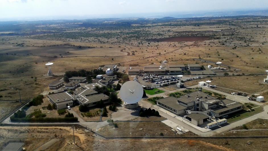
    The ASI Space Centre in Matera. (Photo: ASI)
    The ASI Space Centre in Matera. (Photo: ASI)

    Specifically, the network will enable the provision to the national supply chain—from research centres to SMEs, universities and major corporations—of products and services useful for developing innovative, high-precision positioning applications, which can be implemented in a wide variety of sectors, such as precision farming.

    To contribute to scientific activities, some stations in the new GNSS network have been installed in significant locations where purpose-designed structures are already present.

    All the data acquired by the New National GNSS Frame Network will be received, processed and stored at ASI Space Centre in Matera and provided to all interested users.

  • Geotab and GM expand integrated fleet telematics into Canada

    Geotab and GM expand integrated fleet telematics into Canada

    Integrated solution combines and consolidates valuable telematics data for Geotab and GM customers in Canada

    Geotab Inc. has announced the availability of the Geotab Integrated Solution for General Motors in Canada. With no additional hardware installation required, the offering provides Canadian customers with a simplified fleet management platform to help businesses make better informed decisions.

    With this integration, data from compatible GM vehicles, 2016 or newer, with OnStar embedded factory-first hardware can be securely transferred into Geotab’s web-based fleet management software, integrating all vehicle data into one platform, offering businesses and fleets a seamless user experience.

    By enabling fleet managers to access rich proprietary vehicle data, they can generate safety reports, activity reports and measure other key metrics on one platform to help optimize fleet performance.

    Users can expand the functionality of the solution further with access to the Geotab Marketplace, a growing portfolio of mobile apps and software and hardware add-ons to enable customers to tailor their fleet management solution to help meet all of their connectivity needs including improved safety, productivity and efficiency.

    Image: ipopba/iStock / Getty Images Plus/Getty Images
    Image: ipopba/iStock / Getty Images Plus/Getty Images
  • Percepto launches drone with advanced AI analytics

    Percepto launches drone with advanced AI analytics

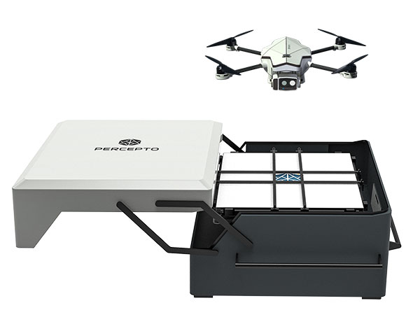
    Percepto Air Mobile drone with base. (Photo: Percepto)
    Percepto Air Mobile drone with base. (Photo: Percepto)

    Percepto, an Israel-based company specializing in autonomous inspection with industrial robotics, has launched its 2022 Autonomous Inspection & Monitoring (AIM) platform and Air Mobile drone.

    Recently listed in TIME magazine’s 100 Best Inventions of 2021, Percepto offers an end-to-end solution powered by artificial intelligence (AI) to collate and streamline all visual data for accurate actionable insights.

    Percepto AIM 2022 has a new Insight Manager to deliver AI-powered packaged solutions for sector-specific use cases, such as solar, mining, energy, oil and gas and other industries. The company drew on tens of thousands of hours collected by autonomous robot missions at industrial facilities to create it.

    Percepto’s AI change-detection framework offers unified visual data and critical business insights for each of the sector-specific solutions. AIM 2022 can be integrated with autonomous drones and robots as well as other visual data collectors, now including DJI drones, and fixed cameras.

    Reports and insights are automatically generated based on the combined visual data. Disseminated to relevant stakeholders on any mobile device, issues and faults are geotagged and displayed on a map, enabling effective action before escalating into more serious problems.

    Percepto also introduced its new Percepto Air portfolio to support the enhanced platform, which will address the diverse needs and increasing demands of various markets.

    Percepto Air Max. The next generation of Percepto Sparrow, the Percepto Air Max is a field-proven solution that operates in the largest mining, oil and gas, and energy companies on six continents. It has a top-grade, versatile payload for specific use cases. Designed to inspect and map complex industrial environments where the highest accuracy and durability are critical, Air Max also has an optical gas imaging (OGI) camera.

    Percepto Air Mobile. This option is a more compact and lighter weight model for smaller sites or organizations taking their first steps with a drone-in-the-box program, or larger sites that need greater deployment flexibility. It is designed for linear inspections, such as pipelines and power lines, and can monitor short-term projects across multiple sites, such as construction sites.

    Percepto Air Max and Air Mobile drones are stored permanently onsite within their respective Percepto Bases. The Air Mobile’s base is light and easy to relocate while maintaining high levels of durability. These encasements are designed for infrequent maintenance and protection against extreme environmental phenomena, such as hurricanes. Percepto’s drones are safe and regulation ready, and ensure all operational aspects meet corporate standards.

    “Percepto AIM 2022 and the new Percepto Air line of drones, together with the most advanced change detection solution, alert and prevent failures and downtime within diverse use cases across many industries,” said Percepto CEO Dor Abuhasira. “Percepto AIM provides the most advanced and comprehensive enterprise inspection software that offers a complete data workflow — from capture to insight. With Percepto Air Max and Percepto Air Mobile, companies have a range of options to choose from depending on the size of their facilities and the flexibility needed to deploy drones.”

    “The real power of Percepto’s system is how data collection and analytics are integrated for a holistic view from both a technical and management perspective,” said Tim Shanfelt, director of Operations Transformation, Koch Ag & Energy. “Our workers are connected to high-level information that helps them make the right decisions while keeping them safe and free to pursue higher value activities. Our goal is to eliminate hazardous, wasteful, and mundane tasks from our operators’ day. For example, instead of an employee climbing an icy ladder in the winter, a robot or drone can perform the same task while still obtaining accurate measurements. We see Percepto playing a significant role in helping make our facilities more safe, secure, efficient, and profitable.”

  • Terry Moore wins international navigation award from IAIN

    Terry Moore wins international navigation award from IAIN

    Terry Moore is the first British academic to take home the John Harrison Award for outstanding contributions to navigation.

    Terry Moore
    Terry Moore

    Terry Moore, a positioning and navigation expert at the University of Nottingham and longtime GPS World Editorial Advisory Board member and author, has become the first British academic to win a prestigious international award in the field.

    Terry Moore is an Emeritus Professor and former director of the Nottingham Geospatial Institute at the University’s Faculty of Engineering.

    The International Association of Institutes of Navigation (IAIN) awarded Moore with its John Harrison Award for outstanding contributions to navigation. The award ceremony took place during a special session of the Navigation 2021 Conference in Edinburgh, which took place Nov. 16-18.

    HRH The Princess Royal (Princess Anne) attended via Zoom to present the award, and had a one-to-one conversation with Professor Moore.

    The John Harrison award is a premier global award in the navigation field and Professor Moore is its first British winner.

    “It’s a great honor to be recognized by the global navigation community, and I feel quite humbled,” Moore said. “John Harrison was a simple country carpenter in the 18th century who solved the major problem of measuring longitude at sea, through his remarkable marine chronometers. Despite his genius, he struggled for acceptance by the scientific establishment, and it took many years until he received the recognition (and financial reward) he deserved. It is sad that over 200 years later we are still fighting for improved equality, diversity and inclusion throughout scientific disciplines. I am absolutely delighted to receive the award in his name.”

    A professor of satellite navigation for 20 years at the university, Moore’s association with Nottingham goes back to his undergraduate degree starting in 1979. During his distinguished career, all of it spent at Nottingham, he has taken a leading role in national and European initiatives aimed at integrating academic research and teaching activities in GNSS. He has also interacted closely with industry throughout that time.

    He was the founding director of GRACE — the GNSS Research and Applications Centre of Excellence — which was jointly funded by the University and the East Midlands Development Agency and has now been extended to cover all geospatial applications as the Geospatial Research and Applications Centre of Excellence.

    Moore has overseen numerous research projects funded by industry, research councils, the European Space Agency and the European Commission, and has supervised almost 40 successful PhD students.

    He is a Chartered Engineer, a Fellow and the Immediate Past President of the Royal Institute of Navigation (RIN) and also a Fellow and a Member of Council of the Institute of Navigation (ION) in the United States. He was recently elected as the Chair of the European Group of Institutes of Navigation (EUGIN), and is an Honorary Member of IAIN. In 2013 he was awarded the RIN Harold Spencer-Jones Gold Medal. He received RIN’s J E D Williams Medal and the ION Johannes Kepler Award, both in 2017.

    Professor Moore is a member of the U.S. National Space-Based Positioning, Navigation and Timing (PNT) Advisory Board and is a Member of the European Space Agency (ESA) GNSS Science Advisory Committee. He was an expert contributing to the UK Government Blackett Review on GNSS Vulnerability and has worked extensively on the UK’s PNT Strategy.

    He is a Fellow of the Chartered Institution of Civil Engineering Surveyors, a Fellow of the Royal Astronomical Society, and an Associate Fellow of the Remote Sensing and Photogrammetry Society, and is a Member of the Editorial Advisory Council of The Journal of Navigation.

    “Many congratulations to Terry on this outstanding achievement,” said Stuart Marsh, director of the NGI. “It is fantastic to see our former director, who has spent so many years of his career in our faculty, serving in many different capacities, receive such a high honor.”

  • Galileo OSNMA position opens, TeleOrbit authenticates with Goose

    Galileo OSNMA position opens, TeleOrbit authenticates with Goose

    On Nov. 15,  the European Union Agency for the Space Programme (EUSPA) opened the Galileo Open Service Navigation Message Authentication (OSNMA) Public Observation test phase for the secured signal.

    The OSNMA is a freely accessible data-authentication function for the Galileo Open Service worldwide. OSNMA provides receivers a first-level of protection against spoofing the Galileo Open Service, assuming that the receiver meets requirements. This is realized by transmitting authentication-specific data in previously reserved fields of the E1 I/NAV message.

    Galileo OSNMA improves confidence on the user side by enabling the user to verify the authenticity of the Galileo navigation parameters required for positioning, navigation and timing. In particular, it will allow the user to authenticate geolocation information of the Open Service:

    • the ephemerides and clock corrections
    • the ionospheric corrections
    • the status flags
    • the Broadcast Group Delay
    • the GST to UTC parameters

    TeleOrbit quickly authenticates with Goose

    In late 2020 and the first half of 2021, TeleOrbit GmbH and Fraunhofer IIS worked on a project to implement the Galileo OSNMA capabilities onto its powerful and compact GNSS receiver lab “Goose”. This project, completed in May, successfully authenticated simulated OSNMA signals.

    For the new phase, the team at Fraunhofer IIS adapted the setup to the newly published Interface Control Documents (ICDs) and receiver guidelines, and was able to authenticate the live signal on Nov. 16.

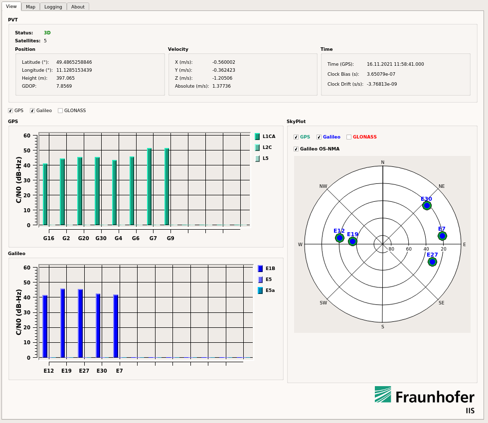
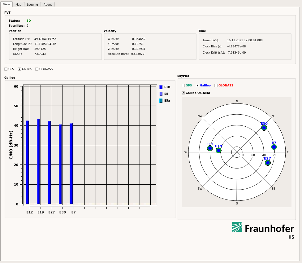
    The screenshots below show snapshots of the Goose user interface with enabled OSNMA and successfully authenticated satellites, indicated by the green circle surrounding the blue Galileo satellites in the skyplot.

    GPS + Galileo authenticated Galileo PVT. (Image: Fraunhofer IIS)
    GPS + Galileo authenticated Galileo PVT. (Image: Fraunhofer IIS)


    Galileo-only authenticated PVT. (Image: Fraunhofer IIS)
    Galileo-only authenticated PVT. (Image: Fraunhofer IIS)

    Access Now Available

    Interested users can sign up for this OSNMA test phase on GSC website. The site provides access to all corresponding documents and information, including the current ICD, receiver guidelines, OSNMA public key and Merkle Tree Root — both needed for the authentication process.

    To learn about using GOOSE for your own tests and projects, contact [email protected].

  • Unmanned and AI: Indy Challenge takes autonomous to big track

    Unmanned and AI: Indy Challenge takes autonomous to big track

    When I saw that there was a plan for a whole bunch of unmanned, semi-autonomous racecars to compete at the Indianapolis Motor Speedway (Indy, or IMS) racetrack, I initially thought we might be headed to one significant mess of broken-up machines and potentially a lot of damage. I tracked the various announcements of the competition as things progressed, especially when a prize of $1 million dollars was put up by the Lilly Endowment in Indianapolis, and the majority of the field appeared to be potentially staffed by undergrad university teams.

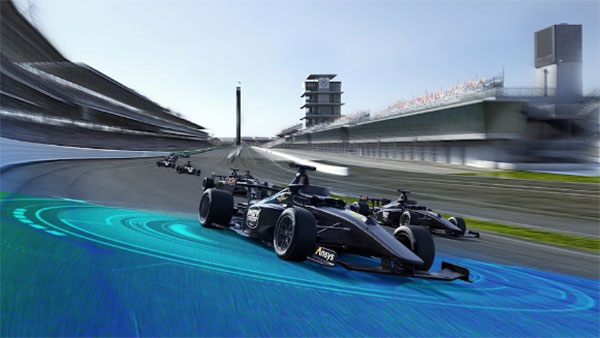
    Photo: Indy Autonomous Challenge
    Photo: Indy Autonomous Challenge

    However, this isn’t the first time we’ve had unmanned, autonomous road vehicles in competition — we’ve seen highly instrumented SUVs in desert settings in Nevada and California, initially with pretty poor results, which began to improve significantly for the second time round, then vehicles in some simulated street settings with some mixed and also some pretty good results.

    So, as the competition date grew closer for the Indy Autonomous Challenge (IAC), the number of published progress reports began to increase, and we began to better understand how the initial 40 teams might take on this seemingly impossible task — how on Earth will they replicate a regular Indy (also a class of racecar) race? Surely many unmanned racecars on the same track at the same time doing more than 150 mph would be catastrophic!

    When you take a look, however, at the advances we’ve seen, which have enabled unmanned cars, trucks, taxis and such – surely this tech could stretch to meet these major objectives? But Dallara AV-21 Indy Light racecars avoiding hurtling walls passing by, cornering, getting in and out of the pits, coping with vehicles behind, ahead and overtaking — even a superior-equipped unmanned racecar at >150 mph — well that’s something we would really need to see.

    Then you have to take a look at the outfits involved, providing support to the IAC teams – companies including Cisco, and motor sport units such as ADLINK, Ansys, Aptiv, Bridgestone, Luminar, Microsoft and Valvoline and the non-profit Energy Systems Network. The University teams from around the world themselves appeared to also have significant heritage and skill-levels.

    As the 40 University teams started the long trek to get over the hurdles that this challenge presented, members from 21 of those institutions were actually able to make it to Indy, grouped into nine “national” teams. By October 23 the nine teams, with only one car each, were ready to test their autonomous vehicles on the actual track.

    Clemson University established the baseline Dallara AV-21 vehicle and technology to be used by each team for the race, with sensors monitoring chassis motion, suspension, tires and powertrain. Each team would install its own guidance and avoidance system, with each vehicle equipped with six cameras, four lidars, RTK GNSS, associated radios and bags of computing running each team’s customized control system software. The object being for cars to exit pit-lane, accelerate, brake, establish an optimum line for each corner and flat, avoid obstacles, evaluate the track conditions and establish tolerable limits.

    The teams were required to complete several stages of selection, from submission of initial proposals through demonstration of existing vehicle automation capability, simulated race performance, qualification testing at the Indy track — all leading to an anticipated head-to head race against the other qualifiers.

    Then 20 days of planned testing stretched to 50, and three months of preparation passed with students working intensely throughout, curing the glitches, experimenting with how to increase lap speed, and pushing the limits while still keeping the cars intact.

    Energy Systems Network managed the rules of the final competition in a way that reflected Indy qualification days prior the main race — they judged that the technology was not yet at a stage where multiple cars on the track at the same time would have been such a good idea. So, each car was to individually run a number of practice/qualification laps and the quickest car would be the winner.

    During the first stage of live competition, cars were required to exit the pits and run a warmup lap, followed by two laps that were timed and a slow-down lap that required navigating around inflatable barriers on the front-stretch, and then return successfully back around the track into their pit-stop locations. There were several spins in the corners and several crashes, but the four surviving cars/teams were able to optimistically post speeds of more than 130 mph.

    The winning Technical University of Munich team. (Photo: Indy Autonomous Challenge)
    Photo: Indy Autonomous Challenge

    The final phase involved the four teams taking their cars around a number of warm-up/practice laps, followed by four timed laps. Only the car from Germany’s Technical University of Munich was able to complete all laps with an average speed of ~136 mph, so that team ultimately won the $1 million prize. Even so, all teams were able to successfully mature their systems’ performance through the many months leading up to the IAC and their progress through the various qualification stages. Even the other three final qualifiers had much to celebrate as a result of the competition.

    The sponsors supporting the various teams as they progressed through the Challenge may have spent more than $120 million, so that high-pressure development work will be invested back into many vehicle automation opportunities. After all, that was the main objective for the whole undertaking. We should hopefully begin to see safer, more capable self-driving vehicles emerge in the months to come as the technology is applied to more production vehicle automation.

    Tony Murfin
    GNSS Aerospace

  • U.S. Space Force contracts Lockheed Martin for 3 more GPS IIIF satellites

    U.S. Space Force contracts Lockheed Martin for 3 more GPS IIIF satellites

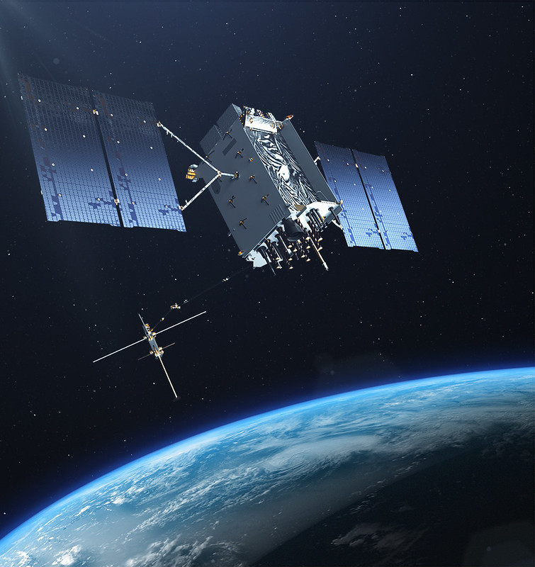
    The U.S. Space Force exercised its second contract option valued at approximately $737 million for the procurement of three additional GPS III Follow On (GPS IIIF) space vehicles (SVs) from Lockheed Martin on Oct. 22, 2021. This contract option is for GPS IIIF satellites 15, 16 and 17 (SV15-17).

    GPS IIIF satellites build off the innovative design of Lockheed Martin’s next generation GPS III satellites (SV 01-10), which provide three times greater accuracy, up to eight times improved anti-jamming capability and increased resiliency, in addition to modernization, compared to legacy GPS satellites in today’s constellation. GPS III also adds a new L1C civil signal that is compatible with other global navigation satellite systems, such as Galileo.

    “GPS IIIF satellites will add new capabilities and advanced technology to the GPS constellation, including Regional Military Protection (RMP); an upgraded Nuclear Detection Detonation System (NDS) payload; a safety-improving Search and Rescue payload; and an accuracy-enhancing Laser Retroreflector Array (LRA),” said Dave Hatch, Lockheed Martin’s GPS IIIF program management director. “The RMP capability further reinforces GPS III/IIIF as a warfighting system, providing up to 60x greater anti-jamming for our warfighters operating in contested environments.”

    GPS III/IIIF support a Space Force effort to modernize the current GPS satellite constellation.

    The GPS IIIF SV11-12 satellites were included in the original September 2018 GPS IIIF contract award to Lockheed Martin to build up to 22 GPS IIIF satellites. Under that contract, the government exercised the first GPS IIIF production option for SV13-14 in October 2020.

    GPS IIIF SV13 and beyond will incorporate the company’s LM2100 Combat Bus, an enhanced space vehicle that provides even greater resiliency and cyber-hardening against growing threats, as well as improved spacecraft power, propulsion and electronics. This evolved bus incorporates many common components and procedures to streamline manufacturing. LM2100 Combat Bus vehicles are also capable of hosting Lockheed Martin’s Augmentation System Port Interface (ASPIN), which would allow for future on-orbit servicing and upgrade opportunities.

    Today Lockheed Martin is close to finishing production on the original GPS III SV1-10 contract. GPS III SV01-05 have been launched and handed over to the Space Force for on-orbit operations. GPS III SV06-08 have been completed and placed in storage at the company’s facility waiting for the Space Force to call them up for launch. SV09 is a fully integrated space vehicle now going through final testing.

    On October 26, 2021, the final GPS III satellite of the original GPS III contract – GPS III SV10 – completed an operation known as “core mate” to assemble it into a full space vehicle at Lockheed Martin’s GPS III Processing Facility. It will proceed into the vehicle testing campaign before year-end.

  • Analog Devices honored with Electronics Industry 2021 Awards

    Analog Devices, Inc. (ADI) recently received four Electronics Industry 2021 Awards presented by Datateam Business Media. The awards honor the best professionals, products, projects, and companies across the electronics sector. ADI received awards in the following categories: environmental leadership, excellence in innovation  (for the ADAR3000 beam forming integrated circuit), aerospace/military/defense product of the year, and embedded solution product of the year (for the MAX78000 artificial intelligence microcontroller). It also received the “Highly Commended” distinction in the Internet of Things product of the year category.

    Established in 2018, the Electronics Industry Awards annually recognize the best people, products, and business practices at the forefront of innovation. The awards winners are determined by a 50/50 weighted decision from an industry vote and a panel of expert judges to ensure the winners are selected for technical expertise and outstanding reputations.

  • Handheld launches new version of its ultra-rugged PDA, the NAUTIZ X9

    Handheld launches new version of its ultra-rugged PDA, the NAUTIZ X9

    Handheld Group, a manufacturer of rugged mobile computers, has announced a new version of its NAUTIZ X9 PDA: an ultra-rugged enterprise handheld built for fieldwork in the most challenging outdoor and industrial environments.

    With an upgraded platform, the Nautiz X9 Android rugged handheld runs Android 11 and is Android Enterprise Recommended (AER). The device, which has a sturdy magnesium casing, is targeted for mobile computing and data collection in industrial and field applications.

    The Nautiz X9 ultra-rugged PDA offers:

    • MIL-STD 810G ruggedness for drops, vibrations, humidity, and broad operating temperature
    • IP67 rating for waterproof, dust-tight performance
    • a sunlight-readable 5-inch multi-touch display with glove and rain mode
    • a high speed 8-core MediaTek processor with 3 GB RAM and 32 GB storage
    • the Android 11 operating system with GMS
    • 4G/LTE, dual band 802.11 a/b/g/n/ac wireless LAN, low-energy 5.0 BT and NFC
    • built-in GPS/GLONASS/Galileo capabilities as standard
    • dual cameras including 13-megapixel rear-facing, and 5-megapixel front-facing
    • optional high-quality, high-speed 2D imager
    • multiple enterprise-focused accessories
    • maxGo software to quickly apply custom settings to larger deployments

    The new version of the Nautiz X9 is expected to start shipping this month.

  • Honeywell launches new resilient navigation systems

    Honeywell launches new resilient navigation systems

    Photo: Honeywell
    Photo: Honeywell

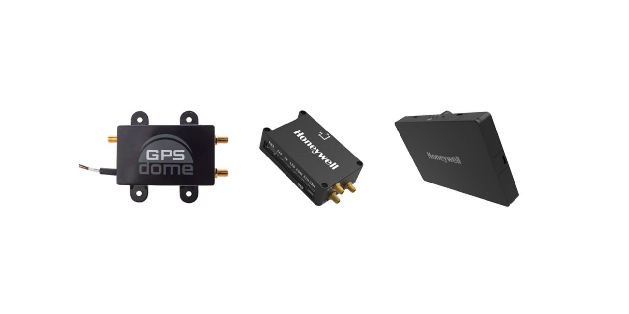
    Honeywell has launched two new resilient navigation systems: the Honeywell Compact Inertial Navigation System and Honeywell Radar Velocity System. These systems, jointly with GPSdome, an anti-jamming system developed by Honeywell’s partner InfiniDome, are designed for commercial and military customers needing reliable navigation solutions that are small and light and have a low power consumption.

    The systems will provide multiple layers of protection that allow continued operations even in GNSS-challenged or denied environments.

    Honeywell’s philosophy of resilient navigation revolves around multiple layers of resiliency achieved by a combination of GNSS anti-jamming, inertial navigation and alternative navigation systems.

    The GPSdome is a small add-on device that provides the first layer of protection against GNSS jamming attempts, ensuring continuity of operation during low-power jamming conditions and the ability to achieve the crucial first GPS lock even in GPS-challenged environments. The device is compatible with any off-the-shelf GNSS receiver and antenna. Honeywell signed a collaboration agreement with infiniDome in August to jointly develop and deliver GPS signal protection systems.

    The new Honeywell Compact Inertial Navigation System is about the size of a deck of cards and uses tactical-grade inertial sensors to provide accurate position information to commercial and military customers. This second layer of resiliency provides the ability to navigate during shorter GNSS outages. This is especially useful in urban canyons where GNSS availability is intermittent or in strong jamming environments where anti-jamming systems are not enough.

  • Australian professor Peter Teunissen recognized as first in two research fields

    Australian professor Peter Teunissen recognized as first in two research fields

    Peter Teunissen
    Peter Teunissen

    Peter Teunissen, senior professor at Curtin University, was named as Australia’s top researcher in two fields — geophysics and radar, positioning and navigation — by The Australian’s 2021 Research Magazine.” Teunissen, who has seen the field of satellite technology expand at a phenomenal rate over the past few decades, said that dependence on GNSS has penetrated all levels of society. “The timing systems we are using for computers, the synchronization of timing – that’s all linked to GNSS,” he says. “All those satellites are equipped with the most accurate atomic clocks. We are all now dependent on those GNSS systems.”

    Teunissen moved to Australia more than a decade ago from The Netherlands and was awarded an Australian Research Council Federation Fellowship. He specializes in interferometric GNSS, the use of satellite signals for the high precision measurement of the parameters of water and land masses; has been associated with Curtin University since 2009; and is now an award-winning and internationally-recognized expert in the field of satellite technology.

    “Cubesat” mini-satellites increasingly deployed by universities and corporations have also caught Teunissen’s attention, who calls them “the future for increasing the number of satellites and constellations.”