DJI Mavic 3 has better sensor, dual-camera system, omnidirectional obstacle sensing, smarter flight modes and longer flight times
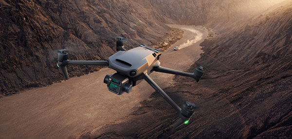
Mavic 3 drone. (Image: DJI)
The new DJI Mavic 3 is an update of the company’s folding camera drone, providing comprehensive improvement and boosting performance for aerial photography.
The Mavic 3 has improved navigation and obstacle sensing systems. A powerful positioning algorithm improves hovering precision with signals from GPS, GLONASS and BeiDou satellites. This enables Mavic 3 to lock onto multiple satellite signals faster. The increased positioning precision also makes the drone less likely to drift in the air and more stable when shooting long exposures and time lapses.
For its obstacle sensing system, Advanced Pilot Assistance System (APAS) 5.0 combines inputs from six fish-eye vision sensors and two wide-angle sensors, which seamlessly and continuously sense obstacles in all directions and plan safe flight routes to avoid them, even in complicated environments.
The obstacle-sensing system also enables more intuitive subject tracking with the upgraded ActiveTrack 5.0. Previous iterations of ActiveTrack enabled the camera to follow a subject as it moved directly toward and away from the drone while remaining largely stationary as well as fly alongside a moving subject. ActiveTrack 5.0 allows Mavic 3 to move with the subject as it moves forward, backward, left, right and diagonally, and fly alongside as well as around a moving subject.
If the subject moves too fast and temporarily goes out of frame, visual sensors on the aircraft will continue to track and frame the subject intelligently and pick it back up when it reappears. These new directions enable much more fluid and diverse drone and camera movement while using ActiveTrack.
Other safety features include geofencing, which alerts drone pilots when they fly near sensitive locations; altitude limits to ensure pilots are aware of altitude restrictions; and the AeroScope Remote ID system that allows authorities to identify and monitor airborne drones in sensitive locations.
Mavic 3’s integrated AirSense system, first widely introduced in DJI Air 2S, warns drone pilots of nearby airplanes and helicopters transmitting ADS-B signals, so they can quickly fly to a safer location.
Hasselblad camera
Mavic 3 has a 4/3 CMOS Hasselblad camera and 28x hybrid zoom camera. Omnidirectional obstacle sensors have a 200-meter range, and redesigned batteries provide up to 46 minutes of flight time.
Upgraded hardware and software can process 5.1K video at 50 frames per second and support 4K/120 fps for high-quality results for slow-motion footage. An enhanced Mavic 3 Cine edition offers Apple ProRes 422 HQ encoding for richer video processing, with an internal 1TB SSD onboard for high-speed data storage.
DJI Mavic 3’s customized L2D-20c aerial camera embeds a professional-grade 4/3 CMOS sensor with a 24 mm prime lens in a sleek and compact form. Rigorous Hasselblad standards for hardware performance and software algorithms allow it to shoot 20-MP still images in 12-bit RAW format and videos in 5.1 K at 50 fps and 4 K at 120 fps. The higher video definition creates smoother footage and more generous cropping possibilities and allows for slow-motion video at 120 fps.
The larger image sensor gives Mavic 3 higher video resolution and dynamic range and more effectively suppresses noise in low-light environments. A native dynamic range of 12.8 stops helps retain more details in highlights and shadows, preserving rich visual information with a greater sense of depth and elevating imagery to a professional level. An adjustable aperture of f/2.8-f/11 is available to meet the needs of aerial photographers in a wide variety of lighting scenarios to get sharper and clearer images.
“What’s new with GPS?” people often ask me when I tell them my job. Recently, I have been responding by telling them about the other three GNSS constellations now fully available. However, as reflected every month in these pages, that is but one of many developments that combine to make satellite navigation ever more accurate, reliable and ubiquitous.
While the GPS program is old by the standards of the digital age, it has never been static. In the 1970s, when GPS was developed, the expected accuracy for civilians was tens of meters, though pioneering commercial users began right away to chip away at the system’s limitations by developing differential GPS (DGPS), carrier-phase positioning, and other techniques. By the end of the next decade, better signal processing and the implementation of DGPS had brought civilian accuracy to about one meter. In the 1990s, phase-ambiguity resolution made real-time centimeter accuracy standard for surveyors.
As the adoption of cell phones exploded, it became imperative to locate them to preserve the 911 system. Initially, this was done using the time-of-arrival of signals to handsets from towers, because it was assumed that GPS receivers could not be made sufficiently small, cheap, fast, power-efficient and accurate to work in cell phones. The implementation of assisted GPS, now standard in all smartphones, largely solved those problems.
Precision for civil GPS users increased by an order of magnitude in May 2000, when President Clinton ordered the removal of Selective Availability, and substantially once enough satellites began to broadcast the L2 civil (L2C) code, enabling ionospheric corrections. Later, the modernized signals in the L5 band enabled sub-meter accuracy without augmentations and very long-range operations with augmentations. There are now more than 80 signals in that band, on GPS, Galileo and BeiDou satellites. On the military side, the effort to deploy M-code signals, cards and receivers continues.
Over the years, in addition to modernized satellites and signals, improvements have included the development of PPP, RTK and hybrid techniques; the proliferation of local, regional and global correction services; improved jamming and spoofing detection; and the increasing integration of GNSS receivers with other RF receivers as well as with inertial, optical, radar, lidar and other sensors.
Future improvements may include:
signal authentication
commercial systems in low Earth orbit that would have a signal strength on the surface three orders of magnitude greater than current GNSS, greatly boosting indoor reception and protection from jamming
inertially aided extended coherent integration, a.k.a. “supercorrelation,” which makes moving GNSS receivers more sensitive to signals they receive directly than to reflected ones
3D-mapping-aided GNSS, which enhances the positioning algorithms by identifying non-line-of-sight signals; this is being pioneered by Google in nearly 4,000 cities, relying on its 3D city models and machine learning.
The moment I send this month’s issue to the printer, I will think of more past and future improvements. As soon as you receive it, many of you will think of yet more. What’s new with GPS? A lot.
ADVA has introduced its OSA 5400 SyncModule embedded timing solution, designed to enable technology suppliers to integrate precise synchronization into their hardware. Its M.2 form factor can add crucial timing capabilities to switches, routers, open compute servers and other IT devices.
The OSA 5400 SyncModule provides GNSS, precision time protocol (PTP) and network time protocol (NTP) engines as well as comprehensive PTP and GNSS monitoring and assurance functionality. According to ADVA, the module can enable assured sub-microsecond timing in public and private networks as well as critical infrastructure.
“Our OSA 5400 SyncModule brings something completely new and very valuable to the market,” said Gil Biran, general manager, Oscilloquartz, ADVA. “For the first time, third-party technology manufacturers will be able to embed the most advanced synchronization capabilities into their designs and easily control them with our Ensemble Sync Director or their own management system.”
Featuring multiple interface options for easy integration, the OSA 5400 SyncModule comes with an open API. It can also be managed by ADVA’s proven Ensemble Sync Director management system.
Though marvelous, GNSS are also highly vulnerable. eLoran, which has no common failure modes with GNSS, could provide continuity of essential timing and navigation services in a crisis.
GPS fits Arthur C. Clarke’s famous third law: “Any sufficiently advanced technology is indistinguishable from magic.” Yet, it also has several well-known vulnerabilities — including unintentional and intentional RF interference (the latter known as jamming), spoofing, solar flares, the accidental destruction of satellites by space debris and their intentional destruction in an act of war, system anomalies and failures, and problems with satellite launches and the ground segment.
Over the past two decades, many reports have been written on these vulnerabilities, and calls have been made to fund and develop complementary positioning, navigation and timing (PNT) systems. In recent years, as vast sectors of our economy and many of our daily activities have become dependent on GNSS, these calls have intensified.
A key component of any continent-wide complementary PNT would be a low-frequency, very high power, ground-based system, because it does not have any common failure modes with GNSS, which are high-frequency, very low power and space-based. Such a system already exists, in principle: it is Loran, which was the international PNT gold standard for almost 50 years prior to GPS becoming operational in 1995. At that point, Loran-C was scheduled for termination at the end of 2000.
However, beginning in 1997, Congress provided more than $160M to convert the U.S. portion of the North American Loran-C service to enhanced Loran (eLoran). In 2010, when the U.S. Loran-C service ended, its modernized and upgraded successor was almost completely built out in the continental United States and Alaska. During the following five years, Canada, Japan, and European countries followed the United States’ lead in terminating their Loran-C programs.
Today, however, eLoran is one of several PNT systems proposed as a backup for GPS.
The National Timing Resilience and Security Act of 2018 required the Secretary of the U.S. Department of Transportation (DOT) to “provide for the establishment, sustainment, and operation of a land-based, resilient, and reliable alternative timing system” as a backup to GPS. In January 2020, the DOT awarded contracts to 11 companies to demonstrate their technologies’ ability to act as a backup for GPS. Of these companies, two were working on eLoran projects.
Technical advisers to the federal PNT Executive Committee have been advocating and recommending that the government implement eLoran for the past 11 years. Yet, while the U.S. government announced in 2008, and again in 2015, its intention to build an eLoran system, it has not done so yet.
Not Your Grandfather’s Loran
In the 1980s, I used Loran-C to navigate on sailing trips off the U.S. East Coast. It had an accuracy of a few hundred feet and required interpreting blue, magenta, black and green lines that were overprinted on nautical charts. The system was a modernized version, launched in 1958, of a radio navigation system first deployed for U.S. ship convoys crossing the Atlantic during World War II. Its repeatability was greater than its accuracy: lobster trappers could rely on it to return to the same spots where they had been successful before, though they may have had some offset from the actual latitude and longitude.
By contrast, eLoran has an accuracy of better than 20 meters, and in many cases, better than 10 meters. It was developed by the U.S. and British governments, in collaboration with various industry and academic groups, to provide coverage over extremely wide areas using a part of the RF spectrum protected worldwide. Unlike GNSS, eLoran can penetrate to some degree indoors, under very thick canopy, underwater and underground, and it is exceptionally hard to disrupt, jam or spoof.
Unlike Loran-C, eLoran is synchronized to UTC and includes one or more data channels for low-rate data messaging, added integrity, differential corrections, navigation messages, and other communications. Additionally, modern Loran receivers allow users to mix and match signals from all eLoran transmitters and GNSS satellites in view.
Finally, eLoran can be used for integrity monitoring of GPS — and vice versa. “Think of a resiliency triad, consisting of GNSS (global), eLoran (continental), and an inertial measurement unit, a precise clock, or a fiber connection,” said Charles A. Schue, CEO of UrsaNav. “It is extremely difficult to jam or spoof all three sources at the same time, in the same direction, and to the same amount.”
For the eLoran system to cover the contiguous United States, between four and six transmission sites could provide overlapping timing coverage, and 18 transmission sites could provide overlapping positioning and navigation.
U.S. Developments
The INVEST in America Act authorizes $157 million for the Department of Homeland Security to conduct research in five separate areas, one of which is positioning, navigation and timing resiliency; however, none of this money is for eLoran per se. The regular DOT appropriation for next year has $17 million for PNT-related research, $10 million of which is for “GPS Backup/Complementary PNT Technologies Research.” However, neither of these bills has yet been finalized, let alone passed into law, so they may change.
“These are very complex systems, with five- to seven-year sales cycles,” pointed out Schue, “and the process is even slower now due to the pandemic. With adequate funding, eLoran signals could start becoming available in the contiguous United States within a year of a service contract being signed. We should recall that GPS — as, indeed all of the GNSS — was brought online gradually as satellites were developed and launched into space. There should be no expectation that any other nationwide system would be available at the flip of a switch instead of through gradual implementation.”
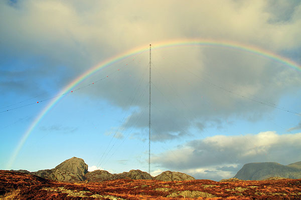
the former Loran-C transmission antenna at Værlandet, Norway. (Photo: UrsaNav)
International Developments
Loran-C and eLoran operate internationally. Saudi Arabia, China and Russia continue to operate Loran-C or Chayka systems. In October 2020, a Chinese paper described how the nation is expanding Loran to its west to cover the whole country to protect itself from disruptions of space-based services. A previously published report made it clear that they are upgrading or have upgraded from Loran-C to eLoran. South Korea has an ongoing project to upgrade its Loran-C to eLoran. It also seems the project will ensure that the South Korean system will be useable on its own, even if the Russian and Chinese systems with which it normally cooperates are not available for some reason, according to Dana Goward, president of the Resilient Navigation and Timing Foundation.
The United Kingdom is still committed to eLoran, and operates one station that has been used as an alternative time reference to GNSS. “However, as the sole station still transmitting in that area of Europe it’s of no use for positioning,” said Nunzio Gambale, CEO of Locata Corporation. “Unfortunately, the EU’s shutdown of their old Loran sites seems to have been completed, and no EU-based Loran sites remain operational. Their actions leave scant hope for Loran’s resurrection any time soon as an alternative to GNSS positioning in Europe. That’s a shame, because eLoran has beneficial PNT characteristics that other alternate technologies will struggle to replicate.”
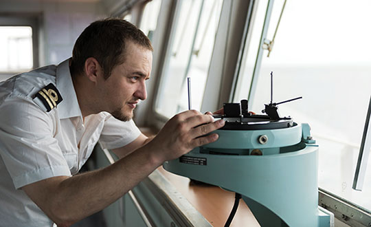
A deck officer on a ship takes a relative bearing using a pelorus. Loran-C was developed in large part for maritime navigation. (Photo: aytugaskin/iStock/Getty Images Plus/Getty Images)
Advocacy
“There is fairly good agreement across the PNT community that there is no sole solution [to GPS vulnerabilities],” Schue said. “It needs to be a system of systems.”
The PNT community, he said, is working with Congress and the administration “to move ahead with actual RFPs to start the contracting process — instead of continuing to admire the problem.” UrsaNav, NextNav, OPNT and other companies and organizations “are working together as best as we can to tell the federal government that we all believe in a system-of-systems approach and that there ought to be some tangible forward motion.”
While DOT has the lead on providing PNT resiliency, it and the departments of Defense and Homeland Security need to cooperate on this, Schue argued. “Many, if not all, of the other departments — such as Commerce, Energy, State, Interior and Agriculture — also have a stake.”
GNSS will remain for a reason. “Unless a new national terrestrial PNT system moves the game forward for many markets, it’s just far too easy to remain with the GNSS system, which is fundamentally free,” Gambale said. “That’s a really difficult price point to compete with, unless you’re delivering significant new value to the market.”
The time to act is now. “This issue has been studied to death for more than 20 years,” Goward said. “There are technologies ready to deploy. It is time for action. A failure of national PNT will be catastrophic.”
A roundup of recent products in the GNSS and inertial positioning industry from the November 2021 issue of GPS World magazine.
OEM
Simulator
Designed for desktop convenience
Photo: Orolia
The BroadSim Solo has a compact form factor designed to fit comfortably at a typical desk or workstation. It shares the same Skydel simulation engine that runs on a standard BroadSim, BroadSim Anechoic and BroadSim Wavefront. It supports advanced scenario creation features and the benefits provided by a software-defined architecture such as high dynamics, a 1000-Hz iteration update rate and ultra-low latency of 5 ms. Nearly all civilian GNSS signals can be generated through the Solo’s single RF output (one frequency band at a time), along with jamming or spoofing signals, and GPS AES M-code.
Series offers GNSS, 5G NR, and wifi-6E combination
Photo: 2J Antennas
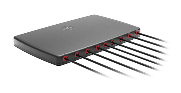
The Stellar series of antennas is designed for a large suite of devices with a focus on GNSS, sub-6 GHz, 5G NR, 4G LTE, 3G, 2G and WiFi-6E technologies. The series is suitable for law enforcement, medical transportation, fire rescue and other mission-critical applications. The series includes single or up to 9-in-1 configuration choices within the range of 617 MHz to 7125 MHz frequency bands. The patent-pending technology reduces the antenna footprint by 55% while implementing a new double trifilar design and longitudinal resonances for MIMO/ARRAY configurations that traditionally have more complex size restrictions (such as B71 band/600 MHz). Each antenna configuration uses symmetrical or asymmetrical resonators for negative sections of the antenna, resulting in maximum performance at low and mid frequencies.
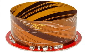
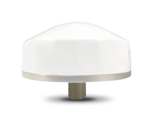
The full-band GNSS HC990E embedded helical antenna is designed for precise positioning, covering the GPS/QZSS-L1/L2/L5, QZSS-L6, GLONASS-G1/G2/G3, Galileo-E1/E5a/E5b/E6, BeiDou-B1/B2/B2a/B3, and NavIC-L5 frequency bands, including the satellite-based augmentation system (SBAS) available in the region of operation [WAAS (North America), EGNOS (Europe), MSAS (Japan), or GAGAN (India)], as well as L-band correction services. The HC990E embedded helical antenna is designed and built for high-accuracy positioning. It is packaged in a very light and compact form factor, making it suitable for a wide variety of applications, especially lightweight UAV navigation. The HC990E is 60-mm wide and 25-mm tall, weighing 12 grams. It features a precision-tuned helical element that provides an excellent axial ratio and operates without the requirement of a ground plane. The HC990E also features a low-current, low-noise amplifier (LNA) and pre-filter to prevent harmonic interference from high-amplitude signals, such as 700 MHz band LTE and other nearby in-band cellular signals.
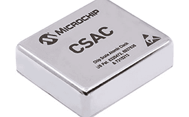
The SA65 chip-scale atomic clock (CSAC) provides precise timing accuracy and stability in extreme environments. Designed for military and industrial systems, it features ultra-high precision and low power consumption. The SA65 CSAC delivers higher performance than the previous SA.45s CSAC, including double the frequency stability over a wider temperature range and faster warm-up from cold temperatures. It has an operating temperature range of –40° C to 80° C and a storage temperature range of –55° C to 105° C. The warm-up time of two minutes at –40° C is 33% faster than that of the SA.45s. These performance improvements benefit designers of highly portable solutions for military applications such as assured positioning, navigation and timing (A-PNT) and C5ISR (command, control, communications, computers, cyber, intelligence, surveillance and reconnaissance).
Samsung Electronics is offering a new processor for wearables, the Exynos W920. The new processor integrates an LTE modem and is built with an advanced 5-nanometer (nm) extreme ultraviolet process node, offering powerful yet efficient performance demanded by next-generation wearable devices. The Exynos W920 is embedded with a GNSS L1 receiver (GPS, GLONASS, BeiDou, Galileo) for tracking speed, distance and elevation during outdoor activities. It also has a 4G LTE Cat. 4 modem. It has two Arm Cortex-A55 cores for high-performing, power-efficient processing and an Arm Mali-G68 GPU with CPU performance improved by 20% and 10 times better graphics performance than its predecessor. The Exynos W920 supports a new unified wearable platform that Samsung built jointly with Google, and will be first applied to the upcoming Galaxy Watch model.
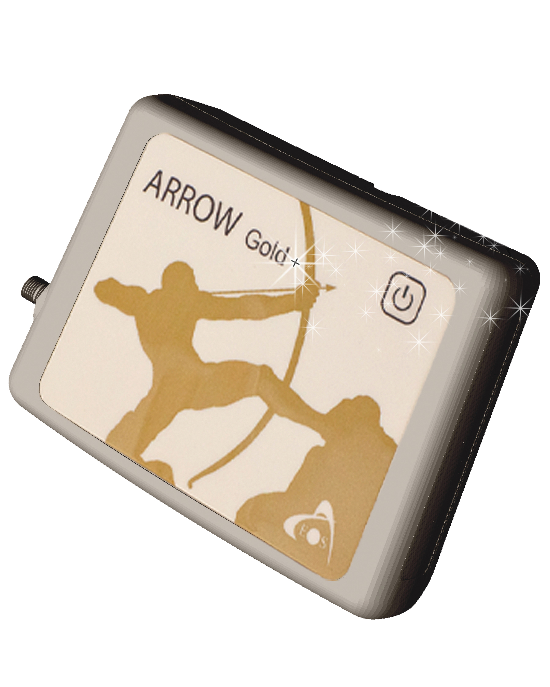
The Arrow Gold+ and Arrow 100+ expand upon the features of the Arrow Gold and Arrow 100. The Arrow Gold+ has a battery life 3.5 hours longer, for a total of 11 hours of field autonomy. It supports concurrent use of BeiDou B3 and GPS L5 signals when using RTK corrections, and the upcoming Galileo E6 High-Accuracy Service (HAS). The Arrow 100+ has a battery life 6 hours longer than the Arrow 100, for a total of 18 hours of field autonomy. It also supports Atlas H50 (Basic) service subscriptions, which provide 30-50 cm positioning accuracy worldwide when no SBAS or RTK network is available. Both the Arrow Gold+ and Arrow 100+ use Eos Bridge to connect with external sensors — multiple mobile devices can connect to a single Arrow GNSS receiver via Bluetooth.
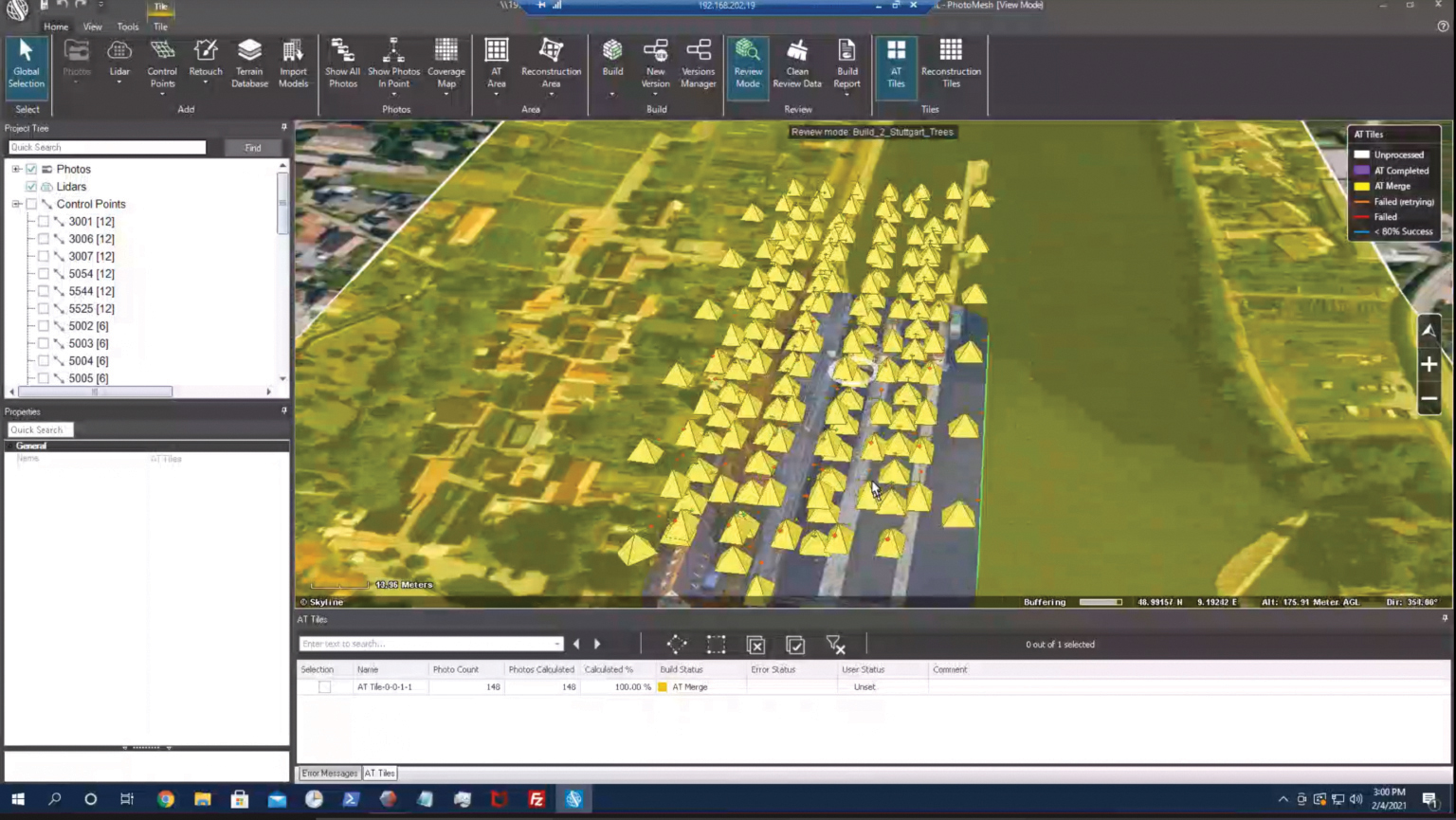
EagleView’s high-resolution ortho and oblique imagery now can be converted into 3D mesh layers with Skyline’s PhotoMesh and viewed, edited and analyzed on Skyline’s TerraExplorer platform. EagleView customers will be able to use Skyline’s TerraExplorer web-based GIS viewer and editor to see, analyze and share their imagery in an immersive environment. Accurately measuring distance, area and volume is now easier than ever, which is critical for planning and zoning to verify regulations or estimate the costs of flattening a site. With floodplain analysis, disaster management can identify flood risks before they happen, and with viewshed calculations E911 can pre-plan for high-profile events. Other key analytic features for customers include the ability to analyze shade, view contour and slope maps, and view in underground mode. The additional 3D Mesh capability is available as an add-on to any new Reveal Essentials+ Property or Neighborhood image capture.
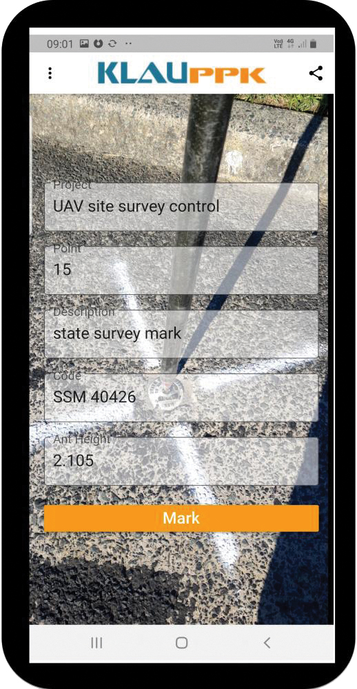
The KlauPPK Phone App, designed for use on drones with KlauPPK hardware and software, enables users to collect ground survey points with a name, description, feature code and antenna height like a traditional survey controller. The app sends the information to the operator’s computer for processing with the raw GNSS data logged in the KlauPPK unit on the pole. After post processing, the accurate survey data can be brought into CAD software to create points and line strings. The app takes a photo of the point being captured, and metadata is collected in the project. Users can place ground control points or check points, pick up as-built data like roads and utilities, and perform basic surveying. The system is compatible with the hybrid PPP/PPK MakeItAccurate post-processing service.
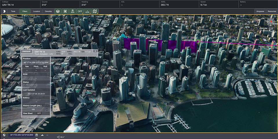
TerraLens 9.3 is a real-time software development toolkit for geospatial visualization. This release improves performance for 3D visualization for large viewports and multi-domain visualization features for command-and-control applications. It is significantly faster to enhance situational awareness. With increased multithreading in its map handling, TerraLens can load and display vector, raster and elevation formats smoothly without pre-processing, suitable for applications with disk size constraints or customers with a short turn-around time. A pre-processing option is still included. Improved data culling ensures only visible items will be rendered — especially noticeable when displaying large numbers of dynamic tracks and objects. New tools and features including support for OGC 3D Tiles for cityscapes, and a new API to control resolution of terrain mesh. Elevation warnings can now be displayed.
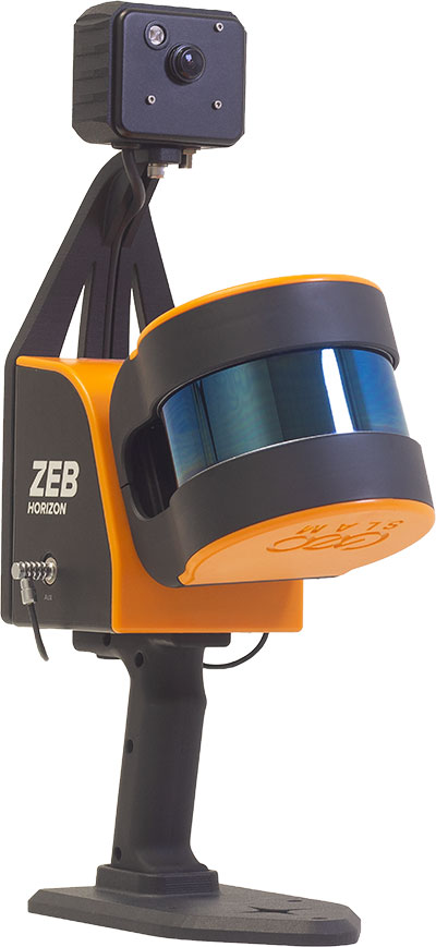
The ZEB Vision 16MP panoramic camera is now available for pre-order. Suitable for any ZEB Horizon, the new camera provides better colorization, image walkthroughs and point-cloud measurements using optional Draw software. Further updates mean GeoSLAM customers now can take a ZEB Horizon from handheld to UAV usage to get a more complete picture of projects. ZEB Horizon is compatible with the DJI Matrice 300 UAV.
A new series of automotive-grade positioning modules are operational up to 105° C (221° F). The NEO-M9L modules and the M9140-KA-DR chip are built on the u-blox M9 GNSS platform and use dead-reckoning techniques to provide accurate position data when satellite signals are compromised or unavailable. The NEO-M9L-20A and NEO-M9L-01A modules, as well as the M9140-KA-DR chip, are specially designed for first-mount automotive solutions. The NEO-M9L-01A variant offers an extended operational temperature range up to 105° C, making it suitable for integration on the roof, behind the windscreen, or inside hot electronics control units. Applications include integrated navigation systems such as in-vehicle infotainment (IVI) and head units, integrated telematics control units and V2X.
Provides positioning accuracy in tunnels, parking garages
Photo: SkyTraq
The PX1120D GNSS/inertial measurement unit (IMU) is suitable for both automotive pre-installation and aftermarket. The robust dead-reckoning module integrates a six-axis IMU and a concurrent quad-GNSS chipset. It receives signals from GPS, GLONASS, Galileo and BeiDou, as well as QZSS. The sensor-fusion module maximizes positioning accuracy in challenging environments, providing continuous navigation in tunnels and underground parking lots. For automotive pre-installation applications where vehicle wheel-tick signals are available, the PX1120D provides wheel-tick sensor fusion with automotive dead-reckoning. In aftermarket applications where wheel-tick signals are unavailable, the PX1120D provides an untethered dead-reckoning sensor-fusion solution. A single PX1120D module provides both automotive and untethered dead-reckoning functionality, simplifying logistics. It is suitable for infotainment systems, telematics control units, vehicle tracking, and advanced driver-assistance systems.
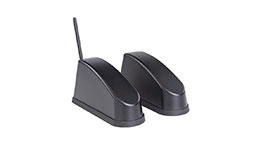
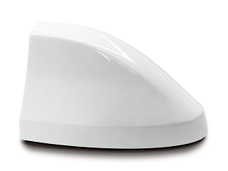
The Trooper Max 5G FR1 antenna platform is a 5G configurable and low-profile antenna platform for intelligent transportation and public safety applications. Configurable and optimized for multiband applications, the platform includes an option to add land mobile radio connectivity through an external whip port. With a slender shark-fin form factor, the Trooper Max is recommended for installation on public safety fleets. It is compatible with cellular routers supporting 600-MHz to 6-GHz frequencies. It also covers Wi-Fi 6 frequency ranges.
Version 7.9 of the CompassTrac fleet and asset management solution provides winter fleets with more detailed spreader controller information and greater insight through enhanced dashboard and reporting functions. Features include integration of numerous spreader controllers for granular, pre-wet and liquid materials; a snow-fighting dashboard consolidating key performance indicators; and a snow materials report that delivers historical reporting of granular, pre-wet and direct liquid material application rates and totals, including air and road temperature (where available). The fleet-management solution integrates GNSS, GIS and wireless networks, enabling end users to view the real-time locations and status of vehicles, people, and other high-value assets for full situational awareness.
New departure scheduling charts route, wind, tides
Photo: Savvy Navvy
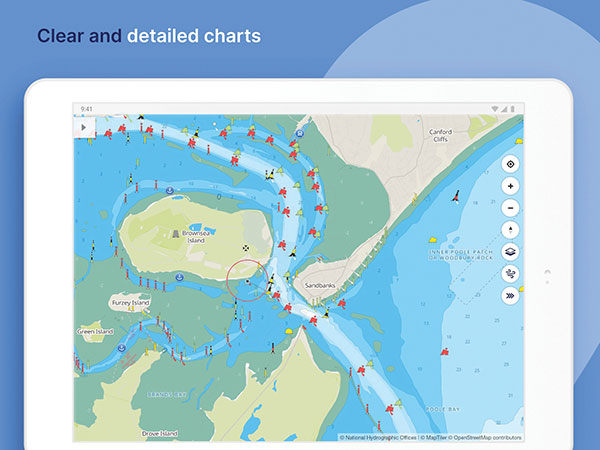
Smartphone app Savvy Navvy now allows boaters to plan better by visually showing the best time to depart given wind and tidal implications, leading to more informed and cost-saving decisions for journeys. By comparing passage times, as well as weather and tide information, boaters can immediately make crucial decisions based on safety, comfort, time and cost. Savvy Navvy is available on Android, iOS, PC and Mac and can be used on an unlimited number of devices simultaneously. It charts, weather, tide, marina details and passage planning with full tidal vectors. Active GPS tracking shows vessel position and enables boaters to instantly check course over ground (COG) and speed over ground (SOG). The app uses UKHO, NOAA and other official hydrographic charts from around the globe, as well as tide data from 8,000 tidal stations.
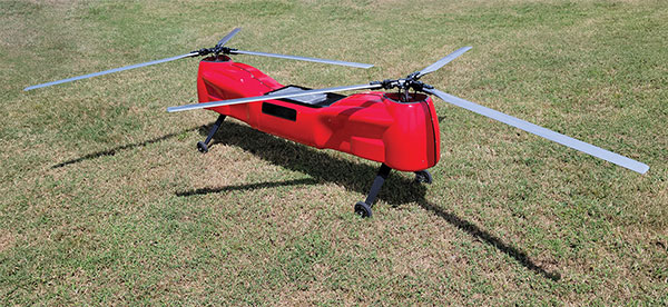
The Anzen EG-1250 provides a heavy lift, multi-drop, long endurance and flexible platform, expanding the services and operational support offerings from UAS Global Services. With an endurance of six hours, the EG-1250 can carry 75 pounds, cruise at 65 knots, in any weather day or night. The EG stands for an electric and gas dual-engine configuration, with the secondary engine able to power the aircraft or act as a power boost for the primary Skypower rotary SP-180 SRE engine. The Anzen EG-1250 is auto-rotation capable and offers an optional safety parachute system. The flexible platform can support industries such as maritime, agriculture, oil and gas, utility, cargo delivery and intelligence, surveillance and reconnaissance (ISR).
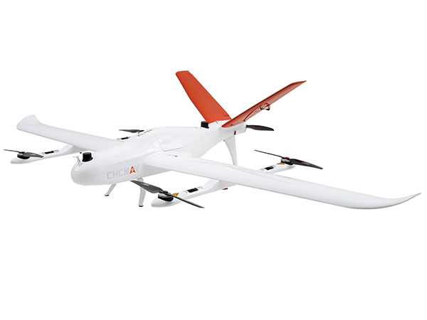
The P330 Pro is a high-performance vertical takeoff and landing (VTOL) fixed-wing UAS for aerial surveying and mapping. It provides high accuracy, long endurance and multiple payloads. It features a 100-Hz differential module, which allows aerial mapping operations at the centimeter level, and a flight endurance with payload reaching more than 150 minutes. The P330 Pro can be used to conduct small- and large-scale aerial surveys with extreme data quality, and is an alternative to manned aircraft for surveying and mapping, mining, construction and infrastructure, environmental monitoring and agriculture.
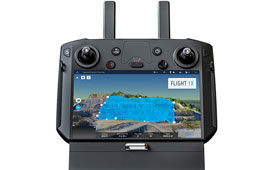
Capability expansion enables M300 for data capture
Photo: Skycatch
Flight1x software now provides data-capture capabilities for the DJI Matrice 300. The Skycatch High Precision Package provides mining operations with cloud or edge-based data processing that enables viewing terrain in 4D, automated RTK/PPK industrial drone management, and fast edge processing with data visibility in minutes. Built on technology adopted by large mining companies, Flight1x includes purpose-built flight automation software for the M300, leveraging DJI’s L1 and P1 sensors. Flight1x is part of the Skycatch High Precision Package, which provides mining operations with cloud or edge-based data processing that enables viewing terrain in 4D, automated RTK/PPK industrial drone management, and fast edge processing with data visibility in minutes.
Offers 5G and artificial intelligence capabilities
Photo: Qualcomm
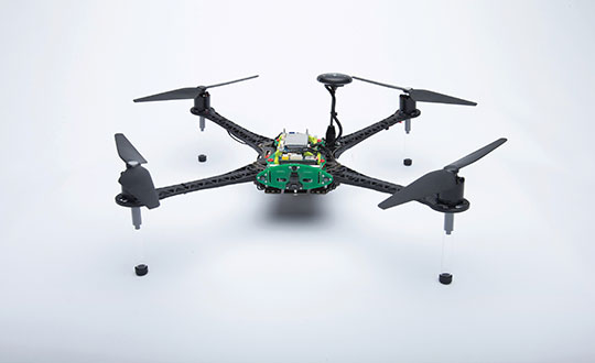
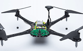
The Flight RB5 5G platform is designed to accelerate development of commercial, enterprise and industrial drones. Powered by the Qualcomm QRB5165 processor, it condenses multiple complex technologies into a tightly integrated drone system. With 5G and Wi-Fi 6 connectivity, the platform enhances critical flying abilities beyond visual line-of-sight to support safer, more reliable flight. High-performance computing provides power efficiency for artificial intelligence and machine learning, enabling fully autonomous drones. A secure processing unit supports cybersecurity protections. New camera capabilities deliver premium image capabilities and performance. The Flight RB5 5G drone reference design is available through ModalAI. Use cases include mapping, inspection, film and entertainment, defense, security and emergency response, and delivery.
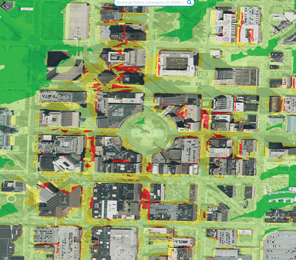
Spirent GNSS Foresight lets operators know where and when unmanned vehicles, air taxis and drones can operate safely and dependably beyond visual line of sight, especially in urban areas where buildings frequently obstruct GNSS signals. The cloud-based solution can produce forecasts using data from any of the world’s satellite constellations, and is of particular interest to the aviation, UAS and automotive industries. Spirent GNSS Foresight’s ability to accurately predict where and when autonomous systems will perform enables users to scale operations or services by expanding operational areas, reducing the number of system disengagements, and providing a greater level of safety and reliability assurance when reducing — or ultimately removing — human involvement in the driving or piloting task.
If we introduce children who have an interest in visualization of puzzles, art and mathematics to the appropriate training methods, we can help train future STEM students that could turn into our next generation of surveyors and geospatial professionals.
Many of us who were children before computers, the internet, and lots of electronic gadgets used our imagination to create fantasy worlds and environments. Many of these visions were drawn on paper using pencils, crayons and paints to recreate those images so we could share them with others. While the world in which we live, work and play exists in three dimensions, our minds were kept to a two-dimensional level because of how ideas and visions were made possible only on flat surfaces or media.
Photo: Tim Burch
Surveying has been no different through the centuries. Surveyors have generally divided their work into two categories: land boundaries and topography. Typically, the surveying process of parcel establishment and retracement has been a two-dimensional task, while topographic surveys utilize elevations to determine relief and drainage patterns. This survey information was drawn as graphic depictions on paper to provide the pertinent data to users. It has been generally impossible to express survey data, including boundaries and topography, in a three-dimensional form as the human eye sees it. Many different professions have tried to present information beyond the second dimension but with little success.
The beginning of the imagery revolution
In the 1800s, the invention of photography brought a new medium into our world by capturing images of still life onto a two-dimensional format. Photographs, when taken at a proper angle and lighting, helped establish depth to an image, but only if taken in the right context and for the correct purpose. The 1830s brought us the stereoscope, utilizing two slightly different versions of the same photograph to be viewed through a binocular device and “tricking the brain” into establishing depth within the image. This is one of the first examples of using a visual technique to teach our brain to gather 3D information based upon a 2D image or dataset.
The 1800s also brought us the “motion picture” or movie as we traditionally know it. Ranging from 16 to 24 frames per second and using varying methods to “flash” through a sequence of progressing images, the movie brought another new medium into our world. While silent films were the predominant movie type, several inventors conceived varying ways to produce movies in three dimensions. The most popular type was the stereoscope movie, but moviegoers found it too cumbersome to sit behind a stationary set of stereoscope glasses for the length of the film.
Another innovation from the 1890s was the creation of the anaglyph. This viewing style required glasses with a red lens for the left eye and a blue lens for the right eye to view two negative images that form a stereoscopic subject. These images remained popular well into the 20th century, with the concept crossing over into films.
It is one thing to see an object in real life and make a mental note of what it looks like from varying angles. It is another thing to accurate depict the same object on a two-dimensional medium that gives the viewer the same perspective of the real object. Artists who can simulate depth on an otherwise flat media with drawings and paintings are rare; one of the most famous is M.C. Escher (1898–1972), a Dutch artist known worldwide for his “impossible” drawings and sketches based upon mathematical figures. He had a gift of seeing his art in three dimensions and translating it to various mediums.
But not every drawing is an artistic interpretation. Ideas that come to fruition in an inventor’s mind often get drawn to scale on paper for sharing with others. Mechanical engineers often used a system known as isometric drafting, a method of drawing a three-dimensional item to join an isometric view, giving the shape within the drawing a sense of depth.
Toys and games as training tools
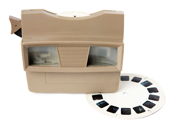
Little did we realize as children and young adults that many of the inventions for imagery led to many popular toys in our history. For instance, the View Master was invented in 1938 and widely introduced at the 1939 New York World’s Fair. This toy turned the stereoscope concept into a sightseeing treasure. In the 1960s, the photographic reels viewed within the View Master began featuring television, movie and cartoon characters in various storylines. It is estimated that more than 1.5 billion reels have been produced covering sites and subjects from every corner of Earth.
There have also been many variations on the optical illusions designed to make one see a certain image, then suddenly see something completely different. One significant entry in the illusion category is Magic Eye, a series of images based upon single-image random-dot stereograms, or autostereograms. These images utilize computer graphics to “hide” a 3D image within patterns of other shapes and trick your brain into focusing on the hidden subject. After more than 25 years and hundreds of millions of copies of its books, Magic Eye is still challenging people to “see” objects in three dimensions.
However, the biggest training device for seeing 3D objects in a 2D medium happened within the same timeframe and has no plans for slowing down any time soon: video games. The video game platform has reinvented itself several times in its short life, but the premise behind the visualization remains the same. Some of the systems allow for virtual reality glasses or goggles to enhance the user’s experience.
“Yes, in fact, my child is gifted…”
The scientific term for this visual ability is called spatial intelligence. Spatial intelligence has and attracted attention in recent years for helping determine a person’s strengths and capabilities. Spatial intelligence, also known as spatial reasoning, is one of the nine intelligences in the Theory of Multiple Intelligences proposed by psychologist Howard Gardner. In his theory, Gardner challenged the narrow definition of general intelligence with his proposal of nine types of intelligences:
spatial
linguistic
logical-mathematical
musical
kinesthetic
interpersonal
intrapersonal
naturalistic
emotional
Often, we know people who display various traits as defined within this list of intelligences. Someone with linguistical intelligence is well-spoken, enjoys reading and writing, and can explain a situation or story well. A person with logical-mathematical intelligence solves difficult computations and is a tremendous problem solver. Musical intelligence is found in one who is a “natural” at playing a musical instrument or singing. The pattern continues with the rest of the list and helps to establish strengths within one’s abilities. Most of the intelligences are born within a person, while a few can be somewhat taught. Finding the people with the strongest abilities in a given trait leads us to the highest performers.
Spatial intelligence is observed in those who like to draw, design or build things, and are quick to mentally manipulate objects to solve puzzles. David Lohman, a researcher who has spent most of his career studying the subject, defines spatial intelligence as “the ability to generate, retain, retrieve and transform well-structured visual images.” Individuals with highly developed spatial intelligence have a unique ability to view objects and imagine them in rotated positions or different angles, and how a group of items can fit together.
How important is spatial intelligence as a teachable subject?
In the past, having spatial intelligence was a naturally occurring trait. Important figures in history, including Picasso and da Vinci, are a few examples of individuals with high spatial intelligence. Clinical research, however, has determined this ability to be a skill that is actually trainable in many instances. If we introduce children who have an interest in visualization of puzzles, art and mathematics to the appropriate training methods, we can help train future STEM students that could turn into our next generation of surveyors and geospatial professionals. By employing a spatial component into lessons and challenging students through visual tasks, they begin to identify objects and other matter into geometrical patterns and spatial relationships. Students who display these spatial characteristics are better at critical thinking and problem solving, which in turn gives them more self-confidence.
Another important characteristic of spatial intelligence is that gender does not play a large role. Studies have shown that with training and a challenging curriculum, both boys and girls are prone to excel at gaining more spatial awareness and ability to solve problems. The key to maintaining this equality in spatial intelligence is to provide equal education and training for both genders in the formative years. Often, only boys are steered toward sports, math and science while girls are directed to the arts and humanities. By providing all children with the opportunity to experience spatial learning, they will begin to build skills that will help them for a lifetime.
What does spatial intelligence have to do with GNSS and surveyors?
It has everything to do with geospatial data! Literally all survey data collected these days is geospatial in nature and contains three-dimensional coordinate values. Why is the evolution of seeing 3D objects in 2D spaces so important? Not everyone can visualize these shapes immediately in two dimensions. If we are able to identify those with strong spatial intelligence levels, we can steer them into the many variations of geospatial fields and surveying.
Previously, our surveying profession dealt with data collection in small doses. A good day of topographic surveying might see a crew collect 1,000- to 2,000 points. (Not to mention the days before data collectors!) Because the area covered within the day’s work was significant, the surveyor did not have to look at a “big picture” of terrain and improvements. These smaller chunks, even though they were collected with elevations, were plotted in 2D. The contours drawn using the points were simply grade proportions between points and did not produce a 3D effect.
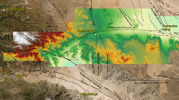
Lidar data collected in May 2021 for a study of the San Andreas Fault system. (Image: Stephanie Dudash, USGS)
Fast forward to the surveying instruments and CAD software in today’s work environment. Remote sensing through UAV-mounted, vehicle-mounted and terrestrial-based instruments collect thousands to millions of points (per second in most cases), and we get the resulting point clouds produced by these instruments. It is equally important to see the spatial relationship of the terrain, improvements and overall site conditions for both the surveyor and the CAD technician. We now have data that literally blankets the surface of the subject site, and it is up to both field staff and office staff to correctly interpret that data for the prospective client. Having surveyors and technicians with a reasonable sense of spatial intelligence gives the data a better chance of correct interpretation and depiction.
Many STEM industry experts are beginning to work with researchers on creating more educational curriculum based upon the various intelligence categories previously discussed. Spatial intelligence will continue to increase as an influencing factor in helping students decide on their career choices. Having our educational system also increase the amount of spatial relationship curriculum within their core teachings, we can help grow our potential STEM professionals and technicians for generations to come.
While many professions and occupations continue to struggle in anticipation of their future need for employees, the surveying and geospatial professions can help do something about it now. Encourage your kids to play video games, fly their drones, play sports, and solve complex problems. Playing and learning today may help them with their future profession. If not, they can enjoy themselves while they can. Don’t we all wish we were kids again some days?
“Seen & Heard” is a monthly feature of GPS World magazine, traveling the world to capture interesting and unusual news stories involving the GNSS/PNT industry.
Photo: Tesla
TESLA’S TUSSLES
Tesla has offered “full self-driving” on its cars since 2016, but most owners have never come close to experiencing a self-driving Tesla, with owners telling CNN Business that they’ve lost confidence in CEO Elon Musk’s predictions. Incidents of Teslas involved in accidents while on autopilot haven’t helped. In California in September, authorities arrested a woman for a DUI while her Tesla drove on autopilot, while in August, another Tesla on autopilot hit a parked police car in Florida. Unsurprisingly, the autopilot feature has increasingly come under scrutiny by U.S. regulators and lawmakers. Meanwhile, Musk announced a “Tesla Bot” humanoid robot prototype is coming in 2022.
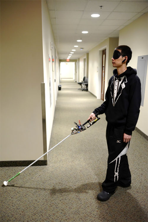
Study author Lingqiu Jin tests the robotic cane. (Photo: Cang Ye, VCU/NIH)
MANEUVERING INDOORS
A robotic cane is being developed to help the visually impaired navigate indoors. The cane is equipped with a color 3D camera, an inertial measurement sensor and an on-board computer. When paired with a building’s architectural drawing, the device can accurately guide a user to a desired location with sensory and auditory cues, while helping the user avoid obstacles such as boxes, furniture and overhangs. Its development is funded by the National Institutes of Health and other agencies. Details of the design were published in the IEEE/CAA Journal of Automatica Sinica, under lead author Cang Ye (pictured), Virginia Commonwealth University.
Photo: Monterey Bay Aquarium
MAKING TRACKS WITH SEA OTTERS
Space Shop, a 3D print shop at NASA’s Ames Research Center in California, is printing a better tracker for wildlife. The prototype is being tested on sea otters at Monterey Bay Aquarium with the help of USGS. The GPS-enabled tracker is lighter and more accurate than current trackers; it costs less and is solar powered. It withstands a salt-water environment, and the occasional chomping from a sea otter’s strong teeth.
Photo: Garmin
NIGHT VISION? NO PROBLEM
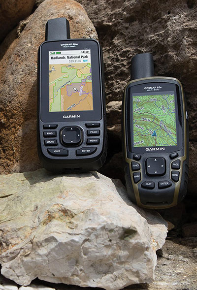
Garmin has provided India’s defense forces with two handhelds equipped to receive the country’s NavIC signals. Both multi-GNSS handhelds also are equipped with altimeters, barometers and three-axis electronic compasses. The GPSMAP 66sr model has specialized military features, including compatibility with night-vision goggles so troops don’t have to remove their goggles to use it. The Indian Space Research Organization (ISRO) has asked Garmin to integrate NavIC into all of its upcoming satellite navigation devices.
The General Lighthouse Authorities (GLA) of the United Kingdom and Ireland has named Alan Grant to the top post of its research and development team. Grant assumed his new role on Nov. 1.
As part of his duties, he heads the GLA’s research and development program, considering existing and future maritime requirements and operational strategy. GLA Research and Development (GRAD) is tasked with improving maritime safety by developing innovative and cost-effective maritime aids-to-navigation (AtoN).
GRAD projects have included all aspects of AtoN including human and machine interaction, operational life and environment. The team has deep technical expertise and experience with automatic identification systems (AIS) , the VHF Data Exchange System (VDES) , eLoran, e‑navigation, GNSS, SBAS and visual signaling.
The organization is well known for its expertise in electronic navigation aids and was an important contributor to the MarRINav project. The project effort was funded by the European Space Agency and examined what combination of electronic aids to navigation are needed to ensure uninterrupted UK shipping.
Grant joined the GLA in 2003 and has worked on a variety of systems during his time with GRAD. He led a series of successful GPS jamming trials and the development of the multi-system radionavigation receiver performance standards, from initial concept to international recognition at the IMO. He continues to support resilient positioning, navigation and timing in maritime navigation at both technical and strategic levels.
Grant is a Fellow of the Royal Institute of Navigation, where he is a member of the council and served as vice president, 2019-2021. He is also a member of the U.S. Institute of Navigation and served on the ION Council, 2013-2017.
Grant chairs the International Association of Marine Aids to Navigation and Lighthouse Authorities (IALA) radionavigation services working group and is a member of several international standards bodies. He is a chartered engineer, a chartered physicist, and author of more than 120 journal papers, magazine articles, and conference papers.
Martin Bransby, the prior GRAD leader, has taken a position with Telespazio in the UK.
Longstone Lighthouse is situated on the Outer Farne Islands on the Northumberland Coast in Northern England. (Photo: ad_foto/iStock/Getty Images Plus/Getty Images)
The European Space Agency (ESA) and National Aeronautics and Space Administration (NASA) have publicly released a globally harmonized assessment of aboveground biomass — information vital for managing global climate change.
The Multi-mission Algorithm and Analysis Platform (MAAP) provides seamless access to aboveground biomass information from both NASA and ESA Earth observation data. The open-science tool is now fully operational and accessible online.
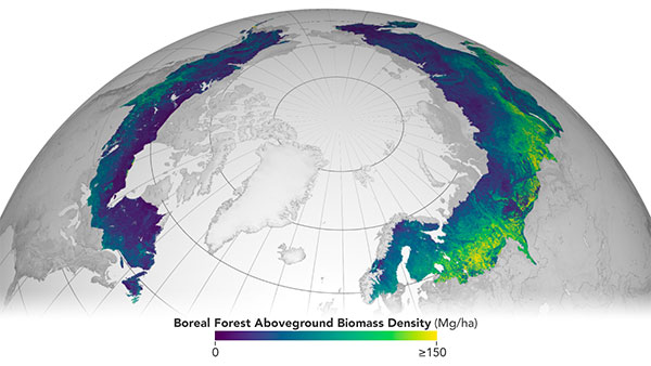
Circumboreal forest biomass density mapped at high spatial resolution (30 m) with NASA’s ICESat-2, the joint NASA/USGS Landsat-8 and ESA Copernicus Digital Elevation Model (DEM) data. This provisional product is representative of 2020 conditions and is an open-source science product created on the NASA-ESA MAAP platform that will be validated in the coming months. (Image: NASA/ESA)
MAAP is the culmination of a two-year NASA and ESA effort and reflects the cooperation between the two agencies under the NASA and ESA Joint Program and Planning Group (JPPG) Joint Working Group (WG) on Ground Segment and Operations.
The MAAP platform enables international scientists and researchers to collaboratively develop algorithms and code as well as analyze and visualize large datasets acquired from sources including satellite instruments, the International Space Station, and airborne and ground campaigns. The large data and high-performance computing required for MAAP, along with a shared code repository and catalog, are stored and managed in the cloud. MAAP capabilities are supported and shared between NASA and ESA.
“Biomass is the first ESA mission with open-source algorithms,” said Clement Albinet, ESA’s Biomass data quality manager. “Thanks to that, the community will be able to access all the source code, the test data and all the documentation, and will be able to contribute in a collaborative way to the improvement of the biomass products. MAAP will allow scientists to easily work with large datasets at a global scale and to finally focus on science.”
The initial application of MAAP focuses on aboveground biomass to help determine the size and carbon content of Earth’s forests. These data are vital for informing our understanding and forecasting of climate change, including regular updates to the Intergovernmental Panel on Climate Change (IPCC).
While biomass is the first application of MAAP, it can be adapted for collaborative exploration across the breadth of science data and scientific disciplines available through NASA, ESA and similar research agencies.
MAAP includes data from missions such as NASA’s Global Ecosystem Dynamics Investigation (GEDI) and the joint NASA/ESA AfriSAR campaign, and will eventually support data from upcoming NASA and ESA missions such as the joint NASA/Indian Space Research Organization SAR (NISAR) and ESA’s Biomass mission.
Several projects are producing continental to global biomass maps for 2020, including ESA’s Climate Change Initiative Biomass and JPSs global map, both at 100 m, as well as NASA’s GEDI 1-km map. GEDI, the Global Ecosystem Dynamics Investigation, is a spaceborne laser instrument that measures the structure of Earth’s forests in high resolution and three dimensions.
The world’s Earth observation biomass community is undertaking an exercise on MAAP aimed at resolving discrepancies between those products and producing harmonized estimates of biomass and uncertainty at a policy-relevant, jurisdictional-level scale.
Harxon is offering two new GNSS antennas for intelligent connected vehicles (ICV). ICVs are equipped with advanced sensors, controllers, actuators and other devices. They are enabled for intelligent information exchanges between the vehicle and everything (car, road, people, cloud), technology known as V2X.
The Harxon HX-AUST002. (Photo: Harxon)
The Harxon HX-AULT002. (Photo: Harxon)
The ICV antennas connect autos with GNSS, 5G, Wi-Fi, ultra-wideband and more. Both highly integrated high-performance multiband automotive antennas provide swift, reliable connectivity to meet the increasing demands of seamless communication experience for intelligent transportation system (ITS) applications.
The integrated antennas support dedicated short-range (DSRC) and cellar vehicle-to-everything (C-V2X) communication. The antennas embed a premium GNSS antenna with high gain for consistent and reliable precise positioning service. They also allow for multiple input and output of data to achieve swift internet download speed in 5G networks.
HX-AULT002. (Photo: Harxon)
The Harxon HX-AUST002 is designed to connect unmanned passenger vehicles to networks, clouds, other vehicles, and ITS roadside infrastructure.
The Harxon HX-AULT002 is designed for unmanned commercial vehicles, including short-distance delivery vehicles, mainline logistic heavy-duty trucks, and intercity shuttle buses.
The versatile antennas are suitable for integration in on-board units (OBU), intelligent roadside units, chipsets and Tier 1 automobiles.
Chronos Technology Ltd., a UK-based resilient synchronization and timing company, has transitioned to employee ownership through the Chronos Technology Employee Ownership Trust (EOT) Ltd.
Charles Curry who established Chronos Technology in September 1986 and was co-owner alongside his wife, Angela Curry, had been deliberating succession planning and their exit from the business. Various options such as a third-party sale or a management buyout were considered but quickly dismissed.
“I am aware of business owners who had exited through third-party sales and had not enjoyed the experience of working under new management for the agreed handover period,” Curry said. “New owners generally change the dynamic of the business, often introducing new staff and work practice without giving opportunity to existing staff and process, and we did not want this for Chronos.”
“Over the years we have established a work ethic that puts the customer first,” Curry continued. “The EOT protects the loyal Chronos family and ensures the customer-facing continuity of the business and, most importantly, safeguards jobs. Going forward, in the hands of the employees, the company will benefit from increased customer engagement and the commitment to a team approach to steer the business on the next phase of its journey.”
Chronos Technology specializes in resilient synchronization and timing systems, smart technologies, GNSS and cybersecurity solutions for critical national infrastructure, with industry experience gathered over 35 years in specialist technologies such as GNSS, PTP, NTP and SyncE.
The company provides GPS coverage solutions in hangars, manufacturing areas and underground, as well as smart technology solutions and GNSS jamming detection and location solutions for law enforcement. Customers include telecom, finance, energy, data centers, broadcast, aerospace, defence and security, enterprise/IT, emergency services, transport and manufacturing.
The TopAXYZ inertial navigation unit by Thales. (Image: Thales)
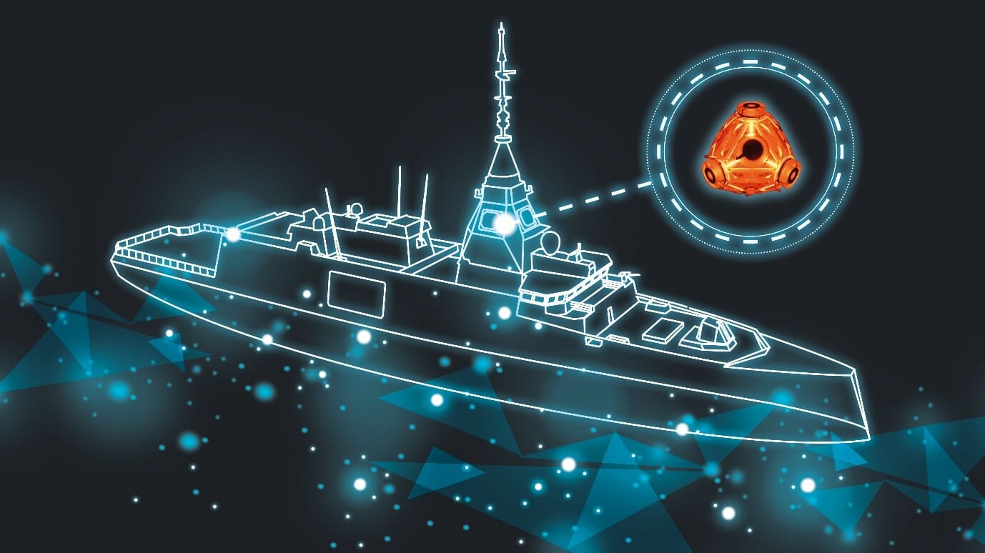
Thales and CS Group partner to offer navies a cybersecure, jam-resistant navigation system inspired by civil aviation
Thales and CS Group have partnered to offer a complete navigation system for navy surface ships. At the heart of the system is the Thales TopAxyz inertial navigation unit, which is integrated with CS Group’s real-time computer to combine high-level performance and resilience in an electronic warfare environment. The system provides high-precision pointing, gyrocompass, location and navigation functionality for all types of naval platforms, from surface combatants and submarines to autonomous vehicles.
The TopAxyz inertial navigation unit has delivered outstanding performance in the rigorous conditions of civil aviation, clocking more than 20 million hours of operation. The naval version of the unit was integrated on a French Navy vessel in less than a day by CS Group, and has already proven its operational value for maritime navigation in a sea trial.
“After proving their value on board aircraft, space launchers and French Army land vehicles, Thales inertial navigation systems are now available for naval platforms,” said Tristan Grivel, vice president business development and sales for Thales’s flight avionics business.
“CS Group has supplied real-time navigation computers, military-grade GPS receivers and other solutions to the French Navy and Naval Group for many years, explained Gilles Rigal, director of CS GROUP’s naval systems business line. “This partnership with Thales allows us to offer an innovative, robust and resilient maritime inertial navigation system for surface ships,” Rigal said.
Countering electronic warfare
In today’s constantly changing naval environment, crews need to contend with the threat of cyberattacks, electronic warfare activity and the high risk of jamming and spoofing of GPS-based radionavigation solutions. Accurate navigation data, real-time data distribution and resistance to external threats are crucial for every mission conducted by a naval vessel today.
Thales and CS Group have worked together for more than 20 years to address these issues. Drawing on their combined expertise across all the key navigation system technologies, the two companies are now proposing a new approach to maritime navigation based on more trustworthy and reliable navigation data.
The TopAxyz inertial unit uses accurate, reliable navigation information that is independent of sea state and vessel location, combined with a function that detects attempts to spoof GPS signals. The navigation data calculated by TopAxyz is distributed in real time by the NDDS (Navigation Data Distribution System) developed by CS Group’s onboard computer.
The computer uses the latest technological advances in cybersecurity, guaranteeing the best level of resilience to attacks. Its architecture offers three key advantages: safer navigation, reduced costs and integration risks, ease of use and simplified maintenance of the system. No calibration is required during the service life of the system, reducing the total cost of ownership.
The new maritime navigation system are now available, and are being manufactured at the companies’ production and integration facilities in Châtellerault and Aix-en-Provence in France.