Raven Industries, Inc., a manufacturer of driverless ag technology, showcased and demonstrated its OMNi suite of technology at the recent Farm Progress Show, one of the largest public farm shows in the United States. At the show, Raven featured its technology in the event’s Autonomy Zone, where the company debuted OMNiDRIVE on Case IH Magnum and showcased OMNiPOWER performing autonomous missions.
Raven’s OMNiDRIVE is the first driverless ag technology for grain cart harvest operations. The company launched OMNiDRIVE in May 12, 2021, with a year one limited release of 75 aftermarket systems. Today, all systems have been committed to by founding dealers. Through the remainder of the summer, the company is holding OMNiDRIVE demonstration events at its Founders Club dealers, where participants get a first-hand view of OMNiDRIVE controlling a driverless tractor pulling a grain cart and commanding it to sync with a harvester.
OMNiDRIVE is Raven’s aftermarket technology solution that transforms existing tractors into driverless machines. The technology connects, manages, and safely operates autonomous agricultural machinery and is compatible with:
Case IH Magnum CVT (2014-2020 models): M250 / 280 / 310 / 340 / 380 (available in October 2021)
New Holland CVT (2014-2020 models): T8.320 / 350 / 380 / 410 / 435 (available in October 2021)
John Deere 8Rs Powershift and IVT (2010-current models)
OMNiPOWER is a self-propelled power platform that easily interchanges with farm implements, allowing the ag professional to perform multiple farming operations.
Raven Industries makes precision agriculture, high-performance specialty films, and aerospace and defense solutions.
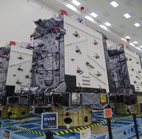
The U.S. Space Force’s Space Systems Command recently declared GPS III SV06, SV07 and SV08 satellites “Available for Launch.” Here, the space vehicles await official call up for launch in Lockheed Martin’s GPS III Processing Facility in Waterton, Colorado. (Photo: Lockheed Martin)
The U.S. Space Force’s Space Systems Command recently declared the eighth GPS III satellite as “Available for Launch.” This significant accomplishment officially marks the third space vehicle within the GPS III program to be declared available for launch in the past three months.
GPS III SV06, SV07, and SV08 are now awaiting official call up for launch in Lockheed Martin’s GPS III Processing Facility in Waterton, Colorado.
“SV06, SV07, and SV08 AFL milestones in just three months prove that GPS III production continues to benefit from efficiencies with each satellite delivery,” said Col. Edward Byrne, chief of SSC’s Space Production Corps’ Medium Earth Orbit Space Systems Division.
The first of the three recently completed satellites, SV06, is scheduled to launch in 2022 and will join the operational constellation of 31 GPS satellites.
GPS III satellites deliver enhanced performance and accuracy through a variety of improvements, including increased signal protection and improved accuracy. GPS III also expands the civilian L5 signal, dubbed the “safety-of-life” signal, currently broadcast by the 12 GPS IIF satellites, but not yet operational, and delivers a new L1C signal designed to grant interoperability to similar international space-based positioning, navigation, and timing systems around the world.
Space Systems Command, located at Los Angeles Air Force Base in El Segundo, California, is the U.S. Space Force’s Center of Excellence for acquiring and developing military space systems. SSC’s portfolio includes space launch, global navigation satellite systems, military satellite communications, a defense meteorological satellite control network, range systems, space-based infrared systems, and space domain awareness capabilities.
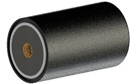
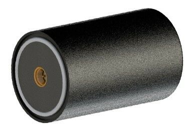
Maxtena has introduced a new multi-frequency antenna shaped for high-precision applications featuring L-band corrections.
Photo: Maxtena
The design will offer simultaneous GNSS reception on L1: GPS, GLONASS, Galileo, Beidou, L2: GPS L2C, Galileo E5B, and GLONASS L3OC, and L5: GPS + L-band corrections in a rugged, compact, and ultra-lightweight form factor. The antenna is well suited for high precision applications. The M9HCT-A-SMA is a great fit for the UAV markets, where high performance and low weight are driving features in antenna selection.
The new rugged active helix antenna is designed and manufactured using automotive grade electronics for GIS, RTK and other GNSS applications.
Auterion, the company building an open and software-defined future for enterprise drone fleets, has partnered with Phase One, a developer and manufacturer of medium and large format aerial photography systems. The companies will make the Phase One P3 Payload lineup easily accessible, with a plug-and-play integration to Auterion’s open drone ecosystem.
Enterprise inspections today are limited to periodic inspections of selected assets in a small geographic area. Enterprises are forced to use either internal drone operators or operators who are trained in the organization’s workflow to effectively collect pertinent data. Scaling the inspections from tens of assets to thousands of assets requires a platform-agnostic, end-to-end, streamlined workflow. This enables drone operators to conduct the inspections across a large region, lowering the cost and increasing the coverage.
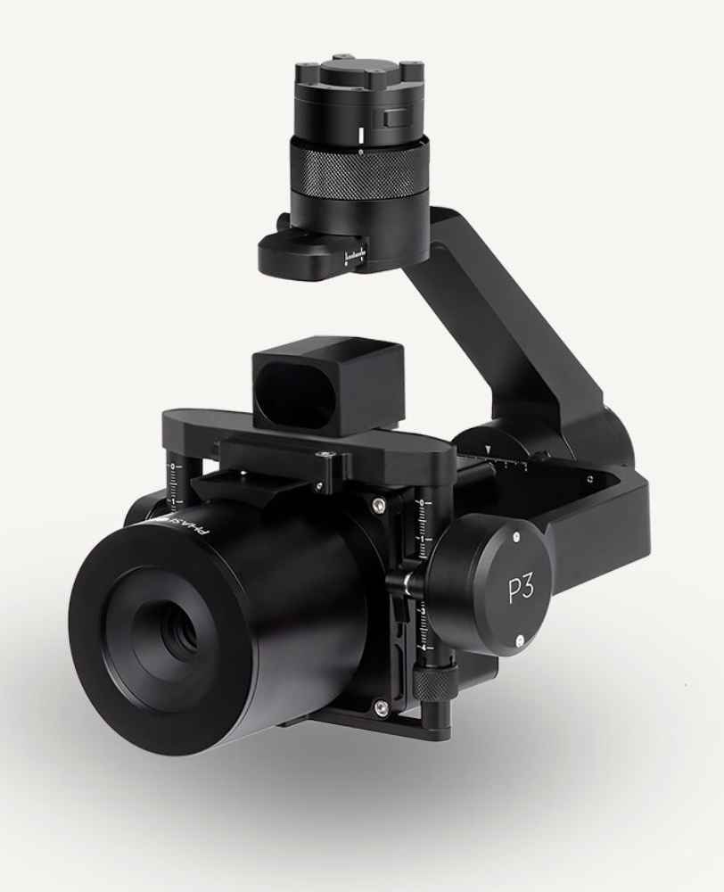
Known for its image quality in high-precision and time-critical inspections, Phase One’s P3 Payload consists of a high-resolution 100MP iXM camera—uniquely designed for UAVs—containing a BSI sensor with the highest dynamic range of 83dB, a rangefinder with smart focus, and a broad array of lenses including 35 mm, 80 mm and 150 mm. The partnership joins the P3 Payload’s inspection capabilities with the versatility native to Auterion’s ecosystem of software-defined and connected drones— enabling customers to integrate real-time inspection data into their existing applications and workflows. The P3 Payload is Phase One’s first payload compatible with the Auterion ecosystem.
Drones leveraging the Phase One P3 Payload and the power and connectivity of Auterion’s Skynode and Suite are capable of dramatically scaling high-value, high-risk and time-critical inspections including those of wind turbine fields (on land and offshore), oil refineries and offshore rigs, power masts and utility lines, bridges, dams, nuclear facilities, large infrastructure projects and other use cases. The combination also benefits faster geospatial mapping, bringing world-renowned image quality with very high resolution, dynamic range, color fidelity and geometric accuracy to projects.
Phase One A/S researches, develops, and manufactures medium format and large format digital cameras and imaging systems. Auterion provides enterprise and government with an ecosystem of software-defined drones, payloads, and third-party applications within a single, easy-to-use platform based on open-source standards.
A drone equipped with an echo sounder surveys the Dead Sea. (Photo: SPH Engineering)
Israeli drone service provider ERELIS has conducted a number of pilot projects using a drone equipped with a single-beam echo sounder in the Mediterranean Sea and the Dead Sea. The data was validated by authorized local surveyors and reports from previous surveys of the same areas by the Michmoret Campus, Faculty of Marine Science.
The reference bathymetric data was collected using a manned boat and multi-beam and single-beam echo sounders and demonstrated a good match between the results of new drone-based and traditional methods.
The bathymetric system consisted of a standard commercial DJI drone (UgCS SkyHub onboard computer and terrain-following system with radar altimeter) and Echologger ECT400 single-beam echo sounder provided by SPH Engineering, Latvia. For data processing, the Eye4Software Hydromagic software package was employed.
“I was surprised by the maneuverability of the system and how easy it is to conduct bathymetric surveys using a UAV equipped with an echo sounder,” said Roman Kirsanov, CEO of ERELIS. “Some of our survey areas were 400 to 500 meters away from take-off and landing positions, and that means that remote sensing comes to the world of hydrography and becomes available to any drone service companies.”
Screenshot: SPH Engineering
“It was good to see that applicability of our system with a single-beam echo sounder validated in conditions outside of its initial focus on small-scale surveys of inland water bodies,” said Alexey Dobrovolskiy, CTO of SPH Engineering. “We can now recommend our system for small-scale surveys in coastal areas and virtually in any liquids. The density of water in the Dead Sea is 1.24 kg/l.”
In May, SPH Engineering launched a UAV integrated with an echo sounder, as a new product for bathymetric surveys of inland and coastal waters. This data-collection method has since been used in Denmark and the UAE, and is suitable for mapping, measuring and inspections, as well as environmental monitoring.
The Nippon Foundation-GEBCO Seabed 2030 Project and Kongsberg Maritime have entered a memorandum of understanding (MOU) in support of the global initiative to produce the complete map of the ocean floor. Under the terms of the MOU, the two parties will work together to advance understanding of ocean bathymetry. The effort complements the goals of the United Nations Decade of Ocean Science for Sustainable Development.
Seabed 2030 is a collaborative project between The Nippon Foundation and GEBCO to inspire the complete mapping of the world’s ocean by 2030 and to compile all bathymetric data into the freely available GEBCO Ocean Map. GEBCO is a joint project of the International Hydrographic Organization (IHO) and the Intergovernmental Oceanographic Commission (IOC) and is the only organization with a mandate to map the entire ocean floor.
Kongsberg Maritime provides solutions for safe, efficient, and sustainable maritime operations. The solutions are suitable for offshore energies, seaborne transportation, hydrography, science, navy, coastal marine, aquaculture, training services and more. Kongsberg Maritime is the largest business area within Kongsberg Gruppen ASA. The Group has an integrated portfolio of solutions for businesses, partners and nations operating from the depths of the sea to outer space and to the digital frontier.
All data collected and shared with the Seabed 2030 Project is included in the GEBCO global grid, which is free and publicly available.
The Nippon Foundation-GEBCO Seabed 2030 Project is a collaborative project between The Nippon Foundation and GEBCO. The Seabed 2030 Project, launched at the United Nations Ocean Conference in 2017 by Chairman Sasakawa of The Nippon Foundation, coordinates and oversees the sourcing and compilation of bathymetric data from different parts of the world’s ocean through its five centers into the freely-available GEBCO Grid.
Kongsberg Maritime is a global marine technology company providing technology solutions for all marine industry sectors including merchant, offshore, cruise, subsea and naval.
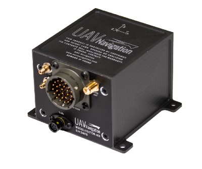
Autopilot platform developer UAV Navigation is integrating Iris Automation’s detect-and-avoid Casia software into its advanced autopilot solution, Vector. UAVs equipped with Vector and Casia now can detect uncooperative crewed aircraft in their airspace and autonomously or manually take corrective action, avoiding potential collisions.
The integration comes as Iris Automation releases Casia Software v2.2. The release also includes improvements to performance, track fusion and flight data uploads. Casia Software is embedded in all Casia systems and uses computer vision and artificial intelligence to detect and classify aircraft intruders, similar to human pilots.
Vector autopilots are specifically designed to execute flight completely autonomously, even if the remote-control datalink becomes unavailable or fails. They are used by a wide range of commercial clients flying rotary wing, target drone, fixed wing, and VTOL uncrewed aerial vehicles, worldwide.
UAV Navigation specializes in the design of guidance, navigation and control solutions for unmanned aerial vehicles (UAVs). Iris Automation is a safety avionics technology company pioneering detect-and-avoid (DAA) systems and aviation policy services that enable customers to build scalable operations for commercial drones.
Individuals and organizations wishing to comment on the appropriateness of any of the members of that team or on any other aspect of this study have until Sept. 19.
The April 2020 decision by the FCC has generated significant controversy and opposition within the public and Congress. This resulted in, among other things, seven separate petitions for reconsideration being filed, all of which are still pending, and several provisions in the National Defense Authorization Act for 2021. One of those provisions requires the Department of Defense to sponsor a study of the technical assumptions and analyses that went into the FCC’s decision to allow Ligado Networks to operate.
According to the post on the National Academies website, the study will consider:
Which of the two prevailing proposed approaches to evaluating harmful interference concerns — one based on a signal-to-noise interference protection criterion and the other based on a device-by-device measurement of the GPS position error — most effectively mitigates risks of harmful interference with GPS services and DOD operations and activities.
The potential for harmful interference from the proposed Ligado network to mobile satellite services including GPS and other commercial or DOD services including the potential to affect Department of Defense (DOD) operations, and activities.
The feasibility, practicality, and effectiveness of the mitigation measures proposed in the FCC order with respect to DOD devices, operations, and activities.”
This announcement is the first significant public step for the effort which is expected to take approximately 12 to 18 months. Sources say that there will likely be public and classified versions of the report. The classified version is likely to take significantly longer to compile.
Proposed study team members
Chair: J. Michael McQuade
Members:
Jennifer Lacroix Alvarez
Kristine M. Larson
John L. Manferdelli
Preston F. Marshall
Y. Jade Morton
Richard Reaser, Jr.
Jeffrey H. Reed
Nambirajan Seshadri
Stephen J. Stafford
Staff Officer: Jon Eisenberg
Individuals and organizations wishing to comment on these proposed team members may do so through the project web page.
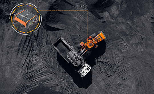
Septentrio, a leader in high-precision GNSS positioning solutions, has launched the AsteRx SB3 receiver family, enclosed in an IP68 housing. The receiver offers superior availability of RTK high-accuracy positioning because of its ability to track a wide variety of signals from all currently operating GNSS (GPS, GLONASS, Galileo and BeiDou).
Even in dual-antenna mode, AsteRx SB3 uses triple-frequency tracking to maximize robustness and availability of its heading angles.
“The AsteRx SB3 brings state-of-the-art GNSS positioning and heading performance in a very compact and rugged enclosure that is fully certified and ready to use,” said Silviu Taujan, product manager at Septentrio. “Its simplicity and ease of use make it a truly plug-and-play device, allowing customers to have a fully operational system within minutes.”
The new line includes two types of receivers, both offering unique triple-band sub-degree GNSS heading.
AsteRx SB3 Pro is a high-performance rover receiver featuring the latest core GNSS+ algorithms for maximal reliability and availability in challenging environments, such as near high structures or under foliage.
AsteRx SB3 Pro+ adds value to the Pro version with base station functionality and internal logging. It also offers higher update rates and ultra-low latency, both important factors for fast-moving vehicles or mechanical components in automation or guidance systems.
AsteRx SB3 products are pin-to-pin compatible with Septentrio’s AsteRx SB ProDirect receiver and with the recently released AsteRx SBi3 GNSS/INS system, making it simple to change receivers.
The Septentrio AsteRx SB3 Pro is ruggedized for tough environments. (Image: Septentrio)
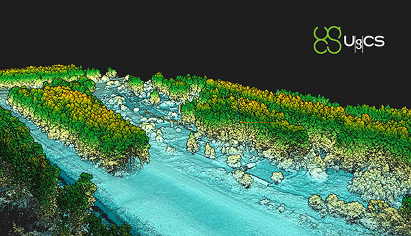
SPH Engineering has released a lidar toolset update to UgCS — the company’s UAV mission planning and flight control software. The lidar toolset is designed to eliminate human error in remote sensing.
Features include precise calibration, flight patterns for route planning, anti-shake turns, and constant line spacing and buffer.
The UgCS lidar toolset allows users to optimize time and cost-effectiveness at all stages of data collection and processing. At the flight planning stage, time is saved on mission planning, with flight patterns and turns designed specifically for lidar surveys.
At the flight stage, users can acquire high-quality laser data with preset inertial measurement unit (IMU) initialization patterns and anti-shake lidar turns. During post-flight data analysis, the high accuracy of the acquired data ensures the desired results with a single trip to the field
“We have received various requests from lidar producers and end-users to improve the accuracy of laser data collected with a UAV,” said lexei Yankelevich, head of software development at SPH Engineering. “We have invested in UgCS R&D to focus mainly on automated IMU calibration commands, automatic calculation of required line spacing and overlap, and prevention of sensor shaking. Trial flights over SPH Engineering’s in-house test range have confirmed UgCS lidar toolset capacity to support main lidar market players.”
Application areas include power line inspections, road inspections, construction, mining, archaeology and forestry.
A new European project is researching automated collection of geodata and production of high-definition maps.
The GAMMS project is funded by the European Union Agency for the Space Programme (EUSPA), and will take place until the end of 2023. Galileo will be the main enabler of GAMMS, given its precise, multipath-resistant measurements and its upcoming high-accuracy service (HAS).
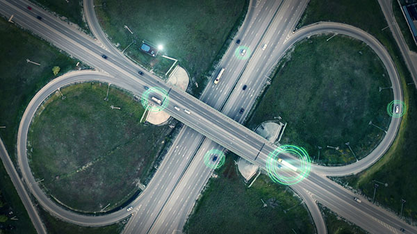
A European consortium, led by the French map service provider GEOSAT, will investigate how the combination of self-driving mapping cars (autonomous mobile-mapping systems) and artificial intelligence-based mapping software can automate the production of high-definition maps.
These maps are used by driverless vehicles and need to be provably accurate, complete and up to date. Fast, sustainable production of trustworthy maps is the goal.
Consortium members include:
GEOSAT — map-making and machine learning
GeoNumerics — multi-sensor fusion and accurate navigation
“It is as challenging as interesting to bring together the geodetic estimation methods with the navigation ones in multi-sensor systems powered by EGNSS and its differentiators, VDMs (vehicle data management systems) and visual features,” said Marta Blázquez, responsible for GAMMS at GeoNumerics. “GAMMS will boost the development of NEXA, our trajectory determination platform, and GENA, our adjustment platform for dynamic networks, in the direction of trustworthy navigation.”
GeoNumerics is responsible for computing the mapping vehicle trajectory (a time series of position, velocity and attitude coordinates) by integrating the manifold of sensors available in a mapping vehicle.
Measurements of inertial units and atomic clocks will be fused with measurements of all available navigation satellites (GPS, GLONASS, Galileo and BeiDou), odometers, cameras and laser scanners. For this purpose, GeoNumerics’ GENA and NEXA systems will be further developed to include new sensor mathematical models and to improve its robust estimation methods.
In June 2019, Regulus Cyber’s experts successfully spoofed the GPS-based navigation system of a Tesla Model 3 vehicle. This experiment provided an important warning for all companies using GNSS location and timing: these technologies, on which they depend, are highly vulnerable to spoofing attacks. In the two years since the experiment, companies and governments have continued to research the potential harm that can be caused by spoofing attacks and are learning more about how to defend themselves from them.
The Tesla experiment was groundbreaking because it was the first time that a level 2.5 autonomous vehicle was exposed to a sophisticated GPS spoofing attack and its behavior recorded.
We chose Tesla’s Model 3 because it had the most sophisticated advanced driver assistance system (ADAS) at the time, called Navigate on Autopilot (abbreviated NOA or Autopilot), which uses GPS to make several driving decisions. However, this experiment exposed several cybersecurity issues potentially affecting all vehicles relying on GPS as part of their sensor fusion for autonomous decision making.
NOA makes lane changes and takes interchange exits once a destination is determined, without requiring any confirmation by the driver. Its several other features include autonomous deceleration and acceleration according to the speed limit, autonomous lane changing, and adaptive cruise control.
These features use a variety of sensors, including cameras, radar, speedometers and more. The researchers wanted to test the extent to which the Model 3 relied on its GNSS receiver to make these driving decisions and how it behaved when receiving contradicting information from its GNSS receiver and its other sensors.
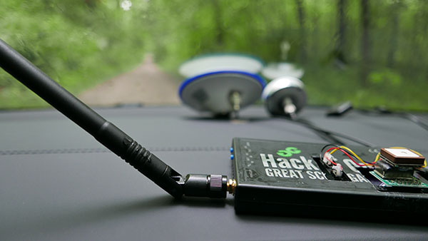
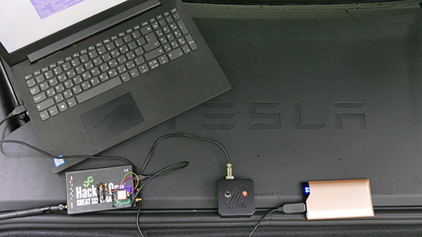
The researchers used hardware and software purchased online to mimic the tools potential hackers would use. The experiment involved two software-defined radio (SDR) devices purchased online, one to spoof GPS and one to jam all other constellations, connected to an external antenna to simulate an external attack. The software used to simulate the GPS signal was downloaded from an online source, available for free.
The test included three scenarios the researchers assumed would involve usage of GNSS, each one using a different spoofing pattern:
Scenario 1. Exiting the highway at the wrong location
Scenario 2. Enforcing an incorrect speed limit
Scenario 3. Turning into incoming traffic
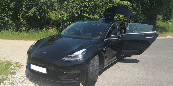
A Tesla Model 3 was remotely hacked in a test of a GPS spoofing attack. (Photo: Regulus Cyber)
Scenario 1: Exiting the Highway at the Wrong Location
The car was driving normally at a constant speed of 95 KPH with NOA enabled. The destination determined for this ride was a town nearby and the car designated a certain interchange as the destination for an autonomous exit maneuver. The experiment began 2.5 km before the vehicle reached that interchange; however, the researchers’ fake GPS signal resulted in coordinates of a location on the same highway but only 150 m before the exit.
As soon as its GNSS receiver was spoofed, the car assumed that it had reached the correct exit and began to maneuver to the right, activating the blinker, slowing down, turning the wheel, and crossing a dotted white line to its right side, exiting to an emergency pit-stop, confusing it with the exit 2.5 km ahead.
To be clear, this would not have happened at any location along the highway, because sensor fusion with the radar and the camera enables the car to avoid physical obstacles and ensures that it does not cross a solid white line that makes a turn illegal.
The spoofing attack succeeded, in that it enabled the attacker to remotely manipulate the car’s sensor fusion and make it exit the highway at the wrong location.
Scenario 2: Enforcing an Incorrect Speed Limit
The car was driving to a random city far away on a highway, at a constant speed of 90 KPH, which was 10 KPH below the highway’s speed limit, with NOA enabled. The researchers generated a fake GPS signal, with the coordinates of a nearby town road that has a speed limit of 33 KPH. Shortly thereafter, the vehicle assumed the speed limit had just changed to 33 KPH and instantly began decelerating. Each time the driver attempted to accelerate using the gas pedal, as soon as he lifted his foot off the pedal the car engaged in heavy braking to quickly decelerate back to 33 KPH.
To be clear, this would not have happened if NOA had been turned off. The cruise mode can be disabled by either using the touch screen or by pressing the brakes, which would allow the driver to regain full manual control over the vehicle’s speed.
Again, the spoofing attack succeeded, in that it allowed the attacker to remotely manipulate the car’s speed and made it enforce a speed limit much lower than the actual one on the highway.
Scenario 3: Turning into Incoming Traffic
The car was being driven manually on a two-lane road with one lane in each direction, the type of road on which NOA cannot be used. The researchers generated a fake GPS signal, with coordinates of a nearby three-lane highway, with all lanes in the same direction. Furthermore, the spoofed location was 150 m from a designated exit that the vehicle’s navigation system was programmed to take, requiring a left turn.
Shortly after the car’s GNSS receiver was spoofed, the vehicle assumed it was on a highway and engaged NOA. Next, it triggered the exit maneuver, which began with activating the left blinker, followed by turning the wheel to the left. The driver had to quickly grab the wheel and manually drive the car back to its lane to avoid a collision with oncoming traffic.
To be clear, this kind of scenario would not be possible without the driver enabling the NOA. Once a Tesla driver enables NOA, it automatically turns on once the vehicle is on the highway with a set destination. This is why the researchers assumed that NOA would be turned on by default, and as long as NOA is activated, the vehicle is susceptible to the attacks mentioned in the experiment.
Once again, the spoofing attack was successful in that it enabled the attacker to remotely steer the vehicle into the opposing lane, placing it on a direct collision course with oncoming traffic. Out of the three scenarios described, this one proved that GNSS spoofing can endanger lives.
The hardware used for the GPS spoofing test. (Photo: Regulus Cyber)
GPS Cybersecurity for Automotive Applications
The NOA system in the Tesla Model 3, being an ADAS, allows drivers to rely on the car and its sensors for basic driving functions. Therefore, it enables drivers to briefly take their hands off the wheel and reduces the number of actions they are required to take. Nevertheless, drivers are still required to be fully attentive to the road so that they can take control of the vehicle at any time.
However, since this spoofing attack had such a sudden and instant impact on the car’s driving behavior, a driver who is not fully attentive and aware would not be prepared to quickly take control and prevent an accident. By the time the driver notices that something is wrong and reacts, it might be too late to prevent an accident. Already drivers have been found sleeping at the wheel, driving under the influence of alcohol, and doing other inappropriate tasks with NOA engaged.
Furthermore, this situation assumes a level 2.5 autonomous vehicle as was tested. But what happens in level 3 vehicles, in which driver engagement is limited, or level 4 and 5, in which driver response is non-existent? This research provides us with a glimpse into the crucial importance of sensor cybersecurity and particularly of GNSS cybersecurity.
The Tesla hack experiment and its results were eye-opening for the autonomous vehicles sector – the danger is real and rising as more and more vehicles are depending on GNSS technology as part of their sensors for assisted or automated driving. Up to 97% of new vehicles since 2019 incorporate GNSS receivers and most if not all are still vulnerable to the same spoofing attacks presented in this research.
In January 2021, the UN’s World Forum for Harmonization of Vehicle Regulations (WP.29) issued Regulation No. 155, which sets guidelines for cybersecurity in the automotive industry with the goal of addressing every possible cyber threat that it might encounter. Annex 5 of the regulation defines cyber attacks and states that in order to get approvals in the future vehicle manufacturers will need to provide solid evidence that their vehicles are sufficiently protected against them.
Among the cyber threats mentioned in the Annex is spoofing of data received by the vehicle — both sybil spoofing attacks and spoofing of messages. The Annex also lists the appropriate protection that vehicle manufacturers should implement and states that vehicle manufacturers will be required to provide evidence of the effectiveness of the mitigation measures they choose. These upcoming regulatory requirements can make the difference between life and death in situations caused by GNSS spoofing and ensure that only reliable and resilient positioning is used within vehicles, both today and in the future.
Please note: Tesla released a statement saying that it is “taking steps to introduce safeguards in the future which we believe will make our products more secure against these kinds of attacks.” Regulus Cyber researchers did not perform any further experiments with Tesla Model 3 since this research was published two years ago.
See the Tesla GPS spoofing experiment from the driver’s point of view: