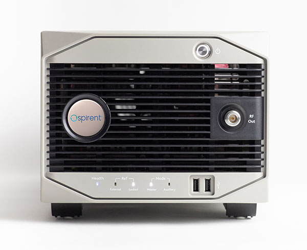
Spirent Federal has launched an alternative RF navigation simulator. As GPS jamming and spoofing continue to rise, interest in complementary sources of positioning, navigation and timing (PNT) data has likewise increased.
Recent government directives recommend a layered, multi-source approach, with much of the attention focused on non-GNSS radio frequency signals. These RF signals, coined alternative RF navigation, offer unique PNT capability in GPS-degraded or denied environments. The signals are secure and resilient and can act as an effective complement to GPS signals.
Spirent Federal’s product can simulate resilient alternative RF navigation signals on its own or concurrently with GNSS signals. Testing can be static or dynamic, with stationary, pedestrian and ground vehicle trajectories available.
“As a result of our extensive research and development incorporating a variety of assured PNT technologies, we’re pleased to be the first to provide this capability to our customers,” said Roger Hart, director of engineering. “Our product enables developers to test early and often, from the first stages of R&D to integration and field testing. Solutions can be tested with edge cases, hardened against interference, and deployed faster with greater confidence they will work for our warfighters.”
Spirent is actively engaged with several alternative RF navigation technologies and technology providers to incorporate signal simulation capability. To learn more, contact Spirent Federal to discuss fielded configurations.
A U.S. Marine Corps radio operator grounds an during long-range HF radio training in Kuwait Oct. 7, 2020. (Photo: U.S. Marine Corps/Capt. Joshua Hays)
Collaboration with Xona Space Systems
Spirent Federal Systems also announced that it is collaborating with Xona Space Systems to develop simulation and test capabilities for Xona signals produced by small satellites (smallsats) operating in low Earth orbit (LEO). Xona is a San Mateo-based startup developing a smallsat constellation for a dedicated PNT service.
Xona’s patent-pending approach using small satellites in LEO is intended to improve global PNT resilience and accuracy by both enhancing GNSS and operating as an independent system. Xona’s high-power signals utilize advanced signal structure and security techniques, improving jamming and spoofing resistance as well as multipath mitigation.
“We do all we can to protect, toughen, and augment PNT and are eager to work with emerging companies like Xona who are developing a next-gen navigation and timing architecture,” said Jennifer Smith, senior director of Business Development at Spirent Federal. “Our simulators provide critical support to developers and integrators by enabling testing and validation before the product deploys.”
The space and defense sectors also benefit from Spirent Federal’s expertise in generating high fidelity RF signals using quadrature (I/Q) data. Spirent test tools allow the full customization of I/Q data. Customers can generate unique I/Q data corresponding to experimental modulation schemes and use Spirent Federal’s signal generation capabilities to create the corresponding RF. Such rapid prototyping allows for quick turnaround times and shorter iteration cycles.
Alternatively, scenarios created using Spirent Federal’s proprietary SimGEN software can be saved as I/Q data which can be processed by software-implemented receivers.
“Building a new generation of satellite navigation and timing services goes far beyond just the satellites,” said Brian Manning, CEO of Xona Space Systems. “It requires building an entire ecosystem from ground stations to chipset manufacturers to end users and systems integrators. Having reliable and trusted simulation capabilities is critical to support all of these areas which is why we are thrilled to be working with Spirent to provide a robust solution to our partners.”
NV5 Geospatial has acquired the new Riegl VMX-2HA dual-scanner mobile mapping system. The system will initially deploy in utility and transportation projects and enable NV5 Geospatial to collect highly accurate, feature-rich data at highway speeds.
The flexibility, ease of setup, and smaller footprint will also allow the use of the VMX-2HA on various platforms, including boats, all-terrain vehicles and trains.
The VMX-2HA delivers mobile point clouds at a resolution of 1,000 to 4,000 points per square meter (pops) and 0.08-foot vertical accuracy in terms of 95% confidence intervals. It also features a high-speed 10 GigE link, which supports reliable data acquisition of up to 2 million measurements per second and image data from all integrated cameras.
NV5 Geospatial will launch the VMX-2HA as part of a mapping project for a large U.S. utility company and implement it for work being done for the U.S. Department of Transportation.
A roundup of recent products in the GNSS and inertial positioning industry from the July 2021 issue of GPS World magazine.
OEM
GNSS/INS Sensors
Photo: Septentrio
Five receivers in new product line
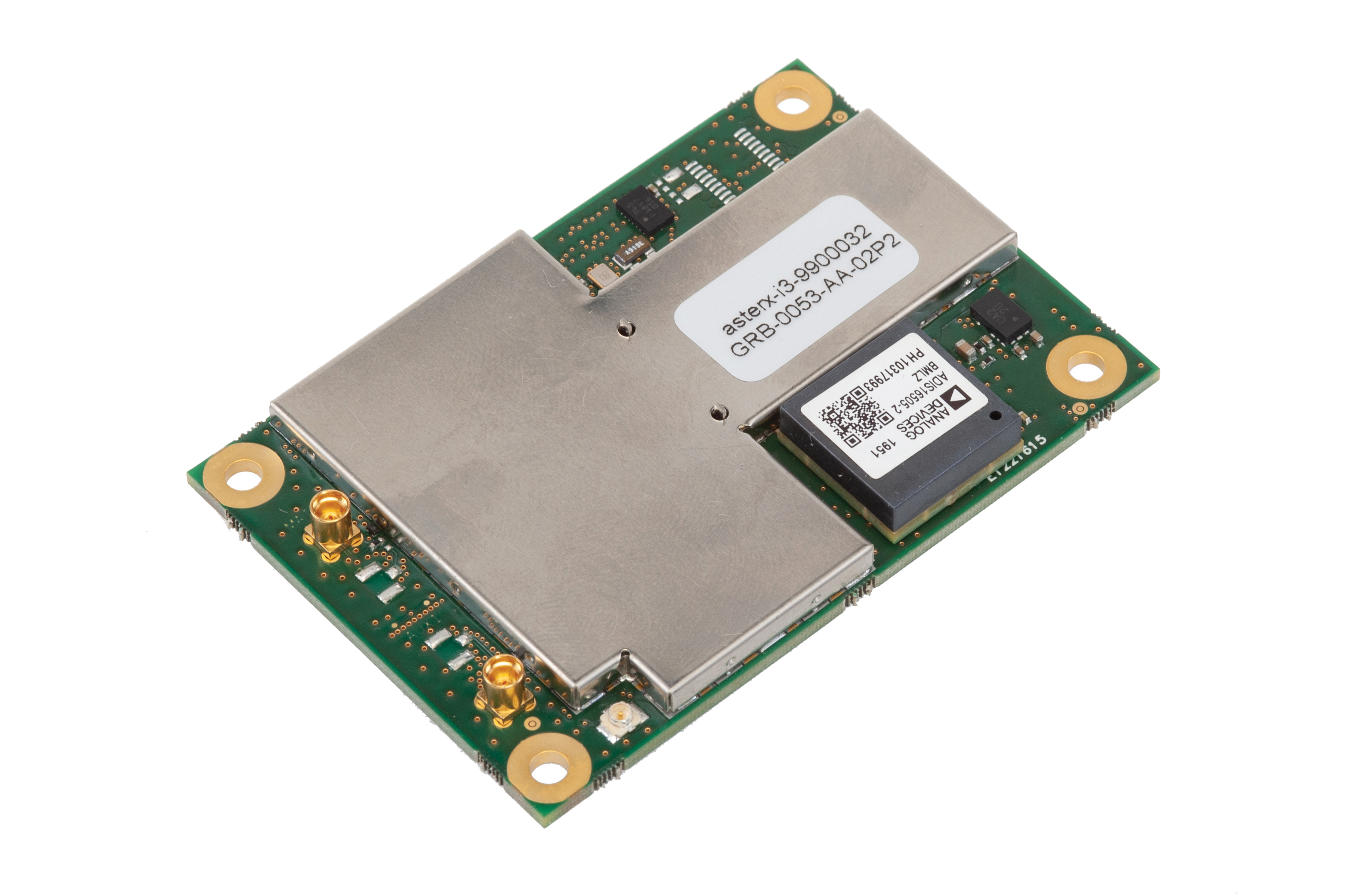
The AsteRx-i3 product family provides an array of next-generation receivers, from plug-and-play navigation solutions to feature-rich receivers with raw measurement access. Included are OEM boards and ruggedized receivers enclosed in a waterproof IP68 housing. The Pro receivers offer high accuracy positioning with 3D orientation and dead-reckoning for plug-and-play integrations. Pro+ receivers provide integrated positioning and orientation along with raw measurements, in single- or dual-antenna configurations, suitable for applications with sensor fusion. One of the receivers offers an off-board inertial measurement unit (IMU), which can be mounted exactly at the alignment point of interest.
The RES 720 GNSS dual-frequency embedded timing module provides next-generation networks with 5-nanosecond accuracy. It uses L1 and L5 GNSS signals to provide superior protection to jamming and spoofing, mitigates multipath in harsh environments, and adds security features to make it suitable for resilient networks. At 19 x 19 millimeters, the RES 720 is suitable for 5G Open Radio Access Networks (RAN)/XHaul, smart grids, data centers, industrial automation and satellite communication networks, as well as calibration services and perimeter monitoring applications.
The new HG1125 and HG1126 IMUs are low-cost inertial measurement units that serve both commercial and military applications. They use sensors based on micro-electromechanical systems (MEMS) technology to precisely measure motion. They can survive shocks up to 40,000 G-force. The HG1125 and HG1126 can be used for a variety of defense and commercial applications, such as tactical military needs, drilling, unmanned aerial vehicles or navigation systems for general aviation aircraft.
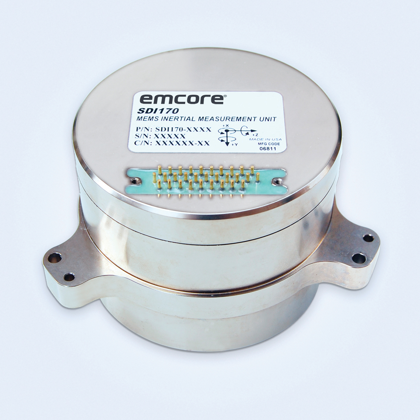
The SDI170 quartz MEMS tactical-grade IMU is designed as a form-, fit- and function-compatible replacement for the HG1700-AG58 ring-laser gyroscope (RLG) IMU, but with superior overall performance, versatility and a significantly higher mean time between failures (MTBF) rating over ruggedized environments. The SDI170 IMU delivers highly linear accelerometer performance and longer life compared to the HG1700 IMU.
The OSA 5405-MB is a compact outdoor precision time protocol (PTP) grandmaster clock with a multi-band GNSS receiver and an integrated antenna. It ensures timing accuracy by eliminating the impact of ionospheric delay variation, enabling communication service providers and enterprises to deliver the nanosecond precision needed for 5G fronthaul and other time-sensitive applications. A multi-constellation GNSS receiver and antenna enable the OSA 5405-MB to meet PRTC-B accuracy requirements (+/–40 nanoseconds) even in challenging conditions. It receives GNSS signals in two frequency bands, using the differences between them to calculate and compensate for ionospheric delay variation. The OSA 5405-MB is resilient against jamming and spoofing, considered critical for 5G synchronization. It can work with up to four GNSS constellations concurrently (GPS, Galileo, GLONASS and BeiDou).
The Toughbook S1 is a fully rugged 7-inch Android tablet for capturing and accessing critical information in the field. GPS and LTE come optionally. The tablet is supported by Productivity+, a comprehensive Android ecosystem that enables customers to develop, deploy and sustain the Android OS environment in the enterprise. The Toughbook S1 tablet’s compact, rugged and lightweight body is made for portability and reliability for field workers. It has a 14-hour battery life and warm swap battery. Features include a sleek outdoor-readable anti-reflection screen, patented rain mode and multi-touch performance whether using a stylus, finger or glove.
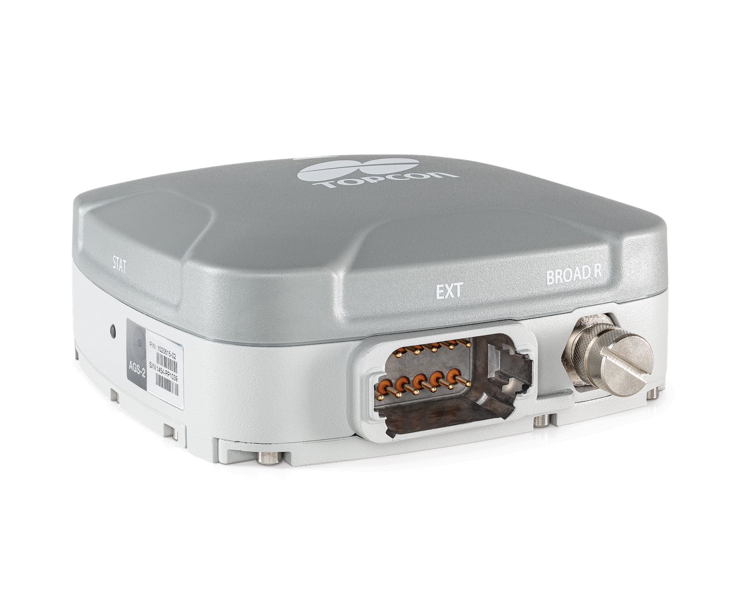
The AGS-2 and AGM-1 are manual guidance and autosteering receivers. Location data enable crop optimization, including soil preparation, seeding, crop care and harvesting. Designed to suit virtually any agricultural machine type, make and model, the AGS-2 receiver and steering controller combines steering with network reception and tracking. It comes standard with DGNSS correction services and is upgradeable using NTRIP and an optional RTK radio in the Topcon CL-55 cloud connectivity device. The AGM-1 is offered as an economical entry-level manual-guidance receiver.
Provides fast data processing for construction and surveying
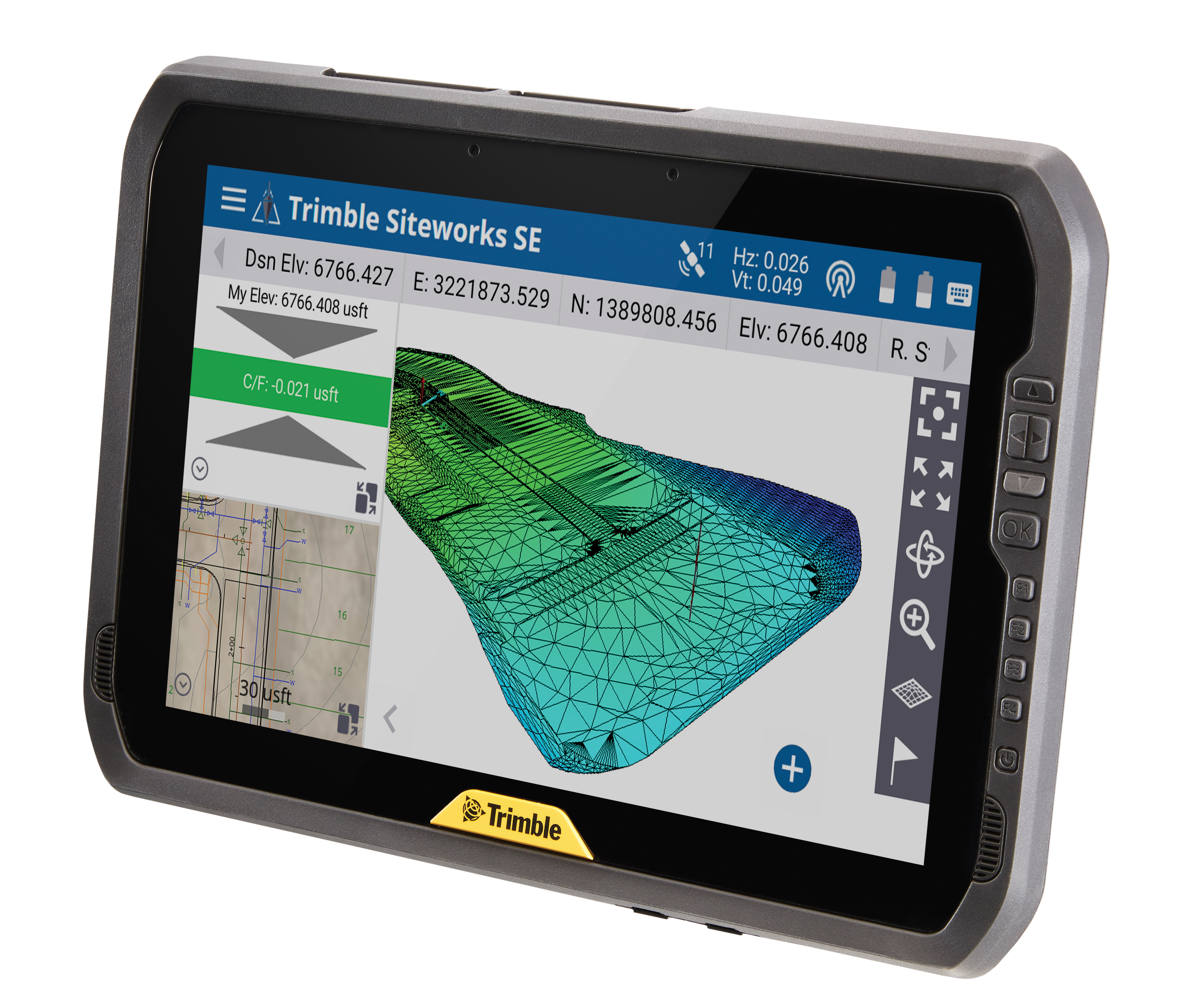
The Trimble T100 high-performance tablet is suitable for both experienced and novice users. It is optimized for Trimble Siteworks Software and supporting office applications such as Trimble Business Center. Its accessories are designed to complement user workflows, enabling users to complete quality assurance and quality control before leaving the field. The tablet is designed to be flexible and usable in a variety of configurations and job sites. It is engineered to be ergonomic and portable on and off the pole. Features include a 10-inch (25.4 cm) sunlight-readable touchscreen display, a directional keypad with programmable function keys and a 92-Wh internal battery.
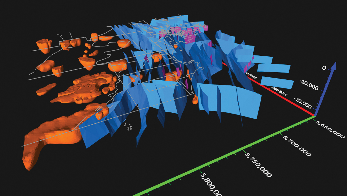
Surfer has new gridding, contouring and surface mapping software to make it easier for users to visualize, display and analyze complex 3D data. Surfer enables users to model data sets, apply an array of advanced analytics tools, and graphically communicate the results. The scientific modeling package is used in oil and gas exploration, environmental consulting, mining, engineering and geospatial projects. Enhancements have been made to 3D Base Maps, Contour Volume/Area Calculation, 3D PDF Exporting Options and automated features for creation of scripts and workflows.
A Catalyst-AWS collaboration delivers actionable geoscience analytics to users, providing satellite-based Earth observation intelligence. The data and analytics are delivered via Amazon Web Services (AWS) Cloud. Catalyst is a PCI Geomatics brand. The initial solution, available through AWS Data Exchange, is an infrastructure risk-assessment service that uses satellite data to continuously monitor millimeter-level ground displacement over a subscriber’s area of interest anywhere on Earth. Catalyst is exploring additional risk mitigation solutions and monitoring services using AWS. Having image processing science and imagery on the cloud reduces latency and costly data transfers.
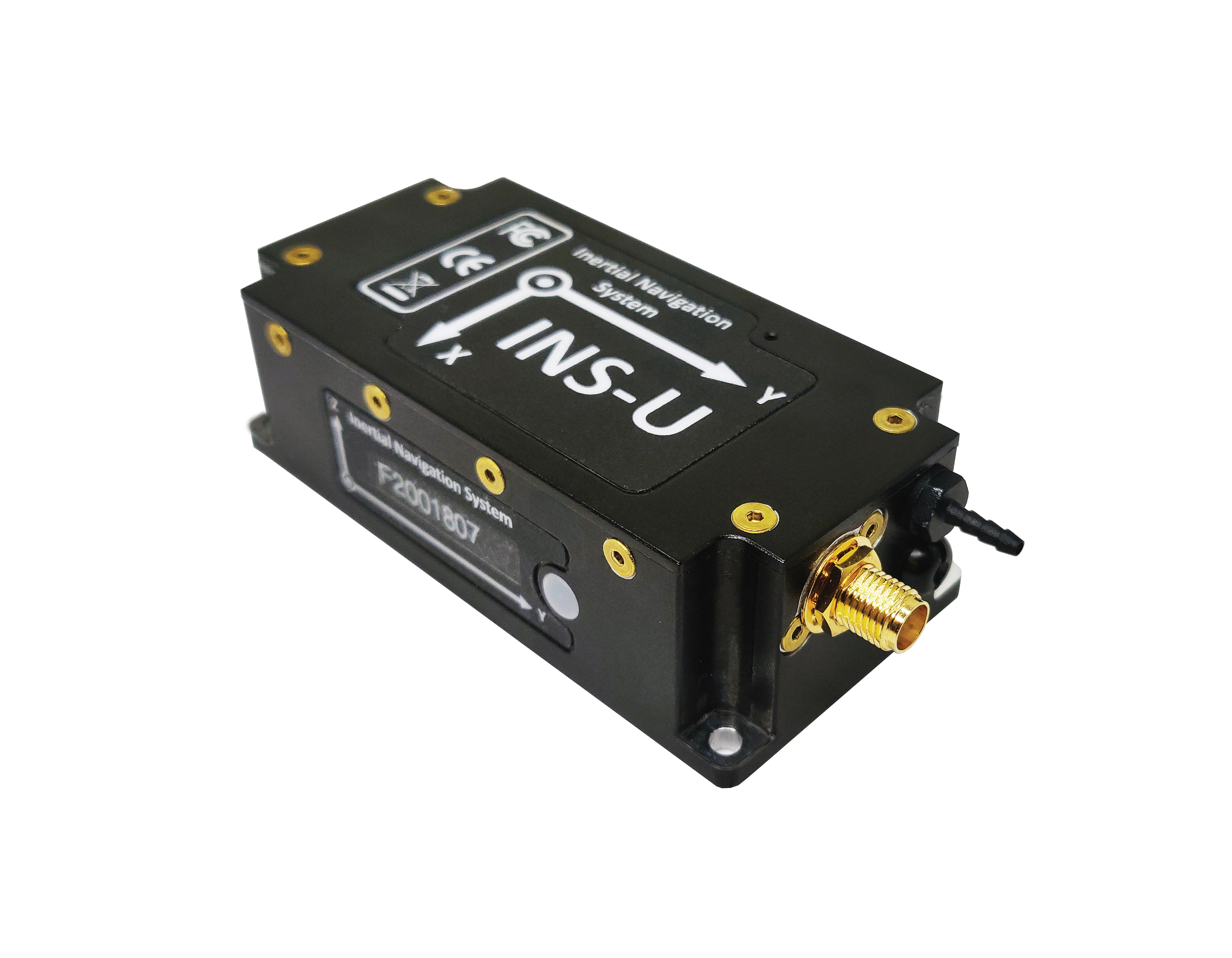
The GPS-aided INS-U is a fully integrated attitude and heading reference system (AHRS), IMU and air-data computer high-performance strapdown system that determines position, navigation and timing information for any device on which it is mounted. The INS-U uses a single antenna, multi-constellation u-blox GNSS receiver. With access to GPS, GLONASS, Galileo, QZSS and BeiDou, the INS-U can be used in a variety of GPS-enabled environments and is protected against spoofing and jamming. The INS-U has two barometers, a miniature gyro-compensated fluxgate compass, and tri-axis temperature-calibrated advanced MEMS accelerometers and gyroscopes. These high-performance sensors, along with Inertial Labs’ new on-board sensor-fusion filter, and state-of-the-art guidance and navigation algorithms, provide accurate position, velocity and orientation of the device under measurement.
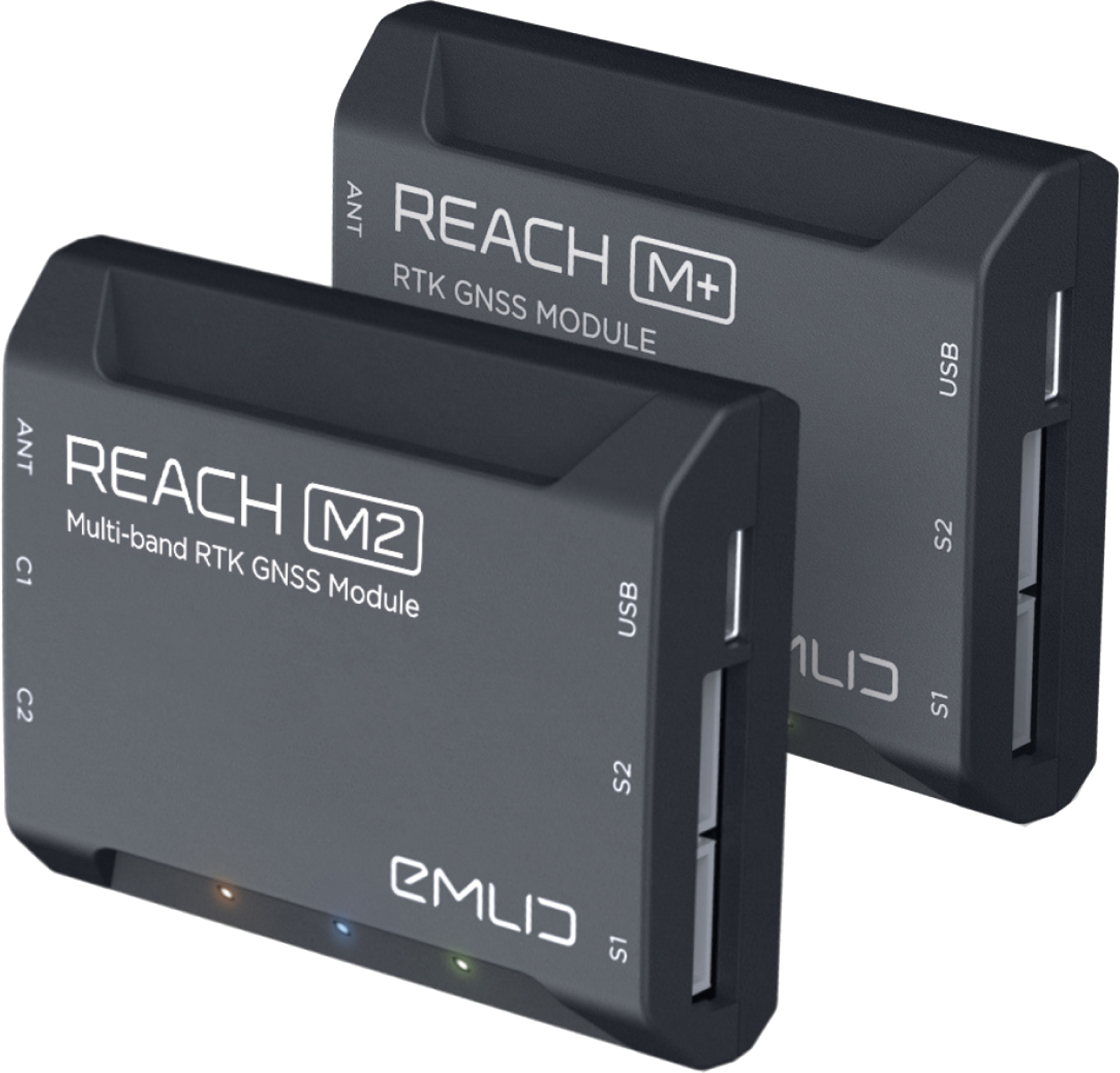
The Reach M+ and Reach M2 positioning modules for UAV mapping provide centimeter-level accuracy in real-time kinematic (RTK) and post-processed kinematic (PPK) modes, enabling precise UAV mapping with fewer ground control points. The Reach M+ single-band receiver has a baseline up to 20 kilometers in PPK. The Reach M2 is a multi-band receiver with a baseline up to 100 kilometers in PPK. Reach connects directly to a camera’s hot-shoe port and is synced with the shutter. Time and coordinates of each photo are logged with a resolution of less than a microsecond. Reach captures flash sync pulses with sub-microsecond resolution and stores them in a raw data RINEX log in the internal memory. This method allows ground control points to be used only to check accuracy.
System simplifies drone inspection missions, deliveries
The Dronehub is an automated solution that can provide undisturbed drone service 24/7 in nearly any weather condition. With the integration of IBM artificial intelligence technology, Dronehub solutions can operate and automatically provide information with little human interaction. The system includes the drone and a docking station with automatic battery replacement. It can fly for 45 minutes in +/–45° C weather, up to 35 km in winds up to 15 m/s. It can carry a payload up to 5 kg as far as 15 km. It can be used for monitoring, inspection and measurement; cargo transport and parcel deliveries; and mobile ground infrastructure; and security.
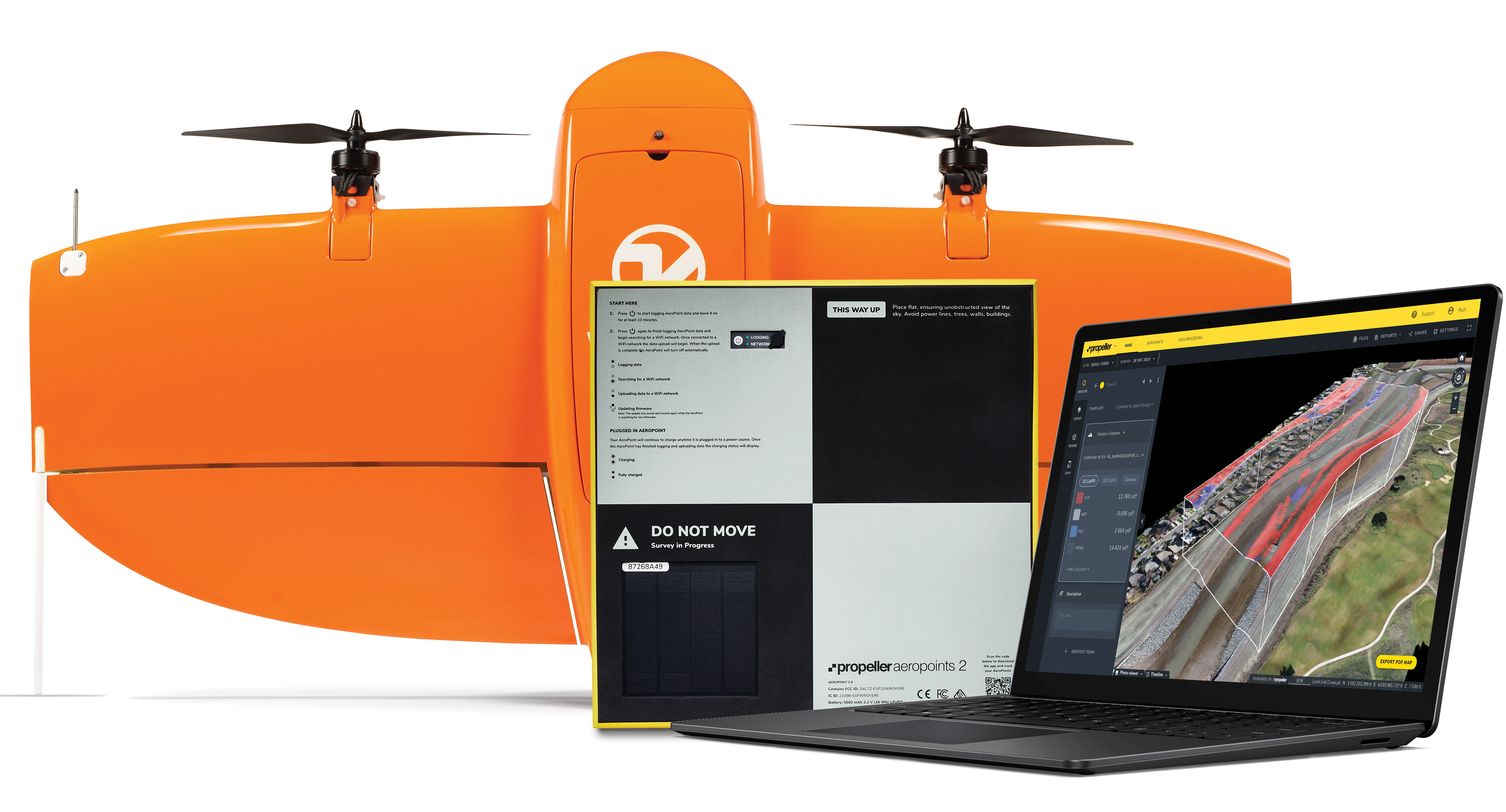
The Propeller Platform and WingtraOne drone package enable construction professionals to collect survey-grade data across the worksite consistently and accurately. To operate, surveyors place Propeller AeroPoints (smart ground-control points) on their worksite, and then fly the WingtraOne drone to collect worksite survey data. Survey images are uploaded to Propeller’s cloud-based platform, where the fully automated geotagging and photogrammetry processing is completed within 24 hours of submission on the platform. Uses include mines, road and railway projects, highways and industrial complexes. Data collection with AeroPoints and Propeller PPK can serve as a reliable, single source for survey data and progress. Teams across the entire worksite can view geographically accurate and realistic 3D site models and track, inspect and report on job progress and productivity safely and accurately.
Stamp-sized module provides RTK positioning and heading
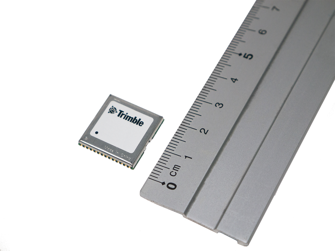
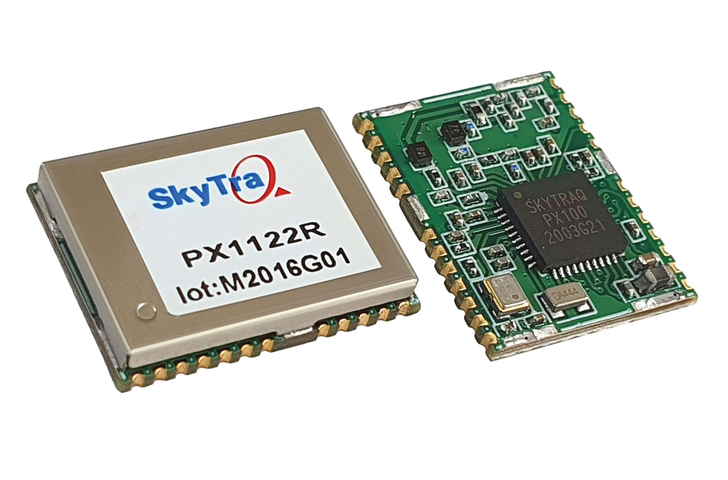
The PX1122R is a high-performance multi-band quad-GNSS real-time kinematic (RTK) receiver featuring 1 cm + 1 ppm position accuracy and under 10-second RTK convergence. It has a 12 x 16 millimeter form factor, about the size of a postage stamp. It can be configured for a base or a rover, and supports a moving base RTK for precision heading applications. The PX1122R has a maximum quad-GNSS RTK update rate of 10 Hz, providing a quick response time and more stable performance for fast-moving precision guidance applications.
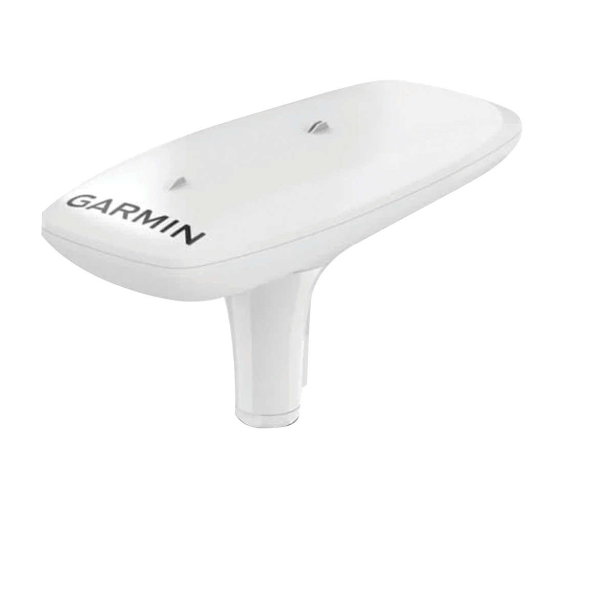
Utilizing both L1 and L5 GPS frequencies, along with multi-constellation support (GPS, Galileo, GLONASS and BeiDou), the MSC 10 marine satellite compass provides precise positioning and heading accuracy within 2 degrees. Its 10-Hz position update rate delivers detailed tracking information. It eliminates magnetic interference, which can degrade heading accuracy. The MSC 10 is easy to install and can be used as the primary position and heading sensor across multiple systems, including autopilots. If the satellite signal is lost, it will transition from GPS-based to a backup magnetometer-based heading.
Tallysman Wireless Inc. has added its first full-band GNSS antenna to its line of helical antennas.
The full-band GNSS HC990E embedded helical antenna is designed for precise positioning, covering the GPS/QZSS-L1/L2/L5, QZSS-L6, GLONASS-G1/G2/G3, Galileo-E1/E5a/E5b/E6, BeiDou-B1/B2/B2a/B3, and NavIC-L5 frequency bands, including the satellite-based augmentation system (SBAS) available in the region of operation [WAAS (North America), EGNOS (Europe), MSAS (Japan), or GAGAN(India)], as well as L-band correction services.
The HC990E embedded helical antenna is designed and built for high-accuracy positioning. It is packaged in a very light and compact form factor, making it suitable for a wide variety of applications, especially lightweight unmanned aerial vehicle (UAV) navigation.
The HC990E is 60-mm wide and 25-mm tall, weighing 12 grams. It features a precision-tuned helical element that provides an excellent axial ratio and operates without the requirement of a ground plane. The HC990E also features a low-current, low-noise amplifier (LNA) and pre-filter to prevent harmonic interference from high-amplitude signals, such as 700 MHz band LTE and other nearby in-band cellular signals.
The HC990E antenna base has a flying lead with a UFL connector. To facilitate the installation, Tallysman provides an optional embedded helical mounting ring, which traps the outer edge of the antenna circuit board to the host circuit board or any flat surface. Tallysman also supports the installation and integration of embedded helical antennas to enable successful implementation and provide optimal antenna performance.
New SA65 CSAC provides wider operating temperatures, faster warm-up and improved frequency stability in extreme environments
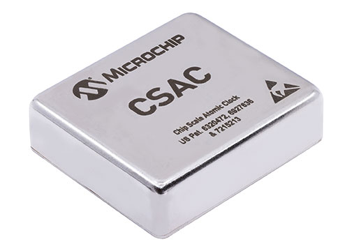
Photo: Microchip Technology
Microchip Technology Inc. is offering the new SA65 chip-scale atomic clock (CSAC), providing precise timing accuracy and stability in extreme environments. Designed for military and industrial systems, the Microchip’s SA65 CSAC features ultra-high precision and low power consumption
Advanced military platforms, ocean-bottom survey systems and remote-sensing applications all require precise timing. CSACs ensure stable and accurate timing even when GNSS time signals are unavailable, thereby helping industrial and military system designers to meet timing requirements.
Microchip’s SA65 CSAC is an embedded timing solution with improved environmental ruggedness, delivering higher performance than the previous SA.45s CSAC, including double the frequency stability over a wider temperature range and faster warm-up from cold temperatures. The SA65 has an operating temperature range of –40 to 80 °C and a storage temperature range of –55 to 105 °C. The warm-up time of two minutes at –40 °C is 33% faster than that of the SA.45s.
These performance improvements benefit designers of highly portable solutions for military applications such as assured positioning, navigation and timing (A-PNT) and C5ISR (command, control, communications, computers, cyber, intelligence, surveillance and reconnaissance). It meets precise frequency requirements of a low size, weight and power (SWaP) atomic clock. Improvements such as fast warm-up to frequency after cold start, temperature stability over a wide operating range, and frequency accuracy and stability enabling extended operation while GNSS is denied help to ensure mission success in conflict environments.
The SA65 CSAC provides precise timing for portable and battery-powered applications requiring continuous operation and holdover in GNSS-denied environments. The SA65 is form-, fit- and function-compatible with the SA.45s, which minimizes risk and redesign costs for the system developer while improving performance and environmental insensitivity.
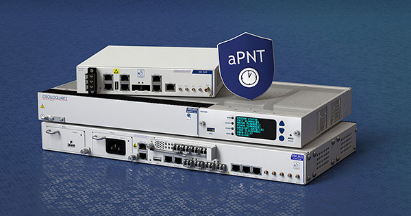
ADVA’s aPNT platform is key for the development of PGE’s critical network infrastructure (Photo: Business Wire)
Portland General Electric (PGE) is deploying Oscilloquartz PTP grandmaster clock technology as it upgrades to packet-based synchronization and protects its network against GNSS vulnerabilities and cyberattacks. The upgrades also conform to PNT Executive Order 13905.
PGE, one of the largest power utilities in the Western United States, is using the ADVA scalable timing solution to enable a smooth transition from legacy synchronization and ensure new levels of accuracy, reliability and resiliency. The new system will timestamp data and control grid substations at the edge.
With multi-band GNSS receivers and artificial-intelligence (AI) threat detection, ADVA’s assured PNT (A-PNT) platform helps maintain resilient timing, even in challenging circumstances such as deliberate jamming and spoofing attacks. It also provides multi-source backup, including PTP network timing and in-device holdover oscillators for when GNSS signals are unavailable or disrupted.
The solution is built on the OSA 5410 and OSA OSA 5420 series of edgeSync+ grandmaster clocks. It features multi-band, multi-constellation GNSS receivers and supports multiple PTP profiles, including substation power and core telecom backup sync, while also allowing conversion between them and supporting legacy interfaces.
The products are part of ADVA’s new aPNT platform, integrating threat detection, multi-source backup and ADVA’s intelligent Ensemble Sync Director.
How will widespread deployment of 5G most benefit GNSS?
Greg Turetsky
“The connectivity options that widespread 5G offer will accelerate multiple GNSS benefits. The high bandwidth is starting to encourage many into the RTK domain, but I think the bigger opportunity may come from the low power versions that enable IoT applications. The combination of the ubiquity of cellular connectivity with the low power of NB-IoT could truly accelerate the real time asset management sector all the way down to the package/pallet level.” — Greg Turetzky
Allison Brown
“Widespread deployment and adoption of 5G is likely to continue to increase the demand for spectrum as broadband access continues to expand. The recent FCC decision allowing Ligado to operate terrestrial networks in bands near GPS is likely not the last decision that will result from this increasing demand. It is not clear to me that 5G deployment will ‘benefit’ GNSS and chipset vendors may need to prioritize developing products that have improved robustness in the presence of nearby interference.” — Alison Brown
Miguel Amor
“The benefit of 5G will be seen in the long term, when 5G ranging capability is available. Hybrid positioning algorithms using both 5G and GNSS observations will provide significant positioning benefits in challenging urban environments and seamless navigation between indoor and outdoor environments. Applications across markets will see the benefits of hybrid 5G and GNSS navigation, but the real advantage lies in how this hybrid will enable the future of autonomous mobility. We will see both technologies working closer together to deliver a seamless and ubiquitous positioning solution.” — Miguel Amor
Mitch Narins
“Like communications, the ability to precisely and securely position and navigate is an essential part of 21st century life. Together they must support both critical and non-critical operations. This requires finding a common understanding of spectrum needs and how to have the best of both. In the long run, end runs by either side may achieve myopic goals but will damage society. The problem is crying out for an enterprise-level systems engineering leadership that can plot our future spectrum course. Else, the push for spectrum will continue, fueled by ‘entrepreneurial spirit’ and often a lack of understanding of the importance of other spectrum uses.” — Mitch Narins
A roundup of recent products in the GNSS and inertial positioning industry from the August 2021 issue of GPS World magazine.
OEM
GNSS board
Photo: Javad GNSS
With GLONASS dynamic calibration
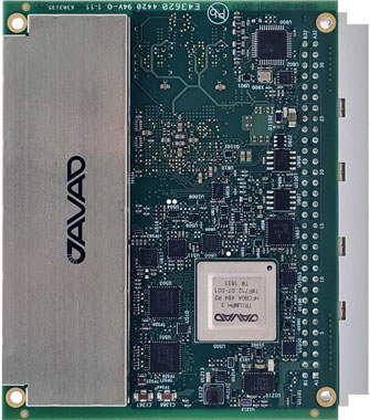
The TRE-3S GNSS board measures 100 x 80 mm, weighs 87 g and tracks 874 channels with all-in-view satellite tracking. It includes numerous features to protect against interference and improve signal output: spectrum data output, spoofing detection, advanced multipath reduction, in-band interference rejection, GLONASS 0.2-mm dynamic calibration, heading determination, attitude determination and fast acquisition channels. The TRE-3S receives GPS L1/L2/L2C/L5; Galileo E1/E5A/E5B/AltBoc/E6; GLONASS L1/L2/L3; BeiDou B1/B1C/B2/B3; QZSS L1/L2/L5/L6 (L61/L62); and SBAS L1/L5. It has a 20-Hz update and real-time kinematic (RTK) rate for real-time positioning and raw data (code and carrier). Optional features include tracking QZSS L6 (LEX) and IRNSS L5/S-band, and a data update rate and RTK rate of 100 Hz.
For high-precision applications with L-band corrections
Photo: Maxtena
The M9HCT-A-SMA is a patented helix antenna for GNSS plus L-band corrections services, suitable for high-precision and autonomous multi-frequency applications. It provides simultaneous GNSS reception in a rugged, compact form factor. The M9HCT-A-SMA is suitable for high-precision applications such as the UAV market, where high performance and low weight are driving features in antenna selection. The active helix design features Maxtena’s patented compact and lightweight Helicore technology, which provides excellent pattern control, polarization purity and high efficiency in a compact form factor.
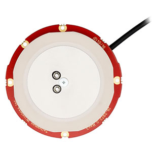
New eXtended Filtering (XF) is now employed in the TW3900 series of Accuntena precision antennas. The XF feature mitigates interference from all near-band signals and ensures the antenna provides the purest possible GNSS signals. The custom XF filtering has been tested to mitigate new (in Europe and Japan) and existing LTE signals, enabling the XF antennas to produce clean and pure GNSS radio frequency data. The XF models are TW3972XF, TW3972EXF, TW3972LGXF, TW3967XF and TW3967LGXF. All are triple-band antennas that support GPS/QZSS (L1/L2/L5), GLONASS (G1/G2/G3), Galileo (E1/E5ab), BeiDou (B1/B2/B2a), NavIC L5 and L-band correction services.
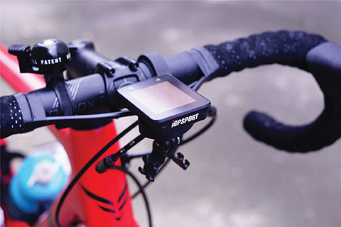
The iGS320 cycling computer builds on the u-blox M10 positioning platform, leveraging the M10’s ultra-low power consumption, compact size, and ability to track all four GNSS to offer endurance athletes a superior user experience. Adopting the M10 in its iGS320 cycling computer brought iGPSPORT an 80 percent increase in the power autonomy to deliver 72 hours of continuous tracking, up from 40 hours in their previous device. Concurrent reception of up to four GNSS constellations increases coverage and accuracy in otherwise challenging signal environments.
The Beamo 3D mapping platform enables surveyors to scan a project site and immediately collaborate with teams in the field without lengthy delays or cumbersome equipment. The digital twin created in the platform provides a single and secure source of truth for teams without requiring highly technical knowledge. With a 360-degree camera, surveyor teams can create detailed digital environments that remote teams can use to track progress, collaborate with coworkers, and take accurate measurements without having to physically visit the site.
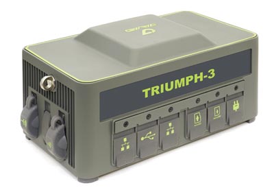
The Triumph-3 receiver tracks efficiently even in difficult conditions. It can track all current signals and is ready for future satellites. The Triumph-3 can operate as a base together with Triumph-LS and Triumph-LS Plus to efficiently accomplish any geodetic job. Its RTK system communicates via integrated UHF, 4G/LTE, Wi-Fi and Bluetooth channels, and eliminates the need to subscribe to a real-time network for corrections. A powerful and reliable receiver for high-precision navigation systems, the Triumph-3 is based on the Javad GNSS 874-channel chip. It is equipped with an internal 4G/LTE/3G card and secure and accessible microSD and microSIM cards. It also supports Javad’s lift-and-tilt technology.
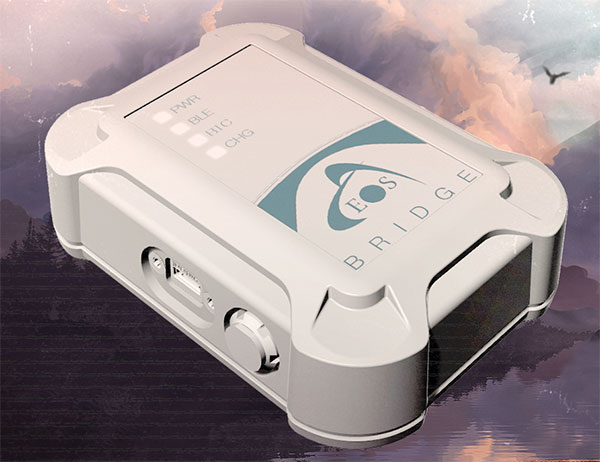
Eos Bridge enables almost any instrument to become iOS Bluetooth compatible. The pocket-sized device connects to instruments via Bluetooth Classic or serial port, and then transmits data to any Apple iOS device, such as iPhone or iPad, Android device or Windows mobile device. Instruments equipped with non-iOS Bluetooth can connect to Apple iOS devices using the Eos Bridge, including laser rangefinders and utility-locating instruments. Instruments whose only connectivity option is a serial port also can connect, such as any instrument or sensor with an RS-232 serial port. The Eos Bridge is lightweight, at approximately 150 grams (about 5.3 ounces). It can be worn clipped to a belt, stored in a pocket, or mounted to an instrument or sensor. The battery lasts 48 to 72 hours.
The OceanReports web tool provides users with specialized “ocean neighborhood analyses,” including maps and graphics, by analyzing more than 100 ocean datasets instantaneously. Reporting data includes information about habitats and species, industries in the area, potential hazards (such as undersea cables or shipwrecks), the economic value of ocean commerce, and other detailed oceanographic information. The web-based interactive tool for ocean mapping and planning, created by the National Oceanic and Atmospheric Administration (NOAA) and the Department of the Interior’s Bureau of Ocean Energy Management, provides professional users and the general public with opportunities to explore the ocean from their own computer.
HxGN Mass Transit is a geospatial transportation infrastructure management system with 3D and AI capabilities for visualizing and analyzing transit and rail assets and operations. Built on Hexagon’s M.App Enterprise, HxGN Mass Transit provides an advanced digital twin of a city’s entire public transportation network — including tracks, stops, switches, construction sites, ticket machines, benches and garbage cans. It integrates asset and spatial data so operators can visualize and analyze an entire network with accurate and up-to-date information.
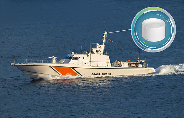
The GAJT-410MS provides anti-jamming to marine vessels. (Image: NovAtel)
The GAJT-410MS provides NovAtel’s GPS Anti-Jam Technology (GAJT) for the commercial and defense marine markets. The low SWaP variant protects civil and military operations from interference and jamming, with jammer direction-finding capabilities for enhanced situational awareness in the marine environment. The GAJT-410MS provides dynamic protection on both GPS L1 and L2 bands, as well as Galileo E1, QZSS L1 and L2, and SBAS L1 to combat intentional and unintentional interference.
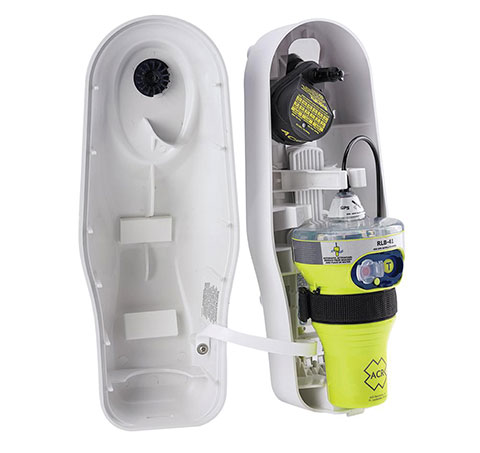
The ACR 2830 GlobalFix V4 EPIRB marine distress beacon has multiple built-in redundancies to increase chances of survival in an emergency situation. The internal GPS receiver pinpoints the user’s location, which is then transmitted on the 406-MHz distress signal. In the absence of GPS-derived coordinates, the signal can be used to triangulate the position. The beacon’s 121.5 MHz homing signal will bring local search-and-rescue forces directly to the position; an LED strobe light allows them to see the position in low light. A Category 1 Emergency Position Indicating Radio Beacon (EPIRB), the GlobalFix V4 is a float-free device that will automatically activate when submerged in water. Two self-tests monitor transmission, power and battery performance as well as GPS acquisition.
A new connected platform for rail passengers with Wi-Fi, information and entertainment content is being installed on OUIGO Spain trains through the OUIFUN portal. Passengers can connect via smartphones, tablets or PCs, access the internet on board to check email or browse the web, and enjoy entertainment content. Passengers also will be able to get travel status information in real time via an interactive map, access tourist guides or consult a menu for on-board catering. The service, provided by Moment, launched on May 10 on OUIGO’s first high-speed line in Spain connecting Madrid to Barcelona, and will gradually be extended to the whole high-speed OUIGO network.
The ANAFI Ai UAV uses 4G as its main data link between the drone and the operator. The 4G link improves data transmission and enables precise control at any distance. For BVLOS flights, it stays connected even behind obstacles. The 4G link between the drone and the user’s phone is encrypted, with a secure element protecting both software integrity and data privacy. A software development kit enables creation of custom code for flights and gives access to all sensors, including obstacle-avoidance sensors, occupancy grid and internet access.
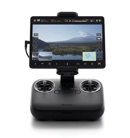
An introductory model in Sony’s new Airpeak line, the small S1 drone can be equipped with the company’s full-size mirrorless interchangeable-lens Alpha camera. Its proprietary motor, propeller, control system and sensing technology allow it to fly at high speed (a maximum speed of 55 mph) with stable wind resistance. Propulsion technology using a combination of devices developed by Sony provides wind resistance in strong wind speeds up to 44.7 mph. The Airpeak S1 includes obstacle detection, automatic flight control via sensing, and increased safety via cloud management of the aircraft.
At 80 grams, George is a low SWaP certifiable solution for enterprise operations and those wishing to type certify their UAS. Built around the open-source autopilot Cube from CubePilot, George combines Cube with Design Assurance Level C (DAL-C) hardware and safety and sensor monitoring, enabling customers to meet the type certification and safety case requirements for BVLOS operations. Its triple-redundant IMU includes three accelerometers, three gyroscopes, three magnetometers and three barometers. The hardware platform is designed and built to RTCA DO-254 DAL-C and meets rigorous DO-160G and MIL-810H power and environmental qualifications.
Additional Loyal Wingman jet-powered drones are being developed. Plus, quadcopters are helping calibrate and maintain aviation ground navigation systems.
I’ve previously discussed the Loyal Wingman project. Companies in the United States and Australia are developing unmanned full-scale jet-powered drones t0 fly alongside frontline fighters, and perhaps take on riskier missions.
The Loyal Wingman drones are powered with artificial intelligence developed for the U.S. Air Force Skyborg program.
Programs in other parts of the world are also developing technology for the same fly-along objectives. The United Kingdom has launched the Lightweight Affordable Novel Combat Aircraft (LANCA) program, and India is working on the Combat Air Teaming System (CATS) Warrior project.
UK LANCA project
The UK usually takes its time progressing with new aviation concepts, but has now awarded a £30 million concept contract to Spirit Aerosystems in Belfast to develop and fly a demonstrator drone by the end of 2023.
Meanwhile, Kratos in the United States and Boeing Australia both have Loyal Wingman UAVs well into flight test programs as part of the Skyborg program. (The first test flight of the Loyal Wingman was successfully completed in February.) Nevertheless, the LANCA schedule should mesh with that of the UK’s next-generation fighter program, known as Tempest, which is just getting started.
Computer rendering of the United Kingdom’s Mosquito drone concept. (Credit: UK Defense Department)
Spirit Belfast is the Irish subsidiary of Spirit AeroSystems (Wichita, Kansas), previously owned by Bombardier (Montreal, Canada) and, before that, Shorts Brothers, Belfast. Spirit was previously involved in manufacturing aerostructures and will apply its unique composite resin transfer-infusion technology to build a high-speed capable, lightweight fuselage for the aircraft.
Spirit has formed Team Mosquito, joining Northrop Grumman UK and Intrepid Minds for flight controls and avionics. An engine supplier and developer has yet to be announced.
CATS Warrior project
On the other side of the world, Indian state-owned Hindustan Aeronautics Limited (HAL) has apparently invested significantly since at least 2019 in a program to develop another Loyal Wingman concept, known as the HAL Combat Teaming System Warrior (HAL CATS Warrior). A mockup of the CATS Warrior was on display at Aero India 2021.
While still in the early phase of development, the program appears to be well into the major undertaking by HAL and its partner Newspace R&D. HAL has been the indigenous aircraft manufacturer for the Indian Air Force since the late 1940s, with facilities in Bangalore and with more than 25,000 employees.
The design goals for the Warrior drone appear to mirror those of the programs in the United States and the United Kingdom — to create an independent, autonomous, unmanned vehicle that can be teamed alongside frontline fighter aircraft as an expendable force multiplier.
Flight inspection drones
While we’re on the topic of aviation, let’s pull back to more current unmanned applications. News has emerged of a drone being used to inspect a landing-aid system in Russia. Aviation authorities in many countries spend lots of time and money on verifying and calibrating new and existing ground-based landing and navigation aids, to the point of equipping general aviation aircraft with extensive instrumentation and dedicating them to regularly checking key airport and en-route systems.
This is an expensive and lengthy task — all the way from buying, maintaining and operating aircraft to equipping each flying laboratory and maintaining complex onboard equipment, as well as training and employing skilled pilots and equipment operators.
The Cursir nav-aid inspection drone. (Photo: Cursir)
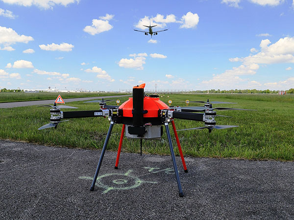
Cursir in Russia has installed a specialized radio receiver on a commercial drone and used it to pre-configure a newly installed instrument landing system (ILS) at the Ulyanovsk-Vostochny airport, where difficult terrain makes the initial set-up of the ILS quite complex.
However, by using this calibration drone, set-up time was significantly reduced and adequate preparations were made for subsequent control flights by a fully equipped flight inspection aircraft. Even though these formal flights were still required, calibration of the ILS was less involved and fewer flights were necessary.
In the future, maintenance checks using only the calibration drone may be possible. Drones have also been in use for complete NAVAID inspection for some time, with companies including Canard in Spain and Colibrex in Germany.
Canard’s drones undertake flight inspection of runway lighting, ILS and other airport NAVAIDS. It uses a database of airports, runways and systems for flight planning, autonomous drone operations and analysis/reporting of collected data. Canard was founded in 2015, and its first flight inspection contract was in 2017 for seven European airports.
The Canard flight inspection drone. (Photo: Canard)
Colibrex built its own COL-X8 NavAidDrone in order to better integrate its in-house flight inspection receivers and antennas. The requirement for flight inspection is to accurately evaluate the signal-in-space being transmitted by the NAVAID, so Colibrex invested heavily in the development of its on-board RF reception and in-house results analysis systems. Early trials were first run in 2012, through many different measurement campaigns around the world; Colibrex has now established an extensive drone flight inspection capability.
The Colibrex NAVAID drone. (Photo: Colibrex)
To sum up, more Loyal Wingman jet-powered drones are in development, and perhaps we now have a little insight into how quadcopters are being used to calibrate and maintain aviation ground navigation systems. These are just a couple more innovative applications for unmanned aircraft.
SkyTraq Technology Inc. has launched a GNSS/inertial measurement unit (IMU) suitable for both automotive pre-installation and aftermarket.
The robust PX1120D dead-reckoning module integrates a 6-axis IMU and a concurrent quad-GNSS chipset, forming a sensor-fusion solution that maximizes positioning accuracy even in challenging environments. The PX1120D receives concurrent GPS/GLONASS/Galileo/Beidou/QZSS signals.
For automotive pre-installation applications where vehicle wheel-tick signals are available, the PX1120D provides wheel-tick sensor fusion with automotive dead-reckoning. In aftermarket applications where wheel-tick signals are unavailable, the PX1120D provides an untethered dead-reckoning sensor-fusion solution.
A single PX1120D module provides both automotive and untethered dead-reckoning functionality, simplifying logistics. The PX1120D provides 100% position coverage. It is suitable for infotainment systems, telematics control units, vehicle tracking, and advanced driver-assistance systems (ADAS) applications that require the highest performance and reliability, as well as uninterrupted positioning.
The PX1120D supports flexible mounting in any orientation. Its auto-calibration feature simplifies the installation procedure.
The 12 x 16 mm PX1120D offers continuous navigation in tunnels and underground parking lots. It can output attitude, gyroscope and accelerometer sensor data, making it useful for black-box driver behavior monitoring and insurance accident reconstruction.
The PX1120D uses an AEC-Q100 qualified chipset and is manufactured in ISO/TS-16949 certified plants. An engineering sample, evaluation kit and datasheet will be available by the end of August. Volume delivery to customers begins in the fourth quarter of this year.
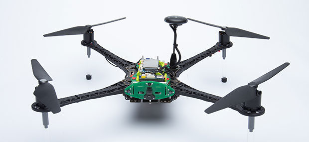
The Qualcomm Flight RB5 5G platform accelerates and scales development for drone manufacturers to deliver powerful enterprise and industrial 5G drones
Qualcomm Technologies has unveiled a drone platform and reference design that offers both 5G and artificial intelligence capabilities.
The Qualcomm Flight RB5 5G platform is designed to accelerate development of commercial, enterprise and industrial drones. Powered by the Qualcomm QRB5165 processor, it builds upon Qualcomm Technologies’ latest offerings for the internet of things, delivering a solution that will drive the next generation of high-performance, low-power, 5G drones, the company said.
As a primary driver of global 5G proliferation, Qualcomm Technologies has enabled 5G to scale for both the drone and robotics industries. The new 5G platform condenses multiple complex technologies into a tightly integrated drone system. Use cases include mapping, inspection, film and entertainment, defense, security and emergency response, and delivery.
Photo: Qualcomm
The Qualcomm Flight RB5 5G Platform’s high-performance and heterogeneous computing at ultra-low power consumption provides power efficient inferencing at the edge for AI and machine learning (ML), enabling fully autonomous drones, the company said. New camera capabilities deliver premium image capabilities and performance.
With 5G and Wi-Fi 6 connectivity, this platform enhances critical flying abilities beyond visual line-of-sight (BVLOS) to support safer, more reliable flight. In addition, safety controls alone can no longer assure industrial and commercial drone safety, especially when scaling to Beyond Visual Line of Sight operations.
The Qualcomm Flight RB5 5G platform is equipped with a Qualcomm Secure Processing Unit to support modern drone demands for cybersecurity protections as a key enabler of data-protection and safety requirements.
Partners. Qualcomm Technologies is working with Verizon to complete network testing of the Qualcomm Flight RB5 5G Platform for the Verizon 5G network, and expects the platform, which is 5G mmWave capable, will be offered via the Verizon Thingspace Marketplace.
The Qualcomm Flight RB5 5G drone reference design is available now for pre-sale through ModalAI. A development kit is expected to be available this year in the fourth quarter.
“We have continued to engage many leading drone companies, enabling 200+ global robotics and drone ecosystem members in addition to consistently driving and promoting worldwide drone standardization and transformative 5G capabilities in organizations such as 3GPP, GSMA, the Global UTM Alliance, the Aerial Connectivity Joint Initiative (ACJA) and ASTM,” said Dev Singh, senior director, Qualcomm Technologies.
In addition, global carriers and IoT ecosystem who have validated or expressed support for the drone platform include Asia Pacific Telecom, AT&T, China Unicom, Everguard.ai, FlightOps, Juganu, KT Corporation, LG Uplus, MITRE, ModalAI, Taiwan Mobile, TDK, Veea, Verizon Skyward and Zyter.