Accurate and reliable positioning, timing and navigation (PNT) technologies, such as GPS, have become “invisible utilities” that enable many critical applications, including the electric grid, telecommunications, agriculture and port operations. These systems, however, are vulnerable to accident and attack, including cyber threats and jamming.
Therefore, the Science and Technology Directorate of the U.S. Department of Homeland Security and the National Risk Management Center of the Cybersecurity and Infrastructure Security Agency have been working in collaboration with industry and government stakeholders to develop the Resilient PNT Conformance Framework, which provides a common framework for defining resilient PNT systems and addresses strategic risks to U.S. national critical infrastructure. This work is now transitioning to the Institute of Electrical and Electronics Engineers (IEEE) as the Standards Working Group for Resilient PNT User Equipment (P1952) and will help serve as starting resources for the refinement and development of a standard.
By creating common definitions for different levels of resilient PNT systems, this new standard will enable vendors to differentiate their products from non-resilient PNT systems, as well as enable end-users to make deliberate, risk-informed decisions as to which systems are most appropriate for their applications and needs. The development of this voluntary standard will help influence the future design, acquisition and deployment of resilient PNT systems within our national critical infrastructure.
The IEEE standards process is an inclusive one, designed to gather many stakeholders interested in resilient PNT. If you would like to participate in the standards working group, just notify the group’s chair (Shelby Savage at [email protected]) or its secretary (Patricia Larkoski at [email protected]). Voting membership requires sufficient participation in work group meetings.
The development of this voluntary standard will help influence the future design, acquisition and deployment of resilient PNT systems.
After the standards working group votes to approve the draft standard, it will be submitted to the membership of the IEEE Standards Association (IEEE SA) for final approval. The IEEE Standards Balloting Center will then send an invitation to any SA members it knows to be interested in the subject matter of the proposed standard, and anyone answering the invitation affirmatively will have a right to vote on the final standard.
Compared to the early days of GPS, PNT systems have become highly sophisticated pieces of equipment with a multitude of components, both hardware and software, along with associated vulnerabilities. Additionally, with a wide array of stakeholders and a variety of ideas on what PNT resilience means, getting consensus and developing such a standard would be challenging without an established process.
To help address this challenge, DHS developed the Resilient PNT Conformance Framework with input from industry stakeholders to establish baseline concepts on the definition of resilience and necessary behaviors within resilient PNT systems. DHS designed this framework to be outcome-based and non-prescriptive, to encourage industry innovation.
“To address security and resilience, GPS and PNT receivers need to be treated more like computers rather than radios,” said Ernest Wong, technical manager for the Science and Technology Directorate. “The refinement of the Resilient PNT Conformance Framework into industry standards will help to ensure that future PNT receivers are resilient and designed to withstand and recover from threats.”
Editor’s Note: This article does not represent a formal position of P1952 Working Group, Communications Society Standards Committee, IEEE, or IEEE SA.
“Seen & Heard” is a monthly feature of GPS World magazine, traveling the world to capture interesting and unusual news stories involving the GNSS/PNT industry.
Photo: IBM
Sailing new school
An autonomous ship designed to recreate the Mayflower’s historic journey across the Atlantic 400 years ago returned to the UK after developing a mechanical problem. IBM’s Mayflower Autonomous Ship (MAS) set sail on June 15 on its 3,500-mile journey from Plymouth in the UK to Massachusetts in the United States. The voyage is expected to take about three weeks, and includes collections of data on marine life and sampling for plastic waste. The 50-foot long, solar-powered trimaran is capable of speeds of up to 10 knots (18 km/h) and is being navigated by on-board artificial intelligence (AI) with information from six cameras and 50 sensors. Project leaders say the AI worked perfectly. The ship navigates with precision GNSS, inertial measurement units, radar, weather station, SATCOM and the automatic identification system.
Photo: Lt.j.g. Alexander Fairbanks/U.S. Navy
Sailing old school
U.S. Navy sailors aboard mine-countermeasures ship USS Patriot used celestial navigation to navigate an 1,100-mile voyage back to port on the western coast of Japan in July 2020. The voyage allowed the crew to improve their mariner skills as they used sextants to find their latitude and longitude and compasses to determine their heading. The exercise wasn’t entirely old school. The sailors entered the celestial measurements into a computer to pinpoint their position using the System to Estimate Latitude and Longitude Astronomically (STELLA). The combination of repeatedly inputting sextant measurements, the course and speed of the ship, and time into STELLA, provided an accurate fix of the ship’s position. For backup, Combat Information Center (CIC) watch standers followed the ship’s course with GPS. Training in celestial navigation returned to the Navy as a core competency in 2016, 17 years after the U.S. Naval Academy stopped requiring midshipmen to learn the technique.
Photo: Lt.j.g. Alexander Fairbanks/U.S. Navy
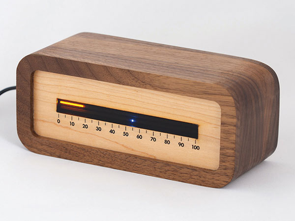
Linear clock shows sunrise, sunset
A creative technologist spent his COVID-19 downtime creating a device that uses a GNSS receiver to compute time relative to sunrise and sunset. “Since it derives time from the satellite signal, it never needs to be set, or ever adjusted for daylight saving time,” explains creator James Wilson on his webpage. The device uses satellite navigation and astronomy to show time as a progress bar measuring the percentage of the day elapsed since sunrise. A second indicator marks the time to sunset in blue.
Tracking Iran’s nuclear site
A team with Stanford University’s Center for International Security and Cooperation (CISAC) is keeping tabs on activity at Iran’s Natanz nuclear facility using BlackSky’s geospatial imagery and burst collection technology. BlackSky’s satellites provide intraday revisit capabilities, allowing CISAC’s research team to receive multiple images a day, throughout the day, rather than just one image collected at roughly the same time each day. The satellites also can capture a sequence of 20 images within minutes (burst collection) and splice them together to generate a moving sequence of activity. With BlackSky’s assistance, the research team was able to witness trucks emerging from the facility’s underground tunnels.
Catapult, a sports performance technology company, says that it helped athletes at the 2020 Olympic Games in Tokyo win 24 medals. Catapult athletes took part in rugby, football and rowing, representing various countries. Among athletes using Catapult were members of the Canadian women’s football team, who helped Canada win gold for the first time in the sport.
“We strive every day to find the improvements that unleash the full potential of all our athletes and teams, and we’re proud to see our customers’ hard work pay off on the world stage,” said Will Lopes, CEO of Catapult. “Following an unprecedented year of delayed and disrupted training, athletes were able to use our technology to continue to compete at the highest level and perform at their best.”
The athletes were wearing the Vector system, which provides data to aid decisions on performance, risk and return to play. The Vector GNSS/LPS device combines advanced GNSS capability with Catapult’s ClearSky LPS to deliver tracking data both indoors and outdoors.
NV5 Geospatial has launched Trim Optimization, a predictive modeling platform that enables electric utilities to enhance vegetation management programs with risk-based assessments.
Using information from existing lidar and historical data, utilities can leverage Trim Optimization to prioritize tree-trimming activities by taking into account the risk posed by individual trees and other operational constraints.
“Trees are to blame for a large percentage of outages, and vegetation management is the single biggest cost for electric utilities. Yet, utilities have only started to look at proactive, risk-based management programs, rather than the traditional cycle-based ones,” said Ian Berdie, vice president of innovation for NV5 Geospatial. “NV5 Geospatial’s Trim Optimization platform will help utilities improve grid reliability through better decision making, while also saving them money through greater efficiency and the ability to target areas that have the most potential for problems.”
Vegetation is one of the largest sources of outages, accounting for more than half, according to a recent survey, “Geospatial Analytics, Resilience and Extreme Weather Readiness.” The majority of respondents also noted that they use data to analyze risk, but budget constraints often prevent them from investing in the data they need.
The trim optimization platform takes a phased approach to identify relative risk to target vegetation management work where it will have the most impact. With extensive expertise, NV5 Geospatial first identifies several attributes associated with vegetation-caused outages that can be modeled from high-density lidar and provide a relative risk score.
Utility-specific data, such as historic tree failures information or other factors, can be analyzed to enhance results further.
The final risk scores will provide a quantitative assessment of combined risk, enabling utilities to develop work plans that prioritize vegetation management mitigation efforts and result in greater operational efficiency.
NV5 is holding a webinar on Trim Optimization on Aug. 25. Register here.
The research satellite will in collecting high-quality, high-resolution data for terrestrial, coastal and ocean ecosystems for a three-year period after launch, according to Matthew McCabe, director of the KAUST Climate and Livability Initiative. McCabe described the launch as a qualitative process for the Kingdom’s efforts in the field of protecting and restoring ecosystems on land and at sea.
A CubeSat is a small satellite consisting of one or several 10x10x10 cm units, no more than 1.33 kilograms per unit. CubeSats can range from 1 unit (1U) to 12 units (12U). The KAUST satellite is 6U.
“In the past, launching a satellite was the sole domain of governments, with costs well beyond the reach of a university,” McCabe said. “CubeSats are helping to democratize space, providing the opportunity to launch a customized platform at a fraction of the traditional cost.”
The data collected will provide high-resolution details about current conditions of ecosystems in the region, and monitor improvements from environmental management strategies, supporting the Saudi Green Initiative among others.
The CubeSat is equipped with Spire’s GNSS reflectometry reflectors, as well as a hyperspectral imaging sensor. It is supported by advanced capabilities in processing and artificial intelligence.
The satellite will allow KAUST University researchers collect and analyze high-resolution images of the Earth’s surface for detailed mapping of terrestrial environments, monitoring of vegetation cover status, exploration of coastal ecosystems and coral reefs, development of precision agricultural research, and a host of other Earth and environmental science applications.
The imaging sensor can image areas of interest anywhere in the world across more than 30 user-adjustable spectral bands. The sensor data can be combined with Spire’s GNSS receiver to monitor micro-environmental variables such as soil moisture, helping in many areas such as agriculture, forestry and land management.
“The capacity to observe the Earth in high-resolution hyperspectral detail will allow for the production of enhanced metrics to map and monitor change anywhere in the world,” McCabe said. “Closer to home, Saudi Arabia is focusing considerable effort towards the protection and restoration of its precious terrestrial and ocean systems. The data from this KAUST CubeSat will be invaluable in providing new information on both the state of existing ecosystems, and for monitoring changes resulting from improved management strategies – something that can be used to support aspects of the Saudi and Middle East Green Initiatives.”
The trial for the U.S. Department of Homeland Security showcases the precise, resilient timing capabilities of NextNav’s TerraPoiNT service in the event GPS is unavailable.
NextNav has successfully demonstrated the timing precision and resilience of its terrestrial positioning, navigation and timing (PNT) system, TerraPoiNT, in a recent evaluation by the Science and Technology Directorate of the Department of Homeland Security (DHS S&T).
The trial tested the timing redundancy of the TerraPoiNT system in a number of scenarios, including instances of GPS outages, spoofing and jamming. It validates TerraPoiNT’s capabilities as a terrestrial, GPS-free network capable of powering critical national infrastructure in the event of GPS failure.
During a simulated 72-hour GPS outage, the TerraPoiNT service was able to deliver a timing accuracy better than 50 nanosecond in urban and semi-urban environments, successfully meeting timing requirements for various applications including 5G networks, the synchronization of the power grid, and more.
In addition, TerraPoiNT provided precise timing and redundancy utilizing two alternate absolute timing sources — atomic clock (Cesium/Rb) and LEO satellite (Satelles).
“GPS is critical infrastructure, but it has its limitations,” said Ganesh Pattabiraman, co-founder and CEO of NextNav. “In working with DHS S&T, we’ve validated that TerraPoiNT can serve as an important backup to GPS and ensure the resilience and continuity of our nation’s most critical systems, including next-generation telecommunications networks, financial services, and power grids.”
Satelles STL
STL from Satelles was one of two alternate absolute timing sources for the trial. Available today on a global basis, STL is a service that provides alternative PNT independent of GPS, supporting PNT-reliant applications such as 5G communications networks, high-frequency trading in financial markets, and electrical grids throughout the United States and around the world.
“Satelles applauds NextNav for conducting a successful field demonstration of its resilient PNT service, and we were delighted to have played an instrumental part in the exhibition,” said Christina Riley, vice president of Commercial PNT.
NextNav’s selection of STL to help demonstrate their own technology’s operation in the absence of GPS was a natural fit. That’s because earlier this year the U.S. National Institute of Standards and Technology (NIST) confirmed STL as an accurate and reliable source for the wide-area delivery of Coordinated Universal Time independent of GPS/GNSS.
Previous TerraPoiNT evaluations
The successful trial builds on recent evaluations of TerraPoiNT conducted by independent bodies. Earlier this year, the Department of Transportation (DOT) evaluated 11 alternate PNT solutions, in which each was rigorously tested across applications and scenarios. As a result of the evaluation, the DOT named TerraPoiNT the best and only performing solution across all PNT categories.
Spartacus. In June, NextNav entered into a definitive merger agreement with Spartacus Acquisition Corporation in a transaction that would result in NextNav being listed on the Nasdaq. The transaction is expected to close late in the third quarter of 2021 or early in the fourth quarter of 2021, subject to satisfaction of customary closing conditions.
Spirent Federal Systems, a provider of PNT/GNSS test equipment, announced plans to fully validate the inertial interface between Spirent GNSS simulators and both Northrop Grumman legacy and modernized inertial systems under the EGI‐M program.
For years, Spirent Federal has developed inertial interface test tools in collaboration with Northrop Grumman that yield repeatable, accurate results.
Northrop Grumman’s embedded GPS/inertial navigation system (INS)‐modernization, or EGI‐M, program is developing airborne navigation capabilities with a government‐owned open architecture. The fully modernized system integrates new M‐code capable GPS receivers, provides interoperability with civil controlled air space, and implements a new resilient time capability.
“Spirent Federal has long supported testing of the Northrop Grumman family of interfaces,” said Jeff Martin, Vice President of Sales for Spirent Federal, “and our customers have always obtained precise, reliable results. Spirent Federal strives to keep abreast of the newest technology to be ready to meet the needs of industry, and this collaborative effort that includes the EGI‐M program is yet another example. Spirent is an important part of Northrop Grumman’s test solutions and this validation project acknowledges that importance.”
Spirent Federal has been providing tools for testing inertial systems for more than two decades. Available SimINERTIAL interfaces comprise various EGIs and IMUs from manufacturers of inertial sensors, including Northrop Grumman (formerly Litton), Honeywell and Atlantic Inertial Systems, as well as standardized interfaces such as STANAG.
Testing the full operational performance of GPS/inertial systems usually requires expensive and time‐consuming field testing on a moving vehicle. Spirent’s SimINERTIAL system emulates inertial sensor outputs while concurrently simulating GPS RF signals, enabling controlled, repeatable testing of EGIs and reducing the need for field trials.
UNMANNED SOLUTION, a South-Korean company based in Seoul, develops autonomous vehicles, including driverless shuttles, autonomous agricultural equipment, robots, and educational platforms. (Image: SBG Systems)
What is complementary / alternative positioning, navigation, and timing (PNT)? In this month’s cover story, five of our marketing partners share their perspective on this question and explain how their products address it.
The four global navigation satellite systems (GNSS), two regional navigation satellite systems and public and private augmentation services continue to provide exceptional levels of accuracy and reliability for positioning, navigation and timing (PNT). Yet their well-known vulnerabilities also continue to fuel the need for alternative/complementary sources of PNT data, especially for new and rapidly expanding user segments such as autonomous vehicles.
What constitutes a complementary service to GNSS for PNT and what constitutes a true alternative is partly a matter of definition and opinion. In a January report, the U.S. Department of Transportation stated
…suitable and mature technologies are available to owners and operators of critical infrastructure to access complementary PNT services as a backup to GPS. To achieve the parallel objective of resilience, as described in Executive Order (EO) 13905, that path should involve a plurality of diverse PNT technologies. Promoting critical infrastructure owner/operator use of those technologies that show strong performance, operational diversity, operational readiness, and cost-effectiveness is worthwhile. Based on this demonstration, those technologies are LF and UHF terrestrial and L-band satellite broadcasts for PNT functions with supporting fiber optic time services to transmitters/control segments. (Andrew Hansen et al., Complementary PNT and GPS Backup Technologies Demonstration Report, prepared for the Office of the Assistant Secretary for Research and Technology, Department of Transportation, January 2021, p. 195.)
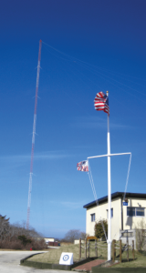
A portion of the former USCG Loran Support Unit in Wildwood, New Jersey, with its iconic Loran antenna. (Image: UrsaNav, Inc)
For this year’s Q&A on complementary / alternative PNT, I asked five companies in the GNSS/PNT space to tell us how they define the issue, what solutions they prioritize, what markets they target, and which of their products specifically address the need to make PNT more resilient.
Roger Hart: The deep adoption of the state-sponsored, space-based global navigation satellite systems (GNSS) defines them as the primary PNT source at this time. Inertial navigation, long predating GNSS, does provide an independent navigation solution but does not provide time. In today’s conversation, alternative PNT generally refers to deriving position and timing from existing signals not purposed for navigation, to ground-based location systems, and also to emerging satellite systems that operate at higher power — or out of the GNSS band — to provide a diversity of PNT sources.
David Sohn: Simply put, alternative PNT is usually anything that is not GNSS. So, this includes PNT derived from low Earth orbit (LEO) satellites; vision, radar, lidar combined with inertial measurement units (IMUs) and map matching; positioning off cellular WiFi, digital TV signals and other signals of opportunity; legacy nav aids like VORTAC, ILS, DME and eLoran; and new dedicated infrastructure positioning systems like Locata, NextNav or RFID.
Matthieu Noko: Here at SBG Systems, for 15 years we have been developing navigation systems based on smart coupling of GNSS technology and inertial sensors. From our perspective, inertial sensors as well as sensors such as odometers or DVL, combined with high-end algorithms and RAIM, build consistent alternatives to GNSS-only systems in the vast majority of outdoor applications. Inertial sensors dramatically enhance GNSS-only navigation systems, making it possible to provide navigational data during GNSS outages in urban environments or to reject false GNSS measurements due to multipath effects.
As its entry into the driverless category of the Formula Student Germany car race, AMZ modified the car it has used in competition since 2015 to be driverless. (Image: SBG Systems)
The hybridization of several technologies makes it possible to reach a sufficient reliability level for the majority of commercial applications. However, in some indoor applications or in case of intentional jamming or spoofing, a higher resiliency is required. Using visual odometry can then complement quite effectively the navigation system, although this technology is still at a research level. Compared to infrastructure-based alternative PNTs — such as WiFi, Bluetooth or ultra wideband (UWB) ranging — visual odometry has the great advantage of not requiring any infrastructure.
Jacob Amacker: GNSS remains the dominant method of PNT in terms of market applicability and performance, but there are many rival technologies that have great potential and will compete with GNSS going into the future. The most important changes in PNT will be methods of position localization that are able to replace GNSS, and we will likely see these technologies integrated into huge systems, making use of ubiquitous technologies such as lidar. Whereas GNSS still provides the most accurate timing, as systems get more complex, time synchronization becomes a bigger issue, so different methods of this need to be explored.
There are many ways of improving the navigation data overall. Most commonly an IMU and a Kalman filter will be employed to stabilize any errors in the position localization method. A Kalman filter is a method of processing data from a range of sources—say, GNSS, an IMU, and a wheel speed sensor—and using them in such a way as to arrive at the position with a greater accuracy and precision than either source alone would be able to achieve. This process, however, requires precise timing for each data stream. Therefore, one area in which alternative PNT has to compete with GNSS is timing precision. GNSS makes use of atomic clocks used on satellites that are as accurate as you will get. There are also several ways of synchronizing time. A timing system can only be as precise as the most precise clock on the network, but there have been developments, such as Precision Time Protocol (PTP) that can synchronize timings across a network of clocks over Ethernet connections. Traditionally, PPS has been used and whereas this is still very precise it is not able to compete with PTP on convenience or sophistication.
Charles Schue: The common definition these days for “alternative PNT” seems to be with respect to, or as compared to, GPS or GNSS. Even the U.S. DOT’s website speaks to PNT as related to GPS.
I used alternative, complementary and backup somewhat interchangeably during my entire career with the U.S. Coast Guard. In recent years, I injected “co-primary” into the conversation as well. Prior to GNSS becoming ubiquitous, alternative, complementary and backup were not technology-based terms, but were instead operationally based. For example, “the prudent mariner” or “the prudent aviator” should use all means at their disposal to safely navigate their platform. For the navigator, this would include visual, audible and electronic signals or aids. The solution of choice obviously was the one that provided the highest accuracy, availability, integrity and continuity. However, prudence required always checking the solution of choice against other readily available alternatives, preferably that complemented each other, to ensure safety and continuity of operations. At one time, shipboard navigators might have at their disposal Loran-C, OMEGA, GPS, INS, radar, sextant, visual bearings (such as lights and landmarks), beacons, and soundings. Similar alternatives were available on aircraft.
Although always in the mix, timing was often in the background until around 2000. Then it started to become as important as positioning and, in many areas, even more important than positioning. Today’s incredible dependence on technology, and interdependence between technologies, means that knowing your “when” has become as important as knowing your “where”.
Whatever the terminology, the definition of alternative PNT should include some key features. Firstly, we should accept that the solution of choice today is GNSS, and we should define it as primary or co-primary. Next, we should acknowledge that when the primary solution is available and trustworthy, it should always be used, or at least considered. Finally, the primary solution should continually be compared with alternatives to ensure safe and secure provision of PNT to the user. Thus, an alternative PNT solution is one that is readily available; provides an easy and seamless transition to/from the primary or other alternatives; allows continuity of operation at a possibly degraded, yet usable, level of accuracy, availability, integrity or continuity; and is dissimilar enough from alternatives to withstand the effects that might be affecting the primary solution.
Do you agree with the U.S. DOT’s assessment, cited above, of what it will take to make the national PNT much more resilient and reliable? If you do, how do your offerings fit into that framework?
RH: While there are intricate differences in the signals generated by the primary PNT systems, they are all quite similar in terms of frequency and power and are all vulnerable to the same types of interference. Achieving the most resilient solutions will require the use of alternative RF bands and non-RF sources. Having a variety of alternative PNT sources will allow users to integrate the method most applicable to their platform constraints. Integration across the various PNT sources will need time synchronization to take full advantage of the alternate PNT systems. Our offerings work concurrently with GNSS, providing simulation and testing of GNSS and alternative PNT as true complements, while also offering the ability to measure timing accuracy in real time.
DS: Yes, we agree with the DOT’s assessment. However, to be clear, the DOT does not require “LF and UHF terrestrial and L-band satellite broadcasts for PNT functions with supporting fiber-optic time services to transmitters/control segments.” It stated that to achieve resilience, systems “…should involve a plurality of diverse PNT technologies…that show strong performance, operational diversity, operational readiness and cost-effectiveness.” Their demonstrations showed that those technologies they called out meet these criteria. Our solutions have been leading this resilient approach by offering several diverse, alternative PNT references.
We have fielded time-server equipment that operates from both GNSS and eLoran. Our standard offering time servers are equipped with multiple references from GNSS, network-based time services from NTP, PTP and PTP WR; internal references from disciplined atomic clocks; wireline references from IRIG, 1PPS or ASCII time code; and LEO PNT reference from the STL signal.
(Image: SimonSkafar_E+_Getty Images)
L-band or more generally the use of geostationary satellites was until very recently the only communication link for PNT augmentation services, although these signals are weak and easily disturbed or masked, especially at high latitudes. Resilient navigation will clearly need to allow multiple downlinks for corrections such as terrestrial networks (4G/5G) or satellite-based internet. In the mid-term, we expect the correction delivery over IP to become the standard, and L-band corrections to be used as a backup only. All our high-performance products already include an NTRIP client able to handle the IP corrections very easily.
JA: This is certainly one option. Largely, it is borne out of a need to compensate for the disadvantages of GNSS. This larger range of frequencies would provide a range of satellite-borne signals that have different penetration characteristics and information carrying properties but the same core purpose. Therefore, somebody making use of such a system will be better able to receive these signals even when under obstructions. Of course, some obstructions will still be impenetrable to GNSS signals and there is a long way to go to developing a comprehensive solution that can deal with timing differences when the signals travel through objects. It is likely that some other source of timing information, for example through the proposed fiber-optic services, will be necessary to smooth out these issues. Although we will see this much-needed upgrade to cover the shortfalls of GNSS employed, many other alternatives will start to take prominence. It is difficult to say which solution will win out, and it is likely that an upgraded GNSS will continue to dominate for the next decade or two at least. In terms of our offerings, we are exploring all possibilities and keep our core technology open to any position localization method. Of course, we will welcome any new technology that is a viable and improved method of PNT.
CS: I have long been an advocate of a system-of-systems approach simply because there is no PNT solution available yet that works everywhere, under all conditions, for all users, all the time. Many solutions provide only a component of PNT: an INS provides position (the “PN”), and an atomic clock provides time (the “T”). However, an INS does not know “where” it is without initialization and updates, and an atomic clock does not know “when” it is without initialization and updates. Fiber is awesome but is not wireless. Many alternatives depend upon GPS/GNSS as a necessary input. Others are augmentations that depend upon GPS/GNSS as inputs and not direct alternatives, such as space-based or land-based augmentation systems. Some are mode-dependent — such as VOR, DME, ILS, and TACAN for aviators — and thus not useful to other modes: time/frequency, maritime, land-mobile or handheld.
So, yes, we agree with the government’s assessment that low-frequency (LF), generally referring to eLoran in the United States, is the best, very wide area, terrestrial, wireless alternative, and is an essential component of any resilient PNT framework. Irrespective of whether the implementation is Loran-C, eLoran or LFPhoenix, LF is the lowest cost terrestrial PNT solution per million square miles of coverage. All our offerings are focused on the LF portion of the resilience framework. Our offerings easily integrate with any existing PNT technology and have proven in real-world government testing their ability to survive heavy jamming and spoofing environments.
What markets and applications do you target?
RH: Spirent Federal provides simulation test solutions to U.S. government and affiliated organizations. Applications range from core GNSS receiver development to real-time, hardware-in-the-loop system integrations. We have a long history of supplying the U.S. government and contractors with first-to-market products, from Y-code, SAASM, inertial and M-code, to sensor fusion of the latest alternative signals and sensors. We provide test solutions to safety-critical applications that are expected to have the same level of operational performance both in GNSS-available and GNSS-denied environments. Providing a single test platform that can help validate performance in both environments has received positive responses from users in the autonomous vehicle industry.
DS: Aerospace and defense, data-center and communication networks, public safety, industrial control, search and rescue, and space.
Autonomous self-driving mobility solutions move people and goods at appropriate speeds in urban and campus environments. (Image: SBG Systems)
MN: SBG targets a large range of applications including from a relatively small BVLOS drone for remote operation to large hydrographic vessels or airborne survey. We divide the applications into two main categories:
Surveying and mapping, where the inertial navigation system is used to stabilize the measurements from a lidar, sonar or camera to generate high-precision maps.
Control applications, where the PNT and orientation solution is used in real time to feed autopilot or to stabilize a camera. These applications include unmanned vehicles, machine control, camera pointing and more. High resilience is then critical to ensure safe navigation.
JA: Two main applications we are targeting with alternative PNT are surveying and ADAS systems. Both of these applications often make extensive use of lidar systems. We are therefore looking at lidar-based simultaneous localization and mapping (SLAM) algorithms to aid PNT or to provide relative position localization without GNSS. In cases when GNSS is totally unavailable, it is usually possible to set up ground control points. Although these cases are limited, they give much more flexibility in options. Anticipating a future where autonomous driving is the norm and not the exception, new building projects will need to be planned with the adequate systems in place to allow for them, and this will include a system such as UWB.
CS: Our employees have been involved in the design, development, deployment or sustainment of every Loran-C and eLoran system site in the world (transmission, control or monitor) since the mid-1970s, including components of the Russian Chayka system. Our service provider and end-user technologies are operationally proven in commercial and military environments. We specifically target the maintenance and upgrade of existing systems, as well as the implementation of new systems, globally.
Which of your products directly address the need for alternative PNT?
RH: In a broad sense, Spirent offers a market-proven and innovation-driven solution portfolio for the simulation of inertial sensors through the SimINERTIAL and SimSENSOR product lines, seamlessly integrated with our GNSS simulation. Spirent is actively engaged with several alternative RF vendors to incorporate signal simulation capability and will offer an alternative RF navigation product in 2021 called SimAltNav Replay. This product will allow for concurrent GNSS and alternative RF signal simulation. Additionally, Spirent offers many other alternative PNT solutions for testing resilient systems for connected vehicles and sensor-fusion algorithms for tactical and military-grade systems. We are developing new products to incorporate an open Ethernet interface allowing for open-source Ethernet-based sensor simulation.
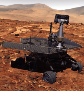
Remotely controlled rovers are used to test and practice complex tasks in Mars-like desert environments. (Artist’s Rendering: Stocktrek Images_Stocktrek Images_Getty Images)
DS: Our time servers are equipped with high-quality precise internal time references such as OCXOs or atomic clocks and then disciplined by external references such as GNSS. They are resilient because they can operate precisely for long periods in GNSS-denied situations as standalone devices in holdover mode or from multiple alternative references, such as:
network-based NTP, PTP and PTP WR time services
wireline references from IRIG, 1PPS or ASCII time code
LEO PNT reference from the STL signal
eLoran when available
They are also resilient because they detect and mitigate interference from the GNSS signal before it can corrupt the PNT solution.
Our GNSS simulators are adding alternative PNT features to provide a complete test and evaluation solution for resilient PNT systems. We have recently added INS/IMU test features and have integrated with Anritsu’s cellular test stations to evaluate and qualify combined GNSS/cellular location functions. Orolia GNSS simulators support generation of custom GNSS signals and playback of IQ waveforms, and provide complete toolsets for GNSS jamming and spoofing testing. This allows creation of the threat environment to allow evaluation of alternate PNT signals as backup or alternative to GNSS. Orolia offers an open-source framework allowing any end user to develop their own sensor plug-in leveraging the Skydel simulation engine.
Our Resilient PNT for Defense product line includes the VersaPNT, which uses alternate non-GNSS PNT sensors such as IMUs, barometers, wheel ticks, INS and non-GPS-based LEO satellites. Alternate RF navigation or non-GNSS sources of radio frequency (RF) are of interest in highly degraded or contested signal environments. Interest is focused on low-Earth-orbit (LEO) constellations. These systems offer high receiver signal power (relative to GNSS) and a secure and resilient link to augment GNSS.
MN: All our products are designed to answer to challenging GNSS conditions, starting with our Ellipse series, which includes an industrial-grade IMU capable of coping with short-term GNSS outages. Its miniature size allows integration in robotics and also makes it suitable for cost-sensitive applications. Our Apogee and Horizon series, with their navigation-grade IMUs, are the most resilient systems in the event of GNSS outages. These products reach very high-end performance in real time, but become exceptional when used with our post-processing software Qinertia. Tightly coupled algorithms make the solution capable of coping with long-term GNSS outages.
JA: We have previously created solutions using retroreflective strips for path following with driving robots. and we are also compatible with Locata’s system, a large infrastructure solution popular for automation in shipping ports. More recently, we have released an offering for UWB in an integration with Pozyx. This is perfect for GNSS-denied environments as a direct replacement for what GNSS can provide in terms of position information. We are also exploring alternative ways to synchronize clocks and get timing information. This year we have developed PTP functionality on all of our devices. Alternative PNT is going to be vital as we look to the future of navigation and thinking about how we can navigate flawlessly anywhere and address more complex environments, particularly urban areas.
CS: We are focused on the provision of terrestrial low-frequency equipment and systems for primary, co-primary, alternative, complementary and backup PNT. We provide all the products and services required to design, develop, install, certify, operate and maintain Loran-C, eLoran and LFPhoenix equipment and systems. We provide the technology to perform coverage diagrams and site surveys; all the equipment required at a transmission site; all the equipment required at a differential reference station or quality-of-service site; all the equipment required for a monitor and control site; ASF measurement and analysis equipment; and various models of end-user equipment (including receivers and antennas) for the timing/frequency, maritime, aviation, land-mobile and handheld markets.
The Association for Unmanned Vehicles Systems International (AUVSI) brings its annual conference, XPONENTIAL, to Atlanta, Aug. 16-19. The event invites industry changemakers and end users to experience new technology that is solving real world problems, from safety and defense, to energy and infrastructure, business, construction, health, and the environment. The convention features keynote speakers, panel presentations, educational programs, specialized workshops, networking opportunities, and an exhibitor hall featuring newly developed technology to preview.
“To support our community and these technologies as they continue to accelerate along the innovation curve, our theme this year is Assured Autonomy,” said Brian Wynne, President and CEO of AUVSI. “As an industry, we must work together to ensure these systems are created, deployed, marketed and regulated to create a virtuous cycle of trust, social benefit, and economic growth. You’ll see that focus throughout our programming on-site, as well as in the technologies and operational services on display from our exhibitors.”
XPONENTIAL typically attracts 8,000+ attendees each year, who attend 100+ educational sessions organized by tracks focused around technology, policy, and public acceptance. The Solutions Theatre features the top experts in their field sharing best practices, technical discoveries and announces the AUVSI XCELLENCE Award winners. The Startup XCELERATOR Pavillion serves as a hub for emerging technologies and early-stage companies providing a glimpse into the industry’s future. Meanwhile, the XPO Hall provides access to more than 450+ companies all showcasing the latest breakthroughs in drones, robotics, and other unmanned systems.
The Exynos W920 offers high performance, efficiency and LTE connectivity in tiny form factor
Image: Samsung
Samsung Electronics is offering a new processor for wearables, the Exynos W920. The new processor integrates an LTE modem and is built with an advanced 5-nanometer (nm) extreme ultraviolet process node, offering powerful yet efficient performance demanded by next-generation wearable devices.
The Exynos W920 is embedded with a GNSS L1 receiver (GPS, GLONASS, Beidou, Galileo) for tracking speed, distance and elevation during outdoor activities. It also has a 4G LTE Cat. 4 modem.
“Wearables like smartwatches are no longer just a cool gadget to have. They’re now a growing part of our lifestyles to keep you fit, safe and alert,” said Harry Cho, vice president of System LSI marketing at Samsung Electronics. “With the Exynos W920, future wearables will be able to run applications with visually appealing user interfaces and more responsive user experiences while keeping you connected on the go with fast LTE.”
The Exynos W920 has two Arm Cortex-A55 cores for high-performing, power-efficient processing and an Arm Mali-G68 GPU with CPU performance improved by 20 percent and 10 times better graphics performance than its predecessor. With upgraded cores and improved performance, the Exynos W920 enables faster application launches and more interactive, eye-catching 3D graphical user interface (GUI) on a device’s qHD (960×540) display.
The Exynos W920 comes in a tiny package with Fan-Out Panel Level Packaging (FO-PLP). The technology incorporates the Exynos W920, power management IC and embedded multimedia card. The processor’s compact size allows smartwatches to house larger batteries or have sleeker designs.
Always-on-display (AOD) for wearables, especially for smartwatches, is a widely adopted feature as it makes it effortless to take a quick look at the time, notifications, missed calls and more without the need to wake the watch up from sleep mode. Rather than powering up the main CPU, the W920 activates a dedicated low-power display processor, the Cortex-M55, reducing display power consumption under AOD mode compared to its previous Exynos model.
The Exynos W920 supports a new unified wearable platform Samsung built jointly with Google, and will be first applied to the upcoming Galaxy Watch model.
The U.S. Department of Defense wants help making sense of commercially and publicly available information that could be used to detect GNSS disruptors, especially over large areas.
Obtaining the ability to detect and geolocate GNSS disruptions has been cited as an unmet need in a number of U.S. national policies and plans dealing with positioning, navigation and timing.
The recently posted solicitation calls the project “HARMONIOUS ROOK – Situational Awareness for Intentional Disruption of Global Navigation Satellite System (GNSS) Users.” The solicitation says:
“The Department of Defense (DoD) seeks commercial solutions leveraging machine-driven analytics and datasets derived from publicly/commercially available information (PAI/CAI) to provide a situational awareness capability for intentional global navigation satellite system (GNSS) disruptions. This solicitation is particularly focused on persistent, large-area coverage of falsified GNSS emitters that result in localized spoofing phenomenology.”
Studies and analyses by non-profit organizations and commercial entities have demonstrated the ability of non-governmental organizations to do this kind of work and produce remarkable results. In 2017, our Resilient Navigation and Timing Foundation detected and reported on widespread GPS spoofing in the Black Sea.
This acquisition is being led by the Defense Innovation Unit, or DIU. The unit was specifically created to accelerate the adoption of commercial technology and services by the defense and national security establishments. While letting a traditional DoD contract for a prototype can often take up to 18 months, DIU aims to award contracts within 60 to 90 days of identifying the problem.
To do this, DIU uses the government’s “commercial solutions opening” process, which is designed to be simple and quick.
Companies who provide analytic services and those who have unique data sets are both encouraged to apply. The deadline is August 23.
Dana A. Goward is president of the Resilient Navigation and Timing Foundation
An Interim Armored Vehicle “Stryker” and AH-64 Apache helicopters with Battle Group Poland move to secure an area during a lethality demonstration as part of Saber Strike 18 in June 2018. (Photo: U.S. Army/Spc. Hubert D. Delany III, 22nd Mobile Public Affairs Detachment)
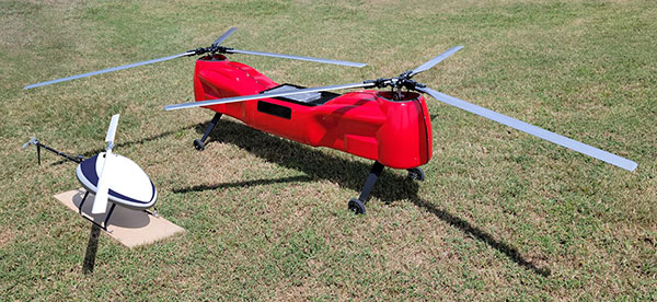
The Sicura EG-1100 (left) and Anzen EG-1250 with Sky Power engines are being exhibited at AUVSI Xponential. (Photo: UAS Global Services)
German engine manufacturer Sky Power GmbH is presenting its UAV engines at this year’s AUVSI Xponential show in Atlanta, Georgia. Plus, new Sky Power customer UAS Global Services of Texas will present two new helicopters, which are powered by different engines from Sky Power.
UAS Global Services will introduce its Anzen EG-1250 helicopter at the show. The Anzen EG-1250 is a heavy-lift, long-range, multi-purpose Group 3 platform. The helicopter will significantly expand UAS Global Services’ service as well as operational support offerings. Basic specifications include a maximum takeoff weight of 250 pounds (113 kg), a maximum flight time of up to 6 hours, a payload capacity of 75 pounds (34 kg), a cruising speed of 65 kts, and all-weather day and night capability.
The “EG” in the Anzen EG-1250 designation stands for a dual engine configuration consisting of electric and internal combustion propulsion. The main engine is Sky Power’s SP-180 SRE Wankel engine, while the secondary engine is a NeuMotors 12030/5.5. This 30KW electric motor can power the aircraft or serve as a power amplifier in combination with the SP-180 SRE. In addition to the added power and safety provided by the two motors, the Anzen EG-1250 is autorotatable and offers an optional safety parachute system.
UAS-GS was contracted by Ireland-based UAV Evolution Ltd. to develop the dual-rotor platform. After more than 5 years of development, the versatile design allows for a variety of engine, payload and operational options. The platform flexibility allows the Anzen EG-1250 to support a wide range of customers in the marine, agricultural, oil and gas, utility, cargo transport, security and other application sectors.
UAS Global Service’s second helicopter is the Sicura EG-1100, which is the third generation of the internally developed single-rotor helicopter. This flight system has become the workhorse of the UAS Global Services fleet in recent years and is now available to external customers. Basic specifications include a maximum takeoff weight of 55 lbs (25 kg), a flight time of up to 3.5 hours using an internal combustion engine or a flight time of 1 hour in electric mode, a payload capacity of 15 lbs (7 kg), a cruise speed of 55 kts, and a takeoff wind speed of 25 kts.
The EG-1100 is available with both electric and internal combustion engines. The combustion engine is Sky Power’s powerful and efficient SP-110 TS ROS two-stroke engine, which has been specially tuned and modified to the flight system. The result is competitive flight performance characterized by stable performance under severe environmental conditions, exceptionally stable flight, and immediate flight response during imaging and LiDAR operations.
With the EG-1100’s considerable payload capacity, customers can implement various transportation tasks in one mission. Different sensor and camera systems can be integrated simultaneously in the Sicura EG-1100, enabling multiple data-acquisition applications in a single flight. This significantly increases the efficiency of the overall UAS mission and provides the customer with timely, cost-effective and high-quality results.
For more information, visit UAS Global Services at the AUVSI show in Atlanta, booth 2498 or visit Sky Power at booth 2641.