Blog

  • Spot on: Alliance to combine robots and GNSS tech for construction

    Spot on: Alliance to combine robots and GNSS tech for construction

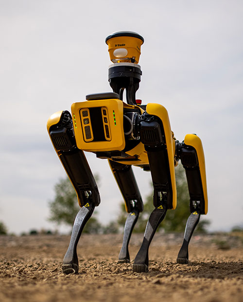
    Spot, the robotic dog from Boston Dynamics, is equipped with the Trimble SPS986 smart antenna to collect data. (Photo: Trimble)
    Spot, the robotic dog from Boston Dynamics, is equipped with the Trimble SPS986 smart antenna to collect data. (Photo: Trimble)

    Trimble and Boston Dynamics plan to integrate a variety of data-collection technologies with the Spot (robot dog) platform for construction and other site applications.

    The jointly developed solution will combine the Spot robot’s autonomous mobility with Trimble’s data-collection sensors and field control software to enable automation of repetitive tasks such as site scans, surveying and progress monitoring, while taking advantage of the robot’s unique capabilities to navigate dynamic and potentially unsafe environments.

    The relationship gives Trimble exclusive rights sell and support the Spot robot with integrated scanning, total station and GNSS technologies for the construction market.

    The turnkey solution will streamline operation of the robot and provide quality control for missions, enabling construction project managers to easily get a clear picture of jobsite progress on an ongoing basis. Trimble technologies integrated with the robot will enable accurate, scalable and rapid data acquisition, while Trimble’s construction collaboration platforms provide a continuous flow of information between field and office.

    Mortenson, a Minneapolis builder, developer and engineering services provider, is one of the first customers to leverage the new technology combination. To eliminate jobsite waste and increase efficiency, the Mortenson team has been piloting Spot robots with the Trimble SPS986 GNSS solutions to autonomously navigate challenging exterior construction environments such as solar farms, continuously documenting site conditions.

    An automated and repeatable approach to field-data capture can provide Mortenson with real-time awareness of project status, helping to accelerate project delivery. Through Trimble’s Early Experience Program, contractors such as Mortenson have advanced access to this technology for the purposes of evaluating its suitability in actual construction projects.
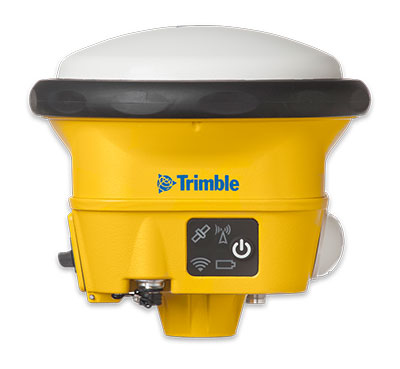
    The Trimble SPS986 smart antenna. (Trimble: photo)
    The Trimble SPS986 smart antenna. (Trimble: photo)

    “Robots will play a crucial role in automated construction workflows and can augment the human workforce by handling dirty, dull and dangerous tasks,” said Martin Holmgren, general manager, Building Field Solutions at Trimble. “Our experience with early adopters like Mortenson gave us visibility into the transformative potential of an integrated solution that seamlessly marries a world-class robot with construction-specific sensors and workflows. We’re excited about this alliance and the potential to bring unprecedented improvements in safety, quality and productivity to our construction customers.”

    “We believe the combination of Trimble’s experience and industry leadership in construction technologies and Boston Dynamics’ Spot can transform the way the industry operates,” said Michael Perry, vice president of business development at Boston Dynamics. “The integrated solution will enable any jobsite leader to deploy Spot and Trimble technologies to get an accurate view of construction progress through real-time data collection. With a more comprehensive view of site activity, project managers can take proactive measures to ensure on-time, on-budget and safer project delivery.”

    The integrated solution is expected to be available by the second quarter of 2021 through Boston Dynamics, Trimble and select BuildingPoint and SITECH distribution partners in the U.S., Canada, the United Kingdom, the European Union, Australia, New Zealand and Japan.

    Through Trimble’s Early Experience Program, select customers will have the opportunity to preview development of the solution in advance of general availability.
     

  • GSA releases 3rd GNSS User Technology Report

    GSA releases 3rd GNSS User Technology Report

    Report cover GSA
    The full GNSS User Technology Report 2020 is available for download. (Cover: GSA)

    News from the European GNSS Agency

    The European GNSS Agency (GSA) has released its latest GNSS User Technology Report, providing a comprehensive analysis of GNSS trends and developments.

    With four GNSS available and more than 100 satellites in operation broadcasting multiple frequencies, the GNSS industry is shifting towards the wide adoption of multifrequency receivers across market segments to meet the diverging user needs of emerging applications.

    The report includes contributions from leading GNSS receiver, chipset manufacturers and service providers, and serves as a valuable tool to support planning and decision-making with regards to developing, purchasing and using GNSS technology.

    Published biennially since 2016, the User Technology Report has become a point of reference for the GNSS industry, research and policy-makers.

    Rapid Evolution

    ‘’The GNSS industry is evolving at a rapid pace and is shaped by the dynamics of emerging applications and user needs as well as the upgrade of existing and new GNSS and Satellite Based Augmentation Systems (SBAS),” said Rodrigo da Costa, GSA executive director. “The industry has understood the potential of Galileo’s unique features.”

    The third edition of the report begins with a chapter devoted to technology trends common to all segments: receiver design, position processing and signal processing. It also discusses protection measures against GNSS jamming and spoofing, such as authentication, including what 5G and other technologies and sensors can do, in combination with GNSS.

    With multi-constellation now being the norm, the industry is moving towards the wide adoption of multi-frequency receivers even for usually power- and cost-constrained consumer solutions. The Galileo E5 is becoming the preferred frequency with about 20% of all receiver models in the market already using it.

    The report is built around four macro segments defined on the basis of commonalities from a technology point of view:

    • high volume
    • safety- and liability-critical
    • high-accuracy
    • timing devices and solutions (a new-entry in this edition)

    Each chapter starts with the macrosegment characteristics and receiver capabilities, depicts the industry landscape and typical receiver form factor, it then delves into the key current and future drivers and trends, and finishes with the added value of the EGNSS, Galileo and EGNOS, for the macrosegment at stake.

    Space Data for Europe

    This year editor’s special “Space Data for Europe” sheds light on the role that Copernicus and Galileo play within the European Space Programme in the data management and use, now and in the future. It also provides a vision of major transformations underway within our society and our economy and the benefits expected from this digital transformation, paving the way towards the European Data Strategy and Green Deal.

    “Today, Galileo and EGNOS already provide increased capabilities which are being used across a broad range of applications, and are already igniting the next generation of location-based applications. In the future, new services — the Galileo High Accuracy Service (HAS), Galileo Open Service Navigation Message Authentication (OS-NMA) and Commercial Augmentation Service (CAS) — will raise the accuracy and reliability bar even higher, and dramatically enhance positioning, navigation and timing solutions for businesses and citizens.

    By bringing insight and understanding into the evolutions of GNSS technology, we are creating opportunities for innovation,” concluded da Costa.

    The full GNSS User Technology Report 2020 is available for download.

  • Russia adds to GLONASS constellation with latest launch

    Russia adds to GLONASS constellation with latest launch

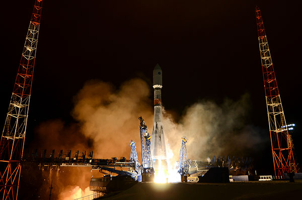
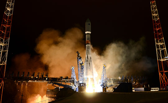
    Russia launched a new-generation Glonass-K satellite, number 15, into orbit Oct. 25. Unlike its Glonass-M predecessors, Glonass-K satellites carry two types of navigation signals — frequency-separated and code-separated. The satellites emit additional code-division L2 navigation signals.

    In addition to their main functions, Glonass-K satellites will transmit information from the Cospas-Sarsat international search-and-rescue system. Additional Glonass-K satellites are in production at ISS Reshetnev, all with a domestic electronic component base.

    Russia’s Aerospace Forces (VKS) Space Forces launched the satellite aboard a Soyuz-2 rocket from the Plesetsk cosmodrome in the Arkhangelsk region. The launch of the carrier rocket and the maneuvering of the spacecraft into the orbit took place under normal operating conditions, according to Roscosmos.

    Two minutes after the launch, the ground-based automated control complex of the Titov Main Testing Space Center acquired the Soyuz-2. On schedule, the Glonass-K satellite was injected into the target orbit by the Fregat upper stage and taken over by the ground-based facilities of the VKS Space Forces.

    Photo: Roscosmos
    Photo: Roscosmos

    A stable telemetric connection has been established and maintained with spacecraft. The onboard systems of the Glonass-K spacecraft are operating normally.

    GLONASS consists of 28 spacecraft, with 24 active, two in reserve, and one Glonass-K undergoing flight tests. Another spacecraft is temporarily out for maintenance.

    Glonass-M satellites form the basis of the system’s orbital grouping. Replacing the orbital constellation with Glonass-K spacecraft will ensure the stable operation of the Russian navigation system and increase the accuracy of its navigation determinations up to tens of centimeters.

    According to Roscosmos, Glonass-K spacecraft are constructed in an unpressurized design, have a guaranteed period of active existence in orbit increased to 10 years, reduced energy consumption, and significantly lower weight.

    Photo: Roscosmos
    Photo: Roscosmos
  • First Galileo personal emergency beacon coming to 19 European countries

    First Galileo personal emergency beacon coming to 19 European countries

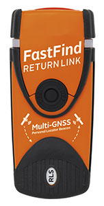
    The first Galileo Return Link Service Personal Location Beacon (PLB) developed under the H2020-funded Helios project will be released in December across 19 European countries. 

    News from the European GNSS Agency (GSA)

    Photo: Orolia
    Photo: Orolia

    In close collaboration with the European GNSS Agency and within framework of the H2020 HELIOS project, Orolia has been working to equip search-and-rescue beacons with the breakthrough Galileo Return Link Service.

    Declared operational in January, the Galileo Return Link Service is a unique feature of Galileo, allowing people in distress to receive an automatic acknowledgement that their signal has been received and their location is known.

    How It Works

    The FastFind ReturnLink PLB transmits the user’s unique ID and GNSS location via the global network of Cospas-Sarsat search-and-rescue satellites. When a person in distress activates the emergency beacon, the Galileo satellites capture the signal and transmit it to a set of ground-segment facilities — the Galileo Return Link Service Provider (RLSP) based in Toulouse, France.

    Once the location of the person in distress is determined, an automatic message is sent through the Galileo satellites, confirming to the user that their position has been detected and the information has been routed to the relevant government authorities. With the FastFind ReturnLink PLB, the person in distress — on land or at sea — will see a blue light blinking on their beacon 10-15 minutes after confirmation that the distress signal and location has been detected.

    ”At the GSA, our objective is to ensure that EU Space investments and our work on Galileo services are bringing added value to citizens,” said Rodrigo da Costa, GSA executive director.  “With the first search-and-rescue beacon worldwide deployed thanks to the H2020 project Helios, we can proudly state that our actions made a difference for innovation but also for the citizens. The ones who need to use this Personal Location Beacon will be reassured by the Return Link Service.”

    Cospas-Sarsat rescue beacon activated. Its signals are picked up by satellites in orbit, including Galileo. (Photo: GSA)
    Cospas-Sarsat rescue beacon activated. Its signals are picked up by satellites in orbit, including Galileo. (Photo: GSA)

    Galileo a SAR Game Changer

    Galileo’s immediate impact on search and rescue (SAR) has been the addition of 26 new satellites, allowing for greater global coverage and faster detection of the 406-MHz distress frequency. Coupled with Galileo’s robust signal, SAR beacons deliver greater positioning accuracy.

    Galileo’s development is part of the European Union’s preparations for upgrading the international distress beacon locating organisation Cospas-Sarsat’s Search and Rescue (SAR) Ecosystem under the MEOSAR program, which requires new Earth-based antenna and a network of 72 GNSS satellites, combining GPS, the EU Galileo and the Russian Glonass systems. The Return Link Service is a unique feature provided by Galileo within its contribution to Cospas-Sarsat.

    Survival Booster

    By sending a confirmation to the user that the distress signal from the beacon has been localised by the Cospas-Sarsat system and the information relayed to the relevant Search and Rescue l authorities, the Return Link Service provides confidence and reassurance to the people in distress that help is on the way.

    “The Search and Rescue community has long known the survival impact of dealing with a distress situation on your own, either as a solo adventurer or as a group that feels isolated due to the lack of communication with the outside world,” said Chris Loizou, vice president of Maritime at Orolia. “The Return Link reassurance signal will reduce the chances of rash decisions taken by those who feel they have nothing to lose, such as leaving the site of an accident or attempting to swim to safety. The psychological impact of knowing that help is on the way cannot be underestimated, and this PLB will provide invaluable peace of mind for those in distress.”

    The Galileo Return Link Service increases survival rates by giving an important psychological boost to people in distress. It is estimated by Cospas-Sarsat that the international SAR system, with the contribution of the Galileo Search and Rescue service, saves more than 2,000 lives a year.

    Countries Included

    The beacons will be sold in the following countries.

    • Croatia
    • Cyprus
    • Denmark
    • Faroe Islands (DK)
    • France
    • Germany
    • Greece
    • Greenland (DK)
    • Iceland
    • Ireland
    • Israel
    • Italy
    • Latvia
    • Liechtenstein
    • Norway
    • Sweden
    • Switzerland
    • United Kingdom

    Eventually, the RLS-enabled beacons will be available in most countries in the world.

  • GNSS + Wi-Fi evaluation kit offered for IoT by Semtech, Actility

    GNSS + Wi-Fi evaluation kit offered for IoT by Semtech, Actility

    Photo: Actility
    Photo: Actility

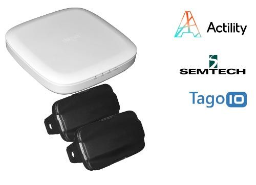
    Actility and Semtech are offering the LR1110 LoRa Edge Evaluation Kit with a tracking device based on Semtech’s LR1110 chipset and Actility’s LoRaWAN network management expertise.

    The solution delivers ultra-low power meter-accurate positioning both indoors and outdoors.

    The kit allows solution providers and integrators to quickly evaluate this new technology and to experience how it reduces the cost and complexity of building a solution for locating and monitoring internet-0f-things (IoT) assets.

    The LR1110 chipset, integrated to LoRa Edge, uses assisted GNSS (AGNSS) and Wi-Fi AP scanning, alongside standard LoRaWAN communications. It is bundled with Actility’s LoRaWAN network server (the ThingPark platform) and with the Tago.io application server.

    ThingPark Enterprise delivers the data to Tago.io through a predefined interface. Tago.ai provides a mechanism for customers to route received location data to an actionable dashboard with the map location history, the data traffic history and other data.

    The chipset has already been adapted by multiple companies such as Abeeway for its newest geolocation module.

    Low-power geolocation

    Semtech’s LR1110 is the first product in its new LoRa Edge platform — a highly versatile, low power, software-defined LoRa-based platform designed to enable a wide portfolio of applications for indoor and outdoor asset management.

    Modular and configurable, the LR1110 can transition between outdoor and indoor activity automatically, using GPS satellite tracking for outdoor applications and Wi-Fi passive scanning for tracking indoor assets. It replaces the need to build different trackers for indoor or outdoor use or trackers that combine multiple location methods with a single chipset, reducing complexity and cost.

    It contains the ultra-low power capabilities of a LoRa transceiver. This means that it can communicate over LoRaWAN and it can be used to acquire position coordinates either through GNSS or Wi-Fi signals. Instead of changing the batteries on asset trackers every three to six months with conventional Wi-Fi technology, LoRa Edge delivers low power consumption allowing battery lifetimes up to three years.

    A crypto engine allows LoRaWAN keys to be stored inside the device for secure joining and communication. Modules can be securely activated from Semtech’s LoRa Cloud Device Activation Service.

  • Hexagon Geospatial updates platform for location intelligence

    Hexagon Geospatial updates platform for location intelligence

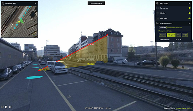
    Luciad 2020.1 provides capabilities with panoramic imagery. (Screenshot: Hexagon Geospatial)
    Luciad 2020.1 provides capabilities with panoramic imagery. (Screenshot: Hexagon Geospatial)

    Luciad 2020.1 features dynamic panoramic imagery capabilities and immersive 3D imagery

    Hexagon’s Geospatial division has launched Luciad 2020.1, a significant update to its platform for building advanced location intelligence and real-time, situational awareness applications.

    Luciad 2020.1 delivers immersive 3D experiences with 360-degree panoramic imagery support that can be combined with other 3D data layers for geospatial applications. The latest release also features additional styling for 3D meshes and 3D data integration capabilities.

    Visualization and Analysis

    Hexagon’s Luciad portfolio allows developers to create powerful, high-performance applications that leverage data from any source for visualization and analysis in 2D and 3D. Combining static, dynamic and real-time data, including moving tracks, Luciad-powered applications support defense, aviation, infrastructure and other critical sectors.

    For the 2020.1 release of LuciadRIA, which is used for building browser-based solutions, Hexagon has added 360-degree panoramic imagery capabilities that can be combined with other 3D data layers to provide complete imagery coverage and detailed information about a location. Panoramic imagery puts users in control of what they want to look at within an image. The panoramic 3D experience is powered by a new streaming imagery data service in LuciadFusion, Hexagon’s OGC-compliant server solution.

    “With the addition of panoramic imagery capabilities and other 3D data enhancements, Luciad 2020.1 puts local governments, transportation departments, utility companies and others in control of what they can observe and analyze within a particular scene,” said Mladen Stojic, president of Hexagon’s Geospatial division. “With these capabilities, organizations can remotely monitor their assets and infrastructure, significantly reduce manual inspection processes and fully leverage location intelligence across the enterprise.”

    More New Features

    The release contains other new features and improvements requested by customers, including:

    • military grid coordinate transformations
    • non-georeferenced WebGL-based views
    • improved imagery sampling
    • additional format support and upgrades.

    For defense customers, the Luciad 2020.1 release consolidates its military symbology support across all Luciad platforms and programming languages.

  • New imaging method uses time to create pictures

    New imaging method uses time to create pictures

    Alex Turpin (Photo: University of Glasgow)
    Alex Turpin (Photo: University of Glasgow)

    A new method of imaging that harnesses artificial intelligence to turn time into visions of 3D space could help cars, mobile devices and health monitors develop 360-degree awareness.

    Photos and videos are usually produced by capturing photons with digital sensors. 3D images can be generated either by positioning two or more cameras around the subject to photograph it from multiple angles, or by using streams of photons to scan the scene and reconstruct it in three dimensions. Either way, an image is only built if spatial information of the scene is gathered.

    Now, researchers based in the United Kingdom, Italy and the Netherlands describe how they have found an entirely new way to make animated 3D images — by capturing temporal information about photons instead of their spatial coordinates. The team’s paper, “Spatial images from temporal data,” was published in Optica.

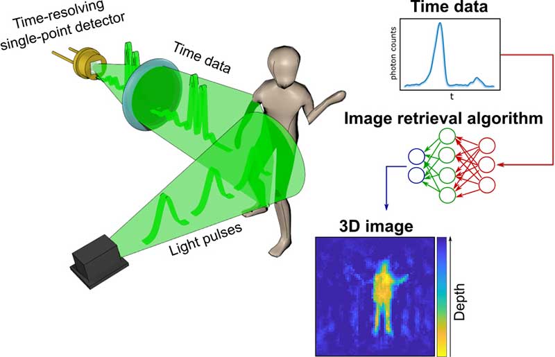
    Their process begins with a simple, inexpensive single-point detector tuned to act as a kind of stopwatch for photons. Unlike cameras, which measure the spatial distribution of color and intensity, the detector only records how long it takes the photons produced by the split-second flash of a pulse of laser light to bounce off each object in any given scene and reach the sensor. The farther away an object is, the longer it will take each reflected photon to reach the sensor.

    The information about the timings of each photon reflected in the scene — temporal data — is collected in a simple histogram. Those graphs are then turned into a 3D image using a sophisticated neural network algorithm. The researchers “trained” the algorithm by showing it thousands of conventional photos of the team moving and carrying objects around the lab, alongside temporal data captured by the single-point detector at the same time. Eventually, the network learned enough about how the temporal data corresponded with the photos that it was capable of creating highly accurate images from the temporal data alone.

    In the proof-of-principle experiments, the team managed to construct moving images at about 10 frames per second from the temporal data, although the hardware and algorithm used has the potential to produce thousands of images per second.

    Alex Turpin, a Lord Kelvin Adam Smith Fellow in Data Science at the University of Glasgow’s School of Computing Science, led the university research team with Prof. Daniele Faccio and support from colleagues at the Polytechnic University of Milan and Delft University of Technology.

    “Cameras in our cellphones form an image by using millions of pixels,” explained Turpin. “Creating images with a single pixel alone is impossible if we only consider spatial information, as a single-point detector has none. However, such a detector can still provide valuable information about time. What we’ve managed to do is find a new way to turn one-dimensional data — a simple measurement of time — into a moving image that represents the three dimensions of space in any given scene.”

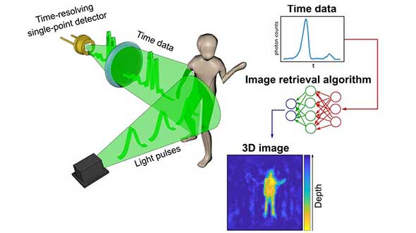
    After data collection, 3D images are retrieved from the temporal histograms. (Image: University of Glasgow)
    After data collection, 3D images are retrieved from the temporal histograms. (Image: University of Glasgow)

    The approach is capable of decoupling light altogether from the image-capture process, and the paper discusses how the team managed to use radar waves for the same purpose. “We’re confident that the method can be adapted to any system which is capable of probing a scene with short pulses and precisely measuring the return ‘echo.’”

    Right now, the neural net’s ability to create images is limited to what it has been trained to pick out from the temporal data of scenes created by the researchers. But with further training and by using more advanced algorithms, it could learn to visualize a range of scenes, widening its potential applications in real-world situations.

    “The single-point detectors that collect the temporal data are small, light and inexpensive, which means they could be easily added to existing systems like the cameras in autonomous vehicles to increase the accuracy and speed of their pathfinding,” Turpin said. “Alternatively, they could augment existing sensors in mobile devices like the Google Pixel 4, which already has a simple gesture-recognition system based on radar technology. Future generations of our technology might even be used to monitor the rise and fall of a patient’s chest in a hospital to alert staff to changes in their breathing, or to keep track of their movements to ensure their safety in a data-compliant way.”

    Next, the team will work on a self-contained, portable system-in-a-box as well as examining options for furthering research with input from commercial partners. The research was funded by the Royal Academy of Engineering, the Alexander von Humboldt Stiftung, the Engineering and Physical Sciences Research Council (ESPRC) and Amazon.

    Citation. A. Turpin, G. Musarra, V. Kapitany, F. Tonolini, A. Lyons, I. Starshynov, F. Villa, E. Conca, F. Fioranelli, R. Murray-Smith, and D. Faccio, “Spatial images from temporal data,” Optica 7, 900-905 (2020), https://doi.org/10.1364/OPTICA.392465.

  • SBG Systems releases virtual base station feature in Qinertia

    SBG Systems releases virtual base station feature in Qinertia

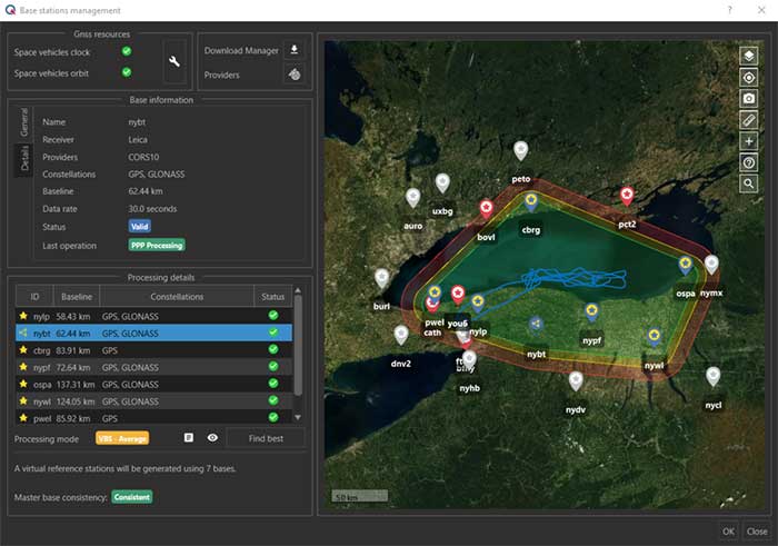
    The virtual base station feature in SBG's Qinertia computes a virtual network around a project in which position accuracy is maximized, homogeneous and robust, the company said. (Photo: SBG Systems)
    The virtual base station feature in SBG’s Qinertia computes a virtual network around a project in which position accuracy is maximized, homogeneous and robust, the company said. (Photo: SBG Systems)

    SBG Systems has released a virtual base station (VBS) feature in Qinertia, its in-house GNSS and inertial navigation system (INS) post-processing software. According to the company, trajectory and orientation are greatly improved by processing inertial data and raw GNSS observables in forward and backward directions.

    The VBS computes a virtual network around a project in which position accuracy is maximized, homogeneous and robust like a PPK short baseline, SBG said. Once surveyors collect data, Qinertia chooses the most relevant reference stations, builds a virtual network and brings the project to the centimetric accuracy with no jump on accuracy nor convergence effects, even in urban areas.

    According to SBG, it has worked to offer a VBS which takes the most out of any GNSS receivers from different brands and models — with different configurations or constellations — and even with different coordinate systems. Qinertia automatically adjusts the VBS network to compensate for any base station position inaccuracy and provides full quality control indicators to assess the expected accuracy and reliability, the company added. Qinertia VBS technology can mix users base stations with permanent network base stations to improve accuracy in remote locations.

    Finally, Qinertia automatically selects the best positioning technology that applies to a user’s project, whether it is a single base station mode, the virtual base stations mode or a precise point positioning computation. Despite this, users can still take control and make adjustments — like — while Qinertia automatically re-checks and re-computes all parameters simultaneously to validate the accuracy and consistency.

  • Topcon Agriculture offers enhanced in-cab displays

    Topcon Agriculture offers enhanced in-cab displays

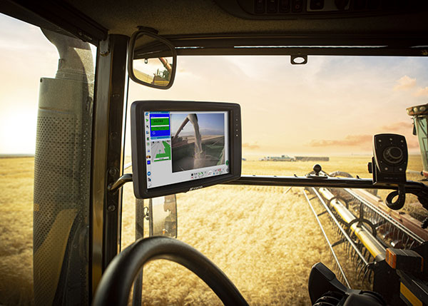
    Photo: Topcon
    Photo: Topcon

    Topcon Agriculture has released new in-cab displays — XD and XD+ touchscreen consoles — with an upgraded user interface experience, Horizon 5.

    With Topcon Agriculture Platform (TAP) integration, the consoles are designed to provide farmers with full-feature customization to optimize their investment by paying only for capabilities they need.

    “As a farmer’s needs grow, often times they’ve had to use multiple single-function consoles. In recent years, Topcon has offered the X family of consoles designed with all-in-one capability to resolve this issue, reducing clutter, improving setup, updates, support, and reducing overall hardware costs,” said Brian Sorbe, vice president of global production solutions. “Now with the additions to the series, Topcon is further simplifying cab control and it’s a modular approach with future needs in mind for each unique farming operation.”

    Farmers can immediately take advantage of off-the-shelf features such as basic guidance, task management, universal ISO-UT compatibility, and TAP Fields to manage farm data. Additional features are unlockable for use with the full range of Topcon sensors and application control technology.

    “TAP is a digital farm management system and it’s a way for a farmer to organize, visualize and make decisions and it begins with the touch of the console in the cab, and now with the new user interface and digital system all integrated, it will be simpler and easier to setup and get to work,” Sorbe said.

    The new consoles are designed to be ready for any application such as soil preparation, seeding, crop care, harvest, weighing and data services.

    The consoles are available in 7-inch and 12.1-inch screens, including new day and night modes.

  • Septentrio open-source software and hardware aimed at autonomous applications

    Septentrio open-source software and hardware aimed at autonomous applications

    Septentrio, a leader in high-precision GNSS positioning solutions, is offering two open-source resources for its GPS/GNSS module receivers.

    • The first, ROSaic, is a Robot Operating System (ROS) driver for the mosaic-X5 module as well as other Septentrio GNSS receivers.
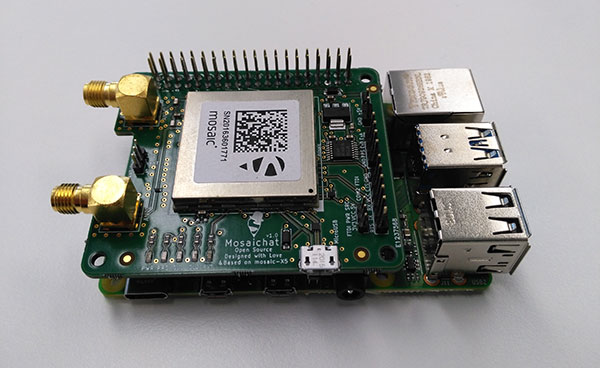
    • The second project, mosaicHAT, is an open source hardware reference design combining mosaic-X5 with a Raspberry Pi single-board computer.

    Both projects facilitate integration of centimeter-level reliable positioning into robotic and other machine automation applications.

    Photo: Septentrio
    Photo: Septentrio

    ROSaic driver operates on ROS, a widely used programming environment within the industry as well as academics, commonly used for integrating robot technology and developing advanced robotics and autonomous systems. ROS allows data from numerous sensors to be combined allowing high levels of autonomy.

    The mosaicHAT project facilitates accurate and reliable GNSS positioning for robotics and automation on a hardware level. Numerous engineers today use Raspberry Pi for prototyping and initial integrations. The mosaicHAT board is an easy way for integrators to get started with Septentrio’s mosaic-X5 GNSS module.

    By plugging mosaicHAT into a compatible Raspberry Pi, users have access to high-accuracy positioning with a high update rate, ideal for machine navigation and control, the company said. The small 56×65 mm board exposes basic interfaces such as USB, serial and general-purpose communication pins. The reference design, footprint and documentation are available for easy board printing or further customization.

    “We are excited about both the ROSaic driver and the mosaicHAT being part of the GitHub community and we highly appreciate the initial authors work as well as the future contributors,” said Gustavo Lopez, market access manager at Septentrio. “Both projects are available as open source, thus empowering the community to easily fit autonomous or robotic systems with highly accurate and reliable GNSS positioning technology.”

    The ROSaic driver is available on the ROS wiki page and on the Septentrio GitHub repository while the mosaicHAT can be found here.

    ROS is a trademark of Open Robotics. Raspberry Pi is a trademark of the Raspberry Pi organization.

  • How drones are helping with COVID-19, first response applications

    How drones are helping with COVID-19, first response applications

    A solution for these COVID-19 days, getting to injured people really fast, and potentially even faster first response applications are all new drone applications featured in this month’s UAV summary.

    As people welcome back football this fall — although playing in empty stadiums – most people are staying home to watch the game on TV. Even though some sports teams like the MLB Dodgers resorted to cardboard cut-outs of fans, maybe to encourage players, nothing beats having real people stamping and cheering in the stands.

    So its not surprising that when the Atlanta Falcons play the Carolina Panthers this month at Atlanta’s Mercedes-Benz Stadium, they are planning on having a limited number of real live fans at the game to cheer on the teams. Even in these pandemic days of social distancing and masks, it would seem that a reduced number of fans might space out well in the huge 71,000 seat capacity stadium.

    But the drone angle comes with the clean-up afterwards — 71,000 seats, handrails and partitions take a lot of manual wiping down – so the Atlanta Falcons are bringing on disinfecting drones to do the job, potentially with only 5% of the effort it normally takes.

    There are two D1 drones being used in Atlanta supplied by Lucid, each equipped with a 2.5-gallon tank filled with nontoxic disinfecting chemicals. The sanitation solution is distributed by specially designed ‘electrostatic nozzles’ which spray evenly and mist the area as the drone passes over.

    Disinfecting drones have been used before in places which include several locations in China, the city of Dubai, and company EagleHawk in New York offers drone sanitizing for stadiums and other large public facilities. If this approach works we’ll probably see it in many more stadiums in an effort to safely bring back the fans.


    Not sure how this next item fits into the unmanned category for this month’s article — because its certainly manned. But what the heck, its certainly interesting and worth a whirl.

    Jet packs have been around for a while, but the U.K. company Gravity has come up with a configuration that appears to be reliable and works well. They recently pitched their system for search and rescue in the Lake District — a mountainous area in the North West of England which is extremely popular for hiking, walking and climbing. So visitors will sometimes get hurt falling off a ledge or a high path on the side of a mountain, or just tripping while walking and injuring an ankle, leg or knee. The rocky hilltops, mountains and many lakes of the Lake District attract around 15 million visitors each year, so there is plenty of opportunity for injuries.

    With five miniature jet engines and carrying around 35 liters of jet fuel, the Gravity system range/endurance isn’t that great, but boy is it quick if you want to run up the side of a mountain to find an injured hiker. So more rapid response rather than search — provided you already know where the person is located.

    The system is powered by a double jet-engine held at the end of each arm and a single engine with equivalent thrust housed in the actual backpack. Altogether, over a 1000 horse power, which is apparently enough to pick a person up and keep them suspended at around 10 feet off the ground. Guess you would need quite some strength to hold onto the arm units, supporting one-third of your weight on each arm, but apparently you get some level of stability assistance from a flight control system in the backpack.

    A recent demonstration test in the Lake District with the Great North Air Ambulance Service certainly showed off the suit’s capability to go from the foot of a mountain up to near the crest of the hill in no time flat. Then a regular air-rescue helicopter was immediately called in to take the victim to hospital. However, the current system apparently costs somewhere around $400,000, so its doubtful it will show up for anything but special appearances and demos until there has been significant engineering cost reduction.


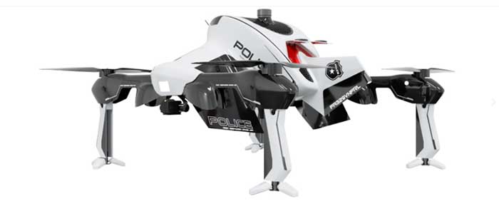
    The "Recruit" hi-speed drone is aimed at rapid first response users (Photo: Sonin)
    The “Recruit” hi-speed drone is aimed at rapid first response users (Photo: Sonin)

    Sonin Hybrid has taken another angle to building a drone by developing a hybrid gas powered propulsion system which charges the vehicle’s batteries while in flight, uses a lightweight carbon-fiber frame with folding landing-legs, and is able to fly at up to 140 mph when pressed to do so. Nominal cruise flight is at 60mph, and flight endurance is claimed to be up to 3 hours – over 5 times that of similar competitor drones.

    The Recruit’s options include a stabilized 4k camera, a night vision/IR camera, 30x optical/12x digital zoom camera, a 6k lumen spotlight and a loudspeaker/siren.

    With several trials currently underway with first responders, Sonin is eager to establish the requirements for police, fire and military applications. Let’s hope that the trials all involve getting eyes on a location as quickly as possible so hi-speed drone capabilities are needed. Otherwise all the drone racers will probably scoop up these 140mph puppies.


    So to enable people to perhaps return to watching sports in person during the ongoing pandemic we have drones pumping disinfecting spray all over sports stadiums which can potentially save huge amounts of manual cleaning effort, provided they can adequately sanitize the target areas — specialized spray nozzles help. Then we have a jet-pack system which was demonstrated getting to injured people as quickly as possible to administer immediate care, followed up by helicopter air rescue. And finally if you want a hi-speed, lightweight drone with good payload capability, Sonin has launched the 140mph Recruit aimed at first responders who need a very quick first response.

    These are all completely different applications, all with completely different solutions.

  • Aceinna joins ST Partner Program for precise positioning

    Aceinna joins ST Partner Program for precise positioning

    Photo: gorodenkoff/iStock/Getty Images Plus/Getty Images
    Photo: gorodenkoff/iStock/Getty Images Plus/Getty Images

    Partnership combines Aceinna’s integrated precise positioning and advanced guidance expertise with ST’s products, technologies and solutions.

    Innovative sensing technology company Aceinna Inc. has joined the STMicroelectronics Partner Program to make its inertial measurement unit (IMU) and real-time kinematic (RTK) precise positioning solutions available to engineers and developers working on next-generation solutions that safely and accurately position autonomous automobiles, trucks, robots and delivery vehicles.

    Aceinna is also participating in the Virtual ST Developers Conference on Oct. 20 and Oct. 21 from 8:30 a.m. to 4 p.m. ET, which discusses precise positioning for autonomous vehicles. Register here.

    “By leveraging ST technology, Aceinna is providing customers with vertically integrated performance sensing platforms,” said Yang Zhao, CEO of Aceinna. “These system-level solutions help customers greatly accelerate development time as well to reduce the time to market for new autonomous vehicle technologies.”

    “The ST Partner Program helps customers’ design teams access extra skills and resources to aid engineering development and shorten time-to-market for new products,” said Alessandro Maloberti, partner ecosystem director, STMicroelectronics. “By selecting, qualifying, and certifying our program partners like Acennia Inc., we are taking yet another major step in helping customers accelerate design and development, and ship to market the most robust and efficient products and services.”

    STMicroelectronics, a global semiconductor leader serving customers across the spectrum of electronics applications, created the ST Partner Program to speed customer development efforts by identifying and highlighting to them companies with complementary products and services. The program’s certification process assures that all partners are periodically vetted for quality and competence.