NASA took on a Herculean precision positioning task that culminated Oct. 20 with a spacecraft sampling the surface of an asteroid from a 5-meter area — a NASA first.
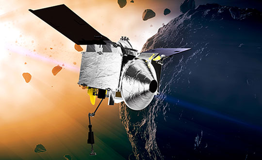
The OSIRIS-REx spacecraft, launched on Sept. 8, 2016, spent two years mapping the Bennu asteroid to determine the best site for removing the sample. Bennu was selected because of its near-Earth position (a mere 200 million miles away) as well as its age. It’s considered a primitive remnant from the formation of the solar system. It’s the smallest body a spacecraft has ever orbited.
The infrared spectrometer on OSIRIS-REx confirmed Bennu was sandy, but photos showed it to be an unrelenting rockscape dominated by boulders. Because of this difficult terrain, the planned sample site was reduced from 50 meters to 5 meters, an area smaller than a parking lot. “This required us to rethink how to navigate to the surface and come up with new ideas,” said Coralie Adam, TAG navigation manager for KinetX Aerospace. TAG stands for Touch-And-Go, the sample-collecting procedure.
The mapping method changed from using a lidar-based technique to an optical-based technique. “When we saw what Bennu looked like, we realized we had to switch to a vision-based approach, and that’s the NFT system,” explained Mike Moreau, Osiris Rex deputy project manager, Goddard Space Flight Center.
The Natural Feature Tracking (NFT) was added to the mission at the critical design review stage. NFT is an onboard optical navigation system that compares observed images to a set of asteroid terrain models rendered in real-time from a catalog stored in the flight computer’s memory. Onboard knowledge of the spacecraft state is then updated by a Kalman filter using the measured residuals between the rendered reference images and the actual observed images. (Read a technical paper on NFT.)
The asteroid terrain models used by NFT are built from a shape model generated from observations collected during earlier phases of the mission and include both terrain shape and albedo information about the asteroid surface.
“The KinetX navigation team spent last two years to learning how to navigate around Bennu using optical navigation techniques,” Adam said. She explained that every few minutes, a navigation camera takes an image of the features below and sends it to the NFT. The system identifies features in the image and sends a signal back to Earth.” The KinetX team worked with the Lockheed Martin team to map the surface of Bennu to a resolution of 2 centimeters per pixel.
With this observational data, the team created a hazard map. With position uncertainty down to half a meter, a sample site dubbed Nightingale was successfully contacted, and 2 ounces of regolith collected.
The team included mission managers from the University of Arizona, Lockheed Martin, and NASA’s Goddard Space Flight Center.
The Origins, Spectral Interpretation, Resource Identification, Security-Regolith Explorer (Osiris-REx) spacecraft
is scheduled to depart Bennu in 2021, and to deliver the collected sample to Earth on Sep. 24, 2023. It will be the first U.S. mission to carry samples from an asteroid back to Earth, and the largest sample returned since the Apollo missions.
Artist’s concept of the OSIRIS-REx spacecraft orbiting the Bennu asteroid. (Image: NASA)
Connected transportation company Geotab has unveiled Geotab Keyless, a platform solution that integrates a secured digital key function with a comprehensive and data-driven fleet management product. Announced at the company’s third annual Geotab Mobility Connect conference, this combined solution is enabling a new class of car sharing by allowing public, corporate, leasing and government fleets to better analyze, pool, utilize and reduce their assets.
“We are proud to be the first fully-featured telematics provider bringing a unique data-driven, keyless solution to the burgeoning car sharing market,” said Christopher Mendes, VP, Electric Vehicles, Geotab. “Keyless vehicle access is critical not only for fleets seeking to improve cost and operational structures but also consumers, who are moving away from vehicle ownership and expecting an easier, more convenient driving experience.”
Car sharing on the rise
According to a 2019 research report from Berg Insights, worldwide car-sharing membership topped 50.4 million in 2018, with the report citing frontrunners including Germany, Italy, USA and South Korea. As the Latin American market continues to rapidly grow, numbers are forecast to hit approximately 227 million by the end of 2023.
Berg Insights also notes that several car makers, leasing companies and car rental companies are introducing car sharing solutions for corporate customers, with a goal to reduce mobility costs for enterprises by decreasing fleet capacity and the need for taxis and rental cars, while enabling self-booking and keyless access. Telematics and smartphones will play a pivotal role.
“Geotab Keyless is designed to enhance car sharing across every segment, including in-car delivery services in the future” added Mendes. “Keyless is particularly advantageous for electric vehicle (EV) car sharing fleets, as the solution can reliably manage vehicles’ state of charge (SOC), charging status and range remaining —a capability no other keyless hardware competitor possesses.”
Scalable platform
A simple-to-install, scalable platform solution, Geotab Keyless supports any make, model and year of vehicle that has a key fob, and provides access to the most extensive telematics data on the market including asset accounting, suitability analysis for corporate car sharing, vehicle management automation and remote vehicle management.
Fleet customers can pair their Geotab telematics solution with a vehicle reservation system software partner of their choice in order to best meet their individual business needs.
Global software partners for Geotab Keyless include Wunder Mobility, Ridecell, fleetster, Eccocar and Moove Connected Mobility. Or fleet customers can create their own reservation software using Geotab’s Keyless APIs.
How Geotab Keyless works
Once a key fob is embedded into the hardware, drivers open their third-party software app on their phone (which is integrated with their MyGeotab platform), locate the OEM button on the screen and use the features to lock, unlock and start the vehicle.
In addition to phone apps, the keyless functionality can be enabled by NFC tags and directly over the cellular connection. Over time, the solution will expand to include other applications and third-party digital key hardware solutions, as well as OEM telematics’ APIs.
“In an increasingly dynamic world, on-demand free-floating shared mobility options are enabling new and innovative business opportunities for government and commercial fleets,” said Jean Pilon-Bignell, VP of Business Development, Government and Smart Cities. “By integrating this capability with a world-class telematics platform, fleets can have confidence in the fact that their shared mobility investments are backed by real data and analytics.”
Data-driven insight
Currently equipping more than 2.1 million vehicles with its telematics technology, Geotab provides data-driven insights to over 40,000 customers worldwide and enables users to customize their solution through a suite of more than 150 hardware add-ons, software add-ins and applications available on the Geotab Marketplace.
As a result, the company processes more than 40 billion data points each day from Geotab-connected vehicles around the world. With active devices present in more than 130 countries, Geotab’s solutions are sold through its global network of Authorized Geotab Resellers.
Telematics company SkyBitz has announced a strategic technology partnership with fleet logistics solutions provider Coretex. The partnership combines Coretex sensor-based refrigeration solution and cloud-based software platform with SkyBitz trailer tracking technology to create a complete solution for businesses needing both powered and non-powered asset tracking.
With the partnership, food, pharmaceutical and retail customers can have total visibility into the status of loads during transportation, resulting in improved food safety and quality assurance.
The SkyBitz and Coretex partnership allow customers to access and manage both reefer device data and trailer tracking data via one seamless solution, enabling greater insight, a more transparent view of their entire cold chain operation, and better decision making. Customers can now automate Food Safety Modernization Act (FSMA) compliance, allowing them to keep assets on the road for longer, monitoring them with advanced temperature tracking capabilities.
“Our customers look to us for innovative, value-driven solutions that help improve profits across their entire operation,” states Henry Popplewell, DVP and president of SkyBitz. “As leaders in the supply chain and logistics arena, we are excited to capitalize on this partnership to continue to grow our cold chain customer base and align ourselves with the foodservice industry through this technology partnership. The Coretex pedigree in last-mile food and beverage distribution is the perfect complement to our asset management technology.”
With this new offering, customers of Coretex and SkyBitz will benefit from the following:
More than 50 features of remote cold chain monitoring capabilities, including two-way reefer control, monitoring of up to six doors, and advanced power management to preserve reefer and telematics unit battery life.
Single point of access to critical and timely best-in-class trailer utilization and reefer information on one seamlessly connected platform, greatly expanding productivity and streamlining operations.
Communication between the trailer and other connected sensors with options to expand to additional Coretex products such as assurance solution CoreTemp.
An unmatched compilation of integrated driver safety, compliance, and asset management tools including the Coretex integration with trailer braking solutions and automatic tire inflation systems.
“Combining SkyBitz leading trailer and asset management technology with Coretex cloud-based software platform, two-way reefer solutions, and deep compliance capabilities create a powerful solution for both companies,” said Coretex CEO Selwyn Pellett. “At Coretex, reefer solutions have been a core part of our business for 16 years, and we’re excited to share our experience with SkyBitz. The trailer expertise of SkyBitz complements our offering, perfectly creating a solution that can help businesses increase the productivity of their assets. With the growing importance of food safety assurance for both food producers and distributors, we think both companies’ customers will find our combined fully-featured solution the best on the market.”
“Seen & Heard” is a monthly feature of GPS World magazine, traveling the world to capture interesting and unusual news stories involving the GNSS/PNT industry.
The Mayflower autonomous ship. (Photo: Tom Barnes for IBM)
No pilgrims needed aboard
The autonomous Mayflower trimaran launched Sept. 16 from Plymouth, England, on a mission to traverse oceans and gather vital environmental data, guided by Veripos GNSS and inertial measurement units from iXBlue and Silicon Sensing. Ocean research non-profit ProMare joined with IBM on the Mayflower Autonomous Ship — an artificial intelligence and solar-powered marine research vessel, two years in the making. Designed to provide a safe, flexible and cost-effective way of gathering data about the ocean, the Mayflower works in tandem with scientists and other autonomous vessels to help understand critical issues such as global warming, micro-plastic pollution and marine mammal conservation.
Photo: nycshooter/E+/Getty Images
A Guardian on the Bus
A school bus app aims to help monitor students’ exposure to others. App developer CalAmp’s Bus Guardian uses the same technology from its Here Comes the Bus app with an added layer of contact tracing. With Bus Guardian, parents can opt-in and invite their student to check on and off the bus. It uses telematics to convert a school bus into a contact tracing solution. Schools can deliver instant and actionable reports of ridership based on contact tracing — important if a student or driver becomes ill.
The Erta Ale volcano. (Photo: guenterguni/E+/Getty Image)
Rift splits Africa in two…eventually
GPS data is refining predictions of when Africa will split into two continents. In 5 to 10 million years , the Gulf of Aden and the Red Sea will flood the Afar region and the East African Rift Valley, creating a new ocean and continent. GPS data is precisely measuring ground movement as three tectonic plates peel away from each other at a triple junction, said Ken Macdonald, professor emeritus, University of California, Santa Barbara. “With GPS measurements, you can measure rates of movement down to a few millimeters per year,” Macdonald said. “As we get more and more measurements from GPS, we can get a much greater sense of what’s going on.”
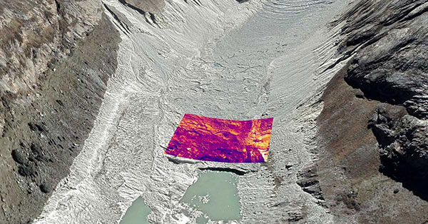
Image: Rosie Bisset
Dangerous Retreat
In a first for mapping glacier retreat in the Peruvian Andes, the CASCADA UK + Peru glacier project used a drone fitted with a FLIR Vue Pro R 640 thermal-imaging camera for insight. A thicker layer acts as insulation. Researcher Rosie Bisset, Edinburgh University, is building a mosaic of the images to better understand how surface cover is affecting the melt rate. The glaciers have shrunk by about 30% in the past few decades, and pose a serious threat to the water supply of in the Ancash region.
A roundup of recent products in the GNSS and inertial positioning industry from the October 2020 issue of GPS World magazine.
OEM
GNSS antennas
Active and passive
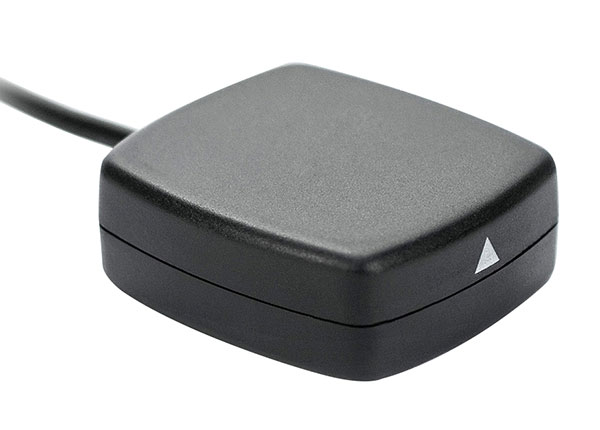
Photo: 2J Antennas
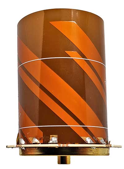
A new range of high-precision GNSS antennas is designed for superior accuracy and reliability, with both active external antennas and passive internal ceramic antennas. The antennas provide precision, high bandwidth, and an advanced signal design for GPS, GLONASS, BeiDou, Galileo, IRNSS and SBAS navigation. They are designed for demanding GPS applications that require centimeter-level accuracy by combining precise point positioning (PPP) of L1 and L2 or by combining L1 and L5 bands with real-time kinematic (RTK) satellite navigation. Applications include aviation safety, UAVs, transportation, autonomous vehicles, agriculture and land and hydrographic surveys.
The HC976 housed and HC976E embedded helical antennas are light and compact, suitable for applications ranging from autonomous navigation to GNSS timing. Both models support GPS/QZSS-L1/L2/L6, GLONASS-G1/G2, Galileo-E1/E6, and BeiDou-B1/B3 frequency bands as well as regional augmentation systems and high-precision L-band correction services. The HC976 and HC976E support QZSS-L6, Galileo-E6 and BeiDou-B3. The HC976 is 44 x 62 millimeters and weighs 42 grams. It features a precision-tuned helical element that provides an excellent axial ratio and operates without the requirement of a ground plane, making it suitable for a wide variety of high-precision applications.
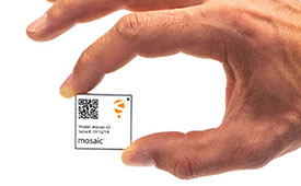
The mosaic-T GPS/GNSS receiver module is built for resilient and precise time and frequency synchronization under challenging conditions. Its multi-frequency, multi-constellation GNSS technology with AIM+ Advanced Interference Mitigation algorithms allows mosaic-T to achieve maximal availability even in the presence of GNSS jamming or spoofing. The compact surface-mount module is designed for automated assembly and high-volume production. Mosaic-T delivers timing and has additional inputs for an external high-accuracy clock.
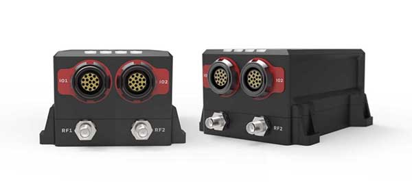
The HGuide n380 inertial navigation system (INS) communicates an object’s position, orientation and velocity when GNSS signals are unavailable. It is built to withstand harsh environments in the air, on land or at sea. It is designed to meet the need for a small, high-performance INS for 3D mapping, surveying and other applications where space is at a premium. It is composed of Honeywell’s HGuide i300 inertial measurement unit (IMU), a GNSS receiver and Honeywell’s proprietary sensor-fusion software, which is based on the algorithms used for navigation on millions of aircraft every day.
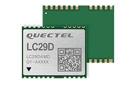
The LC29D eMobility module is a sub-meter-level GNSS module that integrates dead-reckoning and multi-band (L1/L5) real-time kinematic (RTK) algorithm technologies with fast convergence times and reliable performance. The module supports dual-band GNSS raw data output and integrates a 6-axis IMU sensor to deliver high-accuracy positioning performance in seconds. Based on the Broadcom BCM47758 GNSS chip, the LC29D can concurrently receive signals from up to six constellations (GPS, GLONASS, Galileo, IRNSS, BeiDou and QZSS), which maximizes the availability of sub-meter level accuracy. It offers a position update rate of up to 30 Hz (fusion output), enabling dynamic applications like shared emobility, delivery robots and precision agriculture to receive position information with lower latency.
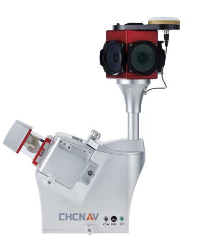
The AlphaUni 300/900/1300 lidar series provides light, versatile long-range laser scanner systems for the high-end market. The series provides optimized data sets powered by advanced GNSS/inertial navigation system (INS) sensors and long-range Riegl scanners. AlphaUni’s design adapts to a variety of applications and can be installed on a variety of platforms, including multi-rotor UAV, fixed-wing vertical-takeoff-and-landing (VTOL) UAV, vehicles, rail trolleys, backpacks, boats and more.
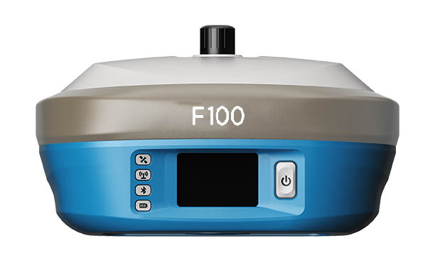
The F100 GNSS receiver, an upgrade to the F90, is designed to meet surveyors’ demands for high field performance, flexibility and cost-effectiveness. It tracks multiple constellations (GPS, GLONASS, Galileo, BeiDou) and can maximize the acquisition and tracking process with all-in-view GNSS frequencies. The 1.45-inch color LCD display is a multi-touch capacitive screen. The F100 has 32GB of internal memory. Its integrated second-generation web user interface control is compatible with all devices and browsers.
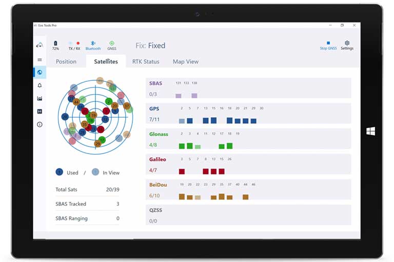
Eos Tools Pro for Windows 10 implements powerful new features that enable users to exploit all four global GNSS constellations and a state-of-the-art NTRIP client to access real-time kinematic (RTK) bases and RTK networks all over the world via NTRIP, Direct IP and wireless radios. It provides the latest support for Windows Geolocation and other features by Microsoft to allow customers to use high-accuracy locations directly in their apps, such as RTK network/RTK base connectivity, support for all new Beidou and Galileo satellites, and SafeRTK functionality for areas with marginal cellular coverage. Features for app developers are also available.
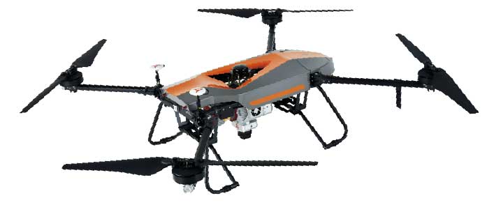
The BB4 UAV high-end multi-rotor drone is optimized for the AlphaUni 300/900/1300 lidar series. Its modular design simplifies deployment in just a few minutes. Its 7-kg payload breaks the capacity barrier, and its more than 45 minutes of flight time increases the airborne lidar survey ability. The redundant CHCNAV and DJI inertial measurement unit (IMU) and GNSS unit provide reliable centimeter real-time kinematic (RTK) positioning, meeting the demand for high accuracy in the geospatial and mapping industries.
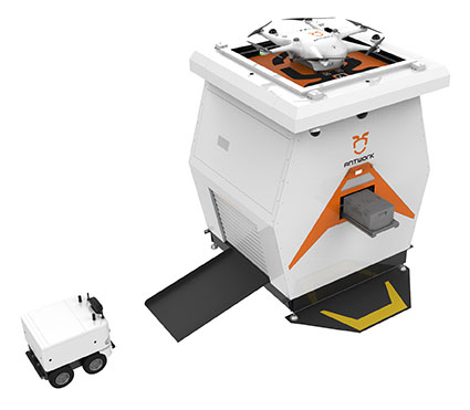
The ADNET autonomous delivery network is a technical solution to transport medical samples and quarantine materials in cities. It uses an RA3 drone, unmanned vehicle RG1 and RH1 hub station to deliver medical supplies without relying on manpower, alleviating time spent in traffic and the cost of traditional delivery. Supplies retrieved by the RG1 vehicle are delivered to the RH1 hub for sorting and redirecting, while the drone transfers the supplies between hubs. The RG1 then delivers goods on the receiving end. The system was demonstrated during China’s COVID-19 epidemic prevention and control period, reducing contact between samples and personnel.
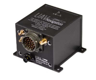
The VECTOR-400 is a compact autopilot designed specifically for unmanned aerial vehicles. It features a robust enclosure and a military-grade connector for harsh environments (MIL-STD 810 and MIL-STD 461). Features enable sea-skimming (extremely low-level flight) and the capability to navigate without GNSS. The VECTOR-400 is able to continue a mission in case of individual sensor failure and when subject to jamming, maintaining accurate estimations of attitude and position. Advanced algorithms provide stall prevention and the ability to carry out an efficient gliding maneuver in case of engine failure. Its air data attitude and heading reference system and inertial navigation system provide high-precision attitude information and reliable navigation under demanding circumstances.
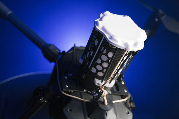
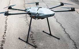
The F700 DroneHunter UAS is a radar-based autonomous interceptor drone for tracking and stopping dangerous drones. Its flexible undercarriage offers interchangeable counter measures for single, multiple or swarm-based threats, while its lightweight carbon-fiber frame enables quick speed and response. The F700 can carry multiple types of anti-drone countermeasures and deploy them in real time, based on which dynamic threat is detected miles beyond the protected area. The pogo pins and payload snaps of the undercarriage are integrated with artificial intelligence for firing and flight software.
Drones equipped with cost-intensive cameras and sensors need protection in the event of a flight-system failure. A parachute system for the DJI M210 drone is now available. Both commercial and emergency response operations are using the M210; its design and flexibility allow for a variety of industry-specific applications. The DRS-M210 parachute system is designed to ensure high pendulum and wind stability, allowing a damaged drone to land safely with minimal impact.
Altitude indicator (AI) or directional gyro (DG) replacement
Photo: uAvionix
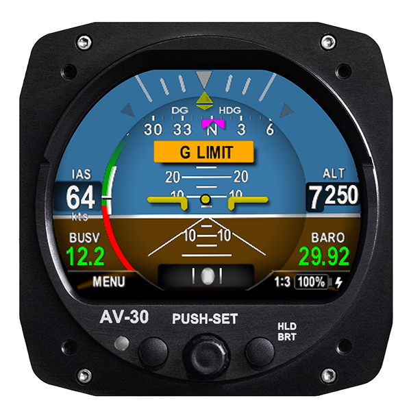
The AV-30-C aircraft panel display adds a suite of in-flight information for pilots, including GPS navigational data, a probeless angle of attack indicator, baro-corrected altitude, indicated/vertical/true airspeed, non-slaved heading, bus voltage and G load. It is designed to fit into any aircraft with a 3 1/8-inch round instrument slot without cutting or modifying the panel. It is authorized for FAR Part 23 Class 1 and Class 2 aircraft listed on the AV-30-C Approved Model List (AML), containing 635 aircraft models including Cessna, Piper, Beechcraft, American Champion, Maule, Boeing, Swift, Mooney, Aviat and others.
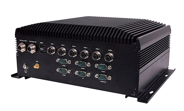
The R3S series of rugged, EN-50155-certified fanless vehicle/rail computers is equipped with a u-blox NEO-M8N module, which receives GPS, Galileo, GLONASS and BeiDou with the default set for GPS + GLONASS dual band. The series offers power-efficient performance for consolidating in-vehicle workloads such as video surveillance, control/monitoring, passenger information and Wi-Fi hotspot sharing. For edge-to-cloud connectivity, R3S uses its internal GPS/GLONASS chipsets for GPS tracking and has two M.2 slots with up to 4x SIM card readers for failover LTE connection. To ensure proper operations in moving vehicles, the series is certified with EN50155, EN50121-3-2, EN50121-4, EN50125-3, EN45545 and E13 standards and has passed MIL-STD-810G shock and vibration resistance certifications. The series can operate under a wide temperature range and offers excellent reliability in harsh railway settings. It has one external removable 2.5-inch HDD/SSD drive bay for recorded footage storage. For consolidating in-vehicle workloads such as in-vehicle control/monitoring and passenger information, the R3S features a variety of I/O support, including 2x HDMI, DI/DO, 3x COM/CAN BUS and 4xUSB ports.
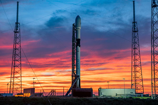
The aborted launch of the fourth GPS III satellite has sparked an investigation into the SpaceX Falcon 9’s Merlin engine. With only two seconds before launch, SpaceX stopped the scheduled launch of the fourth GPS III satellite on Oct. 2.
Tim Dunn of NASA’s Launch Services Program said at an Oct. 16 briefing that the engines had undergone significant testing since the GPS III launch scrub, including taking the Merlin engines from that rocket back to SpaceX’s McGregor, Texas, test site for further study, reports SpaceNews.com. That investigation has involved NASA and Space Force personnel working with SpaceX.
While the GPS III launch has not been rescheduled, Dunn said that the NASA and SpaceX personnel have learned much, with implications involving the rocket hardware.
GPS III SV04 rests atop a Falcon 9 rocket, waiting to be sent into orbit. (Photo: SpaceX)
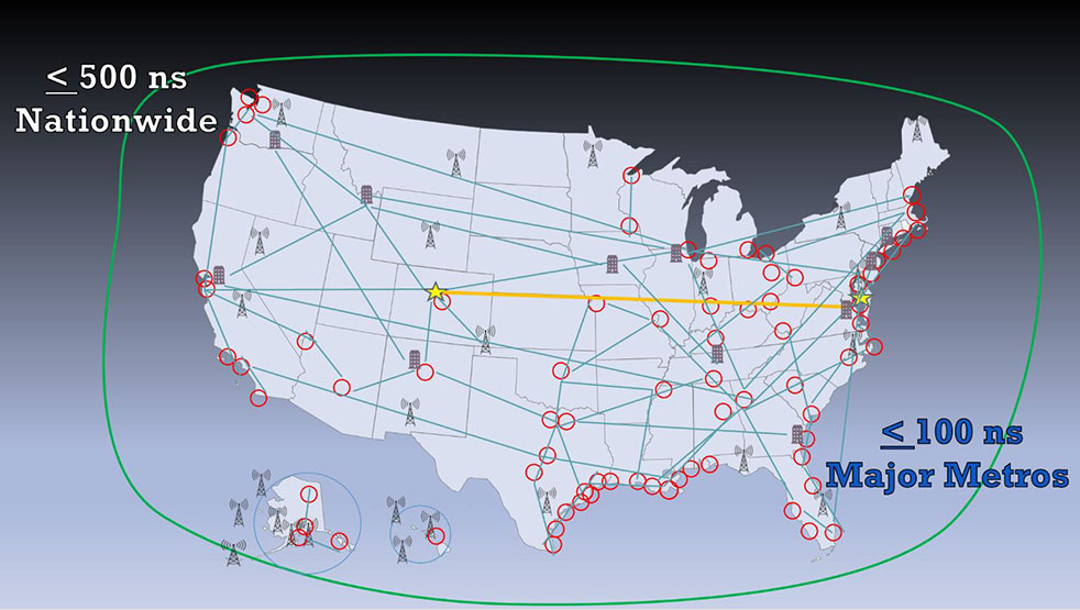
A new white paper sponsored by the Resilient Navigation and Timing Foundation (RNT Foundation) discusses the need and implementation of a reliable and resilient national timing architecture that will include space-based assets. This system-of-systems architecture — GNSS, terrestrial eLoran broadcasts and fiber — is essential to underpin today’s technology and support development of tomorrow’s systems, according to the executive summary of A Resilient National Timing Architecture.
“Everyone in the developed world needs precise time, all the time, whether they know it or not,” said Marc Weiss, one of the paper’s authors and an internationally recognized expert on timing and synchronization. “It is a foundation of every networked technology, digital broadcast, and most navigation systems, to name just a few critical uses.”
Three Paths to Precise Time
“Precise time is so important that everyone needs at least three independent methods of getting it. So, if one, or even two, fail it is not a national disaster,” said Pat Diamond, co-author of the paper. “Our proposed architecture calls for precise time via GNSS, terrestrial eLoran broadcasts and fiber.” Diamond is a long-time network designer, developer, and entrepreneur. He is also a member of the U.S. National Space-Based Positioning, Navigation, and Timing Advisory Board.
Diamond also pointed out that these three methods should be the backbone for timing distribution in the U.S., but won’t be the only methods. “What we are describing is a baseline architecture that will be added to,” he said. “It is a starting point. We envision in the paper additional distribution methods like time from other satellites, user clocks, and so on, all being part of the mix.”
Government Leadership
The U.S. federal government has a leadership interest and responsibility in all of this, according to the paper. Nations have long recognized the military and commercial advantages of determining and distributing precise time. Great Britain’s Longitude Act of 1714 was really about developing a chronometer to support safe navigation of Royal Navy and British merchant fleet. In the United States, the U.S. Naval Observatory has been keeping and distributing a national time scale time since 1845.
“Just because the feds have an important leadership role, doesn’t mean they have to build and own a bunch of systems,” said Dana A. Goward, the paper’s third co-author and executive director of the RNT Foundation. “There are a variety of ways these systems can be established. Public-private-partnerships, subscription contracts like the FAA did with their air traffic ADS-B system, and cooperative agreements are all examples. As we move forward with 5G telecommunications and perhaps even timing and navigation, it will be increasingly important to have a rock solid timing infrastructure to support it all.”
The National Timing Resilience and Security Act of 2018 requires the U.S. Department of Transportation to establish a terrestrial system to backup GPS timing services by December of this year. While the department does not appear to be on track to meet that goal, it completed a technology demonstration program for GPS backup technologies earlier this year. Two companies demonstrated timing distribution by fiber. Another two demonstrated eLoran.
Many Pieces Already in Place
One of the benefits of the proposed architecture is that much of what is called for is already in place, according to the paper. “We already have fiber networks, NAPs (network access points). eLoran is mature and has been deployed by the Brits. And the U.S. government owns enough former Loran-C sites to establish a nationwide eLoran network,” Diamond said. “All we need is a bit of money and some engineering work to put this all together.”
On Oct. 16, Rodrigo da Costa took up his duties as executive director of the European GNSS Agency (GSA), soon to become the EU Space Programme Agency.
He was elected by the GSA Administrative Board on Sept. 15 and met with the ITRE Committee of the European Parliament on Oct. 12.
Da Costa, a Portuguese national who has worked in a number of EU countries, joined the GSA as the Galileo Services Programme manager in March 2017. In this position he was responsible for leading Galileo, the European Union GNSS, in its service provision phase.
He has previously held several senior project management, business development, and institutional account management positions in space industry, in the areas of human space flight, exploration, launchers and research and development.
Da Costa will now be working on transforming the GSA into the EU Space Programme Agency (EUSPA). He will ensure that its existing activities continue to be successfully delivered while also performing new ones required to undertake with the Agency’s new mandate.
Since its creation in 2004, the GSA has made an unparalleled contribution to the EU flagship satellite systems Galileo and EGNOS, which have significantly contributed to the union’s independence and economic growth.
Staffed with highly skilled and dedicated personnel, the agency has boosted innovation, fostered entrepreneurship, led the provision of services, and stimulated the EU economy, in particular through ensuring Galileo and EGNOS uptake across a wide range of market segments thanks to high-quality and secure satellite services.
Rodrigo da Costa, executive director of the European GNSS Agency. (Photo: GSA)
With eyes fixed on the future, EUSPA will further build on the work of the GSA, and will take on additional new responsibilities for further components to the EU Space Programme, including activities in Copernicus (the European Earth observation programme), GOVSATCOM (the EU secure satellite communication system).
Commenting on his new duties da Costa said: “Becoming Executive Director of the Agency means, above all, to lead a team of excellent, dedicated professionals. I’m immensely excited by the opportunity we have to build a successful EUSPA, a key contributor of the EU Space Programme. I’m looking forward to working with all our stakeholders. The task is vast, but I am confident we will be able to play our part, demonstrating to EU citizens what we can do together in EU space activities as GSA/EUSPA.’’
For 30 years, Spirent Communications has built GPS/GNSS simulators, operating at the radio frequency (RF) level and building a broad customer base. Now, with the launch of SimIQ — which starts shipping at the end of October — the company is providing simulation at the I/Q level. (When talking about frequency mixers, the “I” stands for “in phase” and the “Q” stands for “in quadrature.”)
SimIQ is in response to requests from receiver experts, who want to be able to test their receiver algorithms earlier in the development cycle before designing the Application Specific Integrated Circuits (ASIC) or the Field Programmable Gate Arrays (FPGA).
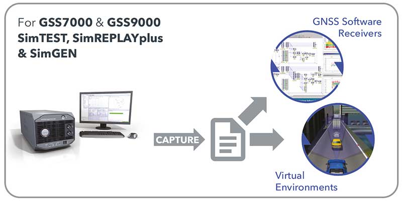
SimIQ Capture: Record I/Q data from Spirent GNSS simulators into files. (Image: Spirent)
“They used to come up with their own individual mechanisms to generate I/Q data and test it,” said Ajay Vemuru, product line manager, NPI, Spirent. “For example, you can use programs that you develop on MATLAB to come up with I/Q data files, but that requires an effort in debugging them and keeping them up to date with the different constellations.” That effort grows as the number of GNSS constellations grows. SimIQ will use the same software as Spirent’s current simulator. However, instead of generating the RF signal, it will generate the I/Q data.
Any GNSS receiver, Vemuru explained, contains a radio that receives the RF signal and down-converts it to create a baseband digital I/Q signal. “That is the I/Q data that we are generating,” he said. “Instead of customers waiting for the RF or the ASIC to be completely designed, they can now take the I/Q straight out of our simulators, inject that into their algorithms, and run their correlators. You can run all your processing on this I/Q data without having to worry about the antenna characteristics and the front-end noise. You can pick and choose which pieces of the receiver you want to test.”
Because the software has not changed, the scenarios — such as the movement of the platform — are the same as before. Plus, customers can reuse them, running them at the I/Q level instead of the RF level.
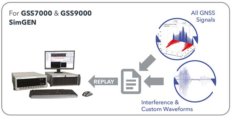
SimIQ Replay: Generate RF with Spirent GNSS simulators from I/Q files. (Image: Spirent)
While Vemuru expects many of Spirent’s customers to be interested in SimIQ, he also anticipates new and evolving markets might take advantage of it. “There will be new teams in existing markets that we haven’t reached because they are engaging an earlier phase of the design process,” said Adam Price, director of PNT simulation at Spirent. “We want to target earlier phases in chipset development.”
In the world of autonomous vehicles, Price explained, engineers are doing significantly more simulation in software to verify more “corner cases” — jargon for problems or situations that occur outside of normal operating parameters, such as when multiple environmental variables or conditions are simultaneously at extreme levels. “As you start to get into safety-critical systems, for example, software simulation is becoming increasingly required,” Price said. “This could allow us to engage that segment. People want to carry out verification earlier in the design cycle.”
By running a simulation in hardware and presenting the devices being tested with a real RF signal, Price points out, engineers are limited to operating in real time. By contrast, in software they can run simulations faster or slower than in real time and even run several simulations in parallel. This is important for developing autonomous vehicles because engineers need to test many scenarios over millions of miles of simulated travel.
Spirent’s SimIQ, however, is addressing a somewhat different market, Vemuru said. “In fact, they would prefer to run slower than in real time because their ASIC or FPGAs are not yet in production. So, they would be essentially running them on CPUs, which take a lot more processing time.”
So far, we have been talking only about capturing I/Q data. However, SimIQ can also replay it. This, Vemuru said, “is essentially for customers who want to add interference patterns that, for some reason, they don’t want Spirent or anybody else to see. It can be any signal, so long as it is within the frequency of the GNSS spectrum. They can inject I/Q files into the platform itself. We take the external I/Q stream, generate the GNSS signals, add them up, and generate this at the RF level.”
One use case deals with classified signals. “They can always generate baseband I/Q data of that classified signal, as a file, and inject it into our simulator, so that we can generate the RF signal for that particular classified I/Q signal alongside the GNSS that already comes out natively from our boxes,” Vemuru explained.
GNSS augmentation solution targets North America and Europe with safe and precise centimeter-level accuracy performance from two geostationary satellites.
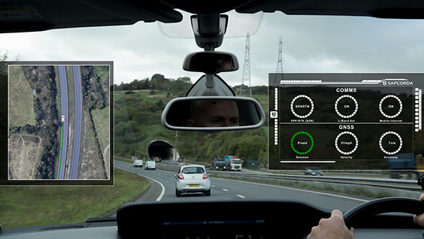
Sapcorda Services GmbH is now testing its GNSS augmentation services for the L-band signal in North America and Europe. The testing lays the foundation for a Dec. 1 launch of what Sapcorda said will be the strongest, most reliable GNSS augmentation signal for safety-critical navigation in autonomous vehicles and machinery.
Available in areas without GSM coverage or mobile internet signal, the new Sapcorda L-band beam solutions from two geostationary satellites provide PPP-RTK data-feed redundancy in real-time by swapping to a second data feed when internet connectivity is not available. This automated swapping significantly improves reliability for life-critical applications such as autonomous cars.
“To use GNSS in mass-market safety-critical applications, manufacturers need GNSS augmentation services that provide correction data with safety-critical positioning,” said Botho zu Eulenburg, CEO, Sapcorda. “By expanding our SAPA services with L-band transmission, we enable a high-power correction data stream for homogeneous performance and end-to-end data security with continental coverage in the United States and Europe — thus improving accuracy, reducing convergence time, and enabling the use of lower-cost receivers and antennae.”
The Sapcorda L-band signal will be transmitted in the open SPARTN format, a format specifically developed for IP-based and geostationary satellite distributions. It will be invaluable for safety-critical applications in automotive (such as V2X and autonomous driving, AD/ADAS) and maritime, as well as a wide variety of uses across sectors such as industrial, robotics and drones.
The L-band satellite beam coverage will be available on December 1, 2020. Sapcorda’s safe and precise augmentation (SAPA) service will broadcast SAPA Basic and SAPA Premium correction data streams.
These data streams feature:
99.9% service availability with fast convergence and an accuracy of less than 10 cm, delivering the precision required for safety- and life-critical applications
Redundancy through dual data streams when internet connectivity isn’t available, ensuring uninterrupted broadcast streaming
Demodulation by any L-band demodulator on the market, simplifying hardware design and reducing bill of materials
Availability of service coverage areas in North America and Europe, allowing manufacturers to use a single GNSS augmentation services’ solution for major global regions
Distributed in the same open format as IP-delivery channels (SPARTN)
Sapcorda’s SAPA services are supported by experienced engineering teams dedicated to systems integrators and enterprise business customers. The Basic and Premium SAPA services for L-band signal operation begins in both regions on Dec. 1.
F. Michael Swiek, president, Mike International LLC
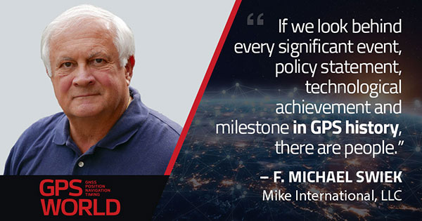
It is often said that “Behind every successful man there is a woman.” Likewise, if we look behind every significant event, policy statement, technological achievement and milestone in GPS history, there are people. They make the textbook chronologies of impressive progress both personal and human.
My own 30-year association with GPS has tracked closely with that of GPS World. Here are vignettes that sit most warmly in my “family snapshot album” of great moments in GPS.
In December 1994, the Civil GPS Service Interface Committee (CGSIC) held its first international meeting in Edinburgh, Scotland, hosted by the Northern Lighthouse Board (NLB). The small team of Americans attending the meeting were invited the following day to participate as the “International Team” in the annual NLB quiz competition held in a venerable pub. The competition is hotly contested each year among the NLB divisions, with the winning division commemorated with a brass medallion on a large wooden plaque kept for decades in NLB headquarters. To everyone’s chagrin, the Americans won. The good humor and boisterous camaraderie of that evening laid the foundation for close and candid dialogue between U.S. and European institutions on a wide variety of satellite navigation issues for years to come.
In 1996, Charlie Trimble was to introduce Vice President Al Gore in a ceremony at the White House to announce a Presidential Policy Statement on GPS. On the scheduled day, Charlie was unable to enter the White House, despite being vouched for by White House officials, because he was carrying no photo ID. White House security asked me if I had anything official with Charlie’s picture. They finally accepted a copy of the Trimble Navigation annual report, because in the words of one security officer, “I’ve heard of fake driver’s licenses, but not fake corporate annual reports.” Charlie was admitted.
On September 11, 2001, all of us attending CGSIC and ION in Salt Lake City sat stunned in our conference room watching the news reports from New York. Our meeting sessions were canceled, but we came from our hotel rooms because we needed to be together as friends in our shock and confusion, worrying about our families and friends and what the days ahead would be like. Anyone with a cell phone able to get a line out gladly shared it.
“I’ll only be a minute, just want to check with my family.”
“Talk as long as you want.”
In the mid-1990s in the ION exhibit hall, I was walking and talking with Charlie Trimble, Randy Hoffman (founder of Magellan Systems) and Gary Burrell (co-founder of Garmin), who were engaged in good-natured trash talking about each others’ companies, products and personalities. Glen Gibbons, founder of this esteemed publication, came across us, smiled, and said he was surprised to see such a congenial group of competitors. Charlie responded that in the marketplace they were competitors, but at ION they were all colleagues.
Glen added, “So, all friends!”
All three blurted, “Don’t go that far!” amid more laughs and grins.
The Japan GPS Council became one of the earliest and most influential industry groups in helping to guide the evolution and growth of GPS policy and industry, due to the personal passion of Hiroshi Nishiguchi. When meetings were held in Washington, Nishiguchi, other international representatives, industry and government officials would be guests in our home for convivial dinner chats. Nishiguchi became so comfortable, we considered him like family. He would leave a cardigan sweater in our coat closet between visits, and upon entering our house would remove his tie and suit jacket, go to the closet, and put on his sweater — like Mr. Rogers — before relaxing for the evening. He performed this ritual even when accompanying senior Japanese officials.
So, while technological milestones and policy commitments tell a great deal of the story of GPS, there are also the unique and cherished people, and the privilege it has been to know them as friends.
Feature image: Smithsonian; Charlie Trimble provides the 4000A GPS Locator to the Smithsonian Museum. Introduced in 1984, the Trimble 4000A was the first commercial GPS positioning product.