An IMU-RTK GNSS receiver that fits in your hand and a fully integrated GNSS base station add a new scale to GNSS surveying applications.
CHC Navigation (CHCNAV) has announced the immediate availability of the i73 GNSS, a versatile pocket-sized IMU-RTK GNSS rover with an integrated inertial module and the iBase GNSS, a rugged base GNSS receiver.
The combination of the i73 GNSS and the iBase GNSS offers a productive and affordable solution for measuring and staking out points in any surveying, mapping or construction application.
“Surveyors and construction professionals are forced to carry heavy and cumbersome GNSS receivers in most situations, resulting in unnecessary fatigue and lower productivity,” said Hans Huang, product manager of CHC Navigation’s Survey and Engineering Division. “Taking this into account, we have developed our pocket-sized i73 GNSS, the lightest GNSS rover powered by the latest IMU-RTK technology, and much more. Our iBase GNSS station follows the same concept of an all-in-one solution, making the need for external radio modems and other bulky accessories obsolete.”
The i73 Pocket IMU-RTK GNSS: A new scale to GNSS
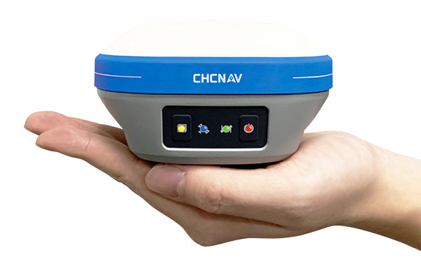
The i73 Pocket IMU-RTK GNSS. (Photo: CHCNAV)
Weighing only 730 grams yet with 15 hours of operating time, the i73 GNSS is one of the lightest and most rugged RTK GNSS receivers on the market.
Easy to carry and use, the i73 will not tire out field workers. It offers superior GNSS signal tracking enables surveys beyond the usual constraints. It features full 624-channel GNSS technology and connects seamlessly to RTK GNSS networks as well as to UHF GNSS station over its embedded UHF modem.
Automatic pole-tilt compensation. The i73 GNSS internal interference-free inertial module (IMU) allows automatic pole tilt compensation of up to 45 degrees. Projects are completed 30% faster and with increased efficiency and safety when measuring hard-to-reach points.
The iBASE GNSS: Redefining the concept of GNSS base station
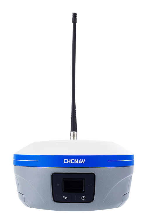
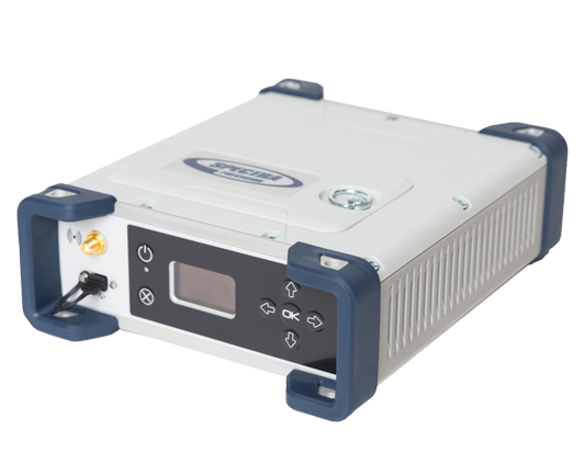
The iBASE GNSS receiver. (Photo: CHCNAV)
The GNSS iBase is a fully integrated GNSS base station, specifically designed to meet 95% of surveyors’ needs when working in UHF GNSS base and rover mode. The performance of the iBase UHF base station compared to a conventional external UHF radio modem is virtually identical. But its unique design eliminates the need for a heavy external battery, bulky cables, an external radio, and a radio antenna. Its 5-watt radio module provides operational GNSS RTK coverage up to 8 km.
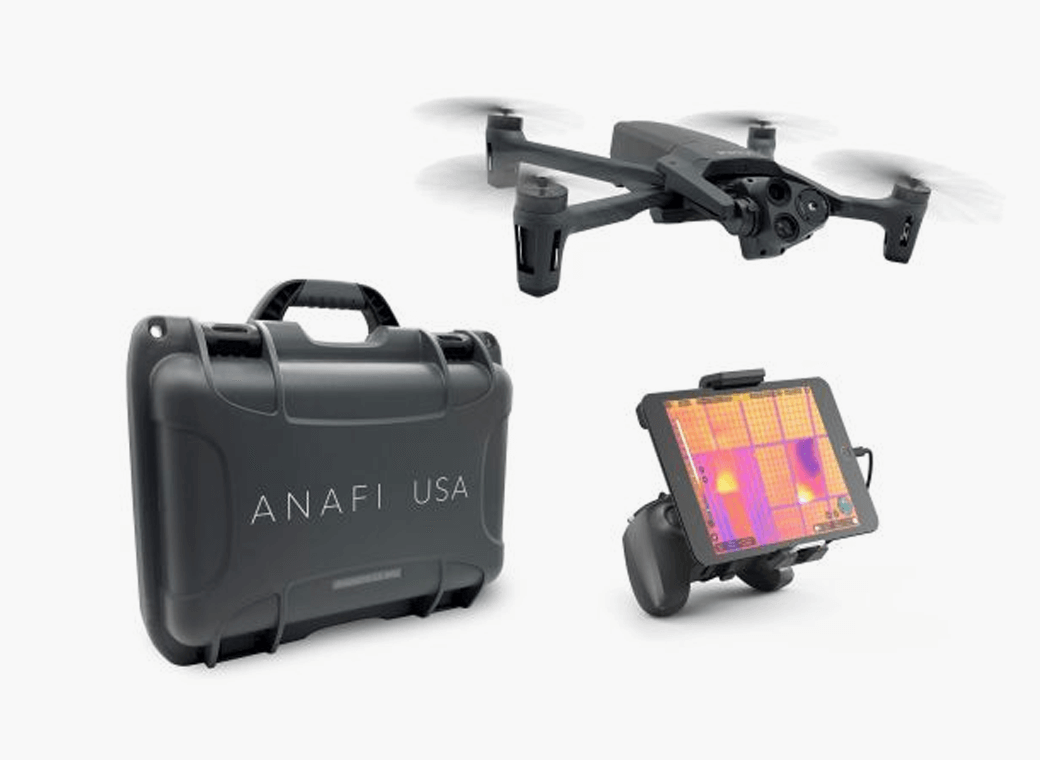
Skyward, a Verizon company, and Parrot, a European drone group, are partnering to deliver Parrot ANAFI drones along with Skyward drone program management, flight-log sync and training to U.S. enterprises.
In particular, the new speaks to a widespread need among U.S. companies and public agencies for a secure, high-end drone manufactured domestically. Sold by Skyward, the ANAFI USA and training package gives enterprises a one-stop shop for building and scaling a drone program with aircraft, policies and procedures, training, and automatic flight log sync to the software platform to manage it all.
“ANAFI USA was designed to meet the needs of the most demanding professional users while offering enterprise data security and privacy,” said Henri Seydoux, founder and CEO of Parrot. “Now, combined with Skyward’s enterprise drone solutions covering training and integrated software platforms, professional users have access to one of the most comprehensive suites of hardware, software and services.”
In addition to its security benefits, Parrot’s ANAFI USA features 32x zoom 4K HDR video and thermal imaging capabilities. It is portable, weather-resistant and ready to launch in seconds.
“Now enterprises can maximize their investment in the ANAFI USA by pairing it with Skyward’s in-person and online operator training and robust management platform,” said Mariah Scott, president of Skyward, A Verizon company. “This is just the beginning of a strong partnership with Parrot. Look for continued feature integration and connectivity offerings as we move the industry forward together.”
Skyward users can automatically log flights from the Parrot FreeFlight 6 piloting application for the ANAFI, ANAFI Thermal and ANAFI USA drones with additional integration features coming soon to maximize the value of both platforms.
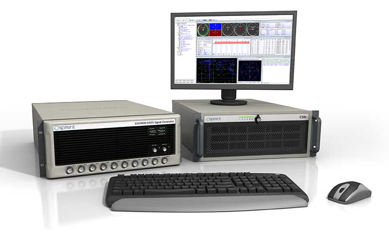
GNSS simulator company Spirent Federal Systems will soon release SimMNSA 2.0. The release adds advanced scenario controls that enable full recreation of government test vectors while retaining the simple key and fly option of the initial release.
Spirent Federal developed software that supports M-code signals using the Modernized Navstar Security Algorithm (MNSA). SimMNSA 1.0 was released in 2018 and is now used in laboratories throughout the country with receivers from all M-code manufacturers.
“SimMNSA is the first MNSA-based M-code signal simulation to receive government security approval,” said Ellen Hall, President and CEO. “We pride ourselves in being leaders in innovation and we will continue to push ourselves to meet the growing needs of our customers.”
Release 2.0 of Spirent Federal’s SimMNSA is scheduled for later this year. It will be available to authorized users of the GSS9000 Series, at no additional cost to current SimMNSA users under maintenance contracts.
Esri has acquired nFrames, a technology company that develops SURE, an imagery and lidar 3D surface reconstruction software.
According to Esri, this will enable the fusion of imagery with 3D GIS, allowing nFrames and Esri users to seamlessly capture and analyze 3D data from aerial, drone and ground-based sensors in an automated end-to-end process.
SURE scales 3D data creation to large city and countrywide airborne image datasets and projects. According to nFrames, it gives professional photogrammetry workflows improved precision, speed and simplicity on premises or in the cloud. SURE can be used for a number of industries, including those in government; national mapping; insurance; and architecture, engineering, and construction (AEC).
Through this acquisition, Esri gains a robust production engine that transforms imagery and lidar data into point clouds, phototextured 3D meshes and true orthos, Esri said.
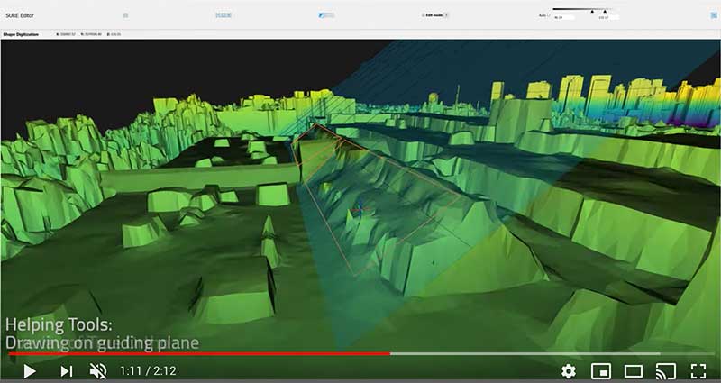
SURE software editor (Screenshot: nFrames)
In addition, SURE allows its users to generate 3D maps at scales from individual construction sites to entire cities and countries. These maps are fully automated at high resolution and repetition rates, nFrames added.
“nFrames is a leading provider of 3D image reconstruction software and services, and I am excited to welcome the company to the Esri family,” said Jack Dangermond, Esri founder and president. “As Esri continues down its path of innovation to create a multidimensional experience, this acquisition enhances our ability to create extremely high-quality 3D data from imagery, which is critical for our customers in the municipal, planning and AEC industries.”
SURE software will become a part of Esri’s ArcGIS platform. According to Esri, it will make SURE capabilities available in ArcGIS Drone2Map and Site Scan for ArcGIS so users can create better meshes, point clouds and true orthos from their drone imagery.
“Together with Esri, we will be able to unlock the full value of 3D surface data through GIS by connecting geometry with metainformation to provide spatial context,” said Konrad Wenzel, CEO and co-founder of nFrames. “This fully automatic chain from data capture to analytics will enable smarter decision-making.”
The nFrames headquarters will now serve as a new Esri research and development center based in Stuttgart, Germany.
The Spectra Geospatial SP90m GNSS receiver will guide the racing yacht Maître CoQ for the 2020 Vendée Globe, single-handed, non-stop around-the-world yacht race. The Vendée Globe is an extreme endurance test for both sailor and boat and widely considered the ultimate challenge in ocean racing. The race starts Nov. 8 and is expected to finish in late January or early February.
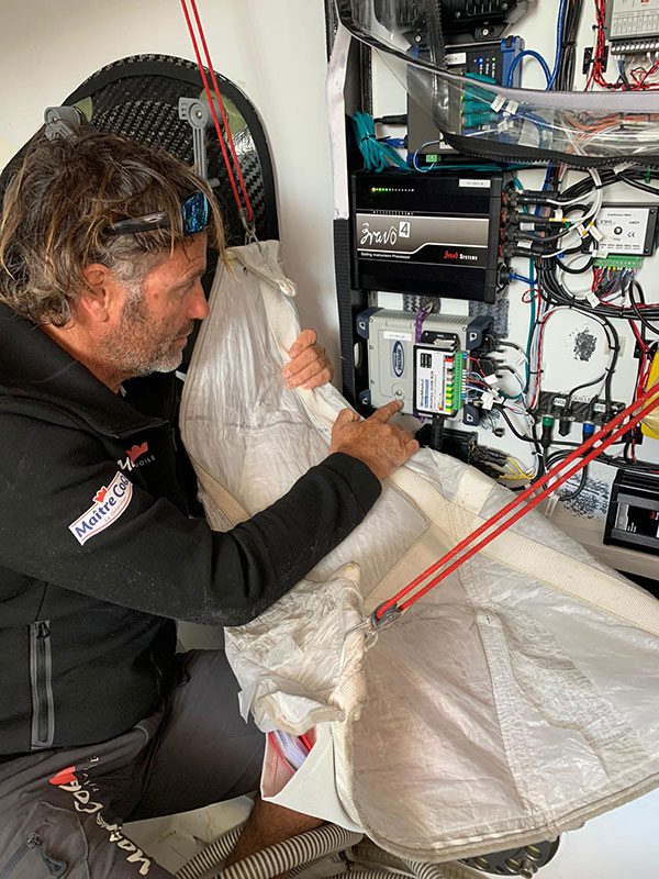
The SP90m will provide the skipper of the Maître CoQ, Yannick Bestaven, with precise position and boat heading information. The SP90m information is integrated to a separate attitude information source, and the entire package of the position, heading and attitude is sent to the boat’s autopilot.
Photo: Spectra Geospatial
Bestaven, responding to the changing sea and wind conditions, strategically adjusts the autopilot to keep the boat moving at top speed to the desired destination as he changes and trims sails and trims foils to achieve maximum sailing efficiency.
The Maître CoQ is an advanced design mono-hull foiling sailing yacht in the category of IMOCA (International Monohull Offshore Class Association) which have a fixed length of 18.28 meters (60 feet), Antoine Connan, head of engineering for the Maître CoQ racing team, selected the SP90m.
The hostile environment and requirements for precise position information at sea far from land made the selection of the SP90m an important technical choice. It always delivers an accurate position and precise heading with no GNSS corrections.
Commenting on the performance of the SP90m in the recent July 2020 2,800-mile qualifying race, the Vendée- Arctique-Les Sables D’Olonne, Connan reports, “We are already very happy with its installation on board.”
The SP90m is a rugged design for marine environments. With 480-channel tracking and dual GNSS antenna inputs, the SP90m is an integrated onboard rover receiver offering minimal size and low power consumption.
When the Maître CoQ technical team, based in La Rochelle, decided they needed to upgrade the boat’s navigation system, they contacted Cadden, a specialist in supplying advanced electronic precision measurement sensors. In addition to the requirement for delivering fast, precise position and heading data, the new sensor had to be lightweight, small, require little power, be easy to integrate, and flawlessly withstand a hostile saltwater environment. Cadden’s analysis concluded the Spectra Geospatial SP90m fit the spec perfectly.
“We are thrilled that the Maître CoQ racing team selected the Spectra Geospatial SP90m,” said Olivier Casabianca, vice president Spectra Geospatial. “It’s one more confirmation that Spectra Geospatial provides truly the highest quality rugged and precise GNSS receivers.“
About the Vendée Globe 2020. Held every four years, the Vendée Globe is a single-handed (solo) non-stop yacht race around the world without assistance. It starts and finishes in Les Sables-d’Olonne in the Département of Vendée in France. The course is a circumnavigation from Les Sables- d’Olonne, that heads south in the Atlantic Ocean to the Cape of Good Hope, then east in the Southern Ocean clockwise around Antarctica, keeping Australia’s Cape Leeuwin and South America’s Cape Horn to port (to the left); and then back north in the Atlantic returning to finish in Les Sables-d’Olonne.
Trimble continues to increase its footprint to deliver high-accuracy positioning correction services
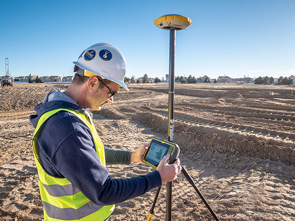
Photo: Trimble
Trimble has acquired MidStates VRS, a network previously owned by Butler Machinery and Frontier Precision. The addition of the network, in North and South Dakota, increases the footprint of Trimble’s VRS Now GNSS corrections service to cover more than one million square miles in North America. Financial terms were not disclosed.
As part of an ongoing expansion strategy, the new coverage for the VRS Now subscription service helps users in more places achieve high-accuracy positioning to increase productivity, reduce operational costs and improve safety.
The correction service is designed for professionals in agriculture, geospatial and construction as well as emerging autonomous applications including lane-keeping for passenger vehicles, vehicle-to-everything (V2X) position identification and unmanned aerial system guidance.
Adding 105,000 square miles of coverage, the acquisition expands Trimble’s VRS Now network to be one of the largest in North America — over one million square miles, contributing to Trimble’s shift toward a software, services and subscription business emphasis.
When using the Trimble VRS Now service, land and construction surveyors, GIS professionals and farmers — with a Trimble or third-party commercial GNSS receiver — can leverage instant high-accuracy corrections delivered via cellular network to improve productivity.
Enabling users to work without a GNSS base station, the service is cost-effective and simple to use. It is ideal for a variety of applications that require sub-inch level accuracy and is an important component of the connected construction site and connected farm workflows.
“The MidStates VRS network covers significant farmland, oil fields and rapidly developing urban areas, providing farmers and surveyors in the region with the real-time GNSS correction services they need to improve their day-to-day work,” said Patricia Boothe, senior vice president of Trimble’s Autonomy Sector. “The purchase of the MidStates network demonstrates Trimble’s ongoing commitment to provide a wide range of correction services for autonomous solutions — delivering unmatched access to fast, reliable and highly accurate positioning in more areas than ever before.”
Trimble networks are supported by a global network operations team made up of GNSS system engineers, geodesy experts and IT professionals. The team monitors the networks 24/7 from operation centers located on three continents, providing consistent and reliable service uptime and performance integrity.
Trimble VRS Now. The correction service offers instant access to centimeter-level positioning tailored to the users’ geographic location; the service is always on wherever and whenever needed within the network coverage area. With no base station or setup required, it is cost-effective, efficient and simple to use.
VRS provides positioning professionals with instant access to real-time kinematic (RTK) and post-processing (PP) corrections utilizing a network of permanent (fixed) continuously operating reference stations (CORS).
Trimble-owned VRS networks are accessible now in areas throughout the U.S. and Canada as well as Eastern Australia and Tasmania, France, Belgium, the Czech Republic, Estonia, Germany, Great Britain, Ireland, Luxembourg, the Netherlands, Sweden and New Zealand.
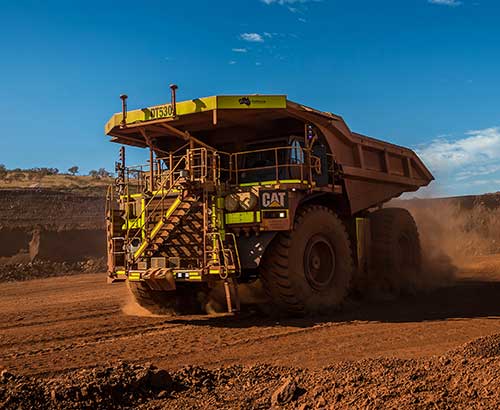
Auto Mining: A driverless Cat 793F CMD truck leaves an iron ore pit. (Photo: Caterpillar)
Individuals who use GNSS today may not know the significant advancements that have been accomplished over the past 30 years to obtain accurate GNSS-derived coordinates, especially GNSS-derived orthometric heights.
Thirty years ago, there were two limiting factors for estimating GNSS-derived heights — estimation of accurate ellipsoid heights in a timely manner and the availability of an accurate geoid model. The geoid model was only good to the decimeter level, between two stations relatively close together. A significant improvement of the measurement of the Earth’s gravity field (such as from the GRACE mission) and digital elevation data (from the Space Shuttle Radar Topography Mission) facilitated the creation of more accurate geoid models. Geoid models went from decimeter values to centimeter, and then sub-centimeter values between closely spaced marks.
A new national network
During the past three decades, the U.S. National Geodetic Survey (NGS) has developed a national network of Continuously Operating Reference Stations (CORS). These CORS, along with the states’ real-time networks (RTNs), have provided the ability to compute accurate GNSS-derived coordinates in an efficient and effective manner. The modeling of antenna phase patterns was a critical development for combining different types of antennas.
Today’s GNSS processing software is basically a “hands-off black-box” system. But 30 years ago, the analyst had to identify cycle slips and ensure that all unknown cycle ambiguities of the carrier-phase data (integers) were determined correctly. It was a time-consuming task, and analysts needed to understand the data. So many things can go wrong when someone relies on an answer from a black box. That said, federal agencies such as NGS and GNSS software companies have produced hands-off software that provides statistics and warning messages, as well as guidelines for ensuring results are consistent and accurate.
The advancements in estimating GNSS-derived coordinates (including orthometric heights) have changed the way many industries do business. Farmers use it to drive their tractors and combines, mining companies control driverless vehicles, construction companies use automated machine guidance to build roads, and, of course, it has improved how individuals navigate from one location to the next.
Hands-off farming and mining
Thirty years ago, few farmers thought they would be able to sit in their cab and let their combine harvester drive itself. Geodesist, surveyors, and engineers had a vision of using GNSS to automate the use of farming and construction equipment, which became a reality.
What will it be like in another 30 years? Will it be routine for individuals to program their car for a destination, and then sit back and read a book?
Positioning with GNSS will be critical for the safety factor of driverless vehicles and the use of drones for delivery. Geodesists, surveyors and engineers, once again, need to lead the way to meet the positioning requirements of the future.
A new military vehicle navigation system designed and developed by South Africa-based Etion Create is ready for the local and export markets.
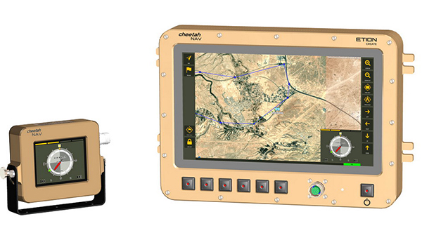
Designed for harsh environments and battlefield conditions, the CheetahNAV provides outstanding situational awareness, according to Etion Create. The crew of a light military vehicle can count on highly accurate position information, irrespective of whether they are denied satellite navigation. This is achieved through an advanced inertial measurement system (IMS), comprising several aids, including a gyro-compensated compass and an advanced Kalman filter-based algorithm.
“We are confident that the system provides dead-reckoning horizontal position accuracy of 0.2% of distance travelled in a GNSS denied situation,” said Jan Hurter, senior product manager. “This translates, by way of example, to accuracy of just 200 metres over a distance of 100 kilometers.”
The CheetahNAV can integrate with any number of different inertial navigation systems (INS) and can be aligned with any of the satellite navigation constellations. Combined with GNSS and compass information, the system enables dead-reckoning and accurate positioning of the vehicle in tactical situations. The tactical grade integral inertial measurement unit (IMU) ensures jamming-free operation.
Some of the guidance cues the system provides to the crew during tactical maneuvers include the vehicle’s current position, true heading and desired heading towards the next waypoint, current speed and desired speed to reach the next waypoint or destination on time, and the next waypoint or destination. It also shows the pitch and roll attitude of the vehicle and the track it has travelled.
This data is displayed on a sunlight-readable touch-screen enabled moving map display unit measuring 11.6-inch diagonal, in 16:9 TFT format, with a 1920×1080 resolution. Etion Create is also offering a slave unit for the vehicle driver, as the main display might be positioned elsewhere in a space constrained vehicle. This slave unit, measuring 3.5-inch diagonal TFT, displays information that is specifically required by the driver.
Significant benefits of the CheetahNAV system include ruggedness for extreme battlefield conditions and 28V or 12V DC operation in line with military standards. Moreover, it boasts a high operational reliability.
“It is important to note that Etion Create, as original design manufacturer, is focusing the CheetahNAV on the export market, including the possibility of technology transfer for indigenous manufacturing,” said Hurter. “Besides we offer a multi-language option, which is certainly a key advantage in multinational operations that are almost the norm nowadays.”
The CheetahNAV is non-ITAR controlled, which is the preference of most land forces around the world today to meet their battlefield management requirements.
Having utilized the building blocks of previously developed military off-the-shelf technologies, Etion Create considers the system to be at a high TRL (technology readiness level), and thus available for the export market.
Previously called Parsec, Etion Create is a South African original design manufacturer (ODM) with a long-standing international reach and a professional portfolio of technology offerings and experience across a wide range of business sectors, including defence and aerospace, information security, and mining and industrial sectors.
The global construction robot market was valued at USD 231.5 million in 2018 and is expected to reach USD 464.8 million by 2026, growing at a compound annual growth rate (CAGR) of 9.5% during the forecast period, according to an InForGrowth market report.
The construction industry is one of the least automated industries that features manual-intensive labor as a primary source of productivity. However, with the advancement in technology, the construction industry is utilizing robots to excel at repetitive tasks in a controlled environment.
Construction robots have a major impact on the construction industry. The construction industry is looking to automate more and more tasks for the sake of productivity and efficiency, which in turn is increasing the demand for construction robots.
The use of robots has grown considerably with increasing speed, efficiency, safety and profit concerns. Construction robots have provided a transformative experience for the entire industry and have helped in replacing or improving existing processes, making them more proficient as well as more precise.
Companies are deploying these new commercially viable robots in various applications such as 3D printing of large structures, disaster relief situations, construction of tall structures, and for assisting workers performing laborious tasks. These robots have helped in automating laborious and dangerous tasks to keep laborers away from hazardous activities and enable them to focus on more productive work.
3D printing. Moreover, the evolution of 3D printing in the construction industry is expected to create opportunities in the market. This will further enhance the market size of the global construction robot market. An increase in research and development activities to minimize the cost of robots will also enhance the market size over the forecast period.
However, the high cost associated with the deployment of robotic solutions is expected to hamper the growth of the global construction robot market during the forecast period.
Key findings. Based on the product type, the traditional robot segment accounted for the largest market size in the global construction robot market in 2018.
Based on automation, the semi-autonomous robot segment accounted for the largest market size in the global construction robot market in 2018.
Based on function, the demolition robot segment held the largest share in the global market in 2018.
Based on applications, the public infrastructure segment is expected to dominate the market during the forecast period. Europe accounted for nearly 30% share of the global market in 2018.
Recent industry news. In September 2019, Built Robotics closed a US$ 33 million Series B funding round, led by Next47, the global venture fund backed by Siemens, for autonomous construction equipment.
In August 2019, John Sisk & Son used MULE at Sisk’s residential Wembley Park E05 site in London to reduce fatigue and injuries among workers and increase productivity.
In June 2019, Boston Dynamics launched an inspection robot named SPOT, which is mounted with 3D cameras to inspect and map construction sites and identify hazards and work progress.
Depending on your age, 30 years represents a varying opinion of time. For some, it may seem like forever; for others, it may be a blink of an eye. In respect to technology, it can represent a complete change in the way we do things.
When we turned the calendar page to January 1990, our world had yet to experience the internet, the Hubble telescope had not been deployed to share its fantastic views, and The Simpsons television series was preparing to become the cartoon juggernaut it remains today.
Yes, lots has changed since 1990, and surveying is no exception.
Most professions look back through their history and see various periods where discoveries and inventions revolutionized how the work was completed.
For surveyors, the past 30 years have contained more advancements than all other years combined, with the greatest achievement being the global navigation satellite system (GNSS). With the United States leading the way with its Global Positioning System and the civilian ability to use this measuring system, modern surveying was forever changed.
Solar and lunar observations replaced
Before the implementation of a satellite navigation system, true global navigation was only computed using solar and lunar readings under specific conditions. GPS provided a new frontier for surveyors to establish positions without having to perform traversing from known points or collecting solar/lunar observations.
As the constellation grew, it became easier to use GPS to gain initialization for accurate and redundant position determination. As processor speeds and data storage capability increased, real-time kinematic (RTK) observations became the norm for surveyors everywhere.
The Russian satellite constellation, GLONASS, began operating fully in the late 1990s, and is now included to create today’s GNSS. More satellites provide more coverage, which in turn means more data collection potential.
Many nations and regions are building their own constellations to augment the current GNSS lineup, and also to safeguard the ability to obtain geographic locations when other systems are not available.
Bathymetric surveys made easy
GNSS capability and integration revolutionized several aspects of surveying, including a new and more reliable way of performing bathymetric surveys over large bodies of water. Computerized depth sounders were programmed to coincide readings with GNSS data collection to provide a more accurate and precise method of hydrographic surveying.
The past decade has continued the reliance on GNSS technology with many more devices and applications — not just for the surveyor, but for the public as well. While surveyors are using GNSS receivers on unmanned vehicles such as UAVs and boats, satellite navigation has infiltrated into many of our everyday routines. Cellphones, fitness trackers and our automobiles use this technology to guide us to our destinations.
Surveyors have used the GNSS revolution to create a digital world for better data collection, asset management and increased efficiency. Much has changed in 30 years for the surveyor and the world around us, so we should not be surprised about what technology will bring us next.
Hexagon’s Autonomy and Positioning division has launched its first autonomy positioning and sensing kits for the agriculture market and validated these solutions in its new autonomous research and development tractor.
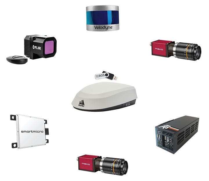
Through collaboration between NovAtel and AutonomouStuff, both part of Hexagon, the autonomous positioning and sensing kits were developed as part of Hexagon’s Smart Autonomous Mobility solutions portfolio launched at CES in early 2020. NovAtel and AutonomouStuff created the solutions with agriculture machinery OEMs and robotic machinery manufacturers in mind.
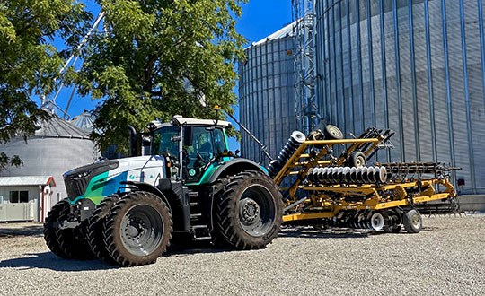
As a demonstrator vehicle for Smart Autonomous Mobility, the autonomous tractor features object detection and classification, simultaneous relative localization and mapping, absolute positioning through GNSS technology, and localization sensor fusing. Built to illustrate the viability of new positioning and sensing kits, the tractor incorporates safety-critical learnings with situational and environmental awareness, and manual remote control when needed. This platform validates how these solutions and capabilities accelerate autonomous development.
Hexagon’s autonomous research and development tractor validated the new kit. (Photo: Hexagon)
The positioning and sensing kits are optimized for autonomous agriculture applications, including products like the Smart7 antenna and autonomous robotic capabilities through the NovAtel OEM7 driver powered by the Robot Operating System (ROS). The kits also feature TerraStar GNSS Correction Services, ALIGN heading and relative positioning firmware, and SPAN GNSS+INS technology. Though designed for agriculture, the kits integrate seamlessly into other off-road autonomy applications.
“These positioning and sensing kits provide developers with technology bringing assured positioning to autonomy in agriculture,” explained Michael Martinez, agriculture segment manager at Hexagon | NovAtel. “Robotic-machinery manufacturers or those experienced in autonomy may be unfamiliar with the unique challenges facing agriculture applications. Conversely, those experienced with agriculture may not have the expertise to integrate positioning and sensing products within autonomous solutions. We can help in both cases through these positioning and sensor kits, as demonstrated by our autonomous tractor.”
The new autonomous positioning and sensing kit. (Photo: Hexagon)
“We’re excited to use this tractor as a platform to validate the human identification, obstacle detection and enhanced environmental awareness that our sensing kits add to our assured positioning solutions in agriculture,” said John Buszek, VP of products and services at Hexagon | AutonomouStuff. “The sensing and positioning technologies we’ve integrated on this demonstration platform showcase the Smart Autonomous Mobility portfolio, which enables and accelerates the development of autonomy in agriculture applications from prototyping to production.”
For more than 30 years, NovAtel has delivered GNSS positioning solutions as a trusted provider for top precision agriculture companies. Combined with AutonomouStuff’s decade of expertise in autonomy and sensor fusion, they significantly reduce the barrier of entry into autonomy to accelerate the time to market for autonomous solutions in agriculture, construction, mining and other off-road applications.
Learn more about their agriculture autonomy capabilities by taking a virtual tractor tour via their 3D interactive app or online at novatel.com/ag-autonomy.
As technology evolves, the Civil Air Patrol will continue to be a platform for implementing new technologies to secure the country in times of crisis.
The strength of this country isn’t in buildings of brick and steel. It’s in the hearts of those who have sworn to fight for its freedom! —Captain America
Eyes of the Home Skies, World War II-era poster of Civil Air Patrol. (Image: CAP)
If you are someone who likes aviation, GIS and emerging technologies like artificial intelligence and computer vision, and you want to fulfill a greater sense of purpose, the perfect time is now.
The Flying Minute Men, so called by Robert Neprud in the 1948 Story of the Civil Air Patrol (CAP), serve on the frontlines of national threats and disasters. They are the air wing for first responders.
CAP works with many government organizations including the Federal Emergency Management Administration (FEMA), The National Geospatial-Intelligence Agency (NGA), the National Oceanic Atmospheric Administration (NOAA), the Army Corps of Engineers, the National Guard, and many others.
CAP works with non-government organizations too, such as the United States Geospatial Intelligence Foundation (USGIF), the GIS Corps, the National Alliance for Public Safety GIS (NAPSG), and the Red Cross.
CAP also works with youth teaching valuable skills in leadership, community service, STEM and aviation. It has a proud heritage originating in World War II.
In the final days of 1941, the world was in flames. Dark shadows lurked in the waters off American shores. German U-boats attacked ships along the coast. The newly established Office of Civilian Defense understood the importance of aviation for stopping the U-boat threat but lacked the military resources. On Monday, December 1, 1941, six days before the attack on Pearl Harbor, Administrative Order 9 was signed creating the Civil Air Patrol, but there would be no celebration. The threat was all too real. The Battle of the Atlantic had begun. Within a few months Germany sank over 230 ships in U.S. waters. American shores were on fire.
A list of known shipwrecks and their locations in U.S. waters can be downloaded from NOAA’s Coastal Survey website. It is not a complete or a clean dataset so some wrangling will be required. A shortcut is using the shipwreck layer in Google Earth. Along the Atlantic Coast, Gulf of Mexico, and Caribbean Sea there are multiple sunken German U-boats. Most notably are U-85, the first U-Boat sunk by the U.S. Navy in WWII, less than 20 miles off of Nag’s Head, North Carolina (35.885, -75.2829); and U-853, the last one to be sunk in WWII 10 miles off the coast of Rhode Island less than 24 hours before Germany’s surrender (41.2268, -71.4187).
The American tanker SS Harry F. Sinclair burns south of Cape Lookout North Carolina, torpedoed by U-203 on April 11, 1942. (Photo: U.S. Naval History and Heritage Command)
During the War, the Civil Air Patrol flew 5,684 aerial escorts for shipping convoys keeping the sea lanes safe and enabling supplies to get to Europe and North Africa. Shortly after the war, on July 1, 1946, President Truman recognized the valuable contribution made by the Civil Air Patrol making them permanent, but once again there was no celebration. On the same day, responding to overwhelming public attention, TIME published “COSMOCLAST EINSTEIN: All matter is speed and flame.” Radios around the world tuned-in as the clock counted down to zero hour. The first post-war atomic bomb was detonated at 22:00 Greenwich Mean Time (5:00 PM Eastern) in Bikini Lagoon (11°36’00” N 165°29’00” E) over a ghost fleet of ninety-five ships in the middle of the Pacific. History’s long shadow fell over the moment. The applause of a grateful nation for the Flying Minute Men was silence.
It is the mark of real heroes, duty is the highest honor, the rewards are personal having the courage to stand in the face of danger and clasp the hand of Victory. It is valor not fame that makes heroes of normal men and women. The Civil Air Patrol rarely makes the front page, but it supports many of the nation’s most significant events.
Photo of Ground Zero taken on September 12, 2001 by Civil Air Patrol. (Photo: CAP)
The first photographs of Ground Zero released to the public the day after September 11, 2001, were taken by the Civil Air Patrol. With the creation of the Department of Homeland Security in 2002 the Civil Air Patrol took on a much larger role in homeland security. CAP serves a unique purpose flying a multitude of missions because aircraft can fly for extended periods at optimum altitudes to get the best resolution. CAP imagery is often the most currently available and of the highest quality after an event. The Civil Air Patrol aircraft can carry interchangeable sensor arrays, such as thermal cameras, synthetic aperture radars, lidar, communications equipment, and more. Imagery collected by the Civil Air Patrol is publicly available on the CAP GIS Portal.
In 2017, FEMA hosted a Disaster Crowdsourcing Exchange laying a foundation for working with the Civil Air Patrol to push the imagery out to various crowdsourcing channels. The Red Cross Humanitarian OpenStreetMaps Team (HOT) used it to map road networks. Crowdsourced imagery analysts used it for feature extraction and damage assessments. In 2018, this effort was developed further using Hurricane Michael imagery of Panama City, Florida, for creating artificial intelligence algorithms to identify and extract features.
The Civil Air Patrol captures imagery with the WaldoAir XCAM Ultra 50 by flying in overlapping circles as the aircraft sweeps over a disaster area. The overlapping images allow the system to create high-resolution 3D point clouds. The spatial intelligence algorithms employed with post flight processing conducted by Skyline and GeoX can automate feature extraction of buildings, vehicles, bridges, roads, cell towers, and other structures, and identify structures as destroyed, damaged, or undamaged. The system can begin damage assessments almost immediately. The process used to take several weeks with an enormous cadre of specialists and resources and now it can finish in a few days or less with a handful of specialized staff.
I had the privilege of speaking with the Director of Operations for the Civil Air Patrol, Mr. John Desmarais, or Moose as his friends know him. He is a 33-year veteran of CAP, has a pilot’s license, a master’s degree from Embry-Riddle Aeronautical University and is married with two children. Moose shared how September 11th, 2001 changed his commitment and understanding of C.A.P.’s role working with and supporting homeland security missions. He shared with me some of the stories above and gave me an in-depth look into CAP’s future.
Screenshot: Civil Air Patrol
Today, the Civil Air Patrol supports important missions. For FEMA CAP does post-event damage assessments after hurricanes, floods, tornadoes, fires, earthquakes, dam bursts, and more. This will be able to get people the assistance they need much faster ultimately saving lives. This year alone, the Civil Air Patrol has saved 91 lives according to the Air Force Rescue Coordination Center. Other examples are providing search & rescue, border protection, homeland security, emergency flight services, remote sensing, humanitarian support, education and training, and Air Force training support to name a few. These initial successes led Christopher Vaughan, the Geographic Information Officer of FEMA, to request the Civil Air Patrol provide GIS support for natural disaster operations. CAP remains very active fulfilling that commitment. Mr. Desmarais said that CAP took close to half a million pictures for the 2018 hurricane season. FEMA hosts all of CAP’s publicly available imagery as part of its GEOPlatform.
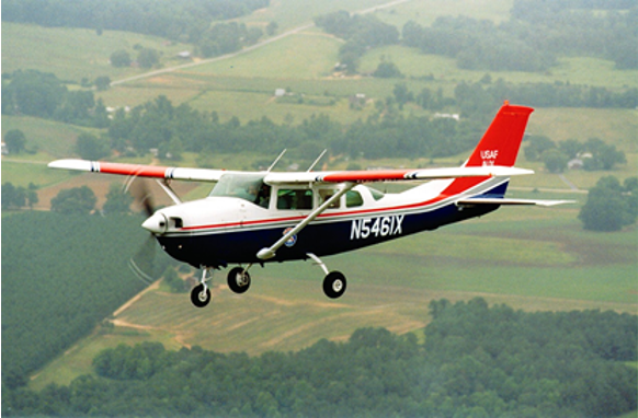
Civil Air Patrol Cessna. (Photo: CAP)
GIS has always been a huge part of what the Civil Air Patrol does when looking at it from a basic level of identifying locations, features, and information. Now, GIS is becoming central to the operations of the Civil Air Patrol because it is a force multiplier as in the example above, using spatial intelligence for completing disaster estimates in days instead of weeks with a fraction of the staff. This is powerful and driving the future of CAP towards a more geocentric operation. CAP’s GIS future is in modeling, remote sensing, crowdsourcing, artificial spatial intelligence, and data sharing.
In 2019, the Civil Air Patrol proposed its path forward creating opportunities for its members to gain valuable GIS skills and creating a qualification in GIS Operations. The Civil Air Patrol has recently begun fielding courses with support from its partners to provide training qualifications. Members of CAP can receive the following training courses: GIS for Emergency Managers, GIS Applications for Emergency Management, GIS Specialist and training in HAZUS, a GIS-based hazard analysis tool. This requirement for operations to become geocentric is so great that a call went out for people who are doing GIS work to reach out to the Civil Air Patrol Wing in their local area and consider joining. To find out more get in touch with your local Wing, visit www.GoCivilAirPatrol.com and enter your zip code to find a CAP squadron near you or you can reach out to the CAP National GIS team at [email protected] for more information. The Civil Air Patrol is using GIS more every day for search and rescue operations where CAP members are locating aircraft crash sites using ADS-B and radar data, and locating missing persons using cell phone forensics, and creating situational awareness maps for tracking resources and planning purposes for CAP senior leaders.
The Civil Air Patrol is investing into autonomous aircraft technologies. It has the largest inventory of small unmanned aerial systems (sUAS) for civilian/ public safety use in the nation. The great advantages to CAP for sUAS are their low costs to deploy and their ability to collect close-up, high-resolutions imagery with minimal risk to people. In disaster areas flying low level flights are extremely hazardous to piloted aircraft because wires and cables and other smaller objects that have shifted. The use of sUAS will fly alongside emergency responders and CAP expects to have sUAS available for each of its 150 incident command posts across the country by the end of 2020 with over 1,000 trained operators nationwide.
In the future, the high-resolution 3D imagery point clouds will enable the Civil Air Patrol to provide real-time virtual environments and augmented reality enhanced awareness for humanitarian assistance and disaster relief operations, especially when that imagery is infused with powerful geographic information systems and artificial spatial intelligence algorithms.
In the near term, the Civil Air Patrol will be expanding the number of aircraft it has equipped with FLIR and other high-end sensors and will continue growing its sUAS operations. It will continue its outreach efforts to build working relationships with new partners and bring onboard volunteers interested in supporting GIS and imagery analysis.
As technology evolves, the Civil Air Patrol will continue to be a platform for implementing new technologies to secure the country in times of crisis. The words spoken by Colonel Scott at the First Report to Congress in May 1948 continue to ring true.
“I predict that the Civil Air Patrol will grow immeasurably stronger — it will continue to contribute to the strength and the security of this nation.” —Colonel Scott, First Report to Congress, May 1948