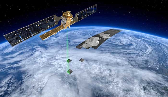
Mobile GIS Services (MGISS) is working with the European Space Agency (ESA) to showcase the potential of satellite positioning systems and imagery in tackling some of the environmental and societal challenges being faced by the water industry.
The two organizations joined together to develop multimedia experiences, group exercises and real-world case studies, which will be shared at the Northumbrian Water Innovation Festival, taking place Sept. 15.
The four-day festival, which has attracted more than 6,500 visitors across previous events, will take place virtually from Sept. 14-17.
“Under the theme ‘We Need Space to Innovate,’ we are aiming to explore how we can use satellite services to improve asset management for organizations such as Northumbrian Water, alongside the wider water and critical infrastructure sectors,” said Mike Darracott, MGISS managing director.
A highlight of the organizations’ participation will their Daily Dashes. The Daily Dashes will be rapid, sprint-style workshops that run through all stages of the subject and include music, video, live demonstration and hands-on workshops to explore specific topics relevant to the water industry. According to MGISS and ESA, the Daily Dashes will provide a better understanding of how satellite services can be used to improve asset insight and operational performance.
“Satellite positioning systems are extensively used for asset location, and yet do users really understand the full array of technology on offer or the additional potential that can be derived from earth observation data?” Asked Alan Cross, regional ambassador for ESA. “By working with MGISS, we will demonstrate how improved positioning and asset insight has the potential to deliver benefits for operational resilience, improved safety and higher productivity.”
GPS World’s November 2020 issue will focus on water applications, so stay tuned for that issue.
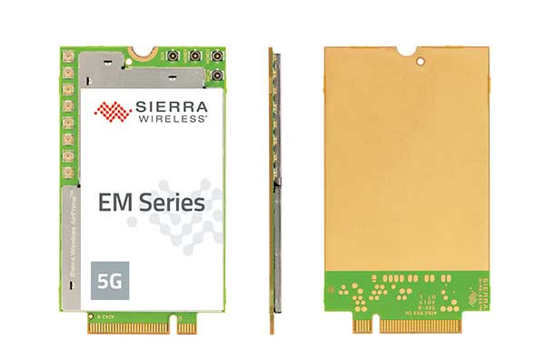
With support for mmWave, Sub-6 GHz and LTE, Sierra Wireless modules will enable original equipment manufacturers to securely deploy 5G worldwide
Photo: Sierra Wireless
Sierra Wireless is now offering its EM919x 5G NR Sub-6 GHz and mmWave embedded modules, which include an integrated GNSS receiver.
Based on the industry-standard M.2 form factor, the 5G modules will enable original equipment manufacturers (OEMs) to deploy secure connectivity worldwide at the highest possible speeds with ultra-low latency for mobile computing, routers, gateways, industrial automation, and many new Industrial IoT applications.
With support for mmWave, sub-6 GHz and LTE, as defined by the 3GPP Release 15 standard, Sierra Wireless’ 5G modules will power next-generation devices that deliver high-bandwidth, low-latency applications.
Applications for the module include private networks, enterprise networking, edge processing, live streaming, video security, e-gaming, smart factories, robotics, drones, virtual reality and machine learning.
Allied Telesis, Dynabook, LiveU, NEC Personal Computers and Panasonic are among the OEMs designing their 5G platform to launch with Sierra Wireless’ EM919x modules.
Module versions available
The EM9190 5G NR Sub-6 GHz and mmWave embedded module delivers high 5G speeds. Along with the GNSS receiver, the module has automatic 4G and 3G fallback and FCC certification for CBRS networks to provides reliability, security and flexibility for Industrial IoT designs.
The EM9191 5G NR Sub-6 GHz module is also available in M.2 form factor, providing a simple upgrade path to mmWave, as well as the EM7690 LTE Cat-20 module to help facilitate the migration and differentiation between 4G LTE and 5G.
Sierra Wireless’ EM919x modules are built on the Qualcomm Snapdragon X55 5G Modem-RF System.
“5G is the most technically challenging evolution in the history of wireless, particularly because of the introduction of mmWave,” said Larry Zibrik, Vice President, 5G & Embedded Broadband, Sierra Wireless. “Sierra Wireless has delivered industry-leading embedded modules, beginning with the first generation of cellular data technologies, and we’re the only partner with the experience to help our customers navigate the complexities of 5G. Industry leaders trust Sierra Wireless to help them get to market on time with secure 5G connectivity, and to invest in the expertise required to enable future key features, such as dynamic spectrum sharing (DSS) and 5G NR standalone mode for even higher performance.”
“Sierra Wireless has been our trusted partner for integrating new mobile broadband technologies for many years. Now working with the EM919x for 5G, our next-generation 5G platform for mobile computing is processing on schedule, and our team can rely on Sierra Wireless’ leading technology and expert support to help manage the challenges that come with new technologies,” said Norimasa Nakamura, Executive Officer Product Development & Engineering, Dynabook Inc.
“Our latest generation of products has been designed to work with Sierra Wireless’ EM919x to unlock 5G potential and deliver superior video and audio capabilities with mission-critical transmission,” said Yaki Luzon, VP R&D, LiveU. “Sierra Wireless helps us ensure that LiveU is at the forefront of 5G technology for the broadcast and sports industries.”
“Sierra Wireless has been a trusted partner helping NEC bring new broadband technologies to market for many years,” said Yasuhisa Ito, Director of NEC R&D, NEC Personal Computers. “We’re pleased with how our work with Sierra Wireless’ EM9191/Sub-6 GHz is progressing on our next-generation 5G platform for mobile computing and look forward to providing unprecedented performance with our new 5G products.”
“5G is a completely new technology, and it will require a significant amount of effort from all parts of ecosystem to roll out,” said James Brehm, Founder & Chief Technology Evangelist, James Brehm & Associates. “Sierra Wireless’ long-standing position as an industry leader, and its relationships with carriers, infrastructure providers and chipset manufacturers will be an advantage for helping their OEM customers get to market on time and troubleshoot the teething issues we expect with new technologies. Working with Sierra Wireless significantly de-risks the process and speeds time to market for its partners. Sierra Wireless is the go-to partner for complex new technology launches.”
For more information on the modules, Sierra Wireless offers these resources:
A recently unclassified CIA drone program provides us with perspective on UAS development. Also, U.S. high-altitude surveillance capabilities are being tested, another record has been achieved, and an award for the U.S. Air Force space plane.
1960s CIA Bird-Drone
Back when the U.S. was flying U2 spy planes over the Soviet Union and Gary Powers was on Russian TV after being shot down, the CIA got to thinking of another approach for gathering airborne intelligence.
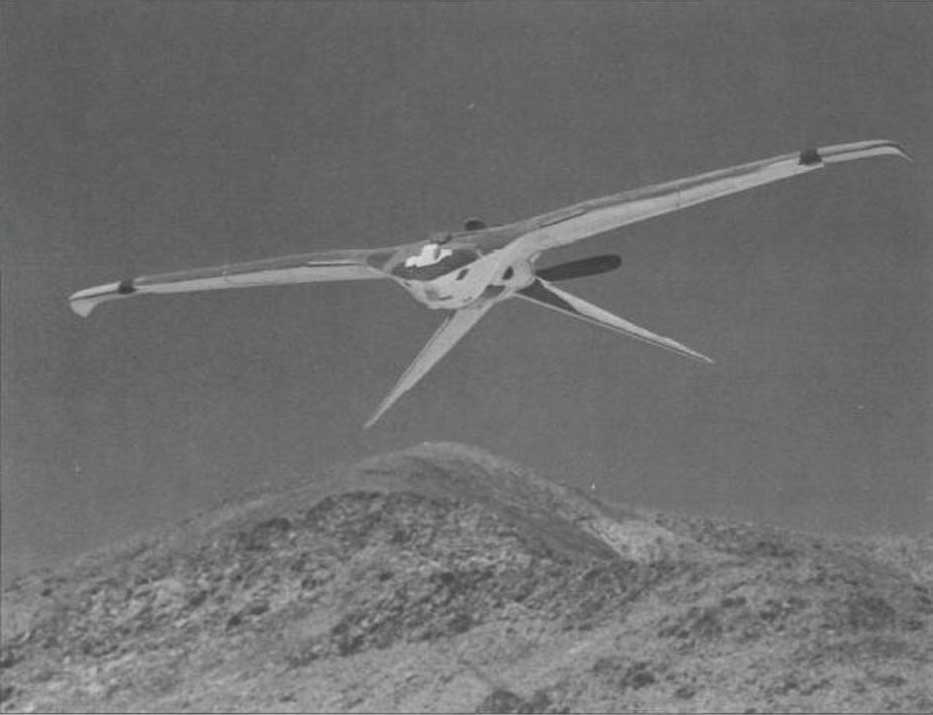
Project Aquiline was an early drone project aimed at making overflight much less conspicuous — because the drone was built to resemble a bird.
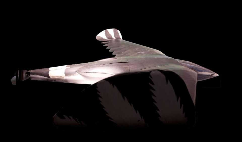
Project Aquiline was contracted to McDonnell Douglas, which produced five prototypes. (Photo: CIA Archives)The Project Aquiline bird drone in flight. (Photo: CIA Archives)
With a two-stroke engine driving a pusher-propeller and an 8-foot wingspan, five prototypes were built and tested through 1967-68. The concept was to fly at lower altitudes than the U2, carrying equivalent camera and electronic surveillance equipment, but to be very difficult to observe from the ground.
Although a two-stroke engine might have been somewhat noisier than a large bird, later phases of the program envisaged a miniature nuclear power source which presumably would have been much quieter with a relatively huge range.
The project began in 1966, and prototypes began operational testing in 1968. The prototypes established a range of around 130 miles, took high-resolution images and successfully returned to the control site.
However, with many stages of development still to go (the cost to complete was maybe too high), the project was canned in November 1971.
Maybe this initial “bird” concept is where the name of today’s high-altitude, long-endurance Global Hawk drone originated — who knows?
NASA High-Altitude Long-Endurance (HALE) UAVs
But the U.S. government seems to have other objectives than just high-altitude reconnaissance. NASA has operated the Global Hawk drone for science missions for a number of years, alongside the U-2 and ER-2 high-altitude manned aircraft.
Armstrong Flight Research Center operates two Global Hawks with support from Northrop Grumman out of Edwards Air Force Base.
Global Hawk is flown with a pre-loaded mission profile at upwards of 60,000 feet, sometimes for as long as 24 hours and more than 8,000 miles. Nevertheless, the aircraft is monitored over both satellite and terrestrial links, with direct sensor payload access throughout.
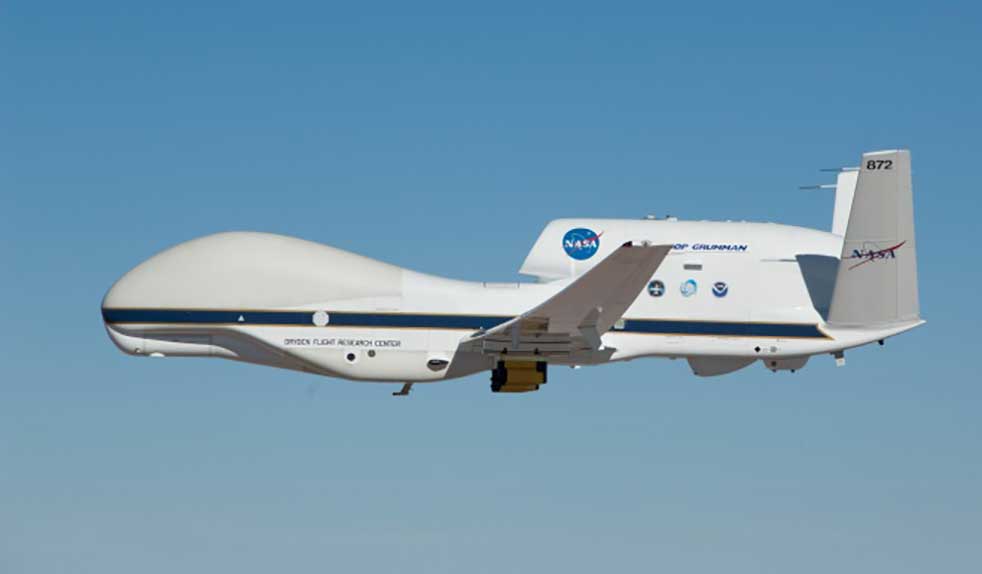
The Global Hawk. (Photo: NASA)
Global Hawk is powered by a Rolls-Royce AE3007H turbofan engine. It has a wingspan exceeding 116 feet, measures 44 feet from nose to tail, has a gross takeoff weight of 25,250 pounds and carries a 1,500-pound payload.
But this aircraft is massive compared to another recent high-flying project that NASA funded through a Phase I and II Small Business Innovation Research/Technology Transfer (SBIR/SBTT) program.
The Swift HALE unmanned aircraft system (Photo: Swift Engineering/NASA)
With the help of NASA’s Ames Research Center, Swift Engineering in San Clemente, California, completed a two-hour flight test on July 7 of its High-Altitude Long-Endurance (HALE) UAS, aiming to join the group of companies already in the high-altitude UAV club.
The 72-foot wingspan, solar-powered HALE weighs <180 pounds, carries a 10-15-pound payload and is destined to fly at up to 70,000 feet for more than 30 days.
This HALE aircraft is expected to complement existing NASA observation platforms and provide unique material alongside existing satellite data. Swift Engineering has been working with NASA Ames since 2016 on a proof-of-concept solar-powered UAS aimed at sustained flight for a month or more.
Swift researched solar panels and high-power, multiple-cycle rechargeable battery technologies to develop a system that could survive harsh temperatures as well as the radiation encountered at high altitude.
During the first of a series of flight tests at Spaceport America in New Mexico on July 7, operations at low altitude were completed to verify systems, aerodynamic control and power-system models. The July 7 flight was the first in a series to collect data and further validate the design.
With NASA, Swift has developed a UAS to not only meet observation objectives, but also one that aligns with the Federal Aviation Administration’s view of HALE deployment and maintenance during extended flights. For the test flight, the vehicle carried a NASA FluidCam for science missions, with a focus on mapping coastal reef systems.
NASA teams are exploring how aircraft such as Swift’s could perform as pseudo-satellites for air-quality monitoring, image coastal zones, map landslides and geologically active regions, and for real-time forestry and agricultural monitoring.
The next step in the development is expected to be a Phase III series of scientific observations at high altitude for days and even weeks.
Boeing X-37B Team Wins Collier Trophy
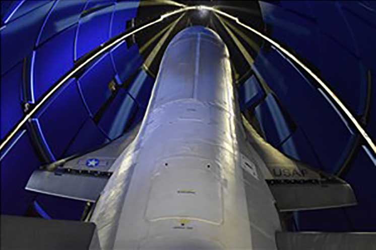
The Air Force/Boeing X-37B autonomous space plane has won the Collier Trophy for best in U.S. aeronautics/astronautics performance and safety in 2019.
The X-37B set a new 780-day on-orbit record and descended through the controlled U..S National Airspace System (NAS) to land at NASA’s Kennedy Space Center.
Initially launched in 2010, the reliable, reusable and unmanned X-37B has provided space access and subsequent analysis for a large number of key experiments.
The Air Force/Boeing X-37B autonomous space plane has won the Collier Trophy. (Photo: USAF/Boeing)
The space plane has now broken its previous on-orbit record of 718 days and has orbited for 2,865 days and more than 1 billion miles in total. Originally designed for only 270 days in space, the X-37B has established endurance records in every one of its last five flights.
Since 1911, recipients of the Collier Trophy have included Orville Wright, the Apollo 11 lunar landing team, the International Space Station team, the U.S. Navy F/A-18E/F Super Hornet team and the Boeing 787, 777 and 747 passenger aircraft teams.
Intelligence Gathering
News about the 1960 CIA drone developments, aimed at gathering unobserved photo reconnaissance intelligence, provide new perspective on NASA’s current-day use of high-altitude observation assets. These are the same types of assets that the U.S. currently uses for intelligence gathering, despite being recently intercepted by Russian jets off the coast of Alaska. It makes for interesting aspects of drone history, along with new aspects of (very) high-altitude unmanned capabilities.
“We cannot have GPS signals be a single point of failure for transportation and other critical infrastructure sectors. More safety applications will depend on PNT in the future. Public confidence in these will be critical.
“People will not be comfortable getting into an automated vehicle or with platooning driverless trucks heading down the highway if they think that their invisible hand is not reliable and that their GPS might be spoofed.
“Getting public adoption of other PNT capabilities — space-based, terrestrial, and self-contained — integrated with GPS technology will be critical to the success of any such system.”
— Diana Furchtgott-Roth, Deputy Assistant Secretary for Research and Technology, U.S. Department of Transportation, Nov. 20, 2019, Edinburgh, U.K.
A Single Point of Failure
The Department of Transportation (DOT) is responsible for leading civil positioning, navigation, and timing (PNT) issues for the United States. At the moment, the U.S. GPS provides the vast majority of PNT services in the U.S. and around the world. Yet, like all space-based systems, its signals are weak and very vulnerable to interference.
A recent example of how dangerous that can be in automated transportation systems was revealed recently in an accident report released by the British government. Interference from an unknown source caused a 15.5 kg drone to get away from its operator and crash. Fortunately, no one was hurt. The report cited analysis showing that such a weight could have easily killed someone on the ground.
Even more concerning, GPS signal characteristics are well known and therefore easy to imitate. Thousands of cases of “spoofing” have been documented with government and malicious actors causing receivers to report they are far from their actual location. In the worst cases, this can cause accidents or enable criminal acts.
One result of all of this is the President of the United States issuing an Executive Order encouraging “responsible use” of PNT systems. It also directs steps to encourage development and adoption of alternative systems. This includes a White House-level plan for research and development of non-Global Navigation Satellite System (GNSS) PNT.
In Europe the European Union (EU) has warned that space based PNT alone is insufficient for “…critical applications requiring continuous availability and fail-safe operations.” The EU has also established a monitoring system to detect sources of GNSS interference, and the European Space Agency (ESA) has established an on-going program funding study of both space and terrestrial alternate PNT systems.
Multiple Cooperating Systems
The ultimate solution, though, according to senior government officials, will be development and use of many diverse PNT systems working together to ensure users have what they need when and where they need it.
Image: DOT
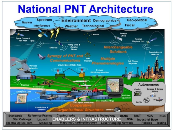
The National PNT Architecture, jointly developed by the US departments of Defense and Transportation, envisions a multitude of PNT sources ranging from GNSS provided by national governments, to inertial and clock suites acquired by users as needed.
“Many people are fond of talking about a GPS backup,” said one administration official.
“It’s more appropriate to use the plural ‘backups’ since one system isn’t going to meet everyone’s needs. Even GPS doesn’t meet everyone’s needs which is why we require complementary PNT capabilities.”
The idea that multiple redundancies are required for an essential function as long been a core principle of systems engineering. This is clearly foundational in the National PNT Architecture.
It is also a feature in more recent documents.
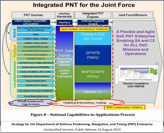
One example is the U.S. Department of Defense’s (DoD) PNT strategy publicly released in August of last year. It envisions use of a multitude of systems as a way of “Ensuring a U.S. Military PNT Advantage.”
Image: DOD
It categorizes these in three layers. A global layer of GNSS and other satellites, a regional layer that includes STOIC and eLoran, and a local/autonomous layer populated by inertial, clock, lidar, radar, scene matching and beacon-based systems.
Another project taking the architecture approach is described in detail by the recently completed MarRINav report. Sponsored by the European Space Agency, it analyzed the PNT needs of maritime commerce in the United Kingdom.
The project concluded that a “hybrid approach” using GNSS, eLoran, and the short-range R-mode VDES would be the best and least expensive combination for maritime. It also recommended a local navigation system such as Locata for port cargo operations. The study found that such a combination of systems would also benefit other transportation and infrastructure sectors.
Implementation
Yet identifying solutions is often much easier than making them happen. Especially for national projects with dozens of stakeholders. Stakeholders who may often have competing interests. And there is always the question of “Who pays?”
In the United States both the Congress and the executive branch of the U.S. government are addressing these issues, and in potentially complementary ways.
Congressional Mandates. With GPS as the cornerstone, both the DoD strategy and the National PNT Architecture show the need for one or more complementary systems to “overcome PNT capability gaps, predominantly resulting from the limitations of GPS.”
According to one senior official close to the issue, these systems need to be, “integrated with GPS and each other” and within the U.S. “serve all parts of the country — urban, rural, wilderness — even coastal maritime areas.” The idea being that they will constantly reinforcing GPS services while also serving as a safety net for users when during GPS disruptions.
The National Timing Resilience and Security Act of 2018 requires DoT to begin filling this layer in the National Architecture by the end of this year. The law, passage of which was overwhelmingly supported by both parties, mandates the department establish a difficult to disrupt, wide area, terrestrial timing system to backup (and complement) GPS timing signals. The system also must be expandable to provide navigation services. Even as a timing service, though, it has the potential to make navigation more reliable. Studies have shown that combining such a timing signal with GPS and other GNSS signals can dramatically decrease users’ vulnerability to jamming and spoofing.
The law also enables the system or systems to be established by leveraging commercial entities and expertise through cooperative agreements, public-private partnerships, and similar arrangements. These tend to be the most expeditious and least costly methods for putting such services in place. As such, they are expected to be very attractive to government program and contracting officials.
On military side, the in-process National Defense Authorization Act for 2021 requires DoD to quickly complete this part of their architecture also. Hinting that the department has failed to respond to combatant commanders “Joint Urgent Operational Needs,” it directs DoD to provide warfighters non-GPS PNT by 2023. It also directs the department to “enable civilian and commercial adoption of [these] technologies and capabilities”.
Presidential Order. The administration’s approach is outlined in a February 2020 presidential Executive Order. The order focuses on commercial entities that contract with the government, critical infrastructure, and research and development.
It calls for, within the next 24 months, agencies to “develop contractual language for inclusion … n the requirements for Federal contracts … with the goal of encouraging the private sector to use additional PNT services and develop new robust and secure PNT services.” The hope is that these new services will be adopted beyond just those companies who routinely serve government needs.
The departments of Energy, Transportation, and Homeland Security are also required to publish plans on how they will engage various critical infrastructure sectors to evaluate the degree of responsible use of PNT by each.
Also, the White House Office of Science and Technology Policy (OSTP) is tasked to “coordinate the development of a national plan… for the R&D and pilot testing of additional, robust, and secure PNT services that are not dependent on global navigation satellite systems (GNSS).” OSTP has already begun this and is seeking input from the public.
Competition and Many Players
Because PNT user needs are so varied and nuanced, most industry observers see growing opportunities for existing and potentially new providers.
“Systems and equipment that improve GNSS services, or that complement and augment GNSS are likely to find ready markets,” said Andrew Bach, a consultant on financial and other PNT issues. “User demands and needs are only going to become more sophisticated as their economic exposure increases.”
Congressional and administration focus on alternative PNT should enhance and multiply such opportunities. So, while there may be no silver bullet for solving national PNT concerns, the need for a robust and resilient architecture of PNT systems will likely mean abundant opportunities for providers.
When I was a kid in the 1960s, I was entranced by the vision of the future. Decades later, we’re here, with personal jetpacks nowhere in sight. What gives?
Photo: Photo: ridvan_celik/E+/Getty Images
When I was a kid in the 1960s, I was entranced by the vision of the future offered by science fiction books, movies, television shows and comics. Advances in technology would deliver us so many wonders — flying cars, hoverboards, robot servants. Disneyland was in on it, with an entire section of the park named Tomorrowland and its now-quaint “Carousel of Progress” attraction.
But the coolest thing would be that jetpack. You could slap it on your back and take off into the atmosphere, traveling wherever you wished like a bird. Certainly by the distant year 2020, we would all be jetting around the atmosphere from place to place.
(It didn’t occur to me that would mean strapping an actual jet engine to my body, along with highly flammable jet fuel. Where’s the fun in that?)
Decades later, we’ve all arrived in the “future,” with personal jetpacks nowhere in sight. What gives?
Then again, what I didn’t imagine in our future was a system that could pinpoint my exact location anywhere on the globe, estimate my time of arrival, and tell me about the traffic up ahead.
Back in the 1960s, that was seriously science fiction. Nor did we accurately predict the effect that capability would have on our daily lives. GPS along with internet-capable smartphones have thrust us into the Information Age.
The internet is a promise delivered, in its own way. Having a repository for all of the world’s information was another future concept, but usually envisioned with a giant worldwide computer that eventually turned on its makers.
As for flying cars, we are gradually getting there. Drone technology, supported by GNSS technology for its navigation, has led to unmanned craft and is heading toward vehicles capable of transporting people. We just need to be a little more patient.
In the spirit of looking back and ahead, check out our 30th Anniversary Supplement, which arrived with this issue. In it, experts from across the industry share memories and thoughts, and gaze into their crystal balls to predict the future of GNSS.
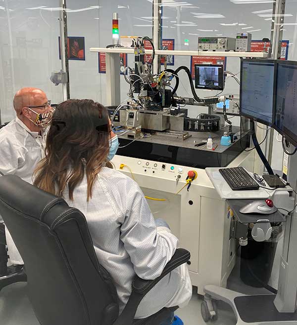
KVH photonics engineers test PICs for validation prior to production. (Photo: KVH)
In June, KVH Industries launched the P-1775 inertial measurement unit (IMU), featuring its new PIC Inside photonic integrated chip (PIC) technology.
After developing and testing the technology for more than three years, the company began incorporating it into existing product lines and has shipped the first units.
The PIC technology features an integrated planar optical chip that replaces individual fiber-optic components to simplify production while maintaining or improving accuracy and performance.
The product is designed to deliver 20 times higher accuracy than less expensive micro-electromechanical systems (MEMS) IMUs. It uses modular designs for ease of integration and has outstanding repeatability unit-to-unit, according to the company.
KVH will add the technology to its inertial sensor product line for use across a broad range of applications, from navigation to stabilization and pointing.
KVH’s fiber-optic gyros (FOGs) and FOG-based products are particularly well-suited for the large and growing autonomous market, which includes applications on land, sea and air, such as drones, people movers, trucks and mining and construction equipment.
Moving Components to the Chip
Photo:With PIC technology, KVH’s FOG production process incorporates machine automation for photonics assembly. (Photo: KVH)
The controls on FOGs have an electronics portion and an optics portion. The latter consists of a light source, a detector, couplers, polarizers, a coil (which performs the sensing), and a piezoelectric device for modulating the light, explained Robert Balog, KVH’s chief technology officer.
Until now, the company had fabricated all the products for that optical circuit in its Chicago facility, in a process that was labor-intensive and required much process control. For the PIC, “We’ve taken the couplers and the polarizer sections specifically and moved them onto the chip level,” Balog said.
While KVH manufactures the chip much like any other semiconductor device, rather than passing the light through the fiber KVH is now passing it through wave guides that are contained within that photonics chip, thereby moving the creation of the coupler module into a wafer-level component.
Mass Production and Better Quality
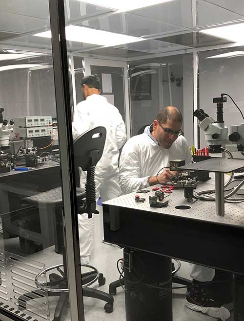
KVH produces the chips en masse on a wafer, then singulates and samples them. Once they are qualified and spot-checked, the chips are incorporated into KVH products.
“This affords us a way to mass produce those components,” Balog said, “and gives us much better quality.”
Photo: KVH
Additionally, it produces a much smaller device than before. The company will not reveal any numbers regarding its performance improvement until it produces and distributes more PICs, but “it is already producing better results than the manually produced components.”
The production process is intimately linked to the overall performance of the sensor. “The tighter your process control, the more reliable you can make the product,” Balog said.
The new process also improves the device’s field reliability because it contains fewer discreet components. The improved performance specifications on each individual FOG improve the overall performance of the IMU or the inertial navigation system (INS) because the bias is more stable and repeatable.
The Future
What is in the technology’s future?
“The next step is integrating the light source and the detector and potentially a modulator into that chip as well,” Balog said. “So, our ultimate technology road map is to continue condensing what would have been discrete components in traditional gyros all within that chip. As this technology progresses, it will get smaller, tighter, and better. Then you will see big leaps in performance.”
Tallysman Wireless has added a line of AccuAuto vehicle antennas aimed at the autonomous vehicle market.
The compact and rugged embedded AccuAuto antennas offer key features not available in other embedded autonomous vehicles antennas on the market, the company said.
The automobile industry is transitioning from offering GNSS-assisted navigation where the accuracy requirement is ±3 to 5 meters (low-precision GNSS code positioning) to providing driver assistance (such as lane-keeping) and autonomous vehicle navigation where the accuracy requirement is < 0.1 meters (such as high-precision GNSS phase positioning).
Current roof-mounted GNSS antennas on most vehicles provide the accuracy required for navigation but they lack the precision required for assisted driving or autonomous vehicle operation. Tallysman’s new line of AccuAuto antennas are designed to provide strong clean code and phase signals that enable high-precision real-time kinematic (RTK) and precise point positioning (PPP) navigation.
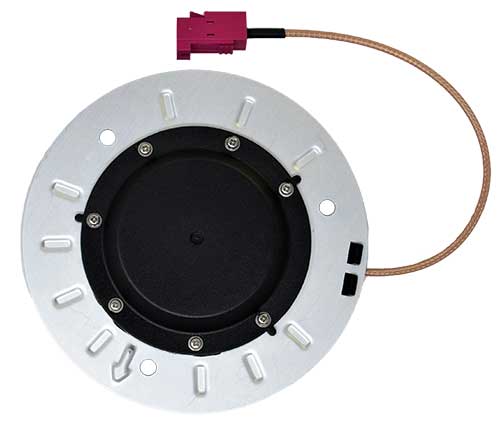
The Tallysman embedded AccuAuto vehicle antenna features a patented Tallysman Accutenna technology multi-constellation and multi-frequency antenna element, an integrated ground plane, radome and underside cover that provides mist and condensation protection.
The bottom cover also supports the antenna cable and mitigates cable vibration to ensure the antenna has a long service life, while the ground plane improves antenna performance.
All AccuAuto antenna electronic components are Automotive Electronics Council (AEC) certified and are designed to perform under challenging environmental conditions, such as extreme temperatures (–40 °C to +125 °C) and continuous shock and vibration.
Signal quality is improved with a deep pre-filter that minimizes out-of-band noise and maximizes in-band reception. This feature enables reliable GNSS signal reception in challenging urban environments, where inter-modulated signal interference from LTE and other cellular bands is common.
The triple-band TWA928 supports GPS/QZSS-L1/L2/L5, GLONASS-G1/G2/G3, Galileo-E1/E5a/E5b, BeiDou-B1/B2/B2a, and NavIC-L5 signals and frequency bands (the TWA928L includes support for L-band correction services).
Hexagon AB has introduced the Leica GS18 I, a versatile, survey-grade GNSS RTK rover so powerful it enables surveyors to measure what they see, even structure in difficult-to-reach places, the company said.
It comes equipped with all the innovative functionality of the Leica GS18 T — Hexagon’s calibration-free, tilt-compensating GNSS solution immune to magnetic disturbances, plus the power of survey-grade visual positioning.
Through sensor fusion of GNSS, motion (IMU) and image (camera) technology, the Leica GS18 I enables the measurement of points from images. The ability to capture and measure sites via images goes far beyond the advantages of the GS18 T, which introduced the quick and convenient ability to measure points in spaces that cannot be measured with vertical poles, such as building corners, walls and points underneath obstacles (for instance, cars).
With the Leica GS18 I, professionals can now map areas that are difficult to reach physically, such as trenches, high power lines and busy roads, or blocked from GNSS signals, such as areas underneath bridges or canopies — safely and effortlessly from a distance.
“With the Leica GS18 I, mapping and surveying just got simpler, safer and more productive than ever before,” said Ola Rollén, Hexagon president and CEO. “The ability to quickly document an entire area of interest without the need to switch between tools or manoeuvre through obstacles frees up equipment and crews. Additionally, the simple and intuitive workflow of the Leica GS18 I brings the versatility of visual positioning to new user segments and applications — from utility service providers to crash scene investigators.”
The Leica GS18 I enables users to measure hundreds of points within minutes. Integration with Leica Captivate field software enables intuitive onsite point measurements and quality assurance from the field.
Further measurement of the captured images is supported by integration with Leica Infinity office software, which also enables the creation of automatically registered and referenced 3D point clouds from the images in standard export formats for use in a variety of point cloud software.
provide a better understanding of the activity, uses, users and broader beneficiaries of the National Geodetic Survey’s Aeronautical Survey Program,
help define its socio-economic benefits,
provide preliminary order of magnitude estimates of benefits of the program, and
examine influences on future needs for the program’s services.
The footprint (trade space) analysis presents data on airport improvement grants, activities of the program, airports, aviation and societal beneficiaries. Methods of estimating socio-economic benefits are considered, preliminary estimates of benefits are made and issues that will affect use of the services in the future are discussed. Additional information is included in 10 appendices.
The FAA Airport Improvement Program (AIP) provides grants, to public agencies for planning and development of the 3,249 eligible public-use airports and the 72 privately owned civil airports.
The FAA requires that geographic information system (GIS) contractors submit plans and surveys with geodetic control, runway, navigational aid, obstruction and other aeronautical data under its Airports GIS (AGIS) program. These contracted survey plans and surveys are sent to the NGS Aeronautical Survey Program (ASP) for quality assurance review.
The GIS information is used by the FAA in establishing flight rules and other requirements to assure safety.
Irv Leveson is an economist with extensive experience examining GNSS markets, applications, benefits and policies. His public studies include: “The Economic Benefits of GPS.” He recently led a National Geodetic Survey study.
Using RTK’s pinpoint-level location data in the Verizon network is a building block to bring to scale emerging technologies such as driverless city zones, expansion of precision agriculture and drone delivery.
Verizon has launched what it calls hyper-precise location using real-time kinematics (RTK) to provide accuracy within one to two centimeters on the Verizon network.
Verizon has built and deployed RTK reference stations nationwide so that compatible internet of things (IoT) devices can receive the higher accuracy. Verizon is working to make RTK accessible with myriad device makers.
RTK will also support emerging technologies that depend on high-level location accuracy, such as delivery drones and customer-approved location data for first responders in emergencies.
RTK technology reduces the cost and risk associated with inaccurate location data, Verizon said in a press release. “Billions of IoT devices across a multitude of industries will benefit from improved location accuracy, with hyper-precise location information enabling a host of new services.
“For instance, robotics at distribution centers will be able to perform more efficient, accurate and safe logistics operations. More accurate positioning can help speed deployment of high-value assets in emergency situations to the precise location, and more precise tracking of emergency equipment can provide faster redeployment in disaster response scenarios.”
The rollout of its hyper-precise location services along with Verizon’s 5G Ultra Wideband network and 5G Edge will pave the way for more autonomous technologies, the company said.
“We are scaling RTK to enable mobile location accuracy to within a few centimeters, transforming what is currently possible when it comes to location-enabled services and new IoT solutions coming onto the market,” said Nicola Palmer, chief product development officer for Verizon. “Continued growth in the IoT environment means billions of devices in fields where precision location services are becoming more critical, such as vehicle automation, unmanned aerial vehicles, precision agriculture technology, infrastructure monitoring, asset tracking and high-value shipping.”
Image: 4X-image iStock / Getty Images Plus / Getty Images
Reimagining road safety
In partnership with HERE Technologies, Verizon is building next-generation technologies for vehicle and pedestrian safety using hyper-precise high-definition mapping and RTK.
This work paves the way for connected services that are designed to drive road safety improvements. By creating a vehicle-to-network (V2N) communication system equipped with hyper-local location accuracy, collision avoidance applications can precisely identify vehicles, pedestrians and bicycles, and relay the information through Verizon’s 5G Edge and HERE’s AI to predict likely travel paths and warn vehicles of impending potential collisions. This partnership is one of multiple recent initiatives Verizon has taken to increase road safety.
“Moving beyond the static fidelity of satellite-based location data enables an exciting new generation of connected, autonomous experiences,” said Jørgen Behrens, SVP, chief product officer at HERE Technologies. “By pairing HERE’s live, hyper-precise HD Map and HD Positioning technologies with intelligent RTK algorithms, and making that scalable, Verizon is putting a transformative level of location insights into the hands of developers and consumers alike.”
Powering the autonomous future
Hyper-precise location accuracy will be critical to advancing autonomous driving and together, Verizon and Renovo are ushering in a new era of transformative solutions critical for the future of autonomy on the road. These solutions leverage machine learning and RTK technology, powered by a combination of next-generation solutions such as 5G.
“RTK is a critical technology for advanced driving assistance systems (ADAS). Accurate positioning helps ADAS vehicles navigate better, drive smoother, and react faster to the surrounding environment,” said Christopher Heiser, CEO and Co-Founder of Renovo. “Nationwide, reliable RTK networks make for a viable way to deliver these enhanced capabilities to mass-market cars and trucks. For companies that manage the huge datasets that power next-generation vehicle platforms like Renovo, this is very exciting.”
IoT devices currently using RTK can be accessed and managed through Verizon’s ThingSpace management platform and APIs.
With 26 satellites now in orbit and more than 1.5 billion smartphones and devices worldwide receiving highly accurate navigation signals, Europe’s Galileo navigation system will soon become even better, ensuring quality services over the next decades.
Following the European Commission’s decision to accelerate development of Galileo Next Generation, ESA has asked European satellite manufacturers to submit bids for the first batch of the Galileo Second Generation (G2) satellites. The new spacecraft are expected to be launched in about four years.
Paul Verhoef, director of the Galileo Programme. (Photo: ESA)
The next-generation satellites will provide all the services and capabilities of the current first generation with a substantial improvements and new services and capabilities.
“We want an ultra-flexible and mostly digital design,” said Paul Verhoef, ESA director of Navigation.
“Developing the second generation is challenging for both industry and for ESA. In 2024, we need to launch the first satellites for this new state-of-the-art constellation.”
Invitation to Tender
Following almost 24 months of a competitive dialogue procedure with the three large system integrators involved, ESA issued a “Best and Final Offer” invitation to tender on Aug. 11 to Airbus, OHB System AG and Thales Alenia Space.
ESA is implementing a dual-sourcing approach, and two parallel contracts are expected to be signed by the end of 2020 among the current three bidders. Under the plan, each of the two selectees will build two satellites for development purposes, with options for up to 12 satellites in total.
The first satellites of the new constellation are expected to be launched before the end of 2024, together with updated ground systems to support the new satellites.
Reconfigurable in Orbit
In addition to being more powerful, the second-generation Galileo satellites will be more flexible, able to be reconfigured in orbit in order to satisfy the expected evolution in end-user needs.
A number of challenges exist for the bidders. The goal of a digital and fully flexible design represents the cutting edge of industrial capability.
Navigation Antenna Progress
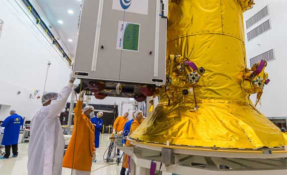
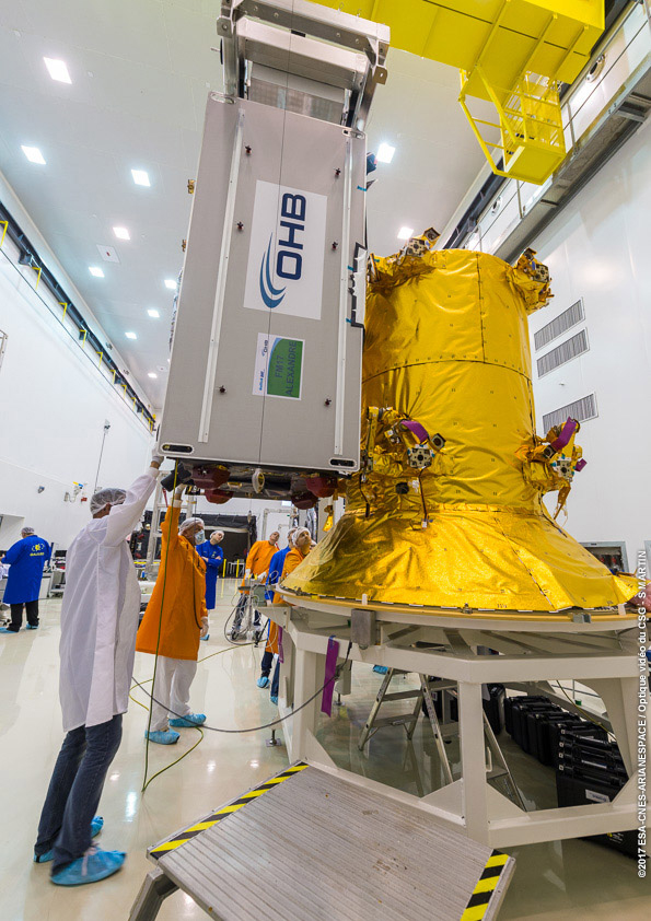
A Galileo satellite undergoes its fit-check validation at the Kourou Spaceport in French Guiana. (Photo: ESA/Arianespace)
Furthermore, the required navigation antennas will have a very advanced design; much research and development by ESA has been done, yet more remains for industry.
ESA has already built such an antenna as a proof of concept at the Agency’s ESTEC technology center in the Netherlands to ensure feasibility, and the know-how has been shared with the three bidders.
“Each bidder must determine how they can best manufacture the navigation antenna, and we’ll have to see how each proposes to do it. Also, requiring a fully flexible payload is quite a challenge. No such navigation spacecraft of that type have flown yet,” Verhoef said.
Ambitious Plan
The European Commission has decided that what was previously going to be called the “transition batch” of new satellites will now become, in fact, the Galileo Second Generation satellites. The European Commission and EU Member States have already made clear that they want to be very ambitious and further increase the technical capabilities of the Galileo system.
The name change reflects of how the current batch is actually shaping up.
The transition satellites were initially foreseen as interim upgrades, to cater for the potential risk of late delivery of the later, completely new and very advanced G2 satellites.
Estimated Lifetime Increased
Based on constant measurements of the performance of the current satellites in orbit, their predicted lifetime has increased. So, together with a slight spreading out of the launches of the Batch 3 satellites — currently under construction by OHB and in testing at ESTEC —this will ensure service continuity before the new, advanced capabilities of Galileo become operational.
The second-generation satellites will gradually take over from the current first-generation satellites in the provision of Galileo services. At a future date, they will all constitute a complete constellation plus the necessary in-orbit spares.
ESA serves as the design, development and procurement agent for Galileo satellites on behalf of the European Commission, which funds the system overall.
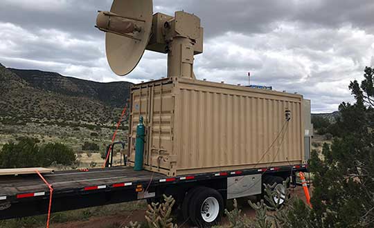
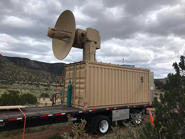
THOR stands for Tactical High-power Operational Responder, a counter-swarm electromagnetic weapon for airbase defense. Although AFRL’s THOR is not a hammer-wielding god associated with thunder and lightning, the system provides non-kinetic defeat of multiple targets. It operates from ground power and uses energy to disable drones.
The THOR drone deterrent designed by the Air Force Research Laboratory. (Photo: AFRL)
“THOR is essentially a high-powered electromagnetic source that we put together to specifically defeat drones,” said Stephen Langdon, chief of the High-Powered Microwave Technologies Branch of AFRL’s Directed Energy Directorate.
AFRL is located at Kirtland Air Force Base, New Mexico. A demonstration system has been built and tested on military test ranges near the base, where it has successfully engaged multiple targets. Further testing against a larger set of drone types in swarming configurations is being planned.
THOR stores in a 20-foot transport container, which can be transported in a C-130 aircraft. The system can be set up within three hours and has a user interface that requires little training.
The technology, which cost roughly $15 million to develop, uses high-power electromagnetics to counter electronic effect. When a target is identified, the silent weapon discharges with nearly instantaneous impact.
With much of the necessary basic research previously completed at AFRL, THOR was rapidly developed and tested in 18 months.
Although there are other drone defensive systems available, including guns, nets and laser systems, THOR will most likely to extend the engagement range to effect and decrease the engagement time over the other deterrent devices.
Langdon said the THOR team hopes to transfer the technology to a System Program Office soon in order to get it into the hands of U.S. warfighters as soon as possible.
AFRL exhibited THOR at the 2019 Air Force Association Air, Space and Cyber Conference at the Gaylord National Resort and Convention Center, located just across the Potomac River from Washington, D.C. and Virginia, Sept. 16-18.