Blog

  • Reflections and Hope for GNSS

    For me, 2014 marks 40 years of my long association with the positioning, navigation and timing (PNT) gold standard we call the global positioning system (GPS), and I find it only prudent and natural to reflect on what has, for many, been a tumultuous 12 months.

    In this regard, I find that I am not alone. Many seasoned veterans (who, unfortunately, by necessity must remain anonymous) have taken the opportunity to take pen in hand and jot down a few of their thoughts for my perusal and cogitation. Not to digress, but I find that many of us of a certain age, when we wish to convey our considered thoughts privately to a trusted colleague, more often than not accomplish said task with a fountain pen and luxurious heavy linen writing stock or in a private conversation, versus email and quick messages on social media.

    In putting the following thoughts together, I have availed myself of those thoughtfully scribed missives from trusted colleagues. The following conveys some thoughts to contemplate on current tactical and strategic PNT matters.

    Political SMEs

    Without a doubt, the most troubling, or certainly discussed, topics this year have revolved around the spurious thoughts, rhetoric and unfortunate resulting public statements by PNT neophytes in positions of power whom, not being from the most lucid generation, seem to believe that GPS or GNSS are vulnerable and should be replaced — end of discussion — no further thought given to the problem other than surely something will come along to replace it — and preferably overnight, at that. Obviously, I am incredulous and find the statements to be nothing more than political hype purveyed by luddites that are essentially technically hapless and clueless. Alas, some are in positions of power where they are frequently and regrettably quoted in the press. Lamentably, the technically clueless parameter rarely keeps them from speaking their — if you will pardon the over-generous appellation — mind.

    Rather than merely complain about political appointees and their hapless, uninformed ramblings, as it is after all a national pastime, I will follow the edict and sage advice of a fellow thinker, mentor and Eminence Grise, General Pete Piotrowski (USAF, Ret.) who pontificated to a young executive officer over four decades ago, “Never come to me with a problem, as problems are nothing more than opportunities waiting to be recognized — so come to me with opportunities and implementation plans that are actionable.”

    Applying that astute and long-remembered advice to our GNSS opportunity leaves us with an essentially technical and actionable way ahead. There can be no question that GPS or GNSS should remain as the baseline bedrock for all PNT solutions while technology provides ample opportunities for enhancements, augmentations and verifications, not merely inadequate substitutions. As one of my colleagues at the Royal Institute of Navigation stated recently, “Truly robust position, navigation and timing will always require a combination of dissimilar PNT technologies.” The top three that come to mind are:

    1. eLoran
    2. Inertial systems
    3. All signals available

    At the risk of belaboring the obvious for my regular, informed readers, let’s take a brief look at each supporting opportunity.

    eLoran

    eLoran in many forms has been around for decades longer than many users realize, and was just months away from being fully implemented in 2010 (more than 80% complete) when it was unceremoniously, all politics aside, abruptly curtailed by those technical luminaries in the OMB (Office of Management and Budget) and the current administration. Since that time companies and countries around the globe, except for the United States of course, have charted their own course for eLORAN both as an independent PNT system and as an augmentation, enhancement and backup to GNSS with accuracies and availability (essentially not capable of being jammed) that rival and exceed most any other non-GNSS PNT system available today.

    In Rotterdam earlier this year, I saw firsthand and wrote about an eDLoran or differential eLORAN system,that, “with modern monitoring can result in consistent horizontal accuracies approaching five meters on a moving platform.” eLORAN has shown the capability to broadcast continuously with several thousand watts of low frequency signal power and provide a PNT system that is reliable and accurate, while essentially making it ludicrous to try and jam or intentionally interfere with GNSS signals. The two systems utilized jointly, GNSS and eLORAN, are an unbeatable combination.

    I am currently contractually embargoed, but hope to write more about some amazing new eLoran receivers in the New Year. However, I can legally say now that I have recently been made aware of two separate multi-GNSS-eLoran receivers that are both affordable and portable. More than that I cannot say, but just think about what that means when you consider there are fully operational eLoran transmitters literally scattered around the globe today, except for the United States, of course. An embarrassing situation that hopefully our Congress will remedy soon.

    Some exceptional multi-PNT devices, which I am allowed to mention, are the UrsaNav UN-155 Resilient PNT receivers from Chuck Shue and company. These innovative new products utilize PNT information from multiple sources including GNSS, eLoran, and maritime medium-frequency beacon systems. The UN-155 contains an embedded computer for easy updating of software and algorithms for resilient PNT, and provides a robust navigation and timing output. While this is not yet a portable unit, miniaturization is all the rage.

    Inertial Systems

    Which is a great segue to our next opportunity, MEMS (micro-electro-mechanical sensors) inertial devices. These are routinely and historically described as devices capable of providing tightly coupled integration of GPS precise point positioning (PPP) and MEMS-based inertial systems. While the tightly coupled descriptor essentially involves Kalman filters and shared positioning data descriptors and fields, there have recently been cogent arguments for an independent non-tightly coupled MEMS inertial device as well, perhaps even both types of devices coupled to a multi-GNSS device with eLORAN.

    Think about it only momentarily and the advantages become obvious for both approaches, and even more so for a combined approach. Again, I am prohibited from providing too many details, due to upcoming press releases and device announcements from major players in the field, but 2015 appears to be promising for new and innovative inertial integration technologies. Suffice it to say, the U.S. Army is enamored with this approach, as well they should be, with the key for the U.S. military being a sustainable low-cost MEMS-inertial . . . and there my tale of new advancements must end — for now.

    For your edification and to help me better understand the new MEMS gyros and inertial units, a well-known GPS-savvy Stanford University professor emeritus recently stated, “Don, think of it this way, the rotation of a MEMS gyro component exerts perpendicular coriolis force on a resonating proof mass and the displacement is measured capacitively and converted to algorithmic terms for inputs to a Kalman filter or to an independent display for the user as required. Our desire is that, in the near future, both operations will transpire simultaneously and independently. Simple, right?”

    Of course it’s not simple or we would all have them in our iPhones, I thought. Then it hit me, we do have accelerometers in our iPhones, as well as basic gyroscopic functions. There are applications today that make use of these devices as highly evolved pedometers capable of correcting and tracking our position inside GPS-denied environments, such as underground, in dense urban environments and deep inside buildings. Not to be flippant, but it appears there is an “app for that,” and 2015 holds the promise for even better technology for PNT device integration. Stay tuned.

    All Signals Available

    Which brings us to one of my favorite topics — all signals available. As simple as this concept seems to be, as in “are you smarter than a fifth grader?”, I was briefed earlier this year along with several of my fellow technical SME (subject-matter expert) journalists by one of those interim pseudo-technical political appointees that wants to replace GPS/GNSS. Be assured it was a very serious briefing and venue, no clown costumes in sight. The appointee briefed — with a straight face, no less — that current government PNT receivers would have a difficult time with GEO (Geostationary Earth Orbit) versus MEO (Medium Earth Orbit) PNT signals simply because of the physics involved. To which, channeling John Belushi in Continental Divide, I very ungraciously and forthrightly replied, “Difficult physics such as the physics employed daily in my iPhone 6+, which is a multi-GNSS device, utilizing MEO and GEO GNSS signals globally, which are integrated with inputs from ground transmitters and onboard accelerometers. You mean those difficult physics?” Can you picture speechless?

    Consider that the iPhone 6+ today incorporates multi-GNSS signals (GPS and GLONASS) plus WAAS and EGNOS, which are GEO PNT transmitters — bent pipes, if you will. The iPhone utilizes and fully integrates PNT signals from space, terrestrial signals from cellular towers, and Wi-Fi computer networks, as well as onboard accelerometers in an area of real estate roughly the size of a quarter.

    Trimble navigation has a fixed commercial PNT unit today, about the size of a softball, that does all this and much more while parsing 129 separate GNSS signals globally, which allow it to determine its position to the centimeter and reject all signals that try to deviate from the known truth set. Plus, it transmits all known positioning parameters, utilized and automatically rejected, to a website. So I submit that our opportunities for PNT today are not restrained by technology, but by atrocious limitations imposed by politicians masquerading as subject-matter experts. Someday I may deign to tell you how I really feel. Allow me to caveat my remarks by saying there are some wonderfully competent government technologists that I have the pleasure to work with on a regular basis, and I applaud their acumen, dedication and hard work.

    Fight Back

    The question remains: How do we fight back against the pseudo-technical pols and their pronouncements concerning the future of PNT? The solution is simple. Educate yourself concerning the art of the possible. Read a book on the subject. I have recommended many fine references over the years. By all means, for the most up-to-date information, read fine publications like GPS World, and of course, I humbly commend my column to you, if you are so inclined. Education may not be the only panacea, but historically, the more we know about a subject, the less likely we are to fall for the falderal and spin routinely spewed forth by the technically clueless with a political agenda.

    To paraphrase Winston Churchill, who once said, when he was encouraging his neophyte code breakers at Bletchley Park to be more well read, “Read a single book on any single subject and you will know more about that subject than most of the world.” I would add a single caveat from Harry Potter’s creator:

    Books are like mirrors: if a fool looks in, you cannot expect a genius to look out.

    —J.K. Rowling

    Stay with me, and we will explore all these opportunities and more in the coming New Year. Fortunately, hope springs eternal.

    Until next time, Merry Christmas, Happy New Year, happy navigating and remember: GPS is brought to you courtesy of the United States Air Force.




  • UAV Creates 3D Model of Largest Mosque in Turkey

    UAV Creates 3D Model of Largest Mosque in Turkey

    Turkey-mosque_adana_W
    Photo: Leica

    The Sabancı Merkez Mosque in Adana, Turkey, has been inspected and mapped by an unmanned aircraft system and a detailed 3D model created. The work was carried out by SISTEM A.S. (the Turkish distributor of Leica Geosystems), NRJ Engineering and Aibotix.

    Sabancı Merkez Mosque is the largest in Turkey, with six minarets, four of which are 99 meters high. The largest of its five domes is 32 meters in diameter and 54 meters high, so determining the actual state of the building using conventional methods would be time consuming and costly. Instead, the authorities commissioned a UAV inspection.

    “We needed only three flights to cover all relevant areas and generate comprehensive data,” said SISTEM A.S. employee Bora Yavuz, who has been working with terrestrial laser scanning systems for the past five years. “Compared to laser scanning, collecting the data from the top sections of this huge building by UAV was extremely easy, since nobody had to climb up to the minarets or dangerous places on the domes and wait for the machine to scan. Furthermore, alongside the data registration the generation of point clouds runs automatically.”

    During the flight over the roof of the mosque, the UAV followed a defined route that had been planned on the computer beforehand. The pilot then steered the UAV manually in two more flights around the building.

    The Aibot X6 was carrying a Nikon Coolpix A digital camera and created high-resolution photos with an 80 percent overlap. Using live images from the UAV’s perspective that were sent directly to the screen of a ground station, the pilot could make sure that all relevant areas were captured, and achieve the best possible results by adjusting the camera to the optimum angle during the flight.

    The data was subsequently processed to create an accurate 3D model of the mosque with a precision down to 1-2 centimeters. The high-resolution photos are linked to the model so that damage can be located accurately, with GPS information synchronized with the images for fast post-processing. The images and the model will now be used as the basis for maintenance and repairs.

    Turkey-mosque_adana_2-W Photo: Leica
    Photo: Leica
    Turkey-mosque_adana_3-W
    Photo: Leica
  • OriginGPS Nano Module Powers Tiny Zano Drone

    What flies, takes selfies and fits in the palm of your hand? The tiny Zano drone.

    Zano is a portable aerial photography and video platform designed for consumers that measures 65 x 65 millimeters and weighs 55 grams. Torquing Group, who is developing Zano with the help of a successful Kickstarter campaign, said that Zano’s ability to fly autonomously will provide new possibilities for users seeking to capture images and videos. The drones can even be programmed to swarm.

    Zano’s location capabilities are powered by OriginGPS’ Nano Hornet, a tiny GPS module with an integrated antenna. Measuring just 10 x 10 x 3.44 millimeters, the Nano Hornet delivers performance and sensitivity with low power consumption. It achieves a rapid time to first fix of less than one second, with approximately one meter accuracy and -163 dBm tracking sensitivity. Because it detects changes in context, temperature, and satellite signals, it achieves a state of near continuous availability, while consuming mere microwatts of battery power.

    The Zano connects directly with smart devices (iOS or Android) via onboard Wi-Fi to upload and share images or videos instantly. With the help of OriginGPS, Zano is able to know exactly where it is in relation to a smart device, even when powered off. Through a virtual tether, Zano will echo any movement made by the smart device it is synced to, with simple gesture control. A user will be able to control multiple Zanos from one device, enabling photographs and video of the same event from multiple vantage points.

    Zano is also able to function in a “free flight” mode, which uses on-screen joysticks for an experience similar to a regular RC-operated UAV. OriginGPS’ location capabilities allow Zano to know if it is getting too far from its corresponding smart device and automatically return. Likewise, it is able to recognize its distance from the smart device and maintain that distance in “follow me” mode.

    Since 2008, Torquing Group has developed small unmanned aerial vehicles (UAVs) for the military and defense industry.

    To further push the boundaries of GPS modules designed to be small, agile and light weight, OriginGPS introduced the Nano Spider integrated GPS receiver in November. The Nano Spider module is designed to support ultra-compact applications where size is at a premium, such as smart watches, wearable devices, trackers and digital cameras. Like the Nano Hornet, it packs a wide range of functionality into its small form factor, including dual-stage LNA, RF LDO, SAW filter, TCXO, RTC crystal and RF shield with market-leading SiRFstarIV GPS SoC.

  • u-blox Inside Explosion-Proof Smartphone

    u-blox Inside Explosion-Proof Smartphone

    Impact-X-docked-with-helmet-O
    Photo: u-blox

    Bartec Pixavi has launched the “Impact X intrinsically safe smartphone” based on u-blox’ rugged 3G cellular module technology designed for devices used in tough industrial and outdoor environments. Bartec Pixavi is a manufacturer of mobile devices used in hazardous or explosive environments such as oil platforms, mines and chemical plants.

    “Our Impact X smartphone is designed with the most robust, reliable and safe components available to ensure security and provide reliable connectivity to workers in potentially dangerous locations,” said Christian Rokseth, CEO of Bartec Pixavi. “We chose u-blox’ cellular module technology because of its industry-leading performance, excellent environmental tolerance and reliability.”

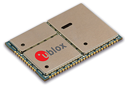
    u-blox LISA u230 module. Photo: u-blox
    u-blox LISA u230 module. Photo: u-blox

    The Impact X is CSA Class 1, Zone 1, IECEx and ATEX Zone 1 certified, explosion proof, waterproof and extremely ruggedized. At the heart of the Impact X is u-blox’ professional-grade LISA-U230 six-band 3G cellular module with 2G fallback capability. LISA modules also provide fully integrated access to u-blox GNSS receivers to enable advanced location-aware applications. Antenna diversity permits LISA-U2 modules to provide the highest data speeds.

    “The Impact X is an excellent example of a high-performance mobile device that demands performance well beyond what is provided by standard mobile phones,” said Armin Boeshenz, General Manager of u‑blox sales EMEA. “We are extremely pleased to be a key module supplier to demanding customers such as Bartec Pixavi as proof of our industry-leading quality and reliability.”

    u-blox LISA-U2 modules are suited for networks worldwide. Features include data-rates of up to 21.1 Mb/s (downlink), a rich set of Internet protocols, very small footprint, very low power consumption and extended operating temperature range of -40 to +85 degrees C.

  • AgJunction Debuts LiteStar III Guidance System for Aerial Application

    AgJunction, a provider of hardware and software solutions for precision agriculture, today announced the release of its latest aerial guidance product, the LiteStar III from Satloc at the National Agricultural Aviation Association annual convention in Louisville, Kentucky.

    As the next generation of affordable GPS guidance system for aerial applicators, LiteStar III builds upon the features of the previous LiteStar II system with more attributes, including simplified navigation set-up and guidance options.

    “LiteStar III continues to represent the high-value, low-cost solution for entry level aerial applicators,” said T. J. Craig, director of sales for Satloc. “And now, the redesigned system features an all new ultra-bright L7 light bar that improves safety and minimizes fatigue.”

    The LiteStar series of aerial GPS systems have provided consistent market success for Satloc for more than a decade, accumulating a large installed base. “The new LiteStar III marks the beginning of a technology upgrade path for many of our customers,” added Craig.

    “One of the best features is the quick return on investment that operators can expect from the LiteStar III system,” Craig said. “It’s not only a low-cost reliable option for aircraft guidance, but the light bar provides the core information the operator needs for an aerial application, including on-swath indicators and spray on/off indicators.”

    The product is being showcased this week at Satloc booth #829 at the NAAA annual convention and is available through Satloc dealers.

  • Customizable iPad Data Form for Wetlands Released

    Wetlands-Test-Pits-W

    CMTINC.COM has released the Wetland – Stakeout application for use on the Apple iPad. Besides providing Feature digitization and GPS Stakeout functions, this app will let the users create a custom data entry and report form. The form could be a simple inventory log, price quote, or job contract, or a sophisticated form for collecting GIS data.

    In particular, a customizable report form is built into the app to facilitate the data collection for wetland delineation. This wetland determination data form contains built-in logic as well as formulas for performing automatic computations. It is based on the “Wetland Determination Data Form — Arid West Region” provided by the U.S. Army Corps of Engineers. The data collection form can be modified by the users for use in other regions.

    The Wetland – Stakeout app will let the users digitize the test sites in a map job or import the test sites from Shapefiles or DXF files. The users can then use the stakeout function to help them get to the test sites and record the observation data. Now that the iOS devices are able to work with some external sub-meter GPS receivers, a user could also record fairly accurate location data for the test holes that are actually dug on site. After completing the wetland data entry, the users can send the report to a PDF file and email it back to the office.

    The Wetland – Stakeout app is one of a series of GPS-based iOS apps developed by CMTINC.COM. It is now available for download from the iTunes App Store.

    Wetland-Input3

  • Amazon to FAA: Loosen Laws or Moving Research Abroad

    Amazon.com is warning the Federal Aviation Administration (FAA) that it will move its drone research abroad if it doesn’t get permission soon to test-fly in the United States, reports The Wall Street Journal. Amazon has already begun researching drone flights in the United Kingdom.

    “Without the ability to test outdoors in the United States soon, we will have no choice but to divert even more of our [drone] research and development resources abroad,” wrote Amazon’s vice president of global public policy Paul Misener in a letter to the FAA, according to The Wall Street Journal. “I fear the FAA may be questioning the fundamental benefits of keeping [drone] technology innovation in the United States,” Misener wrote.

    Current laws restrict the commercial use of unmanned aircraft in the United States. Amazon announced its intention to develop a drone delivery service in 2013.

    The FAA is required by U.S. Congress to frame a “safe integration” plan for the commercial use of UAS by Sept. 30, 2015. Changes in the law could restrict users of commercial UAVs by requiring licenses, with licenses issued to users only after many hours in the cockpit of a manned aircraft, comparable to traditional pilot licenses. The new rules would also limit flights to under 400 feet and within sight of the person at the controls, which is the current rule for hobbyists.

    One of the FAA’s concerns is conflicts with manned aircraft. FAA data shows dozens of dangerous encounters around the country over the past six months, according to the Washington Post. Since June 1, commercial airlines, private pilots and air-traffic controllers have alerted the FAA to 25 episodes in which small drones came within a few seconds or a few feet of crashing into much larger aircraft. Many of the close calls occurred during takeoffs and landings at the nation’s busiest airports, presenting a new threat to aviation safety after decades of steady improvement in air travel.

    Read one blogger’s account of a close call using a drone, partly caused by loss of the GPS signal.


  • Roscosmos, Transport Ministry Sign GLONASS Agreement

    An interagency agreement for the maintenance, development and use of GLONASS was signed Dec. 5 between Russia’s Ministry of Transport and the Russian Space Agency, according to Roscosmos.

    The agreement seeks to increase the efficiency of the use of civilian infrastructure for the development of GLONASS coordinate-time and navigation for the Russian Federation, as well as international cooperation in the field of satellite navigation.

    Priority areas of cooperation will be:

    • integration of resources in departmental networks for tracking GNSS signals to improve the performance of coordinate-time and navigation in Russian Federation territory using GLONASS, and improving the safety and efficiency of different modes of transport;
    • implementation of a coordinated technical policy to support the functioning of terrestrial systems for the efficient use of GLONASS;
    • the creation of a center for collection, storage, use and provision of information to interested consumers on the state of GNSS;
    • implementation of Russian Federation policy to create conditions that promote domestic navigation technologies based on the GLONASS system abroad.

    The interagency agreement will further improve certain aspects of GLONASS, which will make the services of the Russian navigation system more attractive not only for the domestic market, but also the international market.

    The agreement was signed during Transport Week, an annual business event that is one of the largest Russian forums on issues of development and improvement of Russia’s transport system.

  • Azuga, Verizon Wireless to Provide Wireless M2M Services

    Azuga Fleet, a cloud-based, rewards-driven GPS fleet tracking and driver behavior solution, is collaborating with Verizon Wireless. Verizon will serve as the official wireless network provider for Azuga Fleet, providing reliable performance and real time updates to fleet managers from the field in order to further increase efficiencies in the fleet industry through machine-to-machine (M2M) technologies.

    “We chose Verizon Wireless to make Azuga Fleet’s technology even more accessible, simpler and reliable for fleet managers to utilize,” said Vice President and General Manager of Azuga Fleet, Ananth Rani. “Azuga will be expanding its roadmap to encompass products related to IoT (Internet of Things) 2015 and we look forward to working with Verizon as we develop these and bring them to market.”

    “By working together and combining our superior and most reliable network with Azuga Fleet’s unique driver behavior and rewards solution technology we will further increase fleet efficiencies and promote safer driving behaviors,” said Verizon Wireless Region President Lauren Love-Wright. “This new service is a simple and quick solution for any fleet manager to rapidly deploy GPS fleet tracking and driver behavior solutions.”

    The teamwork between Verizon Wireless and Azuga Fleet directly benefits customers, especially those who face limited network service in various parts of the country. The bundled solution will provide Verizon Wireless coverage to all existing and future Azuga Fleet customers, giving fleet managers the high-speed reliability they need for accurate, real-time reporting.

    Verizon Wireless’ M2M services, including secure mobility, device provisioning and troubleshooting, are designed to provide the highest level of customer support to Azuga’s customers. This, coupled with the cloud-based, rewards-driven, plug-and-play technology, will save Azuga Fleet customers money, increase overall productivity, enhance company cultures, and keep drivers safe at 70 cents per day per vehicle.

  • L’Avion Jaune Selects Septentrio’s RTK Technology for UAV Laser Scanner

    L’Avion Jaune Selects Septentrio’s RTK Technology for UAV Laser Scanner

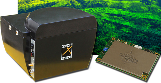
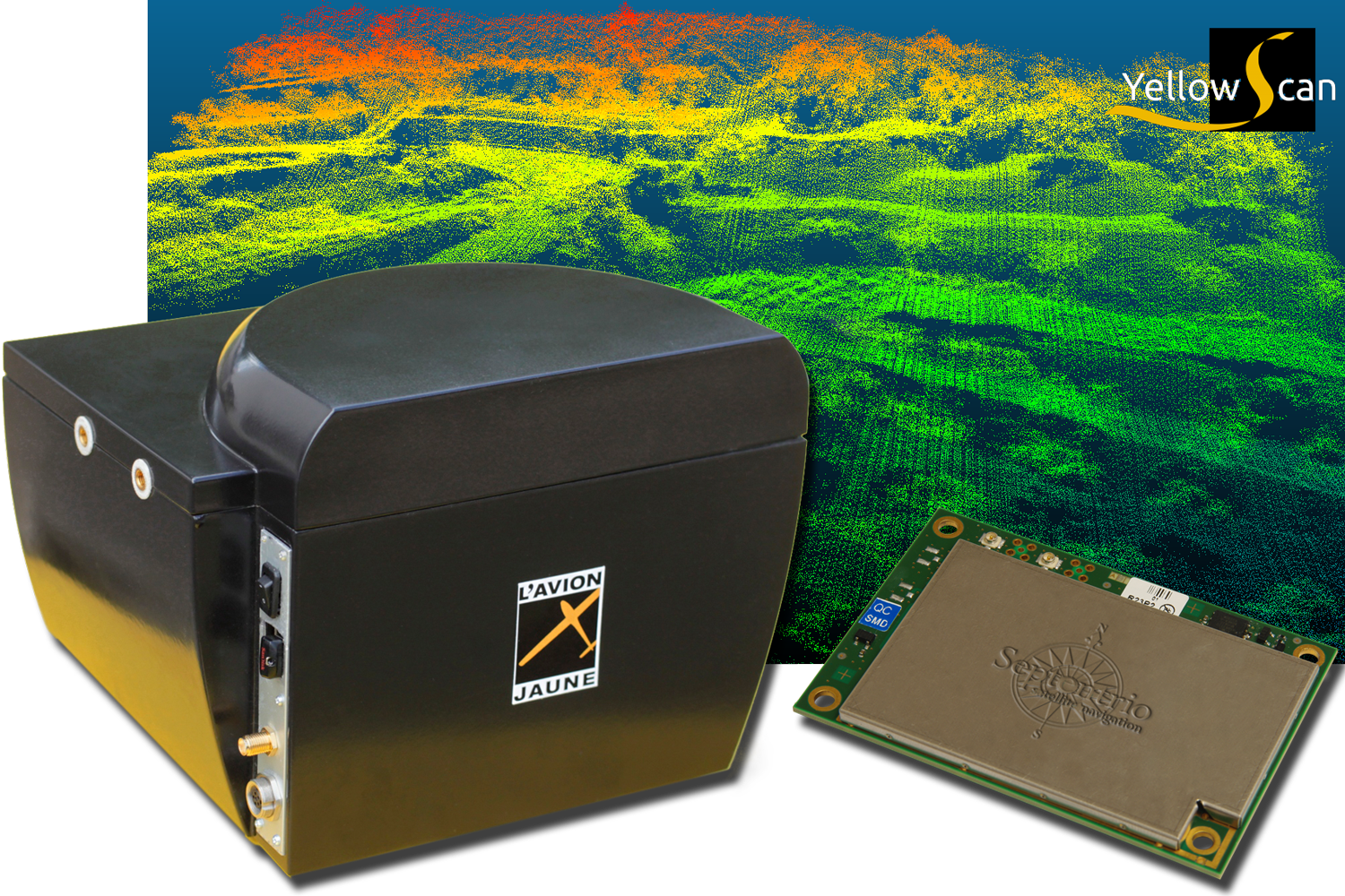
    NR_Yellowscan_Ax-m_picture Photo: L’Avion Jaune
    Photo: L’Avion Jaune

    L’Avion Jaune, a service provider and airborne sensors integrator in the field of aerial surveys, has selected the Septentrio AsteRx-m to equip its YellowScan unmanned aerial system. L’Avion Jaune chose the AsteRx-m for its robustness and low-power consumption, Septentrio said.

    YellowScan is the a lightweight all-in-one solution designed to deliver quality aerial surveys carried out using a LiDAR sensor aboard UAVs. The self-contained system integrates into a small package all the necessary equipment for conducting airborne surveys: a 3D laser scanner, an AHRS, a controller, an autonomous power supply module and the AsteRx-m, a high-performance precision GNSS receiver.

    The AsteRx-m provides a compact and low-power solution for precise positioning in difficult environments where the tracking of both GLONASS and GPS satellites allows the receiver to improve the availability and robustness of a positioning solution. Septentrio’s newest RTK models optimally adapt to situations where GNSS signals can be distorted by reflective surfaces and feature unique countermeasures to disturbances, maintaining accurate and stable measurements wherever and whenever centimeter-level accuracy is needed, the company said.

    “The easy-to-integrate AsteRx-m has proven to deliver the most reliable and stable RTK performance of all, in a compact and exceptionally low-power consumption module,” said Michel Assenbaum, CEO of L’Avion Jaune. “The AsteRx-m allows us to extend the operational range and capabilities of the YellowScan, a fully autonomous surveying solution dedicated to UAVs. We have tested the solution in various environments across the world and have never seen it falter.”

    “We are delighted that L’Avion Jaune, a respected expert in designing unmanned-aerial remote sensing solutions, has validated the excellent performance of our ultra-compact GNSS receiver,” said Jan Van Hees, head of business development at Septentrio. “We are impressed to see how much interest YellowScan has drawn since its introduction and we are very proud to be contributing to the success of a best of breed solution in this highly competitive market.”

  • SkyTraq GNSS Receiver Module Provides Indoor/Outdoor Positioning

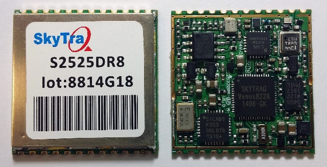
    SkyTraq S2525DR8 Photo: SkyTraq Technology
    Photo: SkyTraq Technology

    SkyTraq Technology, Inc., a fabless GNSS positioning technology company, has introduced an all-in-one S2525DR8 GNSS dead-reckoning module, with integrating MEMS sensor and interface logic on-board. The module is designed for road vehicles requiring high accuracy 100 percent positioning availability.

    The S2525DR8 offers accuracy for both indoor and outdoor positioning. It is based on SkyTraq’s Venus 8 multi-GNSS platform and uses a high-performance automotive-grade XV-8100CB analog output gyroscope and 16-bit differential ADC. A 3D option adds a barometric pressure sensor on-board, offering improved accuracy for altitude reading and altitude change detection over an accelerometer-based scheme in 3D dead reckoning.

    Another monitoring option adds an accelerometer on-board, offering high-accuracy vehicle acceleration monitoring for driver behavior characterization, accident reconstruction analysis, or trigger event recording. The S2525DR8 is compact at 25 x 25 millimeters. It contains a level shifter on board, capable of direct interface to a vehicle odometer and forward/reverse signals ranging from 3V to 30V.

    The SPI interface pins on the module allow autonomous data logging to an external SPI Flash memory device. For high-performance vehicle navigation systems, S2525DR8 provides continuous navigation inside tunnels and underground parking lots without signals; highly accurate barometric altitude enables identification of which level the vehicle is on in a stacked multi-level high-way or a multi-story car park. For automatic vehicle locating or fleet management systems, location can be identified immediately after power on, whether the vehicle is outdoors or indoors under a signal-denied environment.

    The S2525DR8 provides reliable, uninterrupted position, speed and heading information in challenging environments; it is suitable for demanding vehicle navigation and tracking applications requiring the highest accuracy and availability, SkyTraq said. The S2525DR8 is now being manufactured in ISO/TS 16949 automotive-certified factories; an evaluation kit, sample, datasheet, and reference design are available now. A 3D option with barometric sensor and a vehicle-dynamics monitoring option with accelerometer will be available in the first quarter of 2015.

  • Sen. Warner Sends FAA Letter on UAS Regulations

    U.S. Sen. Mark R. Warner (D-VA) sent a letter on Dec. 4 to the FAA administrator regarding the agency’s efforts to design effective regulations for unmanned aerial systems (UAS).

    Virginia is part of a multistate consortium that is one of six FAA regional test sites for studying the safe integration of unmanned aerial vehicles into the existing airspace.

    In his letter, Sen. Warner argues against requiring a pilot’s license for the operation of these vehicles, and urges the FAA to make development of a UAS regulatory framework a top priority in the new year.