GeoLearn is offering seven new GNSS courses taught by Bill Henning, a professional land surveyor who was instrumental in developing RTK guidelines for surveyors at the National Geodetic Survey (NGS). With GeoLearn, he expands on the basics of positioning with RTK and adds a special three-course series on heighting with GNSS.
Henning’s four courses on RTK dissect how GNSS works, covering the physics and surveying implications of what affects the signals from space, benefits and costs of single base versus real-time networks, and best field methods to maximize a surveyor’s effectiveness with RTK. His heighting series (three courses) covers the interrelationships between gravity and heights, use of the NGS hybrid geoid model and height modernization procedures, and use of the NGS 58 and 59 guidelines and real-time precision.
Instructor Bill Henning
“I’ve tried to incorporate the very latest in the science and practical knowledge that many have developed at NGS in collaboration with public and private partners on the subject of effective RTK use and heighting with GNSS,” Henning said.
“We were so pleased when Bill agreed to teach this series of courses,” said Joe Paiva, CEO of GeoLearn. “Bill is a national treasure to surveyors and we are pleased to be able to extend his legacy to the public beyond his tenure with NGS.”
NASA is soliciting research on remote sensing techniques that use GNSS for studying the Earth’s environment.
Specifically, the announcement says NASA “seeks innovative approaches to the development of Global Navigation Satellite System (GNSS) remote sensing techniques and algorithms to study the Earth’s environment from the ionosphere to Earth’s interior.” The announcement says NASA is seeking to emphasize the use of reflected GNSS signals for the characterization of the Earth’s surface and mitigation of natural hazards.
Notices of Intent are requested by January 20, 2015, and the due date for proposals is March 20, 2015.
NASA solicits research through the release of various research announcements in a wide range of science and technology disciplines. NASA uses a peer review process to evaluate and select research proposals submitted in response to these research announcements. NASA says that researchers can help achieve national research objectives by submitting research proposals and conducting awarded research. Visit the announcement page for details.
Esri today released its highly anticipated Android version of Explorer for ArcGIS. The native Android app offers access anywhere to data-rich, visually stunning maps. It combines Esri mapping software with the popular mobile-device platform Android.
Governments, utilities, natural resources, and other commercial businesses have already used Explorer for ArcGIS on iOS and OS X to brief stakeholders, tell stories, and find assets. A sketch function enables highlighting and collaborating. In addition, presentation features make map slides easy to navigate and allow teams to interact with mapped information.
The app intelligently scales to device size. Any owner of an Android smartphone or tablet (version 4.0 and up) can explore Esri public maps from anywhere. Examples of public maps users can view include data-rich views of the Bakken oil fields of North Dakota, Alaska’s glacial retreats, and life expectancy by country.
Users with an ArcGIS Online subscription or Portal for ArcGIS account can use the full power of the app, gaining access to their own and their organization’s maps and data.
Explorer for ArcGIS draws on its native Android operating system with sharing capabilities, including e-mail, text messaging, and push notifications.
A Windows version of Explorer is set to be released next year. It will add to Esri’s growing suite of mobile apps that puts intelligent maps into the hands of people with zero to high GIS experience.
Android users can test-drive Explorer for ArcGIS by downloading it for free from the Google Play Store. Learn more about Explorer for ArcGIS at esri.com/explorerapp.
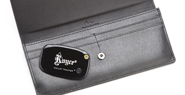
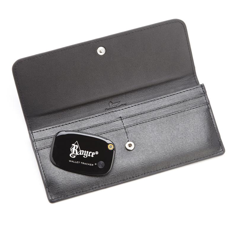
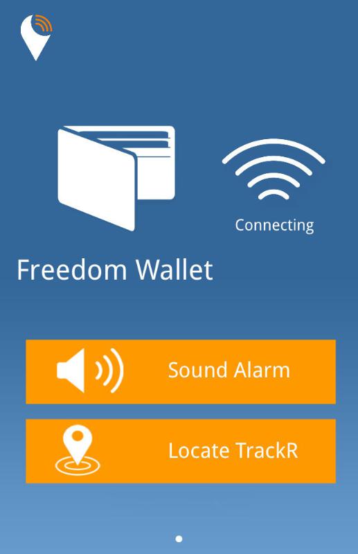
A “GPS wallet” is now being sold at Macy’s department store. Despite its name, the Royce Leather Freedom Wallet uses Bluetooth and a mobile application available on the Apple App Store and Android Market to ensure the safety of your money, according to Andrew Royce Bauer, CEO of Royce Leather.
Bauer told GPS World that the wallet “utilizes Bluetooth technology through a mobile application within a GPS range of 100 yards in addition to crowd GPS technology, in which every active user can act as a point of location reference.”
When activated, the “GPS tracker” can pinpoint the location of a lost or stolen wallet. It also has RFID blocking technology to prevent identity theft by blocking waves from scanning devices that can read and store personal information.
“With the advances in 21st century technology, I was determined to create something better,” Bauer said. “The greatest gift the Royce Leather Freedom Wallet offers is the security of not losing what you already have.”
The wallet’s mobile technology was designed in California; the leather is Italian Saffiano. According to Royce, the wallet meets the rapidly growing demand for luxury technology. “With this new design, I was determined to elevate the functionality of the traditional wallet,” Bauer said. “You should never lose it.”
Photo: Royce
The product exclusive to Macy’s is part of a larger fashion accessories collection by Royce Leather. Other styles include the use of DNA-based fingerprint technology and the RFID blocking technology.
“The Royce Leather Freedom Wallet will financially make a long-term difference in the life of my client,” Bauer said. “Most importantly, the product will reduce the time, stress, and anxiety we have worrying about where our money is. Thankfully, a problem has been solved.”
Besides the wallet, the designer collection exclusive to Macy’s features the Royce Leather Freedom Briefcase; the world’s first security bag with DNA-based fingerprint technology. The product enables a single user to access the bag, demonstrating the ultimate in personal and travel security.
The collection by Royce Leather also includes bags, wallets, and handbags for men and women with fingerprint technology, RFID blocking technology, and the Bluetooth “GPS” technology.
Registration is now open for the Institute of Navigation (ION) Pacific PNT 2015, set for April 20-23 at the Marriott Waikiki Beach, Honolulu, Hawaii. Pacific PNT’s theme is “Where East Meets West in the Global Cooperative Development of Positioning, Navigation and Timing Technology.” The conference brings together policy and technical leaders from Japan, Singapore, China, South Korea, Australia, the United States and more for policy updates, program status and technical exchange.
This year’s theme, Global Cooperative Interoperability, will frame the technical program. Leaders representing academia, government, industry and the scientific community will convene to solve PNT challenges that impact Pacific Rim development.
Pacific PNT 2015 is organized by the Pacific Rim Advisory Board and will feature technical papers presented on a diverse array of PNT topics including:
Algorithms and Methods
Aviation Applications of GNSS
Automotive and Land Vehicle Navigation
Contemporary and Challenging PNT
Earthquake and Environmental Monitoring with GNSS
GNSS Acquisition and Tracking Algorithms
Aircraft Navigation and Surveillance
Ground Based Augmentation System Technology
UAS Technologies and Applications
GNSS Correction and Monitoring Networks
PNT Policy/Status Updates
GNSS Signal Structures
GNSS Augmentations
Alternative and Collaborative Navigation
Inertial Navigation Technology and Applications
Ionosphere Monitoring with GNSS
Interference and Spectrum
Time and Frequency Distribution
For more information the ION’s Pacific PNT 2015, visit www.ion.org/pnt.
According to the December 10 issue of Sibirskii Sputnik (Siberian Satellite), the internal newspaper of ISS Reshetnev, the GLONASS-K1 No. 12 satellite (GLONASS 702K) will be brought into service after a six-month test period and replace an existing GLONASS-M satellite, which will subsequently become a reserve satellite.
In news reported by the Russian magazine Vestnik GLONASS, Information Satellite Systems Reshetnev, the manufacturer of the GLONASS satellites, will now produce nine GLONASS-K1 satellites.
“For a smooth transition to a multi-functional group and due to issues with the very complex GLONASS-K2 satellites, we decided to continue with the GLONASS-K1 intermediate range of satellites and we are preparing for the launch of nine units of this series,” said Nikolai Testoyedov, CEO of Information Satellite Systems Reshetnev.
Testoyedov recalled that the original plan was to launch only two GLONASS-K1 satellites and then move on to the GLONASS-K2 satellites. “In the beginning, really, we wanted after the two GLONASS-K1 satellites No. 11 and 12, to go for the launch of more advanced GLONASS-K2 devices. But, unfortunately, the plans had to be adjusted somewhat because of the sanctions restricting the delivery of radiation-resistant electronic components from the West. We have to put a hold on the in-depth development of technical and technological documentation and that delays us in terms of moving ahead by at least a year or two.”
MicroSurvey has released MicroSurvey CAD 2015, a major update to its desktop survey and design program for land surveyors and civil engineers.
The latest release is powered by the all-new IntelliCAD 8 engine and is the first 64-bit version of MicroSurvey CAD. According to Brian Sloman, development manager at MicroSurvey, “The 64-bit architecture allows MicroSurvey CAD 2015 to access and use more system resources, and in a more efficient manner, unlocking the incredible potential of a modern workstation. With the 64-bit version of MicroSurvey CAD 2015, users will experience faster and smoother drafting and calculation operations, and can work with larger drawings and more points.”
MicroSurvey CAD 2015 can read and write the latest .dwg files for compatibility with AutoCAD 2015 and has improved object enablers for drawings from Civil 3D. It also includes several new capabilities driven by requests submitted by users through MicroSurvey’s online feature request system. For example, layer filters and layer states have been integrated directly into the IntelliCAD Explorer; a dynamic licensing system makes it easy to switch product levels; the AutoMAP Library, which controls how points and figures are presented, has been enhanced with new capabilities; bearings and azimuths of lines can now be instantly viewed in alternate reference systems; the point clusters tool lets you draw exaggerated error vectors for visually comparing coordinate changes between design and as-built points or during deformation studies; additional point cloud data formats are supported; and much more. (Watch the videos here.)
MicroSurvey CAD is compatible with field data from all major total stations and data collectors and is fully compatible with AutoCAD. It includes complete survey drafting, COGO, DTM, traversing, volumes, contouring, point cloud manipulation and data collection interfacing. No plug-ins or modules are necessary. In addition to the 64-bit version, a 32-bit version of the software is also available.
On November 25, the European GNSS Agency (GSA) kicked off the contracts for two new EGNOS GEO transponder services provided by SES.
The kick-off was done with the support of the European Space Agency (ESA) and the EGNOS service provider ESSP. Initially awarded and signed by the European Commission, in line with a new delegation agreement between the commission and the GSA, responsibility for the oversight of the contracts has been assigned to ESA.
The contracts regard the provision of signals from two EGNOS transponders embarked on-board the SES-5 and ASTRA-5B geostationary satellites, both operated by Luxembourg-based SES. The ground-based signals are generated via redundant uplink stations located in Betzdorf, Luxembourg and Redu, Belgium.
The signals include the navigation messages computed by the EGNOS Mission Control Centers. Both satellites are capable of transmitting dual-frequency signals compliant with GPS L1/L5 and Galileo E1/E5 signal specifications. The signals will be introduced into the EGNOS service provision (L1-only signals) between 2015 and 2016.
UPDATE: 1 p.m. US Pacific Time, Dec. 12. See statement from Trimble Navigation below.
In a major step towards allowing unmanned aerial systems (UAS, UAV, drones) to be used for commercial purposes in the United States, the Federal Aviation Administration (FAA) granted five exemptions to four companies this week, allowing commercial UAS operation with an extensive list of conditions and limitations.
If you recall from previous articles such as this one, the FAA says it’s illegal to operate a UAS for commercial purposes in the United States.
Then, when the FAA attempted an enforcement action against a person (Pirker) using a UAS for commercial purposes, an NTSB (National Transportation Safety Board) administrative law judge sided with the person, not the FAA.
Clear as mud?
Of course, the FAA appealed the NTSB opinion v. Pirker, and won. Click here to see the documents explaining the decision. Essentially, the NTSB ruled that a UAS is considered close enough to a manned aircraft that UAS fall under similar rules, and that the FAA is within its rights to apply the rules of careless or reckless operations to UAS as it does with manned aircraft.
So, after some legal wrangling, the rules seem to be as the FAA has stated: no commercial UAS operations. However, under order from the Obama Administration, the FAA is working on developing rules to allow commercial UAS operation in the U.S. The deadline for those rules to be released is September 2015, but there is much speculation that this deadline will not be met.
That said, the FAA is not waiting until September 2015.
In June 2014, the FAA issued the first UAS commercial use CoA (Certificate of Waiver or Authorization) to BP (British Petroleum) to allow commercial use of a particular UAS for surveying roads, pipelines and equipment in Alaska.
Then, in September 2014, the FAA issued CoAs to six aerial photo and video production companies in the film and television industry.
It should be noted that each CoA includes an extensive list of conditions and limitations, which are not necessarily the same, but similar (more on that below).
Looking at these four companies, it’s interesting that three of them are service providers and one is a manufacturer of UAS: Trimble. One might assume that, since Trimble is a manufacturer of UAS, the FAA exemption might carry over to its customers. After checking in with several people on this, the exemption appears to be only for Trimble owned-and-operated UAS, not customers. However, it doesn’t appear that the operator must be a Trimble employee (as opposed to a contractor). In that case, Trimble, as a manufacturer, could potentially deploy UAS under this exemption and have contract pilots operating Trimble-owned UAS.
Following is a statement from Todd Steiner, Trimble’s marketing director for geospatial imaging solutions:
“In the near term, Trimble will use this exemption to begin conducting research activities, sales demonstrations, and flight training with our partners and customers within the U.S. We will also initiate commercial activity as we pursue follow on steps with the FAA.
“In addition, we are working to determine how this exemption might be further leveraged to help our partners and customers. With Trimble’s authorization in place, we can directly support their needs where that is appropriate. Our customers and partners will also be able to apply for authorization to operate our UAS under the conditions of our exemption.
“We believe that these authorizations will be available on a more streamlined basis now that Trimble has received its exemption. We will communicate to our partners and customers as more information is available.”
The exemptions are valid until December 31, 2016, unless rescinded or superceded.
Conditions and Limitations
For each FAA exemption granted, there’s a long list of conditions and limitations for each grantee. You can read the detailed list of these at the bottom of each document issued to the specific company.
Although the conditions and limitations vary with each exemption issued, there are some common to all:
UAS must operate below 400 feet above ground level.
UAS must obey the speed limit (varies by UAS).
UAS must be within VLOS (visual line of sight) at all times by pilot in command.
All operations must have a second person, a VO (visual observer).
Pilot in command must possess at least an FAA private pilot certificate (some exemptions require a commercial certificate) and a third-class airman medical certificate.
There are many more conditions and limitations, but this gives you an idea of what is required. The Trimble exemption contains 35 such items, so before you get too excited, take a look at the complete list of conditions and limitations. It’s not a simple endeavor.
On a positive note, the FAA is making an effort and making progress. For an agency that has a reputation of moving very slowly and methodically, this is near lightning speed.
An Australian company is proposing putting GPS tracking devices in footballs as early as 2015, according to a report by News Corp Australia. Both the National Rugby League (NRL) and the Australian Football League (AFL) are considering using the trackers in footballs as early as next year. The AFL and several National Football League (NFL) teams in the United States already use trackers for player monitoring.
The battery-operated devices, the size of a 10-cent coin, are made by Melbourne-based company Catapult. The devices have the capacity to influence score decisions and analytics, Catapult said. They can track the ball’s speed and time held in possession by a player, and help provide deeper analysis of the game. Spectators also would get a glimpse, with more details of the game made available to them.
Catapult already manufactures and sells GPS devices worn by players in various sports including the AFL, and also makes indoor stadium tracking systems for athletes and elite sports teams. The NRL is aware of the technology, but has not yet decided to implement it.
For the current football season, this year the NFL began using RFID chips for in-game player tracking at 17 stadiums, just over half. The RFID chips, manufactured by MotionWorks, allow the NFL to measure player orientation and capture location information, which is then shared with fans. The data is also used by broadcasters to show plays.
A quarter of NFL teams and 10 major U.S. college programs are using GPS trackers, mostly for training and injury prevention.
“The number one goal of this system right now is trying to help prevent injury as well as help us with the rehab process. There are a lot of different things that goes in to it, but the biggest thing is ‘how can we monitor guys on the field to help us get the information’?” said Eric Ciano, strength and conditioning coordinator of the Buffalo Bills.
“I think us being able to manage practice and how we do it with the GPS system, how we train with that thing year-round, [has] allowed us to take a lot of the guesswork out of how tired your team is, where your pulls, your tears are,” said Jimbo Fisher, head coach of Florida State University football. “Our soft tissue injuries are down 88 percent in the last two years because we’ve been able to apply that. And we use it full-time to gain that information. It’s on my desk, the first thing when we walk in every day.”
On Dec. 1, Trimble acquired privately held Nexala, a provider of enterprise solutions for the rail transport industry, headquartered in Dublin, Ireland. Financial terms were not disclosed.
Nexala’s enterprise solutions manage the lifecycle of rail transport vehicles from operation through maintenance and repair. The Nexala enterprise solutions complement Trimble’s existing portfolio of rail solutions, enabling Trimble to address the broader railway workflow — from initial greenfield track alignment planning to managing the maintenance of locomotives in a repair depot.
Trimble’s existing railway solutions leverage the spectrum of Trimble technology for track and structure construction and maintenance — including construction machine control systems, Building Information Modeling (BIM) software and highly precise track measurement systems — to enable high-quality railway construction on time and budget. On the operations side, Trimble’s fleet mobility solutions, RFID reading technology and Positive Train Control (PTC) mapping systems enable productive and safe operation of passenger and freight railroads. The addition of Nexala will accelerate Trimble’s ability to deliver more complete solutions for both railway infrastructure managers and transport operators.
Nexala provides an integrated suite of on premise and software as a service (SaaS) solutions for large transport operators and global train and component manufacturers. The solutions include:
Engineering Maintenance Management (E2M): The Nexala E2M system is an enterprise-wide engineering, asset and maintenance management system. E2M is designed to control assets, manage stock, streamline procurement, schedule workshop operations and plan maintenance in order to achieve optimum asset availability and labor utilization.
Real-time Remote Diagnostic Monitoring (R2M): The Nexala R2M system combines shore-based software and on-train equipment to deliver fault alerts as they occur for effective condition-based maintenance. Communicating with the maintenance depots in real-time, the system allows for efficient fault diagnostics and work scheduling by the maintenance team. In addition, by analyzing irregularities of individual components and their behaviors across the entire fleet, the R2M system allows maintenance actions to be performed to avoid future failures.
In-Service Performance Planning and Management (P2M): The Nexala P2M system uses timetable, actual vehicle location and real-time diagnostics information to help identify the root cause of delays and plan journeys for optimum timetable adherence. Through a combination of journey planning and improved driver awareness, it also is used to maximize energy/fuel efficiency and manage driver behavior. The P2M system also provides the operations teams with in-service recommendations when fleet failures occur to reduce delays and penalties. P2M is also available as an on-board cab advisory system for drivers.
Component Condition Monitoring (C2M): Nexala’s C2M suite combines trackside and handheld measuring devices with software analytics to proactively monitor wheels, brakes, pantographs and key components for wear and defects. By detecting and analyzing anomalies, it provides predictive advice of maintenance requirements and automates maintenance planning.
“Many of the largest railways in the world rely on Trimble solutions to plan, build and maintain their track and structures. With the addition of Nexala, we also offer rail vehicle lifecycle management solutions for passenger and freight train operators. Trimble can now provide innovative solutions for both the track infrastructure and the train assets that ride on it,” said Ron Bisio, general manager of Trimble’s Railway Solutions Business. “Our fundamental focus is to provide solutions that drive agility, improve efficiency and provide better visibility into railway operations to maximize productivity.”
“We are very excited to join Trimble. I believe the addition of Nexala’s solutions to Trimble’s portfolio extends our collective ability to deliver more powerful and robust rail solutions,” said Karl O’Connell, CEO of Nexala. “In addition, Nexala can leverage Trimble’s international footprint to extend our company’s global reach with a team that shares our passion for innovation in the rail transport industry. As part of Trimble, our commitment to our customers remains unchanged as we continue to deliver best-in-class solutions and services.”
The Nexala business will be reported in Trimble’s Engineering and Construction Segment.
Nexala is a leader in rail transport vehicle lifecycle management solutions. Nexala’s solutions allow companies to plan for the future, improve operational efficiencies, manage their service levels, and to reduce their costs while at the same time ensuring that the service they provide is maintained to the highest level. Nexala has operations in Ireland, United Kingdom, France, Belgium and North America. Nexala’s customers include Southwest Trains, Eurostar, SNCF, Irish Rail, the Go-Ahead group, Abellio, Siemens Transportation, Alstom and Greater Anglia among others.
The Federal Aviation Administration (FAA) today granted five regulatory exemptions for unmanned aircraft systems (UAS) operations to four companies representing several industries that promise to benefit from UAS technology, including Trimble Navigation Ltd.
The four companies that received exemptions want to fly UAS to perform operations for aerial surveying, construction site monitoring and oil rig flare stack inspections.
“Unmanned aircraft offer a tremendous opportunity to spur innovation and economic activity by enabling many businesses to develop better products and services for their customers and the American public,” Transportation Secretary Anthony Foxx said. “We want to foster commercial uses of this exciting technology while taking a responsible approach to the safety of America’s airspace.”
The commercial entities that received exemptions today are Trimble Navigation, VDOS Global, Clayco, and Woolpert (two exemptions). The FAA earlier granted exemptions to seven film and video production companies. This is the first exemption granted to a leading GNSS firm.
Secretary Foxx found that the UAS in the proposed operations do not need an FAA-issued certificate of airworthiness because they do not pose a threat to national airspace users or national security. Those findings are permitted under Section 333 of the FAA Modernization and Reform Act of 2012.
The firms also asked the FAA to grant exemptions from regulations that address general flight rules, pilot certificate requirements, manuals, maintenance and equipment mandates. In their petitions, the firms said they will operate UAS weighing less than 55 pounds and keep the UAS within line of sight at all times.
The exemption will allow Trimble to conduct commercial operation of its UX5 Aerial Imaging Solution. The UX5 is an unmanned fixed-wing aircraft targeted at the surveying, agriculture, oil and gas, mining, construction, environmental industries. The system autonomously captures a series of high-resolution images during flight, which is typically up to 50 minutes covering as much as 2.3 square kilometers (approximately 1 square mile) when flying 120 meters (approximately 400 feet) above the ground. Using Trimble Business Center Aerial Photogrammetry software, images are used to easily generate 2D and 3D deliverables such as orthomosaic images, three-dimensional point clouds and contour maps. The Trimble UX5 enables the collection of large amounts of data, often faster than traditional surveying or mapping technologies.
The Trimble UX5 surveys a construction site. Photo: Trimble
“We are pleased to be among the first companies to receive an exemption from the FAA authorizing commercial operation of UAS,” said Erik Arvesen, vice president of Trimble’s Geospatial Division. “This decision reflects Trimble’s efforts to responsibly operate its UAS business in the U.S. while the FAA addresses air safety issues in opening the NAS for commercial UAS operations on a broader scale. Trimble will continue its efforts to support the FAA’s decision-making process and to provide opportunities for our customers to safely use the UX5 to capture accurate geospatial data for a wide range of applications such as surveying, oil and gas, mining, construction and many more.”
“In the agriculture market, the FAA exemption moves Trimble one step further with the opportunity to provide a solution for safe and legal UAS operations that can benefit growers, ranchers, water management contractors, agronomists and other ag service providers,” said Joe Denniston, vice president of Trimble’s Agriculture Division. “High-speed aerial imaging is a powerful tool that can quickly and easily capture aerial images for scouting and monitoring crop health, locating cattle and their available forage over large areas, measuring crop height, and generating topographic maps and models for land leveling and drainage applications. As a result, the system can be a powerful data collection tool that can aid with recommendations to improve farming operations.”
In granting the exemptions, the FAA considered the operating environments and required certain conditions and limitations to assure the safe operation of these UAS in the National Airspace System. The agency also will issue Certificates of Waiver or Authorization (COAs) that mandate flight rules and timely reports of any accident or incidents..
“The FAA’s first priority is the safety of our nation’s aviation system,” said FAA Administrator Michael Huerta. “Today’s exemptions are a step toward integrating UAS operations safely.”
As of today, the agency has received 167 requests for exemptions from commercial entities.
 GeoLearn is offering seven new GNSS courses taught by Bill Henning, a professional land surveyor who was instrumental in developing RTK guidelines for surveyors at the National Geodetic Survey (NGS). With GeoLearn, he expands on the basics of positioning with RTK and adds a special three-course series on heighting with GNSS.