Leica Geosystems has extended its Spider product family with the new GNSS Unlimited for the Leica GR10 and GR25 GNSS receiver series, allowing receivers to be upgraded to the latest technology standards at any time. Both receivers are designed for Continuously Operating Reference Stations (CORS) infrastructure and monitoring applications, supporting GPS, GLONASS, Galileo, BeiDou and QZSS.
Also, the classic Leica GRX1200+GNSS has been enhanced to support the Chinese BeiDou navigation system.
The Leica GR10 and GR25 Unlimited are scalable reference receiver and server solutions designed for permanent and semi-permanent GNSS network installations and monitoring applications such as RTK and static networks, single base stations, field campaigns, structural monitoring, atmospheric and seismic studies and offshore positioning.
One customer, the Michigan Department of Transportation (MDOT), took advantage of the future proof concept to provide cost-efficient and reliable data products for all its CORS users. MDOT has been working with Leica Geosystems since the beginning of 2000.
“Leica Geosystems’ customer commitment and promise of future proof hardware guarantee has always ensured our investment remains current,” said Shawn Roy, statewide survey equipment development manager at MDOT. “Their promise has allowed MDOT to upgrade, modernize, and expand our network from the early GRX1200’s (GPS-only) in 2005 to the latest GRX1200+GNSS. The company’s continuous development for hardware and software on our GRX1200 family of devices has helped MDOT over the past 10 years to provide cost-efficient and reliable data products for all the users of the Michigan Spatial Reference Network and other affiliated partners, such as NGS and its data products.”
GNSS Unlimited. High-precision GNSS users are faced with an ever-changing GNSS space segment, due to its modernization. According to Leica, the GR10 and GR25 receivers provide a safe and long-term investment for CORS operators and fully support the Chinese BeiDou and Japanese QZSS systems, as well as GPS, GLONASS, and Galileo. The GNSS Unlimited series includes an upgrade to more than 500 channels that will serve the users’ needs well beyond 2020.
Both receivers allow an upgrade of all key hardware parts, such as tracking, memory, power and communications. This enables customers to always keep up with the latest technology advances at minimum cost and only when really needed. The GNSS reference receivers act just like a data center server that satisfies all needs for a reliable operation, such as backup power supplies, redundant data communications, secured access and an easy way to monitor all the servers’ activities.
GRX1200+GNSS. First introduced a decade ago, the GRX1200 series is an example of Leica’s future-proof design with a newly released option to track the signals of the Chines BeiDou navigation system. Since 2004, customers have relied on the sensor’s innovation, allowing them to maintain and increase the value of their initial investment, Leica said.
Ready-mix concrete transportation has long been a challenge for the fleet industry, as concrete is subject to unique time and maintenance limitations to prevent hardening during transit. To improve delivery efficiencies and monitor the integrity of this temperamental cargo, Road King Technologies, Inc., a fleet management and automation company, has integrated Hirschmann Solutions antennas, a supplier of antenna and transceiver systems for M2M (machine-to-machine) and automotive communications, to develop a more reliable fleet data-collection solution.
“As we continue to find ways to provide more data collection benefits to our concrete transport customers, we’re creating strategic partnerships with innovators like Hirschmann, who can help advance our technology,” said Harry Marks, president of Road King. “Our relationship with Hirschmann has been — and will continue to be — a fruitful partnership for years to come.”
Using Hirschmann roof antennas, Road King is able to maintain the best possible cellular and GPS signal connection for its GPS-enabled solution, which is directly installed in concrete delivery trucks. The technology requires constant connectivity to upload data from the truck, including water usage, quantity control and dispatch wait times every 30 seconds. This information is processed by the server and sent to clients in a graphic format showcasing the delivery status of every truck. As a result, customers can review the processed information to improve and adjust their transport systems, boost driver reliability across their organizations and increase overall efficiencies.
“The complexities of delivering ready-mix concrete makes it vital that cargo data collection is constant and reliable,” said Frank Homann, president of Hirschmann USA. “With Hirschmann’s antenna, we’re working with Road King to ensure their data collection solution can optimally operate in any condition, including areas where cellular connectivity can be a major issue.”
Ready-mix concrete trucks work in some of the most extreme cellular environments, such as downtown areas where tall buildings can create urban canyons that block or interfere with cellular transmissions and GPS signals. In some cases, deliveries are made in new urban areas, where cellular towers are not yet installed and service, if any, can be intermittent, at best.
Road King’s data collection technology using Hirschmann antennas is certified by the PTCRB (PCS Type Certification Review Board), an organization setup by network operators to test GSM (global system for mobile communications) devices, such as mobile phones, modules and M2M devices. PTCRB certification is a requirement for launching cellular devices on North American GSM carriers.
u-blox has provided global positioning technology to Cohda Wireless‘ vehicle-to-vehicle (V2V) and vehicle-to-infrastructure (V2I) equipment, collectively called V2X. V2X will be a key technology for the next generation of advanced driver assistance systems (ADAS) as well as autonomous vehicles, the companies said.
Cohda’s DSRC (dedicated short-range communications) based V2X system uses accurate satellite positioning with embedded dead-reckoning technology provided by u-blox. The system enables early warning of imminent collisions, oncoming traffic, the presence of road workers and unsafe speed based on vehicles in the vicinity.
“Cohda’s V2X DSRC-based solutions make full use of u-blox’ advanced automotive-grade positioning technology to enhance driver safety through ample warning time and excellent non-line-of-sight performance. Such technology will soon be a standard feature embedded in all vehicles,” said Michael Ammann, VP platform partnerships at u‑blox.
“Our V2X vehicle warning systems are dependent on highly accurate position and velocity data to deliver the performance that is crucial to meet the safety demands of next generation cars,” said Fabien Cure, Chief Engineer at Cohda Wireless. “u-blox’ satellite positioning solutions, leading automotive dead reckoning technology, module roadmap and clear strategy to deliver lane accurate performance in challenging urban environments was convincing.”
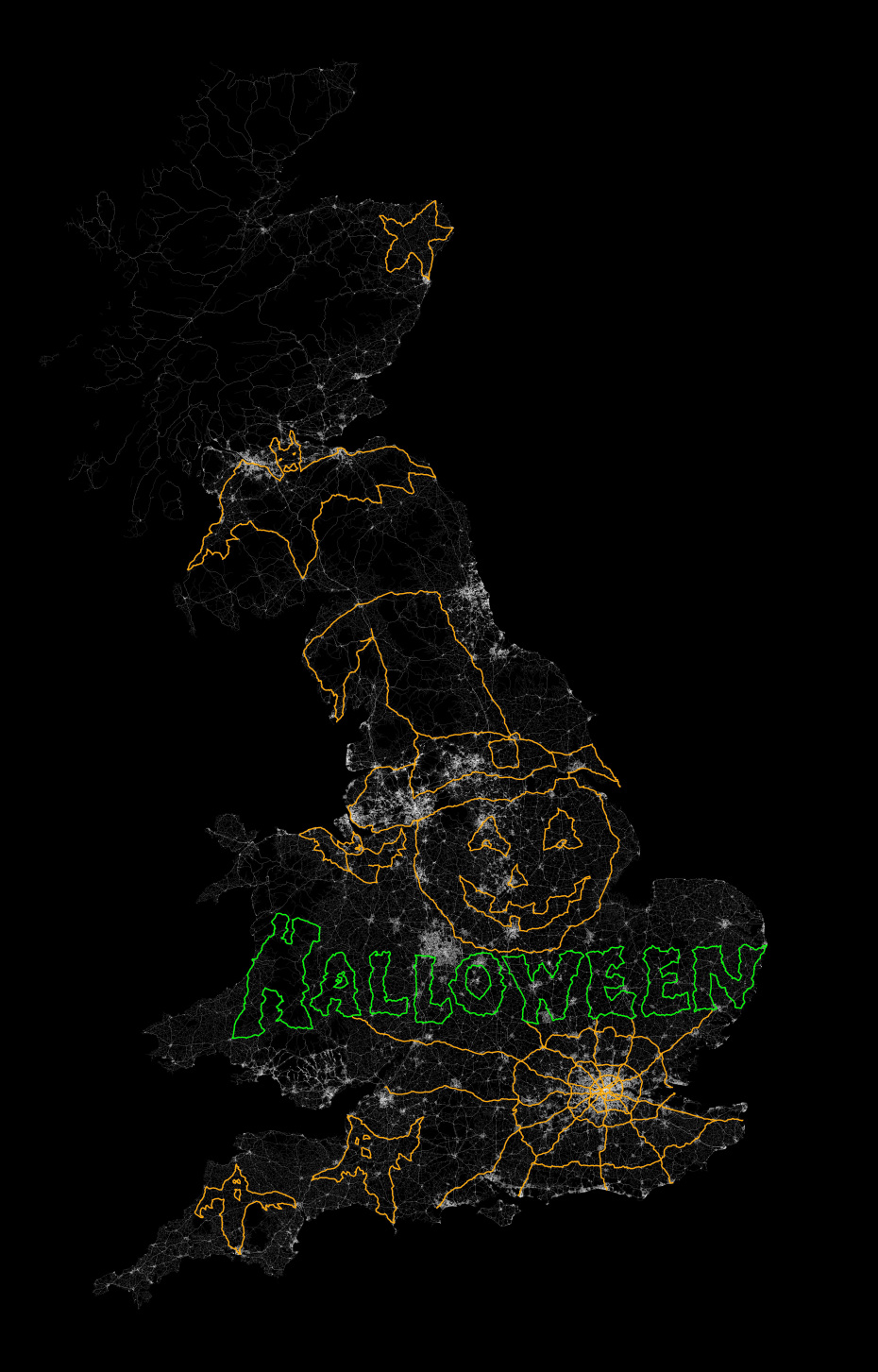
In October, Jeremy Wood drove all over the United Kingdom to create a Halloween message, reports Metro. Wood drove a 10,000-mile, painstakingly-plotted route through England, Wales and Scotland in a Vauxhall Corsa, plotting a 264,000 positions on the car’s GPS. Wood linked the positions on a virtual drawing to create a picture that shows bats, ghosts, a spider web, and a pumpkin in a witch’s hat, with the word “Halloween” underneath. The result is the image below.
Photo: VB
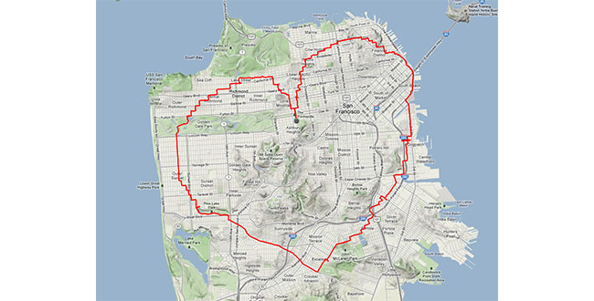
Wood isn’t the first GPS-inclined artist. In 2013, a man in San Francisco equipped with an iPhone and tracking app rode his bike 27 miles around the city. Two and a half hours later, Payam Rajabi had etched a heart shape onto a city map.
Photo: VB
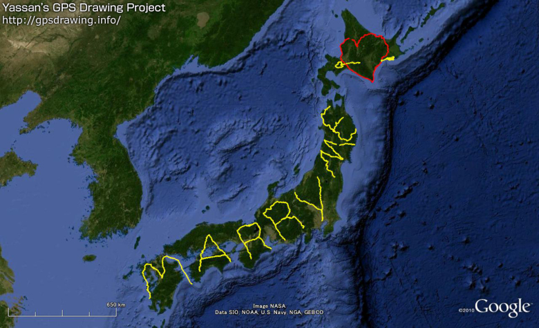
But the biggest devotee of GPS art could be Japanense artist Yassan, who in 2010 left behind his girlfriend for six months to travel across Japan, reports VB News. Carrying a GPS device, Yassan covered 7,163.7 km mostly by walking, but with some use of a car, ferry, and bicycle. He then used Google Maps to connect the GPS points he visited, resulting in this unique marriage proposal:
Photo: VB
Though he made the journey four years ago, his trek is now being featured in a new ad campaign and documentary by Hi-Tec, a company that makes hiking shoes and boots.
Yassan has been creating large-scale GPS drawings for years. Yassan was so inspired by the possibilities of GPS art that he quit his job in June 2008 to pursue his passion for making GPS drawings. Learn more about Yassan’s GPS Drawing Project on his website.
Two weeks ago, CNN had a special airing of the two hour documentary Ivory Tower. The movie, which was released earlier this year, dealt with the growing problem of the increased cost of going to college, growing student debt — now approaching 1.3 trillion dollars, and the inability of students to find employment in their field. The movie raised some important issues and used the plight of the prestigious but small 950-student Cooper Union College in New York City as an example.
The private engineering, architecture and arts college established in 1859 was funded by a very large endowment, and up until last year tuition was free for those lucky students who could get in. However, construction of a $170 million building, high administrative costs (the college president’s salary was reported at $750,000) and some less-than-ideal management decisions resulted in financial disaster and the need to start charging tuition last year. That action prompted a student revolt that is still unresolved.
Original Cooper Union building.New classroom building.
A Politically Incorrect Omission
This example was used to highlight that perhaps colleges have lost their way by concentrating more on prestige rather than education. The size and cost of administration has risen significantly. Universities seem to be competing for bragging rights with each other through massive and luxurious construction projects while state funding diminishes. More time is spent doing high profile research by the faculty members while part time graduate students or adjunct professors actually teach the classes.
The disappointing thing about the Ivory Tower movie was the hand-wringing and focus on the high cost and poor job opportunities. However, they seemed to avoid the gorilla in the room — the choice of majors. One would think that someone smart enough to go to college would be smart enough to research job opportunities resulting from chosen majors. I had a colleague who lamented that his daughter graduated from a well-known New England college $80,000 in debt and was only able to land a $28,000 a year position — her major, journalism. I heard similar stories for other non-technical graduates.
It’s painful and it may not be politically correct, but some degrees are harder to earn and do pay more. I fault colleges for painting a rosier picture than is deserved for many non-technical majors. My son struggled through engineering school and his friends through computer science, accounting and pharmacy schools, but all got hired quickly and are doing quite well even in this weak economy. The real-life lesson, get a degree in a difficult and needed profession.
Thanksgiving
So what does this have to do with the geospatial community? This Thanksgiving I was thankful again that in 1989 I made the decision to pursue a master’s degree in GIS. I struggled with some of the course work, programming and learning ArcInfo 3.0 which was especially confusing at the time because it operated on Sun, DEC or Silicon Graphics workstations running UNIX, so one had to mentally separate the AI commands from the equally unfamiliar UNIX commands. For those of us who finished the master’s program it’s been full employment ever since. However, like other professions, the learning can’t stop, and we in the geospatial community are especially lucky, since there are many education opportunities ranging from brick and mortar schools to online and non-traditional education in subjects related to geospatial. Geospatial is also different from some professions in that there are many entry-level positions that don’t require a four-year college degree. Experience in those positions can be leveraged and ultimately expanded with online, college and graduate-level work to higher level positions.
When I started work in GIS in the early ’90s, we were happy just to be able to digitize paper maps and reprint them with needed updates. We did some limited analysis using buffers and overlays but not at the level found today. Today, geospatial technology has evolved to a point of ubiquity. We regularly collect a variety of imagery sources including satellite, aerial, LiDAR, UAV and ground collection with optical/multispectral sensors. Operations and analysis include the use of multiple online data sources, live AVL GPS tracking, advanced statistical methods, social media overlays, interactive 3D models and virtual reality simulations. Delivery has evolved from single thick client workstations to web services and mobile device apps. All of this requires computer programming skills that are evolving daily.
So?
So what does this mean to you? First, if you have the ear of high school students, try to steer them to an education that will actually get them a job. An easy major may facilitate a lot of partying, but they may be living with their parents for years after graduation. On the flip side, not everyone is suited for college and there are many trades that pay extremely well and offer rewarding and secure careers including geospatial technology.
Second, if you are in the geospatial field, don’t rest on your initial training. We all need to stay relevant, and there is a growing list of non-traditional online education that can build the skills and capabilities of new and existing geospatial professionals. When I was the GIS manager for the Atlanta Regional Commission in the ’90s. we needed someone who was an expert in dynamic segmentation, routes and linear referencing for our transportation planning and modeling. We didn’t have that talent in-house, and I would have hired anyone with that specific skill set — degree or no degree. We were fortunate in finding a graduate student with both the needed skills and broad GIS experience.
Emerging Education Opportunities
There has been a growing list of online education opportunities. For years Esri has been offering GIS classroom and online software courses, Microsoft programming courses and the Kahn Academy expanded online education with MOOC’s (Massive Open Online Courses) in many subject areas. More recently, edX, Coursera and the well-publicized Udacity, co-founded by Sebastian Thrun inventor of Google Glass. Udacity offers many technical online classes including a Georgia Tech Massive Online Master’s Degree in Computer Science. Add to this UnCollege, a social movement aiming to change the notion that “going to college is the only path to success,” and you can see that traditional colleges are in a potentially disruptive environment. Just like Uber and transportation.
GEOINT Education Success Story
For many years, Pennsylvania State University has been a leader in online geospatial education. Penn State offers both a United States Geospatial Intelligence Foundation (USGIF) accredited post-baccalaureate certificate in GEOINT applications and a graduate certificate in GEOINT analytics. Continuing the tradition of providing open educational resources, recently Penn State began to provide free geospatial MOOCs through Coursera.
The joint effort of Dr. Max Baber of USGIF and Dr. Todd Bacastow of Penn State puts Penn State among the eight universities that have achieved USGIF academic accreditation including Northeastern University, University of Redlands, the University of Utah, West Point, U.S. Air Force Academy, the University of Texas at Dallas, George Mason University and the University of Missouri.
According to Bacastow, a West Point graduate and retired Army major, Penn State’s for-credit program has served more than 5,000 students with about 2,500 of these students having already completed. The mapping MOOC has served more than 70,000 students. The GEOINT MOOC will open on January 14, 2015. You can view a video of Dr. Bacastow explaining the GEOINT MOOC here.
He cited numerous success stories including: a wife of a deployed sailor who earned her certificate and is now a lead geospatial architect at a three-letter agency; a severely injured Iraq Army vet who is now a contractor for NGA; a former infantry officer who now fills a key geospatial position at CENTCOM; and the stories continue with NGA currently trying to fill more than 1,000 positions.
Bottom line — don’t stop learning. The opportunities are there, especially geospatial.
P.S. Lest you think that I don’t take my own medicine, I felt that I was behind the power curve regarding social media and just getting by, so I signed up for a comprehensive online social media course so I could do a deep dive into the systems.
The National Geospatial-Intelligence Agency (NGA) has awarded Image Matters LLC a contract to address some of the agency’s most pressing challenges through its Accelerating Map of the WorldInitiative. The initiative will deliver innovative solutions that expedite and strengthen the agency’s Map of the World (MoW). MoW is foundational to the Intelligence Community’s object-based production environment.
MoW will provide easy access to an expanded web of integrated intelligence (content within context), grounded by authoritative geospatial features, for everyday decision makers, operational users, and intelligence analysts.
Image Matters LLC was selected for its proposed linked-data strategy addressing the integration of object-based-intelligence (OBI) with foundation geospatial intelligence. NGA seeks to enhance the capability to generate, curate, analyze and share structured OBI as linked data with originating information tracking.
“This award builds upon a decade of advanced research and development into innovative analysis techniques for OBI,” said Harry Niedzwiadek, CEO of Image Matters LLC. “Our efforts began with NGA’s $1M Innovations in Geospatial Intelligence Award (2005), through which we pursued a vastly improved solution to what former Director James Clapper referred to as the ‘volume, velocity, variety and veracity (4V) problem’, known commonly today as the ‘Big Data problem’. Following this pioneering work, and complementary extended research with DARPA and others, we set our sights on next generation object-based production and analysis tools and services. Accelerating Map of the World has great potential to dramatically enhance the effectiveness and productivity of analysts, in a far more seamless and integrated fashion than ever before.”
CompassData, a provider of geospatial data and services, announced that its CompassTA elevation accuracy software has received OCIO-ITS certification from the U.S. Department of Agriculture (USDA). Certification allows 40,000 USDA users the opportunity to utilize CompassTA software for elevation accuracy verification of LiDAR point clouds, digital elevation models (DEM), and other raster data sets.
“This certification provides assurance to our current and future USDA clients they are using a data verification tool that has been thoroughly scrutinized and tested by their own internal auditing process,” said Jeff Barker, CompassData product manager.
USDA certified the CompassTA software through the Office of the Chief Information Officer – Information Technology Services (OCIO-ITS) within the Device Deployment Services Branch.
Earlier this year, CompassData received DO-200A approval from the Federal Aviation Administration (FAA) to use its CompassAA software and ground control points (GCPs) to verify the accuracy of satellite and aerial imagery for the creation of certain aviation products.
CompassTA and CompassAA are software tools in CompassData’s CompassV&V line of Verification and Validation products. Based on the popular Topo Analyst and Accuracy Analyst software tools CompassData purchased from Spatial Information Solutions (SIS) in early 2014, the rebranded CompassV&V products include CompassAA, for orthorectified image verification, and CompassTA, for QA/QC of elevation data.
For 20 years, CompassData has performed custom GCP collection for clients in the geospatial profession and archived those points in a database for commercial sale to other end users. The CompassV&V tools are used extensively with custom and archived GCP to verify the accuracy of geospatial imagery, surface and elevation models and many other spatial products.
Used by numerous U.S. federal agencies under the SIS brand names, CompassV&V tools are content enhancement solutions that automate map accuracy verification and eliminate manual processing, ensuring consistent quality control of geospatial products backed up by standardized reporting procedures. Both tools establish automated workflows and generate standards-based documentation delivered along with end products.
“Since acquiring and rebranding the CompassV&V tools, we have made administrative upgrades to enhance the user experience,” said Barker. “Additional improvements are in the works.”
Leveraging the CompassV&V software tools, CompassData has expanded its custom Validation Service using GCPs. This service is offered for clients who prefer, or are required, to have an independent third-party perform quality assurance and supply verification reports, CompassData has licensed professionals on staff that perform Validation Services using high-quality GCPs along with the CompassV&V tools. The CompassData team can conduct this service faster and at lower cost than other firms that have to obtain their own GCPs.
Nasdaq — the trading and exchange technology company — is launching a trade time-stamping service at its data center in Carteret, New Jersey, with access to a NIST-certified GPS antenna. The High Precision Time service is provided by Perseus, a provider of global high-speed connectivity, and enables Nasdaq customers to synchronize their time systems across a multitude of data centers.
High Precision Time offers access to a National Institute of Standards and Technology (NIST)-certified GPS antenna as well as Network Time Protocol (NTP) and Precision Time Protocol (PTP) connectivity with nanosecond accuracy to the Coordinated Universal Time UTC (NIST) timescale. These NIST-certified options allow Nasdaq co-located clients at the Nasdaq data center in Carteret to synchronize their system clocks. This tool can be used as clients’ primary time service, or as a back-up for clients which already use Nasdaq’s shared GPS service or have their own dedicated GPS antenna.
“The relationship with Nasdaq is an important step in helping our shared customers mitigate the risks of inaccurate time stamps when disseminating and trading on sensitive market information,” said Anthony Gerace, President, Global Financial Services at Perseus Telecom. “This is especially important for compliance and high-precision trading.”
Nasdaq co-located clients can connect to High Precision Time services via a simple inter-cabinet cross-connect with:
Certified NIST GPS antenna access
Certified UTC (NIST) timescale accuracy and reporting
Choice of delivery protocols: NTP (Network Time Protocol) and PTP (Precision Time Protocol)
“Our adoption of Perseus’ precision time service is another example of our commitment to provide member firms with technology solutions that reduce risk exposure,” said Stacie Swanstrom, Head of Global Access Services and senior vice president of Global Trading and Market Services at Nasdaq. “Transparency and choice is a hallmark of Nasdaq’s philosophy, which is why we continuously improve our Nasdaq Data Center environment while being mindful of the challenges and complexities of the markets.”
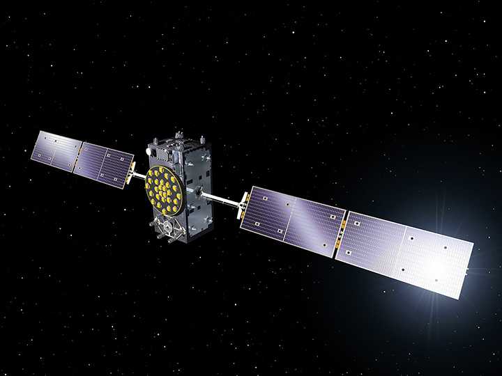
Europe’s fifth Galileo satellite, one of two delivered into a wrong orbit by VS09 Soyuz-Fregat launcher in August, transmitted its first navigation signal in space on Saturday, November 29. It has reached its new target orbit and its navigation payload has been successfully switched on.
A detailed test campaign is under way now the satellite has reached a more suitable orbit for navigation purposes.
Recovery
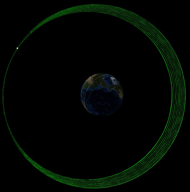
The fifth and sixth Galileo satellites, launched together on August 22, ended up in an elongated orbit traveling up to 25,900 km above Earth and back down to 13,713 km.
A total of 11 maneuvers were performed across 17 days, gradually nudging the fifth satellite upwards at the lowest point of its orbit. As a result, it has risen more than 3,500 km and its elliptical orbit has become more circular.
“The maneuvers were all normal, with excellent performance both in terms of thrust and direction,” explained Daniel Navarro-Reyes, ESA Galileo mission analyst. “The final orbit is as we targeted and is a tribute to the great professionalism of all the teams involved.”
The Launch and Early Operations Phase (LEOP) for Galileo satellites is overseen by a joint operations team from ESA and the French space agency CNES, alternately working from ESOC in Darmstadt, Germany, and the CNES LEOP Control Centre in Toulouse, France. Photo: ESA
The commands were issued from the Galileo Control Centre by spaceopal, the Galileo operator, at Oberpfaffenhofen in Germany, guided by calculations from a combined flight dynamics team of ESA’s Space Operations Centre, ESOC, in Darmstadt, Germany and France’s CNES space agency. The commands were uploaded to the satellite via an extended network of ground stations, made up of Galileo stations and additional sites coordinated by France’s CNES space agency. Satellite manufacturer OHB also provided expertise throughout the recovery, helping to adapt the flight procedures.
Until the maneuvers started, the combined ESA–CNES team maintained the satellites pointing at the Sun using their gyroscopes and solar sensors. This kept the satellites steady in space but their navigation payloads could not be used reliably.
In the new orbit, the satellite’s radiation exposure has also been greatly reduced, ensuring reliable performance for the long term.
A Galileo Full Operational Capability (FOC) satellite, following on from the first four Galileo satellites already in orbit. A total of 22 FOC satellites are on the way, built by OHB in Germany with navigation payloads from Surrey Satellite Technology Ltd. in the UK. Photo: ESA
A suitable orbit
The revised, more circular orbit means the fifth satellite’s Earth sensor can be used continuously, keeping its main antenna oriented towards Earth and allowing its navigation payload to be switched on.
Significantly, the orbit means that it will now overfly the same location on the ground every 20 days. This compares to a normal Galileo repeat pattern of every 10 days, effectively synchronizing its ground track with the rest of the Galileo constellation.
The navigation test campaign
The satellite’s navigation payload was activated on November 29, to begin the full In-Orbit Test campaign. This is being performed from ESA’s Redu centre in Belgium, where a 20-meter-diameter antenna can study the strength and shape of the navigation signals at high resolution.
“First, the various payload elements, especially the Passive Hydrogen Maser atomic clock, were warmed up, then the payload’s first ‘signal in space’ was transmitted,” said David Sanchez-Cabezudo, managing the test campaign.
“The satellite-broadcast L-band navigation signal is monitored using the large antenna at Redu, with experts from OHB and Surrey Satellite Technology Ltd — the payload manufacturer, based in Guildford, UK — also on hand to analyze how it performs over time.”
The first Galileo FOC navigation signal-in-space transmitting in the three Galileo frequency bands (E5/E6/L1) was tracked by Galileo Test User Receivers deployed at various locations in Europe, namely at Redu (B), ESTEC (NL), Weilheim (D) and Rome (I). The quality of the signal is good and in line with expectations.
The Search And Rescue (SAR) payload will be switched on in few days in order to complement the in-orbit test campaign.
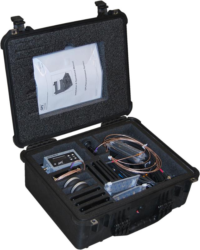
GPS Retransmission Kit by GPS Source. Photo: GPS Source
GPS Source has received a $7.5 million order for its GLI-COTTONMOUTH GPS retransmission kit from an international customer with an armored vehicle application. The kits will be used to provide armored vehicles with improved situational awareness. Shipments for the order are expected to be complete in the secondquarter of 2015.
“GPS Source is extremely pleased to be selected to provide the GPS retransmission solution for another one of our foreign military partners. Situational awareness, survivability and mission effectiveness are all improved by the use of GPS retransmission technology. Successful GPS Retransmission in the confined crew compartment of a military vehicle presents significant challenges, but one in which GPS Source has created the perfect solution,” said Robert Horton, CEO of GPS Source.
GLI-COTTONMOUTH is one of many GPS retransmission kits offered by GPS Source. The kits are available as permanent installs or man-portable. They provide GPS coverage within smaller military ground vehicle or aircraft. GPS receivers will experience no loss in signal coverage as they move out of a ground vehicle or exit an aircraft equipped with a tactical GPS retransmission kit from GPS Source.
GLI COTTONMOUTH and other GPS distribution solutions by GPS Source are in use by the U.S. Army and other military entities throughout the world. GPS retransmission technology developed by GPS Source is currently used by Net Warrior units aboard the Stryker, RG-33, and M1151. The technology is also used within the Canadian LAVIII and the French DGA SCORPION program.
Relevant GPS retransmission kits have received Safety of Flight Approval from the United States Air Force Mobility Command Systems Group and are used aboard the C17, C-130, CV/MV-22, CH-53 E/D/K, CH/MH-47, MH-60, HH60, and other host country aircraft.
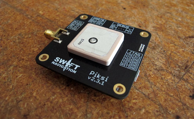
A little more than a year ago, Swift Navigation started a Kickstarter campaign for a $995 RTK GNSS receiver named Piksi. The goal was to raise $14,000 for the project. By the time the Kickstarter campaign was ended, Swift raised $166,097 from 303 backers.
I wrote an article about the Swift’s Kickstarter campaign in September 2013, a few days before the fundraising period ended. Following is a two-minute Kickstarter promotional video describing Piksi.
At the time, the $995 price for the Piksi raised a lot of eyebrows and generated conversations in the high-precision GNSS user community about inexpensive RTK technology.
This week, I took the opportunity to catch up with Swift to see how the project is going and where the company is headed.
I spoke with Tim Harris, CEO of Swift, and Fergus Noble, chief technology officer. Tim said they delivered most systems to their backers in April (2014) as well as issuing “very few” refunds, which is not unusual for Kickstarter projects. As of today, Tim said there are about 1,000 units in the field among 350+ users. He said they still consider the Piksi to be in beta testing phase and expect production units to start shipping next year.
“We are in RTK reliability mode now” — Fergus Noble
Fergus said that the hardware design is stable and hasn’t changed since they shipped Piksi last spring. He said the focus has been on refining the RTK firmware to make it robust and reliable for professional use. He admits that “covering all corners” has been a challenge and, according to Swift’s blog, “The RTK software has been a tougher nut to crack than we originally anticipated.” This is especially ambitious, since Swift said they developed the RTK firmware based on published academic technical papers, combined with their own techniques (preparing patent applications) to run on a low-power hardware platform. Basically, they started from scratch, and without any RTK veterans on their team. You gotta love their guts.
Apparently, the venture capital world liked what they saw. A few months ago, Swift, based in San Francisco, secured $2.6m in seed funding from Fall Line Capital, Felicis Ventures, Kal Vepuri, Lemnos Labs, Qualcomm Ventures and VegasTechFund. With the additional funding, Swift has increased its headcount from 4 to 9.5.
The Devil Is in the Details
Swift Navigation Lodestar. Photo: Swift Navigation
Start-ups like these are a cool story, but at some point the rubber has to hit the road. Piksi is a long way from being an RTK product that you and I use for GIS and surveying, and Tim/Fergus are humble enough to admit this. The founders see the Unmanned Aerial Systems (UAS) market as their key customer base due to Piksi’s micro-size and low cost. They say this is reflected in their current customer base, which is comprised largely of UAS users, then surveying and agriculture, with the remaining 20 percent being a variety of apps like augmented reality. I agree that UAS is the right segment for them to focus on. At this point, the limitations for general surveying and GIS use are too great:
Must use a Piksi RTK base due to the proprietary protocol. In other words, not compatible with existing RTK base stations or networks.
Baseline length (distance between the RTK base and rover) must be very short. They haven’t done much testing even with a one-mile baseline.
RTK initialization is spec’d at 15 minutes, although Fergus said it’s typically 7-10 minutes.
Since Piksi is only a single-frequency receiver (L1), it has the same limitations as other L1 RTK systems we’ve seen marketed over the past few years — short baselines and long initialization times compared to dual-frequency receivers. While these limitations are significant for surveying and GIS users, they aren’t as significant for UAS users, since UAS users require line of sight to the aircraft at all times and UAS are operated in a clear-sky environment.
Communications
If you’ve used RTK, you are aware of the importance of data communications between the base and rover. As part of its kit, Swift supplies license-free, 915MHz frequency-hopping radios to facilitate communications between the base and rover for testing. However, the founderse make it clear that they aren’t in the data radio business. They expect that most Piksi users will incorporate their own communications technology. Swift is discussing incorporating GSM (mobile phone) modem capabilities in the future.
Future
In 2015, Swift plans to roll out the Piksi in production quantities, so Fergus said their focus is on creating a robust and professional RTK system. Of course, the burning question is if/when Swift will incorporate a second GPS frequency into its receiver to take advantage of the faster RTK initialization and longer baseline distances that a dual-frequency receiver offers. Swift isn’t willing to talk about that right now. Said Tim, “We’re holding our plans close to our chest.”
As part of European project MEDUSA coordinated by Telespazio (Finmeccanica/Thales), a workshop will be held in Tunis on Dec. 17 with stakeholders in civil aviation to promote the use of European satellite navigation systems in Libya, specifically EGNOS.
MEDUSA (Mediterranean follow-up for EGNOS Adoption) is a project funded by the European Commission as part of Euromed program GNSS with the objective of promoting the use of European satellite navigation services (E-GNSS), starting from EGNOS (European Geostationary Navigation Overlay Service) ahead of Galileo, in the Euromed area.
MEDUSA assists and prepares countries in the area (Algeria, Egypt, Jordan, Israel, Lebanon, Libya, Morocco, Palestine, Syria and Tunisia) in the adoption process of E-GNSS services, mainly in aviation as well as in other transportation sectors. To this end, MEDUSA implements a ”program of assistance actions” in countries from the area to transfer abilities, create technological capacities and share good practices.
Moreover, MEDUSA has created an operational and cooperation structure, called GEMCO (Galileo EuroMEd Cooperation Office), with a long-term working plan providing for the participation at a regional level of all beneficiary countries.
Located in Tunis, GEMCO acts as a reference point and catalyzer for all Euromed countries and towards Europe. Through GEMCO, MEDUSA favors initiatives connected to E-GNSS in the Euromed region, and contributes to the implementation of assistance actions of the project like national and regional workshops, training sessions, and days dedicated to studying.
GEMCO will host the MEDUSA meeting with stakeholders of Libya’s civil aviation to analyze the country’s needs, identify priorities and help define a strategic vision in the short, medium and long-term in relation to the possible operative introduction of the use of EGNOS. Libya, which has repeatedly shown interest in the project and EGNOS (whose perspective of availability of coverage of respective service is provided for in the short and medium-term), represents an opportunity for EGNOS mainly in the aviation and helicopter sectors.