ArkEdge Space, a Japanese space start-up based in Tokyo, has been selected by the Japan Aerospace Exploration Agency (JAXA) under its Space Strategy Fund to lead the development of advanced lunar navigation technology.
Under the agreement, ArkEdge Space will plan and design the mass production and operation of micro-satellite constellations to lead the development of a next-generation Lunar Navigation Satellite System (LNSS), a vital component to the International “LunaNet” initiative driven by National Aeronautics and Space Administration (NASA), European Space Agency (ESA) and JAXA. LunaNet seeks to establish essential infrastructure to support sustainable lunar exploration and foster the growth of the lunar economy.
This program, supported by up to 5 billion yen ($32.5 million) over four years, tasks ArkEdge Space with developing a 100 kg class micro-satellite, developing crucial technology including the:
Lunar navigation payload
Demonstration satellite platform, along with a system operations plan
Establishment of an approach to mission evaluation
These efforts will help reduce development costs and timeframes while advancing core LNSS technologies and enabling the development of future lunar navigation system demonstration satellites, according to ArkEdge Space.
ArkEdge Space’s work on LNSS leverages its expertise in satellite technology and builds on its ongoing collaboration with JAXA. A key innovation of the project involves the use of faint GNSS signals, originally designed for Earth, to determine satellite position and time in lunar orbit—approximately 380,000 km from Earth. Additionally, LNSS complements advancements in low-Earth Orbit positioning navigation and timing (LEO-PNT) systems, designed to provide high-precision, robust navigation services globally, enhancing existing GNSS infrastructure.
As lunar exploration accelerates, high-precision infrastructure has become indispensable for activities such as rover navigation, base construction, and in-situ resource utilization. LNSS supports lunar operations and serves as a stepping stone for future exploration of Mars and deep space.
This is a challenging time for coral reefs. Although they cover less than 0.1% of the ocean floor, coral reefs support 25% of all marine creatures. Collectively, they form one of the planet’s most important ecosystems. Their health is in jeopardy due to increased ocean acidification, rising temperatures, pollution runoff, and overfishing and other destructive fishing practices.
The news is not uniformly bleak. A global study of coral reefs that seemed wildly ambitious when it launched in 2014 suggests that some coral reefs are showing impressive resilience. Some could even be considered thriving.
From the beginning, managing the study, dubbed the 100 Island Challenge, has depended on a creative and geographic approach.
Geographic information system (GIS) technology helped the 100 Island Challenge scientists define the initial scope of the study. Now it is allowing them to visualize and analyze the data they collect. GIS has also enabled the construction of environmental digital twins. In this case, the highly realistic and navigable 3D models depict many of the world’s major coral reefs, capturing flora and fauna in precise detail.
Reassessing Reefs
“I’m focused on coral reefs because it’s a great place to watch animals,” said Stuart Sandin, an ecology professor at Scripps Institution of Oceanography at UC San Diego. “Organisms are packed together, interacting with one another.”
Since the early 2010s, marine ecologists like Sandin have noted how reef health is indicative of a greater overall breakdown in ocean health.
“The timely issue was that we were seeing a ton of degradation,” he said. “It was no longer just a discussion about these ecological principles.” Coral health became a matter of global urgency that highlighted a possible tipping point, with coral decline contributing to biodiversity loss.
Sandin was drawn to the question of local and direct human influences, like overfishing and pollution. He realized that this was, at its roots, a spatial question and it was urgent. If humans were causing harm, changes could be made to reduce the impact. Analyzing the connection involved assessing the influence of humans on nearby reefs.
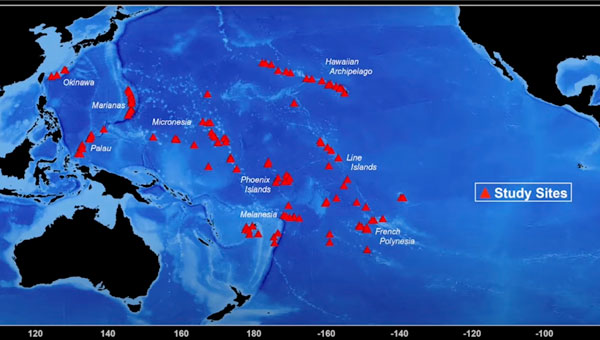
One of the earliest inquiries Sandin and his Scripps colleagues made involved the Line Islands, 11 atolls in the central Pacific Ocean, a thousand miles south of Hawaii. The mix of inhabited and uninhabited atolls belong to the Republic of Kiribati (pronounced “KIR-ee-bas”) and US territories.
Studies of the coral reefs near the uninhabited islands yielded positive results.
“The baseline ecosystems were everything we dreamt of,” Sandin said. “Tons of big sharks, big corals, clean water. We thought it was cool that those conditions still exist.”
When Sandin’s team turned to some of the Kiribati islands with small but growing human populations, the difference was stark. Human activity—particularly the modest amount of fishing done by residents of this small country—had degraded and even destroyed some of the reefs.
The results appeared to speak for themselves. Islands with no human presence had healthy reefs—those with people did not.
As Sandin looked at other islands around the world—including other more distant Kiribati islands—he discovered the strict dichotomy did not hold true. Some inhabited islands that had experienced many generations of fishing still had thriving coral ecosystems. The health of an island’s reef systems was not necessarily determined by human presence.
“I realized the human dimension was more than just binary,” Sandin said. “It wasn’t just presence versus absence. I knew we should start studying the variation of human use, where it works well and where it doesn’t.”
The selection of regions and islands within regions is strategic, with an aim to capture the variability of environmental conditions. (Photo: courtesy of the 100 Island Challenge team at Scripps Institution of Oceanography)
The Challenge Begins
A major challenge of studying ecosystems, even those as spatially concentrated as a coral reef, is the dizzying array of factors that affect their function. Sandin’s team defined 18 types of islands, based on such factors as the size of the human presence and the island’s geography.
The team members decided they should find five island examples of each of the 18 classifications, meaning the project was committed to studying 90 islands. Then they decided that adding 10 islands, bringing the total to 100, would give the study a more impressive pedigree. “We rounded up to make the T-shirts look better,” Sandin joked.
From the beginning, the 100 Island Challenge presented logistic hurdles. Sandin’s team had to research islands for possible inclusion, classify them, and maintain a globally dispersed atlas of candidates. The islands chosen are mostly concentrated throughout the Pacific, the Indian Ocean, and the Caribbean Sea. The team has attempted, whenever possible, to work with residents on each island to both ensure respect for its culture and maximize local knowledge.
“Every island has a story,” Sandin said. “And that’s why we had to go bigger.”
Mapping the Challenge
GIS maps played a key part of building the massive atlas, giving the team members an ongoing reference as they gathered data. The team aimed to visit each island in the study at least twice to monitor changes over time.
GIS also provided a way to determine specific observation sites for every island. From each of these vantage points, researchers can visualize key spatial relationships, including the location of reefs and human settlements, the size and extent of fishing industries, and freshwater sources that flow into the ocean.
The maps promote transparency. Shared with people who live on the inhabited islands, GIS maps help everyone understand the study’s objective of measuring ecological health.
The maps also support the data-gathering process, which includes both low- and high-tech components. Divers swim the reefs, making observations that fall in various categories, such as coral conditions and the amount of wildlife. These categories become individual data layers on the map.
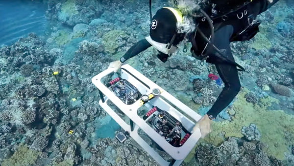
Divers carry still cameras that record one geotagged image every second. This amounts to millions of images added to the map, documenting the conditions of reefs for further study.
A dual-camera rig captures high-resolution images that can be stitched into a 3D composite for ongoing analysis of each reef. (Photo: courtesy of the 100 Island Challenge team at Scripps Institution of Oceanography)
Coral Fights Back
“One of the first things we observed, with the help of image-based mapping products, is that the idea that every coral on the planet is suffering is a complete fallacy,” Sandin said. “What’s actually happening is that every coral on the planet is growing. But in patches, we’re seeing a lot of them die.”
The situation may not be universally dire, Sandin added, but it is urgent.
“Every coral we see is fighting,” he said. “They’re getting hit, site by site, by different stressors, like pollution and overfishing, and some of the hot-water events they can’t recover from. But there is resilience.”
The data-gathering cameras serve a dual purpose. They document reefs that have not been able to recover from the stressors, particularly those linked to climate change. At the same time, the cameras serve to document the resilience. Both objectives help researchers understand how coral can thrive under modern conditions.
Underwater Digital Twins
The amount of data collected by the 100 Island Challenge is staggering. And it’s all feeding into the digital twin.
“Right now, we’re actively involved in finding a way to deal with this petabyte of data, making it transparent and accessible,” Sandin said. “That’s where a lot of these spatial analytic tools and all the creative approaches to visualize data really come into play.”
Thanks to advances in data processing and GIS-enabled imaging, millions of images can be processed quickly. Aided by game engines, computers can stitch together realistic 3D digital twins of the reefs.
Scientists and GIS novices alike can, in effect, explore the reefs in stunning detail. The resolution, which approaches millimeter level, is high enough to see baby coral. The digital twins have also helped scientists understand the dispersal of adolescent and adult coral. GIS tools can even measure the buffering zones around different coral types in various stages of development to see how they interact with each other.
Granting a Voice
For those whose lives are deeply entwined with the reefs, the study’s GIS maps show the coral’s struggle to save itself.
“One of the stories that really struck me was when we were meeting with one of the governors of the southern states in Palau,” Sandin said. “We showed him printed maps and he said, ‘I’m a fisherman, and the fish talk to me. They can tell me what’s wrong. If there are too few fish, I go somewhere else. But the reef has never had a voice.’”
As Sandin recalled, the governor pointed to the map. “This,” he said, “gives the reef a voice.”
“Seen & Heard” is a monthly feature of GPS World magazine, traveling the world to capture interesting and unusual news stories involving the GNSS/PNT industry.
The Texas Attorney General’s Office has filed a lawsuit against General Motors (GM), alleging that the company unlawfully collected and sold driving data from more than 1.5 million Texas drivers. The lawsuit claims that GM gathered detailed information from vehicles manufactured since 2015. Additionally, the lawsuit alleges that GM deceived customers by compelling them to enroll in data collection services during the vehicle “onboarding” process, without fully disclosing how their information would be used. The collected data was reportedly used by third-party companies to generate “driving scores” which were then sold to insurance providers.
3D Scans Reveal Medieval Secrets
Photo: Stichting Grote Kerk Naarden
The Grote Kerk in Naarden, Netherlands, known as the “Sistine Chapel of the North,” is undergoing a 3D scanning project to uncover the secrets of its medieval ceiling murals. A team of researchers from various Dutch universities are collaborating to create a detailed digital 3D model of the church’s barrel vault, covering 700 square meters of painted planks and beams. The project aims to shed light on long-standing mysteries surrounding the artwork’s origins, including the identities of the artists and the precise timeframe of their creation. Researchers will use advanced 3D scanning technology to produce high-resolution digital replicas of the murals, allowing researchers to examine the artwork in extraordinary detail.
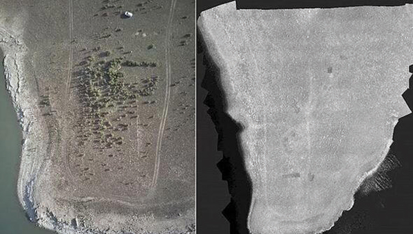
Archaeologists Unearth Hidden Empire
Photo: University of Cádiz
Archaeologists from the University of Cádiz in Spain have discovered 57 Roman Empire-era sites in the Sierra de Cádiz regions, revealed what researchers believe to be an undiscovered part of the Roman empire. The team used multispectral cameras and lidar to detect these hidden sites. The team has begun on-site excavations, including work at the Roman villa of El Canuelo in Bornos, and plans to continue its research to gain a more comprehensive view of Roman settlement in the region.
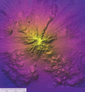
Mapping Secrets of the Seafloor
Photo: SuBastian/Schmidt Ocean Institute via CNN
Oceanographers from the Schmidt Ocean Institute used advanced sonar technology to map a massive underwater mountain in Nazca Ridge, 900 miles off the coast of Chile. The team employed a hull-mounted sonar system on their research vessel, R/V Falkor, to create detailed maps of the seafloor. In addition to sonar mapping, the team used an underwater robot to explore the mountain and surrounding areas. This robotic technology allowed them to document rare marine life, including the ghostly white Casper octopus and unusual siphonophores nicknamed “flying spaghetti monsters”.
Propeller Drones has secured a $7 million contract with the Israel Electric Corporation (IEC) to conduct fully autonomous UAV operations for electrical infrastructure inspection. This project marks an advancement in beyond visual line of sight (BVLOS) drone operations in Israel, as it represents the first government approval for pre-approved BVLOS flights using an unmanned traffic management (UTM) system.
Under the collaboration, Propeller Drones and FlightOps will partner to enhance AI flight capabilities that meet IEC requirements and regulatory standards. Airwayz, a company specializing in low-altitude UTM solutions, has been selected to provide the UTM system for managing drone operations.
Airwayz’s UTM system, developed by experienced air traffic controllers, integrates real-time weather and location data to optimize airspace usage and manage multiple drone fleets simultaneously. This technology allows for efficient rerouting of unmanned vehicles in case of unexpected incidents.
The collaboration seeks to address long-standing regulatory challenges in the UAV industry by demonstrating the ability to conduct large-scale autonomous operations safely and efficiently. According to Propeller, this project has the potential to open up new opportunities for drone applications across various industries, particularly for inspections in hazardous or hard-to-reach areas.
As the system accumulates flight hours and data, it is expected to contribute to the advancement of autonomous BVLOS UAV operations, potentially influencing future regulatory approvals and industry standards. Propeller shared that the success of this project could pave the way for broader adoption of autonomous drone technologies in Israel and potentially serve as a model for other countries.
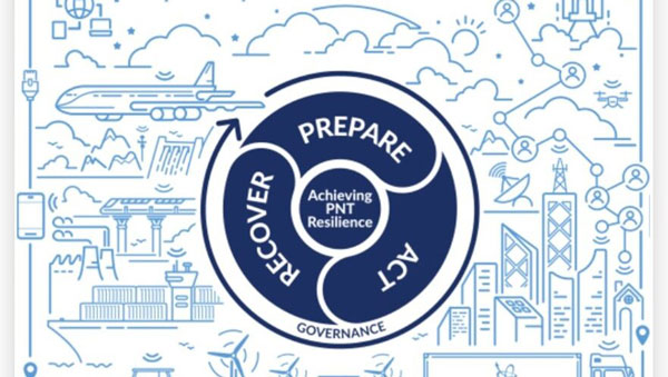
Among them was a funding increase for the National Physical Laboratory’s National Time Centre (NTC) project, from £30 million to £62.7 million, and a plan to have NTC and the first of the nation’s new eLoran towers at initial operating capability by January of 2027.
Plans for all efforts beyond next year were necessarily caveated with “subject to spending review.”
Still, seminar attendees were gratified to hear the minister endorse the ten-point PNT policy framework published by the previous administration in 2023. It was particularly encouraging that he also committed to operationalizing it with implemented systems.
The minister did not mention the UK’s significant investment in quantum research, which was discussed later in the seminar. This research has the potential to contribute to PNT with better timekeeping and inertial and gravimetric sensing. Three quantum hubs — one each in Scotland, the Midlands and the South — are part of this effort.
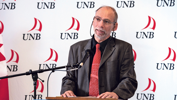
Lord Vallance, UK Science Minister. (Image: 10 Dowing Street)
Lord Vallance and Shabana Haque, Ph.D., the head of the National PNT Office, who spoke later, also mentioned two important non-technology themes.
The first theme was that the PNT office is fully funded, staffed and very active. It was created last year as a cross-government effort and included representation from the Ministry of Defence. In addition to pushing the nation’s PNT efforts forward, the office has been engaged with numerous other governments, including those of the United States, Canada, Australia, New Zealand, Europe, Japan and Korea.
Secondly, the PNT initiatives are necessary for the nation’s resilience and security but will also be a source of economic benefits. This goes beyond PNT resilience, enabling Britain’s economy to function during local and potentially widespread GNSS disruption events. As the nation develops the technology stack to support its own resilient PNT architecture, along with enabling and supporting policies, devices and services will become marketable to others.
Shabana Haque, Ph.D., head of the UK PNT Office, spoke to the RIN at its 2024 UK PNT Leadership Seminar. (Image: RIN)
A sovereign PNT capability that can both stand independently and cooperate with GNSS is becoming increasingly attractive to many nations. Being able to source such a capability from a respected and trusted ally such as Great Britain could make acquiring and implementing such a system much easier for many.
The UK government has been working with several partners to advance its understanding and planning implementation of an eLoran capability. Haque highlighted work with the ESA’s F)!NAVISP program, resulting in the UK’s Roke developing an eLoran antenna for handheld devices. She also discussed the integration of the National Timing Centre’s clock and fiber network with eLoran signals and the development of GNSS/eLoran receivers. Of particular interest to many was an “eLoran Effectiveness Report” that the government commissioned and received from the General Lighthouse Authority’s Research and Development (GRAD) team. GRAD has had extensive experience with the technology, having operated and evaluated a differential eLoran system along Britain’s east coast for more than a year.
In a related move that helped signal the UK’s commitment to the technology, the Ministry of Defence issued a request for information (RFI) about a deployable eLoran capability in September. The RFI indicated that the document was a prelude to an acquisition.
The UK Science Minister also praised the RIN’s work and publication of a series of tools to help explain PNT and the need for resilience to those outside the community. The tools will also help organizations evaluate their readiness for GNSS disruptions.
A PNT Resilience Checklist for organizations to use to self-evaluate their risk from GNSS disruptions.
The RIN recommends that PNT experts use these tools to work with customers, suppliers and partners and act as a “guiding hand.”
The RIN sees these all as a “phase 1 release.” Feedback on the tools is encouraged and should be sent to [email protected] The RIN team say they are eager to know what works, what could be improved, and to receive suggestions for other efforts.
As a “learned society,” the RIN has a significant influence on government policy and direction. Lord Vallance recognized this, saying that “the Royal Institute has played a really important role in recent years to highlight the PNT opportunity and risk, to provide expertise, and to work with government on solutions.”
The RIN’s director, John Pottle, and RIN Fellows Ramsey Faragher, Guy Buesnel and Andy Proctor were all recognized during the seminar for their contributions to the organization’s resilient PNT efforts.
Commercial eLoran to be offered in the UK
Hellen Systems, Inc. and Arqiva have partnered to develop a commercial eLoran service in the United Kingdom. The announcement was made on the Hellen Systems LinkedIn page.
The partners seek to support critical national infrastructure, government, and military users by citing the need for “sovereign, independent, resilient” PNT alternatives.
eLoran is deployed and operating across China and South Korea. Older versions of Loran are operating in Russia and Saudi Arabia. Yet, aside from a single transmitter in the UK being used as a timing signal, operating Loran systems have been off the air in the West since the European system shut down in deference to Galileo in 2016.
In recent years, increasing interference with GNSS signals has rekindled Western interest in the technology. The European Space Agency (ESA) recently sponsored a project that produced an eLoran antenna suitable for mobile devices. Three transmitters are on-air in the U.S., presumably for testing, and the UK Ministry of Defence has issued a request for information, which is expected to lead to the purchase of a deployable eLoran system (the U.S. Air Force operated a deployable capability called Loran-D in the 1970s).
Originally developed and used in World War II, some still view Loran as old technology. Its advocates counter that today’s telephones and televisions are vastly improved over 1940s technology, and the same is true for eLoran over its older Loran-A and Loran-C versions.
A high-power terrestrial system operating at 100kHz, UK demonstrations with differential eLoran in 2014 showed an accuracy of 10 m positioning and 50 ns timing. The positioning accuracy for the previous version of Loran, Loran-C, was approximately 460 m absolute accuracy, 90 m repeatable accuracy and 5 µs.
Hellen Systems’ President, Bridge Littleton, says the partnership is “… excited to bring commercial eLoran to the UK as a unique resilient PNT capability” and cites its advantages as a secure signal able to penetrate deep indoors without the need for an external antenna. The UK frequency regulator, Ofcom, proposed offering commercial eLoran licenses in 2022 and began the process in 2023. Hellen was granted a UK spectrum license for eLoran earlier this year.
The announcement also lists Microchip, Chronos Technology, Ltd, Continental Electronics, and CGI as team members in the project.
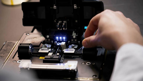
Sodex Innovations, an Austrian company specializing in construction surveying technologies, has unveiled the SDX-4DVision and SDX-Compact machine-mounted terrain mapping systems.
These systems integrate advanced sensor technology and artificial intelligence (AI) driven data processing to create digital twins of worksites while the machine operates. Data is uploaded to the SDX Cloud, allowing for real-time analysis from any location. This allows professionals to monitor evolving site conditions, track inventory through automated volume calculations, and make remote data-driven decisions.
The systems are designed for easy installation on various types of heavy machinery, such as wheel loaders and dozers, making them ideal for construction, mining and civil engineering projects. Their adaptability enables efficient data collection and site monitoring, making them accessible not only to professional surveyors but also to operators and team members who are involved in daily operations.
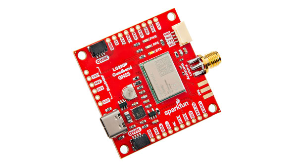
SparkFun Electronics has introduced the SparkFun Quadband GNSS RTK Breakout (Qwiic), which is designed to improve positioning accuracy using the Quectel GNSS module. This module has a compact design and compatibility with the Qwiic connector, making it easy to integrate into various projects. Additionally, it shares the same dimensions, pin layout and connectors as the SparkFun GPS-RTK-SMA Breakout – ZED-F9P, offering a seamless upgrade path for users.
The LG290P module is a quad-band, multi-constellation, high-precision real-time kinematics (RTK) GNSS receiver capable of receiving signals from multiple frequency bands: L1, L2, L5 and L6/E6. It supports all GNSS constellations and offers support for Satellite Based Augmentation Systems (SBAS) — such as Wide Area Augmentation System (WASS) and European Geostationary Navigation Overlay Service (EGNOS) — as well as precise point positioning (PPP) services, including BDS PPP-B2b and MADOCA-PPP. The module is designed to provide precise navigation with fast convergence times and reliable performance through RTCM and RTK corrections.
The module features a built-in NIC anti-jamming unit, which uses advanced algorithms to detect and eliminate interference signals. This can significantly enhance signal reception in challenging electromagnetic environments. The device can be used in complex scenarios, such as urban settings or areas with dense tree cover. Due to its high precision and low power consumption, the SparkFun Quadband GNSS RTK Breakout – LG290P is ideal for applications in intelligent robotics, UAVs, precision agriculture, mining, surveying and autonomous navigation.
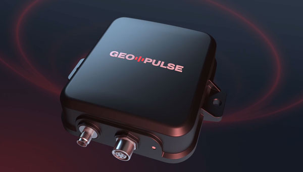
The Global Earth Observation Decentralized Network (GEODNET) Foundation — the organization governing the blockchain-based global navigation network GEODNET — has introduced GEO-PULSE, a GPS navigation device to enhance positioning accuracy for everyday drivers.
With the global vehicle count reaching 1.4 billion, reliable GPS positioning remains a challenge due to obstacles such as parking garages, trees, buildings and atmospheric interference. GEO-PULSE effectively addresses these issues by reducing location errors from 1 to 3 m to less than 0.1 m under typical driving conditions.
GEO-PULSE includes a one-year subscription to GEODNET’s location accuracy service. The device connects seamlessly to iOS and Android devices via Bluetooth, which can improve the accuracy of navigation apps such as Google Maps to provide precise turn-by-turn directions. This connectivity ensures that smartphone users can easily access the improved navigation capabilities offered by GEO-PULSE.
The system is powered by GEODNET’s extensive RTK network, which consists of more than 10,000 validated stations across 100 countries. The device combines sensor fusion with blockchain-powered location correction to deliver centimeter-level navigation accuracy. It supports various automotive applications, including advanced driver assistance systems (ADAS), lane-level navigation and precise positioning for mobility services.
A roundup of recent products in the GNSS and inertial positioning industry from the November 2024 issue of GPS World magazine.
OEM
High-Dynamics MEMS Gyro Designed for precision navigation applications
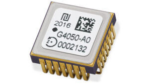
The GYPRO4300 is a high-dynamics MEMS gyro designed for precision navigation applications. It features a ±300 °/s input range, 200 Hz bandwidth and 1 ms latency, making it ideal for dynamic environments. With a bias instability of 0.4 °/h and an angular random walk of 0.07 °/√h, the GYPRO4300 offers high-performance sensing in a compact, digital and low size, weight and power (SWaP) package.
Building on the GYPRO4300, the GYPRO4050 is a specialized north-seeking gyro for low-dynamics applications. This derivative offers 2° azimuth accuracy and is currently in the customer sampling stage. The GYPRO4050 maintains the same miniature package design as its predecessor, ensuring consistency across the product line.
At INTERGEO 2024, TDK showcased a prototype based on an ongoing research and development project. This new development utilizes the same miniature package as the GYPRO4300 and GYPRO4050 but demonstrates ultra-low noise capabilities, achieving an azimuth accuracy of less than 1°. This product is slated for launch in 2025.
This series of anti-jamming antennas comes in two models, PT023 and PT024. The antennas are specifically engineered to operate in challenging environments characterized by complex electromagnetic interference, high-power signals and strong multipath effects.
They are well-suited for scenarios involving low-elevation angle interference, high-power interference sources and radio communication system noise. The PT023 model utilizes multiple array elements combined with amplitude and phase manipulation to achieve spatial radiation shaping. This antenna also incorporates advanced multi-level filtering technology, effectively suppressing out-of-band noise power.
The PT024 model features vertical and horizontal two-dimensional polarization suppressors. This design effectively mitigates the reception of both odd and even LHCP and RHCP signals originating from the rear of the antenna, according to the company. It can also suppress low-elevation multipath signals at the same frequency and out-of-band noise signals. These features seek to enhance the antenna’s performance in complex electromagnetic environments.
Triple-Band RTK Receivers Integrated into ArduSimple’s evaluation boards
The UM980, UM981 and UM982 RTK modules are integrated into the ArduSimple simpleRTK3B series to accelerate high-precision GNSS integration. Supporting Galileo High Accuracy Service (HAS) and fast update rate (50Hz), these devices are suitable for applications that require reliable and precise navigation.
SimpleRTK3B Budget (UM980): The most affordable step into triple-band precision.
SimpleRTK3B Fusion (UM981): Ideal for projects that need GNSS and inertial measurement unit (IMU) sensor fusion or tilt compensation.
SimpleRTK3B Compass (UM982): Designed for setups requiring dual antennas to determine the heading on moving platforms.
ArduSimple has also integrated Unicore UM980, UM981 or UM982 modules into the simpleRTK3B Micro Unicore, part of its compact Micro-format lineup. It is designed for simple PCB integration, which can significantly speed up the development process and the time to market for new products.
The HX-SE402A and HX-SE403A are full-band, full-frequency antennas that integrate GNSS capabilities with a low-profile radio antenna to support 858-878MHz and 902-928MHz frequency bands. This addresses the growing need for devices requiring both navigation and communication functionalities. Harxon’s new low-profile technology achieves the same functionality at 10 mm height, allowing greater versatility in applications that demand precise positioning alongside wireless communication. Additionally, Harxon offers custom tuning services to optimize integration into OEM end-user modules for specific applications.
Advanced Navigation has expanded its Certus product line by introducing the Certus Mini series. This development marks a significant advancement in compact and high-performance navigation technology for field robots, autonomous vehicles and UAVs.
The Certus Mini series comes in three variants:
Certus Mini D: A dual-antenna inertial navigation system (INS).
Certus Mini N: A GNSS-aided INS.
Certus Mini A: An attitude and heading reference system (AHRS).
These lightweight systems, weighing no more than 55 grams (1.9 oz), offer impressive performance and cost-efficiency for their size. The Certus Mini D utilizes dual-antenna GNSS for accurate heading, position and velocity measurements. It operates on L1/L5 multi-constellation GNSS and offers enhanced interference immunity and position accuracy, particularly in challenging urban environments. The Certus Mini series suits various applications, including surveying, agricultural robotics, open-pit mining and asset tracking.
Direct Georeferencing Solution Designed for UAV mapping
The APX RTX portfolio is a new line of direct georeferencing solutions designed for UAV mapping sensors. This system enables high-accuracy mapping across diverse environments, ideal for OEMs and UAV payload integrators. At the core of the APX RTX portfolio is the Trimble CenterPoint RTX technology, which offers both real-time and post-mission direct georeferencing. This capability allows for centimeter-level accuracy without the need for base stations, making it compatible with various sensors, including cameras, lidar and hyperspectral mapping devices.
The DT46 lidar UAV is a fixed-wing system designed for long-distance inspections and the creation of precise digital twins. The DT46 model integrates the YellowScan Voyager lidar with a high-resolution RGB camera. Equipped with a laser scanner with a 100° field of view and an acquisition rate of up to 2400 kHz, the YellowScan Voyager offers optimal point density for demanding projects.
With a flight range of up to 300 km, depending on whether vertical take-off and landing (VTOL) or catapult take-off is employed, the UAV is designed for long-distance operations and can be deployed in under 15 minutes without requiring specialized tools. This autonomous solution offers a seamless end-to-end solution for various industries requiring aerial surveying and inspection capabilities.
GNSS Receiver Featuring a multi-constellation antenna
The Stonex S900 GNSS receiver features a high-accuracy, multi-constellation antenna, a powerful UHF transmitter and the GSM 4G modem for a fully integrated communications choice, combined with a light and modern design. It tracks signals from GPS, GLONASS, BeiDou, Galileo and QZSS satellites. On the S900, two smart hot-swappable batteries can be inserted simultaneously, ensuring a maximum of 12 hours of operation. The power level can be checked and seen on the controller or directly on an LED bar on the battery.
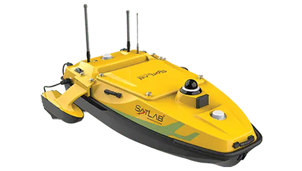
The HydroBoat 1500 is a versatile unmanned surface vessel (USV) driven by four powerful thrusters and designed to carry out underwater topographic surveys of lakes, rivers, reservoirs and other bodies of water. With a payload capacity of 60 kg, it can be integrated with the SatLab HydroBeam M4 portable multibeam echosounder, as well as a variety of other payloads such as side scan sonars and ADCPs. The vessel is IP67-rated and includes a millimeter-wave radar and 360° omnidirectional camera for accurate obstacle detection and safe navigation. It is also equipped with a dual RF and 4G cellular communications system.
The Jupiter Laser RTK integrates GNSS, auto-IMU (inertial measurement unit), laser and dual-camera systems into a single unit. It incorporates a precise green laser that remains visible even in bright daylight. This feature allows for precise measurements of points in hard-to-reach, signal-blocked or potentially hazardous locations. It also features a night vision camera, allowing users to see feature points even in low-light conditions.
The RTK system’s laser range is up to 50 m, making it suitable for challenging surveying environments. It incorporates visual technology to offer surveyors an immersive experience during surveying and stakeout operations, improving working efficiency and productivity.
EchoONE combines Teledyne’s lidar and camera technology with Inertial Labs’ remote sensing payload instrument (RESEPI). EchoONE is designed for industries requiring precise aerial surveying and mapping solutions, such as land surveying, electric utility vegetation management, asset modeling, as well as transportation and infrastructure projects. Users can create detailed 3D models for infrastructure and asset management, offering valuable insights for maintenance and planning. EchoONE also generates fully undecimated georeferenced point clouds in real time, which allows for in-field verification. This capability is complemented by rapid post-processing through RESEPI’s “one-click” PC-Master Pro solution.
The i83 Pro is an inertial measurement unit (IMU) real-time kinematic (RTK) GNSS receiver. This receiver combines GNSS capabilities with extensive compatibility options to address the diverse needs of surveying, construction, and mapping professionals. It incorporates CHCNAV’s third-generation GNSS antenna and the latest iStar algorithm, designed to boost GNSS signal tracking efficiency by 30%, according to the company. With 336 channels supporting GPS, GLONASS, BeiDou, Galileo and QZSS constellations, it can achieve centimeter-level precision rapidly, even in challenging environments.
The i83 Pro supports various GNSS surveying modes, such as RTK Networks NTRIP and UHF base-rover configurations. It features an IP68-rated enclosure for dust and water protection, a compact and lightweight design for enhanced portability, a high-resolution color display for clear status information and a 20-hour battery life for continuous operation in rover mode.
LP360 Land is designed to process lidar, GNSS and SLAM data from handheld sensors, particularly the TrueView GO handheld scanner. It features a GIS interface that allows users to combine various geospatial datasets and offers SLAM point cloud processing capabilities. Additionally, LP360 Land includes advanced visualization tools that support multiple synchronized windows for 2D, 3D, profile and immersive views.
Its coordinate system management includes datum and projection transformations. The software also offers quality assurance and control (QA/QC) tools, along with data editing and cleaning functionalities. Users can perform manual and automatic registration of point clouds and utilize an image explorer for contextual analysis by linking point clouds to photos, which allows for the generation of accurate and colorized point clouds even in GPS-denied environments.
Advanced Navigation and MBDA have partnered to co-develop a resilient navigation system that incorporates MBDA‘s NILEQ absolute positioning technology.
The collaboration aims to provide robust absolute positioning for a variety of airborne platforms, enhancing navigation reliability in both civilian and military sectors. The joint effort is part of a broader initiative to boost research and technology development between the United Kingdom and Australia, aligning with the objectives of AUKUS Pillar 2 — a component of the security partnership between Australia, the UK and the U.S. in September 2021. The partnership includes informed decision-making, strategic autonomy and heightened combat efficiency in the face of emerging threats.
This partnership underscores the importance of developing navigation technologies that are resilient against interference, especially in an era marked by increasing geopolitical tensions and electronic warfare threats such as GPS jamming and spoofing.
NILEQ technology utilizes neuromorphic sensors to identify and compare terrain fingerprints, taking inspiration from biological change detection processes. This sensing technology captures data on changing terrain as an airborne system flies over it, matching this data to an existing database of the Earth’s surface. As a result, systems such as UAVs can achieve a precise position fix on land using a passive solution that is resistant to interference, which enhances the safety of beyond visual line of sight (BVLOS) operations.
The collaboration will conclude with a real-world demonstration of the NILEQ technology in Australia, validating its effectiveness in delivering resilient navigation solutions.
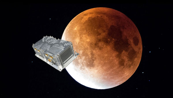
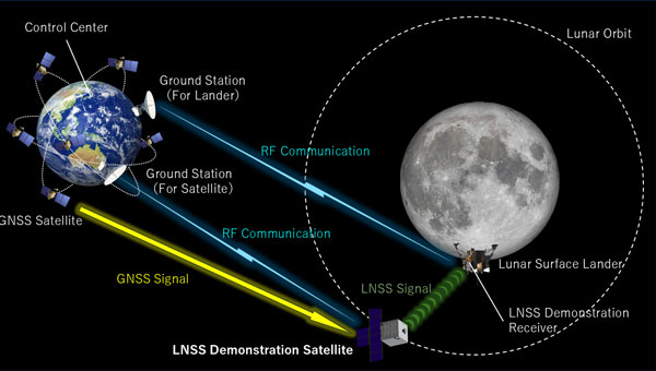
SpacePNT and European Engineering and Consultancy (EECL) have completed the final presentation of the European Space Agency (ESA)-funded Earth Moon GNSS Spaceborne Receiver for In-Orbit Demonstration project. This project aimed to develop and qualify the NaviMoon GNSS spaceborne receiver for lunar applications.
Currently, geostationary orbit (GEO) and geostationary transfer orbit (GTO) missions utilize GNSS signals for in-orbit positioning, navigation and timing (PNT). NASA’s Magnetospheric Multiscale (MMS) mission has shown that GPS signal tracking is possible up to 150,000 km from Earth’s surface, which is half the distance to the Moon. ESA has assessed the feasibility of extending GNSS use for lunar missions through studies under its General Studies Program (GSP). These studies indicate that lunar navigation using GNSS might be feasible if specific high-sensitivity techniques are implemented in GNSS spaceborne receivers.
NaviMoon is an advanced version of SpacePNT’s spaceborne GNSS receiver NaviLEO. It supports dual constellation (GPS and Galileo) and dual frequency (E1/L1 and E5a/L5) operation. The receiver is based on commercial off-the-shelf (COTS) components with radiation mitigation measures. It features fast digital signal processing in hardware and handles acquisition, tracking control and navigation in software. NaviMoon also includes a dedicated microcontroller for interface management and can be reprogrammed in flight.
EECL contributed to the project by providing the GNSS reflectometry front end for remote sensing. The company developed the lunar low-noise amplifier (LNA), which is crucial for detecting ultra-weak signals at lunar distances.
The NaviMoon project involved comprehensive testing, including mechanical tests, thermal vacuum tests, electromagnetic compatibility testing and a full GNSS test campaign. The presentation shared that it is a robust platform with high radiation tolerance and environmental performance. It aims to deliver less than 100 m accuracy at Moon distance while reducing dependence on costly Earth infrastructure for orbit determination.
This project was funded under ESA’s NAVISP program, which is dedicated to European industrial technology innovation in the PNT sector. It also received support from ESA’s GNSS Science Advisory Committee (GSAC).
The November 2024 issue of GPS World features Professor Richard Langley’s 300th and final “Innovation” column. His first one appeared in the January/February 1990 issue, the magazine’s very first. In celebration of Richard’s decades-long contribution to GPS / GNSS / PNT, we are publishing a selection of testimonials and photos (below) from some of his colleagues and friends, gathered by his former students Sunil Bisnath and Attila Komjathy.
Recollection from 1990, Trinidad – University of the West Indies
It was 1990, late into a — thankfully warm — night in Trinidad. I still remember that moment vividly — the sense of anticipation mixed with skepticism. A small group of us, undergraduates from the Land Surveying Department at the University of the West Indies, were standing outside in the middle of the night. We were waiting, eyes fixed on the sky, holding our breath for signals that were promised to come — signals that the foreign professor, Richard Langley, assured us would soon appear and change our lives forever. Back then, GPS satellites were in scarce supply. Only a few were up there, and getting a signal was not guaranteed. Richard’s confidence, however, was unwavering. He was convinced that this technology — this new way of understanding our position in the world — would revolutionize everything we knew about land surveying and navigation. That year was my last in Trinidad. I left with memories of those nights under the stars, waiting for those elusive signals that did eventually come. Over time, I’ve met Richard at numerous Institute of Navigation events, and like the GNSS constellations, we have continued to grow and evolve yet remain united by our passion for a technology that continues to grow beyond our wildest expectations. – Professor Allison Kealy, FRIN, GAICD Director, Innovative Planet Research Institute Professor, Civil Engineering Swinburne University of Technology
I was introduced to Richard more than 15 years ago. I learned quickly that he is not only a man of renown earned by his overarching knowledge on almost all aspects of satellite navigation, but also a man of action. Not surprisingly and probably well known, he was one of the first researchers investigating and improving the Precise Point Positing (PPP) technique. It is less well known that he was also an early adopter of the PPPPP concept. When asked what the abbreviation stands for, Richard would answer with a twinkle in his eye: “Proper preparation prevents poor performance!” I had the honor of seeing Richard in action during a joint measurement campaign where we applied both concepts. We wanted to collect observations of the new Galileo test satellites GIOVE-A and -B to use them for precise positioning. It happened that they had favorable visibility during the ION GNSS conference in Savannah, Georgia, in September 2009. So, we mounted a bunch of equipment onto Richard’s rental car and off we went through the streets, after carefully making sure that the GIOVE satellite were actually visibile and reference product generation back home in Munich, Germany, and New Brunswick, Canada, was properly working. Richard was steering the automobile in rapid turns on the parking lot to get some serious phase wind-up effect going. I was so concentrated on the data logging that I did not even feel the urge to throw up. The measurement collection went well and the data ended up being used for a joint publication the following year, potentially one of the first papers jointly using GPS and GIOVE. PPP using the PPPPP rule — there you go! – André Hauschild, Ph.D., Researcher German Aerospace Center (DLR)
I first knew of Richard Langley through his Innovation column in GPS World. It was largely through this column that I acquired my basic knowledge of GPS. The columns were always so clear and so well written. It was a time of rapid change — the Internet, rapid data transfer between sites, and many, many other challenges. I received a grant to fund the Westford Water Vapor Campaign, and along with Arthur Niell of Haystack Observatory, we set out borrowing as many receivers, radiometers, and radiosondes as we could. Thus began my first “international” phone call to Richard Langley (the University of New Brunswick is, of course, in a foreign country) asking him to borrow receivers. Richard, perhaps because he did his postdoc here at MIT, and spent many hours out at Haystack, was more than amenable. He not only lent us three receivers but also a foreign visitor, Pieter Toor from Delft, and Virgilio Mendes, one of his graduate students. From them I learned immeasurably about the troposphere and water vapor distribution. The Westford Water Vapor Experiment was an important series of measurements, that helped us realize the potential of GPS before it was fully recognized by the community. Later, I was invited to join Jack Klobuchar and the Canadian equivalent of the FAA to fly to the University of New Brunswick, where I met Attila Komjathy for the first time. Later I also came to know Sunil Bisnath. Richard Langley trained a remarkable set of students, many (if not most) of whom have gone on to stellar careers. – Anthea J. Coster, Ph.D., Assistant Director; Principal Research Scientist MIT Haystack Observatory
Professor Richard Langley is truly one of the masters of the GNSS community. He has been the mainstay of knowledge, scholarly activity, and mentoring to scholars and students for decades. His friendly demeanor and wiliness to help out wherever he can, makes him a pleasure to talk to and collaborate with. I look forward to seeing Richard at ION technical conferences with that big smile on his face and observing his love for and devotion to the art and science of navigation. – Professor Chris G. Bartone, Ohio University
Richard and I are of the same “vintage” (date/time: referring to the period when we ramped up our work and study activity) and “terroir” (space/environment: referring to discipline background, circumstances and opportunities). We were both educated as surveyors, we both became academics, and we both mastered the arcane applied science field of geodesy. Geodesy in the 1970-1980s was undergoing a revolution driven by advances of the Space Age, reflected in the increasing use of Earth-orbiting satellites for precise positioning, mapping, gravity field determination, sea surface mapping, and much more. Richard and I are of the generation of geodesists in the 1980s that recognized — before any other engineering or science discipline — that GPS was going to change our world in profound ways. We pioneered its use for geodetic surveying (at the sub-cm accuracy level) even before GPS was declared “fully operational” in the mid-1990s. We had more than a decade head-start in understanding the principles of differential GPS, of carrier phase-based static positioning, and of the system itself. It is a head-start that continues to this day. We developed the first university GPS courses, wrote the first textbooks, educated the first generation of GPS scientists, developed the first measurement processing software, and helped revolutionize the practice of navigation. Although GNSS is considered the most important geoscientific technology that we use today, precise GNSS-enabled positioning has impacted so many other professional, scientific and social applications. With the founding of GPS World’s “Innovation” column, Richard launched an amazing educational and industry outreach service. Those articles tracked the advances in GPS/GNSS technology and applications. While there are still some of our geodesy generation making contributions to their discipline, Richard has continued to promote GNSS for 35 years in a unique way, through his careful curation of “Innovation” column articles. They remain a joy to read. Richard, keep up this great service to the positioning, navigation and timing (PNT) community. – Professor Chris Rizos, President International Union of Geodesy & Geophysics (IUGG) School of Civil & Environmental Engineering UNSW Sydney Australia
I have had the pleasure of knowing Richard since the mid 1980s, when we were part of the team that produced the first and highly successful book on GPS, namely the Guide to GPS Positioning. We have interacted regularly ever since. I have always appreciated reading Richard’s papers for their clarity, thoroughness and novel content. His Innovation column in GPS World for 35 years is now a GPS classic that post-graduate students and experts alike learn from and enjoy reading. Richard has deservedly received major awards for his numerous and outstanding work. Richard, I hope that we will continue to benefit from your contributions for years to come. – Professor Gérard Lachapelle, University of Calgary
Despite being a highly respected leader in the field of PNT, Richard remains a humble human being. He sets a high standard for his work and is generous with his time to catch even the smallest errors in research papers. It has been a great pleasure to get to know him and to have the opportunity to work with and learn from him. He is an inspiration and a role model for me. – Professor Jade Morton, Ph.D., Helen and Hubert Croft Professor Ann and H.J. Smead Aerospace Engineering Sciences Department University of Colorado Boulder
I have had the privilege of knowing Prof. Richard Langley for my entire career in PNT and have always been greatly impressed with his wealth of knowledge and research on high-precision applications of GPS. I first met him in the late 1980s at meetings of the Civil GPS Service Interface Committee (CGSIC) and the early Institute of Navigation conferences on GPS in Colorado Springs. When I joined the navigation team at the U.S. Department of Transportation as a young engineer in 1988, we all had copies of The Guide to GPS Positioning, that Prof. Langley co-authored with David Wells and that we greatly utilized! Since that time, I have enjoyed interfacing with Prof. Langley at ION conferences and serving with him on the ION Council. I have learned so much from his research, including his development of the UNB-RTK system and the study of atmospheric effects for the FAA Wide Area Augmentation System (WAAS), as well as the very informative articles he has published in GPS World! – Karen Van Dyke, Director, Positioning, Navigation, and Timing U.S. Department of Transportation
The 35-year anniversary of Richard’s Innovation column in GPS World seems amazing, also recalling the recent 30-years celebration of the International GNSS Service (IGS), which to many of us seemed like an eternity. This is not surprising, however: from the Guide to GPS Positioning, co-authored by Richard (my first GPS handbook when I started learning about GPS in November 1989 at ICC, Barcelona); to the knowledge, motivation and empathy we have always enjoyed when meeting Richard in so many different workshops (ION, Beacon Satellite…) and collaborative works (e.g., IERS Conventions…). For him, this is normal. CONGRATULATIONS. – Professor Manuel Hernandez-Pajares, UPC-IonSAT, IEEC-CTE Head of the UPC-IonSAT Research Group, IGS Associate Analysis Center Department of Mathematics, Universitat Politècnica de Catalunya, Barcelona, Spain
Professor Langley has been a vital contributor to the Institute of Navigation (ION) for four decades, serving in various volunteer and leadership capacities. In his most recent role, Richard has served as the Editor-in-Chief of NAVIGATION, The Journal of the Institute of Navigation, our esteemed peer-reviewed technical publication. Since taking on this role in 2020, he has expertly led a team of associate editors, guiding NAVIGATION through a transformative period as it transitioned from a traditional print publication to a fully open-access journal. Under his leadership, the journal has seen a remarkable increase in its impact factor, most recently rising to 3.1. Beyond his editorial work, his most important contribution lies in his mentorship. He has profoundly influenced the next generation of GNSS experts, nurturing countless graduate students through ION’s programs and initiatives while fostering their professional development. His dedication to education and commitment to innovation has enriched our community. We deeply value our ongoing collaboration with Richard. His unwavering commitment, expertise, and passion for GNSS and ION have made him an integral part of our organization. It is a privilege to work alongside such a dedicated professional. – Lisa Beaty, Executive Director Institute of Navigation
Like many others, I look back to a long friendship with Richard, who’s always been a mentor and model for me. His sharp mind, paired with a distinct sense of very British humor makes each meeting with him a source of inspiration and memorable experience. From gentle spelling and grammar corrections in manuscripts to advice and leadership in GNSS-related projects, he always offers a helping hand, contributes in-depth knowledge and one or another personal anecdote. From him, I learned the “six P” rule: proper planning and preparation prevents poor performance. This unforgettable saying not only reflects the rigor Richard applies to his work, it also provided me a guideline that I’m now passing on to my own students. – Oliver Montenbruck, Ph.D. Head, GNSS Technology and Navigation Group German Aerospace Center (DLR)
I would like to say, as someone who is not his direct advisee, I’ve always appreciated his avuncular spirit, mentorship, and encouraging guidance over the years. I join you in toasting to him and his successes in growing and connecting the navigation community over his many years of service, in addition to all his technical achievements and innovations. Cheers to Richard! – Professor Seebany Datta-Barua Illinois Institute of Technology
Richard has been a highly respected leader in the GNSS community for more than 30 years, making his mark as a creative innovator, a mentor for generations of future leaders and contributors to the advancement of GNSS, and as an insightful and patient teacher. The well-worn copy of his Guide to GPS Positioning on my bookshelf has helped me and countless students quickly pick up the basics, while his cheerfully engaging series of “Innovation” columns in GPS World explored every feature, misconception, novel application, mystery, and intricacy of GNSS. And, he literally put Fredericton on the map for the GNSS community. – Penina Axelrad, Distinguished Professor University of Colorado
When I became GPS World’s managing editor, in 2000, my exposure to GPS was limited to a few journal articles I had read as a graduate student in international security at MIT in the mid-1990s. Much of my education on the subject during the steep learning curve that followed came from Richard’s “Innovation” column. Also, as his liaison to the magazine, I was responsible for entering his many, meticulous edits to each column, which, at the time, he sent me by fax. Nearly a quarter century later, Innovation is still my favorite section in the magazine. I will miss it greatly.” – Matteo Luccio, Editor-in-Chief, GPS World
Good memories of my collaborations with Richard span a long time to almost the operational beginnings of GPS. Examples range from our collaboration on the Handbook for GNSS to our shared lecturing at the “GPS for Geodesy” school, in Delft, 1996. I always experienced with admiration Richard’s encyclopedic knowledge and excellent lecturing and writing skills. The only one thing that I would have wished for is that Richard would have turned his excellent Innovation columns in GPS World into a book. That would have been a bestseller for sure. – Professor Peter Teunissen Delft University of Technology
I first met Richard in 1982 while a postdoc at MIT about the time that he joined the faculty at the University of New Brunswick, after his postdoc in the same MIT department. After research in VLBI and SLR, he was one of the early pioneers in the development of GPS for precise positioning applications, with contributions in several areas, such as signal multipath and tropospheric refraction. We both taught at the International School of GPS for Geodesy in Delft, first in 1995, and contributed to the resulting monograph, GPS for Geodesy. I have a vivid memory of drinking beer with him in a bar in Delft after a long day at the school. – Professor Yehuda Bock Scripps Institute of Oceanography
I first met Richard shortly after joining MIT as a Ph.D. student in 1979. He was a postdoctoral fellow for two years with MIT’s Department of Earth and Planetary Sciences, carrying out research in geodetic applications of lunar laser ranging and very long baseline interferometry after completing his Ph.D. at York University, Toronto. His research at MIT led to the discovery of a 50-day oscillation in atmospheric angular momentum and length of day determined from lunar laser ranging data. This work was published in 1981 in Nature. Richard has been publishing impactful papers on important topics since very early in his career. His contributions to GPS World’s “Innovation” column have followed that trend. – Professor Thomas Herring Massachusetts Institute of Technology
I did not have tons of personal contact with Richard, but the contact I did have showed me that he was a man of very high standards, and it’s clear that his dedication to the field is enormous. The combination of high standards and selfless dedication is what moves us forward. He also attracted and produced a cadre of highly talented and successful researchers that continue to have an enormous impact on the field. These are great things! – Anthony J. Mannucci, Ph.D. Deputy Manager, Tracking System and Applications Section Jet Propulsion Laboratory
Years ago when assembling material for my advanced GNSS signal processing course here at the University of Texas, I found that for several topics Richard’s “Innovation” column had just the discussion and analysis I was looking for my students to learn. His writing is unfailingly engaging and lucid! What a gift to the community his “Innovation” column has been! Richard is an amateur radio enthusiast. Many of the insights on radio in his columns are backed up by his practical experience with long-distance ham radio communications. He’s connected with people from continents away from his home base in New Brunswick. – Professor Todd E. Humphreys, Ashley H. Priddy Centennial Professorship in Engineering Dept. of Aerospace Engineering and Engineering Mechanics The University of Texas at Austin
I first met Richard Langley in 1989 at what was my first ION Satellite Division meeting. It was a young-looking crowd, but we both could pass for young men then. I also met another young man by the name of Glen Gibbons who was circulating among the attendees to gauge interest in a trade magazine devoted to GPS that he was thinking of launching. GPS World played an important role in my career as a GPS engineer, particularly for its “Innovation” column, edited by Richard. His early columns (such as “Why is the GPS Signal So Complex?”) are classics of cogent writing and served as an inspiration to me when I tried my hand at writing about GPS. His skills as an editor, and his generosity to help a friend avoid embarrassing himself, proved even more helpful to me. My debt to Richard has grown over the years, and so has my admiration and affection for him. – Professor Pratap Misra, Professor of the Practice of Mechanical Engineering Tufts University
When I googled “Richard Langley,” just for fun, I got multiple returns — among them “professional football player,” “state politician,” “actor,” “model maker” and I thought for a while that those are Richard’s other personalities that I didn’t know about. Well, a slight refinement of my search “Richard Langley, geodesy” got me what I was looking for — pages and pages on the accomplishments of the Richard Langley as one of the first scientists who recognized the great potential of GPS as a scientific and civilian tool and an everyday commodity, research publications that all GPS “insider wannabees” have read and memorized, and articles documenting his commitment to GPS World, especially its “Innovation” column — which has long been one of my favorite reads. I congratulate Richard on the 35th anniversary of this outstanding column! – Professor Dorota Grejner-Brzezinska, Vice-Chancellor for Research at University of Wisconsin-Madison
Richard and I first met when I spent a post-doc year at the University of New Brunswick in 1983/84. The nucleus of the Bernese GPS software emerged from this visit. Richard and I became friends and stayed in contact after this visit. We met last time in Bern at the 2024 IGS Symposium commemorating 30 years of the International GNSS Service. What I admire most about Richard is his scientific breath and his at times artistic use of the English language — he announced his visit to Bern with the words “I will be there if I don’t ‘keel over’ between now and then.” – Professor Gerhard Beutler University of Bern
Richard, Fredericton, New Brunswick, 2014.
Andrew Morley, Richard, Anthony van der Wal, Katrina van der Wal, Denise Santos, Marcelo Santos, Katie Komjathy, and Attila Komjathy, Fredericton, New Brunswick, ~1994.
Bill Boucher, Katie Komjathy, Richard, and George Dewar, Halifax Nova Scotia, ~1994.
Attila Komjathy, Sunil Bisnath, Jade Morton and Richard, Ann and H.J. Smead Department of Aerospace Engineering Sciences, University of Colorado Boulder, Colorado, 2023.
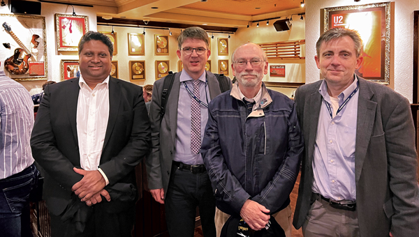
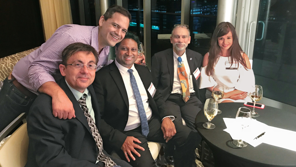
Sunil Bisnath, Steffen Schön, Richard and Attila Komjathy, Denver, Colorado, 2022.
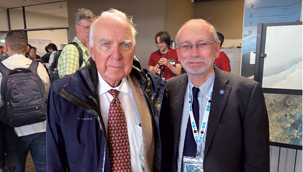
Gerhard Beutler and Richard, IGS Symposium and Workshop, Bern, Switzerland, 2024.
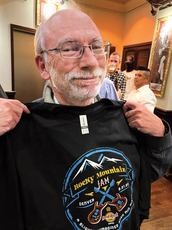
Richard, ION GNSS+ 2022 conference, Denver, Colorado, 2022.
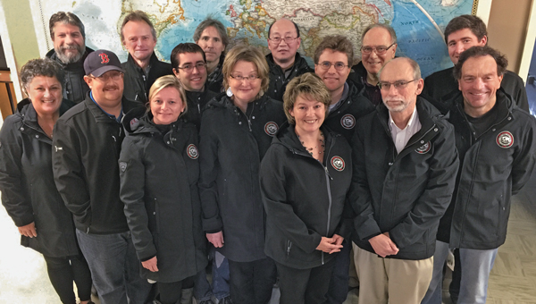
Department of Geodesy and Geomatics Engineering staff at the University of New Brunswick: Lorry Hunt, Marcelo Santos, Greg Smith, Peter Dare, Michelle Ryan, Robert Kington, David Fraser, Monica Wachowitz, Yun Zhang, Sylvia Whitaker, Emmanuel Stefanakis, David Coleman, Richard, Ian Church and Terry Arsenault, Fredericton, New Brunswick, Canada, 2016.
Attila Komjathy and Richard, Nagycenk, Hungary, 1991.
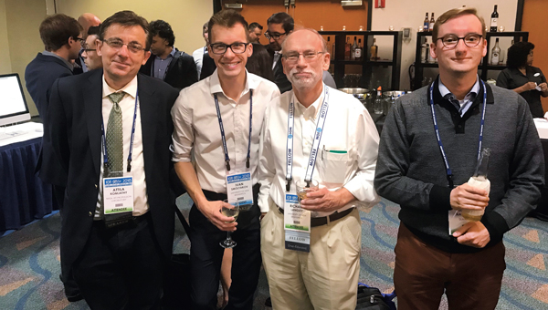
Attila Komjathy, Sunil Bisnath and Richard, IGS Symposium and Workshop, Bern, Switzerland, 2024.
GPS-for-Geodesy lecturing team. Top-row, left-to-right: Richard, Oscar Colombo, Yehuda Bock, Gerhard Beutler, and Alfred Kleusberg. Bottom-row, left-to-right: Hans van der Marel, Geoffrey Blewitt, Clyde Goad, and Peter Teunissen, Delft, The Netherlands, 1996.
Richard, Gary McGraw, Penina Axelrad, Frank van Graas, Dorota Grejner-Brzezinska, Oliver Montenbruck, John Betz, Todd Humphreys, Bradford Parkinson, Jade Morton, Terry Moore, Boris Pervan, Todd Walter and Frank van Diggelen. ION GNSS+ 2023 conference, Denver, Colorado, 2023.
Attila Komjathy, Rodrigo Leandro, Sunil Bisnath, Richard and Fanni Komjathy, ION GNSS+ Miami, Florida, 2018.
Attila Komjathy, Ivan Smolyakov, Richard, and André Hauschild. ION GNSS+ 2010 conference, Portland, Oregon, 2010.


 High-Dynamics MEMS Gyro
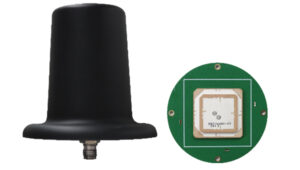 Anti-Jamming
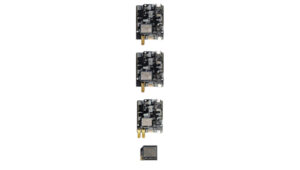 Triple-Band RTK Receivers
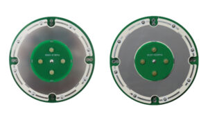 OEM GNSS Antenna
 OEMs
OEMs Direct Georeferencing Solution
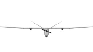 Fixed-Wing UAV
 GNSS Receiver
 USV
USV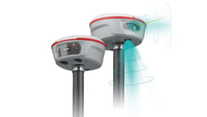 Laser RTK
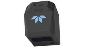 UAV Lidar Scanner
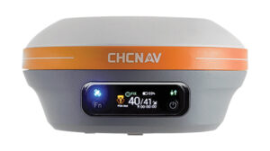 Receiver
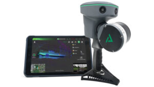 Software Solution