With GeoLearn’s abilities, MSPS can provide more options to its members who seek continuing education opportunities. By accessing the online learning portal through the MSPS website, professional land surveyors and their staff can improve or refresh their knowledge base of land-surveying practices relevant to Missouri.
According to GeoLearn, the online interface is easy to use, affordable, and provides a tool to inventory all course work taken through GeoLearn for easily tracking continuing education credits earned. This is a modern way to get a quality service and course content that is specifically addressed to Missouri-licensed land surveyors. The coursework is available with no delay once a person is signed up for the presentation they select. There is also the convenience of being able to enter the portal and get continuing education credits anytime, at any place.
“We’re happy to partner with MSPS in providing online training,” said GeoLearn CEO Joe Paiva. “We’ve already collaborated with them, Seiler and Mo DOT in producing a free course for the public, on how to use the Missouri DOT Real Time (GPS) Network; many users, not just surveyors, have questions about the network, how they can access it and use it.” In addition, MSPS has launched two Missouri-specific courses on survey minimum standards, presented by J. Michael Flowers, PLS.
The Missouri Society of Professional Surveyors is the premier professional association in Missouri for those engaged in the practice of land surveying. Its purposes include representing the interests of, and to be the primary voice for, the surveying profession in the state; elevating the standards of practice for land surveying in the state for the benefit the public; supporting the general public and offices of public records by encouraging the delivery of superior land surveying services that upgrade land records; sponsoring legislation and educational programs beneficial to the public and land surveyors; and striving to improve the professional recognition of the profession by the public and other related professions.
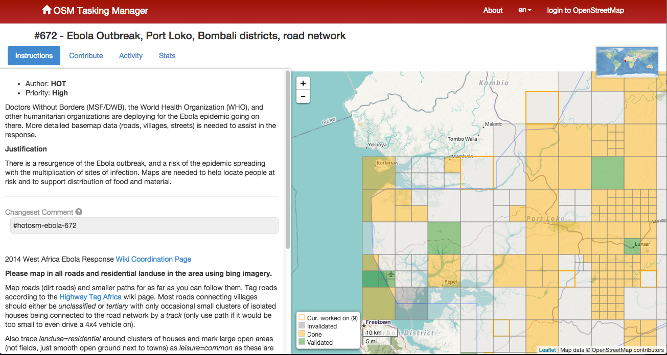
The American Red Cross Geographic Information System team is enlisting volunteers to help map areas in Africa hard hit by the ebola virus. The Red Cross is attempting to get ahead of the virus by creating detailed maps of rural towns and villages so officials can track the deadly virus as it spreads, according to ABC News. Volunteers have been drafted to study satellite imagery of homes, schools and villages.
Once the maps are detailed, they are sent to Red Cross partners, including Doctors Without Borders and the International Federation of the Red Cross and Red Crescent, which are working in the field to treat victims and stop the outbreak.
The maps are useful in a variety of ways. With better maps, epidemiologists can track where the disease is spreading, and find sick individuals in remote areas. In a specific example, the World Health Organization requested that GIS professionals look at cemeteries, a key location where infection can occur.
The volunteers have been able to fine-tune maps of remote villages which are used by relief workers trying to navigate rural roads, towns and neighborhoods. For instance, the original map for Guéckédou, Guinea, a town near the epicenter of the outbreak, showed just nine roads. After volunteers studied satellite photographs, they were able to add hundreds of roads and streams.
The project goes both ways, as people working in the remote areas send in GPS locations for villages that have never been mapped before. The maps can be vital to fight Ebola in rural areas where road signs, maps and GPS locations are scarce.
A GIS expert helps the Doctors without Borders epidemiological team respond to the ebola outbreak. Photo: American Red Cross Geographic Information System
The effort is similar to an effort by MSF-Switzerland (Doctors without Borders) in March 2014, which deployed a dedicated GIS officer to Guinea in response to the Ebola outbreak in the south of the country. During his eight-week his mission, the GIS officer produced 109 maps for this previously very poorly mapped area. The maps included basic orientation maps that showed roads, landmarks and villages but also specialized maps that visualized population density or the spread of the disease.
With the help of the newly created database and subsequently produced maps, the GIS officer was able to pinpoint the exact location of villages and identify villages that had the same name but were in different parts of the prefecture. Based on this information, MSF program staff were able to respond to the outbreak faster, in a more targeted way and with fewer resources.
Plus, the weekly mapping of confirmed and suspected Ebola cases helped translate the progression of the epidemic from technical data into an easy-to-grasp map. As a result, staff at all levels had a better understanding of the emergency.
Just like the American Red Cross is currently doing, the GIS unit crowdsourced certain mapping tasks, which resulted in a substantial number of overview maps created with the help of close to 250 online volunteers. The volunteers helped to map previously unmapped cities and roads within a few days, and at a granular level, mapping individual buildings. These overview maps then became the foundation of many maps that the GIS officer created for the outbreak response.
To learn more about that project, download a PDF report, “GIS Support for the MSF Ebola response in Guinea in 2014.”
For historical context, Esri’s ArcGIS is provides a story map that shows previous ebola outbreaks in Central Africa, 1976–2013, as well as the current outbreak. The interactive story map explores the first known contact with the disease in 1976 in the Democratic Republic of Congo and every outbreak since then, including the ongoing crises in Guinea, Liberia, Sierra Leone, and Nigeria. Users get basic statistics about each outbreak and browse reports from different agencies, all directly within the map.
The third IRNSS satellite heads into orbit. Photo: ISRO
India has successfully launched IRNSS-1C, the third satellite in the Indian Regional Navigation Satellite System (IRNSS), early on October 16. The satellite was launched aboard the Polar Satellite Launch Vehicle (PSLV) C26 at 2002 GMT (4:02 p.m. EDT) from Satish Dhawan Space Centre, Sriharikota.
After the lift-off of PSLV-C26 with the ignition of the first stage, the important flight events — namely, stage and strap-on ignitions, heat-shield separation, stage and strap-on separations and satellite injection — took place as planned, according to the Indian Space Research Organization (ISRO). After a flight of about 20 minutes, 18 seconds, the IRNSS-1C satellite, weighing 1425 kg, was injected to an elliptical orbit of 282.56 km x 20,670 km, which is very close to the intended orbit.
After injection, the solar panels of IRNSS-1C were deployed automatically. ISRO’s Master Control Facility (at Hassan, Karnataka) assumed the control of the satellite. In the coming days, four orbit maneuvers will be conducted from the Master Control Facility to position the satellite in the geostationary orbit at 83 degrees East longitude.
IRNSS-1C is the third of the seven satellites constituting the space segment of the Indian Regional Navigation Satellite System. IRNSS-1A and IRNSS-1B, the first two satellites of the constellation, were successfully launched by PSLV on July 02, 2013, and April 04, 2014, respectively. Both IRNSS-1A and 1B are functioning satisfactorily from their designated geosynchronous orbital positions.
IRNSS is an independent regional navigation satellite system designed to provide position information in the Indian region and 1,500 kilometers around the Indian mainland. IRNSS will provide two types of services, namely, Standard Positioning Services (SPS) — provided to all users — and Restricted Services (RS), provided to authorized users.
A number of ground stations responsible for the generation and transmission of navigation parameters, satellite control, satellite ranging and monitoring, etc., have been established in as many as 15 locations across the country.
This is the 27th consecutively successful mission of the PSLV, which used the XL configuration of PSLV for the seventh time. Honorable Minister of State (Space) Jitendra Singh, witnessed the launch from the Mission Control Centre at SDSC, Sriharikota.
The next satellite of this constellation, IRNSS-1D, is scheduled to be launched by PSLV in the coming months. The entire IRNSS constellation of seven satellites is planned to be completed by 2015.
Below is a slideshow with images from the launch preparations and launch.
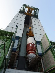
Nozzle end segment of PSLV-C26 being hoisted for assembly. Photo: ISRO
Nozzle end segment of PSLV-C26 being hoisted for assembly with launch pedestal. Photo: ISRO
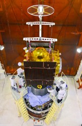
IRNSS-1C being assembled with PSLV-C26 in the mobile service tower. Photo: ISRO
PSLV-C26 inside the mobile service tower prior to satellite integration. Photo: ISRO
IRNSS-1C being assembled with PSLV-C26. Photo: ISRO
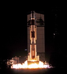
The PSLV-C26, carrying IRNSS-1C, lifts off. Photo: ISRO
Assembly of PSLV-C26, third and fourth Stages. Photo: ISRO
The third IRNSS satellite heads into orbit. Photo: ISRO
Eric Gakstatter, contributing editor of GPS World and Geospatial Solutions, talks with Sarah Liu of Supergeo Technologies, Inc., about the company’s GIS solutions for worldwide users while at InterGeo, held October 7-9 in Berlin.
To submit an abstract and view the full call for papers, visit this link.
In this first event in a brand-new series of world-class conferences, the conference will highlight the state of the art in fields like GNSS and Galileo, indoor positioning, autonomous transport, security and resilience of navigation in the world of cyber attacks, and new quantum technologies. The conference will be of special interest to the maritime, aviation, PNT, transport, research and development and security communities.
Confirmed keynote speakers and topics:
Privacy in Tracking (smartphones & indoor navigation) — Chandu Thota, Google
Security and Resilience — Dana Goward, president and executive director, U.S. Resilient Navigation and Timing Foundation; Professor Todd Humhreys, University of Texas at Austin, USA
Multi-Constellation GNSS — Gian Gherado Calini, GSA
Multi-Sensor Integration — Professor Dorota Grejner-Brzezinska, Ohio State University
Quantum Technologies — Sir Peter Knight, Professor of Quantum Optics and Senior Research Investigator, Imperial College London
Emerging Trends and Current Challenges — Colin Beatty FRIN, CBiL
Autonomy in Transport — BAE – ASTREA
Legal Aspects of Navigation — Professor Frans von der Dunk, Institute of Space Law, Leiden University.
Visit the website for full conference details, including the exhibition and sponsorship brochure.
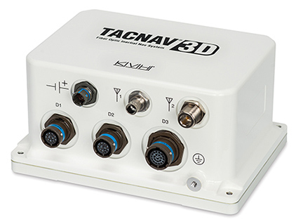
The TACNAV 3D, by KVH Industries. Photo: KVH Industries
KVH Industries, Inc., has received a $19 million contract for the delivery of a new fiber optic gyro (FOG)-based tactical navigation system for use by an international military customer in an armored vehicle application. A variant of KVH’s TACNAV FOG product and KVH’s new TACNAV 3D, the system provides continuous high-accuracy position and orientation even when GPS is lost or jammed.
Work on the contract began in July under a letter contract, and hardware shipments for this order are expected to be made in 2015 and 2016. Program management, engineering services, and out-year support services will be provided as part of this order.
“KVH’s TACNAV navigation solution is an important tool for U.S. and allied warfighters, providing precision navigation as well as coordination of vehicles in critical situations,” said Dan Conway, executive vice president of KVH’s Guidance and Stabilization group. “The system serves as a crucial resource for navigation and battle management, and even as a backup in GPS-denied environments, keeping soldiers safe and out of harm’s way wherever they travel. This new order reaffirms the value of KVH’s TACNAV products for international militaries, and adds to our backlog for the coming years.”
All of KVH’s TACNAV military vehicle navigation systems provide unjammable precision navigation, heading, and pointing data for vehicle drivers, crews, and commanders. TACNAV can also serve as a heading and position source for situational awareness. The TACNAV system ordered is a FOG-based navigation and pointing solution, which is designed to ensure precise navigation data regardless of GPS availability as well as automatic “drive and calibrate” capability. It features a compact design, continuous heading and pointing data output, and a flexible architecture that allows it to function as either a standalone navigation module or as the heart of an expanded, multifunctional TACNAV system. The system is designed to integrate with Battle Management Systems (BMS) and is a vital component for effective battlefield management.
TACNAV systems are currently in use by the U.S. Army and Marine Corps, as well as many allied customers including Canada, Sweden, Great Britain, France, Germany, Spain, Egypt, Botswana, Australia, New Zealand, Saudi Arabia, Taiwan, Romania, Poland, Turkey, Malaysia, Switzerland, South Korea, Singapore, Brazil, and Italy.
After the death of Mao Zedong, who had himself changed the “cultural” face of China, Deng Xiaoping led China from 1978 until his death in February 1997. During that period, China advanced economically further than it did in the previous 200 years, and rose from a financial backwater into one of the world’s largest economies. From 1978 to 1998, GNP increased 500%, average annual income rose from a few hundred dollars to $1,800, savings increased 14,000%, and exports went from $10 billion a year to $153 billion. In a Chinese 1998 survey, Deng was named the number-one hero in China.
Deng Xiaoping.
To achieve all this, there had to be a strategy — a vision of how to bring about such significant change. The approach chosen was to lead and support through government-sponsored initiatives — and the group who was in the best position to be able to convince people and demonstrate by example was China’s well-educated military.
So now we get to GNSS, and of course one of these initiatives was to emulate what the U.S. had done and to create its own satnav system. So we have the BeiDou/Compass space and ground control infrastructure. And having built all this, indeed they did come and a Chinese GNSS industry began to emerge. But it nearly didn’t happen.
In 1994 as part of Deng Xiaoping’s efforts, a state company was formed to pursue economic reform. Ruxin Zhou was one of those military guys who was there, and he recognized that the planned military BeiDou satnav system could be an avenue towards a huge commercial opportunity for China. But the Chinese military was already launched on a course to build BeiDou for their own purposes, and maybe they didn’t want to get caught up in these economic changes going on with the civilian population. As a member of the government advisory group, Colonel Zhou worked long and hard to promote his concept with several levels of government and to persuade military leaders and those involved with BeiDou that they should participate in Xiaoping’s reforms. Ultimately he was successful, and BeiDou eventually emerged as a joint military civilian system.
The next step was to somehow create a commercial business out of all this. To do that, in 2000 Mr. Zhou formed Beijing BDStar Navigation Company Ltd. with only himself and another original founder — Mr. Jianhui Li. Based in Beijing, BDStar was ideally located close to the government, close to military management, and close to the BeiDou operations and control centers. Coincidentally, around the same time, NovAtel in Calgary was beginning to be active in the region and was looking for dealers to market its OEM receivers into China. After a trial phase with a couple of dealers, it was finally agreed that BDStar would represent NovAtel exclusively in China.
That’s when I first met Ruxin Zhou — with U.S. WAAS development well underway, it turned out that China was also interested in creating its own Satellite Navigation Augmentation System (SNAS), and was considering NovAtel’s WAAS GI reference receivers for the ground infrastructure. Mr. Zhou became the contact point between NovAtel and BDStar, and what followed was what appeared to us to be a lengthy, frustrating negotiation which rolled out in both China and in Canada. Now we know that not only was the SNAS program making sure it understood the technology inside the NovAtel WAAS receiver, but Mr. Zhou was also learning English, the ways of doing Western commercial business, and, most of all, he was getting to know and be comfortable with us.
NovAtel went on to win three contracts to supply 85 WAAS receivers to the SNAS system over three years, and the relationship with BDStar and Mr. Zhou became one which both sides wished to grow and prosper. NovAtel OEM receivers were also supplied in quantity into a number of applications that BDStar developed in China over many years. BeiDou was also an important catalyst to initially help BDStar gain traction — the company equipped 40,000 fishing boats with BeiDou messaging receivers over several years, used for basic communication across the fleet and for location reporting to monitor authorized fishing areas.
Fast forward to today. Almost 15 years have gone by. Mr. Zhou is now chairman of the board of the BDStar Navigation group of companies, and Mr. Li is president, running day-to-day ongoing business at BDStar. I sat down with my old friend in Tampa at the Institute of Navigation (ION) GNSS + Conference to catch up with the growth and expansion of this business and listen to the many achievements that have now turned BDStar into the largest (¥780 million RMB = $127 million US) GNSS-based public company in China. BDStar had a difficult beginning between 2000 and 2007, like many start-ups, but has now emerged as a profitable leading enterprise within the Chinese BeiDou industry.
Ruxin Zhou, Chairman of the Board, BDStar Navigation.
Ruxin Zhou was born in March 1963, and he has been involved in China’s GNSS industry since 1994. He lives in Beijing, and is the father of two sons. He is also vice chairman of the Association of GNSS of China. He earned his BSc degree in 1983 followed by his master’s in 1989, both at University of NanKai in Tianjin. His MBA was awarded by the University of Beijing in 2003.
Ruxin Zhou considers BeiDou an important part of the GNSS industry, and he is looking forward to cooperating with other GNSS related companies inside and outside China to add more value to users.
Mr. Zhou chairs the BDStar board of directors — one of whom is the president of the company. There is also a group chief technology officer (CTO), a board secretary who is responsible for investment, three outside directors from industry, and an advisor who is familiar with government financial policy. Along with the parent company BDStar Navigation Products Division and its internal GNSS Applications Division, there are nine subsidiary companies, each of which is governed by a small management board.
BDStar Information Service Co. — Largest BeiDou operations service provider.
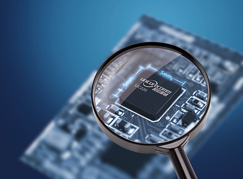
Unicore Communications, Inc. — Consumer and precision chipset and board-level receivers.
BDStar Hong-Kong — Import/export company for the group.
Shenzhen XG Electronics Co. — Vehicle electronics and installations.
BeijingSinsTek Technology — MEMS inertial technologies for defense.
Beijing Hanvic Photoelectricity Co. — Navigation using IR/photo–electric technologies.
BeiDou Information Equipment Co. — National Defense equipment and services.
Recently, the BeiDou Equipment Division within BDStar has become a separate company known as BeiDou Information Equipment Co., and another company — Harxon, which manufactures antennas — is in the process of being added to the group.
The number of people working within the BDStar group has grown from an initial staff of 20 when Mr. Zhou and Mr. Li began operating the company, to around 1,500 people today in 2014.
BDStar Navigation is where this all began as a value-added reseller for NovAtel OEM receivers — integrating them into a number of applications, such as vehicle, marine and military navigation installations. BDStar was also instrumental in the establishment of the ground infrastructure for SNAS and took part in the construction of the system. As this business increased, installations became focused within a separate group, along with building the equipment using integrated NovAtel GPS and inertial OEM equipment — the GNSS Applications Division.
With an increasing number of satellite launches, and a growing ground infrastructure, BeiDou began to become a more important part of China’s GNSS/navigation infrastructure. BDStar began to play a larger role in the emerging BeiDou program (BeiDou System or BDS), and it became clear that BeiDou technology would have to be developed by BDStar in China. And so the spin-off and company start-up phase of BDStar’s growth got underway.
BDStar Information Service Co., Ltd.
BDStar Information Services Limited is a wholly owned subsidiary of BDStar Navigation, providing location-based system solutions and information services, based on the BeiDou Navigation Satellite System, for the fishery, agriculture, forestry, water conservancy, and meteorology industries. By integrating Internet and mobile communication networks with geographic information, BDStar Information Service has now become the largest BDS information service provider in China with more than 40,000 BeiDou end-users, hundreds of government users and more than 100,000 mobile phone users. The service is 24/7/365 and includes real-time positioning, and short message communication for typhoon warnings, emergency alarms and other related services. The system has capacity for over 100 million navigation positioning and communications messages per year.
Ship terminal. Photo: BeiDouBeidou Operational Service Center. Photo: BeiDou
Unicore Communications Inc. (Beijing)
Unicore Communications Inc. is a share-holding subsidiary of BDStar Navigation — a high-tech company dedicated to highly integrated system-on-a-chip (SoC) IC design and GNSS algorithm development. Unicore is focused on the commercialization of BeiDou through advanced GNSS professional applications and innovative technology breakthroughs — one of the leading Chinese companies involved in the “industrialization” of BeiDou systems.
Unicore provides turn-key location-based services (LBS) in both the GNSS professional and consumer navigation segments. An innovative core chip has been independently developed, providing high-performance GNSS as well as low-cost, low-power, high-quality products with positioning accuracy ranging from millimeter all the way up to meter levels. Not only have high-precision requirements for surveying, mapping and CORS reference stations been satisfied, these components have also been used in less onerous applications such as vehicle monitoring and personal navigation.
By the second quarter of 2014, Unicore has sold more than one million BeiDou SoC chips and won multiple breakthroughs in BeiDou multi-GNSS applications such as in-dash automotive navigation, automatic driving test system, Ground-Based Augmentation System (GBAS), and the International GNSS Monitoring and Assessment Service for Open Service (iGMAS).
Beijing Hanvic Photoelectricity is a share-holding subsidiary of BDStar Navigation targeted at the infrared thermal imager market. The company has used in-house infrared optics, imaging circuitry, image processing, artificial intelligence, mechanical structures and system engineering to develop a number of products using planar and linear arrays. Short-medium-long-wave infrared cooling thermal imagers can provide users with a visual context under varying weather conditions from up to tens of kilometers from a target object. These products are widely used in scientific research, electrical distribution, forest-fire prevention, surveillance, public security, firefighting, and anti-smuggling.
Beijing SinsTek Technology Co., Ltd.
Beijing SinsTek Technology is a shareholding subsidiary of BDStar Navigation specializing in the original development of inertial navigation, inertial measurement, and measurement and control systems and devices- for which SinsTek owns all related intellectual property rights. SinsTek has independently developed products such as high-precision quartz accelerometers and gyros, mixed inertial navigation systems, missile-borne computers, a missile overload switch and a ground control system. Products and systems have been widely used within China in various fields of national defense and also commercially.
Shenzhen XuGang Electronics Co., Ltd.
Shenzhen XuGang Electronics was founded as a shareholding subsidiary of BDStar Navigation in 2001. The company undertakes product development, design, manufacture and sales of medium- to high-end consumer-level vehicle audio-video navigation products and services. The company has more than two decades of experience in automobile accessories, and has good cooperative relationships with China’s major automobile manufacturers. With a marketing network that extends across China, the company is one of the most important automotive electronics and navigation products providers in China. Automotive products are also exported to the U.S., Russia, Brazil, Israel and to other countries.
The scope of this business includes:
CAR navigation/CAR audio original design manufacturer (ODM) — High volume/high-quality production of auto accessories, auto electronics and GNSS products.
Marine radio ODM — Waterproof hi-fi player/radios have won wide recognition in Europe and the U.S. This is the only Chinese company whose SIRIUS satellite radio technology has been certified in the U.S.
Telematics auto network solutions — BDStar auto navigation system and BDStar Black Box have been independently developed, fusing sensors, network communications, processing and controlling technologies to provide telematics products and services for auto makers and commercial consumers.
BeiDou online telematics. Photo: BeiDou
Navigation Products Division
The Navigation Products Division has successfully collaborated for more than 10 years with NovAtel as its value-added reseller (VAR) of GNSS and GNSS-inertial products in China. Focused on satellite positioning and inertial navigation applications, BDStar has promoted domestic Chinese navigation and positioning applications development, and has established close cooperative relationships with domestic inertial and integrated mapping companies, research institutes, and other sectors. Application fields include railways, electricity, telecommunications, meteorology, and seismology. Quite naturally, independently developed BeiDou products have also followed this route to market in China.
NovAtel OEM6 receiver. Photo: BeiDou
GNSS Application Division
The GNSS Application Division is the business division of BDStar Navigation, which is mainly engaged in the development, production, sales, and service of the products based on high-precision GNSS technology applications. With the objective of becoming expert in high-precision GNSS solutions used in the developing industry using the “Internet Of Things (IOT),” the company provides a series of GNSS terminal products and solutions for the civilian market. Applications have included agriculture, container ports, and deformation monitoring. Meanwhile, the successful port IOT that this division has provided for Tianjin Port has now been implemented at more than 20 domestic and foreign ports including Shanghai, Ningbo, Shenzhen, and in India.
BeiDou Internet of ships Photo: BeiDou
BeiDou Information Equipment Co.
BeiDou Information Equipment, a wholly owned subsidiary of BDStar Navigation, is focused on supplying products for national defense and government agencies, and provides complete solutions and products for dispatch management of hazardous materials and special cargo handling. Several successful projects have been undertaken, including special hazardous vehicle command and monitoring, public security, anti-terrorism, forest-fire prevention, emergency management, personnel command and monitoring of disaster relief, public security, and border defense. The division relies on its experience in system engineering, command and control software, radio system design, and military satellite navigation to provide users with terminal products such as navigation, timing and heading, and location-based military information service systems. Specific products developed include terminal equipment, vehicle-mounted navigators, vehicle traveling data recorders, police positioning and telecommunication terminals, and an emergency communication system.
Following this phase of significant growth, what does the future hold for BDStar? We know that China’s huge annual rate of GDP growth may have slowed a little, but Mr. Zhou still has pretty big aspirations for his group of companies. His target for 2020 is to have BDStar reach annual sales of 10 billion RMB ($1.63B US). To get there, his intermediate step is to reach 2 billion RMB ($326m US) by the end of next year. Overall, this represents a ten-fold growth in revenue over six years — by Chinese industrial standards, this might even be termed “modest” growth.
But where will all this growth come from? The strategy appears to be textbook:
Through significant organic (internal) growth, or by doing the same things better and to a greater extent.
Through strategic partnerships with targeted leading companies in key growth areas.
Through further acquisition of companies that would improve the bottom line and also benefit from the synergies of the existing corporate group.
While the anticipated course would be to add companies at the corporate level, it’s possible that some companies within the organization may also get to the point where they see adding an organization below or alongside may become a profitable avenue for their own growth. Of course, other suitable companies in China would be on Mr. Zhou’s strategic acquisition list, but he’s also looking for expansion elsewhere around the world. The U.S. market is significant for the type of products and technologies available in the BDStar group, so it would be natural to anticipate that a North American acquisition could help improve product distribution and development. As BeiDou becomes an integral part of global GNSS, and industry partners seek more than Open Service capability and better Chinese access, its also conceivable that partnerships with North American players could come about.
So, at least with BDStar and some other similar Chinese companies, it would seem that those earlier 1990s aspirations of the Chinese government to create a commercial economic sector within the Chinese economy have at least begun to show a measure of success in the GNSS market segment.
Javad Ashjaee, president and CEO of JAVAD GNSS, and GPS World Editor-in-Chief Alan Cameron discuss the design of the TRIUMPH-F1 while at InterGeo 2014, held October 7-9 in Berlin.
In recent tests, the IDS ran continuously for 24 hours monitoring for potential interference originating from traffic on a nearby highway, SR-522, passing through Woodinville, Washington. “In a single day, the IDS detected two separate instances of a sweep jammer moving along the highway,” noted Loctronix Founder and CEO Michael Mathews. “These discoveries were unexpected, given the relatively short monitoring period and the fact that SR-522 is not a heavy truck-route.”
“The two interference events were likely caused by sweep jammers installed within a vehicle’s interior. The intercepted signals exhibited significant variations in amplitude probably caused by the jammer antenna non-uniform radiation pattern as the jammer vehicle passed through the IDS antenna beam pattern,” Mathews added.
Intentional interference is designed to prevent a GPS receiver from acquiring and tracking signals. The use of jammers is in the U.S. is illegal; however, they can still be purchased for as little as $30. Thousands of GPS jammers are purportedly in use throughout Europe and several parties have been caught illegally jamming GPS in the U.S.
Loctronix developed the IDS to identify, characterize, and ultimately geolocate GPS interference. When interference is present, the system analyzes the interference for signal structure and notifies operators if the threat is significant.
The IDS is highly portable, simple to use, and cost-effective, Loctronix said. The system is based upon the Loctronix ASR-2300 software defined radio platform, making it readily configurable (from a single mobile detector to a multi-sensor network array) to monitor additional GNSS bands and, potentially, cellular bands.
In the video below, Michael B. Mathews, Ph.D., CEO and founder of Loctronix, tells GPS World about the IDS at the ION GNSS+ Conference, held September in Tampa, Florida.
Agilis Systems, LLC, a provider of GPS-based software solutions for businesses, now offers MOTOsafety Teen Driving Coach — a specialty consumer product designed to help parents monitor location and driving behaviors of their teenage drivers.
According to the National Highway Traffic Safety Administration (NHTSA), inexperience and speeding are top contributors to teen automobile accidents. The team at Agilis recognized this as an opportunity to leverage the company’s experience improving safety ratings of professional drivers to develop a similar product that would help young drivers become better, safer drivers.
Expanding Agilis’ product line to include a consumer product that will help teens stay safer on the roads was an easy step to take, says Agilis Systems’ President and CEO, David Barford. “Most of us here at MOTOsafety are parents. I, myself, am the father of four children. I know the stress and worry you feel as a parent the first time you hand the keys to a new driver. So evolving our technology from business use to helping safeguard and teach our kids… absolutely. It was a must-do.”
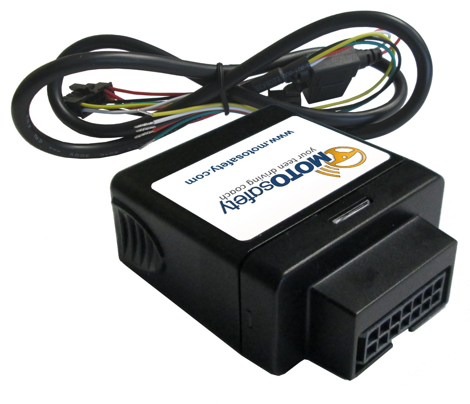
Photo: Agilis Systems
Agilis Systems developed MOTOsafety in collaboration with a former police officer and driving school owner and an advisory board of parents.
MOTOsafety was first offered to the public with a soft launch in 2011. Today, MOTOsafety is the largest and most trusted GPS teen-driving product on the market.
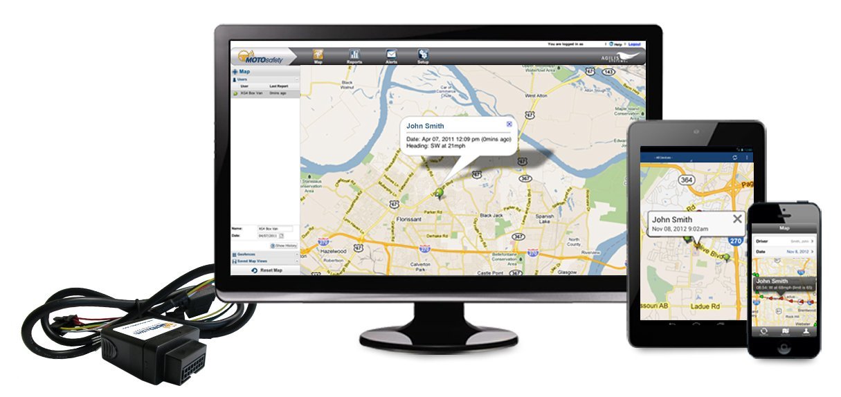
MOTOsafety is a web-based software and mobile app that provides parents with real-time and historical information on their child’s daily driving habits. Data is collected using a small GPS device that installs directly into the vehicle. Customers may choose between a removable plug-in tracker or a hard-wired option. Both devices are small in size, easy to install, and are not visible in most vehicles.
Parents login to secure web-based software to review daily reports on speed, rapid acceleration, harsh braking, routes traveled, and times and locations of driving activities. The MOTOsafety software also allows parents the option to set approved driving hours and designate geofences — customizable, virtual mapped boundaries where their child may or may not travel. Parents may also opt to receive real-time text or email alerts if their teen driver violates speed limits or other established rules, or if the MOTOsafety device is removed from the vehicle.
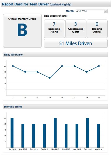
Another MOTOsafety feature is the Daily Driver Report Card. This specially designed report provides a summary of the prior day’s driving activity in a familiar letter-grade format. The Report Card is automatically emailed each day, and serves as a coaching tool for parents to review with their child and facilitate on-going conversation on his or her driving performance, safe driving practices, and goals for improvement.
According to a new research report from the analyst firm Berg Insight, the number of active fleet management systems deployed in commercial vehicle fleets in Europe was 3.65 million in Q4-2013. Growing at a compound annual growth rate (CAGR) of 14.2 percent, this number is expected to reach 7.10 million by 2018.
A group of international aftermarket solution providers have emerged as the leaders on the European fleet management market. Masternaut reported an active installed base of close to 350,000 units in July 2014, mainly in France and the UK. TomTom Telematics was the fastest growing vendor also in 2014 and has now surpassed 400,000 subscribers in August 2014.
The two companies share the number one spot in terms of active installed base in Europe. Digicore has also joined the exclusive group of fleet management providers in Europe having more than 100,000 active devices in the field. Transics is number one in the heavy trucks segment with an estimated 85,000 active units installed.
A major trend in the past three years has been the announcements of standard line fitment of fleet management solutions among the HCV manufacturers. Scania, Daimler, Volvo and MAN now experience fast growth of telematics subscribers thanks to these initiatives. FleetBoard by Daimler, Dynafleet by Volvo and Scania Fleet Management are the most sold systems with cumulative shipments of 150,000 units, 135,000 units and 100,000 units respectively as of Q4-2013.
A recent trend is that LCV manufacturers increasingly work together with aftermarket players to offer fleet management solutions. PSA Peugeot Citroën has for instance launched a new fleet management service on the French market in partnership with Orange Business Services in April 2014. Ford and Telogis recently partnered to deliver fleet management solutions to Ford customers in Europe. Teletrac has moreover for a long time collaborated with OEMs on the UK market, including Citroën and Mercedes Benz.
M&A activities on this market continued with full force in 2014. “Seven major mergers and acquisitions have so far taken place this year among the vendors of fleet management systems in Europe,” said Johan Fagerberg, Senior Analyst, Berg Insight. At the beginning of 2014, Qualcomm finally divested also the majority of the European arm of its fleet business to Astrata Group, a fleet management company headquartered in Singapore.
Later in February, WABCO acquired Transics and the transaction valued the company at about €100 million. Lysanda acquired UK-based TRACKER Network in February and plans to establish Tantalum Corporation from the combined business.
In April, TomTom also acquired the French FM provider DAMS Tracking, adding another 27,000 subscriptions to the installed base. Francisco Partners, moreover, divested Masternaut to Summit Partners and FleetCor in the same month.
In July 2014, Zucchetti Group acquired a majority share of Macnil from its founders. The latest transaction was done in October 2014 when Finder acquired its Polish competitor Autoguard to form the largest FMS provider in Poland. Fagerberg anticipates that the market consolidation of the still overcrowded industry will continue in 2015.
On November 18, a Consultation Event will take place in Brussels on the subject of receiver technology. The event is being held to inform the stakeholders of the European GNSS receiver community about the format and timeline of funding opportunities for the period 2015-2020, and to gather input for the definition of R&D actions in the field of receiver technology.
The workshop will consist of one panel session, during which stakeholders from industry, SMEs, academia, and technology institutes will be asked to debate and recommend important lines of research in receiver technology.
Registration is now open on the Europa website. Interested participants are invited to fill in the registration form and to indicate which application area they are interested in and the fields of research that should be supported.
The workshop will be held at the Committee of the Regions, Jacques Delors building, rue Belliard 99-101, room JDE 53, Brussels.
 GeoLearn has partnered with the Missouri Society of Professional Surveyors (MSPS) to provide customized product training for its members.