Blog

  • OGC Calls for Participation in Major Interoperability Testbed

    The Open Geospatial Consortium (OGC) has issued a Request for Quotation/Call for Participation (RFP/CFP)in the OGC Testbed 11 Interoperability Testbed.

    Testbed 11 sponsors have documented interoperability requirements and objectives for this testbed activity. Organizations selected to participate in Testbed 11 will develop solutions based on the sponsors’ use cases, requirements and scenarios, which are described in detail in the CFP. Participants’ solutions will implement existing OGC standards as well as new prototype interface and encoding specifications introduced or developed in Testbed 11. Prototype specifications may ultimately become OGC standards, revisions to existing OGC standards, or best practices for using OGC standards.

    Testbed 11 sponsors include:

    • European Organization for the Safety of Air Navigation (EUROCONTROL)
    • Land Information New Zealand (LINZ)
    • National Aeronautics and Space Administration (NASA)
    • National Geospatial-Intelligence Agency (NGA)
    • UAE Ministry of Interior Abu Dhabi Police GIS Center for Security (UAE ADP-GIS SC)
    • UK Defense Science and Technology Lab (UK-DSTL)
    • US Department of Homeland Security (DHS)
    • US Geological Survey (USGS)

    The RFQ/CFP and information about Testbed 11 are available online. Responses are due by 5 p.m. EST on November 21, 2014.

    Testbed 11 focuses on spatial communication requirements that emerge when a population is displaced due to coastal inundation. Testbed participants addressing requirements in this scenario will attempt to meet these goals:

    • Advance OGC Architecture with respect to REST and SOAP design patterns for synchronization of geodata across data stores, as well as storage and synchronization of geodata in GeoPackages;
    • Evaluate approaches to JSON and GeoJSON encodings as well as vector data and image streaming in the OGC standards framework;
    • Integration of high-resolution simulation models into geospatial infrastructures
    • Advance use of Linked Data and Semantic Enabling of OGC Web Services, with a special focus on Hydrographic Data;
    • Advance use of OGC Catalog Services;
    • Advance use of spatially enabled Social Media data;
    • Advance use of a common symbology that can be used to share common operational pictures in an international environment;
    • Advance compliance tests for the OGC Web Feature Service and Catalog 3.0 Service interface standards;
    • In Aviation, advance a Digital NOTAM validation service and enrichment service and advance use of Aviation Feature Schema (AFX). Also develop guidance on using geometrical constraints in the Semantics of Business Vocabulary and Rules (SBVR) (an Object Management Group standard).

    Those testbed goals sort into these technology threads:

    • Cross-Community Interoperability (CCI) Thread
    • Urban-Climate Resilience (UCR) Thread
    • Geospatial Enhancements for NIEM (Geo4NIEM)

    This cutting edge technology work has enormous potential for testbed stakeholders — both technology users and the technology providers — and for the world at large. The return on the shared investment in spatial standards is extraordinary, much like the return on the original shared investments in http and html. Technology providers who participate in the testbed gain market exposure, market intelligence, and a chance to quickly take advantage of the business opportunities that arise with the introduction of new standards and associated technical capabilities.

    If you want to learn more about this opportunity, please contact  Lew Leinenweber , Director Interoperability Programs ([email protected]). See http://www.opengeospatial.org/ogc/programs/ip for more information about the 15-year-old OGC Interoperability Program in which OGC testbeds, pilot projects and interoperability experiments are organized, planned and managed.

    The OGC is an international geospatial standards consortium of more than 495 companies, government agencies, research organizations, and universities participating in a consensus process to develop publicly available standards. OGC standards support interoperable solutions that “geo-enable” the Web, wireless and location-based services, and mainstream IT.

  • Unmanned Systems Buzz at InterGeo, Plus: Webinar Follow-Up

    The world’s largest geospatial conference took place earlier this month in Germany. InterGeo is located in Germany every year, changing cities. More than 16,000 people attend the conference annually, mostly from Europe (83%) and only a small percentage from North and South America (~5%). I’ve promoted to the organizers that a similar conference is needed in the West because the most significantly attended geospatial conferences in the West are organized by specific vendors (Esri, Autodesk, Hexagon, Trimble, etc.) rather than being vendor-agnostic. The result is that Westerners only see a sliver of the geospatial products and services that are available.

    InterGgeo-GerMAP-UAS-WInterGeo is always a lot of fun, with a myriad of geospatial hardware and software. Every year, I look for a specific technology that stands out. In the past couple of years, it’s been unmanned aerial systems (UAS). This year, I attended a vendor presentation, and I think they summarized it best: “Positioning is becoming a commodity.”

    Whether it’s RTK GNSS, UAS, optical instruments or imaging instruments, it’s getting easier and less expensive to collect high-precision data. A good example of this is the Topcon LN-100W (sorry for the lack of audio during the video) introduced at InterGeo. It’s an instrument designed for BIM (Building Information Modeling) layout and mapping. It self-levels and works within about a 100-meter radius.

    Then, of course, there’s the new wave of RTK GNSS receivers. South Survey Instrument Co. introduced a palm-sized RTK GNSS receiver, as well as Sokkia, Altus, Comnav, Geneq, CHCNav, Trimble, Carlson, Eos, Stonex, and I’m sure I missed a few others. As I’ve written before on several occasions, the increased availability of RTK GNSS receivers at increasingly lower cost puts centimeter accuracy in the hands of a wide geospatial audience, not just specialists.

    Intergeo-Eric-Riegl-WThen, there’s UAS. UAS, UAVs, drones, or whatever you want to call them, have been hyped to the point that they may be over-hyped. Whereas I saw only a handful of UAS at InterGeo a few short years ago, now there are many tens, maybe a hundred, UAS on display. In fact, there was an outdoor UAS flight demonstration area. We shot a video of the new Reigl RiCopter, which Reigl claims is the first UAS with a LIDAR sensor on board.

    Lastly, VectorNav introduced a great example of sensor fusion. It’s a very small device (4.5 x 4.4 x 1.1 cm) weighing less than 30 grams. It contains two u-blox GNSS receivers (capable of L1 RTK) as well as VectorNav’s MEMS technology (3-axis accelerometers, 3-axis gyros, 3-axis magnetometers) resulting in a high-precision, inertial navigation system that doesn’t rely on magnetic sensors. One of the primary target markets? ….UAS.

    Intergeo-autodesk-eric-WThe week following the InterGeo show, Alan Cameron and I conducted a webinar as a follow-up. You can view the webinar recording by signing up here. It contains good information about the current status of UAS for commercial use in the United States. You can visit the FAA’s UAS webpage to read the latest information it has released. During the webinar, we conducted three audience polls. You might be interested in the results, so here they are.

    Poll 1: Do you currently use a UAS for geospatial work?

    Do you currently use a UAS for geospatial work? (54 votes)
    Do you currently use a UAS for geospatial work? (54 votes)

    Comment: I’m not surprised by this poll result, especially given the lack of regulations for commercial UAS operations that exist.

    Poll 2: Do you anticipate using a UAS in your geospatial work in the future?

    Do you anticipate using a UAS in your geospatial work in the future? (64 votes)
    Do you anticipate using a UAS in your geospatial work in the future? (64 votes)

    Comment: This poll result doesn’t surprise me either. There are a broad range of applications for UAS for geospatial users, from agriculture to accident reconstruction and remote inspection. Furthermore, if a geospatial user isn’t directly operating a UAS, he or she will eventually likely be using data that was generated from a UAS.

    Poll 3: If you were to purchase a UAS for geospatial work, how much would you be willing to spend on a system?

    If you were to purchase a UAS for geospatial work, how much would you be willing to spend on a system? (56 votes)
    If you were to purchase a UAS for geospatial work, how much would you be willing to spend on a system? (56 votes)

    Comment: This poll result surprises me. It says a lot about the belief and confidence that geospatial users have in the geospatial value of UAS. In other words, about 40% of the audience is willing to spend more than $10,000 on a UAS. Clearly, this means those users see the value that UAS bring and believe they can keep one busy enough to make the capital investment.

    Thanks, and see you next month.

    Follow me on Twitter at https://twitter.com/GPSGIS_Eric

  • Carlson Software Debuts BRx5 GNSS Receiver, Surveyor2 at InterGeo

    Bruce Carlson, president of Carlson Software, and William “Butch” Herter talk about the company’s new BRx5 GNSS Receiver and Surveyor2 data collector, among others, while at InterGeo 2014, held October 7-9 in Berlin.

    View our YouTube playlist for more InterGeo videos.

  • InterGeo Interviews Eric Gakstatter

    Eric Gakstatter discusses positioning technology, mapping, UAVs and the industry during an interview with InterGeo TV. Eric is GPS World contributing editor for survey, editor of Survey Scene, and editor of Geospatial Solutions.

    For more InterGeo videos, see our playlist.

  • Topcon Demonstrates New 3D Positioning System LN-100W at InterGeo

    Topcon Positioning Group demonstrates its LN-100W, an update to its line of 3D positioning systems designed for one-operator layout, while at InterGeo, held October 7-9 in Berlin. The latest model includes Bluetooth functionality.

    See more InterGeo videos at GPS World’s YouTube Channel.

  • Qualcomm to Acquire SiRF Chipmaker CSR

    Qualcomm_CSR_acquisition_logos-TQualcomm, Inc., has agreed to buy British CSR for $2.5 billion, to enhance its automotive infotainment and Internet of Things (IoT) offerings. CSR is known to the GPS/GNSS industry as the maker of the SiRFstar series of chips, which are used in many consumer devices. Qualcomm is a leading maker of chips used in smartphones.

    According to Qualcomm, the acquisition complements the company’s offerings by adding products, channels, and customers in the important growth categories of Internet of Everything (IoE) and automotive infotainment. “This opportunity is aligned with Qualcomm’s established strategic priorities in these rapidly growing business areas,” according to a Qualcomm statement. The transaction is expected to close by the end of the summer of 2015.

    Once the transaction is complete, the two major U.S. wireless/mobile-chip design/manufacturers will have GPS/GNSS technology firmly embedded within their organizations. In July 2007, Broadcom acquired Global Locate. More recently, CSR acquired SiRF Technology in June 2009, and now CSR has in turn been acquired by Qualcomm. Throughout 2008, Broadcom and SiRF were locked in a patent battle that Broadcom eventually won, precipitating a decline in SiRF’s one-time dominance and sending it into eventual disappearance/acquisition by CSR. The two companies are again aligned as opponents as part of the rival camps, Qualcomm and Broadcom, whose competition is fully as intense as the former Global Locate (then Broadcom) versus SiRF tussle.

    “The addition of CSR’s technology leadership in Bluetooth, Bluetooth Smart, and audio processing will strengthen Qualcomm’s position in providing critical solutions that drive the rapid growth of the Internet of Everything, including business areas such as portable audio, automotive and wearable devices,” said Steve Mollenkopf, chief executive officer of Qualcomm Incorporated. “Combining CSR’s highly advanced offering of connectivity technologies with a strong track record of success in these areas will unlock new opportunities for growth. We look forward to working with the innovative CSR team globally and further strengthening our technology presence in Cambridge and the UK.”

    The full announcement, issued in accordance with Rule 2.7 of the UK Takeover Code, can be found on Qualcomm’s website at www.qualcomm.com/2.7.pdf.

  • Spectra Precision ProMark Helps Find Mines in Bosnia-Herzegovina

    Spectra Precision ProMark Helps Find Mines in Bosnia-Herzegovina

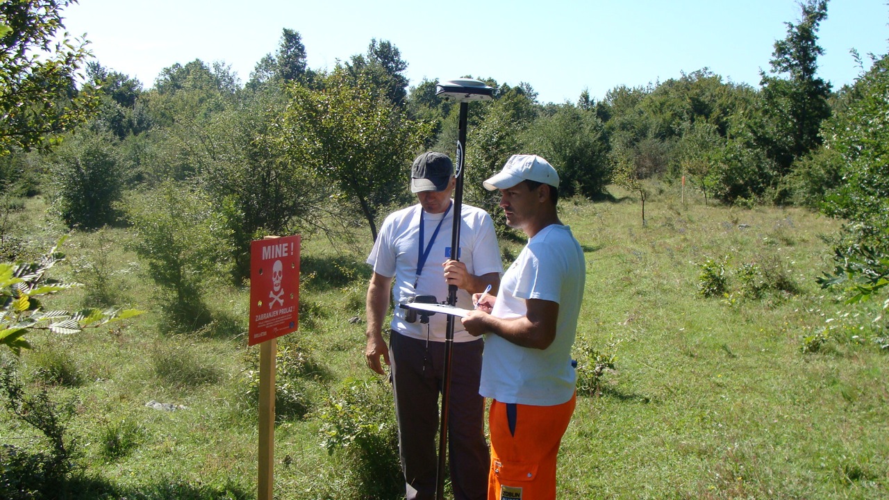
    Post and GNSS Photo: Spectra Precisions
    Photo: Spectra Precisions

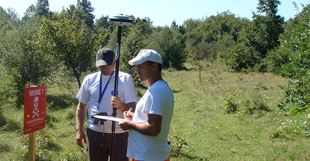
    Bosnia and Herzegovina is burdened with one of the world’s most severe land mine problems as a result of the four years of hostilities from 1992 to 1995 that left an estimated two million unexploded landmines and munitions scattered in 28,699 locations throughout the country. In one district in the northeast of the country, Posavina Without Mines (PWM), a humanitarian, non-profit NGO, is under contract with the government of the District of Brčko to warn residents of mined areas by permanently marking suspected contaminated areas, removing the lethal objects, and helping mine-affected victims.

    The task of marking suspected areas to warn residents begins when Posavina Without Mines (PWM) receives mapping information from the Bosnia and Herzegovina Mine Action Center (BH MAC), the nation’s central landmine research and coordinating authority. BH MAC gathers information by researching records of where minefields were laid, a task made difficult because many landmines were not documented during construction, the records have been lost, hidden or destroyed, or the people who recorded the locations were killed or left the country.

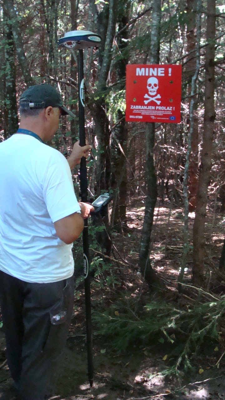
    Posavina Without Mines uploads the data it receives from BH MAC into its Spectra Precision ProMark 800 recently purchased through a grant it received to acquire a GNSS capability. Each warning sign is positioned with the aid of the ProMark 800 and assigned a unique serial number. A list of the serial numbers, coordinates and photos of each site comprises a permanent record and database that is submitted to BH MAC.

    Post and GNSS 2 Photo: Spectra Precisions
    Photo: Spectra Precisions

    Posavina Without Mines had been using an older model handheld GIS GPS for the job. However, according to Ivan Markovic, a Posavina Without Mines spokesperson, “It was producing errors up to two meters necessitating follow up surveys and the involvement of supervisors to rectify the errors.” After reviewing alternative solutions to solve the problem, Posavina Without Mines contacted Gauss Geoinformation Systems.

    The ProMark 800 rover and base station system was chosen for its ease-of-operation, excellent accuracy and light weight, an important feature because it is often used in difficult and virtually inaccessible terrain. “On our limited budget, we are very pleased with the accuracy and simplicity of the ProMark 800, and the high-quality training provided by Gauss,” Markovic said.

    Spectra Precision has recently replaced its ProMark 800 with a new SP80 GNSS receiver, which offers superior accuracy and reliability, enhanced connectivity capabilities, including Wi-Fi, e-mailing or text messaging, and advanced anti-theft protection.

  • Riegl Launches RiCopter UAV at InterGeo

    At InterGeo 2014, James Van Rens, chief executive officer of Riegl, explains the launch of the RiCopter UAV with LiDAR integration, and its designer gives a live demonstration of the UAV in flight. The show was held October 7-9 in Berlin.

    The unmanned aerial vehicle is a survey-grade unmanned scanning platform for a variety of demanding applications, such as corridor, power line, or railway mapping.

    The high-performance UAV can be equipped with the Riegl VUX-1 survey-grade LiDAR sensor to offer a fully integrated turnkey solution. The RiCopter platform design includes a fully integrated Riegl VUX LiDAR sensor, IMU/ GNSS unit with antenna, control unit, and up to four optional cameras providing measuring characteristics of a 330-degree field of view, 500,000 measurements per second, and 10-millimeter accuracy.

    The class 1 unmanned aircraft system can be flown at a maximum operating altitude of 550 meters with a maximum take-off mass of up to 25 kg and a maximum payload of 16 kg, providing a long flight endurance of 30 minutes.

    RiCopter flight characteristics are smooth and stable in hovering positions, as well as on demanding flight maneuvers under challenging conditions.

    See more InterGeo videos at GPS World’s YouTube Channel.

    Another video of the RiCopter in action comes from Riegl:

  • Galileo Team Raced to Respond Following FOC Launch

    Galileo Team Raced to Respond Following FOC Launch

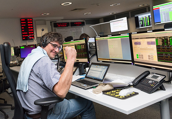
    Flight Operations Director Hervé Côme celebrating success finding the satellites. Photo: Galileo Control Centre
    Flight Operations Director Hervé Côme celebrating success finding the satellites. Photo: Galileo Control Centre

    On September 27, the first two Galileo Full Operational Capability (FOC) satellites were handed over from the European Space Agency’s Space Operations Centre (ESOC) in Darmstadt, Germany, to the Galileo Control Centre, Oberpfaffenhofen, which will care for them pending a final decision on their use.

    The satellites, launched on August 22, are in excellent health and working normally. However, a launcher problem left the pair in the wrong orbit, with higher apogee, lower perigee and an incorrect inclination compared to the planned circular orbit.

    According to a release by the European Space Agency, the orbit presented a sudden and unexpected — though not untrained for — challenge to the team at ESOC responsible for the launch and early orbit phase. For months before each Galileo launch, a joint team of mission operations experts from ESA and France’s CNES space agency train intensively for this critical period, which typically lasts about eight days, from separation until handover to Oberpfaffenhofen.

    “After launch, we quickly discovered that one of each satellite’s pair of solar wings had not deployed correctly,” said Liviu Stefanov, Spacecraft Operations manager. “At the same time, difficulties in receiving radio signals — indicated by unusually low power and instability — alerted us to the fact that the orbits could be incorrect. Basically, the ground stations were pointing to where we expected the satellites to be, and they weren’t there, so we weren’t getting good signals.”

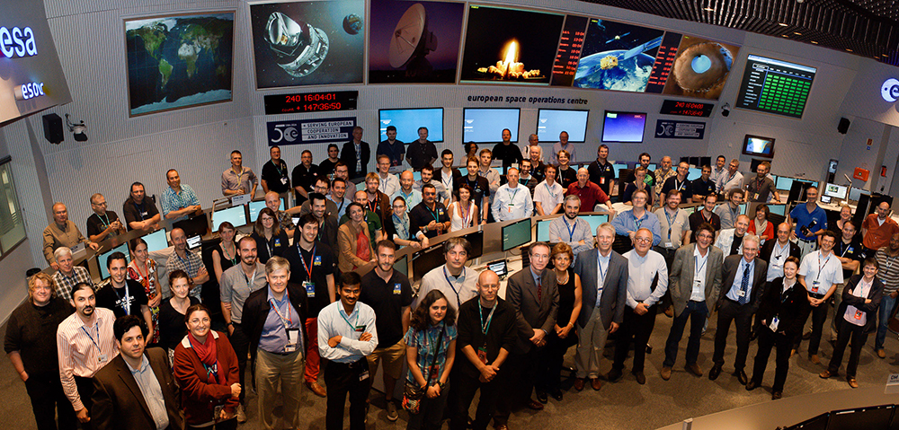
    The joint ESA–CNES Galileo operations team in the Main Control Room at ESA’s Space Operations Center, August 28. (Photo credit: R. Solaz).
    The joint ESA–CNES Galileo operations team in the Main Control Room at ESA’s Space Operations Center, August 28. (Photo credit: R. Solaz).

    Engineers determined within four hours the approximate actual orbit and then generated new commands to point the ground antennas to establish robust radio links. Working around the clock, and with assistance from the Galileo project engineers and the satellite builder, the teams then started to look at how to free the solar arrays. “Each undeployed wing had to be treated as a separate problem,” said Flight Operations Director Hervé Côme.

    “Each satellite had to be maneuvered separately into an orientation where the undeployed panel was facing the Sun because we realized that one cause was linked to the low temperature of the release mechanism. It all required developing, validating and rehearsing new flight operation procedures on the fly.”

    It took three days to release the trapped solar wing of the first satellite, and then two days later the second Galileo’s stuck array was also freed. The satellites have since been brought into full operation, as the teams in Darmstadt were tasked to retain control for five weeks — four weeks longer than planned.

    “This was very demanding on the ESA and CNES personnel, and on the ESOC operations team in particular, but the strong bonds developed through months of joint training enabled them to perform very well,” Liviu said.

    Possible uses of the two satellites are now being studied, and a future mission scenario will be decided at a later date.

    While the process of handing over the satellites to the Galileo Control Centre (where they are operated by teams from a private company, spaceopal GmbH), had been practiced in the past, this was the first time it was done with FOC satellites in orbit. The delicate process involves transferring responsibility for commands and telemetry, and beginning the satellites’ secure mode of operation by the teams at Oberpfaffenhofen. The handover ran very smoothly over the last weekend in September.

    “By the end of the Saturday, the first satellite was fully handed over, while the second handover took place on Sunday,” said Richard Lumb, ESA’s Galileo Mission director.

    “I am extremely proud of the entire Mission Control Team and the way they handled a dramatic and very critical situation resulting from multiple, independent anomalies,” said Paolo Ferri, ESA’s head of Mission Operations. “After launch, the joint team managed to maintain control of the satellites under extremely difficult conditions, rapidly stabilized them, and determined the actual orbit. The accuracy and professionalism of the subsequent handover activities also showed that the joint team at ESOC and the spaceopal team at the Galileo Control Centre are very well tuned for this procedure, which will become increasingly frequent with future launches.”

  • Tallysman Wireless Discusses GNSS Antennas, New Product at InterGeo

    Allen Crawford of Tallysman Wireless Inc. details the company’s GNSS antennas at InterGeo 2014, including a new product Tallysman Wireless plans to launch in the first quarter of 2015.

    See more InterGeo videos at GPS World’s YouTube Channel.

  • Esri Launches Direct Relief 1 Million Health Workers Map

    One-million-healthcare-workers-map

    Esri has launched a story map for the One Million Community Health Workers Campaign, which aims to expand and accelerate community health-worker programs in sub-Saharan African countries. With the use of the latest communications technology and diagnostic testing materials, these frontline workers link the rural poor to the broader healthcare system of doctors, nurses, hospitals and clinics.

    The map was designed to be a constantly evolving tool, regularly updated with information submitted by organizations deploying community health workers across sub-Saharan Africa. The map is refreshed every month as new data becomes available. The date of the data refresh can be found in the legend.

  • European Rail Supported by European GNSS

    European Rail Supported by European GNSS

    bernina-express-on-the-tirano-street-W Photo: European GNSS Agency (GSA)
    Photo: European GNSS Agency (GSA)

    By the European GNSS Agency (GSA)

    As European satellites offer a possibility to improve the efficiency of train control systems, GNSS technology is starting to gain momentum in the rail sector. To promote the role of GNSS in this important sector, the European GNSS Agency (GSA) recently exhibited at Innotrans — a leading rail transport tradeshow.

    EGNOS can and, in the future, Galileo will provide continuous and highly reliable positioning service — helping increase the competitiveness of rail among other modes of transportation. Currently, GNSS in European rail is primarily used within non-safety-of-life applications, including asset management and passenger information services. However, the latest technological developments show that augmented GNSS, together with specific sensors, can help satisfy the stringent CENELEC Safety and Integrity Level requirements.

    As a result, the rail sector has an increasing demand for cost-effective and innovative GNSS applications for both safety critical and non-safety critical purpose. For example, in the safety-critical domain, GNSS-based applications can provide signaling and autonomous train control. In the non-safety critical domain, GNSS is helping improve the performance of asset management and passenger information systems.

    Showcasing the E-GNSS Advantage

    With rail becoming an important market segment for GNSS technology, and to put emphasis on the many benefits E-GNSS can bring the rail sector, for the first time the GSA exhibited at a rail tradeshow. At Innotrans, one of the leading international tradeshows for the sector held September 23-26 in Berlin, the GSA showcased the EGNOS advantage for rail.

    Joining a panel discussion hosted by the European Railways Agency (ERA) entitled “How Heaven Could Support European Train Control System (ETCS),” GSA Head of Market Development Gian-Gherardo Calini explained how European GNSS can serve as a solution to some of the problems the sector currently faces.

    “Although rail will become a major market for E-GNSS, it is already providing benefits, such as helping to improve safety,” he said. “Our role at the GSA is to serve the end user by making sure the technology delivers the necessary solutions.”

    Calini acknowledged there are challenges to the sector’s full adoption of GNSS, but stated that other sectors have overcome challenges and are benefiting from E-GNSS: “It is a successful reality in other transport sectors, especially aviation, and we must focus on building from these experiences,” he said.

    The ERTMS/ETCS is a major industrial project that aims to replace Europe’s different national train control and command systems. The deployment of ERTMS will enable the creation of a seamless European railway system with aligned signalling — essential to increasing the competitiveness of European railways.

    Europe’s GNSS systems — Galileo and EGNOS — are actively contributing to the needed evolution of the ERTMS. One example of this long-term perspective is the Shift2Rail Joint Undertaking, whose objective is also to support the adoption of GNSS in the rail sector. Within this undertaking, it is foreseen that both Galileo and EGNOS will be brought into ERTMS standards and foster European GNSS adoption in the area of Low Density Lines.