On October 21, Jordan will host a Euro-Mediterranean Partnership (EUROMED) regional event focused on the use of GNSS, particularly European GNSS, for freight and road transport. The Euromed GNSS II/MEDUSA meeting will be held in Amman, Jordan, at the Sheraton Al Nabil Hotel.
Organized by the Euromed GNSS II/MEDUSA project, under the auspices of the Ministry of Transport of Jordan, the event will aim to share experiences and best practices, and to discuss strategies and possible ways forward in relation to the use of the satellite navigation for freight and road transport in the region.
At the event, MEDUSA will present the results of its case study, which was conducted with Royal Jordanian Customs and with the aid of the Ministry of Transport of Jordan. Since April, supported by European companies involved in MEDUSA, Royal Jordanian Customs have had the opportunity to test and validate the use of European GNSS, and specifically of EGNOS, for tracking and tracing containers shipped across the Mediterranean Sea and vehicles transporting goods in Jordan.
The case study is one of the technical assistance actions implemented by MEDUSA, and it represents the first life experience of EGNOS services’ usage in areas distant from Europe.
MEDUSA belongs to the EU Euromed Transport Program. Its objective is to promote the adoption of the European GNSS by the Euromed countries, which include Algeria, Egypt, Israel, Jordan, Lebanon, Libya, Morocco, Palestine, Syria (suspended due to political unrest), and Tunisia.
GNSS technology is applied to several user applications, and transport is one of the most important, including aviation, road, maritime, rail, freight transport and logistics. The MEDUSA project includes a program of specific technical assistance actions for the Euromed countries, to facilitate the introduction and exploitation of GNSS services in their markets.
The wide adoption of advanced technology, also including satellite navigation, for freight and road transport applications (such as Intelligent Transport Systems, or ITS) enables the implementation of smart mobility and the enhancement of goods transportation/traffic volumes increasing.
During the event, the participants from the Euromed countries will share lessons learned from the Jordan case study, and learn about relevant best practices in Europe and in the Euromed region, as well as debate strategies and possible ways forward in the light of national interests and common regional perspectives.
Opened by an institutional panel, with representatives of the Jordan Ministry of Transport and the European Commission, the event will consist of a session dedicated to the case study and a session addressing opportunities in other Euromed countries, including the presentation of European success cases as examples of suitable paths to guide the GNSS operational introduction and adoption.
At the conclusion of the event, the participants will elaborate guidelines and recommendations, to be possibly translated into action plans for the Euromed countries.
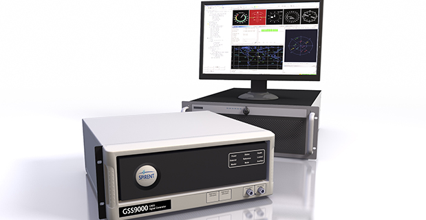
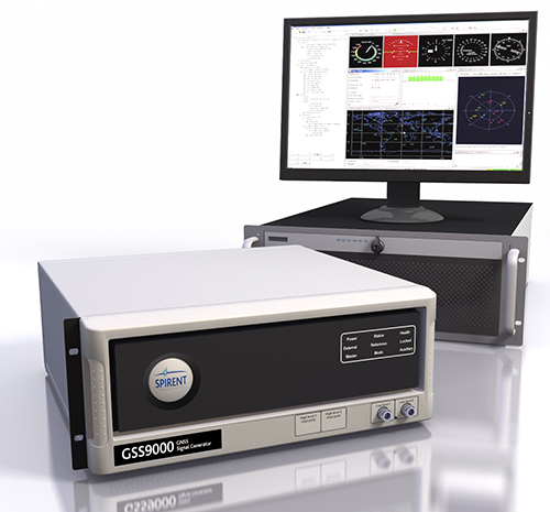
Spirent Federal Systems, a U.S. provider of positioning, navigation and timing test solutions to the government and its contractors, announces that its GSS9000 RF constellation simulator has been reviewed and granted security approval by the GPS Directorate.
Higher dynamic simulations with more accuracy and fidelity are enabled by 1000-Hz (1 ms) System Iteration Rate — a four-fold increase over Spirent’s current GSS8000 product — zero inter-channel bias and a 0.3 mm RMS pseudorange accuracy. The GSS9000 also includes support for restricted and classified signals from the GPS and Galileo systems as well as advanced capabilities for ultra-high dynamics.
According to Spirent, the GSS9000 is being rapidly adopted worldwide by key GNSS system and solution developers and providers because of its flexibility, performance and capability. The GSS9000 builds on the capability and performance of previous solutions from Spirent.
The GSS9000 is highly flexible and can support the widest range of carriers, ranging codes and data streams for the GPS, GLONASS, Galileo and BeiDou as well as regional/augmentation systems. Its flexibility is key to supporting tailored and customizable solutions for specific and unique test needs. Multi-antenna/multi-vehicle simulation, for differential-GNSS and attitude determination, and interference/jamming and spoofing testing are also supported.
Rockwell Collins has successfully received and tracked a Galileo satellite signal using a prototype GNSS receiver designed for secure military use.
In 2013, Rockwell Collins received a $2 million contract from the Air Force Research Laboratory (AFRL) and the GPS Directorate to develop and demonstrate a Secure Software Defined Radio (S-SDR) GNSS receiver capability. By using multiple available satellite signals, improved and more robust signal availability can be obtained, enabling a compatible GNSS receiver to deliver superior position determination that can improve navigation performance and signal availability.
Hosted in a software-defined radio, the S-SDR program will develop the security architecture required for receiver equipment approvals and certifications. The arrival of modernized GPS signals and other global constellations is changing the way the U.S. military and its allies accomplish secure GNSS-based positioning, navigation and timing. The European Galileo constellation coming on line during 2015, including its open signals and secure Public Regulated Service, is expected to provide an opportunity for improved robustness in satellite based navigation, in both commercial and government applications.
“This milestone reinforces our belief that Rockwell Collins is uniquely positioned to produce a navigation receiver that will meet global needs,” said John Borghese, vice president of the Advanced Technology Center for Rockwell Collins. “With decades of experience developing GPS systems and leading edge security architectures, our company continues to be a top innovator in this field.”
More than 35 years ago, Rockwell Collins assisted the U.S. Air Force in developing GPS technology. That legacy continued when the company created the world’s first all-digital miniature GPS receiver under contract with DARPA. Over the years, Rockwell Collins has produced more than 50 GPS products and delivered more than 1 million GPS receivers for commercial avionics and government applications. The GNSS receiver technology being provided for the S-SDR program will continue this legacy of providing leading edge GNSS solutions.
Rx Networks, Inc., has licensed its GPStream PGPS GNSS assistance technology to Recon Instruments, a Canadian technology company that brings heads-up display products to the consumer market. GPStream PGPS will tightly integrate with the GPS chip inside of Recon’s upcoming Jet smart glasses, an advanced wearable computer planned for the first quarter of 2015.
Through its location and GNSS assistance software and services, Rx Networks empowers fast positioning in more than a billion mobile devices every day, the company said. Its GPStream PGPS solution, licensed and deployed in more than 100 million smartphones and personal navigation devices, accurately predicts the future orbits of satellites for up to two weeks in advance. It then stands by, ready to deliver this assistance data into a GNSS chipset when it powers up. This not only speeds up initial time to first fix (TTFF) from 45 seconds down to less than 3 seconds, it also improves the receiver sensitivity and reduces power consumption. From a user perspective, this translates into longer battery life and faster initialization of apps that depend on location, even in difficult environments.
According to IDC, the wearable devices market is expected to grow from 19.2M units in 2014 to 111.9M units in 2018. Most form factors today rely on the presence of a smartphone as a hub for core functions like Internet access or location. “We are seeing an exciting new trend in the mobile location market,” said Guylain Roy-MacHabée, CEO of Rx Networks Inc. “From smartwatches to smart glasses, we are helping OEMs optimally implement satellite navigation and other means of positioning directly in this new class of smart wearables devices.”
Innovate UK (formerly the Technology Strategy Board) and the Natural Environment Research Council (NERC) plan to jointly invest up to £1.3 million to establish new Knowledge Transfer Partnerships in or related to the space sector to help United Kingdom companies to grow in the expanding global space market.
Knowledge Transfer Partnership projects are Europe’s leading program to help businesses improve their competitiveness and productivity through better use of knowledge, technology and skills that reside within the UK knowledge base, according to InnovateUK.
The investments will provide support for 10 to 12 Knowledge Transfer Partnership projects of between six and 36 months, helping to translate the UK’s academic strengths in this area into commercial success.
The competition opens September 15 and is open on a rolling basis for applications until noon on February 11, 2015.
A briefing/launch event for potential applicants will be held at the National Space Centre, Leicester, on September 23, 2014.
The Institute of Navigation’s (ION) Satellite Division awarded Pratap Misra its Johannes Kepler Award on September 12 at the ION GNSS+ Conference in Tampa, Florida, for his contributions to satellite navigation education, the understanding of GLONASS, and receiver autonomous integrity monitoring.
Misra is credited with tracking GLONASS satellites using the AF Deep Space Tracking Network to determine their orbits in the coordinate frame used by GPS, while the satellites broadcast their positions in the Soviet coordinate frame. Misra is recognized for his ground-breaking work on navigation with combination of GPS and GLONASS signals and is the western world’s leading expert on what’s now the Russian satellite navigation system. He was a technical advisor to the Federal Aviation Administration for many of the bilateral and multi-lateral committees that worked on the development of GPS/GLONASS spectrum sharing and avionics.
Additionally, Misra has worked on receiver autonomous integrity monitoring (RAIM), and contributed a novel approach that does not require the simplifying assumption of Gaussian errors. He was also the first to provide a RAIM algorithm that leveraged the receiver clock to put a bound on the vertical position error. These algorithms are expected to play a significant role in the upcoming multi-constellation environment.
Misra is a research associate professor of Mechanical Engineering at Tufts University, and is well known for the textbook that he co-authored with Professor Per Enge of Stanford University, Global Positioning System: Signals, Measurements and Performance. Misra is a past chair of the ION Satellite Division and has held numerous volunteer positions within ION, most recently focusing on the support of student programs. He is both an ION Fellow (2003) and IEEE Fellow (2007).
The Kepler Award recognizes and honors an individual for sustained and significant contributions to the development of satellite navigation. It is the highest honor bestowed by the ION’s Satellite Division.
LandWorks Inc., a developer of land-management solutions, has added linear project mapping capabilities to its online Web AutoMapper service, which converts land legal descriptions into GIS-ready map polygons. Web AutoMapper clients can now download digital parcel polygons with ownership information for every property crossed by a linear right-of-way project.
The linear mapping capability in Web AutoMapper facilitates the planning of any linear infrastructure development project – pipelines by energy companies, electric transmission lines by utilities, roads and highways by departments of transportation, and buried fiber networks by telecommunication companies.
“Web AutoMapper makes it faster and less expensive to map a proposed right-of-way or corridor project,” said LandWorks President Jerry Bramwell. “In minutes, project planners can download all of the digital parcel and land ownership information needed to select the safest and least costly route.”
To use the service, the client logs onto Web AutoMapper and creates an account. The user then uploads a shapefile of the proposed linear project route from their GIS or mapping software. Web AutoMapper prompts them to enter start and end points for the route. Customers are also given the option of having their route mapped with or without a buffer on either side.
Within minutes, Web AutoMapper overlays the route onto the nation-wide tax parcel grid developed by Digital Map Products of Irvine, California. Web AutoMapper then provides an onscreen map showing every property crossed by the route or within the user-selected buffer around the route. Paying with credit card or a customer account, the customer downloads the Digital Map Products parcels for only those properties affected by the proposed route. The parcel polygons are delivered in either shapefiles or as a file geodatabase for seamless ingest into the GIS or other mapping software.
Also included in the Web AutoMapper deliverable is a Line List Report identifying every property crossing in order from the starting to end points of the proposed route. Both the parcel polygons and Line List Report contain important attributes for each property, such as landowner and address details, obtained from county tax records.
“The linear mapping capability in Web AutoMapper serves as an easy-to-use cost-estimating tool for major infrastructure development projects,” said Bramwell. “The planner receives all of the land ownership information that will be needed to acquire rights-of-way for the project.”
In many cases, the ownership information in the parcel file will help planners identify certain types of properties — such as hospitals or schools — where rights-of-way may be impractical or simply too costly to acquire, said Bramwell. This allows the planners to look for less expensive alternatives while the project is still in its early phases.
Some linear projects require the developer to notify land owners within a certain distance of the proposed route. The buffering option in Web AutoMapper enables the planners to easily obtain land ownership information for properties within the regulated proximity to the line.
LandWorks introduced Web AutoMapper in 2013 as a fast and easy method of processing many types of standard property descriptions and converting them into digital map polygons. The cloud-based application is used extensively by organizations that must manage large tracts of land and keep property records up to date for activities related to oil and gas, renewable energy, mining, banking, utility, pipeline, state/local government, transportation, telecommunications, water and real estate sectors.
In the presence of the European Commission, the European GNSS Agency (GSA) and EuroControl have signed a new cooperation agreement to jointly contribute to the implementation of European Union GNSS policies as they apply to the field of aviation.
As Europe’s skies and major airports become increasingly congested, there is need for Air Traffic Management (ATM) technologies to evolve from ground-based infrastructures to more advanced systems based on new technologies. EuroControl and the GSA have a shared objective in developing and exploiting European GNSS technology to improve accessibility, efficiency and safety to European operators, pilots and airports.
To accomplish this objective, the agreement focuses on a range of activities, including:
Definition of aviation user requirements for EGNOS and Galileo
Introduction of European GNSS services for aviation within the European Civil Aviation Conference (ECAC) area
Coordination in aviation research and development
Aviation-specific GNSS performance monitoring
Promotion of European GNSS aviation activities at the international level
“This is another example of European Commission support of the aviation sector,” said Daniel Calleja Crespo, director general of DG Enterprise and Industry at the European Commission. “I am confident that a strong cooperation between the GSA and EuroControl will benefit aviation, the European GNSS Programs and indeed European citizens.”
“The full deployment of GNSS offers unprecedented opportunities to further improve air traffic management safety and capacity, while reducing costs at pan-European level,” said GSA Executive Director Carlo des Dorides. “EuroControl’s activities in this field will complement those of the GSA to ensure that the development and implementation of satellite-based navigation provides an optimal solution for European airspace users.”
“EuroControl and the GSA share a common objective — the secure and safe implementation of European satellite navigation policies in the aviation sector. The enhanced cooperation between our two organizations means that EuroControl will now bring its unequaled capacity to understand, coordinate and represent the needs of the civil and military airspace users to the promotion and development of GNSS,” said Frank Brenner, director general of EuroControl.
EGNOS is Europe’s first venture into satellite navigation and has been providing a certified safety service for aviation users since 2010. EGNOS is owned by the European Union and, since January 1, 2014, the GSA is responsible for its exploitation, ensuring service provision, operations, maintenance and evolution.
Do you know any conspiracy theorists? You know, those folks who I am sure are well meaning, but see a conspiracy behind every event? Think Mel Gibson in the great 1997 movie with the very imaginative title Conspiracy Theory. Well, the conspiracy theorists have been coming out of the woods following the Galileo launch fiasco, and they are blaming both the Russians and European Space Agency for allowing the Russians the capability to effectively render useless what should have been the first two operational Galileo PNT satellites.
Think about it. The European Union spends more than 17 years gearing up for a launch of the first two operational Galileo satellites, and they leave the final orbit determination to equipment from a country (Russia) that their countries, and the United States, are collectively (European Union) currently sanctioning for numerous treaty and humanitarian violations.
Who knows? Maybe this was all just a big mistake, and there were no overt actions taken by Russia to place the two Galileo satellites in the wrong orbit. Frankly, I have no idea if the final stage was sabotaged or not, but it makes for an interesting theory and gedankenexperiment. It also should serve as a warning to the U.S. government, especially the USAF when it comes to utilizing the remaining Russian rocket engines we have in stock.
I have been to the location where the handover of the Russian rocket motors takes place. The motors are delivered by the Russians and accepted by USAF and United Launch Alliance officials. Then, I have been assured, that the engines are gone over with a fine-tooth comb. Hopefully, there is no opportunity for a motor that has been tampered with passing our inspections, validations and launch certifications. Still, there is always that niggling worry in the back of your mind that won’t go away. So, even if the conspiracy theorists are all wet, and I hope they are, the whole Galileo launch fiasco should still serve as a warning to our National Military Space (NMS) acquisition and launch certification officials. A little extra scrutiny of Russian-manufactured space equipment might be in order.
Of course, there does not have to be a conspiracy. It could be just bad luck or poor workmanship. It is public knowledge that the Russians have had numerous launch and space-equipment failures in recent months, while the U.S. has had more than 115 consecutive NMS launches without a single failure. Indeed, there has not been a single NMS launch failure since the Broad Area Review (BAR) in the late ’90s.
There have been two additional follow-on BARs since and they all recommended greater situational awareness and attention to detail. So maybe the Russians just need a good BAR — pun intended. At any rate we should know in the next few months as there are no fewer than three separate European investigations being conducted as I write this. Let’s hope the conspiracy theorists are all just crying wolf.
Flying for GPS Book Review
This is the title of a new book by an old friend and colleague, Len Jacobson. This is Len’s second full-length book, as he writes copious articles (many for GPS World) and chapters of books for other writers. In my opinion, this is the better of his two books, although the first book was much more technical in nature. It sits on my GPS bookshelf and I refer to it frequently. So maybe this one is just a better read.
When Len’s autographed book arrived, I dove into it and immediately discovered it is as much about Len and his life before and since GPS (BCEGPS and ADGPS if you will) as it is about the Global Positioning System per se. This is certainly not a criticism, merely an observation, since the personal touch makes this book come alive.
Seriously, this book is an unabashed personal history, a travelogue and a history of the GPS program all rolled into one, and although Len cautions readers to only read Part Two if they only want to know about GPS, I maintain that you will miss a great read if you go that route.
Len Jacobson
As I said, I have know Len since about 1975 ,and even though we have known each other for 39 years I had no idea of all the qualifications Len brought to GPS and how his life, after 1975, has revolved around this singular military weapons system.
The book is a tour de force for GPS, but also is about an engineer coming of age in the 1960s during the Vietnam War. Len describes the technology and communications capabilities and programs that made GPS possible. But more than that, he also goes into the personalities, and this may be the highlight of the book for many. He names names when possible, and obscures them when circumstances, personal preferences and legal precedents demand it. Still, most of the time ,if you were around in the halcyon days of Parkinson and Getting, then you know exactly who Len is describing. And even if you don’t know, it is fun to guess.
Len gives some painful insights to the birth pains that GPS experienced — to include the early rejections by both the military and the Federal Aviation Administration (FAA). And his description of the whole Selective Availability saga sheds new light for me on just what took place, and I was there.
Throughout the book, Len describes his life and key roles in self-deprecating terms, and yet acknowledges he was known far and wide. I can personally attest to this, as a GPS proselytizer. There is another word I could use, but since this is a family magazine I will forego the opportunity. Let’s just say that if Len was in the room, you knew you were going to hear about or talk about the latest in GPS technology.
Some of you might describe parts of the book as esoteric trivia concerning GPS, and while that may be true, Len presents it in such a way that you want to file that bit of trivia away for a rainy day and then spring it on your PNT colleagues when they least expect it. For instance, I found it very compelling when Len describes on page 95 the history of the Chinese BeiDou program. I think you will be surprised. I was.
And in the end, many of the companies that Len worked for over the years no longer exist today, such as Figgie, but fortunately many of the people are still around. And Len doesn’t pull any punches. He relates stories of business intrigue, intransigence and even bigotry. He even manages to include the Lacy Peterson murder investigation.
I hope I have piqued your interest, because this is a unique book that everyone who is evenly remotely interested in the history of GPS and PNT in general should read. Highly recommended. Read a quick excerpt from this unique GPS tome on the GPS World website if you have the time.
Happy navigating!
Don Jewell
Until next time happy navigating and remember GPS is brought to you free of charge by the United States Air Force. Aim High!
The announcement is notable in that it expands the relationship formed in June 2011 between Septentrio and Altus, with Septentrio more closely integrating the Altus subsidiary. Additionally, Septentrio is now manufacturing Altus GNSS RTK receivers at its factory in Belgium while Septentrio is closing its separate sales office in the U.S., merging that functionality into Altus, according a spokesman.
The Torrance, California-based Altus, started by Vancans in 2007, has long focused on the surveying sector. Vancans himself is a Fellow of the Royal Institution of Chartered Surveyors in the U.K.
“Ten years ago 90% of the high-precision GPS market was survey or survey-related. But survey is not a high-growth market. Today survey is probably 20% of the market and that’s doing things like putting a $10,000 receiver on a $4,000 lawn mower,” Vancans explains. “The growth market outside that (in consumer wireless) is huge, and it offers many new opportunities and will continue to grow.”
The survey market will continue to be in the Altus and Septentrio strategy, particularly leveraging Altus products with Septentrio’s advanced receiver technology experience in the OEM market.
Vancans has watched for two decades as use in emerging Asian economies has increased demand for surveying equipment and speculates what’s happening in the U.S. and other Western markets with OEM growth will eventually be mirrored there. He estimates the Chinese receiver market alone has grown ten-fold since he worked as president of Leica GPS nearly 20 years ago.
“What’s interesting and exciting is that it will be a big growth market for OEM or non-survey applications based on domestic Asian manufacturers using Western and increasingly Asian OEM,” Vancans says.
“If you can master the distribution capabilities in the OEM market in North America in the next couple of years, that will form the foundation of what happens in Asia in the future.”
Altus’ announcement also came with news the company hired Mo Kapila as OEM sales manager for Septentrio products. Kapila’s background is in embedded wireless, according to Vancans.
Vancans, who spent two days on the CTIA show floor, says the consumer wireless industry is on Altus’ radar, although he is still “very wary” of that side of the business. As general manager of Thales Navigation (which later re-merged as Magellan) in the early-2000s the company worked on a GPS attachment for Palm and integration into other consumer devices.
“The professional high-precision market is stable and products have a long shelf life,” he says. “On the other hand, the good thing with the consumer market is the constant changes in devices, the churning. As consumer markets take up high-precision GNSS products , they will be embedded in products which are rapidly outdated.”
Altus is taking a wait-and-see approach when it comes to professional-grade receivers for the consumer market.
“If the price lowers, the longevity will too,” he says. “The high end will likely go down to meet the low end – the cheap and easy, changeable model.”
Vancans says Septentrio will continue to differentiate itself from competitors based on its low power consumption relative to the functionality and size of the device, and robust positioning, whether it’s for professionals or consumers.
“If you look to the future and think of how much satellites will proliferate and signal availability will open,” he says, “it’s a good position for us to be in with the continuous consumerization of high-precision GPS and GNSS.”
Parsec Technologies, Inc., global provider of wireless positioning antennas and amplifier integrated circuits for the consumer, automotive and defense markets, introduced its GPS/GNSS L1 high-radiated efficiency active antenna at CTIA Super Mobility Week September 10.
The PTA1.5M-9, sized 9 x 9.175 x 1.3 mm, integrates easily with GNSS/GPS 3D-SIPs and system-on-chip (SoC) receivers with only a single direct connection typically required, and is compatible with any GNSS receiver operating from 1560 to 1610 MHz.
The Parsec PTA 1.5M-9 is a wideband antenna ideal for embedded LBS receivers requiring good user experience to operate within 5 to 7 mm of the human body, indoors in the presence of multi-path, and in applications with obstructed views of orbiting satellites.
Key benefits include:
Micro miniature size: 9mm x 9.175mm x 1.3mm (L x W x H)
50 MHz bandwidth: covers GNSS systems from 1560 – 1610 MHz
Highest rated efficiency in class: 50% at 1575.42 MHz
Antenna gain: Ga=0.8 dBi @ Fc = 1575.42 MHz, linear polarization
Ideal for M2M GPS/GNSS requirements
Plano, Texas-based Parsec is displaying their products for M2M devices, showcasing their GPS and GNSS product line of active and passive antennas as well as introducing their new ultra-thin dual band cellular antenna at CTIA 2014 in Las Vegas, Nevada – Booth #6221 in the M2M Zone.
Topcon Positioning Group and MAVinci GmbH have released the latest version of the Sirius Pro surveying UAS (Unmanned Aerial System) program, designed to be compatible with existing RTK (real-time kinematic) base stations or NTRIP (network transport of RTCM data over IP).
“By connecting an external base station, Sirius Pro will receive the RTCM correction signals and deliver 2-5 centimeter accuracy without using ground control points,” said Eduardo Falcon, executive vice president and general manager for the Topcon GeoPositioning Solutions Group. “When you have mobile Internet on your site, you can achieve the same accuracy even without a local base station using NTRIP.”
Sirius Pro is designed to deliver orthofotos and three-dimensional elevation models with a high absolute accuracy of 2-5 centimeters without using ground control points. “Combining MAVinci‘s precision timing technology with Topcon sub-centimeter grade L1/L2 GPS/GLONASS RTK receivers, this robust system stands up with a clever solution that helps in the realizing of projects in a better and faster way,” said Johanna Claussen, CEO at MAVinci.
For users who do not have an RTK base station, an internal base station add-on for the Sirius Pro is available. “It upgrades the Sirius Pro to its full functionality: Use of an internal or external base station depending on your needs,” Claussen said. “This add-on is available anytime via Internet without changing your hardware.”
Sirius Basic is an entry-level solution for UAS surveying, and delivers orthofotos and 3-D elevation models. The system is designed to offer high-accuracy when using ground control points. “Sirius Basic offers you full flexibility,” said Falcon. “It can be upgraded to Sirius Pro via an Internet update later on — no hardware change is necessary.”
The system will be available at the Intergeo trade show for geodesy in October and thereon. The Topcon and MAVinci UAS was first introduced at Intergeo 2013 for the European market and was recently made available in the North American market.
 Organized by the Euromed GNSS II/MEDUSA project, under the auspices of the Ministry of Transport of Jordan, the event will aim to share experiences and best practices, and to discuss strategies and possible ways forward in relation to the use of the satellite navigation for freight and road transport in the region.