
Blog

  • Unicore Announces BeiDou/GPS+MEMS GNSS Module, High-Precision Heading Board at ION GNSS+

    UM220-INS BDS/GPS+MEMS dual-system inertial navigation module.
    UM220-INS
    BDS/GPS+MEMS dual-system inertial navigation module. Photo: Unicore

    Unicore Communications, Inc., is showcasing two new products at ION GNSS+, being held September 10-12 in Tampa, Florida.

    The UM220-INS is a BeiDou/GPS+MEMS dual-system inertial navigation module for in-dash automotive navigation and high-end navigation. Besides dual-system (BeiDou+GPS) GNSS navigation, the UM220-INS features a built in six-axis MEMS and can output a GNSS+MEMS inertial positioning result, making it suitable for applications requiring high accuracy, high reliability, and high continuity positioning.

    The second product is the UB280, a BeiDou/GPS dual-system dual-antenna high-precision heading board for precise RTK position and heading. According to Unicore, UB280 is based on Unicore’s mature BeiDou compatible multi-system GNSS system-on-chip (SoC), features low-power design and dual-antenna input, can offer millimeter-level carrier phase observation value and centimeter-level RTK positioning accuracy, and supports multi-path mitigation. Its advanced technology of instant and long-distance RTK is designed for high-precision positioning, navigation, and heading applications in static and dynamic environments.

    Features of the UM220-INS include:

    • Built-in six-axis MEMS. UM220-INS has a built-in MEMS with a 3-axis gyroscope and a 3-axis accelerometer. The solution fusing GNSS and inertial MEMS enables car-navigation devices to provide a continuous and stable position under complicated environments such as basement parking and tunnels, regardless of satellite visibility.
    • High-Sensitivity Design. With Unicore’s Ultra-Sense high-sensitivity design, UM220-INS can provide excellent acquisition and tracking sensitivity under weak signal conditions, maintaining the position continuity and reliability of the receiver.
    • High-Integrated Design. Different from traditional GPS navigation products, built-in MEMS devices support the odometer / speed pulse, the reversing signal input, and more integrated, simplified overall unit manufacturers’ design.
    • DGNSS and AGNSS Supprt. UM220-INS has extended support for differential GNSS and assisted GNSS positioning functions, and supports RTCM2.3/3.0.
    • Backward Compatibility with UM220. The UM220-III N module is backward-compatible with the UM220 in size and interface, which makes upgrades easy.

    UB280 BDS/GPS dual-system dual-antenna high -precision heading board. Photo: Unicore
    UB280 BDS/GPS dual-system dual-antenna high -precision heading board. Photo: Unicore

    Features of the UB280 incude:

    • Design standard. This board is totally compatible with mainstream OEM boards in dimensions and electrical standards for the convenience of user’s further development. Apart from this, more hardware interfaces are available.
    • Rapid RTK Integer Ambiguity Resolution. With super strong RTK algorithms, it ensures more rapid initializing speed and can make a GNSS-RTK solution on multi-constellation, thus ensuring users take the lead in the interoperability era.
    • Web Interface. The UB280 supports an Ethernet interface, so users can configure the board through Ethernet, managing, upgrading, and restarting the device remotely.
    • Instant Heading Technology. With an innovative RTK algorithm, Unicore has developed the real-time dynamic heading technology on variable baseline length for a moving base station. High-quality carrier observation and perfect RTK algorithm can provide a 0.2° heading accuracy on a 1-meter baseline.
    • Graphical Interface. Based on the graphical Control and Display Tool (CDT), the state, SNR and elevating angle of the satellites of all the constellations could be displayed on the screen, which is convenient for application development.

    Unicore Communications is located in Booth 118 in the ION GNSS+ exhibit hall.
  • Exelis GPS Threat Detection Offers Improved Capabilities


    The Signal Sentry 1000.
    The Signal Sentry 1000.

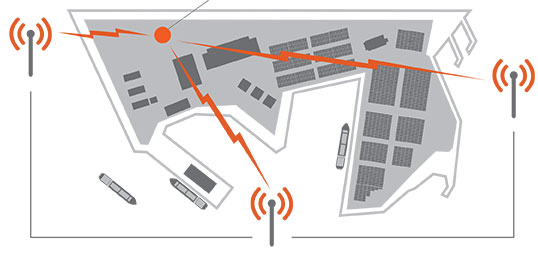
    Based on customer use and feedback, Exelis has improved its Signal Sentry 1000 product to include enhanced, user-friendly analytics and alerts. Signal Sentry technology detects and locates sources of intentional and unintentional interference to GPS signals and provides users with actionable intelligence.

    Exelis is showcasing Signal Sentry 1000 in Booth 619/621 at the ION GNSS+ conference September 10-12 in Tampa, Florida.

    Enriched features of Signal Sentry 1000 include superior sensors that increase detection accuracy to better pinpoint the jamming source, enhanced analytics to recognize patterns of jamming, and easy-to-use history functionality to comprehend where interference happened and to follow its path. Instant reporting of jamming events via text or email so that appropriate resources may be deployed to an incident is also a new feature of Signal Sentry.

    “Signal Sentry was developed by Exelis to protect critical infrastructure and to deliver intelligence to police agencies. Since Signal Sentry has been used by law enforcement, we have been able to enhance the products investigative and intelligent-led policing capabilities,” said Carl Slutsky, product line manager for Signal Sentry at Exelis. “Now, users can see patterns such as what happened and when and where it happened to better allocate their investigative resources. Additionally, we added an alert feature to Signal Sentry that provides real-time notice of a GPS jamming event, so law enforcement can dispatch a patrol unit to the precise location of the jamming event.”

    Because of the broad availability of low-cost GPS jamming devices on the Internet, the risk associated with signal disruption has increased significantly. GPS jammers are often used by criminals to conceal stolen cars and by commercial drivers whose intent is merely to hide their location from their employer. Truckers who used personal-privacy GPS jammers near shipping ports have caused interference with the signal also used to navigate large ships, which severely compromised safety and the efficient operation of the port.

    Signal Sentry leverages GNSS signal domain knowledge and is based upon patented technology developed through the company’s history of designing and fielding electronic intelligence systems. Exelis navigation payloads and components have been on board every U.S. GPS satellite ever launched and have more than 700 years of accumulated on-orbit success.

  • CoreLogic Identifies U.S. States at Risk of Property Loss from Natural Hazards

    Corelogic-hazard-9-9-2014

    CoreLogic, a global property information, analytics and data-enabled services provider, has released an analysis ranking Florida as the U.S. state with the highest level of comprehensive risk exposure to multiple natural hazards, with Michigan identified as the state with the lowest risk.

    The analysis was derived from the new CoreLogic Hazard Risk Score (HRS), an analytics tool launched today that gathers data on multiple natural hazard risks and combines them into a single easy-to-use score ranging from 0 to 100. The overall score indicates risk exposure at the individual property and location level.

    For every geocoded location across the U.S, the CoreLogic HRS is compiled using data representing nine natural hazards: flood, wildfire, tornado, storm surge, earthquake, straight-line wind, hurricane wind, hail and sinkhole. Locations with higher risk levels are exposed to multiple hazard risks and will, therefore, receive higher scores when the risk analysis is aggregated. Subsequently, locations with minimal risk levels have lower exposure and receive lower scores. Geocoded locations are generated at the property-address level using latitude and longitude coordinates and include both residential and commercial properties.

    “Florida’s high level of risk is driven by the potential for hurricane winds and storm surge damage along its extensive Atlantic and Gulf coastline, as well as the added potential for sinkholes, flooding and wildfires. Michigan alternatively ranks low for most natural hazard risks, other than flooding,” said Dr. Howard Botts, vice president and chief scientist for CoreLogic Spatial Solutions.

    The proprietary CoreLogic HRS is able to calculate risk based on a 10 x 10 meter grid, the lowest level of granularity available for the underlying hazard data. In calculating the overall score, both the probability of an event and the frequency of past events are significant contributing factors used to determine risk levels associated with individual hazards, as well as each distinct hazard’s risk contribution to total loss. The data is combined into an aggregated, consistent and normalized value that allows statistically valid combinations to be derived.

    “In the past, natural hazards have been difficult to compare and combine in a meaningful way,” said Dr. Botts. “Hazard Risk Score is a single solution that measures risk concentration consistently and pinpoints the riskiest places in the U.S. with timely and granular accuracy. This insight is critical in conducting comparative risk management nationwide and fully understanding exposure to potential natural hazard damage.”

    Insurers, risk managers and mortgage servicers can use CoreLogic Hazard Risk Score to improve decision-making and enhance a variety of business operations, including:

    • Business continuity and disaster recovery planning
    • Analyzing risk associated with a residential property or portfolios of properties
    • Measuring mitigation savings vs. total hazard potential damage
    • Evaluating and determining natural hazard risk levels of distribution and supplier networks
    • Recognizing which underinsured or uninsured properties may become at risk of default
    • Adverse selection avoidance and identification of “good risk” properties

    U.S. Natural Hazard Risk by State* (Ranked by CoreLogic Hazard Risk Score)

    Rank State HRS

    1FL94.51

    2RI79.67

    3LA79.23

    4CA75.56

    5MA72.12

    6KS69.51

    7CT69.04

    8OK66.82

    9SC66.38

    10DE65.38

    11OR64.89

    12NJ61.54

    13IA61.02

    14TX60.89

    15NC59.72

    16MO57.81

    17DC57.33

    18MS57.05

    19AR56.7

    20NH55.3

    21ID52.75

    22MD52.28

    23CO51.88

    24NE51.86

    25IL51.8

    26IN50.74

    27GA50.58

    28NV50.12

    29AL49.42

    30KY47.34

    31TN46.48

    32UT45.22

    33NM43.76

    34AZ42.81

    35VA42.35

    36WA42.3

    37WI38.52

    38SD38.24

    39MT37.91

    40MN36.42

    41OH34.61

    42ME31.64

    43WY30.24

    44PA28.79

    45VT28.31

    46ND27.5

    47NY24.97

    48WV20.67

    49MI20.22

    Source: CoreLogic 2014.

    * AK and HI were excluded in the ranking due to limited natural hazard risk data.

  • Septentrio Consolidates Sales for Americas in Altus Subsidiary

    Altus Positioning Systems, a subsidiary of Septentrio Satellite Navigation NV, has assumed responsibility for Septentrio products in North and South America.

    Septentrio — a manufacturer of high-end GNSS receivers for demanding professional navigation, positioning and timing applications — is consolidating its sales, service and customer support functions for the Americas in Altus’ facility located in Torrance, California.

    “This decision to base Septentrio’s sales and support functions for the Americas with Altus marks the next logical step in our evolving business relationship and professional collaboration with our parent company Septentrio,” said Neil Vancans, president of Altus. “We look forward to leveraging the strengths of both our organizations to grow the market for Altus and Septentrio products across a wide range of market sectors.”

    Altus has added industry veteran Mo Kapila as OEM sales manager for Septentrio products. Kapila is based in Altus’ office in Torrance, California. Before joining Altus, he was vice president of sales for Qualinetics, a pioneer in vehicle telematics.

    Kapila previously held senior sales management and business development roles at B&B Electronics and Quatech, as well as OEM product management positions at DENSO and Clarion Corporation. He is a graduate from the University of Michigan with a B.S. degree in mechanical engineering.

  • CTIA Connected Car Panel Highlights Safety, Innovation

    When comedian Larry Wilmore started out Day 2 at CTIA Super Mobility Week by reporting from a connected car on the show floor, he was only half joking when he said, “It’s almost like you’re driving in a smart phone, and with smart phones getting bigger it’s not too far off. I think I saw an HTC this size.”

    The experts in the keynote Connected Car panel agreed: The car is the new smart phone.

    Just ask Ralph de la Vega, CEO of the just-formed AT&T Mobile and Business Solutions Group, who called the Chevy Corvette “the best smart phone I’ve ever gotten to test.” The Corvette was conveniently displayed next to the stage, along with a connected Tesla Model S.

    As CTIA CEO Meredith Atwell Baker pointed out, what was once relegated to the CTIA show floor is now in dealerships all across the U.S. The statistics thrown out by de la Vega supported this observation. Thirty-two percent of new cars sold globally (and 60% of new cars sold in the U.S.) by 2017 will be embedded with cellular technology. Seventy-two percent of people would delay a new car purchase one year to buy a connected car by their preferred automaker.

    De la Vega co-moderated the panel with Glenn Lurie, his successor as CEO of AT&T Mobility. Panelists representing General Motors/OnStar, Ericsson, VoiceBox and Tesla overwhelmingly agreed that the emphasis on the connected car going forward has to be safety.

    “[Drivers are] trying to fill the time and be productive. People naturally want to do that. They’re going to bring the phone in, reach over, grab it and try to do things. And the more capabilities, the more they’ll do it,” said Mike Kennewick, co-founder & CEO of VoiceBox, maker of natural language technology. “It’s imperative as we bring the Internet into the car, there’s a component that allows you to do it safely.”

    What that would mean, exactly, though, was a matter of opinion. Each panelist had a chance to discuss their company’s recent and coming advancements.

    • De la Vega says AT&T’s studies show people prefer a shared family data plan that would allos them to share data across people and across devices, and a belief by the wireless provider that customers should be able to add their cars to their rate plans.
    • GM has successfully integrated 4G/LTE into 33 different models in the U.S. and Canada and next plans expansion in Europe, Mary Chan, President of Global Connected Consumer at GM shared.
    • VoiceBox’s Kennewick calls the voice recognition in cars today “just like the movies” but says VoiceBox strives to simplify the apps in cars and make voice activation less about reiterative command-and-control.
    • Telsa, a leader in over-the-air auto updates, will be launching a mass market car “in a few years” and is now exploring how best to keep the customer experience focused in the car. Tesla CIO Jay Vijayan also said the company is considering opening up its infotainment stystem to other partners.
  • ION GNSS+ Blog: Ignite Presentations Spark Interest

    Art Kalinski Blogs from ION GNSS+ in Tampa

    I’m attending ION GNSS+ 2014 in Tampa, Florida, this week. Although this is a GPS conference, there are topics that will be of interest to us geospatial people. The opening plenary session Tuesday night included a series of short “Ignite” presentations that were moderated by Alan Cameron of GPS World.

    I am completely sold on the concept of short “ignite” presentations, which are a preview of full sessions to come later in the conference. It was quick, kept my interest, and drew my attention to sessions that I may not have attended.

    All conferences should start with this kind of quick preview of things to come.

  • Galileo Provides Update on FOC Anomaly, GLONASS a No Show

    Experts representing the Galileo Program provided a frank and open update on how it is addressing the problem of the first two full operational capability (FOC) satellites being delivered to the wrong orbit. The presentation was part of the panel discussion “Status of GPS, GLONASS, Galileo, BeiDou, and QZSS” at ION GNSS+ Wednesday morning.

    No one from Rocosmos attended to present information on the status of GLONASS. A Russian spokesperson had hoped to come but could not obtain a visa, for unknown reasons. There appear to be no Russians at the conference apart from one CEO of a Russian receiver manufacturing firm.

    A new article in Nature magazine provides additional background on the Galileo FOC anomaly. Also, the CANSPACE listserv has been engaged in discussing the issue.

    • An inquiry board is looking into problem to find the root cause of the anomaly. The board has already met several times.
    • An intermediate report is due shortly; a final report and recommendations will come next month.
    • The European Space Agency (ESA) is considering what can be done with the two satellites; ESA hopes to be able to use them operationally as much as possible.
    • ESA is also looking at the impact on the commercial Galileo service and the search-and-rescue service.
    • ESA is already narrowing down the possible causes of the anomaly.
    • ESA is waiting for the enquiry board to report before deciding on when and how the next two satellites will be launched.
    • The payloads of the errant satellites are currently off.
    • ESA wants to try to raise the perigees of the satellites to get them out of the van Allan radiation belt as soon as possible to prevent damage to the satellites. Raising the perigrees will also to reduce the maximum Doppler frequency shift from 9.6 kHz to at least 6.8 kHz to allow receivers to easily acquire and track the satellites, but leave enough hydrazine for future station keeping.
    • ESA is looking at the almanac problem and whether unused bits in the Galileo navigation message might be able to support a special almanac for the satellites.
    • ESA is also looking at possible rephasing of the satellites to optimize their use with the other satellites in the constellation.
  • NovAtel’s Velocity Magazine Features PPP

    NovAtel is offering a sneak peak at its Velocity 2014 magazine, which features an informative technical article on precise point positioning, or PPP. The article, “Advanced GNSS Positioning Solutions with Precise Point Positioning,” discusses how NovAtel CORRECT is designed to optimally handle GNSS constellations and corrections to deliver the best possible positioning solution.

    The new Velocity magazine is available at the ION GNSS+ conference in NovAtel’s booth, Booth J.

    Anyone not able to attend ION GNSS+ will find Velocity 2014 bundled with the next issue of Inside GNSS, or can email NovAtel.

    NovAtel is also offering a significant cost savings on the NovAtel CORRECT with TerraStar PPP positioning solution through September 30.

  • New Broadcom Chip Provides Always-On Location and Sensing for Mobile Applications

    Broadcom Corporation today announced the industry’s first low-power GNSS and sensor hub combo chip to deliver new always-on location applications for a full range of mobile devices.

    The Broadcom BCM4773 minimizes battery drain and adds a new layer of intelligence to location technology on mobile devices by integrating the GNSS chip and sensor hub into a single combo chip. Broadcom’s architecture enables information from Wi-Fi, Bluetooth Low Energy (BLE), GPS and micro electro-mechanical systems (MEMS) to be calculated on a single system-on-chip (SoC) instead of the application processor (AP). This design drives more than 80 percent power savings by offloading from the AP and lowers cost by reducing board area by 34 percent.

    “Broadcom today extends its leadership by announcing the industry’s first combo chip that brings GNSS and sensor hub technology together to revolutionize mobile apps in areas such as health, fitness and lifelogging,” said Mohamed Awad, Broadcom director, Wireless Connectivity. “We are proud to make all mobile platforms even smarter by enabling them to dynamically predict and react to consumers’ needs.”

    Additionally, Broadcom brings more intelligence to context awareness by integrating GNSS and providing a direct connection to the Wi-Fi combo chip. This allows a mobile device to know where a user is and what the user is doing to further personalize the experience. For example, a BCM4773-based smartphone can use information from Wi-Fi, BLE, GPS and MEMS to recognize when a runner is outdoors versus inside on a treadmill and dynamically manage these technologies to save battery life and optimize the user experience, all without involving the main AP.

    Key Features:

    • Optimized for hardware offload of sensor fusion, on-chip positioning, geofencing and location batching
    • More than 80 percent power savings compared to standard GNSS receivers
    • 34 percent board area reduction by integrating GNSS receiver and sensor hub
    • Standalone microcontroller offloads fusing of sensor data from the AP to maximize power savings
    • Concurrent support for five different satellite systems, including GPS, GLONASS, SBAS, QZSS and BeiDou
    • Ultra-low power on-chip positioning for background and foreground location using GNSS
    • On-chip Wi-Fi positioning using a direct connect communication protocol to the Wi-Fi SoC
    • Batching support for all devices connected to the Location Hub, including Wi-Fi, MEMS and GNSS

     The Broadcom BCM4773 is currently in production.

  • Septentrio, Altus Showcase High-Performance RTK at ION GNSS+

    Septentrio and Altus will be presenting their high-performance RTK systems at ION GNSS+ 2014. Attendees are invited to learn more at:

    • The Triple-frequency Multi-system RTK Engine for Challenging Environments (Session A1 room 18, Wed. 9/10 @11:48)
    • Gap Bridging in Precise Point Positioning (Session B6 room 19, Fri. 9/12 @3:20)

    High-performance RTK provides accurate positioning

    • in urban environments or under dense canopies
    • while suffering high ionosphere activities or
    • when coping with sparse networks
    • for maintaining a smooth transition during outages

    Plus, there is no baseline impact, even at greater than 40 kilometers. Visit booth 318/320 in the Exhibit Hall to learn more about the technology behind the performance.

  • Loctronix Advances GNSS Integrity Monitoring with HGX Interference Detection System

    Loctronix Corporation, a provider of positioning, navigation, and timing (PNT) solutions for GNSS-challenged environments, has unveiled the HGX Interference Detection System (IDS) for identifying and monitoring intentional and unintentional interference sources. The IDS is being demonstrated September 10-11 at ION GNSS+ 2014, in Tampa, Florida.

    “The IDS can detect sources of interference ranging between 5 dB and 60 dB GNSS jamming to signal (J/S) ratio. Featuring a novel profiling function, the IDS not only detects, but can identify the type of interference given a database of known/previously recorded profiles,” stated Michael Mathews, Loctronix’ CEO and founder.

    According to Mathews, “The greater dependence of GNSS within critical infrastructure — including, transportation, communications, finance and the growing availability of jammers — requires new tools to respond to potential threats. The IDS is the first tool to combine the powerful capabilities of Loctronix Spectral Compression Positioning (SCP) technology for identification and characterization of signals with traditional GNSS signal processing to provide full situational awareness of GPS/GNSS operations. The IDS system will benefit government, military, and commercial/industrial applications wherever there is a critical dependence upon quality GNSS data.”

    The IDS was developed using the Loctronix HGX hybrid sensor toolkit along with the company’s ASR-2300 ASR Workbench software defined radio platform. The standard implementation supports L1 GNSS bands and measurement rates of 10 measurements per second. Partner-licensed custom/solutions can support multiple bands (such as L2, L5) with greater bandwidths and measurement rates. Multiple sensitivity modes enable monitoring of sub-thermal and high-power interference.

    The HGX toolkit API will be available for specialization of the system for custom/embedded applications and adaptation to other hardware platforms. Visit Loctronix in Booth 422.

  • Air Force Shares GPS Status at CGSIC at ION GNSS+

    News courtesy of CANSPACE Listserv.

    Two U.S. Air Force officers provided a GPS program update at Tuesday morning’s Civil GPS Service Interface Committee meeting plenary session at the ION GNSS+ 2014 conference in Tampa, Florida. Here are some key points from the presentations by Colonel Matthew Smitham, deputy director, GPS Directorate, and Lieutenant Colonel Todd Benson, Commander, Second Space Operations Squadron:

    • 31 primary satellites on orbit, 7 satellites in residual status, 1 satellite in test status
    • 1+ billion civil/commercial GPS users now; perhaps several billion GPS devices worldwide
    • recent performance of GPS (global averages):
      •    best daily URE of 46.6 cm on 8 June 2013
      •    best weekly URE of 58.7 cm during week of 18 August 2014
      •    newer satellites typically perform better than older ones
      •    anticipate URE dropping to about 30 cm in a few years as more modern satellites come on line
    • 60-70 navigation data uploads to the satellites are performed each day; average of about two per satellite per day
    • IIFs:
      •  SV 3 and SVs 5-12 have improved rubidium clocks; one of the IIFs is running on a cesium clock
    • 14 SVs are currently broadcasting L2C (set healthy); 7 SVs are broadcasting L5 (set unhealthy)
    • CNAV:
      • Data uploads are currently being done about twice per week to each satellite; daily updates expected by December 2014
      • average UREs currently about 1.4 m (data ages quickly with few uploads per week); expect CNAV URE to be marginally better than LNAV (Legacy NAV) when daily uploads begin
    • Continued progress in bringing M-code on line; expect early use by 2017
    • GPS III:
      • satellites will use three improved rubidium clocks
      • although the program is behind schedule, SV 1 will be available for launch starting in January 2016
      • the Block 0 version of the OCX (Next Generation Operational Control System), currently under test, will be needed to support the GPS III satellites