Michael B. Mathews, Ph.D., CEO and founder of Loctronix, details the company’s Interference Detection System (IDS) at the ION GNSS+ September 9-12 at the Tampa Convention Center in Tampa, Florida.
Blog
-
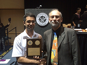
Langley’s Student Wins ION Parkinson Award
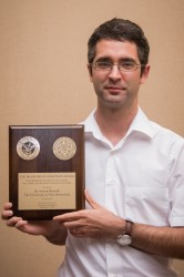
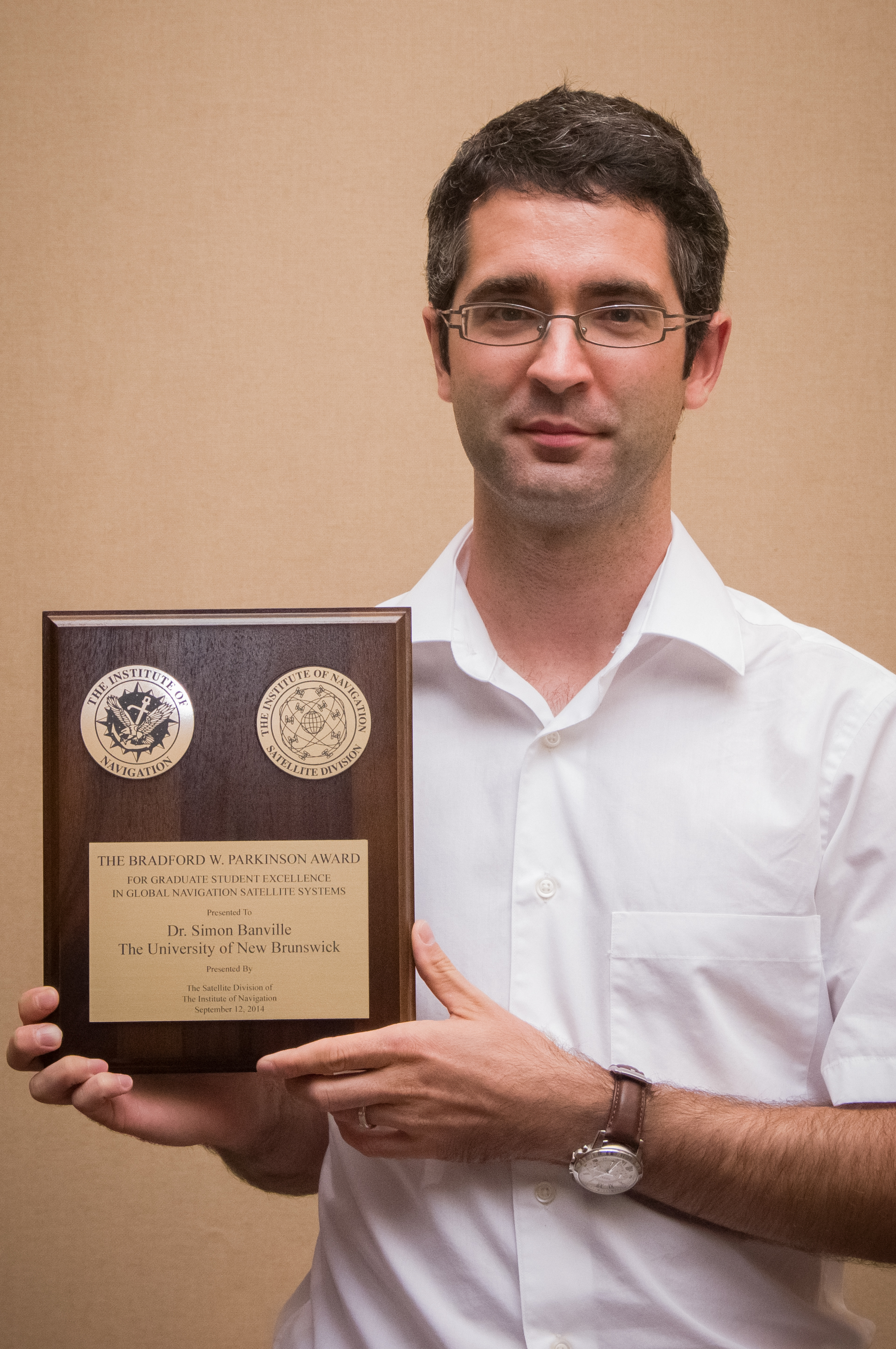
Simon Banville Simon Banville, a Ph.D. geodesy and geomatics engineering student at the University of New Brunswick, was awarded this year’s Institute of Navigation Bradford W. Parkinson Award.
The $2,500 honorarium and plaque was presented recently during The Institute of Navigation’s GNSS+ meeting in Tampa, Florida.
The Parkinson Award recognizes an outstanding graduate student in the field of global navigation satellite systems, such as the Global Positioning System. The winner is selected based on the theses and dissertations submitted by supervisors from the global GNSS research community.
Banville was selected for his outstanding contributions that represent truly significant innovations in the technology, application, or policy of modern satellite navigation systems. Supervised by UNB’s Dr. Richard Langley, his dissertation is entitled Improved Convergence for GNSS Precise Point Positioning.
The award honors Dr. Brad Parkinson for his leadership in establishing both the U.S. GPS and the Satellite Division of the ION.
Ph.D. student Simon Banville and Prof. Richard Langley. Precise Point Positioning or PPP is a relatively new single-receiver positioning technique that uses precise information on the orbits of navigation satellites and the atomic clocks they carry along in a rigorous mathematical model for analyzing receiver measurements. It permits positioning accuracies down to the few-centimetre level and Mr. Banville’s improvements to the technique will have significant economic benefits for those using GNSS in high-precision applications.
Banville will receive his Ph.D. degree at UNB’s Fall Convocation next month.
-
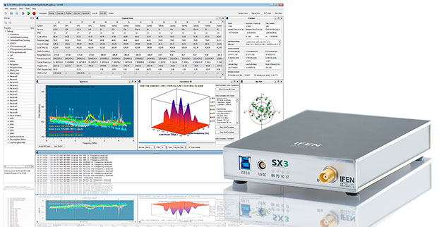
IFEN Officially Launches SX3 Software Receiver
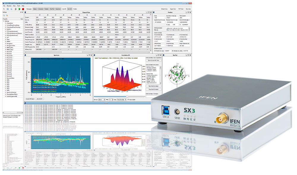
Photo: IFEN IFEN has launched the SX3 receiver. The company’s previous scientific software receiver, the SX‐NSR, was subject to major upgrades, while the respective hardware front-end was completely redesigned. Together, they build the new SX3 GNSS software receiver.
IFEN’s most important innovation of the year was introduced at the ION GNSS+ Conference September 9-12 in Tampa, Florida.
One of the SX3’s key features is four RF frequency bands, which can be split into a maximum of eight sub-bands per unit. This enhances the bandwidth to a full 55 MHz per RF band, offering additional signal power, especially in E5 band. The new USB 3.0 port empowers a unrivaled data transfer rate that makes a maximal bit-quantization of up to 8-bit possible — for every single stream.
The additional power is compressed into a significantly smaller and lighter hardware chassis than before. Among other options, a dual antenna-input feature can be ordered as well as an OXCO clock. (Standard equipment of the SX3 GNSS software receiver is a precise temperature-controlled oscillator.)
The proofed difference correlator notably ruggedizes acquisition and tracking of any navigation satellite signals. Polyfit tracking reduces measurement noise through averaging (such as code/carrier measurements). (See “Innovation: Software GNSS Receiver.”) Accordingly, vector tracking improves the tracking of weak signals in degraded environments and the reacquisition of “lost” satellites.
Just like its predecessor, it is also able to act as a framework for a customer’s own signal processing algorithms. “Customers can fully concentrate on their applications instead of dealing with potentially obscure code when using open source,” said Product Manager Bernhard Riedl. “Our professional support is specifically dedicated to scientific work as well as SX3’s capability for additional customizations. SX3 is far more than just a COTS product. This makes IFEN’s new SX3 scientific software receiver a mighty powerful tool for research and development.”
-
CTIA SMW Features Large Connected Car Presence
CTIA’s Super Mobility Week featured machine-to-machine technology, connected vehicle vendors, and a few location-based services companies. While combining its spring and fall conferences, which drew a big crowd, CTIA also tried to be everything to everyone in wireless. Meeting planners also placed the conference with conflicting dates — as the Institute of Navigation, Berlin IFA and ITS World Congress were held in the same week. One of my goals as a reporter was to make sense of a big trade show — and to limit the times an interviewee said “Internet of Things.”
LAS VEGAS — Outside of the announcement by GM and AT&T to expand OnStar to Europe, the CTIA Super Mobility Week here featured several connected car panels, but limited location news. The action seemed to be in company backroom meetings with existing clients — or trying to find additional niche opportunities for location products.
One company, Annapolis, Maryland-based TeleCommunication Systems, said it is proving its navigation product for the Atlanta-based AT&T Drive Studio. The company is involved in most location markets, now ranked No. 2 in terms of units deployed (second to Ericsson, according to one source), said Jay Whitehurst, TCS president, commercial software group.
TCS’ Location ToolKit, which will be used in the 5,000-square foot AT&T Drive Studio, offers navigation, with automatic map updates, traffic, real-time gas prices, weather, movies and showtimes.
Whitehurst said a market that is growing is e-health and mobile payments, which are both big topics at CTIA SMW and at the Barcelona Mobile World Congress. “We are developing a new product in conjunction with physicians to allow first responders to be able to reach patients who are not responsive. We are working the system into clinical workflows to provide diagnosis,” he said.
Standards, particularly for connected vehicles and handsets that control functions, will be important as new systems and vehicles offer this technology, said Alan Ewing, Car Connectivity Consortium president and executive director.
“Having a proprietary service is okay until someone says, ‘Hey, we don’t want to do this anymore,’ then there is a button in a car that does nothing,” he said. “We want to ensure that button is meaningful. While a lot of cars have MirrorLink built in, what happens when it disappears and consumers don’t know where to buy a compatible phone? [Consumers] don’t want three different phones for their vehicles.”
Ewing said that despite proponents’ arguments that autonomous vehicles are here to stay, he believes it is a generational issue. “I don’t want to give up control of a vehicle. But it is a surprise to hear younger people are not even getting driver’s licenses.”
Ford, which is not a MirrorLink member, had its inaugural developer’s conference at CTIA SMW. The developer’s conference was a big hit, with more than 200 application developers, said Douglas VanDagens, Ford global director, connected services solutions organization.
u-blox Rolls Out New Module, Outlines Marketing Strategy
Several companies at CTIA SMW are attempting to find niche opportunities in the crowded machine-to-machine market — and Switzerland-based u-blox is no exception. The company is focusing on the mobile, industrial and consumer-location markets, said Thomas Seiler, u-blox CEO.
While Seiler says there is no one dominant market for u-blox, the fleet market has been very good for the company. In addition, asset tracking has been a good market, he said.
“We are also seeing consumer markets such as e-bikes, golf carts, commercial helicopters and drones growing,” Seiler said.
While many location companies are fretting about government regulation, u-blox is taking the position that most agency requirements have actually helped build the market. “Regulatory requirements have been driving business for us. The [National Highway Traffic Safety Administration] proposes that vehicles report location, speed and direction,” said Nikolaos Papadopoulos, u-blox America president. “The collision avoidance regulations have helped to create an ecosystem that drives business.”
The company recently rolled out its ODIN-W160 multi-radio module for automotive, industrial, medical and security applications.
Nick Papadopoulos, president of u-blox America, tells CTIA Super Mobility Week show-goers what they should see at the u-blox booth.
Numerex Exec Talks Omnilink Purchase
The recent $37.5 million purchase of offender-monitoring company Omnilink allowed Numerex to boost its presence in the tracking of prisoners, Alzheimer’s patients and children, said Kelly Gay, Numerex president, security solutions.
“Our strategic focus is on M2M solutions — the Omnilink purchase is a perfect fit. Both companies are based in Atlanta and we have a lot of products we are working on together,” she said. “It’s been a great four months [since the acquisition].”
Gay said Numerex is focusing on four markets, or “battlefields” for growth: solutions as a service; asset identification and tracking; supply chain delivery; and remote monitoring, which includes oil and gas, tank monitoring, water systems and tracking weather.
LBS Companies Few and Far at CTIA…
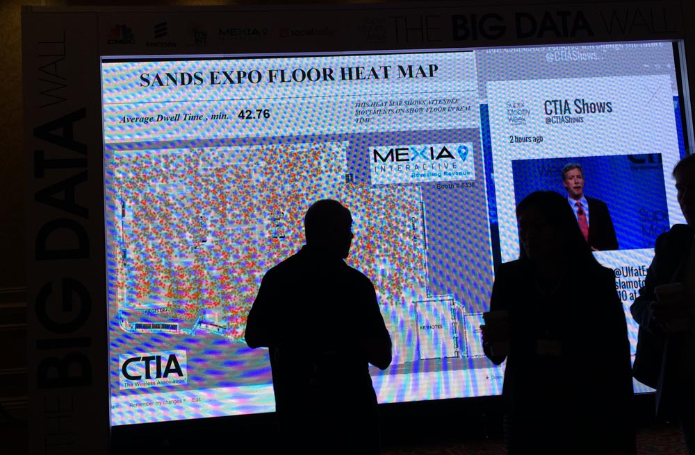
While there were only a handful of LBS companies at CTIA SMW, one company, Mexia Interactive, mapped the exhibit hall in the Sands Convention Center. The Winnipeg, Canada-based company is offering indoor location beacons — and has installations in four airports, with six more under contract.
“We set up 80 sensors in this area to capture data from mobile devices, every 10 seconds, to place the information on a heat map. With this heat map, retailers can see how many people are in a registration area, patterns of who is going to booths — and who is not,” said Glenn Tinley, Mexia president and CEO.
While Tinley says his company, which was founded in 2010, can work with both Apple and Android systems, he believes Apple is pushing Android out of the indoor market.
At airports, both security and airlines can see how long lines are with the technology to open up new lines and distribute personnel to meet the need, Tinley said. “We can instantly send a text alert to have a new check-in line established. Retailers can do the same thing at check out,” he said. “At retailers, [long lines] represent potentially billions in losses each year.”
Iridium Expanding M2M Market Demand
Iridium recently reduced the price of its short-burst data receivers by 50 percent to allow its OEMs and value-added resellers to offer a product that works worldwide in areas with no cellular coverage.
“The machine-to-machine market is one of our fastest growing [segments]. We see a combination of new services being developed,” said David Wigglesworth, Iridium vice president and general manager. “By the end of the year, we should have a push-to-talk service like the old Nextel phone.”
Big changes are coming to Iridium and its satellite constellation. The Iridium NEXT satellite network will consist of 66 in-orbit satellites and several in-orbit spares. The constellation is expected to begin launching in 2015 and will offer greater bandwidth and data speeds when fully operational in 2017.
“We are replacing the whole Iridium system. Space X is our launch partner — and they have been great,” Wigglesworth said. “The new constellation will allow new services. We see aviation as being a big market. The satellite industry has many niche markets.”
In other CTIA SMW news:
- One of a handful of antenna companies exhibiting at SMW was Ireland-based Taoglas, which says there is growth in distributed antenna systems, said Dermot O’Shea, Taoglas president. “We are seeing a huge movement to LTE,” he said. One of Taoglas’ customers is Omnilink, which uses a custom GPS antenna in its offender-monitoring product.
- Stockholm-based Birdstep is getting into the connected car market, based on its defense experience, with future data plans that turn off when a car is stationary. “Why should consumers pay for a data plan when a car is parked 90 percent of the time?” asked Lonnie Schilling, Birdstep CEO.
- Spirent Communications launched its Elevate Test Framework for M2M devices and services. Because of the surge in smartphone and M2M devices, the new testing device allows evaluation and performance tests to enable faster development cycles, the company said.
- Fleet Freedom rolled out a new mobile resource-management product that works with Android, iOS and Magellan’s RoadMate fleet units at SMW. “This unit is the fourth generation. It features dispatch integrated, while most of our competitors view this as a separate product,” said Andrew Singer, Fleet Freedom general manager.
-

What Mattered at CTIA
The morning sunlight steams into the Sands Expo Center. To those attending CTIA’s Super Mobility Week in Las Vegas September 9-11, it was clear that we’ve entered a period of divergence. Sensors, multiple platforms, all sorts of devices, computing in clouds, processing in clouds, car companies, connected houses, smart watches and indoor location positioning are being touted as part of the “Internet of Things” that will work together seamlessly. Some day. The connected car was a highlight of the show and Ford held (purportedly) the automotive industry’s first developers’ conference. The exhibit floor was jammed with machine-to-machine (M2M) solutions, some positioned for the Internet of Things, most for traditional telematics. In the past, wearable devices were in the show’s fringe, but new smart watches have mainstreamed wearables.
Telematics solutions were plentiful at CTIA, but these companies are all looking for new markets. The second-largest telematics market in the world is China, but it has been a bit of a mystery. C.J. Driscoll and Associates’ report on the Chinese commercial telematics market was just released. “There are five million fleet vehicles in China that use a tracking system,” says Clem Driscoll. “Regulations are part of the impetus for telematics, but the cost of transporting goods in China is very high, so economics play a role in the adoption.” Almost all telematics devices sold in the U.S. market are being manufactured in China.

Jeff Lawson, CEO of Twilio, comparing “hardware people” and “software people,” says Tesla’s Model S interior forgoes extra buttons for useful, adaptable software. Ford, a newbie at CTIA, entered the conference with a bang, hosting what it claimed to be the first developers’ conference for the automobile. Developers from 17 countries participated and received access to simulated vehicle data, including speed, fuel economy and GPS, based on data from Los Angeles. As the night wore on, I expect the floor was littered with spent energy drinks, coffee and pizza in the all-night coding session. Currently, there are 60 apps developed for Ford; the company forbids apps with games, videos and complicated demands on the driver. Ford had been at the forefront of the connected vehicle and already has connected collision avoidance, adaptive cruise control, smartphone integration, and parallel parking assistance.
GM is furthest ahead in bringing cars to market with embedded connectivity and, unlike Ford, has plans for an app store. Embedding connectivity into the car greatly deepens the functionality of car apps and also allows for over-the-air updates of firmware and software (FOTA and SOTA). Maintenance issues can be caught quickly. “Software and firmware updates save OEMs the $400-$500 that it costs each time a vehicle is serviced at the dealer for a recall,” said Egil Juliussen of market research firm IHS. “Currently, 70 percent of recalls come into the dealers, but with over-the air-updates, I expect about 95 percent of car owners will obtain updates.” Juliussen expects to see self-driving vehicles on highway lanes in 2017, followed by automated lane switching and local road driving in 2025. His assessment is consistent with other automotive experts.

CTIA President Meredith Atwell Baker laughs as The Daily Show’s Larry Wilmore provides news updates between opening keynotes. Besides pleading to the FCC for more spectrum, most keynote speakers talked about technologies or products that require LTE (often called 4G) for fast connectivity. GM, in partnership with AT&T, leads U.S. car makers in LTE deployment. The 2015 Chevrolet Malibu is the first 4G LTE-equipped GM vehicle, to be followed by more than 30 more GM models by the end of the year. In 2016, GM plans to roll out “Super Cruise” for hands-free highway driving, at both highway and stop-and-go speeds, as well as lane following, speed control and braking that will be available in an undisclosed Cadillac model in 2017.
To spur usage, a three-month free data trial is being offered by GM, and 90 percent of owners with cars equipped with LTE are participating. Billing for in-car connectivity is complicated. Few OEMs have a mechanism for collecting ongoing fees, such as for data services. With the GM offering, current customers of AT&T can add a car (similar to adding another phone) onto a phone plan for $10 per month. Otherwise, data can be purchased in increments, the same way some pre-paid phone plans work.

CTIA fielded a panel of experts moderated by CNBC’s Julia Boorstin to respond to Apple’s Live Event. Google and Apple each want to get a proprietary connected platform into vehicles as a way to control the integration of apps with vehicles, as well as to “own” the ecosystem. The traditional automotive players, including the OEMs, have banded together to create MirrorLink, a collaborative, standards-based non-proprietary platform, an effort facilitated by the Car Connectivity Consortium. MirrorLink is being created by collaborators from 105 countries who grapple with standardization issues. “The biggest concern we have right now, is how to get the platform distributed throughout the world,” remarked Alan Ewing of Car Connectivity Consortium. “In three years we will be talking about the ecosystem of apps, and you will see 100 more times than what we see today.” Who prevails with this platform — MirrorLink, Apple or Google — will have a huge advantage.
The location services that deliver content to vehicles and devices have been in the foreground, but there is a quieter category of location services. Companies like LocationSmart and Locate are automatically identifying the location of customers (with permission) for enterprises that include asset management, mobile gaming, financial security services, and customer management services. Initially, the services were based on identifying the location of callers to customer service centers, who could then route callers accordingly. A broader set of use cases is now seen. “We’ve moved far beyond traditional location determination,” says Mario Proietti of LocationSmart. “For instance, LocationSmart is providing financial service companies with the location of a customer’s phone, which is matched with the location of financial transactions.” If a credit card is being used at a store in Chicago while the customer’s cell phone is in Miami, fraud may be involved.
An engaging heat map of all attendees in the exhibit hall demonstrated the power of indoor positioning. On the hall’s ceiling, Mexia Interactive installed Wi-Fi/Bluetooth sensors to receive attendees’ cellular signals. The sensors were spaced at about every 10,000 square feet. Mexia has the distinction of being the only exhibitor mentioning a bathroom use case. A customer is using the sensors to keep 90 bathrooms clean. After the sensor receives signals from a set number of phones, the cleaning staff receives an alert to service the bathroom.
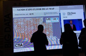
The show floor heat map, by Mexia, uses sensors throughout Sands Expo to show where people are connecting to Wi-Fi. Things people said:
- “Wearable smart watches are not quite enough to get everyone to buy one.” — Steve Mollenkopf, CEO, Qualcomm
- “Wearables are highly unregulated. Experiential apps will always have a privacy component. The most privacy-sensitive areas are fitness, health and children.” — Rudy Zefo, Vice President, Intel.
- “Of consumers looking to buy a car within the next two years, 50 percent are willing to switch brands to get connected services.” — Ralph de la Vega, President and CEO, AT&T Mobile and Business Solutions.
What will we be talking about at CTIA 2015? I’m betting that we will still be focused on the connected car and the Internet of Things. I expect to see more automotive and indoor location companies, and of course, smart watches. And yes, there will be more pleas for added spectrum.
-
ION GNSS+ 2014: KVH Industries, Inc.
Jay Napoli, vice president of FOG/OEM sales for KVH Industries, Inc., chats with GPS World about fiber-optic gyros (FOGs) while at the ION GNSS+ Conference September 9-12 at the Tampa Bay Convention Center in Tampa, Florida.
-
ION GNSS+ 2014: NavtechGPS
Carolyn P. McDonald, president and CEO of NavtechGPS, catches up with GPS World at the ION GNSS+ Conference September 9-12, 2014, at the Tampa Convention Center in Tampa, Florida. Franck Boynton, vice president and CTO of NavtechGPS, also shares about simulators with software, the company’s OEM presence and more.
-
Satellite-Synchronized Network Clock Released by SEL
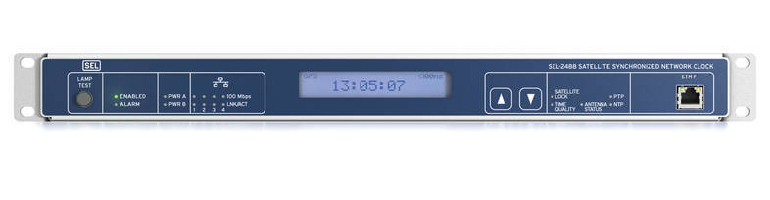
The SEL-2488 satellite-synchronized network clock. Photo: SEL SEL has released a new network clock designed for critical infrastructure and harsh environments. Model SEL-2488 receives GNSS time signals and distributes precise time via multiple output protocols, including IRIG-B and NTP.
The SEL-2488 provides time-delay compensation for antenna cables and output cables on per-port basis to further optimize time distribution accuracy. For security, the clock features the Syslog Ethernet standard for event messaging, role-based accounts and LDAP for user authentication, and secure HTTPS web interface.
The clock synchronizes with precise time accuracy to within ±40 nanoseconds to UTC for power protection applications. The standard TCXO holdover accuracy is 36 µs/day and the optional OCXO holdover accuracy is5 μs/day.
Time can be distributed from eight time outputs configurable for IRIG-B or time pulse outputs. The SEL-2488 also includes four standard Ethernet ports, which provide NTPv4 and are available in copper as well as single- or multimode fiber.
With Satellite Signal Verification, the SEL-2488 uses signals from a second satellite constellation to validate the GPS time signals, providing a layer of protection from GPS spoofing attacks. The SEL-2488 also provides an option for a second, redundant power supply and operates in a temperature range of –40° to +85°C (–40° to +185°F).
The SEL-2488 supports DHCP with a captive portal, LDAP, an HTTPS device webpage, and acSELerator QuickSet SEL-5030 software for easy and secure configuration.
-
Proteus Discusses Satellite-Derived Forest Inventory in Webinar
Proteus FZC, a provider of satellite-derived mapping and classification services, will discuss its use of high-resolution WorldView-2 imagery to derive accurate forest inventory and tree classification maps in Abu Dhabi during a free webinar with DigitalGlobe.
“Vegetation Analysis in the Desert Using Satellite Imagery,” part of the ongoing DigitalGlobe LEAD Webinar Series, will be held September 24 at 12:30 p.m. BST (7:30 a.m. U.S. EDT). Register by clicking here.
The webinar is aimed at managers and technical analysts from forestry, agriculture, remote sensing and GIS organizations in private and public sectors. The webinar will cover:
- How very high-resolution satellite remote sensing technology is being deployed commercially for tree inventory and condition analysis.
- Tools that are available now to help agriculture, forestry and environmental decision makers in areas with sparse water resources.
- How to use satellite data in support of environmental planning and policy creation.
Richard Flemmings, Proteus project manager, will offer insight into a recent 20-million tree mapping and classification project performed by Proteus FZC in Abu Dhabi. As an extension to an Emirate-wide habitat and land use/land cover project, Proteus applied advanced processing algorithms to the multispectral and panchromatic WorldView-2 image data to differentiate many tree species and assess the condition of individual trees, critical for irrigation management.
“This project demonstrates the viability of using very high-resolution satellite imagery to quickly and cost effectively create baseline vegetative inventories within diverse land-use areas,” said Flemmings. “The mapping technique used in Abu Dhabi can be applied to create forest and vegetation inventories of other species anywhere in the world.”
Since 2011, Proteus has been delivering solutions for mapping and classification projects using multispectral satellite imagery. These mapping projects have been delivered for environmental, oil & gas, engineering and other coastal zone applications in Europe, USA, the Middle East and Caribbean.
For more information on Proteus products, see www.proteusgeo.com or email [email protected] for further details or to discuss individual requirements.
-
ESA Releases Diagrams Showing Galileo 5 and 6 Orbit
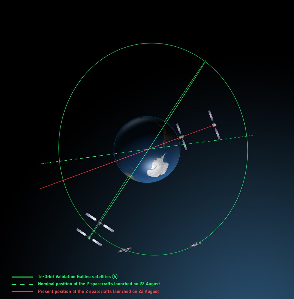
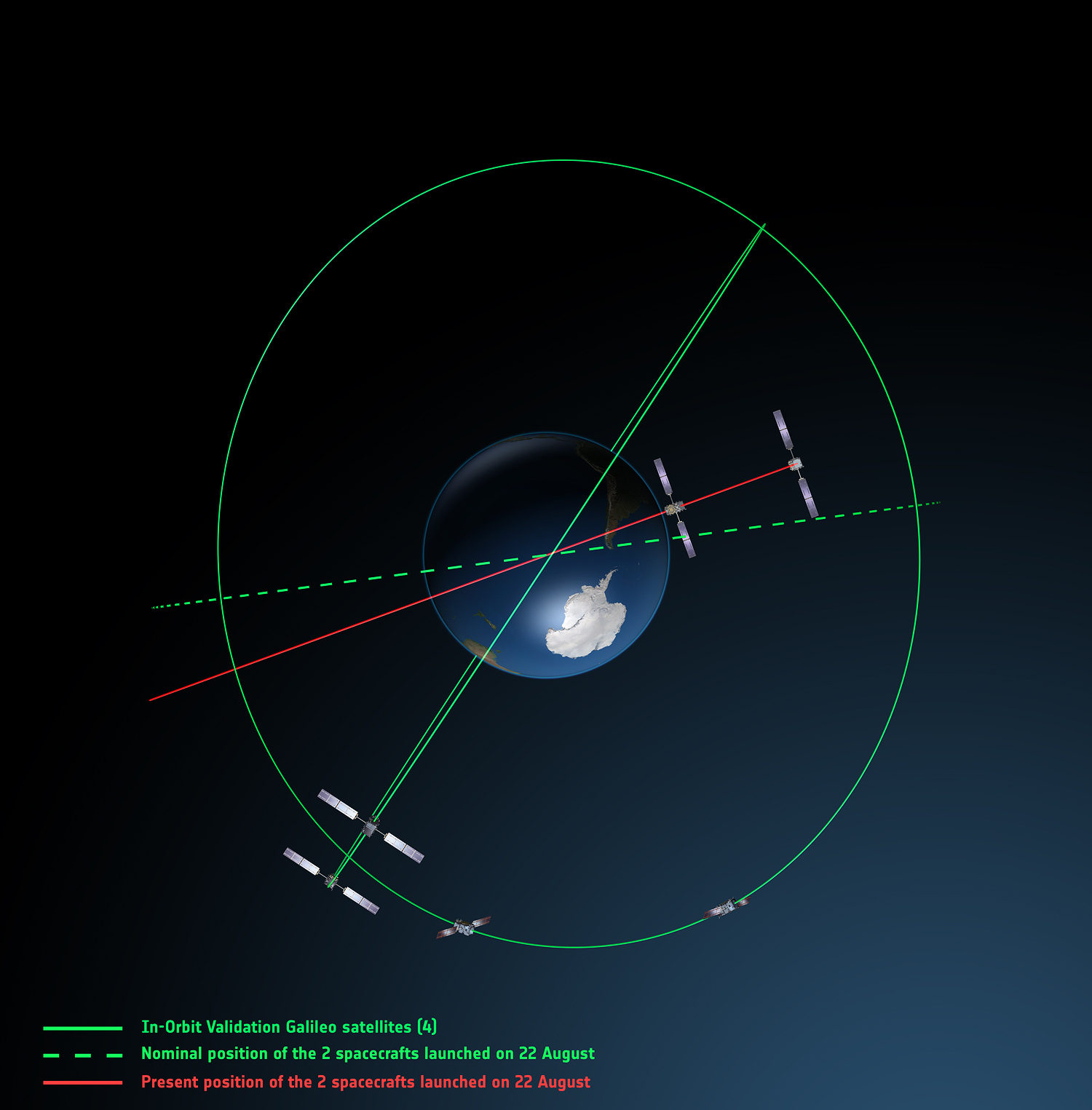
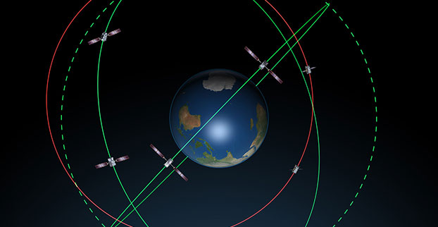
Galileo orbits viewed from above: Orbits of the fifth and sixth satellites in red, compared to their intended position in dashed green, and the position of the four satellites launched in 2011 and 2012 in solid green. This view looks down over the South Pole to illustrate how the inclination relative to the equator is less than intended. The satellites are in an elliptical rather than circular orbit, with a maximum altitude of about 25,900 km and a minimum altitude of about 13,700 km, compared to a planned circular orbit of 23,222 km altitude. Photo: ESA The fifth and sixth Galileo satellites have been in a safe state since August 28, under control from ESA’s center in Darmstadt, Germany, despite having been released on August 22 into lower and elliptical orbits instead of the expected circular orbits. The European Space Agency has released two diagrams showing the orbits.
ESA said that the potential of exploiting the satellites to maximum advantage, despite their unplanned injection orbits and within the limited propulsion capabilities, is being investigated. Various ESA specialists, supported by industry and France’s CNES space agency, are analyzing different scenarios that would yield maximum value for the program, and safeguard — as much as possible — the original mission objectives.
More detailed analysis, alongside consultations with industry, is under way, checking for a potential “improved orbit” where the satellites could both provide operational services.
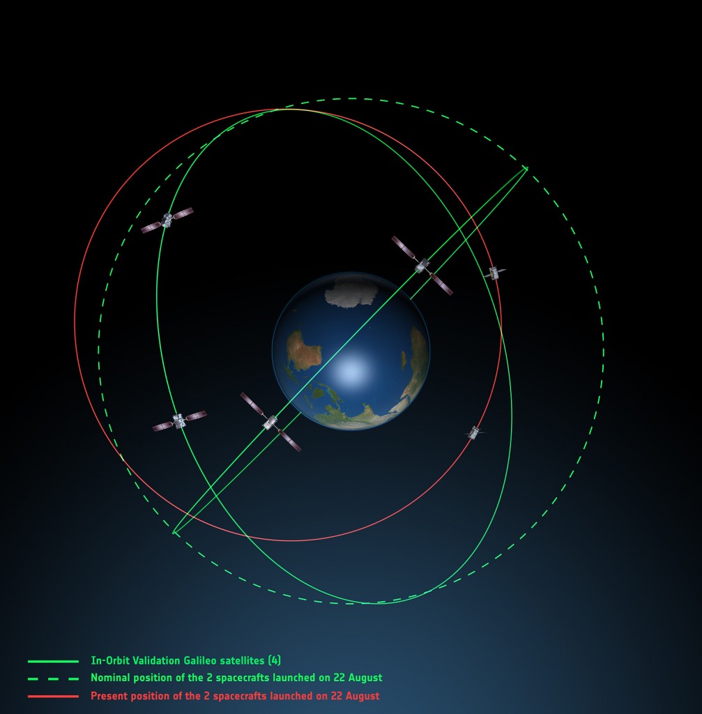
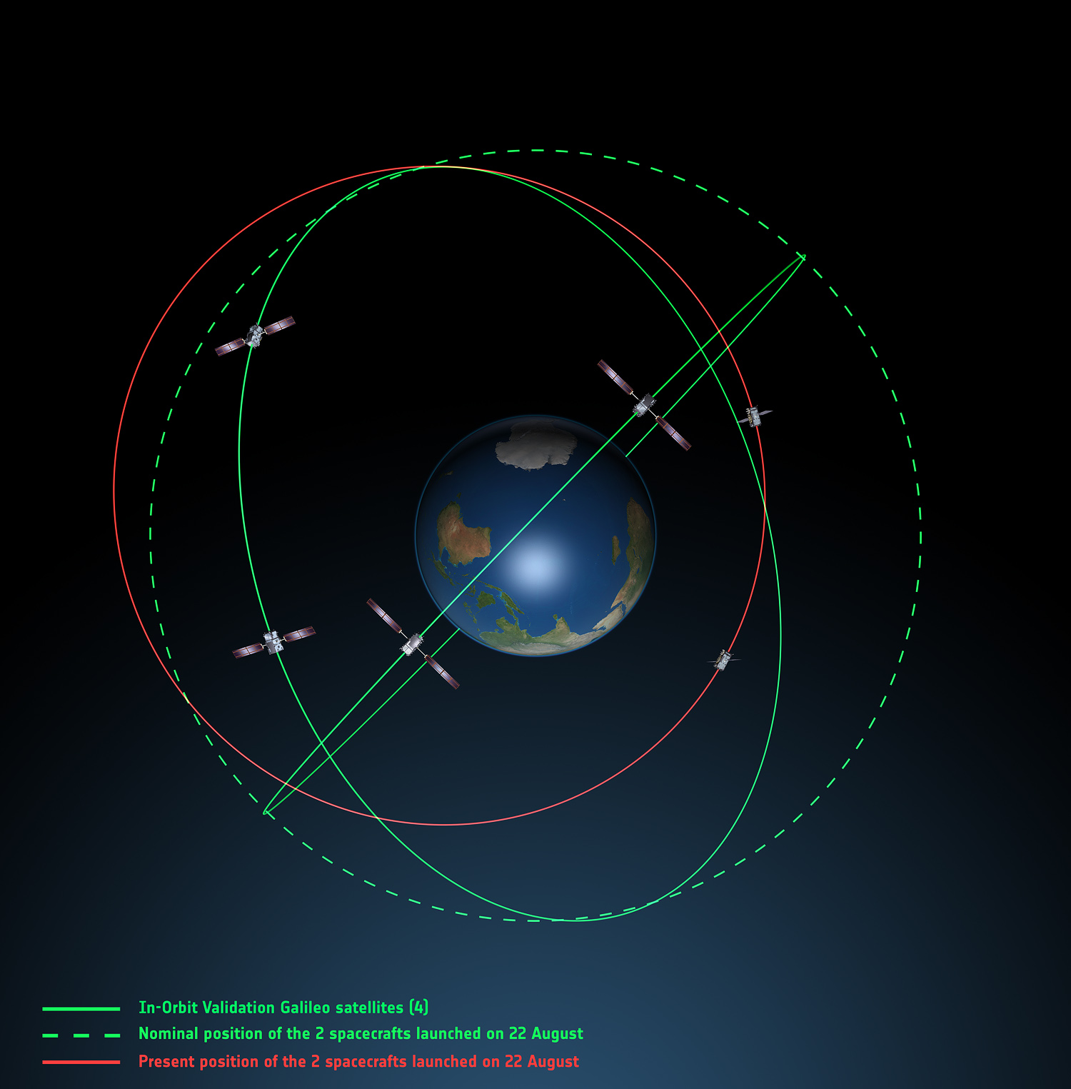
Galileo orbits viewed side-on: The fifth and sixth Galileo satellites in red, compared to their intended position in dashed green, and the position of the four satellites launched in 2011 and 2012, in solid green. This view looks side on to the two satellites’ orbital plane, which is off-center relative to Earth. The targeted orbit was circular, inclined at 55º to the equator at an altitude of 23,222 km.They are in a safe state, correctly pointing towards the Sun, properly powered and fully under control of an ESA–CNES team. Photo: ESA -
Explorer for ArcGIS on Mac Now Supports 22 Languages
Following the July launch of Explorer for ArcGIS on Mac OS X, the Explorer team released an update into the app store today that broadens the reach of Explorer by adding support for 21 new languages.
Explorer for ArcGIS is now available in all of the country app stores supported by the Mac App Store.
It can be downloaded from the Mac App Store.