The U.S. Federal Communications Commission convened a June 20 workshop on “GPS Protection and Receiver Performance” whose bite turned out to be far less than its bark had led some in the GPS industry to fear. The hastily assembled workshop — three weeks notice was given — appeared at first notice to derive from the call for “GPS receiver performance standards” that was one of the outcomes of the LightSquared controversy of 2012. The FCC chief emphatically noted, however, before anyone else could say anything, that the meeting was “not about FCC-mandated receiver standards.” A nearly audible sigh came from the collected dignitaries.
Perhaps the slotting of “GPS Protection” into first position within the workshop’s title might have given some clue. The meeting did turn out to be a less-than-alarming gathering of stakeholders, and in fact a reiteration of the need to emphasize and safeguard critical infrastructure and public safety — two key uses of GPS.
Two weeks prior to the workshop, Brad Parkinson declared to the National Space-Based Positioning, Navigation, and Timing (PNT) Advisory Board that “A number of manufacturers are quite panicked over this because of the possibility of some superposition of, in essence, how you design a receiver for GPS. This could vastly affect the whole substance of what we are if carried to the point that someone dictates how you design a receiver. I think that’s kind of dangerous.”
But the meeting, in the end, took a positive, protective, and conciliatory tone, even as the FCC continues beating the drum for more frequencies for mobile broadband, citing the need “get more out of the radio spectrum.”
“Today is about federal and non-federal leaders coming together to discuss successful industry-driven collaborations and GPS receiver performance,” said FCC Chairman Tom Wheeler in his opening remarks. “These are not abstract issues. But let me also be specific about what today is not. It is not about FCC-mandated receiver standards. Rather it is about the best way to protect GPS operations in the context of evolving technology and adjacent spectrum activities.”
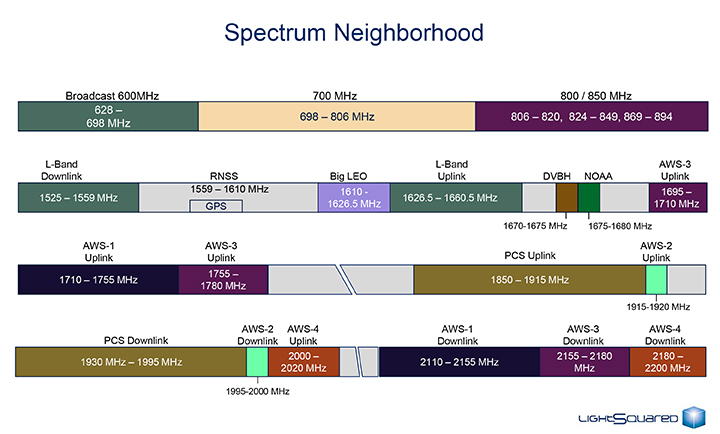
The specter of adjacent spectrum use hovered intermittently throughout the day, appearing fully in the presentation by LightSquared and one from the President’s representative. Otherwise, scant mention was made of the oft-expressed 2012 sentiment that GPS receivers needed to be modified in the way they work, to stop their alleged “peeking” into adjacent spectrum.
Peekin’? We don’t need no steenkin’ peekin’!
After further introductory remarks from the FCC’s head of Public Safety and Homeland Security Bureau, the audience heard a technology market update from the U.S. Consumer Electronics Association (CEA). The report relied almost entirely upon the European GNSS Agency’s (GSA’s) 2013 GNSS Market Report for its global statistics, while displaying some domestic charts of its own. Among the conclusions: GPS/GNSS is an enabling technology for innovation and disruption; and the consumer market, defined as road and location-based services (LBS), represents the biggest opportunity. The CEA presentation is available here.
The morning’s first panel discussion focused on the importance of GPS for critical infrastructure and public safety users, with presentations by Qualcomm, Motorola, and AT&T in addition to various government agencies. Cormac Conroy, vice president at Qualcomm, emphasized the critical role of GPS in emergency calls from mobile phones (E-911) and what he called “enhanced location services”: vehicle and pedestrian navigation, location-based alerts and reminders, and location as context in mobile apps.
Other speakers, including representatives from Ericsson, T-Mobile, Spirent, Garmin, NovAtel, and John Deere, covered GPS’s role in timing and thus controlling the nation’s power grid, the financial markets, the telecommunication network including cable TV, and the national breadbasket, precision agriculture. Paul Galyean of Deere said that “Certainty on the spectrum environment is needed. It’s difficult to design for the future without it.” And further, if GPS receivers had to filter out cellular activity, this “might impact sensitivity, involve excessive size or cost, and might cause distortion of GPS measurements.” The Deere presentation is available here.
Chris Hegarty from the MITRE Corporation gave one of the day’s most compelling arguments for not overhauling GPS receiver methodology: the extremely long lead times for commercial passenger aircraft. “Until 2022 every new Boeing and Airbus is going to fly off with $250,000 worth of navigation equipment that has three $50,000 GPS receivers and antennas and everything else, and they are going to want to use that for 20 to 25 years. So, you have a timing issue. Even if we all decided today that we wanted to do that, some communities simply aren’t going to be able to get it into place until we’re all dead.”
White House Espouses Adjacent Spectrum
Tom Power, deputy chief technology officer for telecommunications, held up the banner for “efficient use of spectrum” and pronounced the Administration opposed to “listening in.” Ironic, given its other proclivities. He advocated against some technologies exerting undue elbow room on “nearby users who want to make a change.”
Half the year is over. It’s gone. Now it’s time to figure out where the location industry is going for the remainder of the year. One analyst (actually, several) believe that the industry, fueled by indoor location and place-based advertising, is around $14 billion right now — with no place to go but up — given some bump in consumer awareness. In other news in a busy month, Google bought Skybox Imaging for $500 million in cash.
As the mid-point of 2014 arrives, with a few big location industry deals already consummated, there is a chance for industry executives to study what is going to be a strong niche market in the months ahead.
One analyst believes a big location niche is indoor analytics and proximity marketing, which is defined as nearby a store or within a business. “The latter would include ads and coupons. We’ve estimated that roughly $3.5 billion of potentially $14 billion, or so, in 2014 U.S. mobile ad revenue, will be location-based [broadly defined],” said Greg Sterling, founder of Sterling Market Research. “Of that, about $1.4 billion will be ‘geofenced’ or nearby.”
Sterling believes that the in-store component is still in an embryonic stage. “There are billions of dollars of coupons distributed every year, but most of that is still print. Some of that is in-store distribution and redemption,” he said. “A portion of that over time will migrate to mobile in or near stores.”
Sterling said there are billions of dollars available from proximity marketing, but it will take time. He cites “Mapping the Indoor Marketing Opportunity,” a report he authored for Opus Research, that says the market for indoor location and place-based marketing/advertising will surpass $10 billion by 2018. (See a preview of the report here.)
In a published report, Sterling admitted that he was nervous about the $10 billion number, but it may turn out that the figure could be conservative because of the software licensing from indoor markets.
Sterling says that while indoor positioning has been important to the older location business, it is still in its early stages. The big deal is mobile, which has brought new attention and interest to location, he said. “Indoor location will feed mobile and online marketing with data and analytics as well as targeting opportunities,” he said.
Many executives and analysts in the location industry have marginalized privacy issues; some even say it is dead with opt-in approval by consumers. However, privacy issues will continue to hamper the location industry, Sterling said.
“Privacy is far from dead. Indeed, it’s on the rise, and a major issue that everyone in the location and mobile segments needs to tackle head on,” Sterling said. “Denial, delay and obfuscation will result in regulatory intervention and/or consumer fear/rejection.”
In a blog, Sterling said that the San Francisco-based Philz Coffee chain no longer will be tracking customers after a local ABC affiliate revealed they were using Euclid retail analytics. Sterling said the ABC report acted as if it had uncovered a big government or corporate conspiracy.
Sterling will be giving the keynote address at the Place Conference in New York on July 22 at the W Hotel. Topics include proximity marketing, indoor positioning markets, privacy and other location topics.
Google Continues Location Industry Dominance with Acquisition
Google enhanced its online mapping service by acquiring Mountain View, California-based Skybox Imaging for $500 million in cash. Sources say both Google and Facebook are purchasing satellite and drone companies in an attempt to expand into other market areas.
One of the ways Google will be leveraging Skybox is in disaster relief and to improve Internet access in remote areas, something the company has been strongly pursuing.
On its website, the five-year-old Skybox said that it plans also to share in the development of the burgeoning autonomous vehicle market and continue to design its own satellites.
A Skybox satellite image of Tampa, Florida.
AT&T Expands Location Information Services
AT&T’s new Location Information Services, which includes a security function and LBS, is expanding into more than 150 countries this summer in a pilot project. The Location Information Services are enabled through an API that can notify companies when their customers, who opt-in for the service, arrive in a new country.
Some application examples, provided by AT&T, include credit card companies confirming customers have traveled to a new country as soon as a device is turned on; allowing the credit card company to either decline or approve purchases overseas; companies using the service to track the movement of equipment to prevent stolen property; and the ability for hospitality entities to offer restaurant and other suggestions to consumers based on their location.
In other LBS news:
The new Amazon Fire Phone has GPS and location functions plus a new feature, Dynamic Perspective, which can be used for such built-in apps as maps and games. The phone is available on July 25, but Amazon is taking pre-orders. In the meantime, competitor Apple has a new iOS 8 feature that allows shoppers to enter their payment details on an m-commerce site by scanning their credit card with the camera on their mobile device, according to published reports. The operating system will use sensors to provide apps with indoor positioning data.
HERE acquired the mobile predictive analytics firm, Seattle-based Medio, earlier this month. The company plans to integrate Medio’s predictive analytics, in conjunction with its map platform, to customize LBS “prediction experiences” for consumers, according to published reports. These experiences (full disclosure, I hate it when companies use the word, “experience”) may include delivering restaurant or other information at a relevant time, such as around lunch. While no financial details were released, the deal is expected to close at the end of July.
Hundreds of businesses in Brixton, near London, will be integrating Apple’s iBeacon as part of the first networks for mobile payments, according to published reports. Businesses in Brixton are switching from currency payments to mobile payments by text. Previously, iBeacons have been used for proximity offers, advertisements and product information when a user is in a retail area. The mobile payment application allows users to quickly check out, reports say.
Google enhanced its online mapping service by acquiring Mountain View, California-based Skybox Imaging for $500 million in cash. Sources say both Google and Facebook are purchasing satellite and drone companies in an attempt to expand into other market areas.
One of the ways Google will be leveraging Skybox is in disaster relief and to improve Internet access in remote areas, something the company has been strongly pursuing, according to GPS World’s LBS Editor Kevin Dennehy.
On its website, the five-year-old Skybox said that it plans also to share in the development of the burgeoning autonomous vehicle market and continue to design its own satellites.
Skybox posted a message about the acquisition on its website: “We’ve built and launched the world’s smallest high-resolution imaging satellite, which collects beautiful and useful images and video every day. We have built an incredible team and empowered them to push the state-of-the-art in imaging to new heights. The time is right to join a company who can challenge us to think even bigger and bolder, and who can support us in accelerating our ambitious vision.
“Skybox and Google share more than just a zip code. We both believe in making information (especially accurate geospatial information) accessible and useful. And to do this, we’re both willing to tackle problems head on — whether it’s building cars that drive themselves or designing our own satellites from scratch.”
Steven Spriggs was pulled over by a motorcycle cop for using his iPhone while driving. He immediately held it up to show the officer that he was using Apple Maps, and not talking or texting. More about Mr. Spriggs later. With approval of the pending transportation bill in Congress, smartphone maps and navigation will be regulated. The National Highway Traffic Safety Administration (NHTSA) would receive the power to regulate apps like Google Maps or Apple Maps. NHTSA’s job would be to review navigation apps and order changes to decrease driver distractibility.
Guess who is in favor of this new regulation for smartphone apps? Automakers. Embedded navigation systems, those found in the dashboard of vehicles, are already regulated by NHTSA. Smartphone navigation apps are a much cheaper option than the systems offered by automakers, who are looking for a more level playing field and a way to slow down the smartphone navigation juggernaut.
The downside to this regulation is big. If it was just Apple and Google mapping, oversight would be simpler, but Apple App Store and Google Play Store are filled with hundreds of mapping and navigation apps. Logistically it doesn’t seem possible for the NHTSA to review all of the apps efficiently without causing interference in the market. NHTSA doesn’t currently have the budget, infrastructure or staffing to be successful.
The forum of the radio show “Car Talk” is alive with discussion on NHTSA’s desire to control navigation. The vast majority of posters point out the distraction from using a paper map or being lost. “Personally, I prefer a full-sized road atlas on the seat beside me for all my navigation needs. Taking occasional readings with a sextant helps, but is difficult while eating my Big Mac and holding the wheel with my knee,” Paul Carney writes with sarcasm. On the other side, Victor Cooper responds, “YES! It is long overdue. And I think it is about time we treat texting while driving the same as we do drunk driving…criminal penalties and all.”
I think regulation on mapping and navigation may help make the apps simpler to use and less distracting. Before passing a regulatory law, I’d like NHTSA to successfully demonstrate a review system that doesn’t impede innovation, significantly delay new products, or make it overwhelming difficult for small start-ups.
So what happened to Steven Spriggs? The police officer went ahead and wrote a $165 ticket for using a cell phone while driving, despite Spriggs argument that the law didn’t apply to navigation apps. Spriggs challenged his ticket in California’s state appeal court and won. The $165 went back into Spriggs’ pocket and map users everywhere sighed with relief,
By Gerhard Beutler, Rolf Dach, Urs Hugentobler, Oliver Montenbruck, Georg Weber, and Elmar Brockmann
What Happened: On April 1, 2014, at 21:15 UTC, all GLONASS satellites started to transmit wrong Broadcast Messages (BM) as previously reported by GPS World. The satellite positions derived from these BM were wrong by up to ± 200 kilometers in each of the three coordinates x, y, and z of the Earth-fixed, geocentric, equatorial coordinate system. The problem disappeared after an hour (after two erroneous BM) for two GLONASS satellites; for other satellites, the problem lasted much longer: up to 10 hours. By about 07:30 UTC on April 2, the April Fools’ “joke” was over.
Effect on GPS/GLONASS Receivers
Essentially, we can distinguish two classes of receivers: those using the GLONASS BM for tracking and those not using them. The first class of receivers “became aware” of problems in real time, because GPS and GLONASS observations did not result in a consistent position estimation. In the best case, all affected GLONASS observations were flagged (and removed from further consideration) and the positioning worked properly with a reduced number of satellites. In the worst case, the receivers stopped tracking GPS and GLONASS satellites completely. The second class of receivers tracked GPS and GLONASS normally. The tracking problems created a major uproar in the user community of combined GPS and GLONASS receivers.
On June 3, 2014, at the 13th meeting of the U.S. National Space-based Positioning, Navigation, and Timing (PNT) Advisory Board, Gerhard Beutler, representing the authors of this article, delivered a presentation including an example of a permanent network of GPS and GLONASS dual-system receivers in Switzerland and neighboring countries, where about 40 percent of the approximately 60 receivers stopped tracking both GLONASS and GPS satellites. The malfunctioning receivers had to be reset manually on the morning of April 2 (for more information, see: www.gps.gov/governance/advisory/meetings/2014-06/beutler1.pdf).
Event as Viewed by the IGS
At first sight, the GLONASS April 1 and 2 event was actually a non-event for the International GNSS Service (IGS). The IGS is a voluntary federation of more than 200 worldwide agencies that pool resources and data from about 400 permanent GPS and GLONASS stations to generate precise GPS and GLONASS products.
The IGS product series, including precise GPS and GLONASS ephemerides, were generated as usual before, during, and after the event. On April 4, a quick analysis by Urs Hugentobler revealed that only the GLONASS BM were affected; the GLONASS code (pseudorange) and phase observations and the GLONASS satellite clock corrections, were not affected.
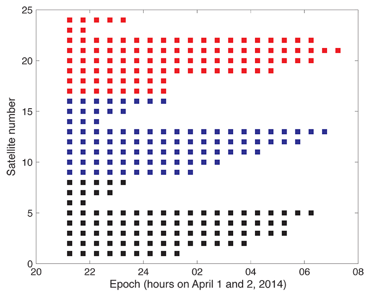
Figure 1 shows that the GLONASS event started simultaneously for all satellites (for stationary receivers, the first wrong positions were calculated for 21:00 UTC, based on the BM with Time of Clock (ToC) at 21:15 UTC). The problem was fixed for the first two satellites (the GLONASS satellites in orbital slots 6 and 23) one hour later; the last satellite wasn’t fixed until 07:30 on April 2 (using the correct BM at 07:45).
Figure 1. Affected broadcast messages for each GLONASS satellite. Colors indicate the different orbit planes.
More than 60 percent of the more than 200 combined GPS and GLONASS receivers in the IGS network tracked the GLONASS satellites normally. Fewer than 40 percent of the combined-constellation receivers had serious data outages (for GLONASS or even for both GLONASS and GPS). The number of GLONASS observations used in the daily work of the IGS analysis centers (ACs) was, however, only reduced by about 10 percent on April 2 (and even to a lesser extent on April 1). The small reduction is explained by the fact that only the last three and the first seven hours of April 1 and 2, respectively, were affected.
As the IGS ACs do not need the BM (neither for GPS nor for GLONASS), but may rather use their predicted orbits derived from the precise ephemerides of the preceding days, the number of good observations was still amply sufficient to calculate precise GLONASS orbits for April 1 and 2, essentially at the expected accuracy level.
Detailed Analysis
To further explore the structure of the problem, the BM-derived satellite positions were used as pseudo-observations in an orbit determination process. Orbit determination was successful when analyzing only “good” positions (prior to April 1, 21:00 or after April 2, 07:30). Orbit determination was successful, as well, when using only positions from “bad” BM. Successful means that the root-mean-square (RMS) error of the orbit determination process was of the order of about 0.5 meters per satellite coordinate — the expected order of magnitude.
As the bad satellite positions are now known to obey the laws of orbital motion, one may further investigate the nature of the differences between the “good” and the “bad” orbital positions. For that purpose, the precise GLONASS orbits of the IGS Center for Orbit Determination in Europe Analysis Center served as a reference. Its orbital positions were compared in the inertial coordinate system (one not rotating with the Earth) to the erroneous BM-derived positions by means of an orthogonal transformation, where only the three rotation angles around the x-, y-, and z-axes of the inertial equatorial coordinate system were estimated.
Table 1 shows that the positions derived from the normal (“good”) GLONASS BM compare very well to the IGS precise orbits. Except for a minor rotation about the z-axis, one obtains zero-rotations about the orthogonal axes in the inertial coordinate system.
Table 1. Rotation of the entire system of good orbit positions (April 1, 0:00 – 20:45 UTC) with respect to precise IGS reference orbits (“good” BM) and rotation of the entire system of bad orbit positions (April 1, 21:00 – April 2, 07:00 UTC) with respect to precise IGS reference orbits (“bad” BM).
Table 1 also shows that the “bad” positions were obtained from the reference positions by a rotation of about 0.5 degrees around the inertial x-axis. The RMS of 71 meters should be compared to the entire effect of up to 200 kilometers per coordinate. Comparing this RMS of 71 meters with the RMS of the orbit determination of about 0.5 meters per coordinate also says, however, that the “true” transformation is more complicated than one represented by just a series of three rotations.
We did not further investigate how this more or less consistent rotation could enter into the GLONASS BM. It seems to be clear, however, that a systematic error slipped into the realization of the GLONASS BM, which were activated at a common reference epoch for all satellites (but uploaded to individual satellites at different times).
Figure 1 suggests that the problem was almost immediately recognized by GLONASS operators: already an hour later the first two satellites started to transmit BM with the usual accuracy level.
Figure 1 also supports the idea that the problem was remedied satellite-by-satellite. A back-of-the envelope calculation revealed that the satellites were above the horizon of at least one of the Russian uplink sites at the times of switching back to the correct BM.
Summary and Conclusions
The GLONASS event was one that we might have described by the phrase “such a thing can never happen.” For the user community, the situation was aggravated by the fact that the event was not reported through the official Russian channel by issuing a Notice Advisory to GLONASS Users (NAGU). This definitely should have happened in the interest of transparency.
The above analysis was based on information available through the IGS. It was performed weeks after the event. It is worth noting, however, that the information needed for the analysis was available in real time. The reference orbit used in the analyses could have been replaced by the IGS predicted orbits generated in the ultra-rapid series.
In view of the importance of BM for all users and in particular for the users of IGS real-time products, the IGS might consider monitoring the quality of BM for all GNSS.
Fixing the GLONASS Bug: Report from Moscow
In a May 23 conversation with journalists, Javad Ashjaee, president of JAVAD GNSS, decried the recent controversy about monitoring stations on both U.S. and Russian soil, saying it was based in misinformation and misinterpretations, inflated by a political crisis. He also supplied a different perspective on the GLONASS signal outage than has been reported in other media outlets.
“There was speculation in early April that it took GLONASS 11 hours to correct a software bug because it took that long for all the satellites to pass over a control station on Russian soil. This was not the case, I have learned from conversations with their engineers and with the head person responsible for all of this. One engineer made a mistake and uploaded the wrong software. Until they could find it and debug it — and it took them 11 hours to do so — they could not upload correct software to the satellites.
“The 11-hour outage was not due to a wait for all satellites to pass over ground control stations on Russian soil to receive a fresh upload of data,” continued Ashjaee. “GLONASS has the capability, like GPS, to make updates via inter-satellite communication. The delay was caused by the time it took to find the bug in the erroneous software that had been uploaded and correct it.”
Ashjaee addressed the monitoring station controversy, saying that Russia had sought GLONASS monitoring stations in the United States, not for uploading any data, but for monitoring GLONASS satellites to provide more accurate orbit and clock information, for the free benefit of all users.
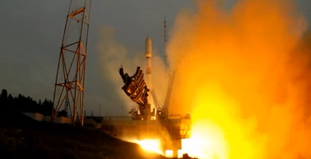
A single GLONASS-M satellite was launched from the Plesetsk Cosmodrome on June 14. GLONASS-M 55 (with designation 755 once operational and also known as Kosmos 2500), was inserted into the constellation’s Plane 3 and will occupy orbital slot 21.
Manufacturer Reshetnev reported that the satellite is equipped with an experimental payload capable of transmitting signals in the L3 frequency band. The L3 signal, centered at 1202.025 MHz , is CDMA unlike the GLONASS legacy FDMA signals. The experiment will include flight testing of the new equipment and evaluation of its accuracy characteristics. The GLONASS-K1 test satellite also transmits an L3 signal.
European Space Symposium: Digest
Copernicus, “the younger brother of Galileo,” will be the main implementation of Galileo and other GNSS technologies going forward in Europe, according to to Paul Weissenberg, EC deputy director general for enterprise and industry. An Earth-observation satellite program administered by the European Space Agency to provide accurate and timely information to improve the management of the environment, understand and mitigate the effects of climate change, and ensure civil security, Copernicus was previously known as the Global Monitoring for Environment and Security (GMES).
Sliding to the Right. Galileo will make its “early-service declaration in the first half of next year,” said Matthias Patschke, director of EU satnav programs. This appears to back off slightly from previous dogged determination to declare services before the end of 2014.
The EC may propose legislation to make mandatory the use of GNSS technology in different areas: as with eCall, starting in 2015, including Galileo in the receivers inside cars, according to Marian-Jean Marinescu, member of the European Parliament.
Peter Large of Trimble spoke out against the mandating of a specific GNSS use in any market: “A bad policy outcome that moves backward into regionalization.”
An independent study of indoor tests of a hybrid wireless location technology was submitted today to the Federal Communications Commission (FCC) by wireless location engineering firm TechnoCom. The study demonstrates that existing technologies can satisfy location requirements within the timeframe proposed by the FCC in its draft rule on indoor 911 accuracy for wireless calls, according to True Position, which commissioned TechnoCom to perform the testing.
Multiple wireless carriers have challenged the technical feasibility of the proposed rule, claiming that existing technologies cannot satisfy the proposed accuracy requirements, with a spokesperson for the industry trade association claiming the rule represented “aspirational target setting.”
The results filed today by TechnoCom disprove those assertions, showing that viable technology exists in the market today, True Position said. According to TechnoCom’s findings, “The outcome is a current overall performance that readily meets the FCC’s proposed location performance threshold for indoor wireless E911 at the 67th percentile. The demonstrated performance even comes very close to meeting the 50 meter threshold at 80%, which is intended for 5 years from adoption of the proposed rules.”
Multiple other vendors have submitted filings to the FCC claiming that their technologies would also satisfy the requirements of the rule on the timeline proposed by the FCC.
“These results should prove helpful to the FCC as it moves toward reaching a resolution on its proposed rule on indoor location requirements,” said Craig Waggy, CEO of True Position. “We know that accurate location information is vitally important to American consumers, and that the FCC is intent on remedying the lack of wireless indoor location requirements for calls placed to 911 from wireless devices.”
The tests were conducted using True Position’s commercially available Uplink Time Difference of Arrival (UTDOA) technology standalone, and a hybrid solution consisting of Assisted GPS (A-GPS) and UTDOA technologies, and included indoor testing in both urban and suburban environments in Wilmington, Delaware, and surrounding areas.
For the testing, buildings of varying sizes, construction materials and use were selected by the independent firm, and a total of 62 test points were selected among 16 buildings. In all cases, the test buildings and test points remained anonymous to True Position until the conclusion of the testing and delivery of all results to the independent firm.
In early 2013, TechnoCom conducted the indoor accuracy testing for the FCC’s Communications, Security, Reliability and Interoperability Council (CSRIC). The same location and measurement methodologies were used in these tests.
The FCC has estimated that 10,000 lives could be saved each year if calls made to 911 from wireless phones had accurate location information.
Eagle Mapping Ltd., a North American digital airborne mapping company, is now using the new Riegl LMS-Q1560 airborne laser scanner system. Designed to capture ultra-wide swaths and complex environments, the high-performance Riegl LiDAR will enable Eagle Mapping to expand into new markets including large-area, forestry and urban mapping applications for governments and first-nation organizations.
“The Riegl LMS-Q1560 is a powerful laser scanner developed to acquire data over large geographic areas at high altitudes,” said James Hume, Eagle Mapping President. “This will allow us to map expansive cities, counties and tribal lands quickly and cost effectively.”
Riegl designed the powerful dual-channel LMS-Q1560 laser scanner with integrated medium-format camera for a variety of airborne mapping projects with an emphasis on wide-swath coverage. With a 58-degree field of view, the laser can be operated at a maximum pulse repetition rate of 800 kHz capable of measuring 530,000 points per second on the ground from an altitude up to 15,500 feet AGL.
“The Riegl LMS-Q1560 is the most cost-competitive airborne laser scanner on the market today,” said Hume. “We can fly at a higher altitude and collect a denser spacing of elevation data than any other LiDAR system out there.”
In addition, the Riegl LMS-Q1560 has a forward-and-look capability which, when combined with its wide field of view, enables the device to capture data from multiple angles effectively and accurately at an extremely high point density. The sensor also utilizes Multiple-Time-Around processing, echo digitization and waveform analysis to simultaneously track more than 10 pulses in the air.
This means the LiDAR can collect tightly spaced elevation points even in complex environments. Examples are built-up city centers with a variety of buildings and vertical structures, as well as extremely rugged mountain terrain where elevations change dramatically and abruptly.
“Whether working in the mountains of British Columbia or over a densely developed urban center, we will capture accurate elevation points between soaring peaks as efficiently as we do between high-rise office buildings,” added Hume. “And regardless of the terrain, we’ll collect more data in a day and finish jobs faster than we could before.”
Over nearly three decades, Eagle Mapping has built its reputation on finding more accurate and affordable mapping technologies. Focusing primarily on the global mining industry, the Vancouver firm was among the first to deploy airborne LiDAR technology for mapping. More recently, the Canadian firm configured a high-density, narrow-swath Riegl VQ-580 LiDAR with a DiMAC medium-format camera on a single aircraft to simultaneously collect elevation and image data for efficient mapping of pipeline and transmission line corridors.
“As we expand into urban and large-area projects for government clients, we will continue to support our extensive client base in the international mining and corridor mapping markets,” said Rodney Cope, vice president of sales and marketing.
Eagle Mapping operates a Cessna 206 and Piper Navajo aircraft based in British Columbia. The Navajo carries the new Riegl LMSQ1560, and the Cessna is equipped with the Riegl VQ-580 LiDAR and DiMAC digital camera. The firm maintains field offices in Bellingham, Washington, USA, and Medellin, Colombia, in South America.
The LBS market continues to grow strongly and with the arrival of always-on ubiquitous location, ABI Research believes that the market is ready to truly support location based advertising efforts. In Western Markets, a third generation of location-based services is now underway. It has forecast retail/shopping, ambient intelligence, hyperlocal social and personal asset tracking/BLE beacon applications to emerge as the next wave of important location based services over the next five years, with ABI Research forecasting a four-fold increase in revenues by 2019.
In emerging regions the value of location is not lost with strong local deals/offers markets already emerging. Senior analyst Patrick Connolly comments, “In Asia, ABI Research sees LBS downloads breaking 4 Billion in 2019. In China, major Internet companies can see the necessity of location and are acquiring/integrating as they move to mobile. Tencent, the Chinese Internet giant, has spent approximately $200 million to acquire an 11.28% stake in mapping company NavInfo. This follows Alibaba’s acquisition of AutoNavi. Tencent has also invested in the Chinese Yelp, Dianping, which is one of the top three players in the local deals market, which is estimated to have reached $1.2 Billion in 1Q14. Sina Weibo, which floated on the NASDAQ in April also has its own Places application.”
Furthermore, in a reversal of previous LBS application trends, ABI Research expects to see many of these companies expanding into international markets in the future. Momo is such an app, with 20 million subscribers, which is using location to go local and generate advertising revenues. It has used a round of investment to launch an English version of the application, which it hopes will enable it to expand.
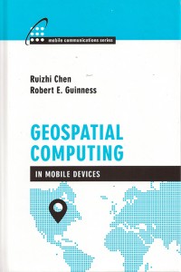
A new text and reference book, Geospatial Computing in Mobile Devices, has been published by Artech House. Recent developments in smartphones enable them to meet many of the demanding requirements for geospatial computing, in terms of computation power, data storage capacity, and memory space. This book, written by Ruizhi Chen and Robert E. Guinness, addresses and instructs in geospatial data acquisition, processing, visualization, context detection, and context intelligence.
Chapters of the 209-page book include:
Fundamentals of Mobile Positioning
GNSS, Wireless, and Hybrid Positioning in Mobile Devices (three separate chapters)
Mobile GIS and LBSs (two separate chapters)
Context Awareness and Reasoning (two chapters), and
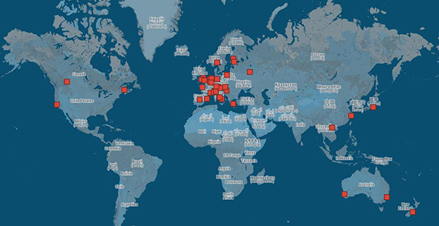
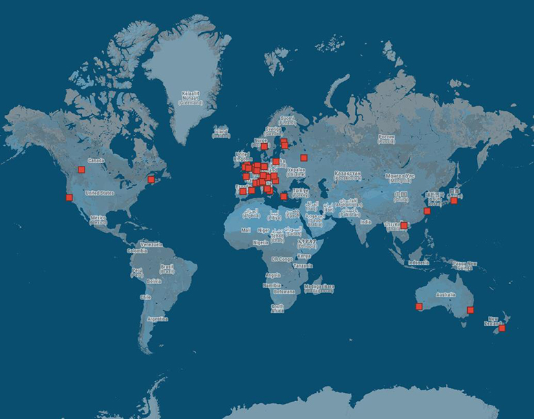
ESA offered to issue certificates for the first 50 Galileo positioning fixes — provoking responses from across the whole world. While half the applications came from Galileo’s home continent, others came from the rest of the world, including Australia, Canada, China, Egypt, New Zealand, Russia, United States, and Vietnam.
Billions of satnav position fixes are performed daily, but determining your place in the world using Europe’s Galileo system is quite new. Because of this, in March the European Space Agency (ESA) offered to issue certificates for the first 50 Galileo fixes.
Responses to the offer came from around the world. While half the applications came from Galileo’s home continent, others came from Australia, Canada, China, Egypt, New Zealand, Russia, the United States, and Vietnam.
The first two satellites of Europe’s Galileo constellation were launched in October 2011, followed by two more a year later. Four is the minimum needed for determining position, allowing testing of the full Galileo system to begin.
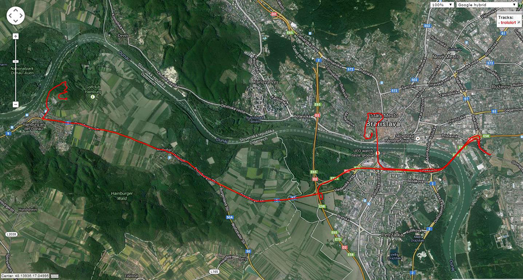
Slovakian company GoSpace performed Galileo positioning while driving around Bratislava on 1 May 2014. The company was among those certified by ESA for their early Galileo positioning achievement.
The historic first positioning fix using only Europe’s civil-owned navigation system took place at ESA’s Navigation Laboratory in its ESTEC technical centre in Noordwijk, the Netherlands, on March 12, 2013.
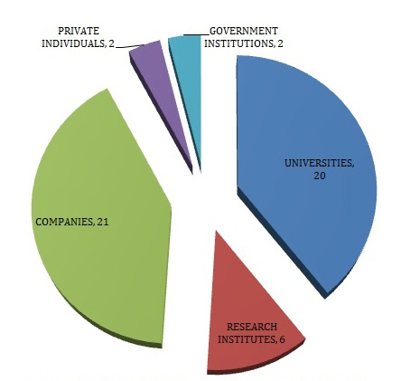
Galileo’s navigation signals could be picked up anywhere in the world that the orbiting satellites come into view, however. Equipped teams from industry, universities, research centers, and government institutions took the opportunity to perform their own fixes, along with a couple of private individuals.
The Galileo team knew of fixes being performed on an informal basis. The idea came to mark the anniversary of the first positioning fix by issuing commemorative certificates to groups who had picked up the signals to perform their own fixes. Teams were asked to include details of the receiver they used, the start and finish of the fixes in Universal Time Coordinated (UTC) and a plot of their latitude/longitude positioning overlaid on a map, such as Google Earth.
Italy turned out to be the single best-represented country in Europe, with six separate fixes,
Germany and the UK followed Italy closely with five fixes each.
Several groups achieved fixes on the very same day as ESA.
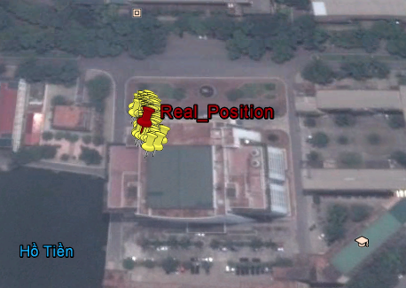
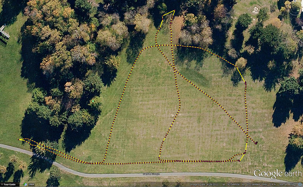
Galileo positioning performed in the NAVIS Centre at the Hanoi University of Science and Technology in Vietnam on March 27, 2013, overlaid on a Google Earth map.
Most of the receivers were software-based radio systems, with signal processing performed by software on a computer linked to a radio-frequency front end. Professional receivers were also customized.
A private individual from Gdansk, Poland, used his own receiver to perform a fix, intended for amateur rocketry.
An individual in Pec, Hungary, achieved a fix with a modified receiver.
Most of the applications were obtained with static receivers and simple position fixes with Galileo’s Open Service signals, but there were some special cases. These included precise point positioning, where offline processing is applied to give extremely precise centimeter-scale positioning — typically used in surveying, the oil and gas industries, and precision agriculture. Some of these fixes were actually performed before the first real-time positioning fixes, including fixes done at the University of New Brunswick.
Belgium’s Royal Military Academy performed Galileo’s first position fix at sea, aboard Belgian frigate Leopold-I, which sailed along the Norwegian coast.
A navigation company from New Zealand performed positioning while walking.
A technology firm in Slovakia performed drive testing.
A German telecom company made use of the satellite signals for timing and network synchronization. One of the most important applications of Galileo will be as a nanosecond-scale time source, enabling the effective synching of financial, power and data networks around the globe.
A Trimble Navigation team used one of their own handheld receivers to perform Galileo-based positioning in pedestrian testing in Christchurch, New Zealand on 14 April 2014. The results are overlaid on a Google Earth map.
The certificates will be issued soon.
General use of Galileo will begin as more satellites join the first four in orbit so the first services can be rolled out. The next two Galileo satellites are in French Guiana, beginning their preparations for launch.
It should take only a slight software update to ready the current generations of satnav receivers to work with Galileo signals, ESA said.
In the June issue’s cover story, “Interchangeability Accomplished,” is a paragraph headed, “Satellite Intersystem Biases,” which appears to assert that Galileo System Time (GST) is 3 seconds ahead of UTC.
However, in the version of the Galileo Signal In Space Interface Control Document posted at: http://ec.europa.eu/enterprise/policies/satnav/galileo/files/galileo-os-sis-icd-issue1-revision1_en.pdf, paragraph 5.1.2 appears to indicate that Galileo System Time (GST) was synchronized, at the second level, with GPS time on 22 August 1999 (that is, 13 seconds ahead of UTC). And, given that a) GST, like GPS time, does not step for announced leap seconds, and b) the IERS has, as of today, announced 3 leap seconds since 22 August 1999, such would appear to suggest that GST is presently roughly 16 seconds (vice 3 seconds) ahead of UTC.
— Stuart Eventhal Fountain, Colorado
Author Frank van Diggelen replies:
Yes! You are right, the article should have said 16 seconds for Galileo, not 3. Thanks for catching that. I’ve corrected the text that appears in the online version of the article, and the accompanying figure.
Media Scoop
The online article covering Javad Ashjaee’s input on the GLONASS situation makes a positive statement that clarifies what has been a horrible reporting job across the board by news channels.
Fox, CBS, NBC, and ABC should all be ashamed that GPS World scooped them on what appears to be a simple story.
Good work.
— Mark Silver IGage Mapping Corporation Salt Lake City, Utah
To Consumer-Grade GNSS Chip Manufacturers
I would like you to consider including a very simple feature in your GPS functionality that will permit elevation to be identified to decimeter level in many instances. The changes needed to the chip are simply the ability to accept an accurate latitude and longitude input, and an elevation calculation function that uses input latitude and longitude.
In addition to enabling instantaneous calculation of an accurate elevation, it may be that a “residual better accuracy” will remain for some time after the calculation, and that this will permit substantially improved latitude and longitude identification at a close distance.
The geo-location scene has evolved rapidly over the past 20 years. It is now very commonplace to be able to locate the latitude and longitude of a location extremely quickly and extremely accurately. For instance, the Google Earth image from the front of my house shows the dotted dividing line in the center of the road. Measuring one of these lines in Google Earth gives a size of 3.1 meters by 20 to 30 cm wide. The lines actually measure 3.0 meters by 12 cm wide. From within Google Earth I can identify the latitude and longitude of the end point on the centre of this line to within ±10 cm with a high degree of confidence. In addition there may be some other small errors in Google’s reporting of the latitude & longitude (for example due to placement of the image or distortion of the image), but these are hopefully minimal.
Now if I place my GPS unit on the end center of this line in the road, I am provided with a result that I know is erroneous. The GPS horizontal location shown in Google Earth is very rarely within two meters of my known location. It is known that altitudinal accuracy is always some two times worse than horizontal accuracy.
If I can simply tell the GPS unit that I am at this known horizontal location, it is a relatively simple calculation to recalibrate the clock and pseudoranges to provide my elevation, which will have an accuracy of a two times the accuracy of the horizontal position. Decimeter horizontal accuracy will provide 2-decimeter altitude accuracy. This is close to 100 times better than the elevation accuracy currently available on any consumer grade stand-alone device and is also effectively instantaneous!
This functionality is simple to implement. I would hope that it could be implemented with nothing more than an upgraded ROM which includes a new API function to allow the input of “I know this is my current horizontal location” and an enhanced calculation process which uses this horizontal location to calculate altitude.
I am unsure whether a residual improvement in accuracy can be attained. Even an improved accuracy for 1 minute after the fix would be useful in many situations, and an improved accuracy for 5 to 10 minutes would be a boon.
I’ve written this many, many times in the past eight years that I’ve written for GPS World magazine, but I have to write it again — this is an exciting time for GNSS!
For me, high-precision GNSS is particularly exciting. I’ve been traveling like crazy, and involved in a number of really fun projects that incorporate high-precision GNSS. Of course, on these various projects I usually incorporate many types of technologies that support GNSS, such as computing, communications, power, and mechanical.
Along those lines, I find myself more and more frequently setting up custom RTK bases for companies because they’re getting cheaper and cheaper, regardless of the fact that there are an increasing number of publicly available real-time kinematic (RTK) base stations. Setting one up doesn’t just involve plugging power into a RTK base receiver and hitting the on/off switch. As I mentioned above, setting up an RTK base involves several different types of technologies. Sometimes, I set up a desktop computer next to the RTK base to act as a server to manage the RTK GNSS base and communications (both network and RTK communications) equipment.
In your mind, when you think of a desktop computer, you probably envision something that occupies 2-3 square feet (~one square meter) of desktop space, along with a keyboard and monitor. So, a consideration when deploying an RTK base is finding desk space somewhere in the user’s office to accommodate the desktop PC and other equipment.
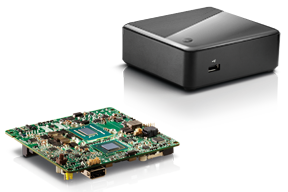
Recently, I took a different approach. I found (actually, my client found) an incredibly small computer to be our server. Just as high-precision GNSS receivers are getting smaller and smaller, so are computers. The Intel Mini-PC measures 4 inches x 4 inches (10.16 x 10.16 centimeters) and has no hard disk. It uses solid-state drive (SSD) memory for storage. SSD technology is still somewhat expensive ($1+ per gigabyte), but it is small compared to a classical disk drive, and doesn’t have any moving parts. Furthermore, the Mini-PC has ethernet ports: when we connect a network cable to it, we could access the Mini-PC via Remote Desktop. That meant we didn’t need a keyboard or monitor. The Mini-PC had all the power we needed, and we could load any sort of control software on it because it runs the standard Windows 7 (or 8) operating system. Last but not least, the Mini-PC costs only $149. However, you need to add memory, SSD, and so on, so the real cost is ~$400 depending on your configuration. While not cheaper than similarly performing “boxes” available, it’s certainly one of the smallest.
Intel Mini-PC Measuring 4″ x 4″
In fact, it’s so small that we stuffed it inside a 14” x 12” electronics enclosure box along with the RTK GNSS base and other network equipment, and hung it out of sight on a closet wall. No desktop space required. Without stretching your mind much, you can see where desktop computing is headed; very small and inexpensive enough to be dedicated to specific tasks. Think about this and then consider the Internet of Things concept. It’s very exciting.
More RTK on Mobile Devices
Later this week I’ll be experimenting with RTK on mobile devices with the CRTN (California Real Time Network), a collection of 330 RTK bases located throughout California. I’ll be using a Panasonic ToughPad running ArcGIS Mobile (and maybe ArcPad) and an iPad using a cloud-based mapping service. The latter is particularly interesting because there are lots of cloud-based GIS data collection apps on the market and under development. Specifically, there’s a lot of subscription-based, cloud-based software. The challenge is that they are even less geodesy-intelligent than the “professional grade” GIS data collection software on the market. In other words, they read coordinates (NMEA format) from GNSS receivers and feed them directly into their app. No datum transformations are provided, neither horizontal nor vertical. That’s going to be a problem.
FCC Levies Record Fine Against Chinese Supplier of GPS and Mobile Phone Jammers
The Federal Communications Commission (FCC) announced that it plans to issue the largest fine in its history against C.T.S. Technology Co., Limited, a Chinese electronics manufacturer and online retailer, for allegedly marketing 285 models of signal jamming devices to U.S. consumers for more than two years. The FCC plans to levy a $34.9 million fine against CTS. The FCC reported that CTS sold 10 high-powered signal jammers to undercover FCC personnel.
The FCC is asking people to report the sale or use of an illegal jammer by contacting the FCC Enforcement Bureau through the FCC online complaint portal, or by calling 1-888-CALL-FCC (or 1-888-225-5322). To voluntarily relinquish a signal jammer, e-mail [email protected]. Additional information, including the FCC Consumer Alert on the jamming prohibitions and the FCC Enforcement Advisory to retailers regarding the marketing of illegal signal jammers, is available at www.fcc.gov/jammers.
You can view the FCC enforcement action against C.T.S. here.
Satellite Launch Pads are Warming Up
Two GPS Block IIF satellites, one launched in February and one launched in May, were set healthy in the past three weeks, making a total of six IIF GPS satellites in orbit broadcasting on three civil frequencies; L1, L2C, L5.
On July 31, the seventh GPS IIF satellite is scheduled for launch, followed by an October 2014 scheduled launch of the eighth GPS IIF satellite.
On June 14, Russia launched a GLONASS-M satellite. It has not been set healthy yet. There are a total of 24 healthy GLONASS satellites in orbit. You can check the current status of GLONASS satellites here.
On August 22, Europe is scheduled to launch the first two Galileo FOC (Full Operational Capability) satellites to add to the four test satellites in orbit that will be integrated into the final operational constellation. A second pair of Galileo satellites is scheduled for launch in November 2014. These are projected dates and subject to slippage.
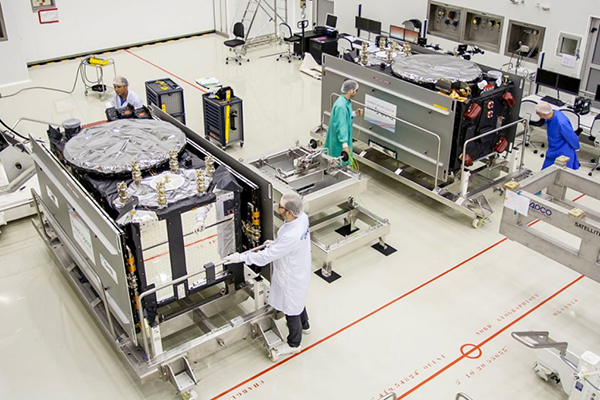
Galileo Satellites in the Clean Room
Live Webinar from the Esri International User Conference on July 17
In a GPS World first, we’ll be producing a live Webinar from the Esri International User Conference next month on Thursday, July 17 @ 10 am Pacific Time in the exhibit hall at the San Diego Convention Center. Of course, the webinar will be focus on one of the hottest topics, high-precision GNSS on mobile devices; from iPads to Android tablets to smartphones.
Tune in or join us live from the exhibit hall floor! Register here.