Blog

  • M3 Systems Announces Simulator Based on Vector Signal Transceiver

    M3 Systems Announces Simulator Based on Vector Signal Transceiver

    StellaNGC_Simulator-O

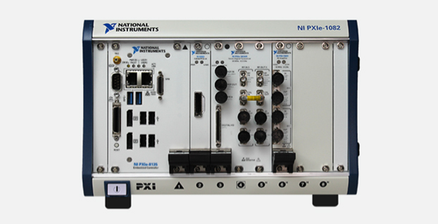
    M3 Systems is now offering the StellaNGC multi-constellation GNSS simulator based on the National Instruments (NI) vector signal transceiver.

    The simulator is designed for the testing of satellite navigation receivers for GPS, GLONASS, Galileo, and EGNOS/WAAS. It is designed to improve performance, scalability, and versatility, and reduce cost over existing navigation test solutions.

    GNSS is the predominant technology today for navigation and outdoor positioning. However, given the weakness of GNSS signals, receiver performance is often affected by interference from the local environment and propagation channel conditions. Understanding the effects of this interference is of particular importance not only for existing GNSS signals but also for future signals that will appear with the deployment of new constellations such as Galileo.

    To properly characterize receiver performance under varying conditions, the StellaGNC multi-constellation GNSS simulator provides signal generation, signal recording and replay, interference generation, signal and data processing, and complete analysis tools. The StellaNGC simulator is based on the NI vector signal transceiver in PXI for improved performance and full simulation capabilities. For record and playback only, a scaled-down version is also available based on the NI USRP (Universal Software Radio Peripheral). Both options were developed with NI LabVIEW and benefit from the performance and flexibility of the NI RF platform.

    The simulator provides a scalable solution that allows easy signal additions through software upgrades, multi-frequency, processing extensions with the addition of FPGAs with NI FlexRIO, and an HDD extension for storage increase. Because the simulator is based on the open PXI standard, the hardware investment can also be extended to other applications, such as simulation, record and playback, or payload simulation.


  • EuroGeographics to Create Expert Group in GNSS Positioning

    Members of EuroGeographics are creating a European platform for networking, sharing best practices, and exchanging expertise on GNSS positioning.

    Plans for the new Positioning Knowledge Exchange Network (KEN) were revealed at the association’s recent Extraordinary General Assembly following a proposal by the Head Office for Geodesy and Cartography, Poland. Its focus will include:

    • maintaining a network of experts in satellite positioning and navigation
    • following the development of relevant technologies and practices
    • working on the most effective utilization of Galileo services, and
    • developing common standards, policies and guidelines for best practice.

    Now EuroGeographics members will work to agree on roles and joint actions through a cooperation agreement with the European Position Determination System (EUPOS), the Reference Frame Sub Committee for Europe (Euref), and the Council of European Geodetic Surveyors (CLGE). The new Positioning KEN will incorporate experts from all four organizations and will also invite other key players to participate.

    “This is a really exciting addition to our range of benefits for members,” said EuroGeographics Executive Director and Secretary General Dave Lovell OBE. “It demonstrates how they are driving the association’s development to ensure its activities continue to meet their needs by reflecting emerging trends and the relevant interests of the European Institutions. We look forward to strengthening our relationships with EUPOS, Euref and CLGE as we work together to create the uniform GNSS service for Europe.”

    EuroGeographics KENs provide an open forum for members and invited experts. Each focuses on an area of particular interest for national mapping, land registry and cadastral authorities. These include Business Interoperability, Quality and Emergency Mapping.

  • Generate Contour Maps on iPads and iPhones

    screen568x568-1   screen568x568

    CMTINC.COM (Corvallis Microtechnology, Inc.) has added a new dimension to its iOS-based GPS/GIS application software by releasing the Contour – Volume – Stakeout app for iPad and iPhone. Now that higher accuracy GPS receivers are available for use with iOS devices, it makes sense to develop GPS/GIS apps that utilize elevation values, the company said.

    The Contour – Volume – Stakeout app will generate contour lines and a colored contour map based on elevations or on the values of any numeric variable of interest (such as the amount of fertilizer to apply). It can compute volumes (such as the amount of soil to move) based on the contour information. It also provides stakeout functions to let the GPS guide the user toward a point or along a line or area boundary.

    The data to be contoured can be digitized and entered via the app itself, or it can be imported via Shapefiles or a text file. To aid data collection, the app provides a function to generate sampling grid points over an area. The contour map can be printed to PDF. The contour data can be exported to a text file. The Feature data can be exported to DXF and Shapefiles, and the contour data can be exported to a .CSV text file.

    The app is now available at the iTunes App Store.

  • FCC to Fine Chinese Jammer Retailer $34.9M for Online U.S. Sales

    FCC to Fine Chinese Jammer Retailer $34.9M for Online U.S. Sales

    GPS_Jammer

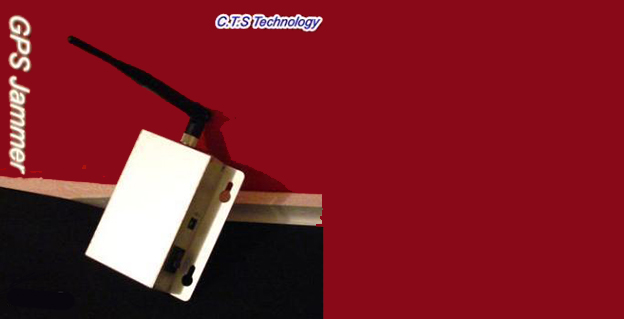
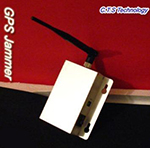
    The Federal Communications Commission plans to issue the largest fine in its history against C.T.S. Technology Co., Limited, a Chinese electronics manufacturer and online retailer, for allegedly marketing 285 models of signal jamming devices to U.S. consumers for more than two years.

    The FCC applied the maximum fine allowed to each jammer model allegedly marketed by C.T.S., resulting in a planned fine of $34,912,500.

    “All companies, whether domestic or foreign, are banned from marketing illegal jammers in the U.S.,” said Travis LeBlanc, Acting Chief of the Enforcement Bureau. “Signal jammers present a direct danger to public safety, potentially blocking the communications of first responders. Operating a jammer is also illegal, and consumers who do so face significant civil and criminal penalties.”

    GPS_jammer_CTS-T2C.T.S. operates a website that markets consumer electronics to individuals in the United States, where it allegedly misled U.S. consumers by falsely claiming that certain signal jammers were approved by the FCC. In fact, the use of such devices by U.S. consumers is illegal under any circumstance. C.T.S. also sold 10 high-powered signal jammers to undercover FCC personnel.

    The FCC also is ordering C.T.S. to cease marketing illegal signal jammers to U.S. consumers and provide information to the FCC about any persons and entities in the United Sates that purchased its devices.

    Signal jammers are radio frequency transmitters that intentionally block, jam, or interfere with authorized communications, such as cellphone calls, GPS systems, Wi-Fi networks, and first responder communications. It is a violation of federal law to market, sell, import, or use a signal jammer in the United States and its territories, except in very limited circumstances involving federal law enforcement.

    The FCC is asking people to report the sale or use of an illegal jammer by contacting the FCC Enforcement Bureau through the FCC online complaint portal, or by calling 1-888-CALL-FCC (or 1-888-225-5322). To voluntarily relinquish a signal jammer, e-mail [email protected]. Additional information, including the FCC Consumer Alert on the jamming prohibitions and the FCC Enforcement Advisory to retailers regarding the marketing of illegal signal jammers, is available at www.fcc.gov/jammers.

    The FCC enforcement action against C.T.S. is available at http://hraunfoss.fcc.gov/edocs_public/attachmatch/FCC-14-92A1.pdf.

  • Rugged IP68 GPS Handhelds and Field Computers Launched

    Rugged IP68 GPS Handhelds and Field Computers Launched

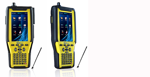
    The GAGAN-enabled Sxtreo GN11.
    The GAGAN-enabled SXtreo GN11.

    Stesalit today announced the availability of the SXtreo range of rugged GPS handhelds for survey, industrial use, and field work under extreme conditions such as agriculture, forestry, roads, security and construction.

    The SXtreo series of mobile devices are rated IP-68, meaning they are waterproof, dust proof, shockproof, and are coupled with built-in mobile GIS applications. Long battery life allows GPS data collection for a full work day, without the need for recharging. The GNSS devices come with full-size USB port for connecting devices.

    Stesalit is based in India, and the SXtreo gives that country an affordable option to take geotagged photos and conduct waypoint surveys. The design and conceptualization of SXtreo is a result of the in-house R&D effort of Stesalit. The road towards the birth of SXtreo is presented in the video:

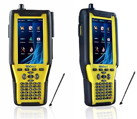
    The GAGAN-enabled SXtreo GN series of rugged GNSS field computers and PDAs comes with a full keypad and large five-inch sunlight-readable screen for field data entry in large forms. These models are designed for GPS data collection and asset management, socioeconomic surveys, mapping, agriculture, logistics, forestry, public transportation, construction and security.

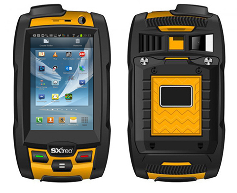
    The SXtreo WP 60 and WP61 devices have all the features of a smartphone.

    The Sxtreo WP 61 rugged smartphone.
    The SXtreo WP 61 rugged smartphone.

    SXtreo handheld’s Android and embedded Linux-based open-source secured operating systems are compatible with a range of sector-specific applications designed by Stesalit.

    • SXgeo is specially designed for waypoint, routes, and track surveys. The added advantage from the similar existing applications is that one can capture geotagged photos and transfer the survey data through GPRS.
    • SXsurvey is a complete suite for comprehensive survey management. With the features of SXgeo, one can also create large forms dynamically in the devices for survey data collection.
    • SXfield is specifically built for the field workers and employees working away from office like road construction, oil, gas and other utility services, logistics and distribution chains, FMCG, consumer and white good companies with large sales networks, operations and maintenance organizations with large service networks, and security organizations including police.
    • The integrated application SXagro is a geospatial agriculture decision-support system in use by agriculture universities and state agriculture departments.

    In addition, the SXtreo range of IP68 rugged smartphones is compatible with most of the off-the-shelf mobile software applications.

  • KVH Launches TACNAV 3D Inertial Nav System with Embedded GPS/GNSS

    KVH Launches TACNAV 3D Inertial Nav System with Embedded GPS/GNSS

    TACNAV-3D-KVH-O

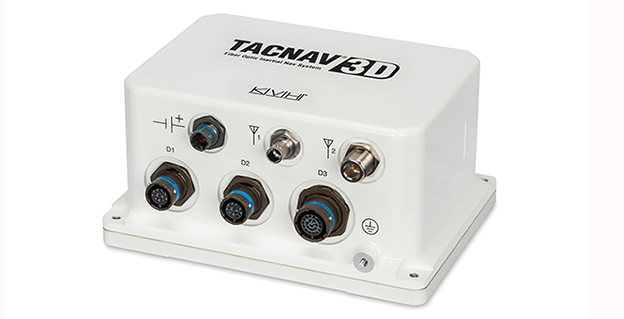
    KVH Industries has introduced TACNAV 3D, a highly accurate inertial navigation system designed for battlefield vehicles, at Eurosatory 2014, an international defense and security industry trade show in Paris, France.

    The TACNAV 3D system is the latest product in KVH’s TACNAV line of tactical navigation systems, and will be on display in the KVH booth (Stand J531, Hall 6) at Eurosatory through June 20.

    The fiber-optic gyro-based TACNAV 3D inertial navigation system provides full three-dimensional navigation and an embedded GNSS. Its modular tactical design and flexible architecture allow it to function as either a standalone inertial navigation solution or as the core of an expandable, multi-functional battlefield management system. It is designed to provide navigation for light armored vehicles, both wheeled and tracked, medium and heavy combat vehicles, and main battle tanks.

    The TACNAV 3D system is fitted with an Iridium transceiver to transmit and receive vehicle position, waypoint, and target location to or from a command center or other vehicles, and can receive messages from the battlefield management system to pass on to the command center via the Iridium short duration burst message function. TACNAV 3D can also receive and transmit Ethernet and CANbus signals, and RS-422.

    “For military vehicles operating on the modern digital battlefield, this completely modular package is a vital component for effective battlefield management,” said Dan Conway, KVH executive vice president for Guidance & Stabilization sales. “It is affordable, lightweight, and easy to integrate with any number of existing vehicles, both turreted and non-turreted. With a built-in communications option, TACNAV 3D is designed for short duration burst messaging, which can make a life or death difference to a soldier.”

    TACNAV 3D builds upon the success of KVH’s TACNAV family of products, and incorporates the 1750 IMU, which combines 3 axes of KVH’s compact high accuracy DSP-1750 fiber optic gyro (FOG), with three axes of high-performance MEMS accelerometers. The TACNAV 3D system is designed to provide extremely accurate heading, dead reckoning, navigation, orientation, and 100% situational awareness in GNSS-denied environments.

  • Android App Geotags and Maps Photos, Video, and Voice Notes

    Red Hen SystemsMediaMapper Mobile is an Android app that lets users snap a photo, record a video, make an audio note, and collect project data, while automatically geotagging it. The result is geotagged media that when displayed will show its exact location on a map. The media can be shared via email or a direct upload to a server.

    “MediaMapper Mobile is unique because it geotags photos as well as audio and video,” said President and Founder Neil Havermale. “This easy-to-use app has the ability to geotag information and display it on a map, allowing users to analyze and respond quickly and efficiently to what is happening in the field. It is the simplest and most affordable high-tech solution for detecting, gathering, and analyzing geospatial information.”

    MediaMapper Mobile offers a convenient way to collect and geotag media in the field. It connects wirelessly to GIS equipment to collect geotagged video, audio, and high-resolution imagery.

    Using MediaMapper Mobile, gas and pipeline inspectors, pilots, and natural resource managers in the field can collect visual and audio recordings of what they see and hear along pipelines, coastlines, forests, and more. They can fill in inspection and collection forms while traveling, and gather diverse sensor data such as percent humidity, temperature, slope distance, and azimuth. GPS details about location, such as time, latitude, longitude, and altitude are viewable.

    Once data collection is complete, media files can be transferred to a laptop or computer to view and analyze using Google Earth or Red Hen Systems isWhere software. There is no need for extra equipment — MediaMapper Mobile has the necessary features to gather and record a wide variety of essential data.

    This version of MediaMapper Mobile is improved over older versions because it can interface with various Bluetooth devices (GPS receivers, Laser Range Finders, Blue2CAN), collect features of interest, take sequential photos based on time and distance intervals, and control external cameras such as GoPro from the Android device.  Red Hen Systems added features and gave it an extensive user interface makeover to enhance its appearance and usability.

  • gvSIG Joins United Nation’s Mountain Partnership

    MPflowers

    The gvSIG Association is a new Mountain Partnership member, with GIS maps as focal point. The Mountain Partnership is a United Nations voluntary alliance of partners dedicated to improving the lives of mountain people and protecting mountain environments around the world.

    “The gvSIG Association hopes to collaborate in this international alliance, working together with the common objective to achieve sustainable mountain development around the world,” the association said.

    The Mountain Partnership addresses challenges facing mountain regions by tapping the wealth and diversity of resources, knowledge, information and expertise, from and between its members, to stimulate concrete initiatives at all levels that will ensure improved quality of life and environments in the world’s mountain regions.

    Currently, 53 governments, 14 intergovernmental organizations, and 167 major groups (such as civil society, NGOs, and the private sector) are members.

    “With this agreement, we add our knowledge and experience in free geomatics to the work of a lot of organizations that take part in this alliance already,” the gvSIG Association said.

  • Proteus Completes Satellite-Derived Forest Inventory Pilot in Abu Dhabi

    Tree crowns above 1m2 are extracted, then a Soil Adjusted Vegetation Index (SAVI) is applied to provide an indication of tree health. Green indicates a healthy tree, red indicates a less healthy tree (within the Abu Dhabi forest plantations). So far this process has been applied to over 4,000,000 trees in Abu Dhabi.
    Tree crowns above 1m2 are extracted, then a Soil Adjusted Vegetation Index (SAVI) is applied to provide an indication of tree health. Green indicates a healthy tree, red indicates a less healthy tree (within the Abu Dhabi forest plantations). So far this process has been applied to over 4,000,000 trees in Abu Dhabi.

    Proteus FZC, a provider of satellite-derived mapping and classification services, has completed a demonstration project using satellite imagery to inventory tree plantations in the Emirate of Abu Dhabi. The tree mapping pilot is a spin-off of a larger Emirate-wide habitat and land use/land cover (LULC) project now being spearheaded by Proteus.

    In the pilot, the Proteus team processed multispectral data collected by DigitalGlobe’s WorldView-2 commercial imaging satellite to identify the species and conditions of individual trees within the pilot area. Proteus managed the project, in which GMV of Spain performed image processing and automatic tree extraction with local ground-truthing support from Nautica Environmental Associates in Abu Dhabi.

    “This pilot demonstrates the viability of using very high-resolution multispectral data to establish a baseline inventory of tree type and health within diverse forest plantations,” said Proteus Project Manager, Richard Flemmings. “We mapped every tree crown larger than one meter in diameter in the pilot area with minimal ground truthing and delivered the results in an Esri geodatabase.”

    Abu Dhabi has planted forest plantations totaling nearly 20 million trees that provide aesthetic and environmental benefits throughout the Emirate. Comprised of gaff, acacia, mesquite and other species, these plantations require continuous irrigation with desalinated water at considerable expense. The Environment Agency — Abu Dhabi (EAD) — requested the pilot as it seeks to find an efficient and cost-effective way to monitor the forest stands.

    “These forest plantations are valuable resources for Abu Dhabi,” said Flemmings. “EAD envisions a monitoring program that identifies isolated health problems so they can be remediated.”

    Proteus applied image processing techniques using all eight WorldView-2 multispectral bands plus one panchromatic band, with an emphasis on the mid-infrared spectra. This multi-step processing distinguished several tree species by their individual canopies and detected stress, possibly related to irrigation, salinity or infestation issues, in some of the trees.

    Compared to the traditional ways of monitoring forestry plantations in the area, which implies walking along the tree lines to detect damaged/dead trees, remote sensing offers a cost-effective alternative.

    “We used pan-sharpened imagery to create the baseline plantation map, but less expensive lower-resolution imagery such as Landsat could be used for ongoing periodic monitoring,” said Flemmings. “This individual tree mapping technique can be applied to create forest inventories of other species elsewhere in the world.”

    Aside from the tree plantation pilot, Proteus is engaged in a fine-scale satellite-derived terrestrial and marine LULC and habitat mapping project for the entire Emirate of Abu Dhabi. The three-phase, multi-million dollar project will ultimately include 60,000 sq. km. of land area and the coastal marine environment down to the 15-meter contour. Advanced processing algorithms are being used to extract LULC and habitat features from high-resolution multispectral satellite imagery acquired over both land and sea. Tree plantations are one of the LULC types identified by the Proteus team in the larger EAD project.

    In the coastal Arabian Gulf, Proteus is delivering seabed classifications to depths of 15-20 meters. Deliverables for each phase of the Abu Dhabi mapping project include bathymetric analysis, orthorectified mosaic, LULC/habitat ecological classifications, geospatial models, printed maps at multiple scales, and knowledge transfer.

    Since 2011, Proteus has been delivering solutions for mapping and classification projects using multispectral satellite imagery. These mapping projects have been delivered for environmental, oil & gas, engineering and other coastal zone applications in Europe, the United States, the Middle East, and the Caribbean.

  • Arrow RF & Power Reaches Agreement with Maxtena

    Arrow Electronics, Inc., has announced that its RF & Power business will globally distribute products from Maxtena, Inc., a developer and producer for wireless solutions, including GNSS, Iridium, Inmarsat and Thuraya satellites, and terrestrial M2M, MSS and LTE applications.

    Arrow RF & Power will distribute Maxtena’s line of rugged and compact helix antennas, microstrip antennas, and combo antennas, and will also support customers with custom wireless solutions ranging from smart metering to 4G LTE. Maxtena’s products are designed for portable wireless applications including satellite phones, communications gear, handheld navigation, asset tracking, UAVs, recreational devices, and industrial equipment.

    “Maxtena’s proprietary Helicore technology provides high-performing yet miniaturized antenna solutions,” said Mark Vitellaro, director, strategic marketing, Arrow RF & Power. “Maxtena’s technical and competitive advantages combined with our technical and customer support will enable design engineers to utilize the optimum antenna solution for their needs.”

    “Maxtena is very excited to have Arrow RF & Power on board as an authorized distribution partner,” stated Vanja Maric, director of sales and marketing, Maxtena. “Their product and technology knowledge and expertise, along with their ability to form strong and lasting customer relationships make Arrow RF & Power a perfect fit for Maxtena and our unique products.”

    More information is available at www.arrow.com/rfpower.

  • Russia Launches Single GLONASS Satellite

    Russia Launches Single GLONASS Satellite

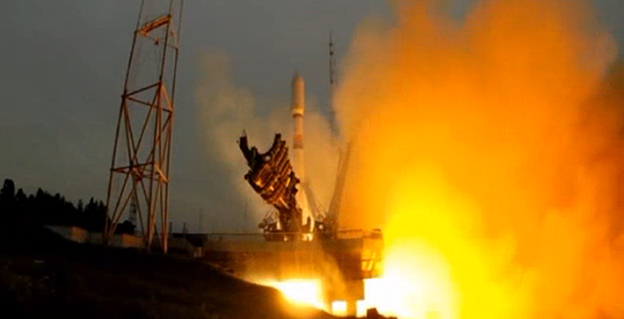
    GLONASS-launch-OA single GLONASS-M satellite was launched from the Plesetsk Cosmodrome on Saturday, June 14, at 17:16 UTC. The satellite, GLONASS-M 55 (with designation 755 once operational and also known as Kosmos 2500), was inserted into the GLONASS constellation’s Plane 3 and will occupy orbital slot 21, according to ISS Reshetnev, the manufacturer of the satellite.

    Reshetnev also reported that the satellite is equipped with an experimental payload capable of transmitting signals in the L3 frequency band. The L3 signal, centred at 1202.025 MHz , is CDMA unlike the GLONASS legacy FDMA signals. The experiment will include flight testing of the new equipment and evaluation of its accuracy characteristics. The GLONASS-K1 test satellite also transmits an L3 signal.

    A video of the launch can be viewed on the Zvezda (meaning “Star”) TV network run by the Russian Ministry of Defence.