Blog

  • 30th Space Symposium Plus: A Truly Global Event

    30th Space Symposium Plus: A Truly Global Event

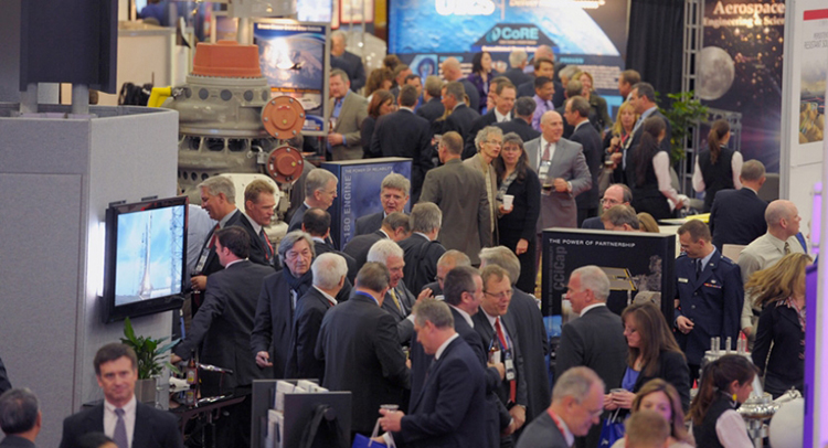
    The 30th Space Symposium offered a lot to see and do.
    The 30th Space Symposium offered a lot to see and do.

    I have said before and will undoubtedly say again, there is absolutely no space-related event in the world today that approaches the sophistication and professionalism of the Space Symposium held annually in Colorado Springs, Colorado, at the five-star Broadmoor Resort. The Space Symposium, carefully engineered and meticulously overseen by the Space Foundation, is truly the premier, must-attend space event of the year on a global basis.

    I have been honored to attend 27 of the 30 symposiums, and I hope to attend many more before I shuffle off this mortal coil. Believe me when I say this; it is not merely an oblique reference to health issues. I was hospitalized for four days afterwards with exhaustion among other issues, and the chairman of one of the key companies in space today now has walking pneumonia. So, while this is a major event, you can overdo it, but that is a personal issue and not by any means the fault of the Space Foundation or the event sponsors. Instead, it is an affirmation of the quality and necessity of the event. Indeed, the Space Symposium, with an average attendance of 9,000+, has grown to the point that a single individual just cannot take it all in. It is just not physically possible, whether you are 25 or 65 — believe me, I tried.

    Therefore, planning your time at the Space Symposium is essential. Unlike many symposiums where you are able to “play it by ear” and take events as they come, at the Space Symposium if you don’t plan well you will truly miss some crucial space-related event. Plus, it is difficult to relate the quality of the networking opportunities. You have access to space professionals and company VIPs at the Space Symposium that you would never be able to contact in normal daily business circumstances, and the beauty of it is they don’t have an office to escape to. There are so many additional cultural and social events that most VIPs attend, so if you don’t contact your target company VIP, it is probably just for lack of trying. Having said that, it is always good to have your elevator speech polished, because your quantity of time may be limited. You must take advantage of every opportunity. And no matter how well you plan, there are always those chance encounters, which is one of the aspects that make the Space Symposium so worthwhile. Sometimes just the opportunity to rub shoulders and discuss space matters with other professionals is all that’s required; those opportunities were abundant at this year’s symposium.

    May Day versus April Fool’s Day

    This year circumstances prevailed, and the 30th Space Symposium was held 30 days later than normal. The events that led to that scheduling change are significant in their own right. For instance, I will list just a few events and names; they might initially seem random, but they are intricately related:

    • Phil Anschutz
    • Broadmoor Resort
    • Construction
    • Renovation
    • Colorado weather
    • School schedules
    • Graduation dates
    • Space legislation
    • Sequestration
    • Colorado governor
    • Ambiance
    • Consistency
    • Education

    OK, the list could go on and on, but the point is that the Broadmoor Resort, as a resort, has been around since 1918, or 96 years. The property history actually goes back as far as 1871 and the founding of Colorado Springs by Spencer Penrose, but that is another story for another time.  The most recent important facts are that in October 2011, Mr. Philip Anschutz, a local Denver-based billionaire, purchased the Broadmoor, a place he fondly remembered from his childhood. He decided that it needed renovating in the best style of the early 1900 Italian Renaissance — which was always reflected in the older  resort buildings on the eastern side of the lake, but was not reflected in the newer western side, with a lack properties. Consequently, the two-plus-year renovation certainly impacted the dates and availability of rooms and services available for the annual Space Symposium. In 2012-13, the event took place in spite of construction, but the 2014 date needed to be moved from April to May to ensure all facilities would be available. Indeed, the formal completion and grand opening after renovations took place was on the Friday preceding the Sunday opening of the Symposium. But then, close only counts in love and horseshoes.

    So this accounts for a few words on the list, but the rest are definitely related to the conference itself. For years, many of the non-Colorado space companies and sponsors of the symposium wondered aloud if the second week in April in the foothills of the Rocky Mountains might be a bit early for such an event, since it invariably snowed, usually more than once, on participants sometime during the week-long event. However, the Space Foundation held firm on the dates for many reasons, one of which was the belief that flatlanders just don’t understand that the foothills of the Rocky Mountains are eligible for snow 12 months out of the year. Seriously, we have lived here for going on 25 years now, and we always said we were eligible for snow 11 months out of the year until a couple of years ago, when it snowed ten inches in August. It had been 80+ degrees the day before. So the Space Foundation pretty much ignored the clueless flatlanders and stuck to their guns on the date issue.

    But, in all honesty, there is much more to the date debate. The Space Foundation prides itself on education and fostering interest in all things space related. It helps fund numerous space-related institutions, scholarships ands organizations. The future of space and our national heritage as it relates to our future space professionals is a consuming force in the Space Foundation’s mission. In May, most schools in the Rocky Mountain region have been dismissed for the year, and quite frankly, as they discovered this year, the space symposium is significantly diminished if the students, teachers and professors cannot attend. This year the attendance was down almost 2,000 attendees, from 9000+ to 7000+, simply because schools and educators from grade school to graduate school found it difficult to participate. Be that as it may ,the Space Foundation could not ignore Philip Anschutz and the multimillion-dollar Broadmoor renovation, nor the major inconvenience to the guests and attendees. So they reluctantly agreed to move the date to May as a one-time experiment.

    The results of that experiment were definitely mixed. On the plus side, the renovations were complete and the transformation was phenomenal — if you had never visited the Broadmoor before, you would not be able to tell anything was changed. Facilities and buildings on both sides of the lake look like they were built in the early 1800s, but with all the modern conveniences of the 21st Century — a truly amazing accomplishment and tribute to Phil Anschutz’s vision. I visited the Broadmoor at least once a month during the two-year renovation, and I was still amazed at the transformation.  Nineteenth-century Italian ambiance and 21st-century convenience, what a combination.

    Now to the weather. Indeed, there were only a couple of small snow showers in the early morning hours during the week at around 0500, which most everyone missed. But Wednesday’s monstrous mega-hailstorm happened in the middle of the afternoon and was not to be missed, visually, aurally or physically. I was enroute to a meeting with Dr. Mark Crews and company from Ball Aerospace on the East side of the lake when the meteorological freight train struck. Fortunately I was under a huge Broadmoor umbrella at the time, or would have surely suffered a concussion, and that is no exaggeration. Golf-ball-sized hail appeared in biblical proportions (Moses would have been proud), and insurance companies executives, many who were in attendance, could be seen talking rapidly on phones and groaning visibly. Indeed, USAA, my insurance company for the last 50+ years, reported more than 800 automobile and 400 property insurance claims in a 24-hour period following the storm, and many insurance companies sent in their disaster and catastrophe teams. So, all in all, I vote for the occasional light snow in April versus the icy rocks raining from heaven in May. I know it is an anthropomorphic illusion, but it is as if Mother Nature were thumbing her nose at those flatlanders who dared be critical of a few snowflakes in April. On the plus side, the added moisture ensured the fireworks display could take place as planned this year, and it is always a spectacular event over the Broadmoor Lake.

    Politically Speaking

    Politically, the timing could not have been better for the Governor of Colorado, the Honorable John Hickenlooper, who came south of the Mason-Dixon line and attended the event where he ceremoniously signed significant Colorado State tax legislation that — bottom line — makes it more profitable for all space-related companies to operate in Colorado. Colorado currently ranks third in the nation for space-related income. Many believe it will return to the Avis, or number-two, spot that it held for many years, after this legislation has time to take effect. Current rankings are California first, Florida second, and Colorado third.

    Social Events

    And last but not least, let’s not forget about the entertainment and social gatherings. There are more breakfasts and luncheons than you could possibly attend. Of course you have to be invited, but if you have something somebody wants, the invites flow. The evening dinners and some social events are much more restricted in nature, but are in truth where much of the real “marketing” and work — read deals — are accomplished.

    This year just as last year there is one event that stole the show. Strictly invitation only — last year only 200 select individuals were invited, and this year although the number doubled (word got out), it was still very much the exclusive event. I am speaking of highly coveted invitations to the Connecting Colorado Gala hosted by Braxton Technologies at the Cheyenne Lodge at the Broadmoor, several miles from the main event. There were CEOs, company presidents, CFOs, politicians and wanna-be senators and congressmen. A small chamber music group  played quietly in the background, and you could actually talk in a normal tone of voice and be heard. Delicious delicacies streamed out of the world-class kitchen for hours. There were huge roaring fireplaces on the wrap-around deck, lit with torches, and of course lugubrious cigars, champagne and other fine wines and brandy in abundance. The weather cooperated and the stars put on a fine show. Security was clearly evident, and it worked. Because parking is extremely limited and buses provided the majority of the transportation, you could not board the bus without an invitation. There were no gatecrashers at this event. As my highly prized pass to the event clearly stated — Non-Transferrable — some names were checked against photos at the door. It was truly a classy evening, one that will be long remembered and one that absolutely works from a networking point of view, and if you are not networking, then why be there? My hat is off to the O’Neil brothers, Kevin and Kenny, as well as their CEO Frank Backes. It was a class act, the place to be, and they literally showed every other company at the symposium how it should be done.

    We haven’t even discussed all the announcements and events that took place at the 30th Space Symposium, and yet if you were there, you saw seamless million-dollar renovations at a major five star resort, all of your closest buddies in the space world, as well as VIPs you have been trying to get in to see for years, and meteorological and man-made fireworks second to none — along with networking opportunities that frankly only occur once a year at this prestigious event.

    I was able to meet with and have lengthy conversations with many VIPs from major space companies, and there are some exciting announcements to come. Believe it or not, some companies want to get out of the government space business — frankly, seques-castration has scared them away. They no longer want to bet the future of the company on congressional budgets. Certainly understandable. Then there are companies that have been out of or momentarily unsuccessful in the GPS/PNT business and are anxious to get back in the game. There are groups of companies that briefed me on proposals that will simply amaze you, and be assured I am doing my best to obtain permission to write about those opportunities. These stories and conversations with VIPs are just too important to give short shrift,  so I will be reporting on them in future columns.

    Now let’s address the huge shift in Who’s Who in Military Space. The national military space landscape is changing dramatically and is being led by the imminent retirement, in August, of my long time friend and colleague General William Shelton. Willie will retire in the Colorado Springs area and be replaced as the Commander of AFSPC by Gen (S) John Hyten, who I have also had the pleasure of knowing and working with for the past 20 years. Indeed, almost all the major space players in Air Force Space Command and at SMC are changing and those that remain are in the most part good guys, like Colonel Wild Bill Cooley and Mr. David Madden at SMC who understand this business and can be trusted to do the right thing. However, be advised the changes are still pervasive. A friend emailed me just this week and asked me for info on all the significant changes in the Command that I knew about, that affected the continuity of the national security space mission. Just off the top of my head, I came up with 14 moves and retirements — so you get the point.
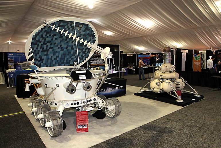
     A Lunokhod Rover from the Kansas Cosmosphere and Space Center on display at the Space Symposium.
    A Lunokhod Rover from the Kansas Cosmosphere and Space Center on display at the Space Symposium.

    One of the major changes concerns the GPS IRT (Global Positioning System Independent Review Team), which John Darrah and I co-founded in the Chief Scientist Office at HQ Air Force Space Command just over 19 years ago in May. We decided that in order to operate totally independently, the IRT needed to be administered by a truly autonomous organization, so the IRT was designated to be tasked by the commander of AFSPC. For a time, this was the Undersecretary of Defense for Space through the auspices of an FFRDC (Federally Funded Research & Development Corporation) think tank, known as the Institute for Defense Analyses or IDA. During the last 19 years the IRT conducted studies and helped solve thorny space issues, mostly related to GPS and PNT, for eight commanders of Air Force Space Command and for key officials in the Department of Defense. Our first chairman was none other than the late Dr. James Schlesinger, who previously served as chairman of the Atomic Energy Commission, director of the CIA, U.S. Secretary of Defense, and the U.S. Secretary of Energy. He also served and advised eight presidents, and at the time of his passing was serving (since 2007) as the chairman of the National Space-based Positioning, Navigation, and Timing (PNT) Advisory Board. The PNT Board is composed of recognized GPS experts from outside the U.S. government that advise the deputy secretary level PNT Executive Committee in its oversight management of the GPS constellation and its governmental augmentations.

    No sooner was the IRT formed under Dr. Schlesinger’s leadership than it was given a non-GPS or PNT-related task, and it proved to be a major task indeed. The task was to form a Broad Area Review panel for space launch and determine why the U.S. had, over the period of a few months, put more than $4 billion worth of space hardware into saltwater versus the vacuum of space. Since that original and subsequent BAR, the U.S. has not had a single complete launch failure in over 120+ launches, a record that cannot be claimed by any other space-faring nation and testament to the value of world-class, truly independent review teams that tell it like it is, warts and all.

    Dr. Schlesinger represented the caliber of people that serve on the IRT, which still exist today as an independent panel led by Major General (USAF, Retired) Robert Rosenberg under the auspices of the Independent Strategic Assessment Group, also administered by IDA and chaired by former Chief of Staff of the USAF and former head of IDA, General Larry Welch (USAF, Ret).

    The landscape and leadership are changing, but the National Security Space mission remains the same. Hopefully the national leadership will be able to adapt and perceive the current changes as opportunities – because while brilliant and intelligent leaders matter, people matter. Success should never be about personalities but rather about integrity, professionalism, and dedication – about doing the right thing and making the right decision every time.

    What Is Don Reading?

    Lindbergh_bookThis month I only have room for one important tome: Lindbergh by A. Scott Berg.

    I initially read this wonderful volume several years ago and enjoyed it very much. I read it again recently because of the Time and Navigation display at the Smithsonian that piqued my interest in all things related to time and navigation through the ages. Lindbergh’s first solo flight across the Atlantic Ocean was not a flight of fancy, but rather a flight of daring as well as one of historical significance from a world-class aviator. He did not take any over-water navigation classes until after the event! As the jacket states, “…here at last is the definitive life of one of the most legendary, controversial, and enigmatic figures in American history.” I hope you enjoy it as much as I did. Highly recommended.

    Until next time, happy navigating, and please make your plans now to attend the 31st Space Symposium in 2015. I hope to see you all in Orlando, Florida, at the ION JNC (Institute of Navigation Joint Navigation Conference) event later this month (June 16-19, 2014).
     

  • GLONASS-M Satellite to Launch June 14

    GLONASS-M Satellite to Launch June 14

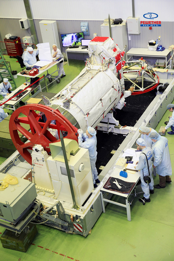
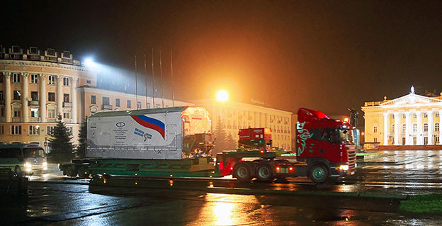
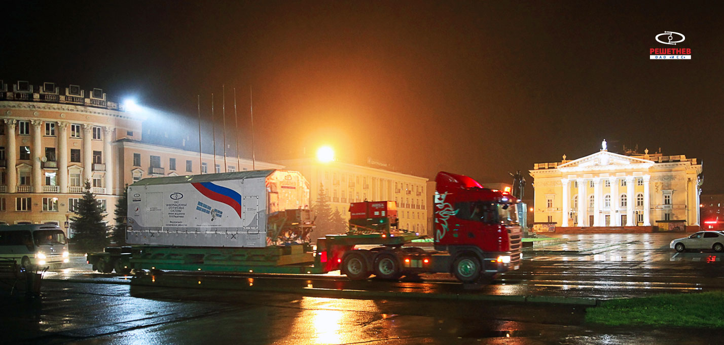
    glonass_150514-2bGLONASS-M satellite number 55 is planned for launch on June 14 from the Plesetsk cosmodrome, said the first deputy director Viktor Kosenko as reported by Interfax.ru.

    Kosenko said that through 2020, 25 more GLONASS satellites are planned: 11 GLONASS-M, 10 Glonass-K1, and four Glonass-K2. At the same time, he said, one GLONASS-K1 spacecraft is in orbit undergoing flight tests.

    GLONASS-M number 55 is equipped with experimental apparatus emitting navigation signal in the frequency range L3. The experiment flight qualification of this equipment and accuracy characteristics of the navigation software. Using the third frequency band along with the L1 and L2 bands comprising GLONASS satellites is directed to improving the competitiveness of the system as a whole.

    A Soyuz2.1b rocket will be used for the launch. This is the second launch campaign for the development of the GLONASS system this year.

    glonass_150514-1b


  • Sokkia’s GHX2 RTK Rover Designed for Demanding Environments

    Sokkia’s GHX2 RTK Rover Designed for Demanding Environments

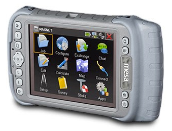
    Sokkia GHX2 RTK network rover.
    Sokkia GHX2 RTK network rover.

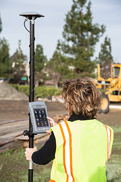
    Sokkia has added the GHX2 network rover to its GNSS family of surveying products in the North American market. The GHX2 is designed to pair with the Sokkia SA300 external antenna to provide enhanced positioning accuracy and RTK performance in demanding environments.

    “The power of a built-in survey and mapping grade GNSS receiver makes the GHX2 an excellent choice,” said Brice Walker, Sokkia vice president of survey sales. When combined with the Sokkia SA300 antenna, the system is a perfectly balanced and lightweight solution for surveying professionals.”

    Features include a large 5.7-inch, sunlight readable touchscreen, waterproof housing, a built-in 3.2 MP camera with 4 GB of flash storage, and Bluetooth and Wi-Fi connectivity.

    The system is compatible with MAGNET Field and Sokkia Receiver Utility (SRU) software.

    GHX2_Unit_Sokkia-W

  • North Dakota, Delaware and Maryland Quads Updated

    The latest North Dakota, Delaware and Maryland Quads are now available from the United States Geological Survey.

    The new US Topo maps for North Dakota (1,402 maps), Delaware (38 maps) and Maryland (213 maps) have been posted to the USGS Map Locator & Downloader and are also accessible through The National Map viewer.

    The new maps feature a design that was launched earlier this year and replace the first edition US Topo maps for those states. The new design presents a crisper and cleaner presentation, which enhances the readability of the maps for online and printer use.

  • CoreLogic Expands Insurance Offerings with Hail, Wind and Lightning Weather Forensics

    CoreLogic, a global property information, analytics and data-enabled services provider, has expanded its natural-hazard risk-management capabilities through the addition of Weather Fusion hail, wind and lightning weather forensics to provide near real-time property-specific weather event verification.

    The combination of proprietary CoreLogic data and analytics with Weather Fusion weather peril verification will enable the insurance and other industries to more reliably identify loss shortly after a weather event occurs through single-source access to multiple weather data sets and solutions.

    CoreLogic offers more than 30 weather peril verification and natural hazard risk reports nationwide, helping risk managers across all industries proactively manage risk and loss associated with extreme weather, natural hazard and catastrophe events. According to the Insurance Information Institute, insured losses due to hail and thunderstorms alone totaled $25 billion in 2011 and $14 billion in 2012. The new CoreLogic hail, wind and lightning reports will enable insurers, underwriters, property managers and owners to confidently verify the cause and date of damage and losses near real time, saving critical time and money. A product performance assessment completed by the top five Insurance Carrier’s Claims Department concluded that the Weather Fusion hail algorithm is four times more effective at identifying address-level hail fall than current hail detection algorithm-based hail data.

    CoreLogic analysis indicates that hail and wind claims are among the most significant categories of property damage expense. Insurance Information Institute data shows from 2007 to 2011, the average claim totaled $7,177, with $30 out of every $100 collected in a homeowner’s insurance premium typically going toward wind and hail claim payments. Credibly verifying damages caused by wind, hail and lightning at the property level has traditionally been a challenge for insurers. The addition of Weather Fusion science and weather forensic reports helps CoreLogic solve this challenge by delivering:

    • Historical address-level weather event insight for underwriter examination that ultimately results in smarter, more informed policy decisions.
    • The ability to accurately distinguish what areas were actually impacted and what size hail fell during a weather event.
    • Hail reports shortly after a severe weather event occurs, with maps updated as frequently as every hour.
    • Timely notifications of hail activity for custom addresses, as well as the previous day’s hail activity.
    • The ability to reduce fraudulent claims attributed to severe weather and accelerate the claims verification process by provisioning information directly after a weather event.
    • A Hail Risk Score, which compares address-specific historical hail events against historical claim experience for all relevant hail locations in the U.S., refreshed daily.
    • Digital plots of hail paths for impacted geographic areas and color-coded by quarter-inch increments illustrating hail from three-quarters of an inch to four inches in diameter.
    • Historical hailstorm data at a custom address-specific location, including hail claim verification with the dates and sizes of hail for each hailstorm, within one, three and ten miles of the address.
    • Address-specific lightning strike analysis, along with date and time (to the nearest millisecond), including count of individual lightning strokes, custom maps, latitude/longitude, polarity (negative or positive) and amplitude of a stroke.
    • Wind Risk Scores, designed to verify maximum wind gust and direction at an individual address level.

    “Traditionally, wind event verification has been considered an unsolvable problem and was based on public safety algorithms or relied on hand-drawn maps and single-point data observations collected from the nearest airport locations,” said Jay Kingsley, senior vice president for CoreLogic Insurance and Spatial Solutions. “Now, the unique weather science and data techniques behind our wind, hail and lightning solutions will provide insurance carriers with a more scientific approach to understanding individual property damage from storms,” continued Kingsley.  “Though billions of dollars are paid out every year for exterior damage to homes, up until now there has been no real way to credibly verify these losses. CoreLogic now provides a more powerful, data-driven approach to this problem through weather peril verification reports.”

  • CoreLogic Expands Insurance Offerings with Hail, Wind and Lightning Weather Forensics

    CoreLogic, a global property information, analytics and data-enabled services provider, has expanded its natural-hazard risk-management capabilities through the addition of Weather Fusion hail, wind and lightning weather forensics to provide near real-time property-specific weather event verification.

    The combination of proprietary CoreLogic data and analytics with Weather Fusion weather peril verification will enable the insurance and other industries to more reliably identify loss shortly after a weather event occurs through single-source access to multiple weather data sets and solutions.

    CoreLogic offers more than 30 weather peril verification and natural hazard risk reports nationwide, helping risk managers across all industries proactively manage risk and loss associated with extreme weather, natural hazard and catastrophe events. According to the Insurance Information Institute, insured losses due to hail and thunderstorms alone totaled $25 billion in 2011 and $14 billion in 2012. The new CoreLogic hail, wind and lightning reports will enable insurers, underwriters, property managers and owners to confidently verify the cause and date of damage and losses near real time, saving critical time and money. A product performance assessment completed by the top five Insurance Carrier’s Claims Department concluded that the Weather Fusion hail algorithm is four times more effective at identifying address-level hail fall than current hail detection algorithm-based hail data.

    CoreLogic analysis indicates that hail and wind claims are among the most significant categories of property damage expense. Insurance Information Institute data shows from 2007 to 2011, the average claim totaled $7,177, with $30 out of every $100 collected in a homeowner’s insurance premium typically going toward wind and hail claim payments. Credibly verifying damages caused by wind, hail and lightning at the property level has traditionally been a challenge for insurers. The addition of Weather Fusion science and weather forensic reports helps CoreLogic solve this challenge by delivering:

    • Historical address-level weather event insight for underwriter examination that ultimately results in smarter, more informed policy decisions.
    • The ability to accurately distinguish what areas were actually impacted and what size hail fell during a weather event.
    • Hail reports shortly after a severe weather event occurs, with maps updated as frequently as every hour.
    • Timely notifications of hail activity for custom addresses, as well as the previous day’s hail activity.
    • The ability to reduce fraudulent claims attributed to severe weather and accelerate the claims verification process by provisioning information directly after a weather event.
    • A Hail Risk Score, which compares address-specific historical hail events against historical claim experience for all relevant hail locations in the U.S., refreshed daily.
    • Digital plots of hail paths for impacted geographic areas and color-coded by quarter-inch increments illustrating hail from three-quarters of an inch to four inches in diameter.
    • Historical hailstorm data at a custom address-specific location, including hail claim verification with the dates and sizes of hail for each hailstorm, within one, three and ten miles of the address.
    • Address-specific lightning strike analysis, along with date and time (to the nearest millisecond), including count of individual lightning strokes, custom maps, latitude/longitude, polarity (negative or positive) and amplitude of a stroke.
    • Wind Risk Scores, designed to verify maximum wind gust and direction at an individual address level.

    “Traditionally, wind event verification has been considered an unsolvable problem and was based on public safety algorithms or relied on hand-drawn maps and single-point data observations collected from the nearest airport locations,” said Jay Kingsley, senior vice president for CoreLogic Insurance and Spatial Solutions. “Now, the unique weather science and data techniques behind our wind, hail and lightning solutions will provide insurance carriers with a more scientific approach to understanding individual property damage from storms,” continued Kingsley.  “Though billions of dollars are paid out every year for exterior damage to homes, up until now there has been no real way to credibly verify these losses. CoreLogic now provides a more powerful, data-driven approach to this problem through weather peril verification reports.”

  • CoreLogic Expands Insurance Offerings with Hail, Wind and Lightning Weather Forensics

    CoreLogic, a global property information, analytics and data-enabled services provider, has expanded its natural-hazard risk-management capabilities through the addition of Weather Fusion hail, wind and lightning weather forensics to provide near real-time property-specific weather event verification.

    The combination of proprietary CoreLogic data and analytics with Weather Fusion weather peril verification will enable the insurance and other industries to more reliably identify loss shortly after a weather event occurs through single-source access to multiple weather data sets and solutions.

    CoreLogic offers more than 30 weather peril verification and natural hazard risk reports nationwide, helping risk managers across all industries proactively manage risk and loss associated with extreme weather, natural hazard and catastrophe events. According to the Insurance Information Institute, insured losses due to hail and thunderstorms alone totaled $25 billion in 2011 and $14 billion in 2012. The new CoreLogic hail, wind and lightning reports will enable insurers, underwriters, property managers and owners to confidently verify the cause and date of damage and losses near real time, saving critical time and money. A product performance assessment completed by the top five Insurance Carrier’s Claims Department concluded that the Weather Fusion hail algorithm is four times more effective at identifying address-level hail fall than current hail detection algorithm-based hail data.

    CoreLogic analysis indicates that hail and wind claims are among the most significant categories of property damage expense. Insurance Information Institute data shows from 2007 to 2011, the average claim totaled $7,177, with $30 out of every $100 collected in a homeowner’s insurance premium typically going toward wind and hail claim payments. Credibly verifying damages caused by wind, hail and lightning at the property level has traditionally been a challenge for insurers. The addition of Weather Fusion science and weather forensic reports helps CoreLogic solve this challenge by delivering:

    • Historical address-level weather event insight for underwriter examination that ultimately results in smarter, more informed policy decisions.
    • The ability to accurately distinguish what areas were actually impacted and what size hail fell during a weather event.
    • Hail reports shortly after a severe weather event occurs, with maps updated as frequently as every hour.
    • Timely notifications of hail activity for custom addresses, as well as the previous day’s hail activity.
    • The ability to reduce fraudulent claims attributed to severe weather and accelerate the claims verification process by provisioning information directly after a weather event.
    • A Hail Risk Score, which compares address-specific historical hail events against historical claim experience for all relevant hail locations in the U.S., refreshed daily.
    • Digital plots of hail paths for impacted geographic areas and color-coded by quarter-inch increments illustrating hail from three-quarters of an inch to four inches in diameter.
    • Historical hailstorm data at a custom address-specific location, including hail claim verification with the dates and sizes of hail for each hailstorm, within one, three and ten miles of the address.
    • Address-specific lightning strike analysis, along with date and time (to the nearest millisecond), including count of individual lightning strokes, custom maps, latitude/longitude, polarity (negative or positive) and amplitude of a stroke.
    • Wind Risk Scores, designed to verify maximum wind gust and direction at an individual address level.

    “Traditionally, wind event verification has been considered an unsolvable problem and was based on public safety algorithms or relied on hand-drawn maps and single-point data observations collected from the nearest airport locations,” said Jay Kingsley, senior vice president for CoreLogic Insurance and Spatial Solutions. “Now, the unique weather science and data techniques behind our wind, hail and lightning solutions will provide insurance carriers with a more scientific approach to understanding individual property damage from storms,” continued Kingsley.  “Though billions of dollars are paid out every year for exterior damage to homes, up until now there has been no real way to credibly verify these losses. CoreLogic now provides a more powerful, data-driven approach to this problem through weather peril verification reports.”

  • Enhanced Sea-level Prediction System to Improve Coastal Flooding Plans

    National Geodetic Survey logoAs the Gulf Coast begins another hurricane season, researchers with the Conrad Blucher Institute for Surveying and Science (CBI) at Texas A&M University-Corpus Christi will be improving the data collection system to allow for more accurate planning and predictions for flooding and sea-level rise.

    CBI has been awarded $1.35 million to enhance the National Spatial Reference System that helps model and predict sea level rise.

    Forecasters are predicting a hurricane season with one or two major hurricanes, but flooding can still pose significant threat, especially to the vital infrastructure along the Gulf coast, which includes 10 of the 14 largest ports. The long-term stability of this region’s infrastructure is in question due to the impact of sea level rise and associated increases in risks of flooding. Growing Gulf coastal populations, up 32 percent from 1990 to 2008, compound the risks. Preparing for sea level rise, flooding and other impacts requires accurate data about what’s occurring at the water’s edge. Collection methods for this type of geospatial data will be enhanced through this project.

    The funding, from the National Geodetic Survey, a project of the National Oceanic and Atmospheric Administration, provides the foundation for modeling along the northern Gulf of Mexico through the National Spatial Reference System.

    The project focuses on an area that is most exposed to inundation from tropical storm surge and has a high risk of flooding and long-term effects of climate change and subsidence.

    “We are excited to be part of this project to provide the latest geospatial data with information from tide gauges, sea level observations, land elevation reference points, and 3D positioning,” said Gary Jeffress, director of CBI. “This system will help local and regional leaders plan for improved resilience to the impacts of sea level rise and flooding and develop long-term strategies to address impacts along the northern Gulf of Mexico.”

    The project will extend and improve monitoring stations from Texas to the Florida Keys to provide additional measurements, including more accurate data regarding elevations, 3D positioning, subsidence rates and sea level observations, that will establish ongoing monitoring of the relative sea-level change along the northern Gulf of Mexico in the coming decades.

    Jeffress, Ruizhi Chen and James Rizzo, with CBI and Texas Spatial Reference Center, will lead the project for A&M-Corpus Christi. Researchers from University of Southern Mississippi, Louisiana State University and Florida Atlantic University are also partners in the project.

  • Russia Turns IGS Data Back on — Sort of

    On June 2, GPS World reported that GPS tracking stations co-sponsored by U.S. interests but located in Russia had stopped making their data available to scientists and others.

    Now, “It looks like the tap has been turned back on, at least at slow flow,” reports Richard Langley, GPS World Innovation editor and University of New Brunswick professor. “Hourly and daily data files from the affected stations are once again being sent to IGS data archive centres. Grigory Steblov of the Geophysical Survey of the Russian Academy of Sciences has reported that ‘the transmission of the data from NEDA [North Eurasian Deformation Array] GPS sites [had] been temporarily suspended due to technical reasons.’

    Now, after reorganization, the data flow is being resumed on hourly basis.”

    Langley stresses, however, that the real-time flow of data from the NEDA stations has not been turned back on, which is important for some applications.

  • Ethertronics Unveils GPS Helix Antenna for Mission-Critical Applications

    Ethertronics Unveils GPS Helix Antenna for Mission-Critical Applications

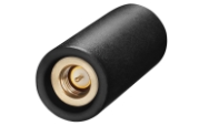
    EtherHelix GPS antenna.
    EtherHelix GPS antenna.

    Ethertronics has unveiled EtherHelix GPS, a small, stand-alone, Right Hand Circularly Polarized (RHCP) external GPS antenna. Measuring 35 mm in length, the EtherHelix GPS is 27 percent shorter than other antennas on the market with no performance trade-offs, the company said. It is designed for high-performance, mission-critical devices such as walkie-talkies, tough books, tough tablets, first responders, public safety, military applications and more.

    EtherHelix can be tuned for various satcom frequencies and various polarizations (RHCP or LHCP). EtherHelix GPS is designed using Ethertronics’ patented Isolated Magnetic Dipole (IMD) technology providing high performance and efficiency in a small form factor.

    EtherHelix GPS has a high tolerance to frequency shifts given the technology’s high RF isolation, which is designed to resist antenna detuning that can otherwise impair reception. EtherHelix GPS provides exceptional coverage inside buildings, vehicles or other areas where weak signals and signal reflection occur, the company said.

    “GPS capabilities are critical for first responders and military applications. It is imperative that the antennas used in these devices are high-performance, small and rugged,” said Olivier Robin, general manager Americas and Europe at Ethertronics. “EtherHelix GPS is the most recent example of Ethertronics’ leadership in developing industry-first RF solutions to provide manufacturers with a way to differentiate their products and stand out in a competitive market. Already we have seen interest in our new EtherHelix GPS antenna given its best-in-class performance coupled with its smallest occupied volume.”

    Given its reduced weight and size — 11.8 g and 35 mm long by 15 mm in diameter — manufacturers benefit from simpler integration for an array of GPS devices, Ethertronics said. In addition, the new GPS antenna’s capabilities include high selectivity, which minimizes the need for additional filters. EtherHelix GPS’s ruggedized design includes IP-68 protection from dust and water, as well as a standard SMA male connector for easy integration. The RoHS Compliant antenna is designed and manufactured in the United States.

    EtherHelix GPS is commercially available now and is the first in a series of antennas for mission-critical applications.

  • Alta Systems Balloon: Oblique Imagery Capture with a Light Footprint

    Alta balloon.
    Alta balloon.

    Three weeks ago, GPS World / Geospatial Solutions held a webinar highlighting new technologies for imagery and data capture. The webinar had four presenters: Paul Smith of CycloMedia, Ted Ralston with Soft Power Solutions, Peter VanAmburgh from IIF Data, and John Ciampa CEO of Alta. You can view a YouTube video of the session. Because webinar time is limited, we couldn’t cover the technologies in detail, so I’m covering some of the technologies one column at a time.

    In February, I devoted my column to CycloMedia, so you may want to review that material if you want more detail. This month I want to delve into the Alta balloon system that was presented by John Ciampa, the CEO of Alta. John was the original patent holder of Pictometry, the revolutionary high resolution geo-referenced metric oblique imagery system. He and Steve Schultz took the concept from theory to a practical functioning system that has been an industry standard for over 10 years.

    John continues his research, dividing his time between the Rochester Institute of Technology (RIT) and Florida International University (FIU) while also working with the National Science Foundation (NSF). Although Pictometry was very successful, he also understood the limitations and cost of a manned aircraft as a capture system, especially for disaster response. Pictometry was a very capable system, but John felt that what was needed was a system that had a “lighter footprint” figuratively and literally. John took his knowledge and experience, and combined it with the latest developments in micro-miniaturized technology, to develop a system that was elegant in its simplicity and usefulness.

    The Platform

    Simply put, the Alta balloon is a steerable oblique geo-referenced camera system attached to a weather balloon. By using a balloon, John solved several problems associated with manned aircraft — cost, image quality, and accessibility. A balloon is cheaper than an aircraft, doesn’t require a licensed pilot, is more easily deployable, and can “fly” at lower altitudes.

    Even a small aircraft is expensive, and requires a trained pilot and complex support logistics. A small used aircraft can run $50,000 to several hundred thousand dollars. Additionally, most high-end aerial imagery systems generally require expensive FAA-approved modifications of the airframe. This adds cost, and limits the aircraft that can be used. Equipped with Pictometry cameras and electronics, a total aircraft capture system can easily cost $300,000 and up.

    A significant factor during disaster response events is transportability and support. Past experience has shown that it can be very difficult to transport and operate even small aircraft in disaster regions, especially if the damage is widespread.  Fuel and ground support in disaster sites can also be a serious limitation. By comparison, a balloon system can be carried in a suitcase, shipped quickly, and set up in less than an hour.  Since the cost is in the range of several thousand dollars, multiple systems are practical and can be deployed in numerous remote locations. Equally impressive is that operators can be trained in less than an hour.

    But don’t get the impression that Alta is as simple as strapping a digital camera to a balloon. Achieving the image quality, accuracy and dynamic performance of the Alta system requires a very sophisticated package, including the balloon, controls, communications and sensors. The balloon system is actually two balloons, one within the other, an outer balloon and inner lift gas balloon. The outer balloon provides some external protection while presenting a consistent profile. The inner balloon provides the lift and is filled with either hydrogen or helium.

    The altitude is remotely controlled by venting lift gas to descend or by dumping water ballast to ascend.  An onboard computer and sensors can also maintain altitude autonomously. When the balloon is brought down, a tethered weight drops to several feet under the balloon. The weight contacts the ground first and “anchors” the balloon and payload for retrieval. This keeps the balloon and payload off the ground, and also makes it easier to spot.

    There are several modes of operation that are determined by the operator prior to launch:

    • “Path Mode”: The balloon is released, ascending to the programmed altitude, then drifting with the wind currents before descending back to the ground.
    • “Patch Mode – single tether”: Used to launch and retrieve the balloon. The balloon ascends to altitude, and its position is downwind based on the strength of the wind acting on both the balloon and tether.
    Patch mode with single tether.
    Patch mode with single tether.
    • “Patch Mode – multiple tethers”: Very precisely controls the location of the balloon over a limited area. This is very similar to the overhead cameras used in televised football games but in reverse, since the balloon wants to fly up.
    Patch mode with multiple tethers.
    Patch mode with multiple tethers.

    The system can also be equipped with a parachute for emergency landings, a solar trickle charger for extended missions, and even a quadcopter that can steer the balloon to specific target areas. The lift capability of the balloon permits significantly longer duration flights than a quadcopter alone. A detailed operator’s manual is available for review at the Alta website — look for the Operators Manual.

    The Payload

    The modular payload is complex, but also lightweight and compact thanks to the latest developments in miniaturization. It consists of a precision GPS unit, inertial measurement/navigation unit (IMU), an onboard computer, environmental sensors, Wi-Fi communications, and an aimable high-resolution camera on a stabilized gimbal. The camera can be RGB, night vision or even multi-spectral. The imagery is downloaded as captured and delivered almost real-time.

    Modular payload.
    Modular payload.

    The Output

    Because the balloon floats at low altitudes, image resolution is an impressive “game changer.” Here is just one example comparing a 4-inch pixel Pictometry/Bing image taken from 3,000 feet to a 1-centimeter pixel Alta image of the same location taken from several hundred feet.

    Bing (left) and Alta images of stadium seats, compared.
    Bing (left) and Alta images of stadium seats, compared.

    Similar to Pictometry, the system uses GPS and IMUs to very accurately determine the camera location and attitude. That information, linked via algorithms to the captured imagery, results in imagery that is geo-referenced, measurable and available with full metadata, including the time of capture.  I can’t over emphasize how important this is. Having instant access to imagery is nice, but having that imagery already geo-referenced means that the imagery can be quickly and easily imported into a GIS and overlaid with legacy GIS data for instant analytics.

    The system has been used for many mundane applications such a real estate, agriculture, construction/engineering and event planning. More critical applications include crime-scene monitoring, surveillance and disaster response. Recently, in response to a South Florida Mall shooting, police launched an Alta balloon to view the crime-scene location. The imagery was instantly and continuously sent to police station computers and mobile devices of responders en route to the mall for pre-planning of their response. Viewing rooftops and walkways for victims and perpetrators, a near real-time operational picture was provided to police before putting themselves and others in harm’s way.

    Actual image from an ALTA Balloon used in SWAT team maneuvers. Dolphin Mall Sweetwater Florida, May 14, 2014, 6:05 a.m
    Actual image from an Alta balloon used in SWAT team maneuvers.

    Dolphin Mall Sweetwater Florida, May 14, 2014, 6:05 a.m.

    The Potential

    I’m especially excited about the potential lifesaving use of Alta balloons. On numerous occasions I was involved in emergency response actions, and the dominant overarching need was high-quality imagery that could be combined with legacy data and imagery as close to real-time as possible. This system answers that need, and at a low cost. I could envision several Alta systems in every county nationwide ready to deploy on a moment’s notice. I believe that these units would be especially valuable for disaster response in second- and third-world countries. Dozens of Alta systems and trained operators could be delivered on short notice to major disaster sites, providing almost real-time common operational pictures for first responders. The added advantage is the very light need for logistics and support.

    Military applications could be equally important. The silence of balloons coupled with a small visibility profile, including almost total invisibility at night, makes them ideal for reconnaissance and surveillance.  The relatively low cost of the platforms also permits them to be expendable. In a tethered mode, the persistent “eye in the sky” could serve as a deterrent, or at a minimum make hostile activity more complicated for the perpetrators as they try to hide activities from the balloon.  The “light” logistics and fast operator learning curve are just added benefits.

    A key question raised during the webinar was FAA control. John indicated that the FAA does not consider the Alta balloons in a tethered mode subject to their control, and is currently reviewing it in a drift mode.  John further amplified that the very low altitude of operation and dual control of descent should also exempt the drifter from FAA involvement. Alta could provide a significant advantage where UAS operations are restricted or not practical.

    In a recent book, “Smaller Faster Lighter Denser Cheaper” by Robert Bryce, reviewed in the Wall Street Journal, the author argues that a similar dynamic, making less do more, drives virtually every technological change that has created the modern world, from cars and airplanes to advanced medicine, strategic metals and the iCloud. Alta balloons are certainly a good example.

    I was an early proponent of Pictometry because, unlike abstract GIS data and ortho imagery, the metric oblique imagery was easily understood by non-GIS users. I saw many examples where it saved lives because police and firefighters were able to form and exploit a common operational picture quickly. Alta has me equally excited because it brings that same capability to users with a much simpler system that delivers almost real-time imagery at a cost anyone can afford. This technology is going to help a lot of people.

  • Alta Systems Balloon: Oblique Imagery Capture with a Light Footprint

    Alta balloon.
    Alta balloon.

    Three weeks ago, GPS World / Geospatial Solutions held a webinar highlighting new technologies for imagery and data capture. The webinar had four presenters: Paul Smith of CycloMedia, Ted Ralston with Soft Power Solutions, Peter VanAmburgh from IIF Data, and John Ciampa CEO of Alta. You can view a YouTube video of the session. Because webinar time is limited, we couldn’t cover the technologies in detail, so I’m covering some of the technologies one column at a time.

    In February, I devoted my column to CycloMedia, so you may want to review that material if you want more detail. This month I want to delve into the Alta balloon system that was presented by John Ciampa, the CEO of Alta. John was the original patent holder of Pictometry, the revolutionary high resolution geo-referenced metric oblique imagery system. He and Steve Schultz took the concept from theory to a practical functioning system that has been an industry standard for over 10 years.

    John continues his research, dividing his time between the Rochester Institute of Technology (RIT) and Florida International University (FIU) while also working with the National Science Foundation (NSF). Although Pictometry was very successful, he also understood the limitations and cost of a manned aircraft as a capture system, especially for disaster response. Pictometry was a very capable system, but John felt that what was needed was a system that had a “lighter footprint” figuratively and literally. John took his knowledge and experience, and combined it with the latest developments in micro-miniaturized technology, to develop a system that was elegant in its simplicity and usefulness.

    The Platform

    Simply put, the Alta balloon is a steerable oblique geo-referenced camera system attached to a weather balloon. By using a balloon, John solved several problems associated with manned aircraft — cost, image quality, and accessibility. A balloon is cheaper than an aircraft, doesn’t require a licensed pilot, is more easily deployable, and can “fly” at lower altitudes.

    Even a small aircraft is expensive, and requires a trained pilot and complex support logistics. A small used aircraft can run $50,000 to several hundred thousand dollars. Additionally, most high-end aerial imagery systems generally require expensive FAA-approved modifications of the airframe. This adds cost, and limits the aircraft that can be used. Equipped with Pictometry cameras and electronics, a total aircraft capture system can easily cost $300,000 and up.

    A significant factor during disaster response events is transportability and support. Past experience has shown that it can be very difficult to transport and operate even small aircraft in disaster regions, especially if the damage is widespread.  Fuel and ground support in disaster sites can also be a serious limitation. By comparison, a balloon system can be carried in a suitcase, shipped quickly, and set up in less than an hour.  Since the cost is in the range of several thousand dollars, multiple systems are practical and can be deployed in numerous remote locations. Equally impressive is that operators can be trained in less than an hour.

    But don’t get the impression that Alta is as simple as strapping a digital camera to a balloon. Achieving the image quality, accuracy and dynamic performance of the Alta system requires a very sophisticated package, including the balloon, controls, communications and sensors. The balloon system is actually two balloons, one within the other, an outer balloon and inner lift gas balloon. The outer balloon provides some external protection while presenting a consistent profile. The inner balloon provides the lift and is filled with either hydrogen or helium.

    The altitude is remotely controlled by venting lift gas to descend or by dumping water ballast to ascend.  An onboard computer and sensors can also maintain altitude autonomously. When the balloon is brought down, a tethered weight drops to several feet under the balloon. The weight contacts the ground first and “anchors” the balloon and payload for retrieval. This keeps the balloon and payload off the ground, and also makes it easier to spot.

    There are several modes of operation that are determined by the operator prior to launch:

    • “Path Mode”: The balloon is released, ascending to the programmed altitude, then drifting with the wind currents before descending back to the ground.
    • “Patch Mode – single tether”: Used to launch and retrieve the balloon. The balloon ascends to altitude, and its position is downwind based on the strength of the wind acting on both the balloon and tether.
    Patch mode with single tether.
    Patch mode with single tether.
    • “Patch Mode – multiple tethers”: Very precisely controls the location of the balloon over a limited area. This is very similar to the overhead cameras used in televised football games but in reverse, since the balloon wants to fly up.
    Patch mode with multiple tethers.
    Patch mode with multiple tethers.

    The system can also be equipped with a parachute for emergency landings, a solar trickle charger for extended missions, and even a quadcopter that can steer the balloon to specific target areas. The lift capability of the balloon permits significantly longer duration flights than a quadcopter alone. A detailed operator’s manual is available for review at the Alta website — look for the Operators Manual.

    The Payload

    The modular payload is complex, but also lightweight and compact thanks to the latest developments in miniaturization. It consists of a precision GPS unit, inertial measurement/navigation unit (IMU), an onboard computer, environmental sensors, Wi-Fi communications, and an aimable high-resolution camera on a stabilized gimbal. The camera can be RGB, night vision or even multi-spectral. The imagery is downloaded as captured and delivered almost real-time.

    Modular payload.
    Modular payload.

    The Output

    Because the balloon floats at low altitudes, image resolution is an impressive “game changer.” Here is just one example comparing a 4-inch pixel Pictometry/Bing image taken from 3,000 feet to a 1-centimeter pixel Alta image of the same location taken from several hundred feet.

    Bing (left) and Alta images of stadium seats, compared.
    Bing (left) and Alta images of stadium seats, compared.

    Similar to Pictometry, the system uses GPS and IMUs to very accurately determine the camera location and attitude. That information, linked via algorithms to the captured imagery, results in imagery that is geo-referenced, measurable and available with full metadata, including the time of capture.  I can’t over emphasize how important this is. Having instant access to imagery is nice, but having that imagery already geo-referenced means that the imagery can be quickly and easily imported into a GIS and overlaid with legacy GIS data for instant analytics.

    The system has been used for many mundane applications such a real estate, agriculture, construction/engineering and event planning. More critical applications include crime-scene monitoring, surveillance and disaster response. Recently, in response to a South Florida Mall shooting, police launched an Alta balloon to view the crime-scene location. The imagery was instantly and continuously sent to police station computers and mobile devices of responders en route to the mall for pre-planning of their response. Viewing rooftops and walkways for victims and perpetrators, a near real-time operational picture was provided to police before putting themselves and others in harm’s way.

    Actual image from an ALTA Balloon used in SWAT team maneuvers. Dolphin Mall Sweetwater Florida, May 14, 2014, 6:05 a.m
    Actual image from an Alta balloon used in SWAT team maneuvers.

    Dolphin Mall Sweetwater Florida, May 14, 2014, 6:05 a.m.

    The Potential

    I’m especially excited about the potential lifesaving use of Alta balloons. On numerous occasions I was involved in emergency response actions, and the dominant overarching need was high-quality imagery that could be combined with legacy data and imagery as close to real-time as possible. This system answers that need, and at a low cost. I could envision several Alta systems in every county nationwide ready to deploy on a moment’s notice. I believe that these units would be especially valuable for disaster response in second- and third-world countries. Dozens of Alta systems and trained operators could be delivered on short notice to major disaster sites, providing almost real-time common operational pictures for first responders. The added advantage is the very light need for logistics and support.

    Military applications could be equally important. The silence of balloons coupled with a small visibility profile, including almost total invisibility at night, makes them ideal for reconnaissance and surveillance.  The relatively low cost of the platforms also permits them to be expendable. In a tethered mode, the persistent “eye in the sky” could serve as a deterrent, or at a minimum make hostile activity more complicated for the perpetrators as they try to hide activities from the balloon.  The “light” logistics and fast operator learning curve are just added benefits.

    A key question raised during the webinar was FAA control. John indicated that the FAA does not consider the Alta balloons in a tethered mode subject to their control, and is currently reviewing it in a drift mode.  John further amplified that the very low altitude of operation and dual control of descent should also exempt the drifter from FAA involvement. Alta could provide a significant advantage where UAS operations are restricted or not practical.

    In a recent book, “Smaller Faster Lighter Denser Cheaper” by Robert Bryce, reviewed in the Wall Street Journal, the author argues that a similar dynamic, making less do more, drives virtually every technological change that has created the modern world, from cars and airplanes to advanced medicine, strategic metals and the iCloud. Alta balloons are certainly a good example.

    I was an early proponent of Pictometry because, unlike abstract GIS data and ortho imagery, the metric oblique imagery was easily understood by non-GIS users. I saw many examples where it saved lives because police and firefighters were able to form and exploit a common operational picture quickly. Alta has me equally excited because it brings that same capability to users with a much simpler system that delivers almost real-time imagery at a cost anyone can afford. This technology is going to help a lot of people.