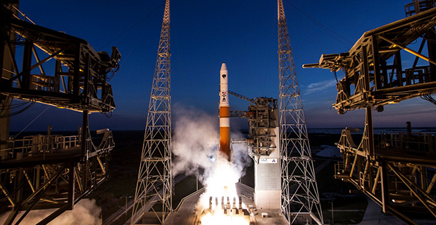
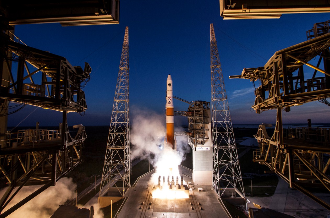
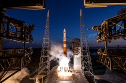
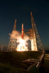
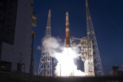
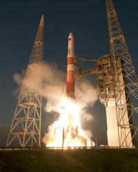
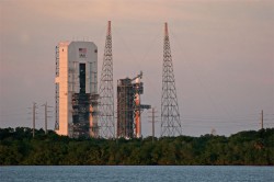
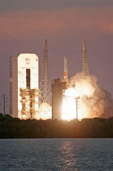
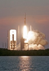
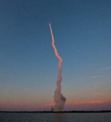
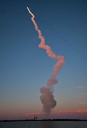
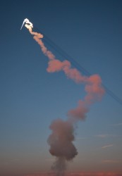
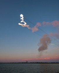
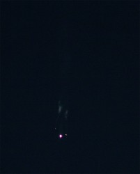
Friday’s launch of a Delta 4 rocket carrying the latest GPS satellite was tracked via GPS itself instead of by radar, reports Spaceflight Now in an article.
United Launch Alliance’s Atlas and Delta rockets are transitioning to GPS metric tracking for range safety functions, which protect the public and property should a launch vehicle veer off course. The move is a money-saving upgrade to the military’s aging range infrastructure.
A special avionics system on the launcher transmitted the location. For decades, most rockets launching from Cape Canaveral, Florida, and Vandenberg Air Force Base, California, have been tracked by C-band radar.
Many of the nation’s leading public safety and public health organizations submitted comments this week in support of a proposed Federal Communications Commission (FCC) rule to help emergency responders more quickly and accurately find 911 callers using wireless phones from indoor locations. More than 300 individuals and organizations filed during the initial comment period with the overwhelming majority supporting the FCC proposal.
Among those supporting the rule were many of the largest and most respected organizations representing 911 professionals, police officers, fire fighters, EMS workers, public safety professionals, older Americans, heart attack and Alzheimer’s patients, and the deaf and hard of hearing. They were joined by hundreds of individual 911 dispatchers and first responders who submitted personal comments through the FCC’s web site or in survey responses that were filed with the FCC.
“The support for this rule across the public safety and public communities is truly breathtaking,” said Jamie Barnett, director of the Find Me 911 Coalition and former chief of the FCC’s Public Safety and Homeland Security Bureau. “These organizations are on the front lines of emergency response, and they know that lives are being lost every day because 911 professionals cannot quickly find indoor callers using wireless phones. The urgency of this rulemaking is unquestionable, and we commend Chairman Wheeler and the other commissioners for their leadership by taking fast action on it.”
According to the FCC’s estimates, at least 10,000 lives a year could be saved by improvements in response time through the FCC’s proposed rule. All of the comments submitted are online.
Find Me 911 is an effort supported by more than 200,000 individuals, as well as national and local organizations. The individuals and organizations represent a broad range of 911 operators and first responders — emergency medical services personnel, fire fighters and police. Find Me 911 seeks to ensure that the FCC moves forward quickly to establish a reasonable, measurable level of location accuracy for emergency calls made indoors, enabling first responders to locate emergency calls from wireless phones from all locations rapidly and efficiently.
Among the organizations filing joint or individual comments in support of the FCC’s proposed rule were:
Law Enforcement
International Association of Chiefs of Police
National Sheriffs’ Association
Fire Fighters
International Association of Fire Fighters
International Association of Fire Chiefs
Emergency Medical Professionals
National Association of State Emergency Medical Services (EMS) Officials
National Association of EMS Physicians
National Association of EMTs
National EMS Management Association
American College of Emergency Physicians
9-1-1 Professionals
National Association of State 911 Administrators
National Emergency Number Association
Association of Public Safety Communications Officials
CALNENA
Texas 9-1-1 Alliance
Texas Commission on State Emergency Communications
[Texas] Municipal Emergency Communication Districts Association
San Francisco Department of Emergency Management
Nebraska Public Safety Commission
Older Americans
AARP
Alliance for Retired Americans
Public Health
Alzheimer’s Association
American Heart Association
Public Safety
National Association of Regulatory Utility Commissioners
National Public Safety Telecommunications Council
Deaf and Hard of Hearing
Telecommunications for the Deaf and Hard of Hearing
National Association of the Deaf
Association of Late-Deafened Adults
Cerebral Palsy and Deaf Organization
California Coalition of Agencies Serving the Deaf and Hard of Hearing
Deaf and Hard of Hearing Consumer Advocacy Network
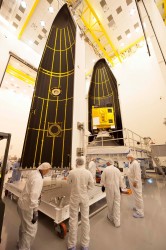
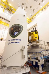
The sixth GPS Block IIF satellite was successfully launched Friday at 8:03 p.m. local time. Built by Boeing Space and Intelligence Systems of El Segundo, California, GPS IIF-6 launched aboard a United Launch Alliance Delta 4 rocket from Cape Canaveral Air Force Station in Florida.
The launch was originally planned for Thursday evening, but bad weather led to a 24-hour hold. One hour remained in the countdown when the launch was scrubbed.
Two more GPS IIF satellites are scheduled to launch before the end of the year.
Below is a video of the launch.
Here are launch highlights.
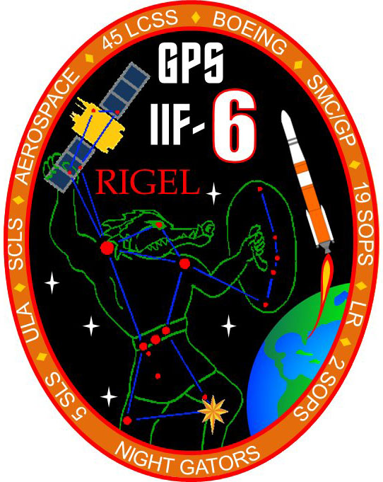
This patch commemorates the launch of GPS IIF-6, nicknamed Rigel.
GPS IIF-6 is nicknamed Rigel. All of the Block II-F satellites have been named after stars. Rigel is is the brightest star in the constellation Orion and the seventh brightest star in the night sky, with a visual magnitude of 0.12.
In the patch commemorating the launch, Orion is depicted with an alligator head. This is in reference to the “Night Gators,” the part of the launch team that is responsible for moving payloads to the launch pad, which has typically occurred at night.
A slideshow of photos from United Launch Alliance:
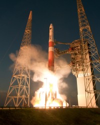
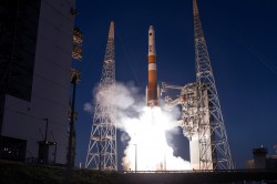
The ULA Delta 4 rocket blasts off at sunset from Cape Canaveral’s Complex 37 on a mission to deploy the GPS IIF-6 satellite. Photo credit: Spaceflight Now.
Photo credit: Spaceflight Now.
Photo credit: Spaceflight Now.
Photo credit: Spaceflight Now.
Photo credit: Spaceflight Now.
Photo credit: Spaceflight Now.
Photo credit: Spaceflight Now.
Photo credit: Spaceflight Now.
Photo credit: Spaceflight Now.
Photo credit: Spaceflight Now.
Innovation Editor Richard Langley helped compile this report.
In 2013, Russia lost three GLONASS satellites when their launch aboard a Proton-M rocket went awry, sending the satellites crashing into the Baikonur Cosmodrome in Kazakhstan instead of aloft into space. Before that, in 2010, three other GLONASS satellites ended up in the Pacific Ocean aboard a Proton-M rocket.
This week, on May 15, another Proton-M satellite crashed, this time with the Ekspress-AM4R telecommunications satellite aboard.
Launch of the Proton-M rocket took place from Launch Pad 39 at the Baikonur Cosmodrome at 21:42 GMT. However, an unspecified failure was noted during third stage flight. The rocket and satellite are lost, according to a NASA Spaceflight article.
Flawed processing of GPS satellite data in some GPS receiver chipsets has caused concern, but the problem is not with the GPS constellation itself. “SVN 64 broadcasts a data message that clearly indicates SVN 64 is unusable for navigation. Nevertheless, the U.S. government has confirmed that certain GPS receivers are using data from SVN 64, in violation of GPS interface specifications, resulting in outages or corrupted, inaccurate position calculations,” Executive Secretariat Rick Hamilton, Civil GPS Service Interface Committee (CGSIC), said in a May 15 message.
Read the full text of the message below.
Known Problem with Certain GPS Devices
May 15, 2014
Recently, many GPS users have reported intermittent GPS outages in their devices. After investigating, the U.S. government has linked the problem to flawed processing of GPS satellite data within certain GPS receiver chipsets. The GPS satellite service continues to function as designed and is fully operational and available worldwide.
The problem affects only user equipment that erroneously ignores the satellite health status information broadcast from every GPS satellite. The problem is not related to the April 28, 2014, activation of civil navigation messages on the GPS L2C and L5 signals.
Since March 15, 2014, the Air Force has been conducting functional checkout on a GPS satellite, designated Space Vehicle Number (SVN) 64. SVN 64 broadcasts a data message that clearly indicates SVN 64 is unusable for navigation. Nevertheless, the U.S. government has confirmed that certain GPS receivers are using data from SVN 64, in violation of GPS interface specifications, resulting in outages or corrupted, inaccurate position calculations.
The Air Force testing is scheduled to end in mid-May 2014 at which time SVN 64 will begin normal operation. At that point, these problems may stop occurring. Meanwhile, the U.S. government urges all GPS device makers to review their products for compliance with the GPS interface specifications, and if necessary, to issue software/firmware updates to users as soon as possible. View specifications.
Users experiencing GPS outages should check with their device manufacturers for available software/firmware updates. In addition, any civil user seeing unusual behavior in GPS user equipment should report it to the U.S. Coast Guard Navigation Center (NAVCEN). Aviation users should file reports consistent with FAA-approved procedures. Military users seeing unusual behavior should report it the GPS Operations Center (GPSOC).
Please direct any civil user questions to NAVCEN at (703) 313-5900,
http://www.navcen.uscg.gov
Please direct any military user questions to the GPSOC at (719)
567-2541, DSN: 560-2541, [email protected] https://gps.afspc.af.mil
Military alternate: Joint Space Operations Center, (805) 606-3514,
DSN: 276-3514, [email protected]
NovAtel Inc. has released the OEM617D receiver, a compact, dual-antenna, dual-frequency, single-card receiver with NovAtel’s ALIGN heading functionality and RT-2 Real Time Kinematic (RTK) GNSS positioning technology, in dynamic and static environments.
NovAtel made the announcement at AUVSI’s Unmanned Systems 2014, being held this week in Orlando, Florida.
The OEM617D offers complete dual-frequency operation with GPS, GLONASS, and BeiDou signals maximizing GNSS availability globally. It also tracks Galileo, SBAS, and QZSS. It is designed for rotary-wing aircraft, marine, autonomous ground vehicle, and other applications requiring precise position and heading accuracy.
NovAtel’s advanced firmware and correction capabilities enhance the positioning performance of the OEM617D receiver, the company said. Firmware is field upgradable and scalable, depending on application needs. In addition to RTK centimeter-level real-time positioning, and ALIGN precise heading and relative positioning, the OEM617D offers GLIDE for decimeter-level pass-to-pass accuracy and RAIM for increased GNSS pseudorange integrity.
“We continually listen to our customers to ensure we develop new innovations that address their performance requirements and ensure their competitive success in the marketplace,” said Cameron Henderson, NovAtel’s product manager, Core Cards. “With the release of OEM617D, we’ve delivered robust and accurate positioning on our smallest form factor, making it a great solution for the unmanned market.”
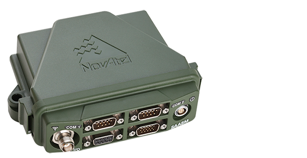
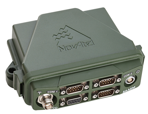
NovAtel has launched the FlexPak-S GNSS SAASM enclosure. The FlexPak-S contains a NovAtel dual-frequency OEM625S receiver card integrated with L-3’s XFACTOR Selective Availability Anti Spoofing Module (SAASM) onboard. The FlexPak-S is security-approved by the GPS Directorate for operational use.
NovAtel made the announcement at AUVSI’s Unmanned Systems 2014, being held this week in Orlando, Florida.
When keyed by authorized defense integrators, the FlexPak-S provides centimeter-level Real Time Kinematic (RTK) Precise Positioning Service (PPS) solution by taking the raw measurements from the XFACTOR SAASM and applying them to NovAtel’s Advanced RTK algorithms. The FlexPak-S can be handled as unclassified when keyed.
In the Standard Positioning Service (SPS) fallback mode, the FlexPak-S continues to provide centimeter-level accuracy by utilizing NovAtel’s dual-frequency civil GNSS positioning engine. FlexPak-S’ fallback mode is configurable for GPS or GPS+GLONASS. Adding GLONASS tracking increases position performance in obstructed sky conditions, which is a benefit for unmanned ground vehicles.
FlexPak-S was developed for size-constrained environments, so it’s compact and lightweight, NovAtel said. Despite its size, the rugged GNSS enclosure has been engineered to ensure reliability, even in harsh environments. The IP67 housing is water-resistant and operates in a wide temperature range. FlexPak-S also allows for easy integration with standardized hardware connections and NovAtel’s comprehensive set of software commands. The SAASM position is provided via a dedicated communication port, as well as through NovAtel’s software command protocol, allowing for maximum flexibility. FlexPak-S uses the same form factor as the FlexPak6 design.
“FlexPak-S is a great option for customers looking for a reliable solution in environments where size is critical, like UAV and robotics applications,” said Shane McEwen, product manager for NovAtel Enclosures. “With standard software and hardware connections, integration is simplified so there is a quicker time to market.”
User equipment incorrectly interpreting data from a satellite set “unhealthy” led to an apparent constellation outage for roughly 1,000 fleet vehicles across Australia in April. The problem was traced to the way a GPS/telecomm chip reacted to an extended navigation test aboard SVN-49, having to do with the recently launched IIF satellite, SVN-64.
Although SVN-49 was set unhealthy at the time, the integrator-equipped fleet vehicles across the continent experienced periods of several hours without satellite visibility, in unobscured environments.
The U.S. Air Force GPS Operations Center reported that in mid-May tests, “PRN 30 [was] broadcasting almanac datasets that do not reflect constellation changes that occurred since it was last uploaded with navigation message data. [. . . ] The utilization of these almanacs in a manner that regards the time of week, but neglects or mishandles the week number (effectively executing as if the current week number is the week number associated with these almanac parameters), will result in an increasing error in visibility determination and other almanac based estimations (elevation/azimuth, Doppler shift, SV clock offset from GPS time, etc) as the dataset’s actual week offset from the current week increases.”
The situation occurred once previously, in 2011 with Mercedes in Europe. The problem was traced to chips from the same manufacturer, installed by the car-maker’s integrator partner, also misinterpreting data from a satellite set unhealthy while broadcasting system test data.
Applanix Corp. and American Aerospace Advisors, Inc. (AAAI), have agreed on an OEM supply agreement that will incorporate Applanix direct georeferencing technology into AAAI’s unmanned aerial platforms. The collaboration creates a commercially available professional-grade mapping UAV system for civilian applications such as pipeline monitoring, power line surveys and emergency-response mapping.
The availability of the system follows a series of successful test flights of AAAI’s RS-16 Unmanned Aircraft System equipped with Applanix’ DMS-UAV aerial photogrammetry payload with commercially available inertial technology. Joint teams from Applanix and AAAI planned and flew a sequence of missions to evaluate the capabilities, including the ability to provide highly accurate, directly georeferenced and orthorectified aerial imagery without the need for ground control points or aerial triangulation calculations.
The system — consisting of the airframe, its avionics, mobile ground control station, telemetry systems and the digital mapping payload — performed according to expectations and successfully produced high-quality imagery.
The announcement was made at AUVSI’s Unmanned Systems 2014 Conference in Orlando Florida, where the most comprehensive collection of unmanned systems for every domain – air, ground and marine – are on display. A video of the system can be watched here.
“The OEM supply agreement with Applanix formalizes our plans to transform the aerial mapping industry by creating an integrated, professional-grade mapping system for unmanned flight,” David Yoel, CEO of American Aerospace Advisors, said. “For civilian aerial survey projects, this can mean safer operations, lower costs and more efficient deployments while still delivering very high accuracy. We are very pleased to announce the availability of the RS-16 Direct Mapping Solution.”
“We believe this is a ground-breaking development for the airborne imaging systems market,” Joe Hutton, Director of Inertial Technology and Airborne Products at Applanix, said. “There has been a lot of attention on developing a commercial, directly georeferenced mapping solution for UAVs, and now it is a reality.”
The RS-16 with the Applanix DMS payload is available through American Aerospace Advisors directly, for sale to jurisdictions where it is permitted to fly civilian UAV systems.
Trimble has introduced the latest version of its deformation monitoring software, Trimble 4D Control version 4.3. The latest version features new optional monitoring applications — the High Rise App, the SeismoGeodetic App and the Trimble 4D Control Site Setup App for Trimble Access — to better analyze complex data communicated from a broad range of GNSS, optical, geotechnical, seismic, atmospheric and metrological sensors.
Trimble says it is continuing to expand the ways in which quantifying movement change can be automated using a range of geodetic, seismic and engineering sensors. The opportunities in automation play a significant part in effective project safety management and construction strategies, the company said. Equally important is the analysis of complex data communicated via simple visual terms in order to understand the impacts of change between disciplines.
Version 4.3 includes a dedicated page to support the functionality of the High Rise App and Composite Views for combining charts, plots and other displays. High-frequency charts, comparative bar charts, tabular and windrose analysis as well as a new visualization tool designated for in-place inclinometers and tilt meter arrays are ways to examine complex data and present findings in a meaningful way, Trimble said.
In addition to the new High Rise App, SeismoGeodetic App and Trimble 4D Control Site Setup App, the software release and apps also provide new functionality for data processing, visualization and analysis. The interactive Web Interface, Trimble 4D Control Web, provides improved multi-select control and more granularity for customizing alarms.
High Rise App: The High Rise App is intended to monitor high-rise structures during construction using GNSS and inclination sensors. Integrated processing of GNSS, total station and inclination data delivers precise and reliable coordinates on demand for stake-out jobs on structures subject to tilt such as towers and high rise buildings.
SeismoGeodetic App: The SeismoGeodetic App integrates the advantages of high-precision GNSS data and high frequency strong motion data. The data from co-located GNSS receivers and Trimble REF TEK strong motion accelerometers can now be processed in an integrated approach resulting in high-precision 3D positions up to a sample rate of 500 Hz.
Trimble 4D Control Site Setup App for Trimble Access: The Trimble 4D Control Site Setup App for Trimble Access field software allows the user to create, enhance or modify a total station site setup for Trimble 4D Control using a Trimble field controller. Once the site setup has been transferred to Trimble 4D Control, round measurements can be performed immediately without the need to run the Site Setup functionality on the server.
Trimble 4D Control version 4.3, High Rise App, SeismoGeodetic App and the Trimble 4D Control Site Setup App for Trimble Access software are available now from Trimble’s worldwide Infrastructure distribution network.
Update: The launch of the GPS IIF-6 satellite has been delayed one day due to bad weather.
Another GPS IIF satellite is expected to lift off aboard a United Launch Alliance Delta 4 rocket from Cape Canaveral at 8:08 p.m. EDT May 15 at the opening of an 18-minute launch window.
The satellite, designated GPS IIF-6 and built by Boeing, is one of the next-generation GPS satellites, incorporating improvements to provide greater accuracy, increased signals, and enhanced performance for users. According to Boeing, each GPS IIF satellite has:
greater navigational accuracy through improvements in atomic clock technology.
a new civilian L5 signal to aid commercial aviation and search and rescue operations.
improved military signal and variable power for better resistance to jamming in hostile environments.
a 12-year design life providing long-term service and reduced operating costs.
an on-orbit, reprogrammable processor that can receive software uploads for improved system operation.
GPS IIF-6 will be the United Launch Alliance’s fifth launch of 2014 and 82nd overall. It also will mark the 26th flight of the Delta IV launch vehicle since its inaugural flight in November 2002.
At the ENC-GNSS Conference in Rotterdam, we delved into actions necessary to officially use EGNOS (giving me déjà vu from WAAS’s early days), heard sage words from Brad Parkinson, the father of GPS, and, on the last day, saw amazing proof of a claim many of us initially thought was outrageous — that differential (DLoran) with modern monitoring can result in consistent horizontal accuracies approaching five meters on a moving platform.
When I was asked if I could cover the European Navigation Conference 2014 (ENC-GNSS) in Rotterdam, The Netherlands, it took me about two seconds to answer in the affirmative. Let’s see… Travel to Europe in the spring, visit The Netherlands — my old stomping grounds where my daughter was born — see miles and miles of beautiful Tulips in bloom, and visit with some old friends. Gee, what a tough decision. Oh, and of course, cover the ENC. Almost forgot that
Seriously, my primary purpose, of course, was to cover the ENC and associated events such as the Resilient PNT Forum and a meeting of the European Maritime Radionavigation Forum (EMRF), but literally miles and miles of brilliant red, white, and yellow tulips interspersed with ancient windmills are hard to ignore. But I digress.
In past years the ENC, with approximately 400 attendees, has been naturally dedicated to European PNT matters, and in reality it concentrated almost exclusively on Galileo with a slight mention of EGNOS. That was about it. This year, the venue was the same, but the program was more open, with presentations on PNT augmentations such as EGNOS and DLoran, and maritime navigation to include radar and inertial systems.
For those of us that have been in the PNT (positioning, navigation and timing) or merely the navigation business, say, for the past 40+ years or so, in some respects it was more than slightly reminiscent of times past. As the great American octogenarian baseball philosopher and malapropism aficionado extraordinaire, Yogi Berra, once said, “It was déjà vu all over again.”
European Maritime Radionavigation Forum
The Port of Rotterdam today (2014).
The EMRF was the first official function to kick off in Rotterdam. When you consider that Rotterdam is one of the busiest ports in Europe and had been around since 1340, you would naturally expect one of the main conversations at the EMRF to concern the port of Rotterdam and navigating in less-than-perfect conditions. The Netherlands is known as the Low Country, and that is as an apt description since most of the country is below sea level — hence the persistent fog, dikes, sea walls, and windmills that pump water and grind grain and all those good things. Today, the modern versions of those windmills are huge — twenty stories tall — and generate electricity. Many of them are close to shore so precise navigation in foggy conditions is even more critical than in times past.
The main topic of conversation at the EMRF revolved around the actions necessary to officially use EGNOS (the European Geostationary Navigation Overlay Service) as a precision and official safety-of-life augmentation for GPS (similar to WAAS, Wide Area Augmentation System) and Galileo.
During those discussions, I swear when I closed my eyes, except for the accented English, I was propelled backward almost 20 years to discussions of WAAS as a safety-of-life system, not for maritime but for aviation purposes. Still, the dialogue and heated discussions echoed down through the years almost verbatim. The main difference, of course, being that in the U.S. it was 20 years earlier, we were embarking on virgin territory, and we had only ourselves, one nation, to debate. Whereas the Europeans are fighting the same battles two decades later, with a system that is purposefully almost an identical copy of WAAS technically, and they are working for maritime and aviation certifications simultaneously. And not with just one nation but the entire European Union. A truly daunting task.
The EMRF website is sponsored by Trinity House in London, which is responsible for the safety of [English and European] shipping and the well being of seafarers, which have been their prime concerns ever since Trinity House was granted a Royal Charter by Henry VIII in 1514. I planned to list the EMRF website for your further edification, but since the latest news on the site concerns the upcoming January 2011 EMRF meeting in Paris, I thought it was best left to molder in obscurity. The website, not the EMRF.
The bottom line for the EMRF is that while it fills an important role where EGNOS and maritime navigation are concerned, it still has a lot to learn and could benefit greatly by lessons learned from WAAS. However, I personally see no indication that will happen, so we wish them luck. Many of us are standing by to assist if asked. Even if it is only, “Been there, tried that, and here is why it did or did not work.” Quod homo non sit Island.
Resilient PNT Forum
I was happy to see Dana Goward (USCG Ret), the head honcho at the Resilient Navigation and Timing Foundation, which conducted the Resilient PNT Forum at ENC 2014. Dana’s forum, which took place just before the official ENC 2014 kickoff, concentrated on the need for and strategies to achieve resilient position, navigation and timing (PNT) services. The event was well attended, and was jointly hosted by the European Group of Institutes of Navigation, the International Association of Institutes of Navigation, and the International Association of Marine Aids to Navigation and Lighthouse Authorities. There was no charge to attend the event, and the collaboration proved interesting, especially since Dana really wanted to talk eLORAN and GPS/Galileo augmentations.
Dana is retired U.S. Coast Guard and worked many years supporting LORAN-C and the USCG Navigation Center. Dana showed a brief video of his recent testimony before the U.S. Congress, where he lobbied for a cessation of the destruction of LORAN-C towers and their associated infrastructure. If recent congressional actions are any indication, he has been somewhat successful in that regard. Now all that is left is to help the U.S. Congress, services, and agencies realize how badly the United States needs LORAN as a backup, enhancement, and augmentation to GPS and other space-based PNT services on a global basis. No small task, but it is a task that Dana Goward and the Resilient Navigation and Timing Foundation have strapped on, and we wish them the best. Plus, as you will see later, a surprise presentation at ENC-GNSS may have given Dana and his cause just the boost they need. Keep reading.
As it turns out, many others thought these non-Galileo presentations were timely topics as well, and the discussions were enlightening, especially the Resilient PNT Forum keynote address by Professor David Last. Among many other titles he holds, Last is a consultant engineer and expert witness specializing in radio navigation and communications systems. He is a professor emeritus at the University of Bangor, Wales, and past president of the Royal Institute of Navigation. He acts as a consultant on radio-navigation and communications to companies and to governmental and international organizations and is active as an expert witness, especially in forensic matters concerning GPS.David and I are old friends, and it is always enlightening and entertaining to hear him speak. On this occasion, Professor Last spoke eloquently and authoritatively concerning the ubiquity of GPS/PNT and the resultant and inherent vulnerabilities of space-based systems. David made the essential point that while GPS remains the sine qua non of PNT, it is still vulnerable and subject to failures as are all space-based PNT systems, the recent GLONASS debacles being prime examples. More on these unfortunate Russian examples of PNT vulnerability at a later date.
David pressed the issue, as he has many times, that we desperately need a ground system or many different ground-based augmentations, backups, and enhancements to ensure that the user is never without navigation and timing data at a critical juncture, such as navigating through an insanely busy commercial port in thick fog.
This theme was carried forward in the ENC-GNSS very adroitly by none other than Dr. Bradford Parkinson, the Father of GPS. Dr. Parkinson spoke at length on the need to “Protect, Toughen, and Augment GNSS” against all enemies, be they manmade or natural. Brad made the point, with all due credit to Will Rogers, that “Rumors of GPS’ death are greatly exaggerated.” Indeed, the GPS constellation has never had more satellites on orbit, in residual status, and spares in the barn than we do today. The SIS or Signal In Space has never been more accurate, and the GPS atomic reference systems have never been more stable than today, and yet GPS remains incredibly vulnerable. But take heart, as Dr. Parkinson is convinced “There are actions such as PTA that can be taken to safeguard PNT for all users.” We will cover Dr. Parkinson’s 60+-slide presentation in depth at a later date.
Surprise! Loran Is the Answer
The big surprise came on the last official day of the conference during a group of alternate PNT presentations co-chaired by Dr. David Last. The rather startling enhanced differention LORAN (eDLoran) presentation was given by Professor Durk van Willigen, representing his colleagues René Kellenbach and Cees Dekker of the Dutch consulting firm Reelektronika, and Wim van Buuren of the Dutch Pilots’ [ed. maritime] Corporation, who helped with the DLoran research and authoring of the paper for the ENC presentation.
Professor van Willigen made what many of us initially thought was an outrageous claim, and then amazingly went on to prove that enhanced differential Loran with modern monitoring produced consistent horizontal accuracies approaching five meters on a moving platform. Needless to say, Professor van Willigen, who teaches at the Delft University of Technology in The Netherlands, was mobbed at the end of his presentation, but I did manage to catch him for a few minutes afterwards. Since then, GPS World Editor-in-Chief Alan Cameron has spoken with Professor van Willigen at length, and the result is the first of what I am sure will prove to be numerous articles on eDLoran in GPS World.
Shipboard DLoran receiver installation (orange boxes on rails).
One would hope that with this rather startling improvement in differential Loran accuracy and the decision by the U.S. Congress to halt the destruction of Loran-C infrastructure in North America, that there might once again be a future for Loran, especially eLoran and/or DLoran in North America, and hopefully globally as well.
As Professor David Last in his best imitation of John Cleese might say, “It is the answer to a maiden.s prayer.”
Until next time, happy navigating. I hope to see you all at the 30th Space Symposium May 19-22 in Colorado Springs at the Broadmoor Resort. More than 10,000 attendees are expected, and I hope you will be one of them. Stop by the GPS World booth and say hello.