Blog

  • VectorNav Launches Dual-Antenna GPS-Aided Inertial Nav System

    VectorNav Launches Dual-Antenna GPS-Aided Inertial Nav System

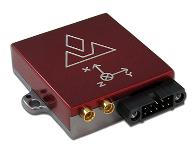
    The VectorNav VN-300
    The VectorNav VN-300

    VectorNav Technologies has introduced its VN-300 dual-antenna GPS-aided inertial navigation system (GPS/INS). A follow-on product to the VN-100 IMU/AHRS and VN-200 GPS/INS, the miniature, high-performance VN-300 enables a wider range of applications through the incorporation of GPS compassing techniques.

    The VN-300 can be used in a wide variety of industrial and military applications, and is well suited for size, weight, power, and cost (SWAP-C)-constrained applications such as unmanned vehicle systems; antenna, camera and platform stabilization; heavy machinery monitoring; robotics; and primary or secondary flight navigation, among others. The VN-300 will be on display and available for review at VectorNav’s booth #330 at AUVSI in Orlando May 13-15.

    Incorporating the latest MEMS sensor technology, the VN-300 combines 3-axis accelerometers, 3-axis gyros, 3-axis magnetometers, a barometric pressure sensor, two GPS receivers, and a low-power microprocessor into a rugged aluminum enclosure about the size of a matchbox. When in motion, the VN-300 couples the position and velocity measurements from the onboard GPS receivers with measurements from the onboard inertial sensors to provide position, velocity, and attitude estimates of higher accuracies and with better dynamic performance than a standalone GPS receiver or Attitude Heading Reference System (AHRS).

    The dual GPS receivers incorporated into the VN-300 provide the added benefit of accurate True North heading measurements when the sensor is stationary through the use of GPS compassing techniques, the company said. The VN-300 is designed for applications that require a highly accurate inertial navigation solution under both static and dynamic operating conditions, especially in environments with unreliable magnetic heading and good GPS visibility.

    VN-300 Differentiating Features:

    • The VN-300 has small size, low weight, and low power requirements.
    • With Development Kits priced around $5k USD, the VN-300 is a fraction of the cost of similarly performing dual-antenna GPS/INS systems and is competitively priced with other MEMS-based GPS/INS systems that do not provide the dual-antenna moving baseline RTK features.
    • The GPS compass feature coupled with the GPS/INS capabilities on the VN-300 enables applications that require high-accuracy position, velocity, and attitude measurements under both static and dynamic operating conditions.
    • The algorithms on board the VN-300 enable applications to seamlessly transition between static and dynamic operations without having to collect extended stationary measurements or perform specific dynamic maneuvers in flight for attitude alignment.
    • The VN-300 incorporates a “True INS Filter” that does not force any requirements on alignment of the sensor to the velocity direction of a platform or specify the orientation of the sensor for initial alignment.

    “The VN-300 is unique in that it provides a complete, high performance GPS-aided navigation solution under both stationary and moving conditions, all in a miniature and cost-effective package,” said VectorNav President, John Brashear. “By addressing some of the most difficult issues users face when trying to integrate an inertial navigation system — high cost; large size, weight and power; unreliable magnetic environments; and restrictive operating requirements — the VN-300 will enable an unprecedented number of applications.”


  • Leica Geosystems Offers CC55 Controller

    The Leica iCON CC55 controller is part of the Leica iCON portfolio.
    The Leica iCON CC55 controller is part of the Leica iCON portfolio.

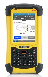
    Leica_ICON_CC55_with_screen-WLeica Geosystems now offers the Leica iCON CC55 controller, a versatile and rugged PDA with a 3.5-inch color display, as part of its iCON construction portfolio. The handheld controls Leica iCON sensors, runs the iCONstruct field software, and has a QuadraClear sunlight readable display and a fast 1-GHz processor.

    The smaller Leica iCON CC55 handheld controller, as well as the seven-inch Tablet PC Leica iCON CC65/66 field controller, are both fully integrated into Leica Geosystems’ iCON portfolio of hardware and software solutions. It runs the Leica iCON build or site software to display and connect measured points for as-built data capturing or to lay out points and construction lines directly from the digital construction plan. The controller provides flexible options for data communication and an extensive data storage.

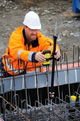
    Leica_iCON_CC55_application-WThe Leica iCON CC55 can be used to control the Leica iCON robot total stations, enabling one-person operation, saving time and increasing productivity for construction layout tasks and as-built checks, the company said. The optional Long-Range Bluetooth allows communication with the iCON robot 50 at distances of more than 350 m/1150 feet. Alternatively, the iCON CC55 can be used as a data logger with the Leica Builder manual total station. Together with the versatile Leica iCON gps 60 SmartAntenna, the iCON CC55 creates a compact and light-weight GPS rover system.

    The iCON CC55 runs the state-of-the-art Windows Embedded Handheld 6.5 operating system and comes with 256MB NAND Flash memory and 8 GB of extended storage, enabling extensive data process and storage capacity. An internal WLAN module and Long-Range Bluetooth offer users impressive distance communication, the company said, and the longer life 5.6Ah battery lets users easily complete a full day’s work. The iCON CC55 also comes equipped with a 5-MP camera so users can document their construction projects.


  • Visual Intelligence Releases iOne STKA for UAV Mapping Apps

    Visual Intelligence has announced that its iOne Software Sensor Tool Kit Architecture (iOne STKA) is available for purchase or licensing by manufacturers of unmanned airborne vehicles (UAVs) who want to deliver an integrated UAV/geospatial imaging solution to customers.

    Capturing high-resolution imagery for applications in engineering, construction, urban planning, military missions and other uses is a significant emerging market for UAV manufacturers, and Visual Intelligence’s iOne STKA makes it possible to bring high-resolution geospatial sensors to UAVs, the company said. By purchasing or licensing Visual Intelligence’s geospatial imaging platform, UAV companies can meet emerging demand for geoimaging solutions that combine the benefits of UAVs with the imaging capabilities of a geoimaging platform.

    iOne STKA provides the technology foundation to configure a variety of multi-purpose sensors, including miniaturized 2D/3D applications, for the emerging UVS and mobile/handheld markets. The iOne STKA received the Geospatial Forum 2013 World Technology Innovation in Sensors Award, is the first to be considered for NEANY’s Arrow UAV, and is field-proven by the commercial large-format 2D/oblique/3D multipurpose metric mapping systems iOne IMS, iOne Stereo, and iOne n-Oblique.

    With the iOne STKA, the same UAS/UAV sensor system architecture can be used for agricultural and forestry mapping, pipeline or corridor monitoring, utility assessments, aerial surveys, research, persistence surveillance and other metric 2D/3D professional applications. The iOne STKA is a modular multipurpose sensor platform reconfigurable for UAVs of any size. With the iOne STKA, UAV manufacturers are no longer limited to offer monolithic, single purpose DSLR type cameras. Using the iOne STKA technology, UAV end users can economically collect high-quality color or infrared NADIR, oblique, or video imagery as well as co-mount and co-register e.g., LiDAR and thermal sensors using the same system architecture.

    “By providing UAV manufacturers and end-users with one reliable and performing end-to-end standard digital sensor system solution for MANY applications, we are empowering our customers with a more efficient and standard technology foundation and paradigm to grow their business, enhance their products, and maximize their return,” said Visual Intelligence President and CEO Dr. Armando Guevara.

    At the core of the iOne STKA is Visual Intelligence’s Patented Advanced Retinal Camera Array (ARCA). Developed using open systems and object-oriented software engineering principles, the ARCA is “encapsulated” with a rich set of advanced proprietary software methods that integrate camera components. The ARCA enables the collection of different types of imagery, fused in one pass, producing low-cost, extremely accurate, high-resolution products. It also enables unprecedented array-based collection and functional scalability sensor fusion. The arrays made of these varied imaging devices perform like a single camera, producing one single metric, radiometrically and geometrically correct image, or set of co-registered and fused images; such as a Virtual Frame, of higher accuracy, resolution and quality than DSLR-based monolithic cameras.

    Adds Guevara, “UAV manufacturers can take advantage and offer bundled with the iOne sensors Visual Intelligence’s advanced computing technology for fast cloud-based basic and advanced actionable information product generation. As a fully automated solution (from the sensor to the cloud), the iOne STKA includes processing software that uses streamlined workflows and processes imagery faster with multicore/multithreaded/GPU computing technology, making it easy to quickly produce and analyze products in a device-content eCosystem environment. This technology/business model is designed to provide UAV manufacturers and users recurrent ROI.”

    UAVs built using sensors based on the iOne STKA have the following features and advantages:

    • Strong digital obsolescence resilience, extending the useable life of the system while improving operational efficiencies and reducing operating costs for an even better ROI.
    • In the field:
      • Collection scalability
      • Functional scalability
      • Sensor reconfiguration, e.g. increase collection or functionality as needed or per mission requirements.
    • Large cross-track and FOV collection through smaller aperture (ARCA enabled).
    • Ability to collect different sources of metric imagery that can be fused in one pass.
    • Sensor fusion: Ability to co-mount and co-register in a “small and tight packaging” the EO capability with any other EO or active sensor such as LiDAR, Thermal, IR, etc.

    The iOne STKA software architecture is normative across all ARCA-based products; that is, the software is the same for different array configurations or sizes. This reusable component approach yields economies of scale in the manufacturing and use of multipurpose UAV/sensor configurations.

  • Ebook Looks at GIS in Health Care

    ebook-healthcare-GIS

    American Sentinel University’s new e-book,The State of the Modern Health Care Industry in the 21st Century: Technology and Business Intelligence Leads the Way, profiles the technology shifts in health care and offers an inside look into how geographic information systems (GIS) can be applied in health care organizations and the industry’s growing need for professionals with GIS knowledge.

    GIS has quickly become an important tool for contemporary health care organizations to run more efficiently and effectively. While some organizations are using GIS to its full potential, others seek additional opportunities to apply geospatial tools and concepts and created an increased demand for GIS professionals.

    Watch the e-book trailer here.

    “Legislation calling for the transition to electronic health records (EHRs) and pay-for-performance initiatives has brought GIS tools front and center,” said Stephen A. McElroy, Ph.D., GIS program chair at American Sentinel University.  “GIS tools provide dynamic data visualization techniques to health care organizations to help them better understand the geographic relationships that affect health outcomes, public health risks, and disease transition to improve their overall strategic decision-making processes.”

    The e-book provides information to those who want to learn how GIS helps improve patient outcomes; increase efficiencies; gain important career insight about the tech shifts in health care; and understand how these changes have resulted in unlimited career opportunities for GIS professionals.

    Topics include:

    • What GIS does for the health industry
    • Health care’s increasing need for GIS insight
    • Job outlook for GIS professionals in health and human services
    • American Sentinel’s GIS programs
    • GIS program comparison worksheet

    “The health care industry is strong and growing. Projected to create 28 percent of all new jobs, this industry is expected to increase its reliance on geospatial technologies. Now is a great time to consider earning a GIS degree as the future looks promising in health care for GIS professionals,” said Dr. McElroy.

  • Next Galileo Satellites Arrive in French Guiana

    Next Galileo Satellites Arrive in French Guiana

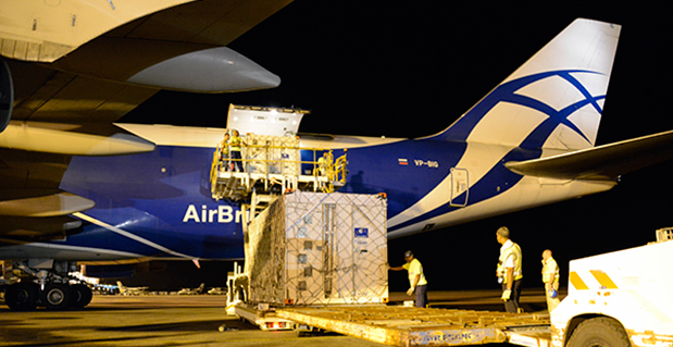
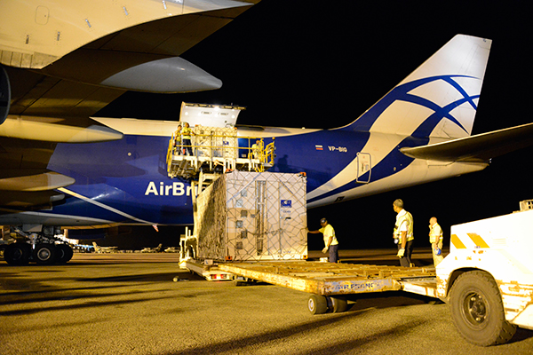
    Europe’s next two Galileo satellites are unloaded from the Boeing 747 cargo aircraft at Cayenne. The two satellites are scheduled to be launched together by Soyuz from Europe’s Spaceport this summer.
    Europe’s next two Galileo satellites are unloaded from the Boeing 747 cargo aircraft at Cayenne. The two satellites are scheduled to be launched together by Soyuz from Europe’s Spaceport this summer.

    The first two Galileo Full Operational Capability (FOC) satellites arrived safely at a clean room in Kourou, French Guiana, at 20:00 on Wednesday, May 7, in preparation for launch this summer.

    Named “Doresa” and “Milena,” the two Galileo FOC satellites arrived at the Félix Éboué international airport in French Guiana at 02:00 local time. They spent the day in an airlock to acclimatize before being taken to their new home, the S1A clean room, where they could be safely unpacked to begin the launch campaign.

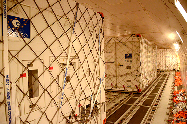
    Europe’s two latest Galileo navigation satellites touched down at Europe’s Spaceport in French Guiana packed safely within protective and environmentally controlled containers. The satellites were carried across the Atlantic aboard a 747 cargo carrier, according to the European Space Agency.

    Manufactured by OHB in Bremen, Germany, with navigation payloads contributed by Surrey Satellite Technology Ltd. in Guildford, UK, these satellites – the first of 22 full-capability models — had spent several months at ESA’s Technical Centre, ESTEC, in Noordwijk, the Netherlands, where they underwent exhaustive testing in simulated space conditions.

    “Adam”, the third Galileo FOC satellite is currently undergoing testing under space conditions at ESTEC. The fourth Galileo FOC satellite, “Anastacia,” will begin final testing at OHB in Bremen before being shipped to ESTEC. The Galileo satellites are named for the children who won a painting competition organized by the European Commission in 2011.

    After successfully passing the Flight Readiness Review (FRR) last week, Doresa and Milena were released for shipment to the French overseas department. “Thanks to the good collaboration between the participating industrial teams and the experts at the European Space Agency ESA as our customer, OHB was able to successfully finish the FRR,” says OHB’s Director of Navigation Wolfgang Paetsch who will be personally overseeing the launch preparations in Kourou.

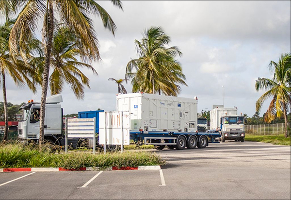
    On May 5, the two satellites left on a pair of lorries for Frankfurt Airport in Germany, from where they flew the following evening. After landing in French Guiana, the satellites were  driven to the clean room. The pair will be launched together aboard a Soyuz rocket, joining the four Galileos already in orbit. This initial quartet — the minimum number needed for achieving a position fix — has demonstrated the overall system works as planned, while also serving as the operational nucleus of the coming full constellation.

    “Similar arrival scenes should become familiar over the next couple of years,” said Giuliano Gatti, Head of ESA’s Galileo Space Segment Procurement Office. “These first two Full Operational Capability satellites are effectively preparing the way for the rest of the constellation, allowing the final validation of assembly, testing and launch preparation procedures. A steady stream of satellites is foreseen, coming from OHB to ESTEC for acceptance testing and then on to French Guiana. Thanks to the preparatory work done with these pioneer satellites, future Galileos will be processed more rapidly.”

    The definition, development and in-orbit validation phases of the Galileo programme were carried out by ESA and co-funded by ESA and the EU. The Full Operational Capability phase is managed and fully funded by the European Commission. The commission and ESA have signed a delegation agreement by which ESA acts as design and procurement agent on behalf of the commission. OHB System is the industrial prime contractor responsible for the total of 22 Galileo FOC satellites. 

    The two Galileo FOC satellites were enclosed in protective, air-conditioned containers for their flight.
    The two Galileo FOC satellites were enclosed in protective, air-conditioned containers for their flight.
    “Doresa” and “Milena” head to the clean room.
    “Doresa” and “Milena” head to the clean room.
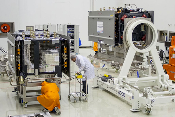
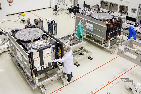
    The two satellites in the clean room.
    The two satellites in the clean room.
    Dorese and Milena rest side by side in  clean room S1A.
    Dorese and Milena rest side by side in clean room S1A.
  • Avenza Releases MAPublisher 9.4 for Adobe Illustrator

    mapublisher-adobe-O

    Avenza Systems Inc., producers of the PDF Maps app for mobile and geospatial plugins for Adobe Creative Suite, including Geographic Imager for Adobe Photoshop, has released MAPublisher 9.4 for Adobe Illustrator. This latest update includes new  features such as streamlined import, support for additional formats when exporting a document to web tiles, and a new image attribute type to support images imported from the PDF Maps app on both iOS and Android platforms.

    “We’re excited to release MAPublisher 9.4 because of its continued evolution to make it even easier to create great looking maps with enhanced cartography tools,” said Ted Florence, President of Avenza. “The enhancements and features in this release have been developed from customer feedback with significant improvements to import and export interoperability. The primary focus of this release is to increase productivity for cartographers and GIS professionals by enabling them to easily and quickly import data, create high-quality map products, and easily publish or export to print and digital formats.”

    Enhancements and new features of MAPublisher 9.4 include:

    • Streamlined data import: Import (formerly Simple Import) and Multiple Data Import (formerly known as Advanced Import). Improved interface provides additional coordinate system information and easier access to format specific Adobe Illustrator options that affect how data is imported.
    • New image attribute type to store an image for each record in a layer’s MAP Attribute table. Image attributes are supported when importing from the PDF Maps app (in KMZ format) and exporting to Google Earth (in KMZ format).
    • Export Document to Web Tiles now supports MapBox and Tile Map Service map providers. A new anti-aliasing option to optimize art or type is now available.
    • New ability to export a coordinate system file for non-geospatial image formats.
    • New ability to specify grid constraints to limit the geographical extent of a Measured Grid. In addition, a new option is available for ticks to follow the line at the grid boundary.
    • New file export option to assign metadata for TAB/MIF and KML/KMZ formats. The metadata assignment option allows layer attributes to be assigned to format specific metadata fields.
    • Improved preview quality makes it easier to see how settings affect the scale bar.
    • Newly designed MAP Layer icons and feature type icons.
    • Various user interface and performance enhancements to improve usability.

    MAPublisher for Adobe Illustrator is powerful map production software for creating cartographic-quality maps from GIS data. MAPublisher tools leverage the superior graphics design capabilities of Adobe Illustrator to manipulate GIS data and to produce high-quality maps with accuracy and efficiency.

    MAPublisher 9.4 for Adobe Illustrator is available free of charge to all MAPublisher users with an active maintenance subscription and as an upgrade for non-maintenance users at US$599. New licenses start at US$1399. MAPublisher FME Auto and MAPublisher LabelPro are also available as add-ons to MAPublisher 9.4 at prices starting at US$399 per license. Academic, floating and volume pricing are also available. Prices include one year of full maintenance.

  • Smart Mapping SuperSurv Available on App Store and Google Play

    SuperSurv-2Supergeo Technologies, a provider of GIS software and solutions, has launched SuperSurv, a mobile GIS app, on the App Store and Google Play.

    SuperSurv contains comprehensive GIS data-collection functions. Designed for both iOS and Android powered devices, it integrates with GIS and GPS technologies to provide functions in field survey, such as Map Display, Query, Measure, etc. With SuperSurv, the collected data can be saved as feature layer (point, line, polygon) in SHP or GEO format in offline mode. SuperSurv supports OpenStreetMap as the base map.

    SuperSurv has been successfully applied in various industries worldwide, including environment protection, pollution prevention, and facility management. The free trial version is now available on Apple App Store and Google Play, allowing users to experience complete functions for seven days before purchase.

    SuperSurv-1For users in North America, Supergeo has released the SuperSurv M3 version to provide easy-to-use and useful data collection and map display functions. SuperSurv M3 supports feature-layer display and offline editing functions. Furthermore, cached maps can be adopted as the base map to facilitate data capture tasks.

    SuperSurv (iOS)

    SuperSur M3 (iOS)

    SuperSurv (Android)

    SuperSurv M3 (Android)


    Screenshot: SuperSurv, Supergeo Technologies

  • Geospatial Corp. Unveils Latest Version of Cloud-Based GeoUnderground

    Geospatial Corporation has unveiled the company’s newest version of GeoUnderground, its proprietary cloud-based GIS platform custom designed around the Google Maps API and Google Maps Engine.

    “The economic and social benefit gained through accurately locating, mapping and managing the world’s underground infrastructure assets in a systematic fashion is huge,” said Mark A. Smith, Geospatial CEO. “To accomplish this, Geospatial has developed a comprehensive suite of technologies capable of gathering accurate 3D positional data on most underground or underwater pipelines. The combination of these data acquisition technologies with our cloud-based GeoUnderground GIS platform provides our clients with a total solution to their underground asset management needs.”

    Geospatial Corporation utilizes integrated technologies to determine the accurate location and position of underground pipelines, conduits and other underground infrastructure data, allowing Geospatial to create accurate three-dimensional digital maps and models of underground infrastructure.

    The company manages the infrastructure data on its cloud-based GIS portal called GeoUnderground, its proprietary GIS platform custom designed around the Google Maps API and Google Maps Engine.

    .

  • SPOT Satellite Devices Mark 3,000 Rescues


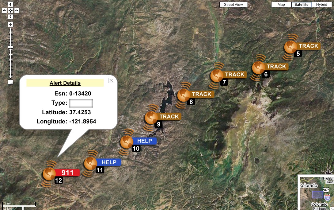
    SPOT LLC, a wholly owned subsidiary of Globalstar, Inc., says its SPOT products have been used to initiate 3,000 rescues around the world since the technology’s launch in 2007. With more than 200,000 SPOT units in service, that averages to one rescue a day. SPOT delivers affordable and reliable satellite-based connectivity and real-time GPS tracking, completely independent of cellular coverage.

    “Lifesaving rescues around the globe are now a daily occurrence for our SPOT products. SPOT is an absolute must for the outdoor recreation market and aviation, as well as an essential government and enterprise solution,” said Jay Monroe, CEO and Chairman of Globalstar. “With 3,000 confirmed rescues, saving lives continuously drives us to innovate, creating affordable satellite communications solutions that reach a market well beyond traditional mobile satellite users, including millions of people globally.”

    Spot-Google-MapSPOT products allow users to track their assets, use location-based messaging and emergency notification services, and make calls beyond the boundaries of cellular. SPOT products work around the world, including virtually all of the continental United States, Canada, Mexico, Europe and Australia, portions of South America, Northern Africa, North-Eastern Asia and thousands of miles offshore of these areas. Over the past seven years, boaters, hunters, recreational pilots, hikers, off-road travelers and outdoor enthusiasts have come to depend on the lifesaving capabilities of SPOT.

    The 3,000th rescue occurred in the Hayman Fire area of Central Colorado. Two dirt bikers were outside of cell range when an accident occurred. One of the riders, Kevin, activated the SOS button on his SPOT Satellite GPS Messenger. The GEOS International Emergency Response Coordination Center was alerted and coordinated the rescue with local law enforcement. “SPOT worked really well. Without it, getting out would have been more difficult and time consuming and who knows what could have happened in that time. There were a lot of different variables involved,” Kevin said.

    SPOT products and services include:

    • SPOT Gen3, a device that provides off-the-grid messaging, emergency alerts, extended battery life, and extreme GPS tracking at 2½-minute intervals.
    • SPOT Trace, a GPS tracking device that uses satellite technology to track anything, anytime, anywhere.
    • SPOT Global Phone, a satellite phone that allows users to make calls virtually anywhere beyond the boundaries of cellular.
    • The SPOT App, a web-based interface allowing users to view their SPOT messages, show their track points, and monitor their assets via smartphone or tablet.
  • TerraStar Offers GNSS Manufacturers Revenue Sharing Opportunities

    TerraStar is offering GNSS manufacturers revenue sharing opportunities, including the possibility to launch their own precise GNSS augmentation services via endorsed rebranding of TerraStar services as a reseller. According to TerraStar, this will provide an attractive recurring service revenue stream to GNSS manufacturers that was not previously available in the industry.

    TerraStar is a brand name of TerraStar GNSS Ltd., which is a wholly owned subsidiary of Veripos Ltd. Following the acquisition of its parent company by Hexagon AB in March, it will continue as a neutral and independent provider of satellite delivered precise positioning augmentation services for land and nearshore markets. It is already well advanced in plans to expand its service offering, the company said.

    Gary Wilcock, general manager of TerraStar, renewed the company’s commitment to resellers, integrators and end customers at the Munich Satellite Navigation Summit, held in March. “TerraStar will remain an open system available to all current and future partners,” Wilcock said. “The TerraStar service will remain available to all partners who have a valid contract on a perpetual basis for as long as long as the services continue to be delivered. We intend to be a long-term partner for our customers.”

    Walter Steedman, CEO of Veripos Ltd. Added, “All partners will be treated on a level playing field. Strict information firewalls will be maintained for all TerraStar dealings with different business partners so that all can be assured that market or other sensitive information remains confidential.”

  • Mother’s Day and Memorial Day Tribute

    How a Haunting Memory Shaped My GIS Career

    In the mid ’80s I set up the Navy’s first Geographic Information System (GIS) to accomplish the 1987 base closure study, now called the BRAC (Base Realignment Commission). That first experience with GIS convinced me to pursue GIS as my second career after retiring from the Navy. Fortunately, I was able to land an ideal final tour of duty as the Commanding Officer of the Naval and Marine Corps Reserve Center in Charlotte, N.C. I worked to get this position since at the time the University of North Carolina at Charlotte was one of the few universities starting a GIS master’s program, and taking some evening classes helped with my transition. Jack Dangermond, who I hadn’t heard of at the time, was the keynote speaker for program kick off.

    That was a nice assignment after years of sea duty and other demanding assignments over an 18-year career, but one aspect would make this assignment hauntingly unforgettable. As the only active-duty Naval Officer within 50 miles of Charlotte, one of my collateral duties was to act as the Navy’s Casualty Assistance Calls Officer (CACO). A CACO is the official representative of the Secretary of the Navy who notifies immediate family members in the event of a service member’s death or severe injury. Unlike some depictions in movies, military branches take special care to notify immediate family members in person not by phone. I did several of these notifications and learned to take a chaplain and corpsman with me in case there was traumatic reaction by the family members to the news.

    It was an especially clear spring day when I received a message to notify a family of the death of their only son. He was a young man living his dream as a Navy diving officer. He worked hard to get there by earning an engineering degree from Duke University while also participating in the NROTC program. He was serving as the diving officer on a submarine rescue ship in the Mediterranean when he was killed in the line of duty. My job was to notify the family.

    The chaplain, corpsman and I arrived at the home just as the mother and father returned from grocery shopping. As I knocked on the screen door the mother looked up and with a surprised smile on her face seeing the three of us in uniform she happily said, “Oh, you’re in the Navy!” and within a half second her voice dropped to a low painful tremble, “Oh no….my son is in the Navy.” She knew. She knew. In a half second she knew the Navy doesn’t send three uniformed people to deliver good news. The only thing I remember as she and her husband collapsed to the floor holding each other was her repeating “Oh no” “Oh no” and mention of her daughter-in-law, who was expecting.

    I could only imagine how she felt after receiving the most horrific news a mother of an only child could receive. I felt like I had just plunged a long jagged dagger into her heart and each piece of additional information just twisted that dagger around further. I pictured her life as a mother racing before her — childbirth, his first steps, school, graduation, his wedding, pending fatherhood. Soon neighbors, friends and their local minister arrived to comfort the family.

    Over the next several days, while the flag draped coffin made its way to North Carolina, I worked with the funeral home and family preparing for the graveside ceremony. I rehearsed our Navy team in preparation — six pall bearers, a firing squad, bugler, chaplain and myself. The day of the ceremony I inspected our sailors and as expected each man was inspection perfect. We loaded up the bus and headed out. The ride to the site was quiet, we all knew that this funeral was different from the numerous retiree funerals we had done. This young man was one of us, gone in the prime of his life serving his country.

    The ceremony went perfectly. The six sailors in their dress uniforms carried the flag-draped coffin to the burial site and stood at attention next to the coffin. Seven members of the firing squad positioned themselves several hundred feet away. We all stood at attention as the chaplain spoke. When he finished I nodded to the six pall bearers; they slowly grabbed the flag, lifted it, and stretched it out over the coffin. That was the signal for the seven-member firing squad to fire three volleys immediately followed by the playing of taps.

    I know of no military member who doesn’t get choked up at the crack of the rifles followed by the melancholy playing of taps. As taps was playing, the pall bearers were folding the flag with precision. The goal is to fold the flag into a perfect tight triangle with only white stars and dark blue showing by the time taps is complete. They did a perfect job, and the lead petty officer then handed the flag to me. It was my task to walk over to the family and present the flag. “On behalf of grateful nation and proud Navy, I present this flag to you for the honorable service of your son and husband.” And that was it, the final capstone to a short and honorable life, or so I thought.

    The funeral director then announced that all were invited to the fellowship hall for a potluck luncheon. I dismissed the funeral team and we all headed over to the fellowship hall. The mood was less somber as family members and friends recalled the good times. It was nice to relax a bit and hear some fond memories of our departed shipmate. Soon it was time for us to go. While my team headed to the bus, I went to pay my last respects to the wife and parents. I shook hands with the wife, the father, and then as I offered my hand to the mother, she held it with both hands and said something that has haunted me to the core ever since.

    Holding my hand ever so tightly she said, “I just wanted to let you know… how bad I felt for you having to deliver the news to me.” Her comment floored me. Three days before I had delivered the most painful news a mother could ever receive. I plunged a dagger into her heart that would never heal….and she felt bad for me? Speechless, I nodded and squeezed her hand back. I left shaking my head in disbelief. I had never met someone so selfless.

    That was over 25 years ago, and the memory of her is just as fresh today. I don’t think that a week goes by without me thinking about her, and every time I do, I still shake my head in disbelief. She definitely left a mark on me. I’ve tried my best to honor her memory in my small way by doing the same thing many of you in the geospatial community do, working hard to provide the tools that may help minimize future flag-draped coffins. I’ve seen our geospatial tradecraft save lives — GIS, imagery, human geography, and now social media and cyber. So whether it’s the intelligence specialist in a Special Operations team, a cyber-analyst in D.C., a geospatial contractor in Huntsville, or the countless GIS personnel supporting first responders in local governments around the country, you all can feel great pride in your life-saving work.

    Over the years I’ve come to realize that there are many people just like her who live quite decent lives doing their best and leaving indelible marks on the hearts and souls of those they meet. Mothers like her may not bask in limelight, but they have provided us with some remarkable citizens and military service members, and I understand the pain that each mother feels when we lose one of our shipmates. I was blessed to meet her and will never forget her.

  • Sparton Introduces GPS-Assisted Inertial Navigation System

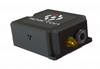
    GAINS-10
    photo: Sparton

    Sparton Corporation has announced that Sparton Navigation and Exploration will introduce its GPS/ GNSS Assisted Inertial Navigation System, GAINS-10, at AUVSI Unmanned Systems 2014.

    GAINS-10 provides accurate inertial navigation in the presence of mechanical shock, transient platform vibrations and extreme magnetic interference. It features high speed, synchronous sampling of all inertial systems combined with high rate coning and sculling compensation and is fully calibrated across temperature.

    “The GAINS-10 delivers precise performance in complex environments,” said Jim Lackemacher, Group vice president of Sparton’s Defense & Security Engineered Products. “Sparton’s GAINS-10 provides flexible integration options and platform customization.”

    Features of GAINS-10:

    • Advanced EKF implementation coupled with Sparton’s proprietary AdaptNav sensor fusion algorithms
    • Multi-GNSS receiver module using multiple satellite constellations in parallel
    • 10 DOF High Performance Inertial Measurement Unit
    • Enhanced MEMS sensing technology (3-axis magnetic, 3-axis acceleration, 3-axis gyro and barometer)
    • High-speed synchronous sampling of all inertial sensors
    • Customizable on-board high speed digital filtering
    • Sculling and coning compensation
    • High-speed data logging capability to off-board uSD card
    • Ruggedized, shockproof design, with proprietary seals that allow barometric pressure sensing combined with IP67 performance
    • Low power consumption with power management functionality (Sleep Mode)
    • Interface to external GPS receiver
    • External data interface via Multi-GPIO connectivity
    • Powerful user programmable customizations via NorthTek(TM) Forth interpreter

    Sparton AUVSI 2014 Events Schedule: Sparton Navigation and Exploration will be featured at the “Beyond the Booth” showcase Wednesday, May 14th at 11:30am (EDT).

    Throughout the AUVSI show, Sparton will host in-booth presentations along with live demonstrations.