Calling it an “unprecedented and deeply worrying total disruption . . . [that] shook the industry,” Locata Corporation reiterated its call for redundant terrestrial systems to back up GNSS in the wake of the April 1 11-hour GLONASS system outage.
Nunzio Gambale, Locata CEO, said “We have been telling the industry for years that you cannot have a critically important capability like GPS without also having a backup! What is Plan B if the satellite systems fail? What replaces the space signal when there is a problem? If anyone needed a sign to understand why Locata has spent years inventing and developing the world’s first local terrestrial equivalent of the GPS system, then last week’s meltdown of a complete global satellite navigation system is it. This event should terrify every nation, government, and company that depends on navigation satellites for their business or, in some cases, their very lives.”
The navigation and timing functions of the global positioning systems underpin the world’s banking systems, stock exchanges, digital TV and Internet, cell phone networks, and, in some cases, the national electricity supply, Locata pointed out. GPS, in particular, plays a crucial role in transportation, shipping, and logistics, serving as the enabling technology for critical functions like air traffic control. Reliability is therefore not just important; it is essential across all applications. Locata, the Resilient Navigation and Timing Foundation (RNTF) in Washington, D.C., and others have persistently called attention to the need for redundant terrestrial systems that will back up expensive, vulnerable, and aging global satellite navigation constellations while simultaneously providing the local control and resiliency that satellite-based systems cannot deliver.
Professor Chris Rizos of the School of Civil and Environmental Engineering at the University of New South Wales stated that “This catastrophic failure of one of the world’s two global satellite navigation constellations is a wakeup call for all of us. We ignore the possibility of these ‘Black Swan’ events at our own peril.”
The GLONASS disruption was felt around the world, immediately upon its origination, especially in professional applications, such as tractor automation for farming, machine control and robotics in mining and heavy industry, and in the national infrastructure used by surveyors and industry across many countries.
“This shows just how interlinked the physical and cyber worlds have now become,” added Professor Brett Biddington, a space and cybersecurity expert from the School of Computer and Security Science at Edith Cowan University, Australia. “The prospect of a software glitch, whether unintentional or intentional, seems highly likely [as a cause for the failure]. If it was a deliberate attack, however, it points to a changing face of warfare where the real enemy may be impossible to detect and deter until very damaging strikes, such as an attack on the GPS system, have already taken place.
“The vital point here is that this is no longer just a question for scientists and technologists. A locally controlled backup system for this essential signal is a national policy question of the highest order.”
Locata Corporation and other industry authorities have long testified on global satellite navigation vulnerabilities and the need for diverse technology options to strengthen and back up GPS, GLONASS, and other systems. Locata developed a robust solution and has been awarded a sole-source contract by the U.S. Air Force (USAF) to provide its terrestrially based alternative positioning for military applications where GPS has been completely jammed. The first wide-area Locata system is being deployed now at the White Sands Missile Range in New Mexico. The USAF demonstrated that the White Sands Locata network delivers what has been extremely high accuracy over a 2,500-square mile area, positioning aircraft flying up to 35 miles away to an accuracy of better than six inches.
A pair of LocataLite transmit antennas overlook a section of the White Sands Missile Range blanketed by the Locata high-precision ground-based positioning system.
“There is no other technology that can do this, and it’s delivered in the complete absence of GPS,” continued Gambale. “What is being demonstrated at White Sands is that Locata supplies precisely the same function as GPS, even when there is no GPS available. That’s exactly what you need if the satellites fail.
“If this event had been a GPS failure instead of a GLONASS failure – and it could very easily have been – then the entire world would have plunged into a catastrophe. This event is the navigation equivalent of a ‘close call moment,’ and from here on out no one can even question that this is a really serious problem that must be addressed. Another industry expert recently told me, ‘If there was a sustained GPS outage, it would cause a global financial nuclear winter from which it would take us decades to recover.’”
Gambale concluded, “We need action to develop local backups like Locata around places like airports and other strategically important areas – now! We must not wait until we are faced with another seemingly impossible event like a complete satellite constellation failure. We may not dodge this bullet a second time.”
Locata terrestrial positioning technologies complement GPS by setting up ground-based transmitters, called LocataLites, to create a local constellation called a LocataNet. Once properly deployed, Locata’s unique nanosecond-accurate TimeLoc system synchronizes the network, which allows it to replicate the positioning capabilities of GPS, locally. LocataNets operate today in environments ranging from small warehouses to open-cut mines, wide-area aircraft approach-and-landing systems, and wider areas for aircraft and unmanned aerial vehicle (UAV) uses.
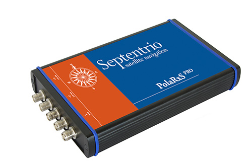
The PolaRxS by Septentrio is a multi-frequency, multi-constellation receiver dedicated to ionospheric monitoring and space weather applications. It features simultaneous high-quality tracking of all visible signals (L1, L2, L5, E5ab/AltBOC GPS/GLONASS/Galileo/Beidou/SBAS) at low noise levels. The receiver outputs an extensive set of GNSS measurements, including signal phase and intensity at up to 100 Hz, with a phase noise standard deviation (phi60) as low as 0.03 rad.
The A Posteriori Multipath Estimator (APME+) tackles short-delay multipath to enhance the measurement quality, while LOCK+ tracking guarantees robust tracking of rapid signal dynamics during scintillation events. Included tools provide continuous total electron content (TEC) and scintillation indices logging for space weather and ionosphere monitoring.
Learn about more Galileo-ready products in our Galileo Product Showcase from the April 2014 issue.
Researchers at Telecom SudParis are working on a solution to provide indoor continuity for GNSS positioning. The idea is to deploy a minimal transmission infrastructure in order to allow a standard receiver to measure pseudo-ranges and carrier phases, thus leading to an indoor accurate positioning. The infrastructure consists of a few antennas fed through optical fibers with a GNSS-like signal.
Based in Paris, Telecom SudParis is a part of the Institut Mines-Telecom, an education and research institution in the fields of information and communication technology.
Nel Samama
To achieve positions accurate to a few decimeters, the locations of the various indoor antennas had to be accurately known. This was achieved with the Spectra Precision FOCUS 8 total station in a local reference frame. In addition, in order to calculate the indoor positioning in WGS84 format, to achieve full compatibility with current outdoor GPS, a Spectra Precision ProMark 800 GNSS receiver was used to link the local reference frame and the GPS. “ The accuracies of the FOCUS 8 and the ProMark 800 and their ease of use were invaluable to us,” said Nel Samama, lead researcher and Professor at the Institut Mines-Telecom.
The International Conference on Indoor Positioning and Indoor Navigation (IPIN) 2012 and 2013 published the first results of the research, and the latest results will soon be published in a paper, “Repealite Based Indoor Positioning System Performance.” The papers propose a new approach to indoor positioning: the repealite system. It aims at providing continuity of the positioning service through the use of GNSS-like signals, thus leading to a single technological means: a GNSS receiver, for both outdoors and indoors. A few error sources have been dealt with in order to reach sub-meter accuracy indoors, among which one has to cite multipath and near-far effects. The paper describes a way to reach indoor sub-meter accuracy and the practical current implementation of the system.
A newly issued report by MarketsandMarkets focuses on growth in the location-based services market, and says it will be worth $39.87 billion by 2019.
The report, “Location Based Services (LBS) Market (Mapping, Discovery and Infotainment, Location Analytics, Leisure and Social Networking, Location Based Advertising, Augmented Reality and Gaming, Tracking) — Worldwide Forecasts and Analysis (2014-2019),” provides a comprehensive market and forecast analysis of the overall market, segmented by products, services, technologies, applications, regions, and verticals. The report covers all the major sub segments of the LBS market and provides the quantitative (market size and market growth) and qualitative (trends, analysis, and insights) analysis for those segments.
Included are 99 market data tables, 17 figures spread through 254 pages, and an in-depth table of contents on the LBS market. This comprehensive coverage of the LBS Market provides important inputs such as drivers, restraints, and opportunities in this market, profiles the major players in this market, maps the competitive landscape, and provides the overall perspective on the LBS Market in the various verticals and regions, according to MarketsandMarkets.
LBS is a solution that stands for applications that integrate geographic locations information with business processes, helping in analysis of location information. The location-based information is required in distinct business data sets for relating, comparing, and analyzing relationships in the data. The service also provides an economical alternative to agencies with existing internal GIS resources. As a result of these multidimensional benefits of location information, operators are considering it as an asset, leading to numerous investments being made to extract, use and market it.
LizardTech will conduct defense-oriented demonstrations of its recently launched Express Server software product next week at the GEOINT 2013* Symposium in booth number 4079. The symposium will take place April 14 – 17 at the Tampa Convention Center in Tampa, Florida. LizardTech is a provider of software solutions for managing and distributing geospatial content.
Express Server is image-delivery software for compressed raster imagery, including multispectral imagery. The latest version includes the ExpressZip web application for browsing, finding, and exporting imagery straight from the web browser. Users can view all of their collections and query by location, by keyword, by projection, and more. If users need to take their imagery on the go, they can use the built-in selection tools to export regions of interest. The ExpressZip application is open source and customizable.
“We look forward to sharing Express Server 9 with the intelligence community at GEOINT next week,” said Jon Skiffington, director of product management at LizardTech. “Most LizardTech users know MrSID and how it can be used to drastically reduce image sizes while retaining visual quality. What they may not be aware of is that Express Server is the fastest, easiest, and most stable way to distribute compressed, high-resolution raster imagery via standard protocols. And now with ExpressZip, our customers will be able to access all of their collections in one place and export imagery straight from the web browser.”
LizardTech will also showcase its GeoExpress software for compressing and manipulating satellite and aerial imagery, and its LiDAR Compressor software, which turns giant point cloud datasets into efficient MrSID files.
Scene Sharp USA will introduce Version 2.0 of its Fuze Go universal image fusion technology April 14-17, 2014, at the GEOINT 13* Symposium in Tampa, Florida. Scene Sharp will be hosted in Global Marketing Insights booth #2091 where it will demonstrate the new Fuze Go MS Sharp and Fuze Go SAR Sharp image fusion processing tools.
Scene Sharp is division of PraEis Ltd., a geospatially focused technology transfer organization with offices in Ohio and New Hampshire USA.
“Fuze Go is a fully automated technology that enables users to quickly and easily fuse data sets to add color to non-colorized satellite and aerial imagery with just a few mouse clicks,” said Scene Sharp CEO Ian Lucas. “By colorizing image data, GIS users can visualize and extract richer information content from remotely sensed data to make better informed decisions.”
In one simple step, the Fuze Go MS Sharp software fuses high-resolution panchromatic image data with lower-resolution multispectral data to generate a high-resolution color image. The full information content of the multispectral bands is retained in the fused image. More importantly, Fuze Go MS Sharp is the only fusion software capable of simultaneously merging up to 30 bands of multispectral data with a panchromatic image.
“Fuze Go MS Sharp runs at least five times faster and yields more consistent results than pan-sharpening applications that can only process four bands of data,” said Lucas. “As is true with the entire line of existing and planned Fuze Go products from Scene Sharp, no expertise in GIS or image processing is needed to use Fuze Go MS Sharp.”
As a universal image fusion tool, Fuze Go MS Sharp can handle data formats from any commercial image processing and enterprise GIS software packages. In cooperation with Exelis Inc., Scene Sharp created a Fuze Go MS Sharp plugin for the popular Exelis ENVI 5.0 and 5.1 image processing package.
“The plugin enables ENVI users to access the Fuze Go MS Sharp tool either within the ENVI workflow or outside of it so that fusion can be performed as a stand-alone application, freeing up the ENVI software license for other image processing activities,” said Lucas. “We are developing similar plugin capabilities for other major GIS and image processing packages.”
Fuze Go SAR Sharp was designed by Scene Sharp for more effective exploitation of data captured by satellite-based synthetic aperture radar (SAR) sensors. Fuze Go SAR Sharp fuses gray-scale radar data with optical multispectral bands to colorize the SAR data set. This image fusion presents the unique SAR data, which is captured through darkness and clouds, in a color context that greatly enhances the user’s ability to interpret the radar data and extract actionable intelligence from it.
Fuze Go MS Sharp and SAR Sharp are available for purchase for an annual license fee. Batch processing versions of the software packages are also offered to perform automatic fusion of multiple optical or SAR scenes.
“The ease of use and attractive pricing of Fuze Go software products make them far superior solutions to any other applications in the geospatial market today,” said Dr. Shawana Johnson, President of Global Marketing Insights. “With their seamless integration into existing image exploitation workflows, Fuze Go products can have immediate impacts in defense/intelligence, homeland security, mining, agriculture, forestry and oil & gas applications.”
The transition to using the terrestrial geocentric coordinate system “Parametry Zemli 1990” (PZ-90.11) in operating GLONASS has been implemented, according to an April 4 announcement by the Russian Federal Space Agency’s Information-Anayltical Center.
The implementation fulfills Russian Government Resolution № 1463 of December 28, 2012, “On the Common National Geodetic Coordinate Systems,” outlining the transition starting at 3 p.m. on December 31, 2013. The fundamental geodetic constants as well as the Earth’s ellipsoid parameters used in PZ-90.11 are provided in the annex to the resolution.
The updated version of the GLONASS ICD (edition 5.1 of 2008) has been published.
SkyTraq‘s new family of high-performance system-in-package (SiP) GNSS receiver modules supports GPS, GLONASS, Beidou, QZSS and SBAS.The modules integrate SkyTraq Venus8 positioning engine, 1MByte Flash memory, LNA, SAW filter, high precision 0.5ppm TCXO, RTC crystal, and other passive components within tiny 10mm x 10mm x 1.3mm package. The smallest configuration requires only antenna and power to have position fix and generate NMEA output.
This new 10mm x 10m sized GNSS module family consists of Venus858F-GL GPS/GLONASS receiver module, Venus858F-BD GPS/Beidou receiver module, and Venus838F GPS receiver module. All three modules support additional QZSS and SBAS signal. The three modules are pin compatible; one application design works for all three models.
Within the consumer and industrial GNSS segment, these modules feature industry’s fastest 50Hz GPS, 20Hz GPS/Beidou, and 20Hz GPS/GLONASS update rate, 29sec cold start TTFF, and better than -160dBm tracking sensitivity.
Module interface includes two UART, four SPI, one 2-wire interface (I2C compliant), and two PWM among the 28 function-multiplexed digital I/O. A customized Arduino IDE can be used to program the modules, making use of the on-chip peripherals and sharing the internal 32bit RISC, IEEE-754 compliant FPU, and memory resources. Venus838F GPS module has roughly 50MIPS + 490KByte Flash + 45KByte RAM available for user programming.
Optimized for lowest bill of material cost, the dime-sized modules are designed for high-volume cost-sensitive GNSS applications. Combined with properly tuned antenna fitted to customer’s application design, it provides optimal performance at lowest system cost.
To lower barrier of adopting latest satellite navigation technology, the traditionally higher-priced GPS/GLONASS and GPS/Beidou receiver modules are offered at same price as the GPS receiver module.
Volume delivery of all three modules to customers begins in May 2014; engineering sample, datasheet, reference design, and evaluation kits are available now.
Last week was spring break (for high school and college) for my kids. We decided to drive to San Francisco and the surrounding area to do a little sightseeing. It’s a beautiful place. This is a view from our 3rd floor room in the hotel, looking over the bay.
Of course, while traveling, I usually manage to work in some GNSS activities.
The first stop was Autodesk, the makers of AutoCAD and other engineering, design and visualization software in downtown San Francisco. AutoCAD occupies 100,000+ square feet at One Market St. in downtown San Francisco and another 20,000+ square feet at Pier 9 right on the Bay. How anyone gets work done with an office on a San Francisco Pier is beyond me. It’s buzzing with people and activity, including a shuttle to the famous Alcatraz Prison, which we enjoyed.
The Autodesk meeting is deserving of an article in itself, but I’ll keep it short with bullet points for the purposes of this article:
AutoCAD 2014 includes a datum/coordinate system library for mapping/surveying users. This is new in AutoCAD.
Infraworks (introduced last year) was built from the ground up with a new workflow for engineers and planners (and surveyors). Most people have never heard of it. It can do things that AutoCAD can’t, such as managing surveying data for large-scale projects. Think BIM (Building Information Modeling).
Model Builder (just introduced), is a tool to build quick and dirty 3D visualizations using data from Autodesk’s cloud service.
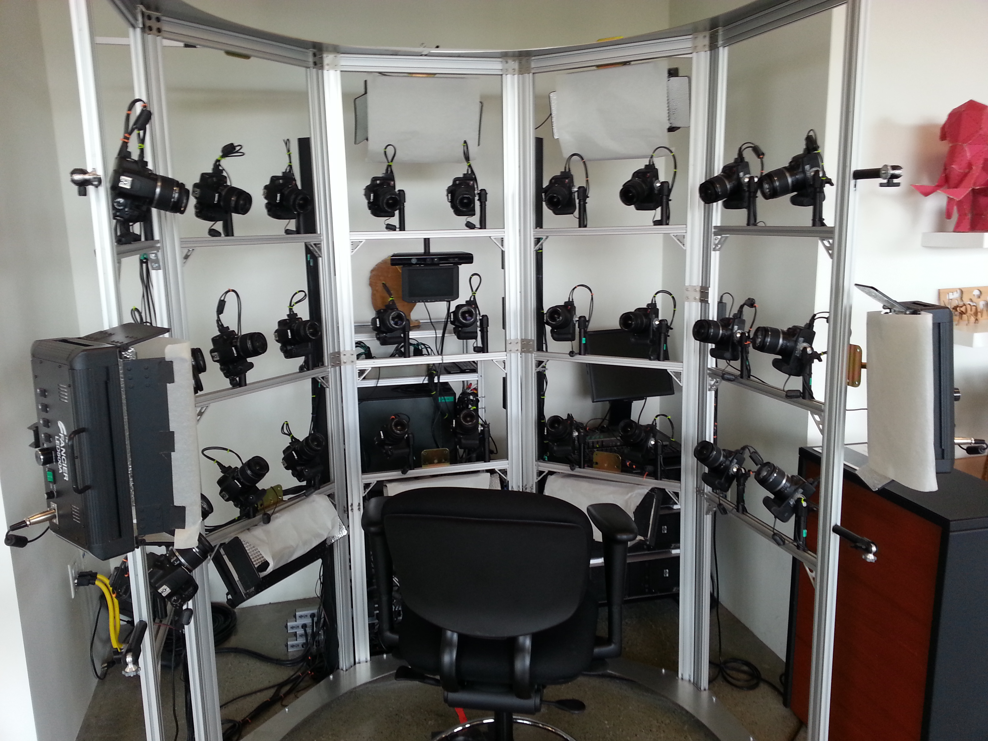
Autodesk 123. This is a really cool free app you can use to create 3D models using your own images. The images can come from smartphone pictures or images you already have. It’s a really cool app.
Photogrammetry Chair in the Autodesk Gallery at One Market St. in downtown San Francisco.
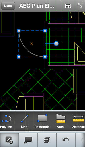
AutoCAD 360 (formerly AutoCAD WS). First of all, any Autodesk product with 360 in the name is a cloud app, whether it’s mobile or desktop. I’ll focus on the mobile apps. There are two AutoCAD 360 mobile apps: one for Android and one for iOS. The mobile apps are free tools that allow you to take AutoCAD drawings in the field. There are also Pro versions available on a subscription basis.
Screenshot of AutoCAD 360 on the Apple iPad.
Last week, I had a chance to use AutoCAD 360 in the field with RTK. It was a last-minute exercise that I hadn’t planned on, so my expectations were set so that even if I couldn’t get it to work, at least it would be a solid learning experience.
The goal was to receive 1-2 cm RTK GNSS positions on an Android smartphone running AutoCAD 360 using a public (free) RTK base station. I knew I could access the free RTK base via PBO real-time streaming because I’ve done that before. However, I didn’t know, or have experience in two areas:
Accessing RTK base data via NTRIP on an Android device.
The ability of AutoCAD 360 mobile app to consume GPS data.
For the Android device, we used a Samsung Galaxy Note. It’s a smartphone, but also a tablet with a 5.7-inch color touchscreen.
Samsung Galaxy Note with a 5.7-inch color touchscreen.
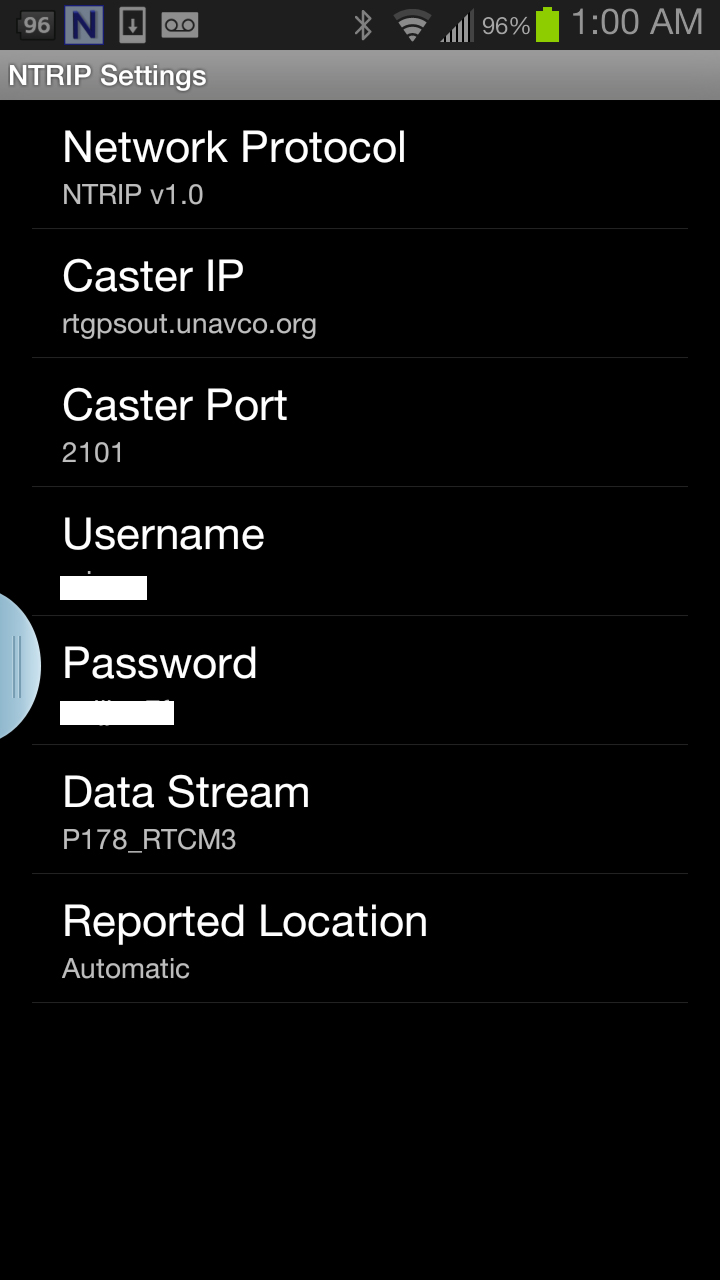
The first challenge was the Android utility software needed to access the RTK base. NTRIP (Networked Transport of RTCM via Internet Protocol). As I’ve written in previous articles, there are lots of free RTK base stations (330+) in California. To access them, all you need is internet connectivity and an NTRIP program to manage the connection to the RTK base. For Windows and Windows Mobile, there are several free NTRIP software programs. For Android, it’s limited (but growing). I found a free Android NTRIP utility on the Google Play store. It’s very easy to install and set up. If you have your RTK base credentials (IP address, port#, login, password), if you have a Bluetooth RTK receiver, you can install the program and be running RTK within a few minutes.
Android NTRIP Utility (Lefebure Design)
Once I entered the RTK login credentials, I was presented with a list of RTK bases. The list of PBO RTK bases are all single-baseline RTK bases (not networked) so I needed to select the closest one to the project site. In this case, it was P178 (see the screen shot above). It was about five miles from the project site. At this point, I can see the RTK base data streaming on the Samsung Note tablet. I didn’t mention before, but I had already Bluetoothed the Samsung to a small RTK GNSS receiver. Once the RTK base data starts streaming, the RTK GNSS receiver goes into FLOAT mode and heading for FIX (1-2cm precision).
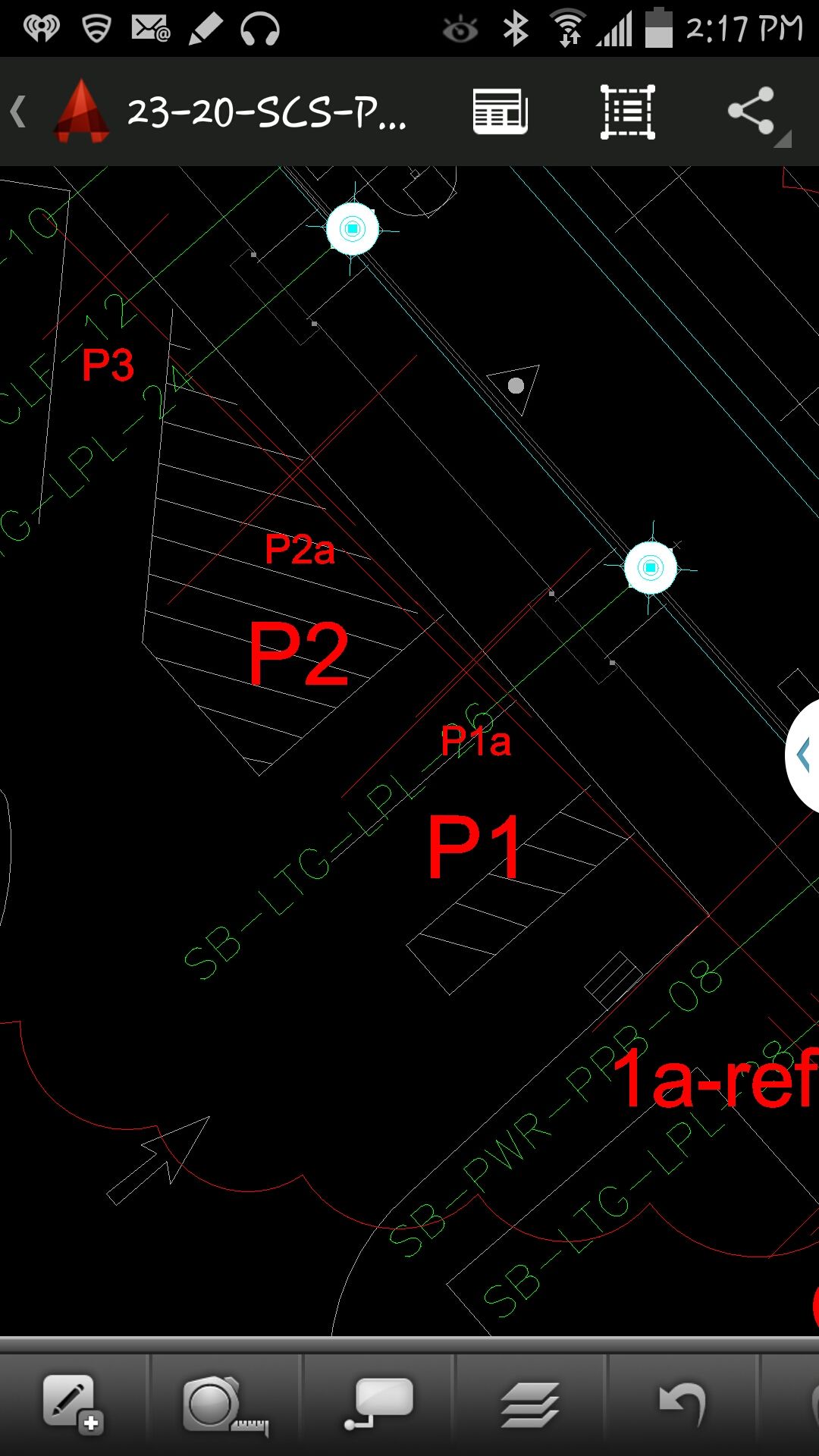
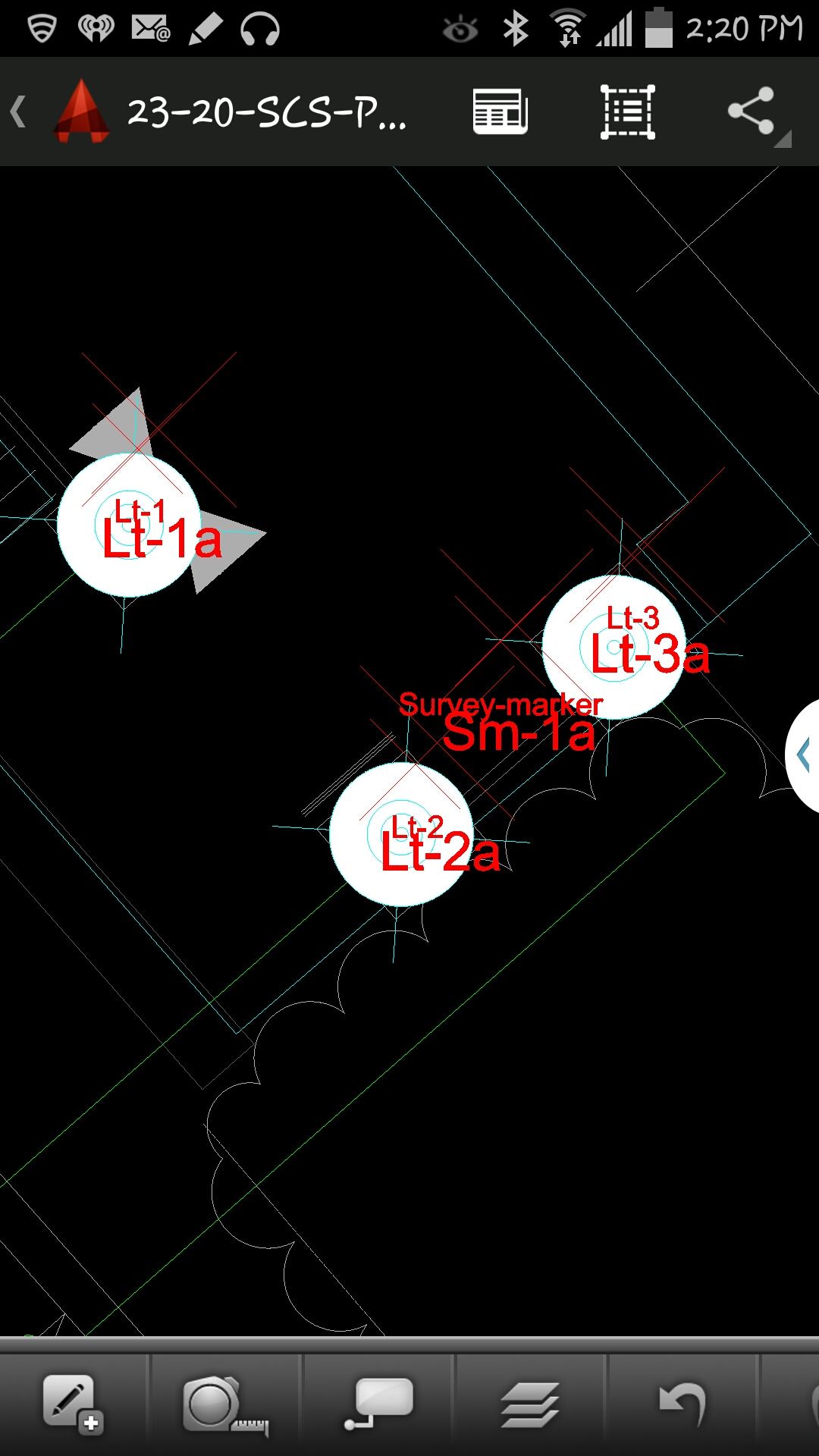
At that point, we (I wasn’t operating AutoCAD 360 on the Samsung) started AutoCAD 360 on the Samsung Note tablet and loaded a drawing that we’d planned to use. Following are a couple of screen shots from our exercise.
AutoCAD 360 running on a Samsung Note Tablet/smartphoneAutoCAD 360 running on a Samsung Note Tablet/smartphone.
It took a minute to figure out how to”turn on” GPS in AutoCAD 360 (we were all newbies), but once we did, our position showed up on the drawing where we expected it. By this time, we were getting an RTK FIX position from the RTK GNSS receiver. We were getting 1-2 cm precision in a native AutoCAD drawing, in real-time, in the field, on an Android smartphone. I was impressed.
We were ready to start our accuracy testing. Our accuracy testing consisted of two parts:
1. To test precision, take RTK shots on two points and measure the distance between the two with a tape measure. We did this several times.
Lt-1 and Lt-2 were on top of a platform with no substantial obstructions.
Lastly, we took a shot underneath a platform with greater than 50% of the skyview obstructed. It didn’t hold RTK in that environment and I didn’t expect it to. The precision was 5 feet (DGPS).
2. The second test was to test accuracy by taking an RTK shot on a survey marker that had published State Plane Coordinates in NAD83/2007 epoch 2007.0
After recording an RTK FIX shot on the marker (albeit I was holding the antenna so I expected a little slop), we compared our result to the survey marker coordinates. Not good…3.0 feet difference.
My first suspicion was that the RTK base was referenced to ITRF, so there would be significant difference between the two coordinate values. No dice. I adjusted the RTK GNSS coordinate to NAD83/2007 (2007.0) assuming it was referenced to ITRF08. The adjusted coordinate was further than the original (6.95 feet). That wasn’t the problem.
My second thought was to double-check what the PBO folks used for a reference position for there RTK bases. They confirmed ITRF08 current epoch. However, after talking to a few people familiar with PBO sites (RTK Network operator and Mark Silver), they suggested to run an OPUS solution on the PBO RTK base and compare it to the reference coordinate being used by the PBO RTK base. Sure enough, there’s a 6.40 feet difference between the 24 hour OPUS ITRF08 coordinate and the ITRF08 reference coordinate being used by the P178 RTK base.
It still doesn’t reconcile the difference we saw between the RTK GNSS coordinate and the survey mark, but I’m still trying to confirm which epoch date the PBO RTK base is using. In California, tectonic plate movement is significant. In that area, the ground is moving 1.7 cm north and 3.4 cm west each year, so the epoch date of the coordinate is significant, especially if the epoch date is 1997.0 or 2002.0. However, that doesn’t prevent you from using RTK Bases like P178 and “localizing” to NAD83/2007 or whichever datum your data is referenced to.
NovAtel, Inc., has added the IMU-KVH1750 as an inertial measurement unit (IMU) option in its SPAN GNSS/INS line of positioning products. The IMU-KVH1750 is a high-performance commercial off-the-shelf (COTS) sensor that offers excellent bias stability and repeatability, NovAtel said. It incorporates KVH’s DSP-1750 precision fibre-optic gyro with very low noise MEMS accelerometers.
Commercially exportable, the IMU-KVH1750 integrates easily with NovAtel’s OEM6 series of receivers to provide a tightly coupled 3D navigation solution, the company said. Offering customers continuous position, velocity and attitude (roll, pitch and azimuth) measurements, a SPAN system is stable and available even through periods when satellite signals are blocked or unavailable.
The IMU-KVH1750 supported SPAN system is designed for mobile and airborne mapping applications as well as hydrographic survey. It can be relied on to provide accurate, continuous performance in harsh environments, and features excellent shock vibration and thermal functionality.
In consulting my notebooks for the spring of 2014, I find many remarkable cases that engaged the attention of my intimate friend Mr. Sherlock Holmes. Among them stand out the tragedy of the ancient British barrow, the disappearance of Pemblestoke the magician, and the curious facts associated with the giant rat of Sumatra, a tale for which the world is still not prepared. Perhaps none of these so well illustrate, however, the advanced technical insights and consultative powers of the great detective as did the intrigue into which we were drawn by the brilliant young American scientist, Geo. P. Hess.
“Watson, we have a new client,” Holmes announced over breakfast, “a friend, actually, upon whom I have depended for many years. He has always proved reliable, helping me navigate the highways and by-ways all across the land.”
“His name?” I inquired.
“The Right Honorable George Parkinson Hess from California, Colorado, Pennsylvania, Florida, and doubtless many other parts of the American nation. I have watched G.P. Hess grow these last 36 years into a prodigiously successful entrepreneur, known the world round for his ubiquity, openhanded generosity to all, and, equally, his devotion to his own country. Now it seems he needs my advice, and I cannot refuse him.“
“I wonder that an American should be able to find his way here this morning,” I replied. “There’s a beastly fog about, and London streets are no friendly environment under the best of conditions.”
“Have no fear, Watson,” Holmes chuckled. “I have never known G. P. Hess to be late for any function. Since a lad he was always on time, right to the second. You can set your watch by him, and as far as I know he has never been lost. He has an uncanny sense of direction and is indeed a fount of knowledge concerning maps and directions. I believe I hear his ring at the bell even now.”
Mrs. Hudson ushered in our American visitor, and Holmes introduced us. “It is always good to see you, G.P. How are you — in good health, I presume?”
“Indeed, Mr. Holmes, things are neither as well they may seem on the surface, nor as well as they could be. I am troubled of late, severely troubled by potential gaps in my future. Not to mention the seismic activity lately in Los Angeles. In the last 18 months, the magnitude of the tremors has grown from 3.1 to 5.1 on the Richter scale. I just can’t understand why they thought to have our major acquisition headquarters in a place that is constantly threatened by tremors, outright quakes, wild fires, floods, landslides, and tsunamis. Not to mention the traffic. It would have been much better to co-locate acquisition with the main headquarters in Colorado. All they have to worry about there are blizzards, high winds, and an occasional wildfire.
“While I could not agree with you more, G.P., I fail to see what I can do, try as I might, about Mother Nature.”
Fire in Florida
“Right you are, Mr. Holmes. I’ll get to the heart of the matter. I am deeply concerned about several of our business ventures: expansion and modernization efforts, if you will. You may have heard about a small but rather serious fire at the U.S. Air Force’s Cape Canaveral radar tracking facility and the subsequent launch delays. That small fire at a single tracking facility has already delayed a National Reconnaissance Office (NRO) launch, and a resupply mission to the International Space Station, currently manned by U.S. and Russian crews who, whether or not they are still speaking to one another, really need the replenishments. Now we aren’t allowed use Russian engine cores for space launch any more. A blessing, actually, as the Russians have put more malfunctioning GLONASS satellites into salt water lately than into the vacuum of space, when they aren’t simply blasting them to kingdom come.
“With all the troubles besetting Cape Canaveral, Elon Musk is burning figure eights in his Tesla, and SpaceX is a very happy company — in the right place at the right time, what? Able to launch its Falcons and Falcon Heavies from Vandenberg as well as Canaveral.
“Imagine, one little fire has caused the cancellation of several space launches, and those still on the manifest are moving to the right daily. We had hoped to put into orbit four new IIF models this year, but that looks next to impossible now. Plus it appears the GPS III payload has hit a snag. It is delayed six to nine months.”
GPS III Delay
“A delay in GPS III had not been looked for, had it?” queried Holmes.
“No sir, it had not. Everything was proceeding smoothly, but now the satellite payload is in question. Subcontractor Exelis has provided every GPS payload since 1978 and all have worked marvelously well, some of them for more than 23 years. But now — there is a problem. Some say it is signal crosstalk, some say it is with the new rubidium clocks. One thing for sure, it is demoralizing. I am given to understand the powers that be in Colorado Springs and Los Angeles are calmly but firmly looking for some competition or even an alternate payload provider.
OCX Delay
“And then there is the GPS ground segment. It has moved one month to the right for every month it has been in existence, it has gone over budget, and now is on its third program manager in three years. Whatever happened to the days when a capable leader conducted a program from beginning to end, knew it intimately from top to bottom, from soup to nuts? What is this world coming to? Where are our leaders?
“And don’t get me started on the effects of ‘seques-castration’!” fumed the young man.
“And the Chinese!” he continued, gathering steam. “Just who do they think they are? Do you know they called their regional system a PNT gold standard? Gold standard! Don’t make me laugh!”
“Now G.P., don’t despair,” soothed Holmes. “There are still excellent leaders out there, you just have to look a bit harder nowadays. In the space arena, Elon Musk, General William Shelton, Wild Bill Cooley, Frank Kendall, and Keoki Jackson are just five of many that come immediately to mind. Of course I would not want to play poker with any of them, but I digress.”
Solutions Appear
“I have been reading and thinking about the alternative payload issue,” the detective continued, “and I have other sources of information as well. Dr. Watson calls them my Baker Street Irregulars, and they are both resourceful and quite knowledgeable. These sources tell me there is another Colorado company, with excellent leadership, that is really on the ball, can move mountains (or huge boulders, anyway), and mark my words, they have top-notch crews, expertise, and even some past performance where an alternative GPS payload is concerned. They might be worth watching.
“As far as OCX goes, frankly I am hearing there are indeed backups and alternatives. My sources have confirmed the existence of a bracket of applicable technologies belonging to a small residual company, run by an Irish clan, believe it or not, with considerable past performance and expertise. Once officially launched to work on the real-time issues, they should be able to help the ground-segment team get back on the fast track.
“As for as the Chinese and their claims, all I can say is no one believes their gold standard rhetoric, although it obviously has a purpose.”
“Mr. Holmes, I hope you are right,” the American replied with an assuaged look. “I knew that if I talked with you I would feel better about these perplexing issues.
“I must resume my journey to Rotterdam, where I will hear a lot more about the Galileo program meeting its launch dates — or not — and the GLONASS outage. As rough a shape as we are in, we’re still far better off than the rest! In the meantime, I’ll pop over to Greenwich to synch up and universally coordinate with those folks before I move on to the Continent.”
G.P. Hess carefully scrutinized his pocket watch. “Now Mr. Holmes, Dr. Watson, I must depart. As you know I have a reputation to maintain: always precisely on time, never lost, and as far as I know, I have never blacked out. Cheerio!”
“What a remarkable fellow, Holmes!” I said after our client had left. “He is certainly full of energy.”
“Yes,” my friend replied, “energetic and very successful. If you had observed him more closely, Watson, you would have noticed his pocket watch. Ah, you did not remark upon it? Standard-issue, atomic-reference version, crafted of solid gold. You might say, and rightly so, that where time is concerned, G.P. Hess is the undisputed holder of the Gold Standard.”
So ends our brief visit with Holmes and the illustrious Watson. Stay tuned for further adventures, and until next time, Happy Navigating! G.P. Hess and I hope to see you all next week in Rotterdam, the Netherlands, at the European Navigation Conference, ENC-GNSS 2014. Drop by and say Hello!
If you can’t drop by and say hello in Rotterdam, the Netherlands, then please join me at the 30th Space Symposium, which is slated for May 19-22, 2014, at The Broadmoor Hotel in Colorado Springs. The Space Symposium is considered by many of us in the Space business to be the premier gathering of space professionals in the world.
In June, I will be attending the 39th NIST Time and Frequency Seminar. It has a great lineup of speakers this year to include: Judah Levine who is the NIST civilian time leader, David Allan who is the original creator of the famous Allan variance, and Neil Ashby, an expert in relativistic timing effects. The seminar takes place in Boulder, Colorado, June 3-6, 2014.
What Is Don Reading?
I had very little time for reading this month, or so I thought — then I had a brief but enlightening correspondence and conversation with local author George E. Nolly, who also lives in Colorado. George sent all four of his wonderful books direct to the Kindle app on my iPad. I had told George I was so swamped I would save his books to read on the airplane on my way to Rotterdam and report on them after the European Navigation Conference.
Then I read just one chapter of the first book and I was hooked. There was nothing for it but to devour all four volumes of the escapades of young Vietnam era USAF pilot, Hamilton “Hamfist” Hancock. Hamfist Out: The Chill Is Gone; Hamfist Over Hanoi: Wolfpack on the Prowl; Hamfist Down! Evasion, Survival and Combat in the Jungle; Hamfist Over The Trail: The Air Combat Adventures of Hamilton “Hamfist” Hancock
It will be like going back in time for many readers of a similar age. George Nolly writes with such an easy-going grace and fluidity that reading of these often stressful and life-threatening times, while sitting in my lounge chair, was, for me anyway, indeed a pleasure.
Certainly I can remember undergoing many of the same flying and ground ordeals, and Nolly tells his tales with such honesty and clarity that it brought back vivid memories. In fact I have never read such accurate descriptions of what it was like to fly the old T-29 with radial engines and all that entails. George actually brought back the unforgettable sound and smell of those two Pratt & Whitney R-2800 radial, air-cooled engines. They are from a long-forgotten era of aviation, but those of us who heard them will never forget them.
T-29A Aircraft, Vietnam era, restored. Courtesy of CONVAIR T29A.
George also makes wonderful plugs for GPS, possibly without knowing it, when he describes using LORAN maps under red lights in a cramped cockpit. This, along with all the time he spent just trying to figure out where he was or where the target was located, just screams for a GPS solution. In truth, in the Vietnam era we airmen spent a great deal of time trying to figure out exactly where we were, where our target was, and where the enemy was located, especially if he was shooting at us. Today all those tasks are made infinitely simpler with the use of GPS and modern electronics. However, this also highlights the amazing feats of airmanship accomplished in the Vietnam era, all while being constantly targeted by the enemy, all the more incredible.
Radial engine.
Just between us veteran airmen, the author relates the tales with such clarity and detail I suspect many of them are autobiographical. George E. Nolly, after graduating from the U.S. Air Force Academy here in Colorado Springs, served as a pilot in the United States Air Force, flying 315 combat missions on two successive tours of duty in Vietnam, winning three Distinguished Flying Crosses and 24 Air Medals, flying O-2A and F-4 aircraft, so he knows whereof he writes.
Even if you are a few generations younger than George Nolly and me, and don’t undergo a nostalgic experience as you read, you will certainly enjoy these fabulous books. Be sure to read them in order, as they are actually one running story that brings to life the trials, tribulations, and joys of Hamilton “Hamfist” Hancock for all of us and vividly recreates the way things were back in the 1960s and ’70s in the United States, the USAF, and what it was like flying in combat in Southeast Asia. I highly recommend these tales. I hope there are more to come.
Upcoming Conferences
If you can’t drop by and say hello in Rotterdam, the Netherlands, then please join me at the 30th National Space Symposium, which is slated for May 19-22, 2014, at The Broadmoor Hotel in Colorado Springs. The National Space Symposium is considered by many of us in the Space business to be the premier gathering of space professionals in the world.
In June I will be attending the 39th NIST Time and Frequency Seminar. It has a great lineup of speakers this year to include: Judah Levine who is the NIST civilian time leader, David Allan who is the original creator of the famous Allan variance, and Neil Ashby, an expert in relativistic timing effects. The seminar takes place in Boulder, Colorado, June 3-6, 2014.
Reports in the semi-official Russian news daily Izvestia indicate that finger-pointing has gotten underway regarding the April 1 GLONASS systemic blackout, which followed two other high-profile disasters, the destruction-upon-launch of three new GLONASS satellites in July 2013, and the Pacific drowning of three other satellites in December 2010.
While we have neither full nor fluent translations from the Russian, we have done the best we can, aided and abetted by Google, with the following passages.
“Temporary GLONASS failure has not led to tangible consequences for consumers of services for the reason that chip manufacturing exclusively GLONASS, the mass market is practically no: there are chips that work only with the signal GPS, and there are those that see both systems GPS and GLONASS.”
Clarification: there are practically no mass-market devices, even in Russia, that use exclusively GLONASS.
“In any case, the failure of the entire system for a long period a serious blow to the image of GLONASS, especially in a situation where Russia has made efforts to promote domestic navigation system to external markets. Plus in 2012, the Russian government officially promised to maintain the characteristics of the international community GLONASS at the proper level for 15 years.
“The following statement was distributed at the XII International Forum ICAO Air Navigation in Montreal by the Head of the non-governmental organization ‘Promoting the development and use of navigation technologies.’ Alexander Gurko believes that now GLONASS is not controlled properly, causing increased risks of such failures.
“There should be a system operator who is responsible for the quality of its operation, development and use, Gurko said. GLONASS still not officially put into operation, although it was promised two years ago and settled in many protocols, the Interagency Working Group. But it is still unclear who is responsible for the general quality of service.
“GLONASS system is not commissioned by the Ministry of Defence and officially still under development.
“Where to users with questions and explanations about the operation or development of the system? Asks questions Gourko. The Defense Ministry, Roscosmos? How are civil user requirements and market trends in the formation positioning system development plans?”
Izvestia further notes that in March of this year, the Russian government cut the GLONASS budget by 16 billion rubles ($450 million). “Signal quality and composition of the orbital constellation sequestration will not affect, say Roscosmos. It is important to reduce not touched the ground part, experts say.”