Blog

  • GPS CNAV Debate, and GNSS Interoperability Moves Forward

    The opening plenary session of the Munich Satellite Navigation Summit is convening as this column goes to the electronic press for distribution. Coverage of these top-level system briefings before a select international GNSS audience in Munich will appear in two e-newsletters next week, The European GNSS and Earth Observation Report (EAGER), and in a shortened form via the Navigate! Weekly.

    If you do not already receive these email newsletters, subscriptions to both are free at env-gpsworld-integration.kinsta.cloud/subscribe.

    Until then, here’s an update on the CNAV debate in the United States and wider system-operator background from two recent meetings.

    CNAV So Far.  In the closing hours of 2013, a departing U.S. Cabinet under-secretary for Transportation dropped a verbal bomb on the Pentagon, in the form of a communiqué expressing concern about reliability of the new civil navigation message (CNAV) signal scheduled to emanate in April from select GPS satellites on orbit. Subsequent explosions were detected in halls from Washington to Colorado and Los Angeles.

    The Department of Transportation issued a call for back-up in the form of public comment via the Federal Register. That comment period closes on April 4.

    Meanwhile, one semi-public organization communicated to its members that it finds nothing disturbing about the plan, set to take effect sometime in the coming month.

    IGS Steps Forth on CNAV.  The International GNSS Service, a voluntary federation of more than 200 worldwide agencies that pool resources and permanent GPS and GLONASS station data to generate precise GPS and GLONASS products, issued a statement to its members and participating institutions in March. “We are confident that the IGS network is not at risk due to this change, and it is a welcomed step towards GPS modernization.”

    The communiqué from the Infrastructure Committee went on to say that “This event is considered innocuous to the stability of the receiver network since during a limited GPS CNAV test campaign in June 2013 the IGS network was not affected, only a very specific receiver problem was detected by the IGS Multi-GNSS Experiment, which was informed to the GPS ground segment and addressed.

    “Most modern receivers can track L2C and L5 and the CNAV messages, but the decoded messages should not be used by the receivers. The traditional L1 NAV messages (LNAV) will continue to be transmitted as usual and thus the receiver navigation files, birds, etc., will continue unaffected. Older receivers will be completely unaffected as they do not track L2C or L5.

    “In any case IGS Station Operators and Station Network Managers are advised to keep an eye on receivers and on their data outputs during the start of the CNAV activation. Just in case something strange is observed please stop data submission and notify the IGS (Network Coordinator, Infrastructure Committee) so that we may investigate the issues quickly. In case of doubt with your own equipment please contact the receiver manufacturer and inform the IGS.”

    PNT Advisory Board Airing. Prior to the appearance of the CNAV letter from the departing deputy secretary, the U.S. PNT Advisory Board heard a report in early December from Air Force Space Command on said implementation plan for the GPS CNAV message on L2C and L5. The minutes of that meeting were recently released.

    The minutes relay the gist of General Whelan’s CNAV remarks as: “CNAV has been under discussion for a considerable time. Currently, L2C and L5 signals are being transmitted, but without a navigation message. AFSPC is working hard to activate these messages as soon as possible. One of the reasons for the delay is that additional time was needed to complete testing prior to activation. Testing began in late summer 2013 and, based on initial test results, a way ahead has been plotted. . . . Current plans are to begin initial broadcasting in the spring of 2014. CNAV uploads will occur twice weekly. The signal will meet GPS Standard Positioning System (SPS) standards, but may not achieve current accuracy levels until full implementation in late 2014.

    “CNAV live-sky testing occurred in June [2013] and was conducted in cooperation with civil, industry, and international partners. The two-week test series included independent assessment and verification. The tests identified four errors that required action. The first, which was addressed in real time, related to implementation of the test series. The second required improvement to the tools suite, which should be totally integrated into the ground segment by December 2014. The third and fourth errors required patches to satellite software. All four issues are now regarded as closed.”

    A subsequent presentation to the PNT Advisory Board from a Department of Transportation spokesperson did not directly mention CNAV, according to the meeting minutes, but did include this reminder on civil signal monitoring:

    “DOT is responsible for performance monitoring of GPS civil signals. The International Committee on GNSS’s (ICG’s) transparency principle states that ‘Every GNSS provider should publish documentation that describes the signal and system information, the policies of provision, and the minimum levels of performance offered for its open service.’ Currently, this is only done on GPS L1 C/A signals. Performance standards for L2C and L5 have not yet been established. The crucial function of signal/service monitoring is to verify that commitments to GNSS performance are being met. Additionally, monitoring improves the situational awareness for GNSS operators, and provides assurance that any civil service failure is detected and resolved promptly.”

    Other Global Developments. The International Committee on GNSS (ICG) held a meeting of its Working Group A on Compatibility and Interoperability, in November 2013 in Dubai, United Arab Emirates. A brief summary of those proceedings is now available.

    The notes evidence steady, deliberate organizational and international progress on collaboration between system providers of GNSS signals.

    Among new presentations to the body came several from Russia. Viktor Kashenko, Russian Federation, presented on the “Prospects for Status and Development of GLONASS System Space Complex,” an update on the GLONASS space segment noting that there is a full constellation of GLONASS-M satellites. CDMA signals at L1 and L2 are expected to be available beginning around 2016 or 2017.

    Grigory Stupak, Russian Federation, followed with a presentation titled “SDCM Present Status and Future GLONASS Signals Development.” There are currently 22 SDCM ground stations around the world with a goal of creating seamless coverage throughout Russia with LPV-200 capability. The U.S. asked a question about whether SDCM provides corrections for other constellations in addition to GLONASS. The Russian Federation explained that SDCM currently augments both GLONASS and GPS, but additional constellations could be added in the future.

    Oleg Denissenko, Russian Federation, discussed the goals of the GNSS Monitoring and Assessment System being developed in Russia and identified a list of parameters to be monitored by the international systems.

    Xurong Dong from China gave the status of the International GNSS Monitoring & Assessment Service for OS (iGMAS). Initial operational capability (IOC) is expected in June 2014.  Ten tracking stations have been installed so far, and 25 additional stations are expected to be added in the future. A signal quality monitoring station has also been established in China and a new 40-meter antenna is expected to be installed in 2014.

    Jeffrey Auerbach from the U.S. State Department presented on outcomes of the second Interference Detection and Mitigation (IDM) April 2013 workshop. The European Union noted that they are conducting a survey of professional users in Europe about privacy concerns, and perceptions and understandings of interference and jamming.

    Stanislav Kizima, Russian Federation, provided an overview of the International IDM system concept and recommended the creation of an IDM system database server to be used for monitoring GNSS facilities. He suggested identifying formalized data exchange formats for IDM. A question was asked about whether something like this already exists in Russia. Kizima responded that Russia does have an active system  for  monitoring interference, but not  specifically for GNSS. There are some issues with the existing system because GNSS is not listed as source of interference and the technical facilities are not able to analyze parameters specific to GNSS. Hence the need for development of specific GNSS monitoring facilities. Tom Stansell from the U.S. responded that cell phones could be enabled to become individual detectors of GNSS interference, and the interference source location could be determined this way. This technique is known as crowdsourcing. Kizima noted that cell phones give information on signal power, but not measurement equipment.

    China continued the session on spectrum protection with a presentation by Weimin Zhen on a proposal to develop a template for GNSS interference detection and reporting. He suggested that a generic template specific to reporting GNSS interference be developed.

    Upcoming principal WG-A related meetings:

    • WG-A Inter-session Meeting, Geneva, Switzerland, possible dates July 16-18, 2014)
    • ICG-9, Prague, November 10-14, 2014.
  • Galileo Countdown to 10 by Year’s End

    Europe’s Galileo satnav system.
    Europe’s Galileo satnav system.

    Signs Point Toward Early Services in December, If ESA Delivers

    A February conference on the European Union’s space policy in Brussels sought to set a course for 2020 and close official ranks behind the prospect of early Galileo services at the end of this year. Much in the business community’s perception of the new system — critical for device availability and mass- and professional-market adoption of Galileo — will depend on meeting the projected unveiling of early services in December. This is turn depends on an operational 10-satellite constellation; the fleet now stands at four.

    Among trends noted at the meeting: the growing importance of the European GNSS Agency (GSA)  as Galileo service provider, with perhaps more authority — and budget — than it has had in the past to get the job done. “The GSA will gradually assume responsibility for the operational management of the programmes while ESA will remain responsible for the deployment of Galileo, and the design and development of new generation of systems,” announced the European Commision (EC).

    EC Vice President Antonio Tajani reiterated there will be three Galileo launches in 2014 to reach the requisite year-end total. “The first will come in June. Two satellites have passed the necessary tests. We need to keep this up, and continue to raise our game.”

    Trouble on the Equator. The next two Galileo satellites may be ready to ship to Europe’s spaceport in South America by early April. But a large European commercial satellite customer is crowding the schedule, pressuring launch operator Arianespace to lift its satellites first. This could delay the Galileo birds, now set for June rise.

    ESA’s year-end plan calls for two more dual-satellite launches in October and December on Russian Soyuz rockets — new partners to the Galileo dance, bringing perhaps new technical connectivity issues.

    It’s Not Easy. With Galileo and EGNOS  financed to the tune of €7 billion for 2014–2020, expectations are high, yet the European Commission brings a decidely conservative approach to expenditure on new ventures.

    “To take a chance, to do what no one has ever done — it’s not easy in a culture that doesn’t like risk,” said ESA director Jean-Jacques Dordain.

    Other conference speakers pointed to the securely established European Geostationary Navigation Overlay Service (EGNOS), the first generation of Europe’s GNSS, now fully operational.

    Carlo des Dorides, executive director of the GSA, responsible for operating EGNOS through the EGNOS Service Provider (ESSP), elaborated on his big job in 2014: maintaining and improving EGNOS performance and maximizing user adoption, particularly in the aviation, maritime transport, and rail transport sectors.

    “The experience we gain through our work with EGNOS will be instrumental as we move towards Galileo service delivery.”

    As well as organizational experience with EGNOS, user adoption of the GNSS precursor augurs much for Galileo. With one eye on the present and another on the future, the GSA has a big serving coming to its plate by December: management of a long-awaited, heavily invested system that has been in discussion since the 1990s and in various stages of gestation since 2000.

  • Downstream Dialog, Tests in Europe

    With Galileo services set to take effect in December, the two European entities charged with the program are engaging manufacturers — the European Space Agency (ESA) in consumer markets, and the European GNSS Agency (GSA) in the government security sector, respectively.

    “We put out an open call to satnav manufacturers offering testing with our laboratory facilities,” said the head of ESA’s Radio Frequency Systems, Payload, and Technology  Division. “We have gone on to work with five mass-market chipset makers and a comparable number of professional receiver manufacturers.”

    Available ESA facilities include:

    • a hybrid localization solution rack for receiver plug-in; it generates simulated constellations of multiple satnav systems along with Wi-Fi or mobile networks. It can also simulate inputs from inertial devices.
    • the octobox, a mini anechoic chamber into which phones or mobile devices can be placed, to feed them simulated satnav and cellular network signals.
    • a telecommunications and navigation testbed vehicle for field tests, carrying its own extremely accurate receivers to assess the performance of the consumer devices under test.

    “Thanks to earlier collaboration with ESA and the EU, the millions of multi-constellation satnav chips we sell annually have been equipped for Galileo signals since 2009,” stated Philip Mattos of ST Microelectronics, whose Teseo II receiver chips are used in satnavs and embedded in cars (see detailed technical article on page 36). “It will take only a software update to enable them to start using Galileo. This cooperation allows us to optimize our software based on access to actual signals and background technical information.”

    Regulated Service. The GSA invited European industries and member states’ Public Regulated Service (PRS) authorities to share views and ideas on technologies at the user segment level for the adoption of the PRS. The PRS uses encrypted signals designed to resist jamming, involuntary interference, and spoofing. GSA’s objective is to ensure that PRS service is affordable and secure for all interested users while also ensuring that European industry maintains its competitive edge in the global satellite navigation marketplace.

    GSA consultations will focus on:

    • steps transforming technologies into products competitive enough in terms of cost, power, dimension;
    • euro-manufacturing capability and capacity, especially nanotechnology;
    • how to build the manufacturing lines capable of serving PRS user segment needs;
    • main domains, elements, and interfaces that will benefit from standardization, allowing for a stronger market adoption of PRS.


  • Galileo Product Showcase

    System Design & Test

    Galileo Test Bed

    Over the past few years, GATE has become well known for being a top-level Galileo test and development range worldwide. It is operated by IFEN GmbH under contract of the owner DLR (German Aerospace Center). The GATE test bed offers a wide range of possibilities for navigation test scenarios with realistic Galileo signals on three frequencies simultaneously in an outdoor environment. Although the test range is, of course, a ground-based infrastructure in the Berchtesgaden Alps, the certified GATE system is able to transmit the original navigation signals from eight “virtual” Galileo satellites. This also includes the simulation of natural influences such as ionosphere or troposphere delays, the adaptation of other signal characteristics, as well as effects of signal strength. Furthermore, GATE includes the capability to induce dedicated “Feared Events” and alerts for one or several satellites of the simulated Galileo constellations.

    IFEN


    Leica-iconMachine Control

    Machine Receiver

    The Leica iCON gps 80 GNSS machine receiver offers features and benefits for system integrators looking for powerful, reliable, and future-proof GNSS machine receivers. It increases the overall performance of the iCON machine control system, allowing users to work more productively. Besides Galileo, signals tracked include GPS, GLONASS, and BeiDou. The iCON gps 80 increases the overall performance of the system, so that the uptime of dozers, excavators, drilling and dredging machines, wheel loaders, graders, and pavers is maximized with fast, reliable 3D positioning and productive operation by a perfectly tuned machine control system.

    xRTK allows machine guidance in difficult environments, increasing machine productivity. Leica iCON telematics provides remote access to the machine computer for fast data transfer and support.

    Leica Geosysems


    GSG-51-GNSS-Signal-Generator-WSimulation

    GNSS Signal Generator

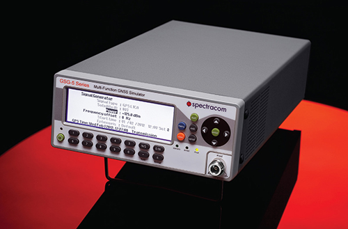
    The GSG-51 GNSS signal generator provides a fast and cost-effective solution for production testing for Galileo and other GNSS. It emulates a single GNSS signal and can be upgraded for Galileo, as well as to increase the channel count, add receiver trajectory control, and add advanced features such as SBAS (WAAS, EGNOS,MSAS, or GAGAN), white noise generation, or multipath simulation. Its main application is a simple but very fast manufacturing test, to assure that the assembly is correct, that the antenna is properly connected, and that the receiver can receive and identify a satellite signal, for instance, in mobile phones with integrated GNSS receivers.

    With a wide RF level range from –65 to –160 dBm, the sensitivity of all types of GNSS receivers can be verified with a minimum of delay. The 60-dB of extra power from normal test scenarios allows for splitting the signal many times.

    Spectracom


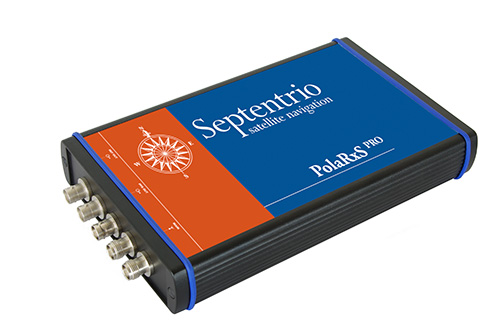
    Septentrio-PolaRxSSpace Weather Monitoring

    Multi-Constellation Receiver

    The PolaRxS is a multi-frequency, multi-constellation receiver dedicated to ionospheric monitoring and space weather applications. It features simultaneous high-quality tracking of all visible signals (L1, L2, L5, E5ab/AltBOC GPS/GLONASS/Galileo/Beidou/SBAS) at low noise levels. The receiver outputs an extensive set of GNSS measurements, including signal phase and intensity at up to 100 Hz, with a phase noise standard deviation (phi60) as low as 0.03 rad.

    The A Posteriori Multipath Estimator (APME+) tackles short-delay multipath to enhance the measurement quality, while LOCK+ tracking guarantees robust tracking of rapid signal dynamics during scintillation events. Included tools provide continuous total electron content (TEC) and scintillation indices logging for space weather and ionosphere monitoring.

    Septentrio


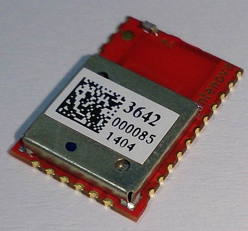
    A3-angle-view-WPersonal Tracking

    Multi-GNSS Antenna Module for Wireless

    The M2M Radionova M10478-A3 antenna module combines a full receiver and antenna on the same ultra-compact module. The highly integrated multi-GNSS RF antenna module is based on the Mediatek MT3333 architecture combined with Antenova’s antenna technology, receiving Galileo as well as GPS, GLONASS, BeiDou, QZSS, and SBAS signals. Using patented external matching means this module is suitable to applications from small watches to smartphones and asset trackers. All front-end and receiver components are contained in a single package laminate base module, providing a complete GNSS receiver for optimum performance.

    Antenova


    Location-Based Services / Wireless

    Software Receiver

    A software-based GNSS receiver from Galileo Satellite Navigation (GSN) is available on Tensilica ConnX digital signal processor (DSP) cores, for wireless mobile applications. The GSN GNSS receiver running on a Cadence ConnX BBE16 DSP consumes as little as 10 mW of power on a 40-nm process and has the ability to work in lower rates, or snapshots, for ultra-low-power mobile scenarios. It delivers high-sensitivity tracking, offering a seamless GNSS experience in challenging environments. This provides customers with the ability to upgrade their designs to include future satellite systems, including Galileo. With no additional silicon costs and a low cost of deployment, this software-based solution offers a way to implement satellite navigation functionality in many products where it otherwise might be impractical.

    Cadence; Galileo Satellite Navigation


    Ulys-Ex2-20217100-detouree-WAsset Tracking

    Hazardous Goods Surveillance

    The Ulys-Ex2 beacon is a standalone tracking unit providing worldwide location-based alerts for up to seven years, for monitoring of unpowered mobile assets in potentially explosive atmospheres.

    With a Galileo-ready u-blox receiver, it provides monitoring data for tank containers and tank-trailer transport operations, increasing the level of security and safety of explosion-sensitive shipments. The beacon is part of a turnkey, real-time dangerous goods monitoring solution adapted to risk environments, guaranteeing global visibility on routing from the production site to the customer delivery point. It is ATEX Zone 1 certified for Europe — Zone 1 is an atmosphere where a mixture of air and flammable substances in the form of gas, vapor, or mist is likely to occur in normal operating circumstances.

    Saphymo


    ubx-m8030-WConsumer OEM

    Galileo-Ready Module

    The Galileo-ready NEO-M8 series of standalone concurrent GNSS modules is built on the u-blox M8 GNSS (GPS, GLONASS, Galileo, BeiDou, QZSS, and SBAS) engine in the NEO form factor. The NEO-M8 series provides high sensitivity and minimal acquisition times while maintaining low system power. It is optimized for cost-sensitive applications, with the NEO-M8N and NEO-M8Q providing high performance and easier RF integration. Sophisticated RF-architecture and interference suppression ensure maximum performance even in GNSS-hostile environments. The NEO-M8 combines a high level of robustness and integration capability with flexible connectivity options. The future-proof NEO-M8N includes an internal Flash that allows simple firmware upgrades for supporting additional GNSS systems, making the NEO-M8 suitable for industrial and automotive applications.

    u-blox


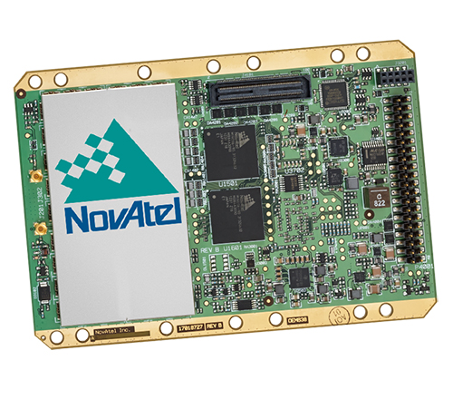
    Novatel-OEM638-WProfessional OEM

    High-Precision Receiver Card

    The OEM638 high-precision receiver card tracks all existing and planned constellations including Galileo, GPS, BeiDou, GLONASS, and QZSS. By providing flexible positioning options, from standalone meter-level to AdVanceRTK centimeter-level accuracy, the OEM638 offers the flexibility to meet a wide range of positioning requirements. A powerful API, 4-GB on-board data storage, wide input voltage, and a host of interface options simplifies integration, decreasing time to market and overall system costs. With 240 channels and comprehensive tracking and positioning with all current and planned GNSS signals, the OEM638 is field upgradeable. It offers user configurability for reference station, timing, and other precision positioning applications.

    NovAtel


    Consumer OEM

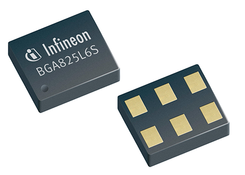
    Infineon-WLow-Noise Amplifier

    The BGA825L6S is a cost-effective low noise amplifier (LNA) for Galileo and other GNSS. It features an ultra-low noise figure, high linearity, high gain, and low current consumption over a wide range of supply voltages from 3.6V to 1.5V. It is designed for GNSS LNA, as it improves sensitivity, provides greater immunity against out-of-band jammer signals, and reduces filtering requirements, which lowers the overall cost of the receiver. The low noise figure of 0.6 dB is a key parameter for GNSS systems as it directly influences the sensitivity of the system, as well as the time-to-first-fix and time-to-subsequent-fix. LNAs with a lower noise figure enable mobile phones with faster GNSS signal fix and higher end-user satisfaction.

    Infineon Technologies AG


    GSS9000-WSimulation

    RF Constellation Simulator

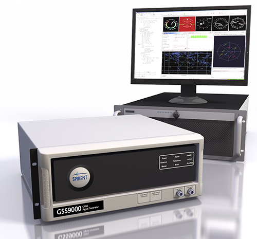
    The newly released Spirent GSS9000 Multi-Frequency, Multi-GNSS RF Constellation Simulator can simulate signals from all GNSS and regional navigation systems, including Galileo. The GSS9000 offers a four-fold increase in RF signal iteration rate (SIR) over Spirent’s GSS8000 simulator. The GSS9000 SIR is 1000 Hz (1ms), enabling higher dynamic simulations with more accuracy and fidelity. It includes support for restricted and classified signals from the Galileo and GPS systems, as well as advanced capabilities for ultra-high dynamics. It can evaluate resilience of navigation systems to interference and spoofing attacks, and has the flexibility to reconfigure constellations, channels, and frequencies between test runs or test cases.

    Hardware changes can be done in the field, supported by the new on-board calibrator module. The GSS9000 is extensible and can support the widest range of carriers, ranging codes, and data streams for the Galileo, GPS, GLONASS, and BeiDou systems, as well as regional/augmentation systems. Multi-antenna/multi-vehicle simulation, for differential-GNSS and attitude determination, and interference/jamming and spoofing testing are also supported.

    Spirent


    Teseo_III_p3509-WTransportation

    eCall-Ready Positioning Chip

    The Teseo II (STA8088 series) is a single-chip positioning device capable of receiving signals from multiple satellite navigation systems, including Galileo, GPS, GLONASS, and QZSS. The Teseo II combines high-positioning accuracy and indoor sensitivity performance with powerful processing capabilities and design flexibility, making Teseo II suitable for eCall, ERA-GLONASS, telematics, handheld, consumer, portable navigation devices, marine, and in-car navigation systems. The Teseo II is being tested by the European Space Agency and the European Commission Joint Research Center for eCall approval. The testing campaign is coordinated by the European GNSS Agency as part of its effort to accelerate Galileo adoption.

    While the Teseo II Ihas always had the capability to be Galileo-ready, ST is enabling a firmware update from Galileo that benefits consumers and doesn’t require a hardware modification. The Teseo II chips can simultaneously use signals from multiple satellite navigation systems, including the currently available Galileo satellites, and progressively, as future satellites are launched, the full satellite constellation.

    STMicroelectronics


    JAVAD_TRE-3Professional OEM

    High-Precision Receiver

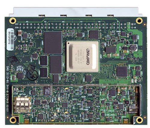
    The 864-channel TRE-3 receiver can simultaneously access all current GNSS signals, with room to spare for multiple-channel tracking of select signals. The new product offers three ultra wide-band (100 MHz) fast sampling and processing, programmable digital filters, and superior dynamic range. After 12-bit digital conversion, nine separate digital filters are shaped for each of the nine bands: GPS L1/Galileo  E1, GPS L2, GPS L5/Galileo E5A, GLONASS L1, GLONASS L2, Galileo E5B/BeiDou B2/GLONASS L3, Galileo altBoc, Galilee E6/BeiDouB3/QZSS LEX, and BeiDou B1.

    JAVAD GNSS


    TeleOrbitInterference Monitoring

    Modular RF Front-End

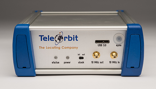
    The GTEC-RFFE is a flexible, portable, and affordable ultra-wideband recording solution that can be adapted to the reception of all GNSS bands available, including Galileo, supporting up to 80 MHz of RF bandwidth. Because of its modular concept, the GTEC-RFFE not only supports a set of pre-selected configurations, it can be set up for multi-antenna inputs, user selectable bandwidth, intermediate frequencies, and customized ADC sampling rates and resolutions. It is designed for development of software-defined radios and receivers, GNSS multi-system signal analysis and comparison, analysis of atmospheric effects such as ionospheric and tropospheric irregularities and scintillation, and interference monitoring for protecting critical operations and infrastructures.

    TeleOrbit


    PCTEL-GNSS1-TMG-26N-WTiming

    GNSS Timing Reference Antenna

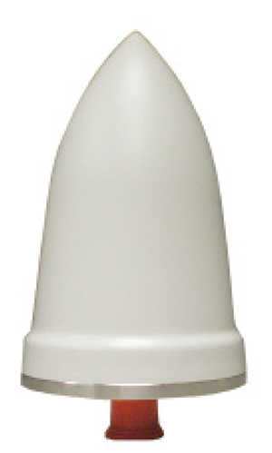
    The GNSS1-TMG-26N is a fixed-mount network timing antenna covering Galileo L1, as well as GPS, GLONASS, and Beidou frequencies. It is designed for long-lasting, trouble-free deployments in congested cell-site applications. The low-noise, high-gain amplifier is suited to address attenuation issues associated with applications requiring longer cable runs. The proprietary quadrifiliar helix design, coupled with multistage filtering, provides superior out-of-band rejection and lower elevation pattern performance than traditional patch antennas.

    PCTEL


    Trimble-BD930-WProfessional OEM

    Positioning and Heading System

    The Trimble BD930 supports both triple frequency from the GPS and GLONASS constellations, plus dual frequency from Galileo and BeiDou. As the number of satellites in the constellations grows, the BD930 is ready to take advantage of the additional signals to deliver fast and reliable RTK initializations for 1–2 centimeter positioning. Different receiver configurations are available, including autonomous GPS L1 to four-constellation triple-frequency RTK.

    Trimble


    SMBV100A_GNSS_front-WSimulation

    Vector Signal Generator

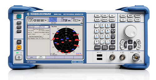
    The R&S SMBV100A vector signal generator can generate Galileo, GPS, and GLONASS signals for up to 24 satellites in realtime. With the SMBV-K107 option, the simulator covers the BeiDou standard as well.

    The R&S SMBV-K101 option allows developers in the automotive and wireless communications industries to test GNSS receivers for specific effects such as obscuration and multipath propagation. If the GNSS receiver of a navigation instrument or smartphone is located inside a vehicle, testing must also take into account the obscuring effect of the vehicle’s metal body. The R&S SMBV-K102 option can simulate this obscuration and, if required, the additional antenna pattern.

    In addition to test scenarios for A-GPS, smartphone developers have the Assisted Galileo (R&S SMBV-K67) and Assisted GLONASS (R&S SMBV-K95) options at their disposal.

    Rohde & Schwarz


    GPS30-blue-WSignal Amplification

    Antenna Amplifier

    The GPS35-BNC is an inline antenna amplifier for both the L1 and L2 frequencies of the Galileo, GPS, and GLONASS satellite systems. When connected between the GPS receiver and the GPS antenna, power from the GPS receiver that normally powers the active antenna powers both the active antenna and the GPS-BNC, so no extra power supply is needed. The GPS35-BNC can be used with either active or passive GPS antennas by selecting internal jumpers. The GPS35-BNC provides a gain of 35 dB between 1200 and 1607 MHz. With the GPS35-BNC installed, extra lengths of cable can be used between the antenna and the GPS receiver itself. If low-loss cable is used, cable lengths over 350 meters (1,150 feet) can be used without any degradation to the GPS signal.
    The noise figure of the GPS35-BNC is less than 3 dB, and signals in the cellular or mobile frequency bands are rejected by more than 35 dB.

    Precision Test Systems


  • Applied EM Offers Anti-Jam Antenna

    Applied EM’s anti-jam GPS antenna, AJGPS045, has achieved a four-channel Controlled Radiation Pattern Antenna (CRPA) in a very small size, weight and power (SWAP) particularly suitable for airborne platforms. Its footprint is the same as a standard GPS Fixed Radiation Pattern Antenna (FRPA), the FRPA-3.

    This is a key enabler to bringing greatly improved anti-jam performance to smaller platforms and to GPS-equipped platforms that have inadequate anti-jam capability.

    When integrated with appropriate four-channel antenna electronics and a military GPS receiver, the AJGPS045 enables L1 and L2 anti-jam performance of typically >80 dB. This is achieved with a passive compact antenna (.7” x 4.6” x 4.6”) that weighs 9 oz.

  • Latest US Topo Maps for Utah Feature Road Data

    March 2014 US Topo map of the Moab, Utah area, 1:24,000 scale. Orthoimage layer is turned on, contour and woodland layers turned off.
    March 2014 US Topo map of the Moab, Utah area, 1:24,000 scale. Orthoimage layer is turned on, contour and woodland layers turned off. Map: USGS

    Newly released US Topo maps  for Utah now feature a new commercial road data provider. The latest highway, road and street data from HERE has been added to the 1,476 revised US Topo quadrangles for the state.

    “HERE, a Nokia business, is proud to provide fresh, robust and comprehensive map content to the State of Utah and the US Topo Maps program,” said Roy Kolstad, VP Sales Enterprise Americas, HERE. “We are excited for users to experience the benefits HERE brings with our more than 25 years of experience in cartography, drawing on more than 80,000 sources of data.”

    The new maps also include Public Land Survey System (PLSS). These data are added to the growing list of states west of the Mississippi River. PLSS is a way of subdividing and describing land in the United States. All lands in the public domain are subject to subdivision by this rectangular system of surveys, which is regulated by the U.S. Department of the Interior. Other selected states will begin getting PLSS map data during the next respective revision cycle.

    The new design for US Topo maps improves readability of maps for online and printed use, while retaining the look and feel of the traditional USGS topographic map. Map symbols are easy to read when the digital aerial photograph layer imagery is turned on.

    Other re-design enhancements and new features:

    • New shaded relief layer for enhanced view of the terrain
    • Military installation boundaries, post offices and cemeteries
    • New road classification
    • A slight screening (transparency) has been applied to some features to enhance visibility of multiple competing layers
    • New PDF legend attachment
    • Metadata formatted to support multiple browsers
    1885 historical USGS map of the Moab, Utah area, 1:250,000 scale.
    1885 historical USGS map of the Moab, Utah area, 1:250,000 scale. Map: USGS

    US Topo maps are created from geographic datasets in The National Map, and deliver visible content such as high-resolution aerial photography, which was not available on older paper-based topographic maps. The new US Topo maps provide modern technical advantages that support wider and faster public distribution and on-screen geographic analysis tools for users.

    The new digital topographic maps are PDF documents with geospatial extensions (GeoPDF) image software format and may be viewed using Adobe Reader, available as a no-cost download.

    US Topo maps are updated every three years. The initial round of the 48 conterminous state coverage was completed in September of 2012.  Hawaii and Puerto Rico maps have recently been added. More than 400 new US Topo maps for Alaska have been added to the USGS Map Locator & Downloader, but will take several years to complete the vast state.

    Download US Topo maps here.

  • Facebook Buys Virtual Reality Startup Occulus

    Oculus_Rift_-_Developer_Version_-_Front-W

    Facebook has purchased Occulus, a virtual reality gaming startup, for $2 billion. “Today, we’re pleased to announce that we’ve joined forces with Facebook to create the best virtual reality platform in the world,” Occulus announced via a blog post.

    “Facebook understands the potential for VR,” the blog said. “Mark [Zuckerberg] and his team share our vision for virtual reality’s potential to transform the way we learn, share, play, and communicate. Facebook is a company that believes that anything is possible with the right group of people, and we couldn’t agree more.”

    Occulus demonstrated its most recent version of the Oculus Rift development kit at the Game Developers Conference in San Francisco, March 17-21. Occulus Rift is a virtual reality  headset for 3D gaming.

    The Oculus Rift DK2 prototype took home the award for Best in Show at January’s Consumer Electronics Show.


  • Facebook Buys Virtual Reality Startup Occulus

    Oculus_Rift_-_Developer_Version_-_Front-W

    Facebook has purchased Occulus, a virtual reality gaming startup, for $2 billion. “Today, we’re pleased to announce that we’ve joined forces with Facebook to create the best virtual reality platform in the world,” Occulus announced via a blog post.

    “Facebook understands the potential for VR,” the blog said. “Mark [Zuckerberg] and his team share our vision for virtual reality’s potential to transform the way we learn, share, play, and communicate. Facebook is a company that believes that anything is possible with the right group of people, and we couldn’t agree more.”

    Occulus demonstrated its most recent version of the Oculus Rift development kit at the Game Developers Conference in San Francisco, March 17-21. Occulus Rift is a virtual reality  headset for 3D gaming.

    The Oculus Rift DK2 prototype took home the award for Best in Show at January’s Consumer Electronics Show.


  • Missing Plane, New Mapping Abilities, and GPS Jamming

    As the tragedy of Malaysia Airlines Flight 370 riveted our attention, many sprang into action. More than two million volunteers scoured online satellite images for signs of the plane via Tomnod, a crowdsourcing project of DigitalGlobe.

    Volunteers like Robert Wilkinson are asked to view satellite photos and tag any signs of wreckage, rafts, oil spills and other objects that may be of interest. “It took me the first hour to understand that I was looking at waves or tidal pools rather than debris or anything useful to the search,” said Wilkinson. “After that, I might have seen one or two things that I couldn’t explain, but I tagged them appropriately.”

    All images that are tagged are reviewed by special algorithms before being viewed by experts. Tomnod reported that more than 650,000 objects had been tagged, and the maps had been viewed more than 98 million times.

    Calls on Flight 370. This month, the Internet was full of questions about mobile communications and the missing Malaysia airplane. People didn’t understand why passengers on board the flight hadn’t made mobile emergency calls. On September 11, 2001, it was widely recalled, some passengers were able to make phone calls from the hijacked planes. Flight 370 was likely too high or going too fast to enable phones to register with cell towers. Experts say that planes flying above 5-10,000 feet would have difficulty making connections. Radar analysis estimated that the plane may have been flying as low as 12,000 feet or as high as 45,000 feet. On 9/11, passengers made calls when the plane was low or used satellite air phones available in business class.

    GPS and Football. Security at places where large crowds congregate is always a concern. At last month’s Super Bowl, GPS devices tracked and monitored the team vehicles. To protect the GPS, a product from Exelis was used to detect and locate GPS interference sources to protect critical GPS signal-dependent infrastructure. Eight sensors were positioned in an array pattern to detect and locate any jamming sources.

    Lost in Space. Google’s Project Tango is showcasing a prototype phone brimming with software and sensors that creates a 3D map of the environment. A select group of developers has been given the device and are expected to create innovative applications, including navigation by sight. We do know that one of these devices will be heading to the International Space Station and will be part of a project to enable robots to explore the inside and outside of the craft. The terrestrial uses of the device will include being able to map the interior of a house (the sofa goes where?), navigate through complicated buildings, provide accessibility for those with impaired vision, and emergency response. Project Tango may find interesting uses with 3D printing, which is riding a wave of interest.

    GPS and LED Lights. Philips has been demonstrating an indoor location-based shopping service based on location positioning from LED lighting infrastructure. The system works by using lighting fixtures that form a dense network that not only provides light, but also acts as a positioning grid. Each fixture is identifiable and able to communicate its position to an app on a shopper’s smart device. ByteLight is another company with LED indoor location technology. Wi-Fi and Bluetooth low-energy (BLE) beacons are more established for indoor positioning.

    Truck Market on the Move. Market demand remains strong for mobile resource management (MRM) devices, particularly among local fleets, reports C.J. Driscoll & Associates. “Manufacturers of light and heavy commercial vehicles are becoming increasing involved with telematics,” says Clem Driscoll. “Heavy truck manufacturers are primarily focused on enabling remote vehicle diagnostics.” Many of the large MRM companies are establishing added offices around the world.

    Awkward Timing. INRIX is launching Russia’s first comprehensive traffic information and driver services platform. Russia has many challenges including difficult traffic conditions. The service, available on Audi cars, was developed through an exclusive partnership with Russia’s navigation services provider cdcom. INRIX XD Traffic in Russia provides real-time traffic and incident information covering more than 236,000 kilometers of roadways across 55 cities.

  • Location-Based Advertising Getting Higher Visibility

    Location-Based Advertising Getting Higher Visibility

    Airpush-MWC
    Airpush

    When one talks about the worldwide location industry, mobile resource management — fleets and trucks, for instance — aren’t sexy at all, but they make money. What is supposed to be sexy is location-based advertising.  According to many analysts, location-based advertising has been hampered by a few things: education for both consumers and mobile advertisers, privacy issues, and relevant proximity information so folks can use it to make purchases. Another concern could be the expense of rolling out indoor beacons.

    BARCELONA—Major consumer privacy concerns aside, companies are starting to see growth in location-based advertising, with new markets emerging in Europe. While the numbers of mobile advertising companies has decreased at the Mobile World Congress, held here in February, from just two years ago, the remaining players are seeing a more mature market.

    Mobile advertisers are beginning to realize that location is the Holy Grail for growth, said Cameron Peeples, Airpush vice president of marketing. “People going into New York from Newark during rush hour can receive a different call to action because of a created geo-fence. Advertisers can determine whether the traveler is there on business or looking for a hotel and other travel deals,” he said.

    Before Mobile World Congress, Los Angeles-based Airpush partnered with AirX, a large mobile ad exchange company. The majority of the AirX inventory, about 120,000 Android applications, includes highly-sought-after GPS location data, the company said.

    There are large differences between the North American and European markets for mobile advertising, Peeples said. “The mobile advertising market [in Europe] is definitely evolving. The European market is key for us, dramatically higher than other markets,” he said. “[The European] market seems to have people connected to a lot of things — they are more mobile, use public transportation more, and always have a phone that is more centric to who they are.”

    Making location-based advertising relevant to the consumer is still a major challenge. “Our focus next year is on native advertising. Native advertising combines not only the right message, but the right delivery vehicle,” Peeples said. “No one bicycling enthusiast wants ads tailored for someone who wants flowers.”

    Peeples said the privacy issues are a big deal, but his company’s services are opt-in. “A lot of it is loyalty advertising. It’s all opt-in,” he said.

    xAd Partners with Waze, Sees UK Growth

    Another mobile advertising company, New York-based xAd, is also making inroads in Europe. “We are in the UK right now, which is really WiFi-focused. A lot of our early [location-based] advertising efforts are in education — to educate consumers and the advertising agencies about the power of location and mobile,” said Monica Ho, xAd vice president of marketing. “Not all location is created equal. The real value of [location-based advertising] is the proximity target to market to.”

    Right before Mobile World Congress, Waze selected xAd as its third-party provider of search and display mobile ads in the United States. Waze, which was bought by Google in a deal worth more than $1 billion, is a top three map and navigation app in the iTunes store — a ranking that was probably helped by the Apple Maps debacle in 2012.

    The companies say the deal will place xAd’s mobile ad targeting technologies into Waze’s location-based advertising platform.

    Ho said there are still two areas of concern for location-based advertising: relevancy to the consumer and privacy issues. “There was privacy backlash from Nordstrom collecting consumer information from their Wi-Fi system,” she said, referring to the controversy last year when the retailer was accused of capturing consumer information during an indoor positioning test.

    Apple to Roll out Upgraded Maps on iPhone 6

    Speaking about Apple Maps, many industry analysts says the company has come a long way since the very public embarrassment nearly two years ago over map inaccuracies and flaws. The company recently released iOS 7.1, but is expected to rollout iOS 8 when the iPhone 6 debuts later this year.

    With the debut of the iPhone 6, an updated version of Apple Maps will also be released, according to published reports.

    Last year, Apple bought two companies, HopStop and Locationary, to allow the company to entrench itself once more in the location business. How firmly those roots prove to be, and how well they serve the company against archrival Google, remain to be seen.

    Apple has been stockpiling companies and mapping software since its introduction of Apple Maps on iOS devices, which had a rough start. GPS World’s LBS Insider reported extensively on the problems Apple encountered with its mapping software. Some of these problems included sending drivers to a wrong location and direction.

    After the mapping software problems were made public, Apple CEO Tim Cook apologized for the mapping software’s problems and even suggested that users go to such competitors as Waze, MapQuest, and Microsoft’s Bing.

    In other location news:

    • A Wall Street Journal reporter basically said there was nothing much new at Mobile World Congress — and that the excitement and action was at the outlying conferences at Fira Montjuic. One of these more interesting conferences, Four Years From Now, or 4YFN, featured start-up companies making pitches and displaying their new products, some of which included location capability.
    • The Mobile World Congress final stats. Organizers said MWC had more than 85,000 attendees from 200 countries — an increase of 13,000 from the previous year. It’s now being touted as the biggest and best wireless show.
    • In February, GPS World reported that TruePosition had purchased Skyhook for an undisclosed price. Skyhook provided location services to a number of companies including Apple and Samsung. The interesting issue is Skyhook’s lawsuit with Google, which alleged that the Internet giant influenced smartphone manufacturers to abandon the Boston-based company. According to published reports, the legal action still is going forward.
    • AT&T Mobility is shuttering its location-based Alerts marketing program. The company said it would release an updated version later this year. AT&T Mobility launched Alerts in late 2012. It featured free opt-in, location-based text message alert service. Participating retailers included Stapes, Gap, Zales, Neiman Marcus, and others.
    • I didn’t go to South by Southwest. Is my cool-guy card revoked? One of the reasons I didn’t is because, outside of meetings that were not part of the conference, there was not one location industry announcement made there. Maybe something will change my mind next year, but call me an old fogey — I just didn’t see the need to go to Austin this year.


  • General Dynamics Awarded $26M for GPS III Communications

    General Dynamics Advanced Information Systems, a business unit of General Dynamics, has been awarded a $26 million contract from Lockheed Martin to support the U.S. Air Force GPS III  Network Communications Element (NCE).

    General Dynamics is already under contract with Lockheed Martin to produce the NCE for the first four GPS III space vehicles (SV01-SV04), as well as for the procurement of long lead material for the second set of four space vehicles (SV05-SV08). This follow-on contract provides General Dynamics with the funding to complete the NCE for SV05 and SV06.

    General Dynamics’ NCE components provide the communications functions for the GPS III satellites, including the ground-to-space command and control channel, the space-to-space inter-satellite channel, and the command and telemetry communications channels within each satellite. NCE components have been delivered for SV01 and SV02. The NCEs for SV03 and SV04 are scheduled for delivery by June 2014.

    “We bring more than a half-century of experience in the spacecraft communications and navigation domain to this program,” said Kirstan Rock, vice president and general manager of Intelligence, Surveillance and Reconnaissance at General Dynamics Advanced Information Systems. “We look forward to continuing working with Lockheed Martin to deliver high-quality, reliable and affordable solutions to the Air Force to advance their mission.”

    The Air Force’s next-generation GPS III satellites will improve position, navigation and timing services and provide advanced anti-jam capabilities yielding superior system security, accuracy and reliability.

    GPS III is a critically important program for the U.S. Air Force, affordably replacing the aging constellation of GPS satellites currently in orbit. Compared to prior GPS vehicles, GPS III satellites will deliver three times better accuracy, provide up to eight times more powerful anti-jamming capabilities and include enhancements that extend spacecraft life 25 percent further. GPS III-series satellites also will carry a new civil signal designed to be interoperable with other international global navigation satellite systems, enhancing civilian user connectivity.

  • Pitney Bowes, IBM Collaborate on Hybrid Cloud Location Services

    Pitney Bowes, Inc., and IBM have announced a collaboration on IBM’s codename “BlueMix” platform-as-a-service to develop new hybrid cloud location services that help businesses unearth deeper connections between their customers, their geography, and their networks to deliver more personalized services and contextually relevant experiences.

    IBM’s BlueMix is a new development environment that helps clients and developers speed the adoption of hybrid clouds. The initiative combines the strength of IBM software, third-party and open technologies. BlueMix provides DevOps in the cloud — an open, integrated development experience that scales to any level. Pitney Bowes is among the first third-party solutions now available to developers and companies on the new IBM BlueMix Platform-as-a-Service (PaaS).

    More than 1.2 billion people around the world today use Pitney Bowes location intelligence solutions when they check in or use location-sharing features on major social media platforms. Pitney Bowes’ location intelligence suite of products offers comprehensive capabilities to provide businesses with the ability to visualize spatial data and understand relationships between specific locations. Using advanced, hyper-accurate location data, insurers can improve underwriting decisions, telecommunications providers can better analyze network coverage, and retailers can deliver more targeted promotions to consumers based on when and where they are most likely to buy.

    For Pitney Bowes, the partnership provides the opportunity to expose key solutions, such as location-based services, e-commerce fulfillment, Internet postage, and parcel management, through IBM’s API Management to an extended ecosystem of innovators and developers. It also speeds the availability of new services from Pitney Bowes to vast new markets globally.

    “Together, IBM and Pitney Bowes are developing a powerful lineup of cloud services around mobile application development and location intelligence,” said Steve Robinson, General Manager, IBM Cloud Platform Services. “This open-platform collaboration will inspire development that accelerates innovation and fosters growth.”

    “Companies need tools and expertise to manage and integrate APIs, leverage location intelligence and customer data, and then seamlessly extend their services to reach their customers via the cloud and mobile devices,” said Roger Pilc, chief innovation officer for Pitney Bowes. “We look forward to delivering Pitney Bowes digital commerce solutions on IBM’s BlueMix.”